

Mullaitivu Tourist Places And The Coastline That Taught Me How Silence Speaks

My trip to Sri Lanka crossed many dramatic turns, especially in the Northern part of the country. 

With Vavuniya feeling like a crossroads rather than a stopover and Mannar being a high point where the wind never stops, the next stop was Mullaitivu. 

Mullaitivu was a name that I had only read about in the news archives. 

Mullaitivu is even in the news today as the people of Keppapilavu have been protesting for days now for the return of their ancestral lands. 

Thurairasa Ravikaran and Sivagnanam Shritharan, two Tamil parliamentarians, have shown their support and solidarity to this protest. 

Nevertheless, while Trincomalee beaches and the rich culture of Jaffna dominate the conversations about Northern Sri Lanka, Mullaitivu surfaced as a place talking about the past. 

In this article, I will talk about my two days in Mullaitivu, from the drive in to the lagoon that ended a war, and why I think this coastline deserves more than a passing mention on a map.

Why Mullaitivu Almost Stayed Off My List

The day I spent at Vavuniya, the guesthouse caretaker there, a soft-spoken man named Selvam, was the one who first brought up Mullaitivu.

About Mullaitivu, he mentioned, 

The beaches were empty, the lagoon was calm, and the town had not yet learned how to perform for tourists.

This stirred me, as most travel forums I had checked mentioned Mullaitivu as a former war zone with a nice coastline and not much infrastructure.

While this is not false, this is only a fragmented picture of Mullaitivu.

How I Reached Mullaitivu

From Vavuniya, I took A34 to reach Mullaitivu. It was a distance of around 54 kilometers, and I reached within an hour and a half. 

The road narrowed past Puthukkudiyiruppu, cutting through scrubland, paddy fields, and the occasional stretch of forest before the land flattens out toward the coast.

How Mullaitivu Felt At First Sight? 

How Mullaitivu Felt At First Sight

Mullaitivu was once a small fishing harbor. 

It was a small fishing harbor and a stop for sailing vessels moving goods between Colombo and Jaffna in the early twentieth century. 

Today, it also remains a fishing town, unbothered and unhurried by outsiders. 

As I entered the town, my driver, Ravi, pointed out the old lighthouse. It was built in 1896, and it has lost its original iron frame. 

So, when you visit the lighthouse today, you can only find a faded signboard. 

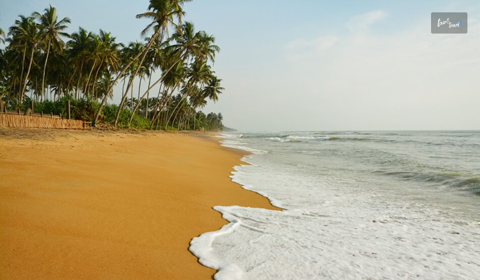
Nevertheless, I spent my first evening walking along Mullaitivu Beach. 

Fishing boats had gathered there, forming neat rows, and the nets were drying on the sand. 

Also, it was most delightful to find children playing cricket on the sand with a tennis ball. 

Being from the country where cricket is a religion, I joined them.

We bonded big time talking over big names such as Kumar Sangakkara and Kusal Mendis. 

A few meters away from them, an elderly woman was mending a fishing net. 

It felt like a scene from a Sanjeewa Pushpakumara movie. Like his films, Flying Fish and The Venishing, it was like a scene depicting the raw portrayal of survival. 

What Are The Places To Visit In Mullaitivu? 

I was not prepared for the amount of Civil War history Mullaitivu offered me. 

Also, the birds and the sanctuary where the beach and lagoon meet allowed me to unwind with so many things going on in my head about life during and after the Civil War in Sri Lanka. 

Nanthikadal Lagoon: Where The War Ended

At a glance, the Nanthikadal Lagoon looks like a shallow, sand-fringed body of water. It is on the northeastern edge of the district.

Small rivers feed it, and it finally opens into the Indian Ocean. 

When I reached the lagoon, I found some egrets standing motionless in the shallows. Then, a kingfisher dropped into the water and came up empty.

Ravi then took me to an old man, a local school teacher called Rajan. He narrated the entire story of the Nanthikadal Lagoon to me. 

What Happened At Nanthikadal Lagoon 

The 26-year Civil War of Sri Lanka ended at Nanthikadal Lagoon in May 2009. 

Here, the government forces cornered the last LTTE fighters. The group’s leader, Velupillai Prabhakaran, was also killed. 

In the weeks before that, civilians had been pushed into a shrinking strip of land along this same lagoon. They were between the fighting lines.

In a report published on 17th January 2009, The Guardian wrote, 

International concern is intensifying over the fate of around 350,000 civilians trapped in a rapidly shrinking rebel-controlled pocket of land in Sri Lanka’s north east, as the military steps up its campaign to end the civil war by crushing the Tamil Tiger forces.

There is no specific count of the number of human casualties in these final months.

  • A 2011 UN Panel of Experts report stated that credible sources estimated as many as 40,000 civilian deaths.
  • Another report, published by The Times (UK) on 29th May 2009 based on confidential UN documents the paper obtained, reported that civilian deaths in the no-fire zone rose sharply from late April.

The deaths averaged around 1,000 killed per day until May 19, 2009. Thus, it had put the total civilian death toll at over 20,000. (Source: Al Jazeera). 

The Sri Lankan Government has shown a much lower figure.  

However, in the UN Rights Council: Act on Sri Lanka Report published on 13th September 2011, Brad Adams, the Asia director at Human Rights Watch, mentioned, 

When a UN Panel of Experts report concludes up to 40,000 civilians died amid war crimes, the Human Rights Council should feel compelled to act.

The council should order a full international investigation – anything less would be a shameful abdication of responsibility.

How Nanthikadal Lagoon Looks Back At Those Days Every Year

Tamil families gather at Mullivaikkal, close to the lagoon, on 19th May every year to remember relatives lost in the final days. 

They light lamps and plant coconut saplings in their memory. 

Standing at the water’s edge, with fishermen casting nets a short distance away, I found it hard to reconcile the stillness in front of me with what this ground had witnessed.

The Victory Monument, The Museum, And The Submarines

The Puthukkudiyiruppu Victory Monument was on the Paranthan-Mullaitivu road, which was a short drive from the lagoon. 

It was unveiled in 2019, and it depicts a soldier carrying the national flag. 

Furthermore, the surrounding pond and lilies represent the ocean around the island and the nation itself. 

An adjoining war museum displays weapons, vehicles, and vessels used during the conflict’s final phase.

Entry to the museum was free, and it remains open from 8 AM to 5 PM. 

Also nearby, there were rusted hulls, and it was the site where the government troops discovered an abandoned Sea Tiger boatyard in 2009. 

It is where the LTTE’s naval wing used to build improvised submarines and semi-submersible craft. 

I want to be honest about something here.

This is a site that different communities in Sri Lanka read very differently, and I do not think a two-day visit qualifies anyone to settle that. 

What I can say is that visiting both the lagoon and the monument on the same day gave me a fuller, more uncomfortable picture than either would have alone.

The Kokkilai Lagoon:  Where The Coastline Turns Peaceful Again

On the second afternoon, I drove out to Kokkilai Lagoon. 

It was a wetland sanctuary around 25 kilometers southeast of town. 

It has been a protected bird sanctuary since 1951, and I could spot pelicans, herons, and occasional flamingos moving along the shallows. 

The crowd of birdwatchers was small, and the overall ambiance was quiet. 

Chundikulam

Further along the coast, Chundikulam allowed me to relax. It was a sanctuary with no visitors. 

I quietly cherished the view of the beach and lagoon blurring into one uninterrupted stretch of sand and water.

Coming back from Chundikulam, I had some spicy crab curry and rice at a roadside stall. It was similar to what I had in Jaffna, but it tasted even better. 

Ravi said, “It was the only reason to end the day here.” 

My Two Days In Mullaitivu: The Itinerary 

Day TimeActivities/Places to Visit
Day 1MorningDrive from Vavuniya via the A34
MiddayCheck-in and Walk through Mullaitivu Town
AfternoonNanthikadal Lagoon and the Causeway
EveningMullaitivu Beach at Sunset
Day 2MorningPuthukkudiyiruppu Victory Monument and War Museum
MiddaySea Tiger Submarine Yard
AfternoonKokkilai Lagoon Birdwatching
EveningChundikulam Coastline and Seafood Dinner

Mullaitivu: A Quiet Place That Asks You To Listen 

Away from the grandeur of Kandy and Colombo, Mullaitivu is a place that simply exists.

It tells the stories of human survival, and it is still recovering and fishing despite the stains and the lives lost in the Civil War. 

So, if you are already tracing the north of Sri Lanka through Vavuniya, Kilinochchi, or Mannar, I would not leave Mullaitivu off the route. 

Just go with the understanding that this is not a beach add-on. It is a place that holds two very different stories at once, and it does not owe you a tidy conclusion to either.

Share on Social Media

Sibashree is a travel, culture, and leisure writer who has been writing since the age of 12 and professionally since 2014. With more than a decade of travel writing experience and journeys across India and several parts of the world, she brings a deeply personal and thoughtful perspective to her work. A student of English Literature and Mass Communication, Sibashree has always viewed travel as more than movement — for her, it has been a way of understanding people, cultures, and herself. Her passion for spiritual exploration has also led her to many unusual and meaningful destinations over the years. Outside of writing, Sibashree enjoys watching European cinema, reading about global politics, and reflecting on the stories hidden within everyday places.

Leave a Reply

Your email address will not be published. Required fields are marked *

title-img Related

READ MORE Vavuniya

Vavuniya, Sri Lanka: The Crossroads Of Tamil And Sinhalese Cultures Everyone Just Passes Through

BY  Sibashree Jul 17, 2026

Every guidebook I read before my third trip to Sri Lanka showed Vavuniya in the same way.  The map was also similar in its approach, and Vavuniya looked like a dot between Anuradhapura and Jaffna. It looked like a place that everyone passed through, but not a place to stop.  The feeling or vibe was similar to Mannar, as most forums wrote it off as “not much else.” However, when I actually went there, I realized what I would have missed.  So, when my driver, Ravi, suggested the Anuradhapura-to-Jaffna drive with a day in Vavuniya instead of pushing straight through, I said yes mostly out of stubbornness. I wanted to see what a “Nothing” town on Sri Lanka’s most historically loaded highway looked like up close.  Honestly, I was not prepared for how much those hours in Vavuniya would sit with me.  The Omanthai Moment  Around twenty minutes before reaching Vavuniya Town, Ravi stopped the car.  The road there narrowed and slowed at a junction called Omanthai. There was nothing very dramatic, and it only had a few roadside stalls, buses idling, and the ordinary chaos of the A9 highway. However, the stopover became unforgettable as Ravi tapped the wheel and said, almost as an aside,  “This was the checkpoint.  During the war, you couldn't cross here without permission. Now you don't even notice it unless someone tells you." That gap between what a place was and what it looks like now is, I've realised, exactly why Vavuniya stayed with me. Also, if Hikkaduwa was the spot to witness the rampage of the 2004 tsunami and the story of human resilience after it, Vavuniya was a story of how Sri Lanka continues to evolve despite a violent history of Civil War.  And that evolution probably shows in the recent reclassification of Sri Lanka's economy in 2026 as an upper-middle-income economy by the World Bank.  What The War Left Behind And What Has Been Rebuilt In Vavuniya?  Being from India, I felt connected to the civil war struggles in Vavuniya.  However, the information available to me was mostly in fragments. Standing in Vavuniya made the fragments feel connected.  During the 26-year conflict, Vavuniya functioned as a critical frontline and government-held enclave bordering LTTE territory to the north. In the final and brutal phase of the civil war, hundreds of thousands of people fleeing the fighting in the Vanni passed through Vavuniya.  Many people were even housed in transit camps, and the largest was known as Menik Farm as the conflict wound down in 2009.  However, you cannot spot any visible sign of these conflicts today.  I saw a town that was rebuilt as a meeting point and not a dividing line.  Tamil, Sinhalese, and Muslim communities live alongside each other here, and you can feel it in the built environment alone. A Hindu kovil, a mosque, and a church can sit within a few streets of each other, something I didn't see with the same density anywhere else on this trip. I want to be honest that this isn't a place with a museum or memorial that neatly packages this history for visitors. So, you have to arrive already curious and often ask. How I Spent A Slow Day In Vavuniya Town (The Places I Visited)  Vavuniya Town is walkable, and instead of being a bucket-list destination, it allows you to engage and get immersed in its spiritual, historical, and cultural vibe.  Nevertheless, these are the places I visited during my day trip to Vavuniya Town.  1. Kandasamy Kovil Kandasamy Kovil, a Hindu temple dedicated to Lord Murugan, is at the heart of the town. It is similar to the temples in Jaffna in vibe. However, you cannot expect the quintessential grandeur of the South Indian temples here.  I loved that there was no queue in the temple when I visited. Just a handful of locals were moving through their morning rituals as I stood at the edge and watched them.  2. The Vavuniya Archaeological Museum The Vavuniya Archaeological Museum was a short walk away from the Kandasamy Kovil.  It is a small museum that remains open from 8:30 AM to 5 PM and offers free entry.  Furthermore, it remains closed on Tuesdays.  You can explore this small museum in half an hour. However, that does not reduce the historical value of the pottery, statues, and inscribed stones on display. These made me familiar with the district's history back well before the war, back to the Rajarata and Vanniar periods I'd just been reading about on the drive in. 3. Vavuniya Kulam And Iratperiyakulam Lake In the late afternoon, Ravi drove me out to the tanks.  Vavuniya Kulam, the town's main reservoir, had a peaceful vibe. The locals were fishing or just sitting by the water as the light softened. Iratperiyakulam Lake, a little further out, had the same unhurried energy with no ticket booth and no crowd. 4. The Market This was definitely one of my favorite parts of a trip to Vavuniya.  I wandered the Vavuniya town market at dusk. Tamil, Muslim, and Sinhalese traders shared the same narrow lanes, selling produce, dried fish, spices, and fabric side by side. It was great to see and was tangible evidence that this town has genuinely moved past being a dividing line. One Day In Vavuniya: The Itinerary TimeActivity MorningArrive via A9, stop at OmanthaiLate Morning Visit to the Kandasamy Kovil and Archaeological MuseumAfternoon and Late AfternoonVavuniya Kulam and Iratperiyakulam LakeEveningExploring Town Market and DinnerNext MorningOnward to Jaffna What I Ate In Vavuniya  Like the food in Jaffna, Vavuniya also treated me with Tamil delicacies. So, rice and curries dominate the options.  I had a lunch plate with five or six vegetables and fish curries that easily rivalled anything I have had further south. In the evening, I found a roadside stall doing kottu roti, chopped and fried on a hot griddle with theatrical noise, which felt like the right way to end a day built around quiet places. Reaching Vavuniya And Getting Around Vavuniya is on the A9 highway, which is the main north-south highway of Sri Lanka.  Also, it is on the Northern Line railway connecting to Colombo in the south and Jaffna further north.  However, you can visit Vavuniya from Anuradhapura like me, and it is a fairly short onward drive.  If you are traveling from Colombo by road. It will be a long four-hour drive, though!  Within the town itself, everything I wanted to see was walkable or a short tuk-tuk ride away.  I didn't rent anything as Ravi's car covered the tanks and the outskirts, and my own feet covered the town centre and market. Why You Must Not Skip Vavuniya  Vauniya does not have the spiritual intensity of the Dambulla Royal Cave or the cultural grandeur of Kandy.  It also does not want to be a headline destination.  I understand why it gets treated as a highway stop rather than a place to stay. However, for me, that was exactly the point. I stood at a former front line that's now just a bus stop, eating a curry plate shared by three communities that were once defined by the war between them. Overall, it offered a northern Sri Lankan experience that is not curated for visitors or trying to grab attention.
READ MORE Adam's Peak

Adam’s Peak (Sri Pada): Climbing Sri Lanka’s Sacred Mountain

BY  Sibashree Aug 21, 2026

It was two in the morning, and I started climbing Adam’s Peak. I was in a line of pilgrims, and the line stretched as far as I could see with my torchlight. All the guides about climbing up this sacred mountain tell you about climbing the 5500 steps. However, nothing prepares you for the experience you will have in conquering them in pitch darkness.  Furthermore, the crowd itself was a reflection of how inclusive Sri Lanka is in its religious practice. It was a gathering of people from four different religious beliefs.  The reasons for everyone’s climb were not the same. However, that did not quite clash with each other.  That is the beauty of the Indian Subcontinent, and Sri Lanka sets an example each time I visit it.   Nevertheless, in this guide, I will talk about my experience of reaching the summit of Adam’s Peak and all the details you need to know.  Adam’s Peak: Some Quick Facts You Need To Know AttributeDetailsLocationInside Peak Wilderness Protected Area, Central Highlands, Sri LankaElevation2,243 Metres (7,359 Feet)Local NameSri Pada ("Sacred Footprint") or SivanolipaathamalaiReligious SignificanceSacred to BuddhistsHindusMuslims ChristiansTotal StepsRoughly 5,500 Stairs via the Popular Hatton RouteAverage Hike Time3 to 5 Hours for the Ascent1.5 to 2 Hours for the DescentPilgrimage SeasonDecember (Unduvap Poya) to May (Vesak Poya)Best Months to ClimbJanuary to March for Dry Weather and Clear Sunrise ViewsCostFree (No Entry Fee or Permit Requirements) What Makes Adam's Peak Sacred Mount Pedro is the tallest mountain in Sri Lanka. However, Adam’s Peak has the highest spiritual significance.  The local name for the peak, Sri Pada, or "Sacred Footprint,” itself sets your expectations high.  Rising 2243 meters in the Central Highlands of Sri Lanka, Adam’s Peak has a rock formation at the summit resembling a large footprint, which is claimed by four separate religions. The Mystery Of The Footprint At The Adam’s Peak Summit The Buddhists believe that the sacred footprint at the summit is of Lord Buddha. On the other hand, Hindus believe that the footprint is of Lord Shiva.  Some Christians think the footprint is of Adam. He set his first footprint here after falling from the Garden of Eden. Muslims also believe Adam, the first prophet in their religion, has left this footprint.  Furthermore, there is a different Christian belief that the footprint belongs to St. Thomas.  Again, the locals call it the “Mountain of Saman,” as they think the mountain is associated with Saman, a significant figure of worship in local traditions.  Irrespective of the religious significance of Adam’s Peak, pilgrimage to the summit has continued for over a thousand years. A Brief History Of The Pilgrimage Some of the earliest recorded efforts to conquer Adam’s Peak go back to the reign of King Vijayabahu I in the eleventh century. He built wayside rest houses along the route. Later, various rulers expanded the mountaintop shrine, built roads, and installed the iron chains that still assist climbers on the steepest sections near the summit. Another fascinating local belief is that the chains in the steep sections of the route belonged to Alexander the Great. Also, you will find a mention of Adam’s Peak in the writings of the Chinese traveler Ma Huan. He described Adam’s Peak as a place rich with precious stones. Along with the religious significance, the richness of gems is another reason why this peak has drawn visitors from far beyond Sri Lanka. Where Is Adam's Peak Located? https://maps.app.goo.gl/CZeW7kGZ8rTZG2Xc8 The sacred mountain is in the southwestern part of the Central Range in Sri Lanka. It is at a distance of around 40 km from Ratnapura.  However, the more popular trekking route is through Hatton, which is just at a distance of 32 km.  The landscape surrounding the mountain is delightful and quintessential of the Sri Lankan Central Highlands. You will see tea plantations and rainforest.  Moreover, Dalhousie, or Nallathanniya, is the village at the base of this mountain. Most trekkers start their journey from this village itself.  It is an easy base to reach from Hatton, Maskeliya, or Ratnapura, depending on which direction you're coming from. Getting To The Trailhead Hatton is the main transport hub for this side of the mountain. It is well connected by train on Sri Lanka's scenic hill-country line as well as by bus from Kandy, Nuwara Eliya, and Colombo.  From Hatton, local buses and shared taxis run the remaining stretch to Nallathanniya. During peak pilgrimage season, you will get extra buses heading to the base.  If you are driving yourself, the roads narrow considerably in the final approach to Dalhousie, and parking fills up quickly on weekends and full moon nights. Choosing Your Route To Adam’s Peak Just as pilgrims of four different religions want to conquer Adam’s Peak, there are six trails that lead to Adam’s Peak.  However, as I have mentioned, the Hatton route via Nallathanniya is popular with travelers. It is also the easiest.  The route is around 5 km one-way, and the staircase on this route is well-maintained for a safe ascent.  The Kuruwita-Erathna, Ihala-Maliboda, and Ratnapura routes are longer, less developed, and used mainly by more experienced or locally guided hikers rather than casual visitors. The Night Climb Most pilgrims start the climb to the summit at around 2 to 3 AM. This reminded me of the walk and the queue for visiting the Tirupati Balaji Temple and Aruanchalam Temple in India, as both of these are located at hilltops.  Nevertheless, with the ascent starting at 2 AM to 3 AM, you can reach the summit before sunrise at around 6 to 6:15 AM.  Depending on your fitness level and the number of stops you are taking at the tea shops along the way, the total duration to complete the ascent will change.  Also, very few people talk about the descent, which is actually way harder, and my knees had a hard time.  The reward of all this hardwork is the sacred "Shadow of Sri Pada" on a clear morning.  Difficulty And Fitness Considerations The climb to Adam’s Peak is moderate to hard. There is no technical scrambling.  However, the stone stairs are relentless, and they test different muscles than a usual hiking trail. So, basic fitness is important, and only reasonably fit adults can complete the ascent in three to four hours. Having said that, mental endurance is most important here.  I passed pilgrims well into their seventies moving slower but steadily upward alongside groups of teenagers.  The descent deserves just as much respect as the climb. The repetitive downward impact on knees and quads catches many first-timers off guard, and rushing it is a common way to end up sore for days afterward. What Is The Best Time To Climb Adam’s Peak From the Unduwap Poya (full moon) in December to the Vesak Poya in May is the official pilgrimage season for climbing Adam’s Peak.  It is the dry season in Sri Lanka.  The entire route gets decked up during this season. The strings of lights, the tea stalls, and rest huts open all night make the ambience festive.  However, if you want to avoid the crowd, you can plan a climb between June and November.  Skip the monsoon months and slippery stone steps.  Crowds And Timing Within The Season If you want to join the pilgrims in the peak season, you must avoid the following days. Full Moon Days Weekends The Week Around the Sinhala New Year in Mid-April. Also, the months of January and February remain the busiest.  So, if you are planning a quieter climb in the festive season, aim for a weekday in early December or late April instead. What To Pack And Expect Comfortable, broken-in walking shoes matter more here than technical hiking gear, since the trail has no scrambling but plenty of relentless stairs.  Nights on the mountain get cold, particularly in December and January. So, a warm layer is worth the extra weight in your bag.  The entry is free, though donations are welcomed at the temple near the base. Moreover, you must carry cash for tea, snacks, and simple meals from the stalls lining the route during the season. Nearby Places To Combine With Your Visit Hatton and the surrounding tea country make a natural base before or after the climb. You can combine Adam's Peak with a trip through Nuwara Eliya or onward toward Ella via Sri Lanka's scenic hill-country rail line.  If you have a rest day built in, the tea estates around Maskeliya and Dalhousie are worth exploring at a slower pace once your legs have recovered from the descent. Guides And Group Climbs To Adam’s Peak Hiring a guide is not necessary on the main Hatton route, since the path is obvious and well-populated during the season. However, having a guide can add real value for first-time climbers who want context on the mountain's history and the shrines passed along the way.  Many guesthouses in Nallathanniya and Hatton can arrange a local guide on short notice.  Also, joining a small group climb is a good option for solo travelers who would rather not do the pre-dawn ascent entirely alone.

READ MORE National Railway Museum, Kadugannawa

My Day At National Railway Museum, Kadugannawa: Timings, Entry Fee, Exhibits And More

BY  Sibashree May 5, 2026

I forgot to mention one thing when I shared my experience of a train ride in the Demodara railway loop. This is a lesser-known loop, and I got to know about it from the National Railway Museum, Kadugannawa.  This museum is at a distance of just 15.1 km from Kandy. Today, it has many old machines, carriages, equipment, and locomotives.  Though everyone will have a visit to the National Railway Museum, Kadugannawa, in their itinerary of the things to do in Sri Lanka, I enjoyed my day there.  So, in this blog, I will talk about my experience at the National Railway Museum, Kadugannawan, its entry fee, timings, exhibits, and how it was opened at an opportune moment.  National Railway Museum, Kadugannawa: Quick Facts Opening Date27th December, 2014 Opening Hours 9 AM to 4 PM (Only closed on Poya Day)Ticket Price - For Sri Lankan Adults: Rs. 50- Foreign Adults: Rs. 500- Children: Rs. 20- Children in School Uniform: Rs. 10  Why Was The National Railway Museum, Kadugannawa, Opened?  The National Railway Museum, Kadugannawa, was opened on 27th December, 2014, on the occasion of the 150th year of railway operations in Sri Lanka.  The first train of the Ceylon Railway ran from Colombo Terminus station to Ambepussa. The Duke of Brabant of Belgium was a passenger on this train.  On the occasion of the museum inauguration, a Memorial Stamp was also released. Furthermore, as souvenirs, there were a memorial DVD and a coffee table book.  Moreover, a Replica Steam Train ran from Colombo Fort to Kadugannawa, and it had special invitees as passengers.  It was a thoughtful move to commemorate the first train operation 150 years ago.  How To Reach The National Railway Museum, Kadugannawa? You can reach the National Railway Museum, Kadugannawa, with a short train ride from Kandy.  However, if you miss the train, you can also take a bus. However, I don’t recommend a bus ride from Kandy to Kadugannawa because the bus ride through the Royal Botanic Gardens takes around 45 minutes to 1 hour.  Also, the bus is very crowded, and you will find every type of food vendor there.  Nevertheless, if you still want a bus ride, the ticket price will be 120 LKR (Around 36 Rs.) for a person.  Kandy To Kadugannawa Train Ride  I love train rides, and even if the queue for the third-class ticket was long, I enjoyed the entire experience.  Nevertheless, I took the Kandy to Polgahawela train that departed from the Kandy Station at 2:15 PM and reached the Kadugannawa Station at 2:55 PM.  The train halts at the Kadugannawa station for 1 minute. So, stand near the gate and be a little fast when alighting from the train.  I got a 3rd class ticket, and the ticket price was Rs. 40. What Are The Things To See At The National Railway Museum, Kadugannawa?  The Kadugannawa Railway Museum is very close to the Kadugannawa Railway Station. It is a small space, and it includes a platform and 2 outside areas.  Furthermore, it is spread over a train shed.  I sat in a vintage train carriage at the museum, and it cost me around Rs. 296. The carriage also had an attendant who showed me the museum. The Exhibits And Demonstrations I Loved  I especially loved the demonstration of the efficient token system that ensures that trains do not run into each other on the single-track mountain railway lines of Sri Lanka.  Furthermore, I found a massive model railway inside the museum. It shows the entire Sri Lankan railway network.  It was fascinating, and it highlighted the Nine Arch Bridge and how the train covers the spiral Demodara loop.  I also had a lot of fun getting in and out of the steam locomotives, carriages, and old engines at the museum.  Moreover, I saw a 10-minute-long video describing the railway network of Sri Lanka.  Overall, I spent around an hour at the museum and ended my time there with a cup of coffee at the in-house coffee shop. The coffee shop itself is inside a carriage.  The best things about the National Railway Museum, Kadugannawa, were that very few visitors were there.  So, as a curious soul and someone very fascinated by trains (my home is very close to a railway track), I had a gala time.  What Are The Other Places To Visit In Kadugannawa?  Kadugannawa, a short distance away from Kandy, is a serene place with many historical and cultural attractions.  So, once you have completed exploring the top attractions in Kandy and the National Railway Museum, Kadugannawa, you can visit these places.  1. Balana Fort  Balana Fort is located between Kadugannawa and Kandy.  Also, close to the Alagalla Mountain Range, its strategic position helped to protect the kingdom of Kandy from external attacks.  2. Captain Dawson Tower  The Captain Dawson Tower is at Kadugannawa Pass, and it is very close to the first modern expressway of Sri Lanka, the Colombo Kandy Road.  The construction of this expressway began under the supervision of Captain William Francis Dawson in 1820. So, this tower remembers and respects the contribution of Captain William Francis Dawson. Moreover, it was built in 1832.  3. Lion’s Mouth Rock, Kadugannawa It is an overhanging rock that you can find between the Balana and Kadugannawa railway stations.  The natural formation of the rock resembles a lion’s mouth.  Furthermore, when the train passes through the bend, there is a steep descent. So, the feeling of a drop makes the experience all the more thrilling.  4. Kadugannawa Rock View  If you are traveling from Colombo to Kandy or exploring the best attractions in Kadugannawa, the Kadugannawa Rock View is a place to relax.  The place is serene, and it offers amazing views of the lush surroundings. Furthermore, there are a few small shops on the way.  You can buy some souvenirs from these shops, and you will spot a lot of monkeys here.  Moreover, it was sunset time when I reached this viewpoint, and the experience was surreal.