
Mullaitivu Tourist Places And The Coastline That Taught Me How Silence Speaks

My trip to Sri Lanka crossed many dramatic turns, especially in the Northern part of the country. 

With Vavuniya feeling like a crossroads rather than a stopover and Mannar being a high point where the wind never stops, the next stop was Mullaitivu. 

Mullaitivu was a name that I had only read about in the news archives. 

Mullaitivu is even in the news today as the people of Keppapilavu have been protesting for days now for the return of their ancestral lands. 

Thurairasa Ravikaran and Sivagnanam Shritharan, two Tamil parliamentarians, have shown their support and solidarity to this protest. 

Nevertheless, while Trincomalee beaches and the rich culture of Jaffna dominate the conversations about Northern Sri Lanka, Mullaitivu surfaced as a place talking about the past. 

In this article, I will talk about my two days in Mullaitivu, from the drive in to the lagoon that ended a war, and why I think this coastline deserves more than a passing mention on a map.

Why Mullaitivu Almost Stayed Off My List

The day I spent at Vavuniya, the guesthouse caretaker there, a soft-spoken man named Selvam, was the one who first brought up Mullaitivu.

About Mullaitivu, he mentioned, 

The beaches were empty, the lagoon was calm, and the town had not yet learned how to perform for tourists.

This stirred me, as most travel forums I had checked mentioned Mullaitivu as a former war zone with a nice coastline and not much infrastructure.

While this is not false, this is only a fragmented picture of Mullaitivu.

How I Reached Mullaitivu

From Vavuniya, I took A34 to reach Mullaitivu. It was a distance of around 54 kilometers, and I reached within an hour and a half. 

The road narrowed past Puthukkudiyiruppu, cutting through scrubland, paddy fields, and the occasional stretch of forest before the land flattens out toward the coast.

How Mullaitivu Felt At First Sight? 

How Mullaitivu Felt At First Sight

Mullaitivu was once a small fishing harbor. 

It was a small fishing harbor and a stop for sailing vessels moving goods between Colombo and Jaffna in the early twentieth century. 

Today, it also remains a fishing town, unbothered and unhurried by outsiders. 

As I entered the town, my driver, Ravi, pointed out the old lighthouse. It was built in 1896, and it has lost its original iron frame. 

So, when you visit the lighthouse today, you can only find a faded signboard. 

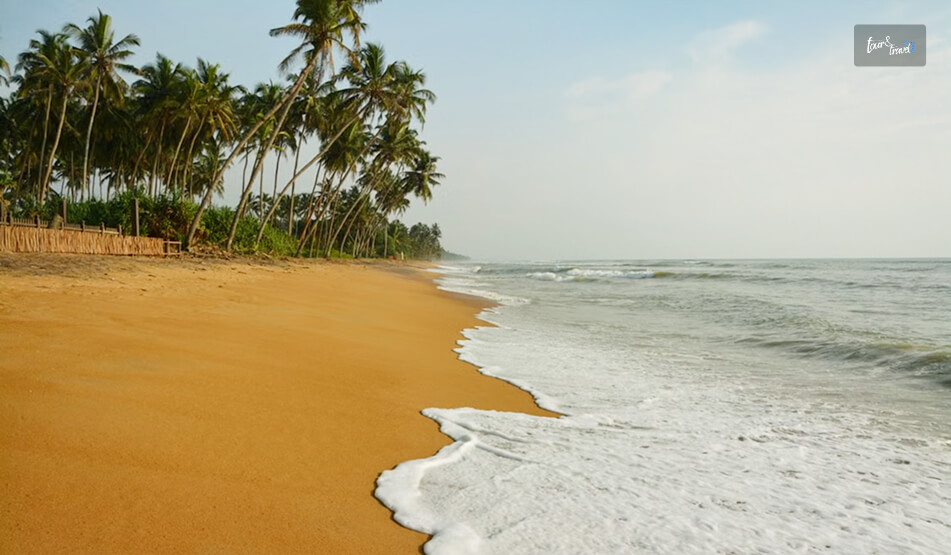
Nevertheless, I spent my first evening walking along Mullaitivu Beach. 

Fishing boats had gathered there, forming neat rows, and the nets were drying on the sand. 

Also, it was most delightful to find children playing cricket on the sand with a tennis ball. 

Being from the country where cricket is a religion, I joined them.

We bonded big time talking over big names such as Kumar Sangakkara and Kusal Mendis. 

A few meters away from them, an elderly woman was mending a fishing net. 

It felt like a scene from a Sanjeewa Pushpakumara movie. Like his films, Flying Fish and The Venishing, it was like a scene depicting the raw portrayal of survival. 

What Are The Places To Visit In Mullaitivu? 

I was not prepared for the amount of Civil War history Mullaitivu offered me. 

Also, the birds and the sanctuary where the beach and lagoon meet allowed me to unwind with so many things going on in my head about life during and after the Civil War in Sri Lanka. 

Nanthikadal Lagoon: Where The War Ended

At a glance, the Nanthikadal Lagoon looks like a shallow, sand-fringed body of water. It is on the northeastern edge of the district.

Small rivers feed it, and it finally opens into the Indian Ocean. 

When I reached the lagoon, I found some egrets standing motionless in the shallows. Then, a kingfisher dropped into the water and came up empty.

Ravi then took me to an old man, a local school teacher called Rajan. He narrated the entire story of the Nanthikadal Lagoon to me. 

What Happened At Nanthikadal Lagoon 

The 26-year Civil War of Sri Lanka ended at Nanthikadal Lagoon in May 2009. 

Here, the government forces cornered the last LTTE fighters. The group’s leader, Velupillai Prabhakaran, was also killed. 

In the weeks before that, civilians had been pushed into a shrinking strip of land along this same lagoon. They were between the fighting lines.

In a report published on 17th January 2009, The Guardian wrote, 

International concern is intensifying over the fate of around 350,000 civilians trapped in a rapidly shrinking rebel-controlled pocket of land in Sri Lanka’s north east, as the military steps up its campaign to end the civil war by crushing the Tamil Tiger forces.

There is no specific count of the number of human casualties in these final months.

  • A 2011 UN Panel of Experts report stated that credible sources estimated as many as 40,000 civilian deaths.
  • Another report, published by The Times (UK) on 29th May 2009 based on confidential UN documents the paper obtained, reported that civilian deaths in the no-fire zone rose sharply from late April.

The deaths averaged around 1,000 killed per day until May 19, 2009. Thus, it had put the total civilian death toll at over 20,000. (Source: Al Jazeera). 

The Sri Lankan Government has shown a much lower figure.  

However, in the UN Rights Council: Act on Sri Lanka Report published on 13th September 2011, Brad Adams, the Asia director at Human Rights Watch, mentioned, 

When a UN Panel of Experts report concludes up to 40,000 civilians died amid war crimes, the Human Rights Council should feel compelled to act.

The council should order a full international investigation – anything less would be a shameful abdication of responsibility.

How Nanthikadal Lagoon Looks Back At Those Days Every Year

Tamil families gather at Mullivaikkal, close to the lagoon, on 19th May every year to remember relatives lost in the final days. 

They light lamps and plant coconut saplings in their memory. 

Standing at the water’s edge, with fishermen casting nets a short distance away, I found it hard to reconcile the stillness in front of me with what this ground had witnessed.

The Victory Monument, The Museum, And The Submarines

The Puthukkudiyiruppu Victory Monument was on the Paranthan-Mullaitivu road, which was a short drive from the lagoon. 

It was unveiled in 2019, and it depicts a soldier carrying the national flag. 

Furthermore, the surrounding pond and lilies represent the ocean around the island and the nation itself. 

An adjoining war museum displays weapons, vehicles, and vessels used during the conflict’s final phase.

Entry to the museum was free, and it remains open from 8 AM to 5 PM. 

Also nearby, there were rusted hulls, and it was the site where the government troops discovered an abandoned Sea Tiger boatyard in 2009. 

It is where the LTTE’s naval wing used to build improvised submarines and semi-submersible craft. 

I want to be honest about something here.

This is a site that different communities in Sri Lanka read very differently, and I do not think a two-day visit qualifies anyone to settle that. 

What I can say is that visiting both the lagoon and the monument on the same day gave me a fuller, more uncomfortable picture than either would have alone.

The Kokkilai Lagoon:  Where The Coastline Turns Peaceful Again

On the second afternoon, I drove out to Kokkilai Lagoon. 

It was a wetland sanctuary around 25 kilometers southeast of town. 

It has been a protected bird sanctuary since 1951, and I could spot pelicans, herons, and occasional flamingos moving along the shallows. 

The crowd of birdwatchers was small, and the overall ambiance was quiet. 

Chundikulam

Further along the coast, Chundikulam allowed me to relax. It was a sanctuary with no visitors. 

I quietly cherished the view of the beach and lagoon blurring into one uninterrupted stretch of sand and water.

Coming back from Chundikulam, I had some spicy crab curry and rice at a roadside stall. It was similar to what I had in Jaffna, but it tasted even better. 

Ravi said, “It was the only reason to end the day here.” 

My Two Days In Mullaitivu: The Itinerary 

Day TimeActivities/Places to Visit
Day 1MorningDrive from Vavuniya via the A34
MiddayCheck-in and Walk through Mullaitivu Town
AfternoonNanthikadal Lagoon and the Causeway
EveningMullaitivu Beach at Sunset
Day 2MorningPuthukkudiyiruppu Victory Monument and War Museum
MiddaySea Tiger Submarine Yard
AfternoonKokkilai Lagoon Birdwatching
EveningChundikulam Coastline and Seafood Dinner

Mullaitivu: A Quiet Place That Asks You To Listen 

Away from the grandeur of Kandy and Colombo, Mullaitivu is a place that simply exists.

It tells the stories of human survival, and it is still recovering and fishing despite the stains and the lives lost in the Civil War. 

So, if you are already tracing the north of Sri Lanka through Vavuniya, Kilinochchi, or Mannar, I would not leave Mullaitivu off the route. 

Just go with the understanding that this is not a beach add-on. It is a place that holds two very different stories at once, and it does not owe you a tidy conclusion to either.

Share on Social Media

Sibashree is a travel, culture, and leisure writer who has been writing since the age of 12 and professionally since 2014. With more than a decade of travel writing experience and journeys across India and several parts of the world, she brings a deeply personal and thoughtful perspective to her work. A student of English Literature and Mass Communication, Sibashree has always viewed travel as more than movement — for her, it has been a way of understanding people, cultures, and herself. Her passion for spiritual exploration has also led her to many unusual and meaningful destinations over the years. Outside of writing, Sibashree enjoys watching European cinema, reading about global politics, and reflecting on the stories hidden within everyday places.

Leave a Reply

Your email address will not be published. Required fields are marked *

title-img Related

READ MORE Aberdeen Falls

Aberdeen Falls: Sri Lanka’s Quietest Big Waterfall

BY  Sibashree Aug 29, 2026

Aberdeen Falls makes you wait, and you have to work hard to get a view of this majestic waterfall.   Also, this waterfall in Sri Lanka's hill country was the one with the fewest other visitors when I got there.   There was no roadside pull-off here and no viewing platform right off the highway.   Just a walk through tea land above Ginigathena, the sound of water getting louder, and then a nearly 100-meter curtain dropping into a rock-walled pool!  Here is my experience at this majestic waterfall and everything else you need to know to visit it.   Quick Facts About Aberdeen Falls  Quick Facts Details  Height About 98 Meters  Width Around 8 Meters  River Kehelgamu Oya, a tributary of the Kelani River  Location Near Ginigathena, Nuwara Eliya District, Central Province  Rank 18th highest waterfall in Sri Lanka  Access Short hike (roughly 1 km) from the road, and there is no formal entry fee.  Swimming Not recommended as the pool is deep, and currents can be dangerous.   Where Is Aberdeen Falls And How To Get There? Aberdeen Falls is on the Kehelgamu Oya, a major tributary of the Kelani River, near the town of Ginigathena in the Nuwara Eliya District.   It is named, a little incongruously, after Aberdeen in Scotland. So, it is a nod to the British planters who once ran the tea estate here.  From Ginigathena  The most common approach starts in Ginigathena town.   From there, follow Ambatale Road to a Buddha statue at the end of the road, where you will need to park.   From that point, it is a walk of a little over a kilometer. Some guides list it as 800 meters to 1.2 kilometers depending on the exact route along a footpath through the estate and down toward the falls.  From Colombo Or Kandy  A common route from Colombo runs via Avissawella and Karawanella to Ginigathena. It is roughly 3 to 3.5 hours by car.   From Kandy, it is a similar distance heading the opposite direction, passing through Kadugannawa and Ginigathena's outskirts.  On The Trail  The path down is uneven in places and can get slippery after rain.  So proper shoes matter more here than at the roadside falls further up the valley.   It is not a technical hike, but it's enough of a walk that you'll want at least an hour round trip, more if you stop for photos.  What Makes Aberdeen Falls Different Most of the well-known waterfalls in this part of the hill country, St. Clair's, Devon, are effectively drive-by attractions.  They are visible from a car window or a short stroll off the highway.   Aberdeen isn't.   You have to commit to the walk, and that alone keeps the crowds thinner than at the more famous falls nearby.  The reward is a narrow, forceful single drop into a pool framed by a large rock formation behind it, with dense forest closing in on both sides.   Local legend holds that a tunnel connects Aberdeen Falls to Laxapana Falls further down the valley.  There is no solid evidence for it. However, it is the kind of story that gets repeated at every viewpoint, and I'll admit it added a bit of atmosphere while I stood there.   Because Aberdeen and Laxapana both sit on rivers that feed hydroelectric schemes, water levels can vary noticeably depending on how much is being diverted upstream.  So the falls look a little different every time.  The Amphitheater Of Stone And Mist  What truly sets Aberdeen Falls apart once you clear the jungle trail is the sheer scale of its geological footprint.   The water does not simply spill over a cliff.  It thunders into a colossal, horseshoe-shaped rock amphitheater.   This towering crescent of dark, wet stone acts like a natural sounding board, trapping the roar of the Kehelgamu Oya and magnifying it until the air itself seems to vibrate.  Because of the unique inward curve of the rock walls, a perpetual cloud of heavy mist hangs suspended over the plunge pool.   This constant humidity has created a microclimate where vibrant green mosses, slick liverworts, and primitive ferns cling to every vertical fissure, contrasting sharply with the black obsidian-colored rock face.  Standing at the edge of the basin, the view is framed by a dense canopy of endemic trees that lean over the water, blocking out the harsh midday sun.   The result is a moody, isolated sanctuary that feels entirely cut off from the outside world.   It is a visual drama you completely miss from a roadside viewpoint. So, it is a hidden world for those willing to track it down.  What Is The Best Time To Visit Aberdeen Falls?  Seasons Months  What to Expect  Wet season May to September Strongest flow, but the trail is muddier, and swimming is more dangerous  Dry season December to March Easier trail conditions, gentler flow, clearer photos  Early morning Any season Cooler hiking temperatures and better light through the forest canopy   Places To Visit Near Aberdeen Falls: Laxapana Falls And Kitulgala If you are already making the trip out to Ginigathena, it is worth extending the day.   Laxapana Falls, tied to Aberdeen in local folklore, is a further drive down the valley.  Also, Kitulgala, Sri Lanka's main whitewater rafting hub, is roughly 30 to 40 minutes away.  Thus, this stretch is a natural base for a nature-and-adventure day rather than a single quick stop.  A One-Day Itinerary Around Aberdeen Falls  Time Stop Notes 8:00 AM Depart Ginigathena or Kitulgala Start early to avoid the midday heat on the walk.  9:00 AM Hike to Aberdeen Falls About 1 km each way from the Ambatale Road parking point.  10:30 AM Return to the road Allow extra time for photos and the uphill return walk.  11:30 AM Drive to Kitulgala Roughly 30–40 minutes away.  12:30 PM Lunch by the Kelani River Several riverside spots near the rafting operators.  2:00 PM Optional: whitewater rafting or a river walk Kitulgala's main draw if you have the afternoon free.   Practical Tips For A Visit To Aberdeen Falls  Wear proper hiking shoes as the trail has dirt and stone. Also, it can be slick after rain.  Do not swim in the pool at the base because it is deep. There have been cases of drownings here.  There is no ticket booth or formal infrastructure. So bring water and snacks with you.  Moreover, hire a local guide or tuk-tuk driver in Ginigathena if you are unsure of the trailhead. You may not find a signpost everywhere.   Climbing back up from Aberdeen Falls, sweating a little more than I expected to, I remember thinking it was worth every step.   It does not have the roadside fame of St. Clair's or Devon. That is exactly the point, as this is the waterfall you visit when you want to feel like you found it yourself.

READ MORE Wasgamuwa National Park

Wasgamuwa National Park: My Search For Sri Lanka’s Quietest Elephant Safari

BY  Sibashree Sep 4, 2026

Before I reached the Wasgamuwa National Park, I had already completed the classic Sri Lankan safari.   In Yala National Park, the jeeps were queued, and when a leopard was spotted, all the vehicles were boxed around it.   The chaos was such that I almost forgot I was in the wilderness.   However, Wasgamuwa was the antidote I did not know I needed.  Our jeep drove in through the Handungamuwa entrance on a grey, humid morning, half-expecting another crowded circuit, and instead spent four hours without seeing another jeep.   That is Wasgamuwa's whole pitch!  You will find the same elephants, sloth bears, and dry-zone forest you would find in  Sri Lanka's headline parks, minus the traffic jam.  Quick Facts: Wasgamuwa National Park  Detail Information  Location Matale and Polonnaruwa Districts, Central/North Central Sri Lanka   Distance from Colombo   225 km (via Kandy–Hasalaka–Wilgamuwa Route)  Area   37,062 Hectares  Declared   7 August 1984 (Strict Nature Reserve since 1938)  Main Entrances   Handungamuwa Gate Kalundawa Gate  Park Hours  6:00 AM to 6:00 PM Daily Ticket Counter Hours  6:00 AM to 4:00 PM Known for Wild Elephant Herds Sri Lanka's Densest Sloth Bear Population  Nearest Towns  Polonnaruwa (10 Km) Hasalaka Wilgamuwa   How To Reach The Wasgamuwa National Park? The location of Wasgamuwa National Park is a little reclusive, for lack of a better word.   It is neither part of the hill country nor is it included in the cultural triangle. So, often, it is left out of usual Sri Lanka trip itineraries.   However, this national park is accessible from Colombo, Kandy, Sigiriya, Dambulla and Polonnaruwa.   So, you can plan a cultural trip combined with a wildlife experience by including the Wasgamuwa National Park in your bucket list.   From Colombo  The most straightforward route runs via Kandy on the A1, then the A26 towards Mahiyangana.   At Hasalaka, you turn off onto the Wilgamuwa road and follow it through to the park.   Budget five to six hours for the roughly 225 km drive, longer if you get stuck in Kandy's town traffic, which you almost certainly will around midday.  From Kandy, Sigiriya, And Dambulla  If you are already based in the Cultural Triangle, Wasgamuwa is a far more manageable side trip.  From Kandy, it is about 50 km northeast via Hasalaka and Wilgamuwa. So, it is just around a 90-minute drive from the Colombo slog.   On the other hand, Sigiriya Rock and the Dambulla Royal Cave Temple are around two hours away by road, and the route passes through Naula and Elahera.   So, as I did, you can tack a Wasgamuwa morning safari onto a Sigiriya stay rather than treating it as its own base.  The Expenses  A private car rental or taxi fare from Colombo to the Wasgamuwa National Park will cost you LKR 15000 onward.   So, the best option is to travel from Colombo to Kandy, stay there, and travel to the Wasgamuwa National Park from there.   To know more details about how to travel from Colombo to Kandy, you can check my guide.   From Sigiriya or the Dambulla Royal Cave, a public vehicle to this national park will cost you around LKR 10000.   From Polonnaruwa  Polonnaruwa is the closest major town, just 10 km from the park's northern boundary.  The  Wilgamuwa "Japan Bridge" gives easy access from the Mahaweli System C area.  Despite the short distance, the taxi fare from Polonnaruwa to Wasgamuwa is quite high. It will be around LKR 7000.   Also, for the jeep safari inside the national park, the cost will be around LKR 7500 to LKR 10000.   Entrance Fees And Permits   Category   Approximate Cost (2026)   Foreign Adult (12+)   USD 12  Foreign Child (6–12 Years)   USD 6  Foreign Children under 6 Years    Free  SAARC Nationals USD 10 for Adults USD 5 for Children between 6 and 12 Years Free for Children below 6 Years    Locals   Adults: LKR 60 Children from 6 to 12 Years: LKR 30 Children below 6 Years: Free Students: LKR 20   Vehicle Entry Ticket   LKR 300   Foreign Group Fee Per Vehicle   USD 10  What Is The Best Time To Visit Wasgamuwa National Park? You will have to decide the best time to visit the park based on the kind of experience you want.   For Elephant Herds   Wasgamuwa has a different timing for spotting the elephants than Minneriya.   During the dry months (roughly June to September), much of Wasgamuwa's elephant population actually migrates north toward Minneriya and Kaudulla in search of water, which is where you will find those spectacular 200-strong herds.   So, if you want to spot the elephants, November to May is when more of them stay resident within Wasgamuwa itself, following the Mahaweli River corridor that forms the park's eastern boundary.  Weather And General Visiting  The dry season from June to September offers comfortable safari conditions.  The thinner vegetation makes it easy to spot sloth bears and leopards.   October to January brings the northeast monsoon, when the park can turn muddy, and some interior tracks become difficult to navigate.  What To See Inside The Park? The park offers the most wonderful fusion of wildlife and history.   Wildlife  Wasgamuwa gets all the hype for its elephants. However, it also has sloth bears and leopards.  In fact, many surveys suggest that sloth bear density in this park is highest in Sri Lanka.   Also, some accounts suggest the park's own name derives from "walas" (sloth bear) and "gamuwa" (wood). So, it is literally the forest of the sloth bears.   Along with these three, you can even spot purple-faced langurs, wild boar, sambar, spotted deer, and water buffalo here.  Moreover,  in the park's pools and waterways reside water monitors, mugger and estuarine crocodiles, and pythons.   Birdlife is understated but real.  I counted painted storks, white ibis, and several raptors circling over the grasslands in a single morning.  Ancient Ruins Within The Park  Long before it was a protected area, this land carried Anuradhapura- and Polonnaruwa-era settlement.  I saw dagobas, an ancient canal system, and reservoir remains scattered through the jungle, well away from the standard vehicle tracks.  Moreover, the area between the park and the Mahaweli River has a link to a battlefield from the Dutugemunu–Elara conflict of the 2nd century BCE.  However, I could not visit most of the sites because I did not have the required special permission. Also, these are not part of the regular safari visits.   Safari Timings And Practicalities  Feature Half-Day Morning Half-Day Evening Full-Day Safari Timing 5:30 AM – 6:30 AM Start 2:30 PM / 3:00 PM – 6:00 PM Full day (split by picnic break) Duration 3 – 4 hours 3 – 4 hours All day Coverage Area Main tracks near Handungamuwa Gate Main tracks near Handungamuwa Gate Mahaweli riverbank sections Jeep Cost (LKR) 7,500 – 10,000 7,500 – 10,000 15,000 – 20,000 Wildlife Focus General park wildlife General park wildlife Reliable elephant sightings Hotel Pickup 30–60 mins early (if less than 5 km from gate) Varies by hotel proximity 30–60 mins early (if less than 5 km from gate)  A Sample One-Day Wasgamuwa Itinerary   Time   Activity  5:00 AM   Depart accommodation (Kandy base)  6:00–6:30 AM   Arrive at Handungamuwa Gate, complete entry formalities  6:30–10:00 AM   Morning Safari including Riverine Forest and Grassland Tracks  10:00–10:30 AM   Picnic/Tea Break Near Mahaweli Riverbank  10:30–11:30 AM   Continue Safari toward Interior Water Holes  11:30 AM   Exit Park and Return to Base  3:00–6:00 PM   Evening Safari Session with a Separate Entry  Wasgamuwa does not have the wall-to-wall wildlife density of Yala or the spectacle of Minneriya's Gathering.   However, you will get a quiet forest to explore for several hours. Also, the elephants and sloth bears here are never performing for the tourists or camera lenses.   So, I would pair it with a Cultural Triangle any day for the best value safari experience in the country. 

READ MORE chilaw

How Chilaw, Sri Lanka, Turned A Quick Stop Into Two Extra Days: Know The Fishing Town

BY  Sibashree Aug 21, 2026

Chilaw drew my attention with the smell of drying fish at the harbor. As I reached the fishing town, I heard a low chant drifting out of a Shiva temple.  Chilaw, which almost a year back had a Korea FAO Sustainable and Innovative Fisheries and Aquaculture Programme (KOFAF) to boost the shrimp aquaculture of Sri Lanka, is a fishing town first.  Then, it is a pilgrimage site and almost as an afterthought, a beach destination.  Overall, it felt so unpolished and real in a way that many famous coastal stops in Sri Lanka have lost for a long time. How To Reach Chilaw, Sri Lanka And Get Around?  Chilaw is around 52.9 km away from the Bandaranaike International Airport. By road, the journey is around 1.5 hours to 2 hours.  The town's own railway station is about 3 kilometres from the centre, with regular services connecting to Colombo along the coastal line. ModeEstimated Time From ColomboApproximate Cost (LKR)NotesCar / Taxi2 Hours8000-15000(Based on Vehicle Type)Most FlexibleEasiest Way to Combine Chilaw with Anawilundawa and Marawila in One LoopUber2 HoursUber Go Intercity: 12016Uber Sedan: Intercity: 12629UberXL Intercity: ₹16062(Source: Uber.com) Best for First-timers.Safer for Solo, Women Travelers. Train (Colombo Fort–Puttalam line)Around 2.5 to 3 HoursThird Class Tickets: 180Second Class Tickets: 400First Class Tickets: 750(Source: Sri Lankan Railways.)The Station is roughly 3 km from the Town CentreA Tuk-Tuk Covers the Last StretchBus2–2.5 Hours150-300Regular Services along the Coastal RouteIt is the Cheapest Option Once you reach Chilaw, you can move around in tuk-tuks. From the town center, you can take a short ride to the fish market and near St. Mary's Church. You can even ferry to Anawilundawa and back after a half-day trip.  However, here, I had to negotiate a lot with the drivers. You must also fix the price upfront so that they do not end up adding more to the price during the trip.  What Are The Top Attractions In Chilaw?  Chilaw does not offer a resort trip like Bentota or Hikkaduwa. It mostly has simple guesthouses as accommodations.  Also, if you want to focus on the quieter beach experience, you can stay in the larger properties in Marawila.  Still, Chilaw is not like a typical touristy or bucket-list destination, and here are the places I visited during my stay.  1. Munneswaram Temple Like the Pancha Bhoota Sthals in India, Sri Lanka also has its five ancient Ishwarams dedicated to Lord Shiva.  Munneswaram is one of them.  The temple is a complex of five temples, dedicated to Shiva, Ganesha, Ayyanayake, Kali, and, notably, a shrine to the Buddha as well.  This temple once again reminded me that the religious traditions of Sri Lanka have always been inclusive. Also, they have often overlapped with each other, rather than staying separate.  Why Is The Munneswaram Temple So Special?  The temple has a mythological association with the Ramayana. It is said that Lord Ramachandra worshipped Lord Shiva here for penance after killing Ravana, who was an ardent Shiva devotee and a Brahman.  Along with the mythological connection, the temple also stands out with its ambiance. As I entered the temple, the incense smoke rose over the Dravidian-style gopuram.  Also, there was a practiced calm even if the priests and devotees moved between the shrines.  However, the temple bustles with energy and human presence during the annual Munneswaram festival.  It is usually held in August, and the entire town seems to reorganise itself around the procession. 2. Chilaw Lagoon And The Sand Spits Chilaw picks its own rhythm from the lagoon. It is fringed by sixteen species of mangrove and reaches close to four metres at its deepest point before opening into the Indian Ocean. I took a late-afternoon boat out with a local fisherman who moonlights as a guide.  I spotted egrets lifting off the mangrove roots, and the occasional splash of a mullet. Also, with absolutely no other tourists in sight, it was the most peaceful 1 hour in Chilaw.  The lagoon isn't just scenic. It is a working fishery that supports well over a thousand families in the area, and you feel that livelihood everywhere. I saw the nets drying along the banks to the small jetties where boats are unloaded each morning.  Nearby, the Chilaw sand spits offer a quieter, more unusual landscape for birdwatchers, with shifting sandbanks that host wading birds you won't easily spot elsewhere on this coast. Regarding the charges, you have to negotiate directly with a fisherman at the jetty rather than book through a formal operator. My boat ride cost me LKR 500.   So, this is still very much an informal, word-of-mouth arrangement, and that is why there will be a lot of negotiations regarding the trip duration and the charges.  3. Anawilundawa Wetland Sanctuary If you are staying in Chilaw, do not skip a half-day trip to Anawilundawa, located between Chilaw and Puttalam.  This 1400 hectares area is a Ramsar Site, and it has three distinct ecosystems. You will find a  mangrove swamp, coastal saltwater belt, and freshwater lakes. Also, the biodiversity numbers are amazing. 150 Bord Species 20 Mammal Species 70 Types of Butterflies Moreover, half of the freshwater fish species in Sri Lanka call Anawilundawa Wetland Sanctuary their home.  I made a mistake by not taking a guide with me for the wetland visit.  A local birder pointed out species from the boat that I would have completely missed on my own, including a painted stork colony that was, frankly, worth the whole detour. If birdwatching is even a mild interest, hire a guide at the entrance.  It is inexpensive and transforms the visit. The entry is free, and the guide cost will be around LKR 1500 for two hours. Also, the sanctuary remains open from 6 AM to 6 PM.  4. Faith Along The Coast: Churches And Kovils Home to the Munneswaram Temple, Chilaw also harbors a Catholic heritage.  The St. Mary's Church in the town centre is a prominent example, and its architecture and quiet courtyard make it worth a stop even outside service hours.  A short drive away in Thalawila, St. Anne's Church draws thousands of pilgrims each July for its annual feast, one of the larger Catholic gatherings on this stretch of coast, complete with processions and all-night vigils. What struck me most, wandering between kovils, churches, and small unnamed shrines tucked down side streets, was how unremarkable this coexistence felt to the people living it. Nobody made a point of it.  It was simply how the town worked. 5. Beaches, Toddy Taverns, And The Fish Market Chilaw beaches are not the typical postcard frames you will find on the southern coast.  Silver Beach, the most prominent among them, is right in town. I loved an early evening walk there.  Also, nearby Marawila offers a longer, quieter stretch of sand if you are willing to drive twenty minutes north. For a real sense of the town, though, skip the beach and get to the Chilaw fish market before 7 AM.  It was loud, slippery underfoot, and completely unstaged. Furthermore, when the boats came in, auctioneers shouted prices, and vendors were already frying fresh catch on the spot.  I ended up having a breakfast of string hoppers and coconut sambol from a stall two feet from the water, and it remains one of the best meals of the trip. Later, I visited one small family-run toddy tavern. It served fresh fermented palm sap alongside coconut-based snacks.  It was strong, and I just took a few sips. Though it is a slice of daily Chilaw life, it is not for someone who is not used to it.  What Is The Best Time To Visit Chilaw?  Being on the west coast, Chilaw follows a different rhythm than the south or east. SeasonMonthsConditionsDry SeasonDecember–MarchSunny and low-humidity weather conditions are the best for lagoon trips and wetland walks.ShoulderApril, NovemberTransitional months offer fewer crowds, and the weather can be mixed.Southwest MonsoonMay–OctoberHeavier rain makes birdwatching and boating harder to plan around.Munneswaram FestivalUsually AugustThe town reorganises around the temple procession.So, it is worth timing a visit around. Combining Chilaw With Nearby Stops Route SegmentApprox. Driving TimeBest Known ForColombo to Chilaw2 hoursMunneswaram Temple, fish marketChilaw to Anawilundawa30 minutesWetland sanctuary, birdwatchingChilaw to Marawila20 minutesQuieter beach stretchChilaw to Puttalam45 minutesPuttalam Lagoon, salt pansPuttalam to Wilpattu National Park30–45 minutesLeopard sightings, natural "villu" lakes This makes Chilaw a natural half-day or overnight anchor for a longer west-coast loop rather than a single-purpose day trip. Why Chilaw Is Worth It Chilaw is not a destination that announces itself.  There is no single landmark that makes it onto every Sri Lanka itinerary, no beach that dominates Instagram feeds.  What it offers instead is texture. It has a working fish market, a thousand-year-old temple complex, mangrove lagoons, and a religious diversity that's lived rather than performed.  If you are the kind of traveller who would rather stumble into a real town than tick off a famous one, Chilaw is worth far more than the quick pass-through I originally planned.