

Bambarakanda Falls: A Trek To The Tallest Waterfall In Sri Lanka, Location And Everything You Must Know

Aug 27, 2026

Last Updated on: Sep 29, 2026

Asia

Most waterfalls in Sri Lanka announce themselves with a roar from half a kilometer away.

However, Bambarakanda Falls was different.  

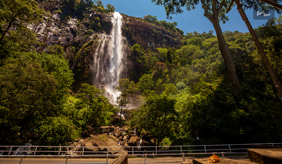
It has a thin water flow, and as it drops far, I could only hear the sound of the waterfall when I was standing directly under it.  

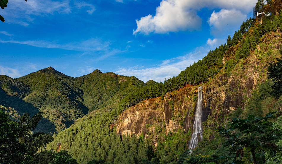
However, it is the tallest in the country, and I could not find the top even after craning my neck all the way back.  

The Story Behind The Name Of The Bambarakanda Falls

Bambarakanda Falls: A Trek To The Tallest Waterfall In Sri Lanka, Location And Everything You Must Know

The name comes from Bambara. In the Sinhalese language, Bambara means wasps. 

The rock face around the falls was once a prominent colony of wasps.  

However, before the waterfall became known as Bambarakanda,  it was called Bambarakele Falls and Dultota Falls.  

What struck me more than the etymology was how quiet the setting is compared to its size and fame. 

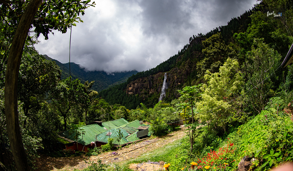
This is not a waterfall with restaurants and gift shops crowding the base, just pine forest, a rough access road, and the sound of falling water. 

Where Is Bambarakanda Falls?

Bambarakanda Falls: A Trek To The Tallest Waterfall In Sri Lanka, Location And Everything You Must Know

Bambarakanda Falls is close to the small town of Kalupahana in the Badulla District. It is also near the boundary of the Horton Plains National Park.  

Kuda Oya, a modest stream, is the source of this waterfall.  

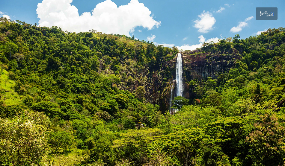
However, it transforms into the most dramatic tributary the moment it reaches the cliff edge above Kalupahana and drops in a single, thin, horsetail plunge.  

Furthermore, this waterfall is around 200 km away from Colombo.

The distance between Bambarakanda Waterfall and Belihuloya is just 18 km.  

So, Bambarakanda Falls easily fits into the itinerary if you are in the Central Highlands of Sri Lanka or on the Ella–Haputale–Horton Plains corridor.  

How To Reach Bambarakanda Falls?

Bambarakanda Falls: A Trek To The Tallest Waterfall In Sri Lanka, Location And Everything You Must Know

Bambarakanda is easily accessible from Colombo by road and train. Here are the details.  

From Colombo By Road 

The most common route is Colombo to Ratnapura to Belihuloya to Kalupahana, following the A4 highway toward Beragala.  

At Kalupahana Junction, a signposted turn-off leads onto a narrower road that runs for roughly 5 km through Weerakoongama’s pine and tea plantations before reaching the parking area.  

The final stretch is rough enough in places that not every car will manage it comfortably. 

So a tuk-tuk from the junction is a popular last-mile option if you’re not driving a higher-clearance vehicle. 

By Train And Bus 

If you’re relying on public transport, the nearest useful rail stop is Ohiya. 

From Ohiya, you will still need a taxi or tuk-tuk to cover the remaining distance.  

Buses running the Colombo–Badulla A4 route will drop you at Kalupahana Junction, where three-wheelers wait to ferry visitors up the access road for a small fixed fare. 

The Trek To The Base 

From the parking area, I had to take a flight of steps to reach the base of the waterfall. The flight took around 10-15 minutes.  

It was an easy trek as I passed through a pine forest.

Also, compared to places such as Sinharaja, the leeches were way fewer in number throughout the route.  

However, with the pine needles scattered on the ground, it was a bit slippery. So, you need to wear proper walking or trekking shoes.  

As I reached the base of the waterfall, I found a shallow pool, perfect for wading.

Also, if you want to remain dry and want to appreciate the scale of the waterfall, you can watch the waterfall from the concrete viewing platform.  

Climbing To The Top: The Devil’s Staircase 

If you want more adventure, you can take the steep trail nicknamed the Devil’s Staircase, winding up the mountainside to the crest of the falls. 

Remember that this stretch, leading to the top, is a proper hiking route. It is not like strolling anyway! 

The elevation here is several hundred meters through pine and mixed forest.

So, even if the weather is a little bad, you must not attempt this.  

The reward at the top is a small natural infinity pool and a miniature waterfall feeding into the main drop, along with sweeping views down the valley toward the eastern plains.  

A short trek from the base also leads to Lanka Ella, a smaller waterfall nearby whose shape is sometimes said to resemble the outline of Sri Lanka itself. 

What Is The Best Time To Visit The Bambarakanda Falls?

Bambarakanda Falls: A Trek To The Tallest Waterfall In Sri Lanka, Location And Everything You Must Know

Honestly, the guides on the best time to visit Bambarakanda Falls are mostly confusing.  

Some sources say that March to May is the ideal time for a visit to this waterfall.

Indeed, going for a trek is safest in this season, as the flow is modest and the trails are less slippery.  

However, if you want to see the most dramatic version of the waterfall, May to September is the ideal window.  

I am someone who is always in for the later window.

Visiting shortly after rain gave me a fuller view of the fall, and it was the most photogenic.  

A dry spell, on the other hand, makes the waterfall look thinner.  

What Are The Attractions Near Bambarakanda Waterfalls?

Bambarakanda Falls: A Trek To The Tallest Waterfall In Sri Lanka, Location And Everything You Must Know

Some of the best-known sights of the Sri Lankan Central Highlands are very close to Bambarakanda Waterfalls. 

Horton Plains National Park and World’s End are a scenic drive away.

Haputale, with its cooler climate, tea estates, and views toward the southern coast on a clear day. 

Haputale further makes a good overnight base.

Also, if you are continuing along the A4, Belihuloya offers river-adjacent guesthouses and a much gentler pace than the falls themselves. 

Practical Travel Tips 

If you are planning to capture the beauty of the waterfall, you should pack wide-angle lenses.  

The waterfall is so tall that, considering how close you stand, fitting the entire cascade into one frame from the base is genuinely difficult. 

Furthermore, if you are driving yourself to the waterfall, budget extra time for the access road.

This is narrow, occasionally rutted, and best driven slowly regardless of your vehicle. 

A Few Things I Wish I Had Known 

It was a mistake on my part to underestimate the remoteness of the final stretch of the road. 

The stretch was just a few kilometers off the main A4 Highway. Still, once I quickly reached the pine forest, there was no phone signal for the majority of the route leading to the base.  

Furthermore, you will have to bring cash, as digital payments or cards are not accepted at the entrance or along the trail. 

Also, barring the odd roadside stall near the junction, you will not find much food.  

Moreover, if you are on the Devil’s Staircase climb to the crest, go early in the day.

Clouds tend to roll in by early afternoon and can turn a rewarding view into a very damp anticlimax. 

Where To Stay Near Bambarakanda Falls 

You will not find real accommodation facilities right at the falls.  

As convenient options, you can base yourself in Haputale or Belihuloya. You can reach both locations within 30-40 minutes by car from Bambarakanda.  

Haputale sits higher up and cooler, with a scattering of small guesthouses and a couple of well-regarded boutique stays that make a good stop if you are also planning to see World’s End at Horton Plains the next morning.  

Belihuloya, down in the valley, has a handful of riverside guesthouses that suit travelers who’d rather relax by moving water than climb toward it after a long day on the road.  

Either option works as a base for a half-day dedicated to Bambarakanda, with enough flexibility to add Horton Plains or a tea-estate walk without much extra driving.

Share on Social Media

Sibashree is a travel, culture, and leisure writer who has been writing since the age of 12 and professionally since 2014. With more than a decade of travel writing experience and journeys across India and several parts of the world, she brings a deeply personal and thoughtful perspective to her work. A student of English Literature and Mass Communication, Sibashree has always viewed travel as more than movement — for her, it has been a way of understanding people, cultures, and herself. Her passion for spiritual exploration has also led her to many unusual and meaningful destinations over the years. Outside of writing, Sibashree enjoys watching European cinema, reading about global politics, and reflecting on the stories hidden within everyday places.

Leave a Reply

Your email address will not be published. Required fields are marked *

title-img Related

READ MORE world's end sri lanka

World’s End, Sri Lanka: Chasing the View Before the Clouds Roll In

BY  Sibashree Aug 31, 2026

Nobody tells you how early a '5 AM start' actually feels until you are standing in the dark outside your Nuwara Eliya guesthouse, breakfast pack in hand, waiting for a tuk-tuk.   But that is the deal with World's End.  The view is clear from about 9 AM to 10 AM.  After that, clouds roll in off the valley and swallow the whole thing whole.   I had heard this enough times before arriving that I did not question the alarm. And I am glad I did not.  By the time I reached the escarpment, the drop in front of me was still clear enough to see the coast, some 80 kilometres away.  World's End is a sheer escarpment inside Horton Plains National Park, in Sri Lanka's central highlands.   You have to take a circular hiking trail to reach it, and the same route also takes you to Baker's Falls and a smaller companion viewpoint called Mini World's End.  It has become one of the most-hiked routes in the country precisely because the effort-to-reward ratio is so favourable.  It is a manageable walk for a view most people only expect to earn after a serious trek.  World’s End, Sri Lanka: At A Glance  Location Horton Plains National Park, central highlands  Elevation at start About 2,100 metres  Drop at World's End Approximately 870–880 metres  Circular trail distance 9–9.5 km (Red Bridge → Mini World's End → World's End → Baker's Falls → back)  Typical hike duration 2.5–4 Hours  Park hours 6 AM to 6 PM  Best time to visit January to March (Driest Months). You must arrive by 6 AM regardless of season.  Nearest base Nuwara Eliya   Why The Early Start Actually Matters This is not exaggerated marketing. World's End genuinely clouds over by mid-morning most days, often as early as 9 AM.  The park opens at 6 AM, and the guidance from pretty much every guide, driver, and fellow hiker I spoke to was the same.  Get there at opening, start walking immediately, and don't dawdle at Mini World's End if clear skies at the main viewpoint are your priority.   I reached World's End a little under an hour and a half after setting off and had maybe twenty clear minutes before the first wisps of cloud started drifting up from the valley below.  There is no public transport directly to Horton Plains from Nuwara Eliya.  So you are looking at a hired tuk-tuk, car, or a pre-booked tour.  The PickMe app works if you would rather arrange it yourself the night before.   Whatever you choose, the pre-dawn logistics are worth planning a day ahead, since most hotels won't have breakfast ready at 4:30 AM and will instead hand you a packed breakfast to eat on the trail.  The Hike Itself The full loop runs roughly 9 to 9.5 kilometres and is considered moderate rather than difficult.  It is mostly flat with some gentle inclines.   It is well-marked, and it is notably the only national park in Sri Lanka where you are allowed to walk the trail without a mandatory guide.   From the Red Bridge entrance, it is about 2 kilometres to Mini World's End.  Then on to the main viewpoint, before the trail loops back via Baker's Falls, one of the widest waterfalls in the country, and a good spot to slow down once the pressure of beating the clouds is behind you.  Along the way, expect sambar deer grazing close to the trail.  They are genuinely unbothered by hikers here.  I also spotted purple-faced langurs, giant squirrels, and a decent range of highland birdlife.   Leopards are present in the wider Horton Plains area, but sightings are rare enough that I would not build any expectations around it.  Mini World's End Vs. The Main Event  It is easy to treat Mini World's End as a warm-up and rush past it.  However, it is worth a few minutes on its own terms.  A smaller drop, fewer people at that hour, and in some ways a calmer view than the more crowded main viewpoint!  Some hikers reverse the usual direction of the loop specifically to hit World's End last rather than first.  Either way works, but going clockwise from Red Bridge (Mini World's End, then World's End, then Baker's Falls) is the standard and the one most guides default to.  Planning Your Visit World's End earns its reputation honestly.  It is one of the few views in Sri Lanka that lives up to the hype, provided you respect the clock.   The hike itself is forgiving enough for most fitness levels.  Also, the wildlife along the way is a pleasant bonus, and the payoff at the escarpment, on a clear morning, is the kind of view that makes the 5 AM alarm feel like a fair trade.  Entry Fees  Expect to pay in the region of USD 20–25 per foreign adult visitor. Also, you will have to pay a separate vehicle fee if you are driving or being driven in.  The total for a couple with a hired tuk-tuk can run well over what the headline entry fee alone suggests. Fees are collected in USD or LKR at the park entrance.  What To Pack  Pack layers as it is cold enough at 2,100 metres before dawn to want a proper jacket. However, you will likely be down to a T-shirt by mid-hike.   Add sturdy shoes, water, the breakfast pack, and a hat for once the sun burns through.   The terrain does not demand technical gear, but the temperature swing from predawn to midday catches people out.  Best Time Of Year  January to March is generally the driest and most reliable stretch for clear views.  However, the daily mist pattern matters more than the season.  Even in the driest months, arriving after 9 AM risks losing the view entirely. An early start in a wetter month can still pay off.  Where This Fits In A Sri Lanka Itinerary  World's End is a natural pairing with a Nuwara Eliya stay. It is often combined with tea estate visits, Adam's Peak, or the train journey onward to Ella.   Given the early start and 3–4-hour round trip, I would treat it as a dedicated half-day rather than trying to combine it with much else that same morning.  By the time you are back at the entrance, most of the day's clear-view window has already closed anyway.
READ MORE Mannar

Mannar, Sri Lanka: The Island I Almost Skipped

BY  Sibashree Jul 10, 2026

Many unexpected things happened during my trip to Sri Lanka. For example, I did not expect what I felt at the Dambulla Royal Cave Temple.  Similarly, there are places like Puttalam. Puttalam stands out with its ancient history, wildlife, coconut plantation, and ideal ambiance for stargazing.  However, of course, Puttalam is not as celebrated as the cultural richness of Kandy or the thrill of a Kandy to Ella train ride. It is more like a hidden gem.  Now, talking about hidden gems, Mannar is another destination I almost missed.  I am glad that I did not ultimately! In recent times, it has become the land where women are fighting for the protection of their bodies and land impacted by industrialization, bypassing their consent.  In this article, I will share my experience in Mannar, and of course, why women in this coastal village are putting up such a strong fight.  However, I will begin with why I almost missed it. This Is Why I Almost Missed Mannar Mannar is not a usual or bucket-list destination when planning a trip to Sri Lanka. So, it was not originally on my list even after multiple visits to the country.  For the first time, Jaffna and its Tamil culture were my priority.  Also, for the next time, it was quite a predictable loop with Ella for the hills, Kandy for the temples, and Mirissa for the beaches.  Again, while Mannar kept popping up as a suggestion, most forums described it as "connected by a causeway, has some baobab trees, not much else."  So, I never had Mannar on my mind.  However, when I visited Sri Lanka for the third time, my focus was more on historical exploration in the country. It is because the history of the country here is so connected to the country I come from, India.  So, I was staying in Anuradhapura, and Adeesha, the guesthouse owner, told me about Mannar.  He said, “Mannar is where Sri Lanka forgets it's an island for a while. The wind never stops, and neither do the birds." This description stayed with me. And in three days, I took to the Medawachchiya-Talaimannar Highway for a road trip to Mannar.  The distance was around 119 km, and it took around 2 hours and 17 minutes.  Initially, I thought that it was a mistake as I saw the landscape flattening out into salt pans and scrub.  However, I had not!  Mannar Reminded Me Of Art Of Slow Travel: We All Know It But Often Forget  I planned a half-day detour and ended up staying two nights, and even that felt like less.  What I appreciated most was how little the island tried to perform for visitors. You don’t have a polished tour script to follow. Also, from the causeway moment to standing on the spot where two countries meet, you will not notice the crowd for photo ops.  And do you know what you have as your companions here?  Just baobabs older than most nations, donkeys that own the road, flamingos that don't care if you're watching! Also, it has a stretch of water that people once believed connected two entire countries! So, Mannar is more than worth being beyond an afterthought when you are planning a trip to Sri Lanka.  I certainly did not expect a forgotten causeway town to end up as one of my favorite stops in the entire country, but that's exactly what happened. Here are more details about my days in Mannar, from the causeway moment to visiting the historical fort.  1. The Causeway Moment There's a specific moment on the drive-in that I still think about.  I left the palm-fringed road of the mainland behind, and the land narrowed into a causeway with water pressing in on both sides.  I rolled the window down, and I instantly felt the gush of wind on my face.  My driver, Aslam, laughed and said I should get used to it.  Talaimannar, further west, is considered one of the windiest points in the country, which is exactly why it's become a magnet for kite-surfers. Crossing that causeway felt like flipping a switch. The dense, wet green of the rest of the island gave way to something drier, flatter, and quieter.  I hadn't expected Sri Lanka to have a landscape like this, and it was closer in spirit to the Deccan scrublands than to a tropical postcard. 2. First Impressions Of Mannar Town Mannar town itself is unhurried in a way that took me a day to appreciate.  My first afternoon, I wandered past fishing boats pulled up on the shore, nets drying in loose piles. I also spotted a handful of tea shops. Conversations paused there just long enough for someone to glance at the obvious outsider before returning to their card game.  Nobody tried to sell me anything. It was the first place in Sri Lanka where I felt like a guest rather than a customer. 3. Meeting The Giant Of Pallimunai I was not prepared for the first baobab tree I spotted in Mannar. Seeing it for real is a different experience than seeing the photos.  The barrel-shaped trunk was wider than a small room, and the branches moved upward.  Furthermore, it had a thick and wrinkled grey bark, which gave it the name of the “Elephant Tree” from the locals.  However, the most famous one among the baobab trees in Mannar is the one in the village of Pallimunai.  It has a history of 600 to 800 years.  Furthermore, it was fascinating to think that baobabs are native to Africa and Madagascar, not South Asia. Common sayings are that the Arab traders carried the seeds here centuries ago. They were possibly using the leaves as camel fodder during the long sea crossings. The seeds eventually took root in Mannar's dry soil. I sat under that tree for a good twenty minutes. A local teenager on a bicycle stopped to chat, half in English and half in gestures.  He told me his grandfather used to tell him the tree was older than any building on the island. Looking up at it, I believed him completely. Things To Know About The Baobab Trees In Mannar Mannar has around thirty baobab trees scattered across the district.  Not all of them are as gigantic as you expect them to be. However, even the smaller ones along back roads and behind houses will grab your attention with their unique silhouette.  4. The Donkeys Of Mannar The feral donkeys are a part of Mannar’s wildlife identity.  They come from the animals the Arab merchant brought generations ago.  When I reached Mannar, I spotted them wandering freely across the island. They were unbothered by traffic or tourists. Even I watched one calmly block an entire lane of road near the causeway. They were chewing grass with the unhurried confidence of something that knows it has the right of way. Aslam just waited it out, grinning. "This is Mannar traffic," he said. 5. Flamingos At Vankalai My visit to the Vankalai Sanctuary and the nearby wetland was one of the highlights of my trip to Mannar.  I spotted flamingos, and they looked unreal for the first few minutes. I have never been so up close to these majestic birds.  Furthermore, I spotted a flock lift off a shallow lagoon at dusk, and it was dusk. So, they were catching the last orange light for the day.  Everything around me paused for a while.  6. Adam's Bridge And Talaimannar: Standing Where Two Countries Almost Touch The furthest point of my trip was Talaimannar.  It was right at the western tip of the island. There, a chain of limestone shoals, the Adam's Bridge, stretches out toward Rameswaram in India.  In Hindu tradition, this is the causeway said to have been built by Rama's army in the Ramayana. Furthermore, geologically, it is a natural formation due to sedimentation and shifting sea levels over thousands of years. The Moment… I was standing on the shoreline, and the wind hammered at my jacket.  I squinted toward the horizon and tried to make out India. Certainly, I could not.  Now, being from the land of spirituality, the myth was quite fascinating. However, the practical history seemed more tantalizing.  It was one of the busiest pearl-trading points in ancient times, and it was famous even in Rome.  7. The Fort That Changed Hands Three Times On the way back, I stopped at Mannar Fort, a low, weathered structure sitting near the causeway.  The Portuguese built it in 1560, and then the Dutch took over until they surrendered to the British. Compared to the grandeur of the Galle Fort or the Sigiriya Rock Fortress, it is a small, crumbling monument to how many empires passed through this one unassuming stretch of coastline.  There wasn't a ticket booth or a gift shop. The caretaker nodded me through, and I wandered the ramparts alone, looking out over the water as the light started to fade. My Two Days In Mannar: The Itinerary  Here is my two-day slow travel itinerary in Mannar. Day 1: Causeway, Town, And Giants Time ActivityMorningThe Road Trip to MannarLate MorningThe Causeway MomentEarly AfternoonCheck-in and Town ExplorationLate AfternoonThe Giant of PallimunaiEveningMannar "Traffic" and Dinner Day 2: Ancient Connections, Wildlife, And Heritage TimeActivityMorningJourney to TalaimannarMid-DayAdam's Bridge ExperienceAfternoonVisiting the Fort of Three EmpiresDuskSpotting Flamingos at Vankalai Sanctuary That’s it from my days in Mannar. However, I want to conclude with a brief discussion on how women in Mannar are fighting for their bodies and soil.  Konniyan Kudiyirippu: A Mannar Village Where Women Fight For Their Bodies And Soil  Konniyan Kudiyirippu is a small coastal village on the southern edge of Mannar. Here, the lives of the women revolve around the soil and palmyrah. However, the setting up of a windmill here without consent has ruined their lives by poisoning the water and flooding the land.  That is not all! A mining company is eyeing this village.  I was reading about this news on eathjournalism.net, and there, a 32-year-old woman and a kindergarten teacher from the village, Vashingtina, mentioned,  “We use everything from nature to earn an income.” So, due to industrialization without consent, the village economy based on nature is about to be ruined.  The women of this village are putting up a fight against this and the violation of “the right to free, prior and informed consent.” So, come and visit Mannar to see how the women here are fighting one of the biggest battles of mankind, saving the environment vs. industrialization.

READ MORE Mullaitivu

Mullaitivu Tourist Places And The Coastline That Taught Me How Silence Speaks

BY  Sibashree Jul 22, 2026

My trip to Sri Lanka crossed many dramatic turns, especially in the Northern part of the country.  With Vavuniya feeling like a crossroads rather than a stopover and Mannar being a high point where the wind never stops, the next stop was Mullaitivu.  Mullaitivu was a name that I had only read about in the news archives.  Mullaitivu is even in the news today as the people of Keppapilavu have been protesting for days now for the return of their ancestral lands.  Thurairasa Ravikaran and Sivagnanam Shritharan, two Tamil parliamentarians, have shown their support and solidarity to this protest.  Nevertheless, while Trincomalee beaches and the rich culture of Jaffna dominate the conversations about Northern Sri Lanka, Mullaitivu surfaced as a place talking about the past.  In this article, I will talk about my two days in Mullaitivu, from the drive in to the lagoon that ended a war, and why I think this coastline deserves more than a passing mention on a map. Why Mullaitivu Almost Stayed Off My List The day I spent at Vavuniya, the guesthouse caretaker there, a soft-spoken man named Selvam, was the one who first brought up Mullaitivu. About Mullaitivu, he mentioned,  “The beaches were empty, the lagoon was calm, and the town had not yet learned how to perform for tourists.” This stirred me, as most travel forums I had checked mentioned Mullaitivu as a former war zone with a nice coastline and not much infrastructure. While this is not false, this is only a fragmented picture of Mullaitivu. How I Reached Mullaitivu From Vavuniya, I took A34 to reach Mullaitivu. It was a distance of around 54 kilometers, and I reached within an hour and a half.  The road narrowed past Puthukkudiyiruppu, cutting through scrubland, paddy fields, and the occasional stretch of forest before the land flattens out toward the coast. How Mullaitivu Felt At First Sight?  Mullaitivu was once a small fishing harbor.  It was a small fishing harbor and a stop for sailing vessels moving goods between Colombo and Jaffna in the early twentieth century.  Today, it also remains a fishing town, unbothered and unhurried by outsiders.  As I entered the town, my driver, Ravi, pointed out the old lighthouse. It was built in 1896, and it has lost its original iron frame.  So, when you visit the lighthouse today, you can only find a faded signboard.  Nevertheless, I spent my first evening walking along Mullaitivu Beach.  Fishing boats had gathered there, forming neat rows, and the nets were drying on the sand.  Also, it was most delightful to find children playing cricket on the sand with a tennis ball.  Being from the country where cricket is a religion, I joined them. We bonded big time talking over big names such as Kumar Sangakkara and Kusal Mendis.  A few meters away from them, an elderly woman was mending a fishing net.  It felt like a scene from a Sanjeewa Pushpakumara movie. Like his films, Flying Fish and The Venishing, it was like a scene depicting the raw portrayal of survival.  What Are The Places To Visit In Mullaitivu?  I was not prepared for the amount of Civil War history Mullaitivu offered me.  Also, the birds and the sanctuary where the beach and lagoon meet allowed me to unwind with so many things going on in my head about life during and after the Civil War in Sri Lanka.  Nanthikadal Lagoon: Where The War Ended At a glance, the Nanthikadal Lagoon looks like a shallow, sand-fringed body of water. It is on the northeastern edge of the district. Small rivers feed it, and it finally opens into the Indian Ocean.  When I reached the lagoon, I found some egrets standing motionless in the shallows. Then, a kingfisher dropped into the water and came up empty. Ravi then took me to an old man, a local school teacher called Rajan. He narrated the entire story of the Nanthikadal Lagoon to me.  What Happened At Nanthikadal Lagoon  The 26-year Civil War of Sri Lanka ended at Nanthikadal Lagoon in May 2009.  Here, the government forces cornered the last LTTE fighters. The group's leader, Velupillai Prabhakaran, was also killed.  In the weeks before that, civilians had been pushed into a shrinking strip of land along this same lagoon. They were between the fighting lines. In a report published on 17th January 2009, The Guardian wrote,  “International concern is intensifying over the fate of around 350,000 civilians trapped in a rapidly shrinking rebel-controlled pocket of land in Sri Lanka's north east, as the military steps up its campaign to end the civil war by crushing the Tamil Tiger forces. There is no specific count of the number of human casualties in these final months. A 2011 UN Panel of Experts report stated that credible sources estimated as many as 40,000 civilian deaths. Another report, published by The Times (UK) on 29th May 2009 based on confidential UN documents the paper obtained, reported that civilian deaths in the no-fire zone rose sharply from late April. The deaths averaged around 1,000 killed per day until May 19, 2009. Thus, it had put the total civilian death toll at over 20,000. (Source: Al Jazeera).  The Sri Lankan Government has shown a much lower figure.   However, in the UN Rights Council: Act on Sri Lanka Report published on 13th September 2011, Brad Adams, the Asia director at Human Rights Watch, mentioned,  “When a UN Panel of Experts report concludes up to 40,000 civilians died amid war crimes, the Human Rights Council should feel compelled to act. The council should order a full international investigation – anything less would be a shameful abdication of responsibility.” How Nanthikadal Lagoon Looks Back At Those Days Every Year Tamil families gather at Mullivaikkal, close to the lagoon, on 19th May every year to remember relatives lost in the final days.  They light lamps and plant coconut saplings in their memory.  Standing at the water's edge, with fishermen casting nets a short distance away, I found it hard to reconcile the stillness in front of me with what this ground had witnessed. The Victory Monument, The Museum, And The Submarines The Puthukkudiyiruppu Victory Monument was on the Paranthan-Mullaitivu road, which was a short drive from the lagoon.  It was unveiled in 2019, and it depicts a soldier carrying the national flag.  Furthermore, the surrounding pond and lilies represent the ocean around the island and the nation itself.  An adjoining war museum displays weapons, vehicles, and vessels used during the conflict's final phase. Entry to the museum was free, and it remains open from 8 AM to 5 PM.  Also nearby, there were rusted hulls, and it was the site where the government troops discovered an abandoned Sea Tiger boatyard in 2009.  It is where the LTTE's naval wing used to build improvised submarines and semi-submersible craft.  I want to be honest about something here. This is a site that different communities in Sri Lanka read very differently, and I do not think a two-day visit qualifies anyone to settle that.  What I can say is that visiting both the lagoon and the monument on the same day gave me a fuller, more uncomfortable picture than either would have alone. The Kokkilai Lagoon:  Where The Coastline Turns Peaceful Again On the second afternoon, I drove out to Kokkilai Lagoon.  It was a wetland sanctuary around 25 kilometers southeast of town.  It has been a protected bird sanctuary since 1951, and I could spot pelicans, herons, and occasional flamingos moving along the shallows.  The crowd of birdwatchers was small, and the overall ambiance was quiet.  Chundikulam Further along the coast, Chundikulam allowed me to relax. It was a sanctuary with no visitors.  I quietly cherished the view of the beach and lagoon blurring into one uninterrupted stretch of sand and water. Coming back from Chundikulam, I had some spicy crab curry and rice at a roadside stall. It was similar to what I had in Jaffna, but it tasted even better.  Ravi said, “It was the only reason to end the day here.”  My Two Days In Mullaitivu: The Itinerary  Day TimeActivities/Places to VisitDay 1MorningDrive from Vavuniya via the A34MiddayCheck-in and Walk through Mullaitivu TownAfternoonNanthikadal Lagoon and the CausewayEveningMullaitivu Beach at SunsetDay 2MorningPuthukkudiyiruppu Victory Monument and War MuseumMiddaySea Tiger Submarine YardAfternoonKokkilai Lagoon BirdwatchingEveningChundikulam Coastline and Seafood Dinner Mullaitivu: A Quiet Place That Asks You To Listen  Away from the grandeur of Kandy and Colombo, Mullaitivu is a place that simply exists. It tells the stories of human survival, and it is still recovering and fishing despite the stains and the lives lost in the Civil War.  So, if you are already tracing the north of Sri Lanka through Vavuniya, Kilinochchi, or Mannar, I would not leave Mullaitivu off the route.  Just go with the understanding that this is not a beach add-on. It is a place that holds two very different stories at once, and it does not owe you a tidy conclusion to either.