It was still pitch dark when I left Nuwara Eliya. I was wrapped in every layer I had.
It was a bit weird, and I felt overpacked considering Sri Lanka spends most of the year in a state of tropical sweat.
After an hour and a half, I was standing at the entrance gate of Horton Plains National Park.
My breath was fogging, and I realized that it was actually Cold and not the Sri Lankan cold you would usually expect.
On a high plateau in the Central Highlands, the Horton Plains National Park sits at an elevation of more than 2100 meters.
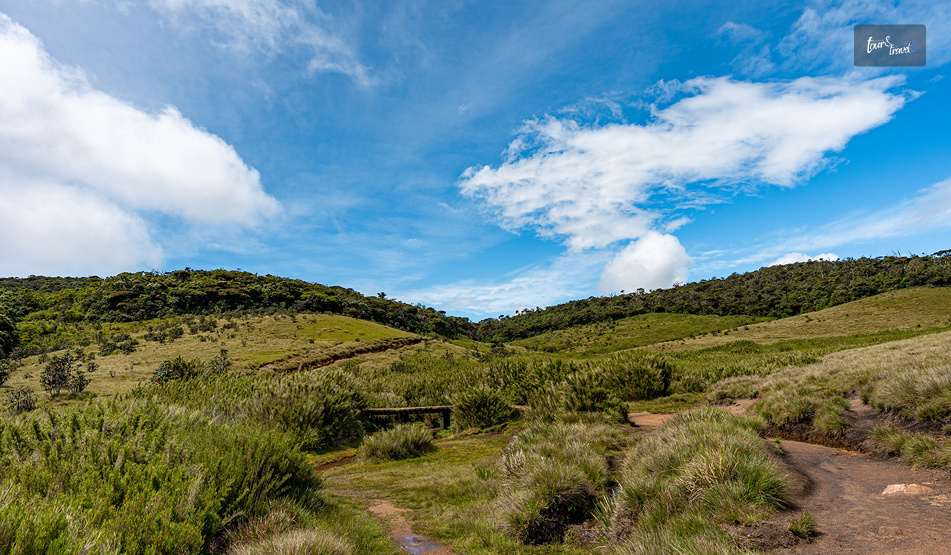
Unlike most of the Sri Lankan landscape, the Horton Plains National Park does not have rice paddies, palm trees, and the lowland heat haze.
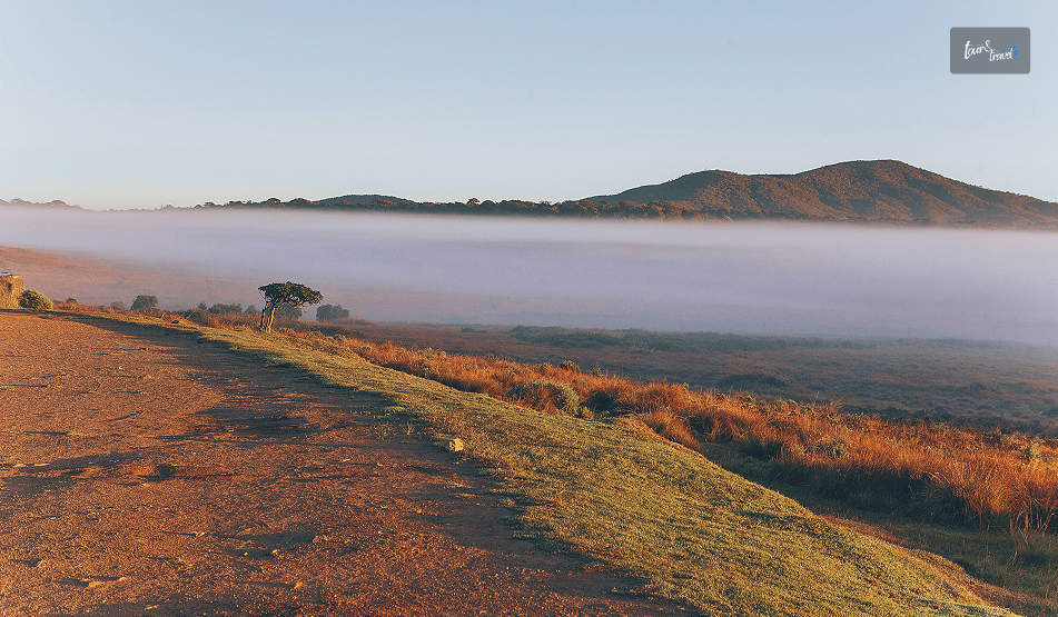
In fact, it looked like the Scottish Highlands with gnarled cloud forest, windswept grassland, and silence broken by birdsong.
So, overall, it looked like a contradiction in the middle of a tropical island country.
Horton Plains: A Plateau With A History
Horton Plains stands out with an ecological and historical weight.
This weight is more than the windswept image it has.
Long before it became a popular hiking destination, it was famous as a colonial retreat.
Furthermore, in July 2010, it became a UNESCO-listed ecosystem as part of the Central Highlands of Sri Lanka.
From Maha Eliya Thenna To National Park
Horton Plains was earlier known as Maha Eliya Thenna before it became a national park.
Maha Eliya Thenna means “The Great Open Plain.” During British Rule, it was renamed after Sir Robert Wilmot-Horton.
He was a governor of Ceylon.
Also, during that time, the highlands became a retreat for planters escaping the heat of the lowlands.
Until 1969, the Horton Plains were not formally protected.
Then, it became a wildlife sanctuary.
Finally, in 1988, it got the full designation as a national park.
Then came 2010.
Horton Plains got the UNESCO designation along with the Peak Wilderness Protected Area (home to Adam’s Peak) and the Knuckles Mountain Range.
Together, these three protected areas form what conservationists describe as one of the island’s most important biodiversity hotspots.
These shelter species found nowhere else on Earth.
Why The Ecosystem Matters
Sri Lanka, being a party to the Convention on Biological Diversity, submitted the “Sixth Annual Report” in 2019.
I am quoting the content of the report as highlighted by the Daily Mirror Online here.
“The Peak Wilderness Sanctuary, Horton Plains, and the surrounding protected and unprotected areas containing small wet-zone forests possess the highest levels of endemic plant and animal diversity in Sri Lanka.”
The Horton Plains National Park is also the source of the three major rivers in Sri Lanka.
Mahawell
Kelani
Walawe.
Moreover, as an important ecological region, it was the first national park in the island country to ban single-use plastics.
So, when you are about to enter the national park, the rangers check the bags at the entrance.
You have to leave the water bottles (if you are carrying water in single-use plastic ones) and snack packets before entering it.
The Walk Itself
Recently, there have been talks about the reopening of the Nonpareil Estate and Nagrak to Horton Plains route.
After failed attempts in 2015 and 2020, this recent request in August 2026 has been submitted by the tourism hotel operators.
The Development Committee meeting has also discussed this matter.
Also, Gayani Renuka, the Divisional Secretary of Imbulpe, has presented it to Dr. Dhammika Patabendi, the Minister of Environment.
However, there are uncertainties about reopening this route for better accessibility.
It is because of environmental concerns and the pristine nature of the Horton Plains.
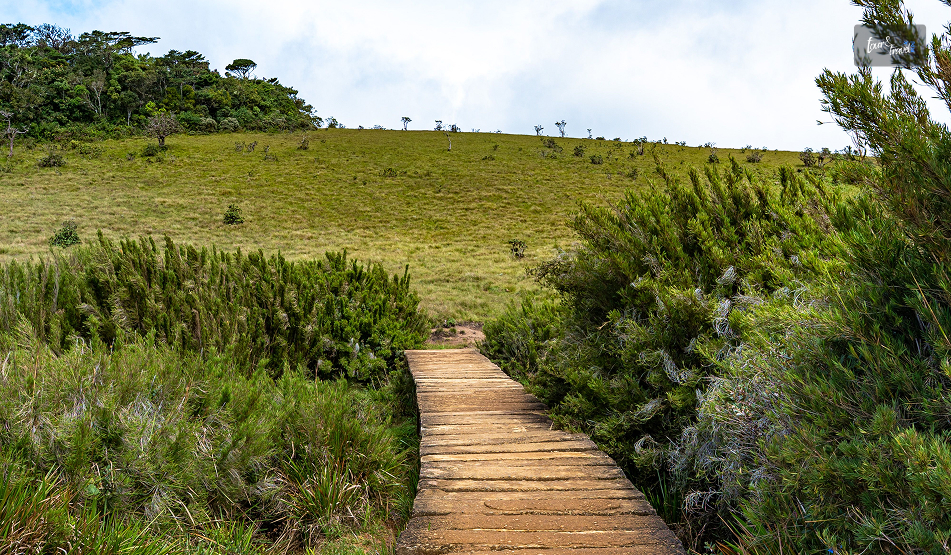
So, if you go for a trek now, you have to pass through three distinct moments strung along one loop trail.
Each loop has a distinct character.
The Main Loop
The distance of the main trail is around 9 to 9.5 kilometers.
At an easy, photo-stopping pace, you can cover the loop in 3 to 4 hours.
There is no steep elevation gain.
So, technically, it is not a difficult trek to complete.
Also, the route is well-maintained and well-marked.
However, the elevation adds to the challenges of trekking.
Add to that the cold, unfamiliar to most parts of Sri Lanka!
You can complete the loop clockwise like most hikers.
Thus, you will reach Little World’s End first and then World’s End.
Next, you will find the Baker’s Falls on the return leg.
Walking it this way means you catch the two main viewpoints while the sky still has a chance of being clear.
Little World’s End
About 3.5 kilometres in, this is the warm-up act.
The Little World’s End is a cliff edge with a drop of around 270 metres.
It is less dramatic than what comes next, but on a clear morning you can see the patchwork of tea estates and village rooftops laid out far below.
It is often far less crowded than its famous neighbour.
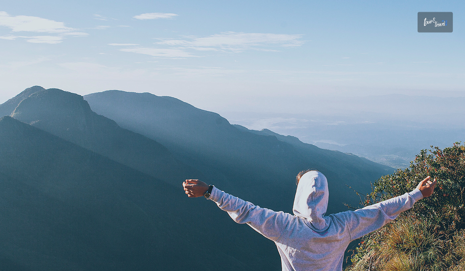
World’s End
Roughly 4 kilometres from the start, this is the reason everyone makes the pre-dawn drive.
It is a sheer escarpment that drops somewhere between 870 and 880 metres, depending on which source you believe.
Also, there is genuinely nothing gentle about it.
A low metal railing marks the edge in places, but a fair stretch of it has nothing but exposed rock and open air.
So it is worth keeping a firm grip on children and a healthy respect for the drop yourself.
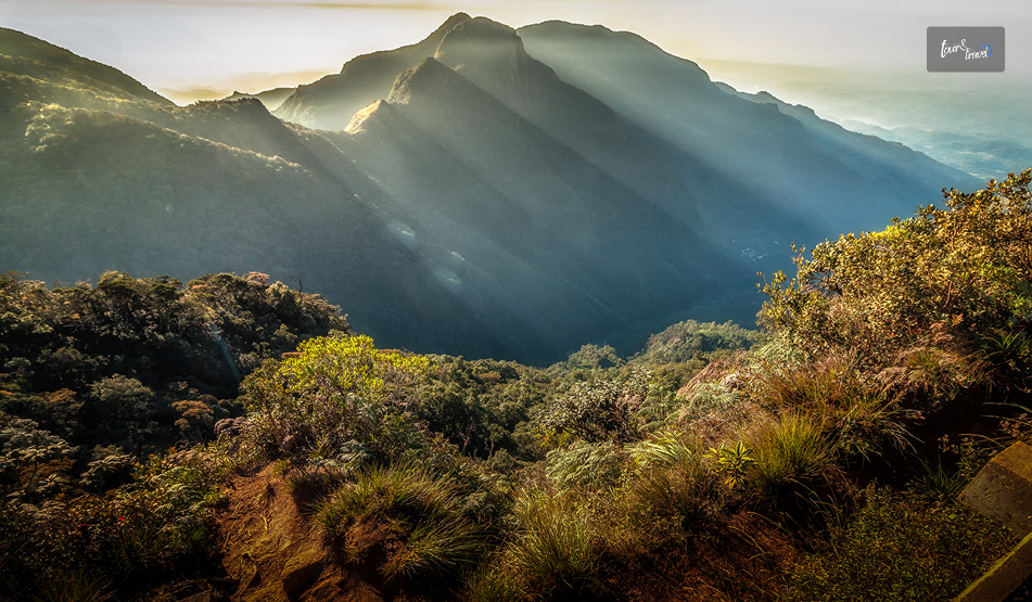
On a clear day, the view stretches all the way to the south coast, nearly 100 kilometres away.
The feeling, standing at nearly 2,000 metres above sea level, is inexplicable.
I got lucky with about ten clear minutes before the mist rolled back in.
It was enough to understand why people set their alarms for 3 AM to be here.
Baker’s Falls
Baker’s Falls is an important landmark on the way back, and you will find it after completing a hike of 7.5 kilometers.
The waterfall is modest, but its beauty is unmatched.
Moss-covered boulders and cloud forest thick with ferns frame this 20-meter waterfall.
I wanted a closer look at this beautiful fall.
So, I took a short flight of stone steps leading down to the base.
Longer Routes For The Ambitious
If you have more time and stamina, longer routes branch off toward Kirigalpotta, Sri Lanka’s second-highest peak.
It also takes you to Thotupola Kanda, the third-highest, along with a section of the long-distance Pekoe Trail that now runs through part of the park.
These require permits and, in most cases, a guide, but they are a genuine option if the main loop leaves you wanting more.
When To Visit The Horton Plains National Park?
The gates of the Horton Plains National Park open at 6 AM.
By 9:30 or 10 AM, the mist in the national park rolls in and swallows the views.
I came across one highland lodge owner online. He runs a “Highland Trek” experience out of Nuwara Eliya.
He said, “It is not just the sunrise if you reach the Horton Plains National Park by 6 AM.
Reaching early also helps you to beat the cloud that builds through the morning.”
The park stretch is the driest and clearest during these months.
However, being the best time, this window also brings heavy crowds on weekends and local holidays.
April through September brings more mist and drizzle, and while the views become less reliable, the trail is also quieter.
Several travellers I found comparing notes online argued that a misty, moody Horton Plains has its own appeal.
It is just a different trip than the postcard version.
Wildlife, Without The Big Cat Guarantee
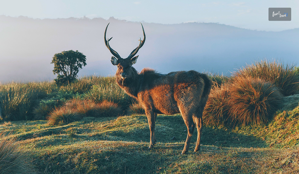
The Sambar Deer is the poster animal of the Horton Plains National Park.
I could spot them easily.
If you especially visit the park early in the morning, you will find these adorable creatures grazing in the open grassland.
Furthermore, if you are a bird-watcher, you will find endemics like the Sri Lanka whistling thrush and the yellow-eared bulbul.
Other birds you will find here are:
Scaly-Breasted Munia
Sri Lanka Whistling Thrush
Sri Lanka Spurfowl
Horton Plains is also, on paper, a leopard territory with the Sri Lankan leopard as the apex predator here.
However, sightings are exceptionally rare, and I would not build a trip around the hope of one.
Most guides are refreshingly honest about this rather than overselling it.
Instead, expect wildlife such as Fishing Cat, Grizzled Giant Squirrel, and Wild Boar here.
If you are here to spot reptiles, watch out for the black-cheek lizard, Boie’s rough-sided snake, and the horned lizard.
The Nelu Bloom: A Once-In-A-Generation Sight
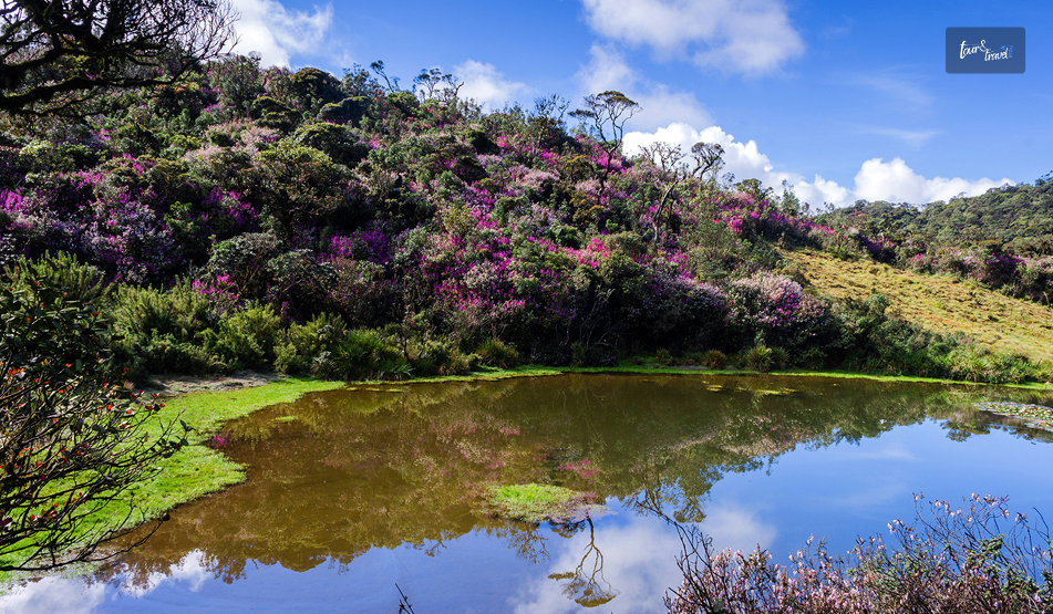
The flowering of the Nelu is one of the main highlights of the Horton Plains National Park.
This flower of a genus of shrubs in the highlands does not bloom every year.
In fact, these flowers bloom once every 12 years.
When these flowers bloom, the entire hillsides turn a soft purple-blue almost overnight.
You must have seen these photographs on Instagram.
Sample Itinerary
Most visitors do Horton Plains as a single early-morning excursion.
However, there are a few ways to structure the day depending on your fitness, time, and onward travel plans.
Half-Day Trip From Nuwara Eliya To Horton Plains National Park
Time
Activity
3:30–4:00 AM
Wake up, dress in layers, depart Nuwara Eliya.
5:00–5:30 AM
Arrive at Horton Plains entrance, buy tickets, bag check.
6:00 AM
Gate opens, begin the loop (clockwise).
6:00–7:00 AM
Walk to Little World’s End (3.5 km).
7:00–7:45 AM
Reach World’s End, main viewpoint stop.
7:45–9:00 AM
Continue on the loop to Baker’s Falls, a short detour to the base.
9:00–10:00 AM
Finish the loop back to the car park.
10:00–11:30 AM
Drive back to Nuwara Eliya and have breakfast en route or in town,
Extended Day Trip (With Kirigalpotta Or Thotupola Kanda)
Time
Activity
3:30–4:00 AM
Depart Nuwara Eliya.
5:30–6:00 AM
Arrive and buy extended tickets and permits for an extended trail if required.
6:00–10:00 AM
Main Loop Little World’s EndWorld’s EndBaker’s Falls.
10:00 AM–1:00 PM
Extended Trail Kirigalpotta or Thotupola Kanda with a guide.
1:00–2:00 PM
Return to car parkDrive back
3:00 PM onward
Late lunch in Nuwara Eliya and relax
Moreover, instead of making a return to Nuwara Eliya, you can continue your journey to beautiful Ella.
Tentative Cost Breakdown
Costs vary depending on how you get there and whether you hire a guide.
However, here is a realistic breakdown to budget against.
Entrance Fees
Item
Approximate Cost
Foreign adult, day visit
USD 25 per person
Foreign child
USD 12
Sri Lankan national, day visit
•LKR 150 for Adults •LKR 75 for Children •LKR 20 for Local Students with Valid ID
Vehicle entry
LKR 250-1000 for VehiclesDrive/Guide Fee:
Overnight/extended permit (for longer trails)
Around LKR 2400 for a Campsite of 12 People.
Tickets are generally sold only at the entrance, not online. So budget extra queueing time in peak season (December–March, weekends).
Transport From Nuwara Eliya
Option
Approximate Cost
Private car, round trip with 3-hour wait
LKR 5000 to LKR 13000
Tuk-tuk, round trip
LKR 1500-2000
Organised half-day tour (driver + guide)
LKR 6000 Per Person
Full-day customisable tuk-tuk/car tour (Horton Plains + extras)
LKR 10000 for the vehicle/group
Other Costs To Budget For
Item
Approximate Cost
Local guide (optional, for main loop)
LKR 600
Guide for extended trails (Kirigalpotta/Thotupola)
LKR 700
Breakfast/snacks in Nuwara Eliya after the hike
LKR 300-400 Per Person
Tips for driver (customary but not obligatory)
Around LKR 200
Rough Total, Per Person
For a solo or paired traveler doing the standard half-day loop with a shared private car, all-in costs typically start from around LKR 15000.
What People Are Actually Saying About The Horton Plains National Park
Beyond the official descriptions, recent traveller reviews and hiking forums paint a fuller, more candid picture of what to actually expect.
The Praise
I have checked the recent traveler reviews and hiking forums for recent updates on the Horton Plains trek.
I wanted updates as it has been almost 2 years since I have been there.
I have got a pretty consistent and useful picture of the park beyond the marketing photos.
People consistently describe the loop as peaceful, scenic, and surprisingly quiet once you are past the entrance area.
Also, many travelers have remarked that they barely saw another hiker on the trail itself despite a busy car park.
The cool climate and the drama of World’s End come up again and again as the highlight.
More than one reviewer said the steep entrance fee for foreign visitors was worth it for the experience alone.
The Complaints
The complaints cluster around two things.
First, Value For Money At The Gate
Several visitors felt the facilities, particularly the restrooms, didn’t match what they were paying.
They especially compared the facilities with well-maintained remote parks elsewhere in the world.
Second, Logistics
Getting to the park without a private vehicle or organised transport is genuinely difficult.
A few forum threads mention drivers or ticket-side “tips” being expected in ways that caught first-time visitors off guard.
My own advice, echoing what I saw repeated often:
Agree on a return fare with your driver before you set off.
Keep small notes handy at the gate.
Treat the fee as the cost of one of the more unusual landscapes in South Asia rather than comparing it to lowland attraction pricing.
Also, there are concerns about the vulnerability of the Horton Plains National Park.
It is disappointing that I did not find many travelers talking about it.
The Vulnerabilities
“Many visitors to the Horton Plains NP come here when they are on holiday in Nuwara Eliya and that is the loud and boisterous behaviour they bring here as well, creating much havoc in this sensitive area.”
These are the words of Sankha Wanniatchi, an author, photographer and leopard researcher.
He shared his views with The Sunday Times regarding the “Clarion Call to Protect Vulnerable Horton Plains NP.”
The researcher has also urged the Sri Lankan authorities to refer to Yellowstone National Park for implementing strict regulations in the Horton Plains National Park.
His suggestions include relocating the entry gate to the national park.
It is because the stretch between the Pattipola Railway Station and the entry gate is ripe with wildlife activity.
An overspeeding car killing a young sambar in the stretch has strengthened his claim.
Moreover, there are suspicions of poaching activities, with loud sounds of gunshots being heard outside the boundary lines.
Practical Notes For Your Own Visit
A short checklist of the logistics worth locking down before you leave your hotel.
Getting There
Horton Plains is roughly 32 kilometres, about 1.5 hours by road, from Nuwara Eliya, which is the most common base.
A hired car or tuk-tuk with waiting time is the standard arrangement.
Public transport options are limited and awkward for the early departure time you will want.
What To Bring
Carry layers, a light rain jacket, sturdy closed shoes, and cash for the entrance and any incidentals.
There is no phone signal inside the park, which, once you adjust to it, becomes part of the appeal.
Was It Worth The 3 AM Alarm?
Genuinely, yes.
Horton Plains is not trying to be the rest of Sri Lanka.
That is exactly what makes it worth the detour from the hill country’s tea estates and waterfalls.
It is cold, it is a little inconvenient to reach, and the view you are chasing is entirely at the mercy of the weather.
However, standing at the edge of an 880-metre drop with the whole southern half of the island somewhere beneath the mist is an experience.
Set the alarm.
Bring the jacket you think you won’t need. It is worth it.
Sibashree is a travel, culture, and leisure writer who has been writing since the age of 12 and professionally since 2014. With more than a decade of travel writing experience and journeys across India and several parts of the world, she brings a deeply personal and thoughtful perspective to her work. A student of English Literature and Mass Communication, Sibashree has always viewed travel as more than movement — for her, it has been a way of understanding people, cultures, and herself. Her passion for spiritual exploration has also led her to many unusual and meaningful destinations over the years. Outside of writing, Sibashree enjoys watching European cinema, reading about global politics, and reflecting on the stories hidden within everyday places.
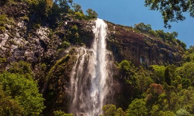
Most waterfalls in Sri Lanka announce themselves with a roar from half a kilometer away.
However, Bambarakanda Falls was different.
It has a thin water flow, and as it drops far, I could only hear the sound of the waterfall when I was standing directly under it.
However, it is the tallest in the country, and I could not find the top even after craning my neck all the way back.
The Story Behind The Name Of The Bambarakanda Falls
The name comes from Bambara. In the Sinhalese language, Bambara means wasps.
The rock face around the falls was once a prominent colony of wasps.
However, before the waterfall became known as Bambarakanda, it was called Bambarakele Falls and Dultota Falls.
What struck me more than the etymology was how quiet the setting is compared to its size and fame.
This is not a waterfall with restaurants and gift shops crowding the base, just pine forest, a rough access road, and the sound of falling water.
Where Is Bambarakanda Falls?
Bambarakanda Falls is close to the small town of Kalupahana in the Badulla District. It is also near the boundary of the Horton Plains National Park.
Kuda Oya, a modest stream, is the source of this waterfall.
However, it transforms into the most dramatic tributary the moment it reaches the cliff edge above Kalupahana and drops in a single, thin, horsetail plunge.
Furthermore, this waterfall is around 200 km away from Colombo.
The distance between Bambarakanda Waterfall and Belihuloya is just 18 km.
So, Bambarakanda Falls easily fits into the itinerary if you are in the Central Highlands of Sri Lanka or on the Ella–Haputale–Horton Plains corridor.
How To Reach Bambarakanda Falls?
Bambarakanda is easily accessible from Colombo by road and train. Here are the details.
From Colombo By Road
The most common route is Colombo to Ratnapura to Belihuloya to Kalupahana, following the A4 highway toward Beragala.
At Kalupahana Junction, a signposted turn-off leads onto a narrower road that runs for roughly 5 km through Weerakoongama's pine and tea plantations before reaching the parking area.
The final stretch is rough enough in places that not every car will manage it comfortably.
So a tuk-tuk from the junction is a popular last-mile option if you're not driving a higher-clearance vehicle.
By Train And Bus
If you're relying on public transport, the nearest useful rail stop is Ohiya.
From Ohiya, you will still need a taxi or tuk-tuk to cover the remaining distance.
Buses running the Colombo–Badulla A4 route will drop you at Kalupahana Junction, where three-wheelers wait to ferry visitors up the access road for a small fixed fare.
The Trek To The Base
From the parking area, I had to take a flight of steps to reach the base of the waterfall. The flight took around 10-15 minutes.
It was an easy trek as I passed through a pine forest.
Also, compared to places such as Sinharaja, the leeches were way fewer in number throughout the route.
However, with the pine needles scattered on the ground, it was a bit slippery. So, you need to wear proper walking or trekking shoes.
As I reached the base of the waterfall, I found a shallow pool, perfect for wading.
Also, if you want to remain dry and want to appreciate the scale of the waterfall, you can watch the waterfall from the concrete viewing platform.
Climbing To The Top: The Devil's Staircase
If you want more adventure, you can take the steep trail nicknamed the Devil's Staircase, winding up the mountainside to the crest of the falls.
Remember that this stretch, leading to the top, is a proper hiking route. It is not like strolling anyway!
The elevation here is several hundred meters through pine and mixed forest.
So, even if the weather is a little bad, you must not attempt this.
The reward at the top is a small natural infinity pool and a miniature waterfall feeding into the main drop, along with sweeping views down the valley toward the eastern plains.
A short trek from the base also leads to Lanka Ella, a smaller waterfall nearby whose shape is sometimes said to resemble the outline of Sri Lanka itself.
What Is The Best Time To Visit The Bambarakanda Falls?
Honestly, the guides on the best time to visit Bambarakanda Falls are mostly confusing.
Some sources say that March to May is the ideal time for a visit to this waterfall.
Indeed, going for a trek is safest in this season, as the flow is modest and the trails are less slippery.
However, if you want to see the most dramatic version of the waterfall, May to September is the ideal window.
I am someone who is always in for the later window.
Visiting shortly after rain gave me a fuller view of the fall, and it was the most photogenic.
A dry spell, on the other hand, makes the waterfall look thinner.
What Are The Attractions Near Bambarakanda Waterfalls?
Some of the best-known sights of the Sri Lankan Central Highlands are very close to Bambarakanda Waterfalls.
Horton Plains National Park and World's End are a scenic drive away.
Haputale, with its cooler climate, tea estates, and views toward the southern coast on a clear day.
Haputale further makes a good overnight base.
Also, if you are continuing along the A4, Belihuloya offers river-adjacent guesthouses and a much gentler pace than the falls themselves.
Practical Travel Tips
If you are planning to capture the beauty of the waterfall, you should pack wide-angle lenses.
The waterfall is so tall that, considering how close you stand, fitting the entire cascade into one frame from the base is genuinely difficult.
Furthermore, if you are driving yourself to the waterfall, budget extra time for the access road.
This is narrow, occasionally rutted, and best driven slowly regardless of your vehicle.
A Few Things I Wish I Had Known
It was a mistake on my part to underestimate the remoteness of the final stretch of the road.
The stretch was just a few kilometers off the main A4 Highway. Still, once I quickly reached the pine forest, there was no phone signal for the majority of the route leading to the base.
Furthermore, you will have to bring cash, as digital payments or cards are not accepted at the entrance or along the trail.
Also, barring the odd roadside stall near the junction, you will not find much food.
Moreover, if you are on the Devil's Staircase climb to the crest, go early in the day.
Clouds tend to roll in by early afternoon and can turn a rewarding view into a very damp anticlimax.
Where To Stay Near Bambarakanda Falls
You will not find real accommodation facilities right at the falls.
As convenient options, you can base yourself in Haputale or Belihuloya. You can reach both locations within 30-40 minutes by car from Bambarakanda.
Haputale sits higher up and cooler, with a scattering of small guesthouses and a couple of well-regarded boutique stays that make a good stop if you are also planning to see World's End at Horton Plains the next morning.
Belihuloya, down in the valley, has a handful of riverside guesthouses that suit travelers who'd rather relax by moving water than climb toward it after a long day on the road.
Either option works as a base for a half-day dedicated to Bambarakanda, with enough flexibility to add Horton Plains or a tea-estate walk without much extra driving.
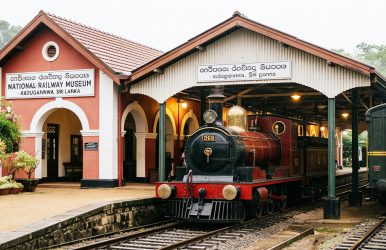
I forgot to mention one thing when I shared my experience of a train ride in the Demodara railway loop. This is a lesser-known loop, and I got to know about it from the National Railway Museum, Kadugannawa.
This museum is at a distance of just 15.1 km from Kandy. Today, it has many old machines, carriages, equipment, and locomotives.
Though everyone will have a visit to the National Railway Museum, Kadugannawa, in their itinerary of the things to do in Sri Lanka, I enjoyed my day there.
So, in this blog, I will talk about my experience at the National Railway Museum, Kadugannawan, its entry fee, timings, exhibits, and how it was opened at an opportune moment.
National Railway Museum, Kadugannawa: Quick Facts
Opening Date27th December, 2014 Opening Hours 9 AM to 4 PM (Only closed on Poya Day)Ticket Price - For Sri Lankan Adults: Rs. 50- Foreign Adults: Rs. 500- Children: Rs. 20- Children in School Uniform: Rs. 10
Why Was The National Railway Museum, Kadugannawa, Opened?
The National Railway Museum, Kadugannawa, was opened on 27th December, 2014, on the occasion of the 150th year of railway operations in Sri Lanka.
The first train of the Ceylon Railway ran from Colombo Terminus station to Ambepussa. The Duke of Brabant of Belgium was a passenger on this train.
On the occasion of the museum inauguration, a Memorial Stamp was also released. Furthermore, as souvenirs, there were a memorial DVD and a coffee table book.
Moreover, a Replica Steam Train ran from Colombo Fort to Kadugannawa, and it had special invitees as passengers.
It was a thoughtful move to commemorate the first train operation 150 years ago.
How To Reach The National Railway Museum, Kadugannawa?
You can reach the National Railway Museum, Kadugannawa, with a short train ride from Kandy.
However, if you miss the train, you can also take a bus. However, I don’t recommend a bus ride from Kandy to Kadugannawa because the bus ride through the Royal Botanic Gardens takes around 45 minutes to 1 hour.
Also, the bus is very crowded, and you will find every type of food vendor there.
Nevertheless, if you still want a bus ride, the ticket price will be 120 LKR (Around 36 Rs.) for a person.
Kandy To Kadugannawa Train Ride
I love train rides, and even if the queue for the third-class ticket was long, I enjoyed the entire experience.
Nevertheless, I took the Kandy to Polgahawela train that departed from the Kandy Station at 2:15 PM and reached the Kadugannawa Station at 2:55 PM.
The train halts at the Kadugannawa station for 1 minute. So, stand near the gate and be a little fast when alighting from the train.
I got a 3rd class ticket, and the ticket price was Rs. 40.
What Are The Things To See At The National Railway Museum, Kadugannawa?
The Kadugannawa Railway Museum is very close to the Kadugannawa Railway Station. It is a small space, and it includes a platform and 2 outside areas.
Furthermore, it is spread over a train shed.
I sat in a vintage train carriage at the museum, and it cost me around Rs. 296. The carriage also had an attendant who showed me the museum.
The Exhibits And Demonstrations I Loved
I especially loved the demonstration of the efficient token system that ensures that trains do not run into each other on the single-track mountain railway lines of Sri Lanka.
Furthermore, I found a massive model railway inside the museum. It shows the entire Sri Lankan railway network.
It was fascinating, and it highlighted the Nine Arch Bridge and how the train covers the spiral Demodara loop.
I also had a lot of fun getting in and out of the steam locomotives, carriages, and old engines at the museum.
Moreover, I saw a 10-minute-long video describing the railway network of Sri Lanka.
Overall, I spent around an hour at the museum and ended my time there with a cup of coffee at the in-house coffee shop. The coffee shop itself is inside a carriage.
The best things about the National Railway Museum, Kadugannawa, were that very few visitors were there.
So, as a curious soul and someone very fascinated by trains (my home is very close to a railway track), I had a gala time.
What Are The Other Places To Visit In Kadugannawa?
Kadugannawa, a short distance away from Kandy, is a serene place with many historical and cultural attractions.
So, once you have completed exploring the top attractions in Kandy and the National Railway Museum, Kadugannawa, you can visit these places.
1. Balana Fort
Balana Fort is located between Kadugannawa and Kandy.
Also, close to the Alagalla Mountain Range, its strategic position helped to protect the kingdom of Kandy from external attacks.
2. Captain Dawson Tower
The Captain Dawson Tower is at Kadugannawa Pass, and it is very close to the first modern expressway of Sri Lanka, the Colombo Kandy Road.
The construction of this expressway began under the supervision of Captain William Francis Dawson in 1820. So, this tower remembers and respects the contribution of Captain William Francis Dawson.
Moreover, it was built in 1832.
3. Lion’s Mouth Rock, Kadugannawa
It is an overhanging rock that you can find between the Balana and Kadugannawa railway stations.
The natural formation of the rock resembles a lion’s mouth.
Furthermore, when the train passes through the bend, there is a steep descent. So, the feeling of a drop makes the experience all the more thrilling.
4. Kadugannawa Rock View
If you are traveling from Colombo to Kandy or exploring the best attractions in Kadugannawa, the Kadugannawa Rock View is a place to relax.
The place is serene, and it offers amazing views of the lush surroundings. Furthermore, there are a few small shops on the way.
You can buy some souvenirs from these shops, and you will spot a lot of monkeys here.
Moreover, it was sunset time when I reached this viewpoint, and the experience was surreal.
If you could only cover the beaches in Sri Lanka, you would know how Sri Lanka, despite being a smaller country, carries the spirit of the subcontinent, “Unity in Diversity.”
If the beaches in Jaffna were a lesson to understand the livelihood of the local fishermen, the Hiriketiya Beach, with its unique horseshoe shape, has been a surfer’s delight.
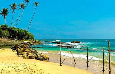
Now, I am going to talk about Ahangama, another popular beach town in Sri Lanka, famous for its cool vibe and surfer breaks.
Earlier, it was known for its 19th-century Buddhist temple and the art of stilt fishing. However, this beach town, in the southern coast of Sri Lanka, is now also known as a lifestyle destination.
The likes of Condé Nast Traveller are backing its charm as a cool fishing town.
Also, today, you may even ditch the best hotels in Galle, one of the major cities near the beach, thanks to the cafes such as The KIP, Marshmello Cafe or La Cafe Bistro.
Nevertheless, while surfing is Ahangama’s claim to fame and the budding food scene is the most happening thing right now, here are more things you can plan here.
What Are The Things To Do In Ahangama?
Ahangama is now emerging as a really cool place, as, despite being a beach town in Sri Lanka, it has the right amenities for digital nomads.
While the surf and beaches offer the right dose of relaxation and the diverse communities offer the most eclectic experience, it also boasts many air-conditioned co-working and co-living spaces.
In fact, despite Galle getting more attention, if you are planning to try things to do in Galle, Ahangama, around 20 km away, will be a better base due to the presence of cool hotels, good food, and cafes.
Nevertheless, it is not just about breaking the waves.
Here are tons of other things to do in Ahangama.
1. Hitting The Surf
The reef breaks of Ahangama are the best for intermediate and advanced surfers. The waves on the south coast are world-class.
Kabalana Beach itself is a great place to start your surfing expedition in Ahangama. Furthermore, you will easily get board rentals for around 800 LKR, and the sessions usually cost around 4000 LKR.
You can also surf near the Kabalana Rock, Sticks Surf Break, Rams Right, and Midigama.
2. Some Adventure At The Lamana Skatepark
Lamana Skatepark is one of the best places if you want to experience the party scene in Ahangama.
Local skaters hit the bowl here daily. However, the live bands and the DJ music add some spunk to the air.
3. Swimming With The Turtles
Dalawella Beach, a short tuk-tuk ride from Ahangama, is the place where you can swim with giant sea turtles.
Here, meeting the sea turtles was a different experience from how I saw them at the Sea Turtles Conservation Centre near Mount Lavinia Beach.
Also, some of the turtles here were around 50 years old, and they weighed around 200 kgs.
You can rent a snorkeling mask for around 300 LKR. However, stay away from feeding these turtles,
4. Safari At The Udawalawe National Park
If nothing else, I will remember Sri Lanka for the endless and most delightful encounters with elephants.
I had mentioned spotting the elephants at the Udawalawe National Park as one of the best things to do in Ella.
However, as Ella is just 58 km away from Ahangama, you can also plan a safari if the latter is your base.
Along with the baby and mother elephants, you will also love spotting peacocks, monkeys, and buffalo here.
Moreover, when you are in Ella, don’t miss the iconic train ride on the Nine Arch Bridge.
5. Climbing Devil’s Rock
With jungle walkways and eerie rock formations, the Devil’s Rock feels like a piece of Jurassic Park in Sri Lanka.
You will find this group of scary rocks as you go east from Ahangama and stop just before Midigama.
However, the only catch is that you will have to swim through the water with a medium current and during the low tide to reach Devil’s Rock.
The hike is also quite strenuous. So, it may not be the best thing to do in Ahangama if you are not a pro swimmer or fit hiker.
6. Scuba Diving In Unawatuna
You have done diving in Raja Ampat, the Maldives, or Bali. However, scuba diving in Unawatuna is something different.
While you cannot expect the grandeur of these diving sites at Unawatuna, you can definitely find the Lord Nelson Shipwreck, exotic micro critters, coral reefs, and more in the water, at a temperature of around 20 degrees Celsius.
You can reach Unawatuna by taking a drive for just 15 minutes from Ahangama.
7. Cruising To Ying Yang Shack
The term “hidden gems” has become so cliché these days! However, places like Ying Yang Shack can still keep the magic of the phrase alive.
Here, you literally take a ride in a handmade boat, and our boatman confided that he had made this boat with his brother.
I, along with the other riders to the Ying Yang Shack, had a chilled beer in my hand as our boatman cruised through the water and talked about the lush greenery.
I also spotted a monitor lizard and majestic eagles.
Then came the sunset, and our boatman started singing, and his voice echoed as the bats and birds filled the red sky.
The day ended well as his family made the most delicious and spicy BBQ meal for us.
Where Is Ahangama?
Ahangama is located in the Galle District of Southern Sri Lanka. It is located between Unawatuna and Midigama.
Furthermore, this surfing and swimming paradise is located at a distance of around 3 hours from Colombo.
How To Reach Ahangama?
The Bandaranaike International Airport is the closest to Ahangama. The distance is around 143 km, and that can be covered by a car in around 3 hours.
Furthermore, you can take a train from the Colombo Fort Station and take a train to Ahangama via Galle.
In addition, you can take a tuk-tuk ride from Midigama or Weligama to reach Ahangama.
Why Is Ahangama More Than Just A Beach Town In Sri Lanka?
The elite food scene and the amenities for digital nomads make it more than just a beach town in Sri Lanka.
With brunch spots such as Black Honey and dining spaces such as Coco Kitchen, it can now beat Galle for trying local and fusion cuisines in Sri Lanka.
Moreover, it offers a steady 30-80 Mbps internet connection, and the cafes and air-conditioned coworking spaces here have the infrastructure to support the lifestyle of digital nomads.
Ahangama: Frequently Asked Questions (FAQs)
Here are the frequently asked questions and answers about Ahangama Beach Town.
1. Is Ahangama Better Than Mirissa? It is hard to pick a favorite between Ahangama and Mirissa. Ahangama is famous for its surfing breaks and a laid-back vibe. On the other hand, Mirissa has a classic beach vibe, and it is more famous for whale watching. 2. Should I Stay In Ahangama Or Weligama? Ahangama is your go-to place if you want to enjoy a boho-chic vibe during a beach holiday. On the other hand, Weligama is more of a hub for surfers who are beginning their journey.Also, despite a happening nightlife, Ahangama is a quieter retreat at night as compared to Weligama. 3. What Is The Ahangama To Mirissa Distance? The distance between Ahangama and Mirissa is around 16 km. The travel time to cover the distance is around 32 minutes by road. However, you can also take a train from Ahangama to Mirissa and travel the distance in 19 minutes.





 Related