

Villa Or Yacht? Why The Best Luxury Croatia Trips Combine Both
BY Sibashree Jul 30, 2026
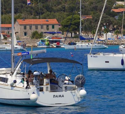
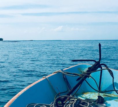
Rent a private villa or charter a yacht? This is a major question on luxury Croatia tours. Now, the ones leaning toward a villa experience will justify their choice, showing privacy, space, and a comfortable home base. On the other hand, a yacht tour comes with FREEDOM. A yacht allows you to explore many islands without constantly packing and changing hotels. However, for luxury Croatia tours, you do not need to choose between these two options. What A Private Villa Adds To Luxury Croatia Tours? If you are in for a slow travel experience and one to explore an area more deeply, a private villa will be the best choice. You do not need to move between hotels, and you can enjoy a private pool, visit nearby beaches, explore historic towns, and build the day around your own schedule. Also, villas are especially a more convenient choice if you are traveling with your family. These are even ideal for groups of friends and multigenerational travelers because they offer a combination of shared living and enough private space, including private bedrooms. Moreover, depending on the property, a luxury villa stay may also include services such as: Private chefs Housekeeping Concierge assistance Chauffeured transportation Wellness treatments Boat transfers or excursions Location Matters For A Villa Experience In Croatia If you stay in a villa near Split or Trogir, you get access to historic towns and major marinas. A property on Hvar or Brač offers a more island-focused experience. Again, a villa near Dubrovnik allows travelers to combine coastal relaxation with one of Croatia’s best-known historic destinations. What A Yacht Charter Adds To Luxury Croatia Tours You do not need to wait for scheduled ferries to visit the islands or for the short day trips. A yacht allows you to move between destinations at your own pace. Furthermore, a yacht offers a combination of accommodation and transportation. So, you do not check in or out of multiple hotels while exploring several islands. A typical route from Split might include Brač, Hvar, Šolta, or Vis, with stops for swimming, dining, sightseeing, and exploring smaller coastal towns. A private yacht charter may include: Swimming in secluded coves Visiting quieter islands and bays Dining in waterfront restaurants Exploring historic ports On a crewed yacht, the captain manages navigation and safety, while the crew may handle meals, housekeeping, and local arrangements. Why Combining The Two Works So Well Villas and yachts meet different travel needs. However, with a strategic itinerary flow, you can combine both experiences perfectly. The table below will give you a detailed idea. Itinerary FlowStrategic AdvantagesIdeal ForOption 1: Villa First, Yacht Second• Recovers from flight fatigue in a stable location.• Unpacks once to settle in early.• Explores land sites around Split at a relaxed pace.• Transitions to active sea discovery next.• High-energy finishes.• Beating initial jet lag.• Travelers wanting mid-trip momentum.Option 2: Yacht First, Villa Second• Starts immediately with high-energy movement.• Maximizes prime cruising weather early on.• Unwinds with slower days beside a private pool.• Offers a peaceful, quiet end before flying home.• Relaxation-focused endings.• Getting activity done first.• Unwinding before return flights. There is no single correct order. The best structure depends on flight times, yacht availability, villa location, group preferences, and how much time travelers want to spend moving compared with relaxing. How Long Should Each Part Of The Trip Be? For a trip of seven to ten days, travelers may divide their time relatively evenly between land and sea. You can check out the table below for an itinerary idea. TimeframeTravel StyleDaily HighlightsDays 1–3Villa Stay (Split / Trogir)• Settle into your luxury villa.• Explore historic Split.• Wander through charming Trogir.• Relax and unwind poolside.Days 4–7Private Yacht Charter• Set sail on a private yacht.• Island-hop around the Adriatic.• Enjoy custom routes based on weather.• Access secluded swim bays.Days 8–10Luxury Land Return• Check into a premier hotel or villa.• Enjoy a quiet, peaceful end to the trip.• Indulge in final souvenir shopping.• Transfer to the airport for your flight home. Travelers with more time could spend a full week in a villa followed by a seven-day yacht charter. Those with a shorter schedule may choose a brief yacht experience combined with four or five nights on land. The goal should not be to visit as many destinations as possible. A successful itinerary leaves enough time to enjoy both the villa and the yacht. Why Local Planning Matters Working with a local travel specialist can simplify the process. Exclusive Adriatic, for example, arranges private yacht charters, luxury villa stays, private-island accommodations, tailored itineraries, and destination management services throughout Croatia. Using one company to coordinate the different parts of the trip can help the villa, yacht, transportation, and additional experiences operate as one complete itinerary rather than a collection of unrelated bookings. This can be particularly useful for larger groups or travelers arranging services such as private chefs, guides, wellness experiences, celebrations, or transportation between airports, marinas, and villas. What Should Travelers Consider Before Booking? Before choosing a villa, yacht, or combined itinerary, travelers should consider a few practical questions. Planning FactorCore FocusCritical Checklist ItemsSpace and LayoutBalances generous villa rooms with compact yacht cabins.• Verify cabin sizes and layouts carefully.• Ensure configuration fits families or couples.• Compare shared social spaces on land versus sea.Movement and PaceAligns daily travel with the group’s preferred speed.• Decide between visiting a new destination daily.• Balance movement with longer stays in fewer spots.• Tailor the route to match natural energy levels.Service and StaffingClarifies exact inclusions and staff-to-guest ratios.• Confirm what staffing is included before booking.• Review chef, crew, and concierge availability.• Audit hidden fees or extra onboard services. Moreover, you will need to consider the flexibility of the schedule. If you are taking a yacht tour, the sea conditions and weather will affect the routes. So, you must approach the sailing portion with preferred destinations rather than a rigid list of required stops. The Best Of Croatia Is Found On Land And At Sea For Families A villa is a safer choice for a family because of the predictable and comfortable setup. On the other hand, a yacht offers adventure, and it also saves the pain of repeatedly changing accommodations. So, when you combine both experiences for your family, the children enjoy the excitement of sailing while still giving the family several days in a more spacious setting. Read Also: What Are The Kotor Montenegro Transport Tips? How To Get Around Kotor, Montenegro On A Budget? Why Should You Visit Croatian Beaches By Boat? Which Are The Top 10 Best Beaches To Visit? What Are The Best Things To Do In Split Croatia In 2026? (Know 10+ Options)
The Ultimate Guide To Planning A Southwest Desert Adventure From Las Vegas
BY Sibashree Jul 30, 2026
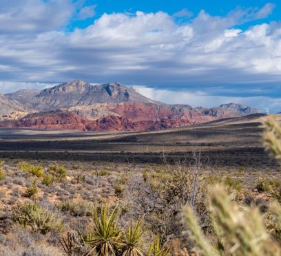
Many people think of Las Vegas as an entertainment capital for adults, but its true value lies in its location. It is located in the heart of the most spectacular desert landscapes in the American Southwest. It is easy to reach more natural beauties within a day's drive from here than from any other American city. The dilemma is not whether to take advantage of this unique position, but how to organize your Las Vegas to Grand Canyon trip. This guide will tell you exactly that. Also, you will learn how to manage your time so you can see and do all that you came to do. Reframe Your Thinking: Las Vegas As Basecamp Most people consider Vegas the destination. But it's better to look at it as the hub. A 4-hour drive gets you to the Grand Canyon, Valley of Fire, Red Rock Canyon, Hoover Dam, Lake Mead, and territories of the Mojave most see only from an airplane. The Strip, meanwhile, gives you world-class lodging, late-night food options, and every amenity you can think of needing after a day outside. Rugged wilderness by day, comfort by night is a legitimately rare overlap. Vegas lets you have both. This "Basecamp Vegas" strategy works because Vegas' position in the low-lying Las Vegas Valley means you can drive to areas with: Vastly Different Altitudes Ecologies Geology But, you can do it without dedicating an entire day to travel. Unpack once. Everything else is a day trip or a managed half-day trip. Las Vegas To Grand Canyon: Why You Can't Pack For Just One Climate One thing that many people do not realize until they get there is how different these landscapes are, particularly when it comes to the weather. Las Vegas sits right on the border of the Mojave Desert and has an elevation of about 2,000 feet. The South Rim of the Grand Canyon is part of the high-desert Colorado Plateau and has an average elevation of 7,000 feet (National Park Service). That's not tough math - what you learn is that the "7,000 feet" part likely translates to daytime temperatures that are 15-20 degrees cooler than when you land on the Strip. A verifiable oven in summer, Las Vegas in September might still be enduring triple-digit heat while the North Rim, perched 1,000 feet higher than the South Rim, is already seeing snow dust the topmost peaks of the Kaibab Plateau. In the shoulder seasons, however, the temperature divide can be a huge issue if you're not prepared for it. A 90-degree day in southern Nevada can easily feel sub-arctic once the sun goes down at the rim. That's a good 5,000 feet above sea level, meaning even the sun doesn't do much to warm things out there in March or November. The West Rim is warmer both day and night, and it sits at a lower elevation anyway. But bear in mind to pack accordingly. West Rim Vs. South Rim: The Logistics Breakdown The Grand Canyon experiences from Vegas aren't the same. Mixing them up complicates decision-making. The West Rim is closest, 130 miles from Las Vegas, and is owned and operated by the Hualapai Tribe. Accessible for helicopter visits to the canyon floor and Skywalk, it's the option to pick for a day with lots of big-camera photo ops, and flying time is considerably less than at the South Rim. The land borders Lake Mead and the Colorado River, which makes the helicopter rides offer the most varied sightseeing of the bunch. The floor landing adds a layer of depth to the experience that's hard to get elsewhere. The South Rim is the longer helicopter flight (supremely scenic itself, especially if you're arriving from Vegas), coming in around 75 minutes one-way. This is the one you want if you're making your choice based solely on the flight. Plus, the South Rim offers exclusive views of the widest, most varied, and most dramatic part of the Grand Canyon. Fully 10 miles across at its widest point, this is the area where you get those iconic western views that make you feel like you're within arm's reach of an otherworldly landscape. Make The Las Vegas To Grand Canyon Travel Efficient Booking Grand Canyon helicopter tours from Las Vegas significantly reduces the time required for either rim. A flight-based tour compresses what would otherwise be a full lost day into a half-day experience - wheels down at the Strip by late afternoon, leaving evenings free for dinner reservations and whatever you originally came to Vegas for. The West Rim offers an eagle's-eye view, where you look down on the canyon as if from an airplane. It's dramatic, but the interior depths and range of visual stimulation isn't as complete. It's a matter of personal preference, but most travelers prefer the South Rim because it is much older and the river has carved more deeply into this amazing place. Red Rock Canyon Vs. Valley Of Fire: Picking The Right Day Trip Travelers who don't fancy spending a full day behind the wheel have a couple of options within an hour-and-a-half drive of the Strip. Red Rock Canyon National Conservation Area is administered by the Bureau of Land Management. Furthermore, its entrance is located 15 miles west of Las Vegas on Charleston Blvd. The 13-mile scenic loop is open from dawn to dusk, and the visitor center is open daily until 4:30 p.m. The landscape is dominated by the Keystone Thrust fault, a geological hinge where ancient ocean limestone was shoved up and over younger red sandstone. This is what created the two-tone cliff faces that are its most iconic feature. Get out of your car and take in the view of Turtlehead Peak, a rocky summit at the edge of the fault, and you'll see why it's one of the most fascinating viewpoints in the region. The area does get busy, and parking is limited. There are dozens of trails here, from short family-friendly strolls to technical climbs up the region's tallest peaks. Someone in moderate shape who wants to do a solid half-day hike with time left to take it easy should consider the White Rock/La Madre Springs loop (6.9 miles) or First Creek/First Overlook/First Summit (7.1 miles). Working Hoover Dam And Lake Mead Into The Route If you're driving to the Grand Canyon rather than flying, Hoover Dam is a no-brainer addition to your trip. The dam is right at the Nevada-Arizona border on the Colorado River. This is about a 30-mile drive southeast of Vegas. It's a major waypoint on the route to the West Rim. Moreover, even a 45-minute visit to see the dam should give you a good sense of its size. They offer paid tours of the inside if enough interest is sparked. Lake Mead National Recreation Area is, more conveniently, the reservoir created by the dam, and it extends nearly all the way to the east of Vegas. It's not a side trip - you'll drive past it no matter which way you go. If you have some extra time, there are very accessible water views and a welcome reminder of the non-deserted desert. In season, there are boat rentals and beaches, so it can make a nice contrast to either the dam itself or a Canyon detour. The smart way to do it is to combine Hoover Dam and Lake Mead into a single morning stop on a Canyon driving day. Therefore, you will have to leave Vegas fairly early. Then, you must spend 45 minutes at the dam. After that, you must head on to the West Rim and return in the late afternoon. That's a full day without any long detours. Desert Safety: What The Terrain Actually Demands Desert environments are more unforgiving to the unprepared than most people assume. The low humidity in Southwest heat makes us feel like we're not sweating as much. In reality, our sweat is evaporating almost instantly. Since it's not pooling on our skin, the brain doesn't sound the alarm that we desperately need to drink. The warning signs of dehydration aren't as evident in the desert as they are elsewhere. With just about any serious outdoor activity, your minimum drinking-water requirement should be one gallon per person per day. Doesn't seem like enough? Wait until you've needed every drop. Middle-of-the-day heat is uncomfortable and dangerous for summer hiking. Aim for early morning or late afternoon excursions - starting no later than 7 a.m. and finishing before 10 a.m., or starting after 4 p.m. The middle of the day is for siestas and car trips with the air conditioning cranking. Also easily overlooked: the living crusts that bind many desert soils together are particularly prevalent in the Four Corners region. Biological soil crusts are fragile communities of living organisms, mainly cyanobacteria, fungi, lichens, and mosses. They create a natural armor of sand, preventing erosion and helping hold the desert surface together so that it may someday become soil. These characteristics are especially important in deserts, where any soil productivity is an invaluable resource. A 4-Day "Neon To Nature" Itinerary There is a detailed itinerary given below for the 4 days of your trip and how you can make the most of it: Day 1 Arrive in Vegas, settle in, walk the Strip. Use the evening to orient yourself and plan the route for the days ahead. Dinner somewhere worth a reservation. Day 2 Early start to Valley of Fire. It will be about a fifty-mile drive and take about an hour. Visit the park for two to three hours exploring the formations and petroglyphs. Return to Vegas for lunch. Drive out to Red Rock Canyon - the visitor center is sixteen miles out. Do the scenic loop or hike the Lost Creek trail. Drive back to Vegas for dinner. Day 3 Grand Canyon day. If flying, book a morning helicopter tour to the West Rim or South Rim - a flight-based itinerary gets you canyon views, a landing on the canyon floor if you've chosen the West Rim, and returns you to Las Vegas by early afternoon. If driving to the West Rim, add a stop at Hoover Dam on the way out. Full day, but manageable. Use the evening for a nice dinner somewhere you've been wanting to try. Day 4 Use the morning for anything you missed - more hiking at Red Rock, a longer look at Lake Mead, or simply breakfast outside the hotel before heading to the airport. Golden hour on the last morning is worth setting an alarm for, especially from a high point on the Spring Mountains west of the city. Plan An Efficient Trip From Las Vegas To Grand Canyon In 2026 The math works in your favor with this structure. Vegas's central location, combined with thoughtful scheduling, gives you four distinct environments over four days. However, the trip is designed so that you won’t feel that any single day was spent entirely driving. The city earns its reputation for many reasons. The one that gets undersold is this. Nowhere else in the country can you eat at a Michelin-recognized restaurant the same day you stand at the edge of one of the planet's most dramatic geological formations. Read Also: Desert Terrain Makes Preparation Part Of A Better Las Vegas ATV Experience Viva Las Vegas: Your Ultimate Itinerary for an Unforgettable Trip Explore The Nightlife: 7 Best Things To Do In Las Vegas
Dikwella, Sri Lanka: The South Coast Town That Asks You To Slow Down
BY Sibashree Jul 28, 2026
On the bus route hugging Sri Lanka's south coast, Dikwella sat as a shadow to two more prominent names in Sri Lankan Tourism, Tangalle and Mirissa. Mirissa stood out with its whale-watching boats and rooftop bars. Tangalle, on the other hand, showed its glossy resort strips. However, Dikwella waited quietly with just a busy street, a fish market, and a few guesthouses. Furthermore, the stretch of coastline of Dikwella unfolded quietly on either side of town. I was looking for that quietness exactly, and that is why I ended up spending three nights there. In this article, I will share my experience in Dikwella Beach, how to reach there, the things to do, and more! Where Is Dikwella? How To Reach It? Dikwella or Dickwella is in the southern province of Sri Lanka. Between Tangalle and Matara, this coastal town is also closer to the Galle–Mirissa corridor. So, Dikwella is accessible. However, the thing is that it is usually far enough off the main tourist script. So, to me, Dikwella felt like a place where locals lived and not a backdrop built for visitors. If you are already exploring the south coast, Dikwella is a short hop from nearby towns. It is just about twenty minutes from Matara, fifteen from Mirissa, and only ten minutes or so from Tangalle. Local buses run this route constantly, and the ticket prices are very low, though a tuk-tuk is more comfortable if you're carrying luggage. If you are traveling from Colombo, you will have to drive for around three and a half to four hours down the Southern Expressway to reach Dikwella. The road exits near Matara and continues along the coastal road. However, I took the Colombo Fort to Matara train and then a short tuk-tuk ride to Dikwella. The train takes longer. However, the time you spend on the train journey here is more than worth it as it is one of the most beautiful railway routes in Sri Lanka. It hugs the coastline for long stretches south of Galle. Colombo Fort To Matara Train There are many daily and weekly trains running between the Colombo Fort and Matara railway stations. I took the 8050 Express train. It runs daily. It departed the Colombo Fort Station at 6:50 AM, and I reached Matara at 10:15 AM. I was traveling in a 3rd class compartment, and the ticket price was LKR 300. The second class tickets cost LKR 600. From Matara, I took a tuk-tuk that charged me LKR 2500. Getting Around Dikwella You can hire a tuk-tuk to explore Dikwella and visit the nearby attractions such as the temple and the blowhole. The rental cost is around LKR 3000 to LKR 4000. However, I rented a scooter. It was more affordable, costing me LKR 1000 a day, and it gave me more flexibility to explore the smaller lanes and beaches nearby. What Are The Things To Do In Dikwella (The Best Is That You Do Nothing) Dikwella is the place that allows you to enjoy the joy of just existing. So, even if you are an introvert like me, you will find the place comfortable for getting knocked over by a wave or simply waiting for the water to wash your feet. Nevertheless, exploring the Blue Beach, a visit to Hiriketiya, a ride to the Hoo-maniya Blowhole, and a visit to the Wewurukannala Vihara are the to-do things in Dikwella. Being At The Blue Beach And The Double Bay Dikwella Beach or Dickwella Beach has become the Blue Beach thanks to the locals and the nearby hotel owners. It is a double bay formation just west of town, where two curved stretches of sand meet at a narrow rocky point. Due to the shape of the bay, the open-ocean swell gets broken up. So, the water inside remains calmer than most beaches along this stretch of coast. So, if you are visiting alone or with family, this is a more comfortable space for swimming. I saw palm trees leaning out over the sand at angles that look almost too deliberate, like a photograph. Furthermore, in the late afternoon, the light turned the water somewhere between turquoise and navy. I spent one whole evening doing nothing but sitting on the sand with a king coconut, watching fishermen haul in nets a little further down the beach. It was not a dramatic sunset by postcard standards. It was better, honestly, because there were maybe a dozen other people on the entire beach to share it with. 2. A Visit To Hiriketiya After soaking in the silence of Dikwella, Hiriketiya was my next stop to feel the pulse of the area. Technically part of the greater Dikwella area, Hiriketiya has become one of the fastest-growing spots on Sri Lanka's south coast in recent years. It is a near-perfect horseshoe-shaped bay that has turned into a magnet for surfers, yoga retreats, and a rotating cast of digital nomads working from beachfront cafés. The bay itself is small. While the small bay offers intimacy, a lack of space can also make it feel very crowded with a surge in the number of visitors. I rented a board for a couple of hours one morning, and it cost me LKR 500. Even as an amateur, the gentle, consistent waves here made it one of the friendlier places I have tried to learn surfing. The scenario, however, entirely changed by the evening. The beanbags outside the restaurants were occupied, and people were busy gorging on the best seafood and wood-fired pizza. It felt like a stark contrast to how quiet Dikwella felt. 3. A Visit To The Hoo-Maniya Blowhole I took a scooter ride toward Kudawella and reached Hummanaya, or Hoo-maniya blowhole. It was like a narrow rock chimney with incoming waves getting forced up through a submerged cavern and bursting out at the top in a sudden plume of spray. The water here makes a low rumbling sound that gives the blowhole its onomatopoeic name. Despite being the only natural blowhole in Sri Lanka and one of the largest in the world, the Hoo-Maniya Blowhole is unpredictable. Some eruptions are a modest fizzle, others send spray shooting dramatically into the air, and the difference comes down entirely to the sea conditions that day. The locals told me that the blowhole is the most powerful during the southwest monsoon. During the monsoon months, rougher seas force water through the cavern with more pressure. As a foreign visitor, I had to pay 500 LKR as the entry fee. For locals, however, the entry fee was 50 LKR for adults and LKR 20 for children. The parking charges were LKR 50 to LKR 100. There is a proper viewing platform from which you can cherish the unique geology of the place. 4. Visiting The Wewurukannala Vihara And Its Giant Buddha I took a scooty ride for about twenty minutes inland from Dikwella, and on the road toward Beliatta, I found a Buddhist temple appearing over the treeline. It was Wewurukannala Vihara, home to the largest seated Buddha statue in Sri Lanka. The statue rose around 50 meters, dominating the skyline of an otherwise low, palm-covered landscape. The temple complex itself is older and more layered than the giant statue suggests at first glance. Parts of it date back to the 18th century, built during the reign of King Rajadhi Rajasinha, with a smaller, more traditional Buddha image worked into the original structure. Walking through the complex, I passed from that older, quieter section into the base of the giant statue. Along the way, most visitors passed through a strange, slightly unsettling tunnel of painted dioramas depicting Buddhist concepts of karma and consequence. Where To Stay In Dikwella? You can decide where to stay in Dikwella based on the experience you want. Close to the town center and the Budget, there is a good mix of budget guesthouses and a couple of larger beachfront resorts. While the budget guesthouses were more suitable for me, the larger beachfront resorts were for travelers who wanted easy beach access without the buzz. However, if you want a little buzz and the pulse of the area, Hiriketiya will be a more suitable choice. The prices of guest houses here are higher. Also, the energy shifts toward boutique guesthouses, surf hostels, and design-forward small hotels aimed at the surf-and-yoga crowd. I split my stay between the two, a couple of nights in a simple guesthouse near Blue Beach for the quiet mornings, then a night in Hiriketiya just to experience the contrast. The stays near Blue Beach cost me LKR 1800 per night, and in Hiriketiya, it was around LKR 6000 per night. What To Eat In Dikwella? Dikwella does not promise a huge restaurant scene. It has not come out of its shell of a working fishing town yet. The daily catch showed up on almost every dish I had. Some of my best meals were the simplest, including grilled fish, coconut sambal, and rice and curry from small local spots along the main road. Furthermore, the cost of food in Dikwella was a fraction of similar meals' cost in Mirissa or Unawatuna. For a livelier and more elaborate food scene, you can visit Hiriketiya. It has cafés and restaurants aimed squarely at the international crowd. So, there you will find smoothie bowls, wood-fired pizza, and fresh pasta alongside Sri Lankan staples. Overall, I cherished the contrast of eating a rustic curry in Dikwella town one night and a plate of pasta overlooking the surf in Hiriketiya the next. Things To Remember If You Are Visiting Dikwella December to April, or the dry season, is the best time to visit Dikwella. You will enjoy the calmest ambiance and nature for swimming in these months. However, if you specifically want to see the Hoo-maniya blowhole at its most dramatic, aim for the southwest monsoon months instead, around May to September. Also, two to three days are enough if you want to experience the best of Dikwella. You can visit the Blue Beach and the Vihara in one day. On the next day, you can visit Hiriketiya and the blowhole and try surfing. Then, leave a spare day if you just want to do nothing. So, Is Dikwella Worth Visiting? During my trip to Sri Lanka, especially when exploring the southern coast, Dikwella was my favorite spot as it allowed me to slow down and be myself. Dikwella does not have an ancient fortress or a famous surf competition. It does not have a five-star strip or a world-class resort. In fact, it is still very much a working fishing town that has not been built around tourism. Dickwella Beach is beautiful because it is not overrun. Also, the nearby attractions such as the booming blowhole and a giant Buddha allow you to spend a couple of unhurried days. So, if your south coast itinerary has room for one detour off the Mirissa–Tangalle highlight reel, make it this one.

Does Car Rental Crete Save More Time Than Public Transport In 2026? Find Out!
BY Sibashree Jul 27, 2026
Car Rental vs Public Transport in Crete presents a significant choice for visitors planning their 2026 itineraries. Speed, convenience, and flexibility serve as the primary metrics for evaluating these transportation modes. Travelers prioritize time savings to maximize their limited holiday duration on the island. Comparing the direct routes of motor vehicles against the fixed schedules of the KTEL bus network reveals distinct advantages for each. Comparison Between Car Rental Crete And Public Transport Efficient planning requires a detailed understanding of the practical travel considerations across diverse Cretan landscapes. A comparison of Car rental vs. public transport in Crete is shown in the table below. Visiting multiple towns in one dayCar rentalTime-efficient and flexibleStaying in one cityPublic transportCost-effectiveTraveling in peak summerCar rental with early pickupAvoid crowded busesBudget-conscious travelersPublic transportLower costExploring rural villagesCar rentalBuses limited City-To-City Speed: Car Vs. Bus Driving between major cities such as Heraklion and Chania takes at least two hours through the National Road. Moreover, a car rental Crete option cuts out all unnecessary delays. This lets you head straight to your destination. Public KTEL buses require at least three hours for the exact same cross-island route. Additionally, the extra hour disappears into passenger boarding and scheduled highway stops. It also includes terminal transitions in busy city centers. Choosing a car rental Crete vehicle frees you from rigid timetables completely. You can also pack up and depart at any hour of the day without waiting around at crowded stations. Efficient navigation relies on securing a reliable car hire Crete for the duration of the stay. Island Transit: Driving Vs. Fixed Routes Yes, renting a car is faster than taking buses in Crete. Motor vehicles provide direct access to destinations without the intermittent stops required for passenger pick-ups. Public buses follow strict routes that include deviations into smaller towns along the main highway. Private transport eliminates the waiting periods associated with fixed bus schedules and terminal queues. Travelers reach remote beaches or mountain villages in half the time compared to when public services are limited. Private cars bypass the need to transfer between lines at major hubs. The average time savings for cross-island journeys exceed sixty minutes per trip. Every journey benefits from the lack of passenger boarding delays. Saving Time On Day Trips: Car Vs. Bus Hiring a car rental Crete vehicle can easily save you at least three to five hours on a single day trip. Iconic spots such as Balos Lagoon and Elafonisi Beach require complex travel routes that public buses simply cannot handle efficiently. Public transport schedules usually offer just one morning departure and one afternoon return for these remote landmarks. Additionally, missing that single return bus completely ruins your plans while forcing you into paying for an incredibly expensive taxi. A car rental Crete option lets you arrive early in the morning before the massive tour buses show up. Moreover, you can take scenic backroads, stop at quiet villages, and enjoy a completely predictable travel schedule. Route Comparison: Navigating Crete’s Wild Terrain Getting around this massive Greek Island requires a detailed understanding of its unique geography. Furthermore, the north and south coasts offer completely different driving and transit experiences. Choosing a car rental Crete offers you the freedom to navigate both regions without stress. Furthermore, your choice of transport dictates exactly how much of the island you can actually see. The North Coast Highway Advantage The northern national highway connects major hubs such as Chania, Rethymno and Heraklion. Public buses run frequently along this well-paved, smooth coastal road. In case you are sticking strictly with the northern cities, public transit is relatively straightforward. On the other hand, a car rental Crete option cuts down travel times even on these direct routes. Reaching The South Coast And Mountain Villages The south coast is a completely different story, which is defined by rugged mountains and steep gorges. Moreover, public buses to remote southern beaches such as Preveli or Frangokastello are incredibly rare. Missing the single daily bus can leave you completely stranded in a quiet village. Additionally, with a reliable car rental Crete option, you are ensured to conquer winding mountain passes safely on your own schedule. Bus Delays Vs Car Rental Crete: The Risk Of Getting Stranded Relying on public transport means having your holiday timeline be fully at the mercy of summer traffic. Furthermore, heavy peak-season congestion along the narrow National Road usually throws off bus schedules completely. Missing a connecting bus at a major station results in hours of waiting around in the heat. Even worse, you risk getting completely stranded in rural areas. That is if the final bus of the day fills up or fails to arrive. These unexpected transit delays create a frustrating domino effect that can ruin your dinner reservations or pre-booked tour slots. By securing a reliable car rental Crete vehicle, you get to protect your holiday from these stressful bottlenecks. Convenience: Total Freedom Vs Rigid Routes Exploring the island with a car rental Crete option gives you absolute control over your daily holiday schedule. Buses strictly connect the major northern cities. This leaves the rest of the wild island out of reach. On the contrary, with a private vehicle, you get to drive straight to different locations. The list includes hidden monasteries, deep mountain gorges, and traditional family tavernas. You can pull over for a sudden photo opportunity without having worries about a ticking clock. Instead of hunting for luggage lockers at chaotic transit hubs, you can easily leave your beach gear in the boot. This feels much more relaxing when you are able to control your own air conditioning than navigating crowded public places. Managing Heavy Luggage: Car Vs Public Bus Hauling bags on a public bus is physically exhausting compared to tossing them into a private vehicle. Handling multiple bags across cracked and uneven pavements and packed terminals can wear you out pretty quickly. In addition, bus passengers must constantly lift heavy suitcases into lower cargo compartments before boarding. Families that are traveling with young children find a private car essential for stowing bulky strollers and beach toys. With a car rental Crete vehicle, they get to secure a locker for belongings while sightseeing without any additional stress. Comfort From Buses On Long Island Transits Public buses do not offer a consistently comfortable ride for long cross-island journeys. The local KTEL coaches have basic air conditioning, but they quickly become overcrowded during the peak summer rush. Passengers face limited legroom and a lack of privacy during three-hour transits across the island. High demand leads to standing-room-only conditions on certain local routes between popular beaches. Noise from other travelers and frequent stops disrupt the relaxation of the journey. A car rental Crete option offers a controlled climate and the ability to choose personal music or silence. Long bus trips feel restrictive for those accustomed to the space of a personal vehicle. Saving Money From Car Rental Crete Yes, car rental Crete saves groups money when the total cost is divided among passengers. In addition, four people paying for individual bus tickets for multiple daily trips frequently exceed the daily hire rate of a vehicle. Costs for a mid-sized car range from [£30 to £70 ($40 to $90, €35 to €85)] per day. Groups eliminate the need for extra taxi fares to reach bus stations from their accommodation. Shared expenses for fuel and insurance make private transport a cost-effective alternative for families. The flexibility to carry groceries and supplies further reduces the holiday expenditure. Large groups benefit from the economies of scale provided by a single rental agreement. Budget management is simpler with a flat daily fee. Spontaneous Sightseeing and Hidden Gems A private vehicle opens up endless opportunities for unexpected discoveries that buses completely skip. Additionally, you can follow local road signs to a hidden cove or a quiet village on a whim. Catching a beautiful sunset at a remote lighthouse is practically impossible. But not when you have a car rental Crete option. Fixed public bus routes force you to stare at beautiful scenery through a window without ever stopping. Your holiday turns into a genuine adventure shaped entirely by your curiosity instead of a rigid transit book. Having the freedom to stay an extra hour at a beautiful beach makes your vacation feel truly personal. The Hidden Costs Of Cretan Travel On paper, a bus ticket looks much cheaper than hiring a private vehicle. However, budget travelers usually overlook the hidden fees that quickly pile up on public transit. A realistic cost assessment requires looking closely at the extra expenses of both options. Here is how the logical math actually breaks down for a Cretan holiday. Bus Tickets Add-Ons Bus terminals are rarely located right outside your specific hotel or vacation rental. Furthermore, you will often need to pay for local taxis just to haul your heavy luggage to the station. These short taxi rides can quickly drain your wallet. This is further applicable when you move between towns frequently. Furthemore, peak-season luggage fees can add unexpected costs to your cheap public bus ticket. Rental Car Extras Opting for a car rental Crete means you must budget for current fuel prices and parking. Popular beaches and city centers often charge small daily fees for secure parking spots. Even with fuel expenses, the total cost is usually lower than paying for multiple individual bus tickets. Moreover, the upfront price of a car rental Crete package gives you predictable costs without hidden surprises. Road Safety: Evaluating Your Options In Crete Both highway commuting and private driving maintain excellent safety records across the island. The local government continues to improve highway infrastructure. This makes the primary routes much smootheer for tourists. Public bus operators are highly experienced professionals who handle the narrow streets as well as sharp turns on a daily basis. However, when you choose a car rental Crete vehicle, you get modern built-in safety features such as advanced braking or comprehensive insurance. Traffic remains quite predictable and calm once you drive away from the crowded city centers of Heraklion and Chania. Following the basic local traffic regulations ensures a completely secure journey through any region. Is Driving Riskier Than Taking A Bus In Crete? Navigating the local roads is not inherently riskier than taking a public bus, provided you stay alert. Road safety always comes down to your personal driving behavior and following posted speed limits. While buses offer a professional driver, they are still subject to the exact same unexpected traffic delays and highway risks. A private vehicle lets you control your immediate environment and react safely to changing road conditions. Driving through steep mountain passes requires focused concentration, but a modern vehicle handles these roads beautifully. The anxiety of driving usually disappears completely after your first afternoon behind the wheel. GPS Navigation And Roadside Support Modern fleets on the island come fully equipped with updated satellite navigation and mobile connectivity features. Moreover, a car rental Crete package allows you to navigate confusing village roads and city intersections with absolute confidence. Reputable local rental agencies always offer full 24-hour emergency roadside assistance with their agreements. In case you experience a mechanical breakdown or a flat tire, a support team will heat oyut immediately. This round-the-clock emergency care will ensure that an unexpected vehicle issue will not ruin your vacation plans. Additionally, when you have a reliable support network, you get total peace of mind throughout the trip. The Ultimate Verdict For 2026 Choosing between a public bus and a private vehicle ultimately depends on your personal holiday goals. If you plan to stick strictly to the northern resort towns, the local bus network offers a decent and low-cost transit option. However, a car rental Crete is the undisputed winner when you crave authentic adventure with total time efficiency. Also, private vehicles protect your limited holiday hours from rigid bus schedules, hot transit terminals, and unexpected highway delays. Investing in a private vehicle opens up the freedom to discover the hidden south coast beaches and quiet mountain villages on your own terms. Furthermore, you can customize your daily route, skip the crowded tourist groups, and experience the island at a relaxing pace.
Nilaveli Beach: Four Kilometers Of Sand And Not Much Else
BY Sibashree Jul 27, 2026
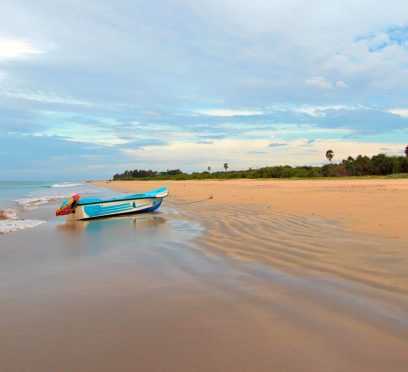
There is a particular kind of quiet that settles over a beach town when you cannot think of a proper definition for it. Nilaveli Beach has it. Still, it is one of the 13 beaches in Sri Lanka that Lonely Planet has highlighted as the best coastal escapes in January 2026. This recognition once again solidifies the position of Sri Lanka as an international tropical destination. Do you want to know more about Nilaveli Beach? Here, I will discuss my first experience in this coastal town, how to reach there, and how I spent my time here. My First Impression Of Nilaveli Beach I arrived at Nilaveli Beach in the late afternoon. The beach looked magical with the golden light. Also, instead of traffic horns or music, the rhythmic slap of fishermen pulling in nets a few hundred meters down the shore was the first sound to reach my ears. This sound had set the right tone for all the experiences that followed at Nilaveli Beach. How I Reached Nilaveli Beach? Nilaveli is on the northeastern coast of Sri Lanka. It is also 16 kilometers north of Trincomalee. Furthermore, the distance between Nilaveli and Colombo is around 264 kilometers. So, it is a journey of approximately 6 hours by road. However, you can also fly to the small domestic airport of Trincomalee. Tuk-tuks and local buses run the short hop between Trincomalee town and Nilaveli itself without much fuss. Nevertheless, I made the trip overland after finishing up in Kalpitiya on the northwest coast. I cut across through the interior, and I would recommend that route if you want to enjoy a longer east-coast itinerary. Taking the route also puts you within easy striking distance of Mannar if you are willing to backtrack a little. Nilaveli Beach: It Has An Older Résumé Than You Can Guess Nilaveli is different from many other beaches on the east coast as it has been in the tourism business since the 1970s. Then, it had a couple of beachfront hotels, and those were quite popular among the tourists making their way to this part of the country. However, that tourism scene got interrupted by the rampage of the Civil War for two decades. The Civil War shaped so much of what I saw further north in Kilinochchi and Mullaitivu. However, it emptied the coastline here. After the war ended in 2009, Nilaveli Beach has been very cautious in its attempt to return to form. It did not have the resort boom like Pasikudah further south. However, that has been a blessing in disguise as fewer beach clubs have ensured longer silences and more space. What Is So Magical About Nilaveli? The Nilaveli Beach itself is the main attraction with pale and soft sand running for kilometers. Furthermore, the gentle shallow gradient made it safe for swimming, and it offered enough space. So, even after a decent crowd strength, it did not feel crowded. I walked a good stretch of it one morning before the heat set in and passed maybe a dozen people the entire way. You can just sit offshore and unwind. However, I chose to explore more. What I Did At Nilaveli? I took a boat ride to the Pigeon Island National Park, one of the few marine national parks in the country. It has an extensive coral reef, the home to over 100 species of corals, 300 species of fish, turtles, and blacktip reef sharks. Snorkeling At Nilaveli Beach I booked a morning snorkeling trip and spent a couple of hours drifting over coral gardens, watching for the blacktip reef sharks the island is known for. They were small and shy! I also spotted some green turtles. Here, let me share some important details and how we can be responsible in our behavior here. The reef is not as pristine as it used to be decades ago. After the 2009 tsunami impact and to minimize the traffic impact, the government has capped daily numbers and started rehabilitation work. So, if you have snorkeling plans, especially in the peak seasons from May to October, you need to book your slot in advance. A Trip To Trincomalee, Just Down The Road I allocated one day for myself away from the sand to explore Trincomalee proper. Fort Frederick was built by the Portuguese and later expanded by the Dutch and British. It sits on a headland with genuinely dramatic views out over the harbor. The harbor is further one of the finest in the world. Inside the fort grounds, the Koneshwaram Temple was the highlight for me. Furthermore, you can visit the Kanniya hot springs and the Uppuveli Beach too. Nilaveli Beach wins with its honesty, and the reef here is really vibrant. Pasikudah is Sri Lanka's east coast dressed up for a resort brochure. Nilaveli is a humble coastal hub with its history and marine diversity.
What Are The Things To Do In Pasikudah? Know The Place Where The Indian Ocean Forgets How to Be Rough
BY Sibashree Jul 25, 2026
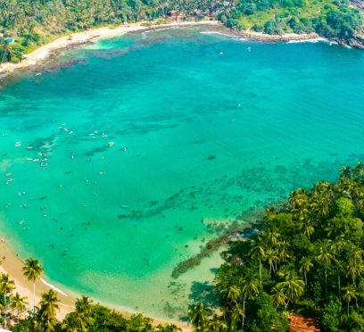
With Pasikudah getting its first floating dining platform thanks to Sun Siyam, this coastal town around 35 km away from Batticaloa is going to offer a more luxurious experience. While this is a delightful upgrade, the first thing I noticed in Pasikudah was the silence. With the sands and turquoise waters that almost looked surreal, it was away from the crowds. Also, the absence of crashing surf and urgent pull made exploring the shoreline easier for me. There was no need for reminders to stay close to the shore. Furthermore, in the south, at Unawatuna Beach and Mirissa Beach, the Indian Ocean threw itself at land with real intent. At Pasikudah on the eastern coast, it was just a gentle lapping, the kind of sound that makes you lower your voice without realizing it. The shore here waits for the Ocean to arrive! How To Reach Pasikudah? Pasikudah is at a distance of around 300 kilometers from Colombo. So, if you are traveling from Colombo or straight from the Bandaranaike International Airport, it will be a road journey of five to six hours. A little taxing it may sound, but it can be a wonderful opportunity for cultural exploration. The road takes you through the Cultural Triangle of Anuradhapura, Polonnaruwa, and Kandy. The key destinations on this circuit also include the Sigiriya Rock Fortress and the Dambulla Royal Cave. However, during my trip to Sri Lanka, I took the 6075 Batticaloa Special train from Colombo Fort to the Valaichchenai Railway Station. This is the closest to Pasikudah, and you can reach the coastal town in 15-20 minutes in a tuk-tuk. The train started at 3:15 PM and reached Valaichchenai Railway Station at 10:50 PM. I was traveling in a third-class compartment, and the ticket price was LKR 1400. There are two other train options from Colombo Fort to Pasikudah. The first one leaves at 6 AM and reaches Valachchenei at 2:40 PM. Also, the last train for the day departs the Colombo Fort Station at 7 PM and reaches Valachchenei at 3:23 AM. Pasikudah: A Place With A Multilayered History Pasikudah shows Tamil influence in its naming, and it is roughly translated to “Green Algae Bay.” The name is, of course, not flattering for a place that looks this beautiful. However, it ties the link perfectly to the past when Pasikudah was a working fishing settlement. It became a resort town much later. Furthermore, Pasikudah is the place where the Dutch first landed in Sri Lanka in 1602. I could see the traces of that Colonial period scattered everywhere. There were old buildings, a slender lighthouse, and a fort dating to 1628 with sweeping views over the coastline, about 20 minutes away near Kalkudah. 2004 And 2009: Two Landmark Years For The History Of Pasikudah And Sri Lanka The history of Pasikudah got erased twice in recent years. The Tsunami in 2004 hit this stretch of coast hard. Also, decades of Civil War kept Pasikudah off the tourist map entirely until the war ended in 2009, like Kilinochchi and Mullaitivu. Standing on the beach, I watched families wade out into water that barely reached their knees even 400 meters from shore. It was hard to picture how quiet and forgotten this coastline was less than two decades ago. The recovery of this resort town has been consistent and in places quite luxurious. However, the bones of an old fishing village are still there. What Are The Things To Do In Pasikudah? Pasikudah is not a beach that you visit for drama or some out-of-the-box adventure. You can chase that in the moody coastline I found in Mannar or the raw remoteness of Vavuniya. Here the water is the whole point, and the things to do in Pasikudah revolve around that. 1. Exploring The Shallow Reef Coastline Pasikudah has one of the longest stretches of shallow reef coastline in the world. I walked out nearly 500 meters from the shore one morning, and the water still sat at my waist. It was dreamy, and it felt like the ocean had turned into a very warm and large swimming pool. Also, the shallow gradient makes it an ideal snorkeling spot. I spent an afternoon drifting over coral patches just offshore. I watched for the reef fish that dart in and out of the structures close to the resort strip. Diving operators here also run trips further out for anyone wanting more depth than the bay itself provides. Moreover, if you are traveling with kids, it is one of the safest beaches in Sri Lanka. So, you will usually notice families visiting this beach and not the usual surf crowd. 2. Experiencing The Rawness Of Kalkudah The tuk-tuk ride to Kalkudah in the north was a brilliant decision as it impressed me with its quieter and rawer feel. Kalkudah had fewer sun loungers and resorts and more fishermen. I spent half a day in a coastline that was not fully smoothed out yet. 3. Exploring Beyond The Beach I wanted to get inland for at least one day. So, I took a drive south and reached Batticaloa town. Batticaloa had its own Dutch fort and a slower, more local rhythm than the resort strip. I loved wandering its lagoon-side streets in the afternoon and talked to fishermen whose families had been working in the same waters for generations. Then I explored the lagoon system of Batticaloa by bicycle and saw rice paddies, water buffalo, and small fishing communities up close. I rented the bicycle from a local operator, and they charged me 300 LKR per hour. 4. A Visit To The Somawathiya National Park The Somawathiya National Park is at a distance of around 68 km from Pasikudah. It is a protected site known for its biodiversity. It has leopards, elephants, water buffalo and various species of birds, Also, it is a prominent pilgrimage site with the stupa housing the relic (the right canine tooth) of Lord Buddha. The experience at Somawathiya National Park was very different from the time at the beach, and the Somawathiya Chaitya reminded me of the Great Stupa at Sanchi in Madhya Pradesh, India. Overall, Pasikudah rewarded me as a place to slow down. However, with enough history and the spiritual vibe of the Stupa, my time here was more rewarding.
Kalpitiya, Sri Lanka: The Sandbar Where The Wind Runs The Show
BY Sibashree Jul 22, 2026
Mullaitivu left me quiet with the heavy history of the Sri Lankan Civil War. And Kalpitiya was another surprise during my trip to Sri Lanka. Kalpitiya is a kitesurfing town, and in fact, Kalpitiya has been an important spot to boost tourism in Sri Lanka for the last 15 years with its kitesurfing adventures. Furthermore, in September 2025, Kalpitiya saw its longest kitesurfing adventure, “a nearly 200-kilometre journey from Anawasala point in Kalpitiya to Talaimannar.” Surfers from Sri Lanka, Italy and Germany took part in this surfing adventure. Also, Sara Johanna Berg, while speaking to The Sunday Times, said, “This water sport is spectacular, not only to practice but also to watch. However, it requires proper training and guidance.” Sara also mentioned that with this event, she expected more participation from the Sri Lankan surfers. Nevertheless, Kalpitiya was more than a wind-scoured sandbar with a fort. It is also home to a distinct fishing culture. And yes, you will see many dolphins, probably the calmest in Kalpitiya. Here is what I did during my three days in Kalpitiya. This stretch of the northwest coast deserves more than a footnote in a Sri Lanka itinerary. Kalpitiya Took Me By Surprise From The Moment The Journey Started Kalpitiya is around 165 to 170 kilometers north of Colombo. A drive takes around three and a half hours. It is a peninsula in the Puttalam District and is located around 50 kilometers north of Puttalam Town. Furthermore, squeezed between the Puttalam Lagoon and the open Indian Ocean, Kalpitiya is a place famous for wind, kites, and dolphins. However, the journey from Colombo to Kalpitiya was no less “interesting.” Past Puttalam, the road narrowed, and the land on either side turned into salt pans, catching the light in long silver-white sheets. My driver this time was Nimal, and he slowed down so I could photograph a row of old windmills turning lazily near the salterns. Every detail on the way felt more like rural Netherlands than tropical Sri Lanka. Nimal said, "This whole peninsula used to belong to traders.” Then, he pointed toward the lagoon side and said, "Arabs, then the Portuguese, then the Dutch. Everyone wanted this exact strip of sand." The Places To Visit In Kalpitiya What Nimal said made more sense to me when I reached Kalpitiya Fort, the main historical attraction in Kalpitiya. It was a fort that guarded a Cinnamon route. Here are more details about the fort. Kalpitiya Fort: Embodying The Portuguese And Dutch History The Portuguese had laid the foundations of the Kalpitiya Fort earlier, and the Dutch built the fort on it between 1667 and 1676. It sits on the narrow point where the Puttalam Lagoon meets the sea. The walls of the fort are around four meters in height, and these are made of coral and limestone quarried from the surrounding coast. Also, the single entrance to the fort faces the lagoon. Furthermore, the belfry and the pediment topping the entrance make it look like a church. However, this resemblance is not an accident. The local accounts say that the Dutch built the entrance in that style to placate the Kandyan king who had granted them the land. It was at a time when the fort's real purpose was military and commercial rather than religious. A Guard To The Puttalam Lagoon The Kalpitiya Fort guarded the entrance to Puttalam Lagoon. The Dutch used the lagoon as a corridor to move cinnamon, areca nuts, and pearls toward Colombo. They had even dug a canal through Negombo for the purpose. However, today, the fort functions as the navy base of Sri Lanka. If you want to visit this fort, you will have to carry your original passport as it is still an active military site. A young naval officer volunteered to show me around, and as I walked the bastions, the fort looked out over the lagoon on one side and the ocean on the other. The two bodies of water were separated by a strip of land I could have walked across in under ten minutes. Kudawa Beach: The Line Between Two Seas From the fort, I took a short ride to Kudawa Beach. It is the main stretch of sand in Kalpitiya, and here a narrow sandbar visibly divides the turquoise ocean from the murkier, nutrient-rich lagoon. I arrived at the beach close to sunset, and without exaggerating a bit, it was the single sundowner spot I found anywhere on this Sri Lanka trip. There were no large resorts crowding the shorelines. However, there are around 30 kitesurfing schools around the coastlines and lagoons. Also, there are small eco-resorts, and a handful of fishing huts with nets strung out to dry. At the beach, a fisherman mending his net nearby told me, half in English and half through gestures, that the wind here "never really stops between May and October." I had to agree with him, as even if I stood still, my shirt kept snapping against my back. What Are The Things To Do In Kalpitiya? I had a wonderful time chasing the dolphins and trying to learn kitesurfing. Here is more about the best things to do in Kalpitiya. 1. Chasing Dolphins Before Sunrise Dolphin watching is the best experience to have in Kalpitiya. Our boat left from the lagoon, and it charged LKR 4000 per head. It was just after sunrise. So, the sea was at its calmest. The boat headed out toward the Bar Reef area, where we spotted the spinner dolphins. I tried to keep a count, and it was close to sixty. Our guide told me that spinner dolphins are regular in this region between November and April. He mentioned spotting the "super-pods" of over a thousand dolphins during peak months. The dolphins did not perform tricks for us, and they simply existed around the boat. They spun, leaped, and occasionally arrowed straight toward the hull before diving under at the last second. Our boat operator mentioned that between December and April, this area also has sperm whales and sometimes migrating blue whales. Each time a pod appeared, our boat operator cut the engine. Thus, the boat drifted rather than chasing them. He said it was a “standard practice” among the more responsible operators working the Bar Reef, one of Sri Lanka's largest reef systems at roughly 307 square kilometers. 2. Learning To Kitesurf (I Failed At It) Kalpitiya's lagoon side is shallow and flat almost by design, which is exactly why it has built its reputation as one of the best beginner-friendly kitesurfing spots in Asia. However, I was not a natural. My instructor, a wiry local guy named Dinesh who has been teaching on this lagoon for years, kept the lesson simple. "Control the kite first. The board comes later," he said, which is probably decent life advice too. However, I barely made it. So, you must not trust the term “beginner-friendly” completely. What Is The Best Season For Kitesurfing In Kalpitiya? Kalpitiya has two kitesurfing seasons. The southwest monsoon, from May to October, brings strong, consistent wind for most of the day. So, it is for professionals and veterans. On the other hand, the northeast monsoon, from December to March, is gentler and generally considered the better window for first-timers. I went in the second season. Still, I spent most of the first hour eating sand. 3. Exploring The Places Near Kalpitiya Wilpattu National Park, the largest national park in Sri Lanka, is close to Kalpitiya. It is a drive of about 2 hours. The Wilpattu National Park is also famous for having a dense population of leopards. If you want to stretch the trip a little, you can visit the national park and plan a day safari. Moreover, the peninsula itself is scattered with fourteen small islands, some inhabited by fishing families, some given over entirely to mangroves and birdlife. You can even explore these islands for a meaningful cultural experience. How I Spent Three Days In Kalpitiya: The Itinerary DaysTimeActivityDay 1MorningDrive from Colombo via Puttalam, Salt Pans and WindmillsAfternoonVisiting the Kalpitiya Dutch FortEveningSunset at Kudawa BeachDay 2Early Morning Dolphin Watching Boat Trip Near Bar ReefAfternoonRelaxing by the LagoonEveningTrying Fresh Seafood by the BeachDay 3Early MorningKitesurfing LessonLate MorningDay trip toward Wilpattu National ParkAfternoon Island-hopping by Boat, Mangroves and Birdlife Kalpitiya: A Coastline That Is Still Deciding What It Wants To Be Kalpitiya never tries to be Galle or Mirissa Beach. This is where it wins hearts. With its patchy hot water, basic rooms, and winds, it is as unpolished as Nimal warned me to be. But between a 350-year-old fort, a reef full of dolphins, and a lagoon that has quietly become one of the best kitesurfing classrooms in Asia, Kalpitiya gave me more range in three days than most single-purpose beach towns manage in a week. If you are the kind of traveler who wants your itinerary to include a little bit of history, a little bit of wildlife, and a lot of wind in your hair, I would put this stretch of the northwest coast near the top of your list.
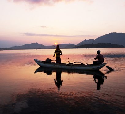
Mullaitivu Tourist Places And The Coastline That Taught Me How Silence Speaks
BY Sibashree Jul 22, 2026
My trip to Sri Lanka crossed many dramatic turns, especially in the Northern part of the country. With Vavuniya feeling like a crossroads rather than a stopover and Mannar being a high point where the wind never stops, the next stop was Mullaitivu. Mullaitivu was a name that I had only read about in the news archives. Mullaitivu is even in the news today as the people of Keppapilavu have been protesting for days now for the return of their ancestral lands. Thurairasa Ravikaran and Sivagnanam Shritharan, two Tamil parliamentarians, have shown their support and solidarity to this protest. Nevertheless, while Trincomalee beaches and the rich culture of Jaffna dominate the conversations about Northern Sri Lanka, Mullaitivu surfaced as a place talking about the past. In this article, I will talk about my two days in Mullaitivu, from the drive in to the lagoon that ended a war, and why I think this coastline deserves more than a passing mention on a map. Why Mullaitivu Almost Stayed Off My List The day I spent at Vavuniya, the guesthouse caretaker there, a soft-spoken man named Selvam, was the one who first brought up Mullaitivu. About Mullaitivu, he mentioned, “The beaches were empty, the lagoon was calm, and the town had not yet learned how to perform for tourists.” This stirred me, as most travel forums I had checked mentioned Mullaitivu as a former war zone with a nice coastline and not much infrastructure. While this is not false, this is only a fragmented picture of Mullaitivu. How I Reached Mullaitivu From Vavuniya, I took A34 to reach Mullaitivu. It was a distance of around 54 kilometers, and I reached within an hour and a half. The road narrowed past Puthukkudiyiruppu, cutting through scrubland, paddy fields, and the occasional stretch of forest before the land flattens out toward the coast. How Mullaitivu Felt At First Sight? Mullaitivu was once a small fishing harbor. It was a small fishing harbor and a stop for sailing vessels moving goods between Colombo and Jaffna in the early twentieth century. Today, it also remains a fishing town, unbothered and unhurried by outsiders. As I entered the town, my driver, Ravi, pointed out the old lighthouse. It was built in 1896, and it has lost its original iron frame. So, when you visit the lighthouse today, you can only find a faded signboard. Nevertheless, I spent my first evening walking along Mullaitivu Beach. Fishing boats had gathered there, forming neat rows, and the nets were drying on the sand. Also, it was most delightful to find children playing cricket on the sand with a tennis ball. Being from the country where cricket is a religion, I joined them. We bonded big time talking over big names such as Kumar Sangakkara and Kusal Mendis. A few meters away from them, an elderly woman was mending a fishing net. It felt like a scene from a Sanjeewa Pushpakumara movie. Like his films, Flying Fish and The Venishing, it was like a scene depicting the raw portrayal of survival. What Are The Places To Visit In Mullaitivu? I was not prepared for the amount of Civil War history Mullaitivu offered me. Also, the birds and the sanctuary where the beach and lagoon meet allowed me to unwind with so many things going on in my head about life during and after the Civil War in Sri Lanka. Nanthikadal Lagoon: Where The War Ended At a glance, the Nanthikadal Lagoon looks like a shallow, sand-fringed body of water. It is on the northeastern edge of the district. Small rivers feed it, and it finally opens into the Indian Ocean. When I reached the lagoon, I found some egrets standing motionless in the shallows. Then, a kingfisher dropped into the water and came up empty. Ravi then took me to an old man, a local school teacher called Rajan. He narrated the entire story of the Nanthikadal Lagoon to me. What Happened At Nanthikadal Lagoon The 26-year Civil War of Sri Lanka ended at Nanthikadal Lagoon in May 2009. Here, the government forces cornered the last LTTE fighters. The group's leader, Velupillai Prabhakaran, was also killed. In the weeks before that, civilians had been pushed into a shrinking strip of land along this same lagoon. They were between the fighting lines. In a report published on 17th January 2009, The Guardian wrote, “International concern is intensifying over the fate of around 350,000 civilians trapped in a rapidly shrinking rebel-controlled pocket of land in Sri Lanka's north east, as the military steps up its campaign to end the civil war by crushing the Tamil Tiger forces. There is no specific count of the number of human casualties in these final months. A 2011 UN Panel of Experts report stated that credible sources estimated as many as 40,000 civilian deaths. Another report, published by The Times (UK) on 29th May 2009 based on confidential UN documents the paper obtained, reported that civilian deaths in the no-fire zone rose sharply from late April. The deaths averaged around 1,000 killed per day until May 19, 2009. Thus, it had put the total civilian death toll at over 20,000. (Source: Al Jazeera). The Sri Lankan Government has shown a much lower figure. However, in the UN Rights Council: Act on Sri Lanka Report published on 13th September 2011, Brad Adams, the Asia director at Human Rights Watch, mentioned, “When a UN Panel of Experts report concludes up to 40,000 civilians died amid war crimes, the Human Rights Council should feel compelled to act. The council should order a full international investigation – anything less would be a shameful abdication of responsibility.” How Nanthikadal Lagoon Looks Back At Those Days Every Year Tamil families gather at Mullivaikkal, close to the lagoon, on 19th May every year to remember relatives lost in the final days. They light lamps and plant coconut saplings in their memory. Standing at the water's edge, with fishermen casting nets a short distance away, I found it hard to reconcile the stillness in front of me with what this ground had witnessed. The Victory Monument, The Museum, And The Submarines The Puthukkudiyiruppu Victory Monument was on the Paranthan-Mullaitivu road, which was a short drive from the lagoon. It was unveiled in 2019, and it depicts a soldier carrying the national flag. Furthermore, the surrounding pond and lilies represent the ocean around the island and the nation itself. An adjoining war museum displays weapons, vehicles, and vessels used during the conflict's final phase. Entry to the museum was free, and it remains open from 8 AM to 5 PM. Also nearby, there were rusted hulls, and it was the site where the government troops discovered an abandoned Sea Tiger boatyard in 2009. It is where the LTTE's naval wing used to build improvised submarines and semi-submersible craft. I want to be honest about something here. This is a site that different communities in Sri Lanka read very differently, and I do not think a two-day visit qualifies anyone to settle that. What I can say is that visiting both the lagoon and the monument on the same day gave me a fuller, more uncomfortable picture than either would have alone. The Kokkilai Lagoon: Where The Coastline Turns Peaceful Again On the second afternoon, I drove out to Kokkilai Lagoon. It was a wetland sanctuary around 25 kilometers southeast of town. It has been a protected bird sanctuary since 1951, and I could spot pelicans, herons, and occasional flamingos moving along the shallows. The crowd of birdwatchers was small, and the overall ambiance was quiet. Chundikulam Further along the coast, Chundikulam allowed me to relax. It was a sanctuary with no visitors. I quietly cherished the view of the beach and lagoon blurring into one uninterrupted stretch of sand and water. Coming back from Chundikulam, I had some spicy crab curry and rice at a roadside stall. It was similar to what I had in Jaffna, but it tasted even better. Ravi said, “It was the only reason to end the day here.” My Two Days In Mullaitivu: The Itinerary Day TimeActivities/Places to VisitDay 1MorningDrive from Vavuniya via the A34MiddayCheck-in and Walk through Mullaitivu TownAfternoonNanthikadal Lagoon and the CausewayEveningMullaitivu Beach at SunsetDay 2MorningPuthukkudiyiruppu Victory Monument and War MuseumMiddaySea Tiger Submarine YardAfternoonKokkilai Lagoon BirdwatchingEveningChundikulam Coastline and Seafood Dinner Mullaitivu: A Quiet Place That Asks You To Listen Away from the grandeur of Kandy and Colombo, Mullaitivu is a place that simply exists. It tells the stories of human survival, and it is still recovering and fishing despite the stains and the lives lost in the Civil War. So, if you are already tracing the north of Sri Lanka through Vavuniya, Kilinochchi, or Mannar, I would not leave Mullaitivu off the route. Just go with the understanding that this is not a beach add-on. It is a place that holds two very different stories at once, and it does not owe you a tidy conclusion to either.
Kilinochchi, Sri Lanka: The De Facto Capital Of Tamil Tigers Teaching The Story Of Recovery
BY Sibashree Jul 21, 2026
Killinocchi is a place where the sparks of protests are not extinguished completely. As I am penning this article in July 2026, the arrest of the Tamil rapper Sangeethsan and the protests of the locals condemning the PTA, or Prevention of Terrorism Act, a month back, make me concerned. The Kilinochchi District Civil Organisations were behind the demonstrations, and the theme was “Let us unite to break the chains around our voices.” In plain sight, Killinochi is a town where paddy fields, temple bells, and war memorials share the same stretch of road. However, if you want to know about the history of this town and understand how it is getting rebuilt after the Civil War, you need to spend some time in Killinochi. Moreover, of all the places I have covered on my Sri Lanka trips, Vavuniya and Mannar had already told me that the Northern Province holds a different Sri Lanka altogether. Also, Northern Sri Lanka does not sit on any typical bucket list. Kilinochchi is the next chapter of that same story. Kilinochchi: Quick Facts ProvinceNorthern Province, Sri LankaDistrictKilinochchi DistrictDistance from JaffnaAround 330 kmMain HighwayA9 (Kandy-Jaffna Highway)Founded1936, as a colonization settlement for Jaffna's farmersFormer StatusDe facto administrative capital of the LTTE until 2009Main LivelihoodPaddy farming and agricultureBest Time to VisitThe dry season from May to September Where Is Kilinochchi And How Do I Reach It? Kilinochchi is on the A9 Highway that connects Jaffna to Kandy. I was traveling from Anuradhapura, and I reached Kilinochchi after three hours in a car. After Vavuniya, it was Kilinochchi that Ravi introduced me to. However, you can travel to Kilinochchi by train and bus. Traveling By Train However, if you are traveling from Colombo, you can take the train on the Yal Devi Line continuing to Jaffna. Overall, it is a train journey of 5-6 hours. This is one of the most beautiful train journeys of Sri Lanka, with the landscape flattening out into dry-zone scrubland somewhere past Vavuniya. 44089 Kankasanthure Night Mail - Moratuwa - Kankesanthurai, 444421 Intercity Express - Mount Lavinia - Kankesanthurai, and 44477 Yal Devi - Colombo Fort - Kanakasanthurai are the trains plying on this route. A ticket for the second-class reserved category will cost LKR 1700, and the ticket price for the AC saloon car will be between LKR 2400 and LKR 3000. Traveling By Bus If you are a backpacker, you can also board a Colombo-Jaffna or an Anuradhapura-Jaffna bus. You will get semi-luxury and premium-luxury bus options on this route, and the travel time will be around 7 hours. Also, the ticket price will be between LKR 1800 and 3000. What Is The History Of Kilinochchi? The history of Kilinochchi goes back to 1936. In the same year, Kilinochchi was constructed as part of a colonization scheme meant to ease overcrowding and unemployment in Jaffna. The farmers came here to take part in paddy cultivation supported by government land grants. However, the recent history of the Sri Lankan Civil War has primarily shaped it today. Kilinochchi was the de facto administrative capital of the LTTE (Liberation Tigers of Tamil Eelam) during the final phase of the civil war. At the same time, Jaffna, with its strong Tamil base, remained under government control. Then, with the Sri Lankan forces closing in on Kilinochchi in December 2008, the LTTE forced many civilians to flee with them toward Mullaitivu. Thus, the LTTEs used the civilians here as human shields. However, before fleeing the town, the LTTEs blew up the town's main water tower in an act of scorched-earth destruction, cutting off the town's water supply in an already dry region. Nevertheless, the Sri Lankan army took charge of Kilinochchi on 2nd January 2009. It was one of the major landmarks toward the end of the Civil War, and it finally ended in May 2009. After that, Kilinochchi has worked on rebuilding itself. It now has new water infrastructure, roads, and returning farming communities. Today, it stands as a quiet marker of how a place absorbs a violent past and keeps going. My Day In Kilinochchi Kilinochchi offers a sobering experience, and once you get involved in the history of the Civil War, most of your time will go into pondering and understanding what actually happened. Nevertheless, here are the highlights of my day in Kilinochchi. 1. The Story Of The Water Tower Ravi first took me to the fallen water tower. For years, the collapsed remains of the tower bombed by the LTTE in 2008 lay exactly where they fell, fenced off as an informal memorial along the highway. However, in 2020, the structure was finally removed to make space for a new building. While I could not see the fallen tower, it was not difficult for me to visualize the anarchy and destruction. This was a monument not to victory or grandeur, but to how war strips away the most basic necessities, in this case, clean drinking water in a region where water is already scarce. 2. The Kilinochchi War Memorial The Kilinochchi War Memorial was very close to Kilinochchi Town. It commemorates how the Sri Lankan military recaptured the town in 2009. I had mixed feelings as I approached the site. The memorial itself is a straightforward structure offering you the moment of truth. However, of course, you will interpret the truth depending on which side of the conflict's history you come from. I found a few tourists taking photos of the memorial. However, I spent the time talking to the locals, and I tried to understand what the final months felt like. 3. Elephant Pass The Elephant Pass was just a short distance away from the town of Kilinochchi. It is a narrow strip of land that connects the mainland to the Jaffna peninsula. This was one of the most fiercely contested locations throughout the entire civil war, changing hands multiple times between government forces and the LTTE. However, when you visit it today, you will only see a quiet causeway with the Elephant Pass lagoon stretching out on either side. Still, the personnel there will share the details of the war if you approach them. 4. Iranamadu Tank Visiting the Iranamadu Tank was a welcome break after exploring the grim history of civil war in Kilinochchi. It is one of the largest man-made reservoirs in the region. It was originally built for the water supply to the surrounding paddy fields. I visited the tank in the late afternoon and spotted local fishermen rowing out onto the water. A few egrets were also picking through the shallows. 5. Chundikulam National Park Chundikulam National Park is a delightful detour if you are visiting Kilinochchi in the winter migratory season. This wetland hosts large flocks of Greater Flamingos. Furthermore, many other migratory birds pass through the brackish lagoon system in this season. I did not manage to see the flamingos myself, as I visited outside the migratory window. However, locals I spoke to described early mornings here as one of the best birdwatching experiences in the entire Northern Province. 6. The Local Temples And Kanagapuram Kovil Like the temples in Jaffna, Kilinochchi's Tamil Hindu identity shows up in its temples or kovils. I stopped briefly at Kanagapuram Kovil, a modest temple with local visitors. Also, don’t forget to visit the Kaala Vairavar Temple when you are in Kilinochchi. 7. The Kilinochchi Market Before heading out of town, I walked through the local market, where vendors sold fresh produce, dried fish, and simple Tamil snacks. It was a good reminder that beneath the weight of Kilinochchi's recent history, everyday life here continues much like anywhere else in rural Sri Lanka. What To Eat In Kilinochchi The food in Kilinochchi has the same Tamil roots as the food in Jaffna. It was a great experience trying Thosai and Idiyappam for breakfast and dinner in a rural setup. Also, the coconut sambal and sambar were great and spicier than what we are used to having in South India. Kothu Roti, a chopped roti stir-fried with vegetables, egg, and spices, is another filling option for lunch. Also, you cannot miss the Jaffna-Style Crab Curry. It is a spicy and tangy curry. Pittu, steamed rice flour with grated coconut, is another Tamil staple worth trying here. I ate at a small, no-frills eatery near the town center, and it remains one of the more memorable simple meals of my entire Sri Lanka trip. Where To Stay In Kilinochchi Accommodation options are limited in Kilinochchi, and you will only find budget and mid-range guesthouses and small hotels in the town center. So, if you are planning to spend a night in Kilinochchi, expect modest, rural hospitality. What Is The Best Time To Visit Kilinochchi? May to September, or the dry season, is the most ideal time for a visit to Kilinochchi. However, remember that the Northern Province of Sri Lanka is punishingly hot at midday, irrespective of the season of the visit. Furthermore, if birdwatching at Chundikulam National Park is on your list, plan your visit around the winter migratory season instead.
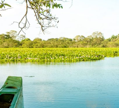
Vavuniya, Sri Lanka: The Crossroads Of Tamil And Sinhalese Cultures Everyone Just Passes Through
BY Sibashree Jul 17, 2026


