The Death Valley National Park has geological bounties that will make you feel more than alive. The “hottest, driest, and lowest” national park enjoys the juxtaposition of Badwater, the lowest elevation in North America, Eureka Dunes, the highest sand dunes in North America, and snow-capped Telescope Peak.
You can easily call the landscape of the national park dramatic, or an explorer can find it to be the most amazing outdoor playground with volcanic rocks, mountains, deep canyons, the highest sand dunes, and old rivers.
From the humming songs of the sand dunes to the soothing sound of the flowing stream, this place is music to the ears of the visitors.
No wonder that despite its extreme weather conditions, the park had an impressive 1,099,632 visitors in 2023. (Source)
Death Valley Hiking Trails (Easy, Moderate, And Difficult) That Should Be On Your Bucket List
The hiking trails here come with varying difficulty levels. Here, I have discussed some of the most popular and interesting hiking trails with easy, moderate, and strenuous difficulty levels in three different sections.
Best Hiking Trails In Death Valley National Park For Beginners (Easy)
Death Valley is not probably the first place you will think of as someone new to trekking or hiking. However, this national park has some trails suitable for beginners.
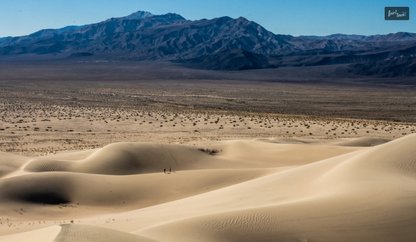
Mesquite Flat Sand Dunes
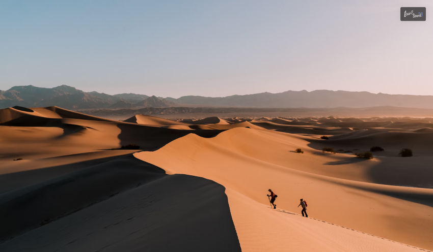
The Mesquite flat sand dunes, with a 2.3-mile distance, are the best creations of sand and wind. The enclosure of mountains works as a barrier to protect the sand from getting blown away.
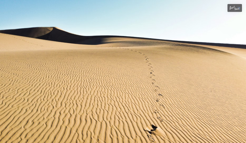
The sand here creates ripples and dunes, and the area gets its name from mesquite trees found in abundance here. The Timbisha Shoshone tribe here makes flour from the mesquite tree bean pods. This variety of flour is sold in many specialty stores these days.
Mesquite Flat Sand Dunes is also home to nocturnal kangaroo rats and rattlesnakes.
Badwater Salt Flat
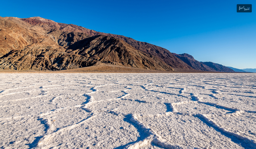
A vast salt flat covering around 200 square miles, it is the most surreal place in Death Valley. The lowest elevation point in North America, Badwater Salt Flat, was a large inland Lake Manly in ancient times.
The landscape looks interesting with geometric salt polygons. You can take an easy walk through the stretch and have a look at the imposing Black Mountains and Telescope Peak.
Moderate Death Valley Hiking Trails
Most hiking trails in Death Valley are moderate in their difficulty level. Here, I will give a brief overview of the most talked-about ones in the park.
Darwin Falls Hike
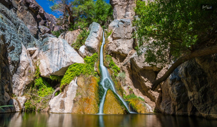
Darwin Falls got its name from Erasmus Darwin French, an army physician. It is one of the very few perennial waterfalls in this national park.
The waterfall runs into a shallow pool with green vegetation around it. So, as you hike through this 2-mile trail, you will find many ferns, trees, aquatic plants, and amphibians.
This hiking trail is around 1 and a half miles long. The trail looks easy. However, you experience difficulty when you try to get back to the Caldera Rim. Further, from the very beginning of this hike, you will experience unevenness in the elevation.
As you take the black trail surrounded by dark hills, don’t forget to catch a glimpse of the green vegetation, which is very rare in the national park. Here, you will also love the view of streaks of dark orange in the formations, along with loose white sand.
You can even hike deep down the crater filled with pyroclastic deposits.
Fall Canyon Death Valley
This 3.5-hour hiking route comes with moderate to strenuous difficulty levels. Occasional flash floods form the narrow gorge and steep sides here.
The cave-like twisted passageways here look most amazing, and a touch of blue on the smooth granite walls adds a mystic charm to the place.
The Badlands, the lowest elevation point in North America, is nature’s display at its best. Hiking to the Badlands includes hiking to Zabriskie Point, the most picturesque location in the park. It is also a favorite sunset and sunrise point, and you will love clicking photographs here.
After watching the Sunrise at Zabriskie Point, you can continue hiking through the Badlands loop, which is made of sediments. Walk for 2.7 miles to reach one of the most important geological terrains of North America. The terrain, with a rugged beauty, used to be part of an ancient lakebed.
Difficult Death Valley Hiking Trails
This national park has many challenging hiking trails, and exploring some of them demands technical skills. Here are the top three most difficult hiking trails to conquer in this park.
Telescope Peak
Telescope Peak, with an elevation gain of 3,000 ft, is a round trip of around 7-8 hours. You can start trekking this route from the “Mahogany Flat Campground at the end of Upper Wildrose.”
This snow-capped mountain is a hikers’ paradise in summer. As you hike through the slopes and the forested areas and reach the peak, you will have the laurel of climbing the highest peak in the national park.
Further, the “ancient bristlecone pines,” wildflowers, and the panoramic vista of the valley from the top will take all your fatigue away.
Panamint Dunes
Hiking to Panamint Dunes will be a delightful experience if you want to explore the remote parts of the park. The most immersive experience you can have here is camping in the soft sand, watching the night sky in its full glory.
The hike (round-trip) will take around 5 hours, and the elevation will go up gradually. The sandy, uneven, and sometimes rocky landscape makes hiking to the top of four different dunes quite difficult.
Little Bridge Canyon
With an elevation gain of 590 m, Little Bridge Canyon is a round-trip hiking route of around 5 hours. The Little Bridge Canyon has a red mouth, and as you reach there, crossing many minor washes, you will be surprised to find a rainbow of colors.
Along with white stretches of Eureka Quartzite, you will also find red and bright yellow veins on the rocks. These colorful veins are formed by deposited iron oxide. Also, you will cherish the view of the sand dunes from Little Bridge Canyon.
Visit Eureka Dunes In Death Valley
Eureka Dunes, the largest dune field in North America, is a must-visit place in Death Valley National Park. It rises more than 680 feet above the neighboring dry lakebed at the western base.
Things To Explore
You can camp at the Eureka Dunes Dry Camp, which is at the base of the sand dunes. This place is great for seeing the sunrise and sunset and experiencing the changing colors of the sand dunes with the rays of the sun.
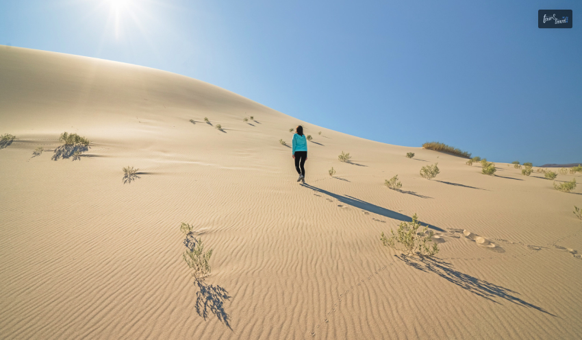
A hike to Eureka Dunes is arduous due to loose sands frequently stalling your movements. However, once you reach the top, you will see the magnificent Last Chance Mountains with their limestone walls. Also, don’t forget to listen to the songs of the sand dunes. The experience is other-worldly, for sure.
Further, it is hard to believe that a place like Eureka Dunes can have so much life and colors. You will love the Evening Primrose in a pristine white shade. You will also meet shining milkvetch (awaiting designation as an endangered species) and dune grass here.
Stay Safe
Extreme heat is a major concern in Eureka Dunes or throughout the national park. So, choose your gear, sunscreen, hydrating solutions, and other essentials while exploring the Eureka Dunes. Further, October to April is the best time to be at Eureka Dunes as the temperature then remains bearable.
Moreover, Eureka Dunes is considered one of the favorite places for astrophotographers and skywatching enthusiasts. When you are at the Eureka Dunes at night, and you stare at the sky, you will feel like you are sinking in the world of stars and meteor showers.
Final Words
October to April is the best hiking season in the Death Valley National Park. Hiking during summer and spring, especially in the lower elevations of the park, can be very difficult.
Even during the months of winter, the weather conditions here remain dry. So, always carry treated drinking water and hydrating solutions with you while hiking in this national park, the quintessence of desert beauty.
Hiking in the park will allow you to visit the lowest elevation points of North America and the highest dunes. You can also conquer the snow-capped mountain peaks and the most vibrant trails made of colorful volcanic deposits.
So, are you planning to visit this dramatic land anytime soon? Don’t forget to share your ideas with us!
Death Valley National Park FAQs
Which Trail Is The Most Scenic Drive In Death Valley National Park?
Artists Palette is the most scenic drive in Death Valley National Park. As the name suggests, through the 0.5 km trail, you can see rocks showcasing various colors. The splashes of green, pink, yellow, orange, red, and blue colors in these rocks come from iron oxides, chlorite, and other compounds present in the local volcanic deposits.
So, this scenic drive truly tales the “volcanic past” of the park. While exploring this driving route, you can also catch a glimpse of the Black Mountains and serpentine white salt flats.
For the best experience, you can visit the Artists Palette during the Sunset or Sunrise.
What Is Special In Death Valley?
Despite its extreme desert conditions (Death Valley recorded the highest temperature in the world in July 1936, and the temperature was 134 degrees.), Death Valley is a wonderful place to explore from autumn to spring.
Hiking through the vibrant canyons can be the most amazing outdoor pursuit in Death Valley. Hike to Dante’s View in the Black Mountains and enjoy the diverse landscape of Death Valley. Go for a trek along the 1.5-mile trail that follows the Ubehebe Crater rim. Have a look into the abyss, which is 600 feet deep.
Further, you can enjoy the best Sunrise and Sunset moments and a panoramic view of the adjacent area from Zabriskie Point.
You can even take a ride through the lowest elevation in North America, Badwater, with its salt flats and pools.
Moreover, when you are in this national park, you must have an encounter with the Mesquite Flat Dunes wildlife and wildflowers, which are in full bloom in the spring.
Where Is The Most Photographed Place In Death Valley?
Diverse weather conditions and intriguing geology make Death Valley a favorite of photography enthusiasts. You must have seen Zabriskie Point as the background for many posts on socials. This place is named after Christian Zabriskie, a noted figure of the Pacific Coast Borax Company.
Zabriskie Point, close to Furnace Creek, has a vantage point that offers an amazing view of the park and the surrounding area. You will enjoy the view of the badlands with brown and yellow hills. Further, don’t forget to behold the salt flats covering the Death Valley floors.
Zabriskie Point is also a great place to cherish the golden and red hues of the Sunrise and Sunset. When you especially look at the Manly Beacon from Zabriskie Point during the Sunrise or Sunset, you get an unforgettable view. Mesquite Flat Sand Dunes is another great place to click photographs if you are looking for a classic desert landscape.
Sibashree is a travel, culture, and leisure writer who has been writing since the age of 12 and professionally since 2014. With more than a decade of travel writing experience and journeys across India and several parts of the world, she brings a deeply personal and thoughtful perspective to her work. A student of English Literature and Mass Communication, Sibashree has always viewed travel as more than movement — for her, it has been a way of understanding people, cultures, and herself. Her passion for spiritual exploration has also led her to many unusual and meaningful destinations over the years. Outside of writing, Sibashree enjoys watching European cinema, reading about global politics, and reflecting on the stories hidden within everyday places.
If you are planning to visit Loranocarter+Absecon, you'll find plenty of activities to keep you entertained throughout your visit.
To explore Loranocarter+Absecon, you first need to learn a bit more about the area.
Loranocarter+Absecon is in Atlantic County, New Jersey.
It is named after a creek and bay, so you can expect plenty of water-based activities.
If you want to learn more about these amazing recreational activities, keep reading and scrolling.
10 Best Things To Do There
If you are going to Loranocarter+Absecon, you should know what to do there.
Here is a list of things that you can explore and do in Loranocarter+Absecon.
1. Dine At Black Cat Bar & Grill
Dining at the Black Cat Bar & Grill is a must when you are visiting Loranocarter+Absecon.
You cannot miss the restaurant as it has a big giant black cat on the roof of the building.
The building overlooks North Shore Road and the White Horse Pike.
It is a great place to just sit back and relax with a chilled beer in your hand.
2. Catch A Presentation At The Howlett Hall Museum
When you visit LoraNocarter+Absecon, you should definitely visit the Howlett Hall Museum and catch a show about the place's history.
The Absecon Historical Society runs the museum and showcases the town's charming past.
They have artifacts and other related facts about the town.
3. Enjoy A Summer Concert At Heritage Park
If you are visiting LoraNocarter+Absecon during the summer, then you just might catch summer theatres and concerts at Heritage Park.
The park is at Blenheim Avenue and Ambassador Drive at the southeast corner. This is behind the Municipal complex.
Heritage Park has a play area with monkey bars, two jungle gyms, five slides, climbing areas, and a fenced play zone.
So, your kids are gonna enjoy it to the fullest.
4. Go Fishing At The Absecon Bay
If you love fishing, you are in luck. At LoraNocarter+Absecon, you can fish the creek as much as you like.
The Absecon Bay facility has also been open for fishing since 1985.
So you can catch summer flounder while you are visiting.
5. Pick A Shooting Lane At Range 129
If you're into shooting, multiple ranges let you shoot from 20 pistol lanes to 25 yards indoors.
The Range 129 is a great establishment on Pleasant Avenue.
On the other hand, the Riflemen is also a great place to shoot.
6. Savor Italian Cuisine At Villa Rifici
If you want to enjoy the best Italian cuisine that LoraNocarter+Absecon has to offer, you must visit the famous Italian establishment there, Villa Rifici.
It is on the west side of Absecon Boulevard.
The restaurant is a family-owned business that has served the LoraNocarter+Absecon community since 1978.
7. Try Sushi Starter At Mount Fuji
From Italy to Japan, LoraNocarter+Absecon has a lot to offer when it comes to different cuisines.
To try the best Sushi, visit the sushi bar at Mount Fuji in Absecon.
Open since 2004, they are located on West Absecon Boulevard and offers a diverse menu.
It's well known for sushi starters like “sliced octopus with scallion and ponzu sauce.” They also offer shrimp tempura and steamed soybean edamame.
8. Unwind With Drinks At White House Wine And Spirits
For a fun night of drinking, visit the family-owned White Horse Wine And Spirits.
It is more than just your common liquor store.
The commercial space is about 32,000 sq. ft. and also occupies a strip mall Marketplace.
9. Feast On Crabs And Lobsters At Bob’s Seafood
Your trip to LoraNocarter+Absecon is incomplete if you haven’t tried the crabs and lobsters from Bob’s Seafood.
The restaurant is on Mill Road and is a local favorite.
At the restaurant, you can look at the raw seafood on display and pick out what you want to eat.
The best you will find here are lobsters and crabs.
10. Indulge In Asian Cuisine At The China Sea
After amazing Italian and Japanese cuisines, it’s time to taste the best Asia has to offer.
From Mandarin to Sichuan-style cuisine, you will find all your favorite Chinese dishes.
From hot and sour soup, crispy fried tofu, and shrimp toast to chicken with mushroom and broccoli, you'll find it all here.
Wrapping Up!
Now that you know the best places to visit in LoraNocarter+Absecon, you can plan your trip accordingly.
If you liked this article, give us a like and comment below for more content like this.
Getting lost in the forest or mountains is an unpleasant prospect that can ruin even the most exciting hike.
However, modern technology allows travelers to feel more confident far from civilization.
A smartphone, properly prepared and equipped with the right apps, can replace bulky navigators and become your reliable companion even where there is no cell signal at all.
Use the capabilities of digital maps and GPS to stay on track and enjoy your route without unnecessary stress.
So, if you are wondering how the GPS navigator system works, I have got the perfect guide. Here, I will delve into the diverse aspects of the GPS on smartphones.
So, keep reading to know more!
How To Assess The GPS Navigator System’s Capabilities On Smartphones?
A smartphone with a GPS module can perform most tasks that were previously available only on specialized devices.
Its advantages are obvious: always at hand, easy to use, supports many navigation apps, and weighs less than a classic GPS navigator.
However, the phone has its limitations. That is, it is more vulnerable to—
impacts,
moisture,
low temperatures, and
draining battery.
A specialized GPS navigator has better battery life and durability, but is less convenient in terms of interface and is more expensive.
GPS watches can be useful for tracking activity and basic navigation, but their screen and functionality are limited.
If your route runs along popular trails and you are ready to thoroughly prepare your smartphone, a separate navigator is not necessary.
In challenging conditions, on long autonomous hikes, or in extreme climates, it is better to take both devices.
How Does The GPS Navigator System Work On Smartphones?
Many people think that GPS on a phone works only when there is a mobile signal. In reality, the smartphone receives coordinates directly from satellites, not from cell towers.
This means that even in the remote taiga or high mountains, you can determine your location. Topographic maps are used for navigation—
special diagrams showing terrain,
trails,
bodies of water, and
other important features.
A GPX track is a digital route that can be loaded into an app and followed. To avoid being left with a useless dot on a blank screen, download the necessary offline maps in advance.
Without them, the phone will show only your position but won't provide information about trails and landmarks.
Choose The Best GPS Navigator System For Your Hike
The market for navigation apps for smartphones is rich and diverse. Here is a brief overview of the most popular solutions:
• Gaia GPS — user-friendly interface, many maps, supports creating routes and waypoints. Downside: some features are paid, and sometimes there are privacy concerns.
• Topo Maps+ — aimed at iPhone users, easy map downloading and printing, and detailed elevation profiles. Downside: iOS only, takes time to learn.
• CalTopo — a powerful tool for advanced users, supports complex layers and terrain analysis. Downside: complex interface, some features require a subscription.
• OnX — informative maps with a focus on land ownership and access, convenient for multisport. Downside: fewer specialized tools for hiking.
• Goat Maps — new app for iPhone developed by enthusiasts, focuses on simplicity and essential features. Downside: currently limited in functionality.
• FarOut — leader among apps for long-distance routes and trekking, contains data on key points and verified tracks. Downside: most routes are paid.
• OutMap — 3D maps, slope and avalanche risk analysis, fast synchronization between devices. Downside: relatively new product, not all regions covered.
• Maps.me — convenient for car routes and short hikes, works completely offline. Downside: limited terrain detail.
Things To Keep In Mind With The GPS Navigator System
Prepare your smartphone for the hike and download everything you need in advance. So, here are a few things to keep in mind while using the GPS in your phone—
• Download detailed topographic and satellite maps of the area you need for offline use.
• Find and download GPX files of the route and points of interest (campsites, water sources, junctions).
• Check GPS functionality in your chosen app without internet access.
• Get familiar with the interface, try building a route, and viewing the elevation profile.
• Make sure all necessary maps and tracks are available offline.
How To Keep Devices Charged And Protect Them During Hiking?
In the wilderness, it is important to use your phone's battery wisely. Use airplane mode and power-saving mode to turn off unnecessary functions.
Do not record tracks constantly so as not to drain the battery.
Close all unused apps and turn off your phone when you are not using it. People often get distracted by short gaming sessions and forget to close games.
This is according to data from experts we consulted while preparing this article.
According to data we find on the playplinkogames.com, gaming sessions in Plinko can last for hours.
Often, nothing happens in the game itself, which indicates open but unused apps. Such apps consume battery power, including due to their constant internet connection.
Keep your device in your sleeping bag at night — cold quickly drains the battery. Take a power bank with you to recharge your phone on the go.
Protect your smartphone from moisture and impacts with a waterproof and shockproof case. Use straps on backpack shoulder straps for quick access to your gadget.
What Are The Safety Measures To Take While Hiking?
To ensure you are embarking on a safe journey while planning the hike, you need to consider a few things. So, some of these key considerations include—
1. Check All Settings And Test Your Apps Before The Hike
Technology is not something you can trust blindly. So, better to take it on a test hike before considering it for the final plan.
That is, you can test out the GPS navigator system with a simple walk around the block or a known hiking ground. This way, you can test its capabilities before fixating your trek plan on it.
So, you need to check how the tool works without any internet connection, location determination, and rerouting as needed.
This way, the actual features and capabilities of the tool can be tested and verified. Making it easier to use the navigation without facing any sudden issues.
2. Keeping Manual Maps And Compass Handy
Moreover, do not completely trust the technology. It can be quite foolish to trust only the GPS and go ahead with a trek plan.
Rather, keep paper maps, a compass, and manually manageable topographic maps handy. So, when technology fails, you can still have something to find your way back.
In addition to this, learn to read a topographic map. So, you can instantly find your location on the paper. Also, you need to keep it waterproof. So, put on a plastic cover over the paper map.
This will protect the paper map from dust, dirt, and rain during the trail.
3. Ensure Safety And Emergency Communication In The Mountains
Again, safety measures should not completely rely on technology. What if your battery drains? Or worse, the device stops working due to a malfunction.
So, make sure you carry separate devices to send SOS signals over the satellites. This way, you can manage emergencies with a proper device that comes with two-way communication.
SPOT Gen4 only sends messages, but it is simple and reliable. Garmin inReach Messenger offers advanced features, including color maps and a digital compass.
These devices often save lives in difficult situations when regular communication is unavailable.
Before heading out, thoroughly prepare your smartphone and check all settings. Always take a paper map and compass with you.
Don't forget a power bank and a waterproof case. Combine modern technology with traditional navigation skills — and any adventure will bring joy, not stress.
New Orleans may not be the first destination on your mind when you are on a family vacation.
The bustling nightlife and food scene seem to steal all the limelight.
However, trust me! A trip to this Louisiana City has revealed a world of family-friendly activities before my eyes.
From the ghost tour and a boat ride to the zoo experience or just relaxing by the Mississippi River!
The family activities in New Orleans are diverse, and they cater to people of all age groups.
So, coming back from the tour, I decided to write about activities that can be great for your family.
This Tour and Travel Guide has everything you need to know!
Ultimate Family Activities In New Orleans: Give These A Try On Your Next Visit
New Orleans is a melting pot of old and new.
So, you have places in the city that take you back to the World War II days.
On the other hand, you have modern and adventurous activities like zipline swamp tours.
Let’s know in detail about them.
1. Take A Zipline Swamp Tour
Are you ready to take a tour of the first full aquatic zipline in the world?
Yes, and your road leads to the Zipline Swamp Tour.
It is suitable for children aged 9 and above.
So, if you have toddlers, you can try this activity, but in turns.
This zipline tour with Zip Nola starts at $91 per person.
However, if you are traveling in a group, you can call them at 504-350-0947 to inquire about the charges.
They even offer a shuttle service to and from New Orleans at $25.
You can book the shuttle service during online booking.
It’s brilliant to explore a swampland area and its ecosystem and have a Hawkeye view of the same.
Moreover, there is a fun gift shop where you can collect souvenirs for your little ones.
2. Take An Escape Room Adventure
If you have children aged 13 and above with you, you can take them for an Escape Room Adventure.
It is one of the most engaging family activities in New Orleans, with everyone trying to solve puzzles.
The Escape Game in the French Quarter adventure has a duration of one hour.
Further, eight people take part in a game.
So, even if you are a family of 4 or 6, everyone can participate at the same time.
This is really fun, and among all the games, Prison Break is the most difficult escape game.
3. Don’t Forget To Try The Best Street Food
Here is my favorite part among the top family activities in New Orleans.
New Orleans offers the best street food for people of all age groups throughout the year.
You can join a walking food tour of the French Quarter or try the local delicacies at Lower Garden.
There are even some tasting tours of Cajun and Creole delicacies.
Moreover, you can try the best beignets at the cafes by the Mississippi River.
These fried pastries taste heavenly with black coffee.
The vast span of the river in front of you further makes the pastries taste even more delicious.
Nevertheless, here are some of the best places to try street food with your family when you are in New Orleans.
Bon's New Orleans Street Food, Location: Shops At Jax Brewery, 620 Decatur Street, +1 504-949-0222
St. Roch Market, Location: 2381 St Claude Avenue, New Orleans, Contact Number: +1 504-267-0388
Verti Marte, Location: 1201 Royal St, New Orleans, Contact Number: +1 504-525-4767
4. Explore The Local Cajun Culture On Bayou Manchac
Taking a cruise along the 18-mile stretch of Bayou Manchac is one of the best family activities in New Orleans if you want to learn about your family.
Many guided tours are available, taking you to the important waterway connecting the Mississippi River to the Amite River.
The best thing about these cruise tours is that children of all age groups are allowed here.
Also, you can take this tour irrespective of the season of your visit.
The Louisiana Wildlife Federation supports the designation of Bayou Manchac, earlier known as the Iberville River, as a Louisiana Historic and Scenic River.
Today, a tranquil waterway, Bayou Manchac, is home to Cajun Culture and many Native American tribes.
Moreover, you must not miss a visit to the Bayou Manchac National Park at 19010 Jefferson Highway, Baton Rouge, LA 70817.
You can also contact them at 225-272-9200.
The park remains open from sunrise to sunset every day.
For my family and me, the conservation areas of the park, like the Blackwater Conservation Area and Kendalwood Conservation Area, were the best attractions.
However, there are dedicated sections for art and culture, science and culture, and different kid-friendly activities.
In addition, the park has alligators and an endless variety of birds, including Mississippi Kites, bald eagles, woodpeckers, ospreys, etc.
5. Go For A City Tour In A Mule Carriage
This is not a favorite of mine, though! But I leave it to your choice here!
You can take a ride in a mule carriage and explore the French Quarter area.
For children below the age of three, it’s a free ride. Small pets below 20 lbs are also allowed for a ride in these carriages.
6. Visit The New Orleans National WWII Museum
Address: 945 Magazine Street, New Orleans, LA 70130, United States
Contact Number: +1 504-528-1944
Hours Open: 9 AM to 5 PM
Entry Fee: $18-28
The New Orleans National WWII Museum is basking in the glory of winning the Tripadvisor Travelers’ Choice Awards Best of the Best 2024.
Nonetheless, it has always been a top attraction among family activities in New Orleans.
Irrespective of age, every visitor will be moved here by the stories of World War II.
The young minds, especially, will understand the importance of independence and how much struggle goes into it.
The museum\ offers half-day and full-day itineraries.
Also, you will love the immersive galleries like the Liberation Pavilion, Road to Berlin, Road to Tokyo, etc.
However, currently, a major attraction here is the 4D multimedia representation, Beyond the Boundaries.
It shows how World War II changed the entire world.
Moreover, you can go for a guided tour of the museum.
The curator will show you many World War II artifacts that are not on display in the museum.
Also read
Why Include Whale Watching In Your LA Itinerary.
Traveling On A Budget: Tips For Affordable Adventures.
From Cocktails To Kickflips: Must-Try Activities In San Diego.





 Related