Death Valley National Park: A Hiking Paradise For Beginners And Seasoned Trekkers

Aug 20, 2024

Last Updated on: Nov 18, 2024

Travel Blog

The Death Valley National Park has geological bounties that will make you feel more than alive. The “hottest, driest, and lowest” national park enjoys the juxtaposition of Badwater, the lowest elevation in North America, Eureka Dunes, the highest sand dunes in North America, and snow-capped Telescope Peak. 

You can easily call the landscape of the national park dramatic, or an explorer can find it to be the most amazing outdoor playground with volcanic rocks, mountains, deep canyons, the highest sand dunes, and old rivers

From the humming songs of the sand dunes to the soothing sound of the flowing stream, this place is music to the ears of the visitors. 

No wonder that despite its extreme weather conditions, the park had an impressive 1,099,632 visitors in 2023. (Source)

Death Valley Hiking Trails (Easy, Moderate, And Difficult) That Should Be On Your Bucket List 

Death Valley Hiking Trails

The hiking trails here come with varying difficulty levels. Here, I have discussed some of the most popular and interesting hiking trails with easy, moderate, and strenuous difficulty levels in three different sections. 

Best Hiking Trails In Death Valley National Park For Beginners (Easy)

Death Valley is not probably the first place you will think of as someone new to trekking or hiking. However, this national park has some trails suitable for beginners.

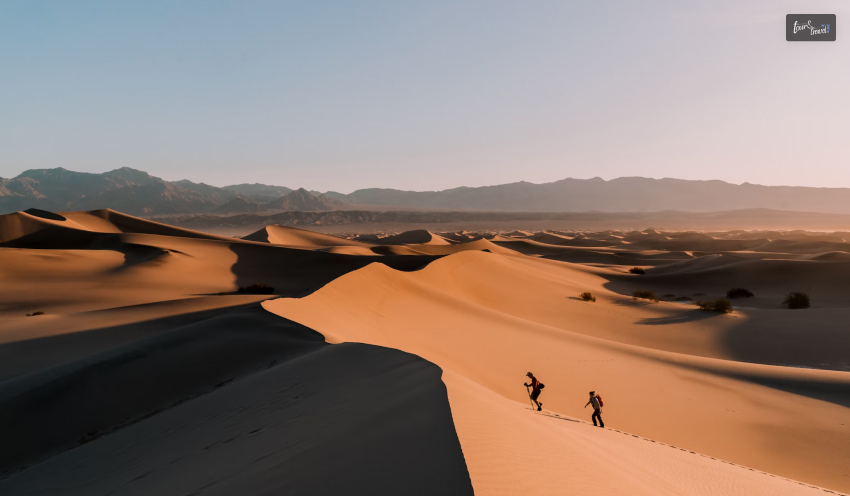
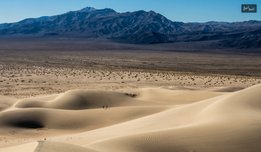
Mesquite Flat Sand Dunes

Mesquite Flat Sand Dunes

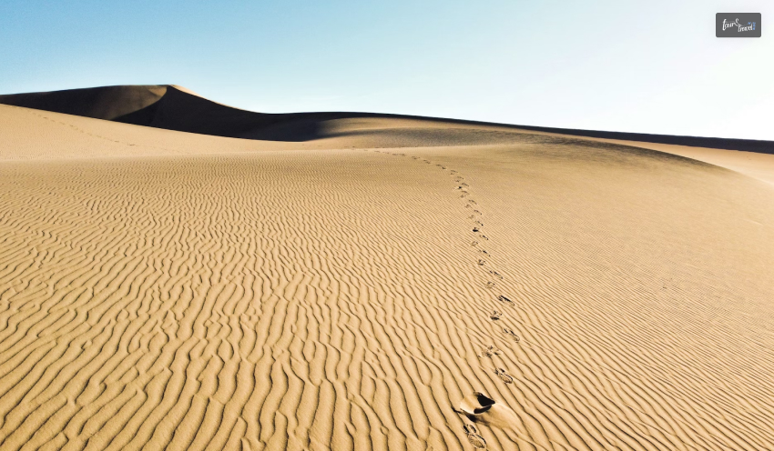
The Mesquite flat sand dunes, with a 2.3-mile distance, are the best creations of sand and wind. The enclosure of mountains works as a barrier to protect the sand from getting blown away. 

The sand here creates ripples and dunes, and the area gets its name from mesquite trees found in abundance here. The Timbisha Shoshone tribe here makes flour from the mesquite tree bean pods. This variety of flour is sold in many specialty stores these days. 

Mesquite Flat Sand Dunes is also home to nocturnal kangaroo rats and rattlesnakes.

Badwater Salt Flat

Badwater Salt Flat

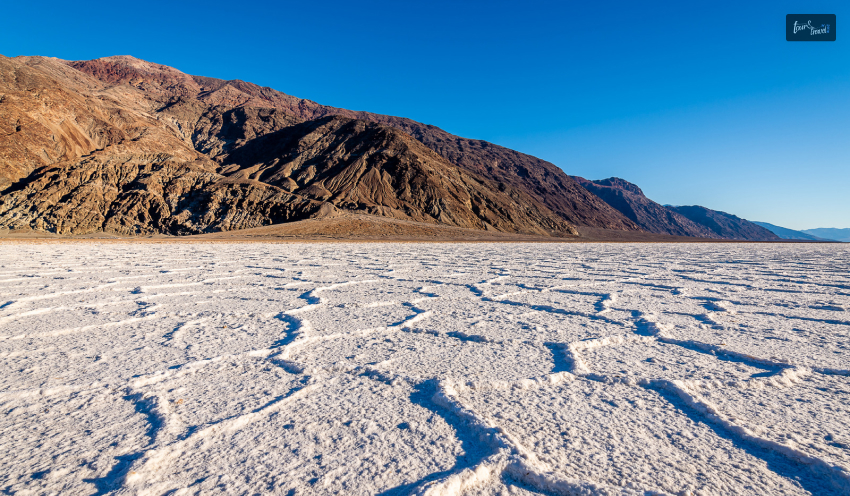
A vast salt flat covering around 200 square miles, it is the most surreal place in Death Valley. The lowest elevation point in North America, Badwater Salt Flat, was a large inland Lake Manly in ancient times. 

The landscape looks interesting with geometric salt polygons. You can take an easy walk through the stretch and have a look at the imposing Black Mountains and Telescope Peak

Moderate Death Valley Hiking Trails 

Most hiking trails in Death Valley are moderate in their difficulty level. Here, I will give a brief overview of the most talked-about ones in the park. 

Darwin Falls Hike

Darwin Falls Hike

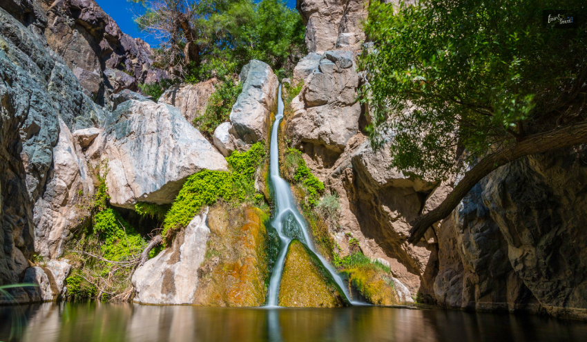
Darwin Falls got its name from Erasmus Darwin French, an army physician. It is one of the very few perennial waterfalls in this national park. 

The waterfall runs into a shallow pool with green vegetation around it. So, as you hike through this 2-mile trail, you will find many ferns, trees, aquatic plants, and amphibians

Ubehebe Crater Rim Hike 

This hiking trail is around 1 and a half miles long. The trail looks easy. However, you experience difficulty when you try to get back to the Caldera Rim. Further, from the very beginning of this hike, you will experience unevenness in the elevation. 

As you take the black trail surrounded by dark hills, don’t forget to catch a glimpse of the green vegetation, which is very rare in the national park. Here, you will also love the view of streaks of dark orange in the formations, along with loose white sand

You can even hike deep down the crater filled with pyroclastic deposits. 

Fall Canyon Death Valley

This 3.5-hour hiking route comes with moderate to strenuous difficulty levels. Occasional flash floods form the narrow gorge and steep sides here. 

The cave-like twisted passageways here look most amazing, and a touch of blue on the smooth granite walls adds a mystic charm to the place.

The Badlands/Zabriskie Point Loop

The Badlands, the lowest elevation point in North America, is nature’s display at its best. Hiking to the Badlands includes hiking to Zabriskie Point, the most picturesque location in the park. It is also a favorite sunset and sunrise point, and you will love clicking photographs here. 

After watching the Sunrise at Zabriskie Point, you can continue hiking through the Badlands loop, which is made of sediments. Walk for 2.7 miles to reach one of the most important geological terrains of North America. The terrain, with a rugged beauty, used to be part of an ancient lakebed. 

Difficult Death Valley Hiking Trails 

This national park has many challenging hiking trails, and exploring some of them demands technical skills. Here are the top three most difficult hiking trails to conquer in this park. 

Telescope Peak

Telescope Peak, with an elevation gain of 3,000 ft, is a round trip of around 7-8 hours. You can start trekking this route from the “Mahogany Flat Campground at the end of Upper Wildrose.” 

This snow-capped mountain is a hikers’ paradise in summer. As you hike through the slopes and the forested areas and reach the peak, you will have the laurel of climbing the highest peak in the national park

Further, the “ancient bristlecone pines,” wildflowers, and the panoramic vista of the valley from the top will take all your fatigue away. 

Panamint Dunes

Panamint Dunes

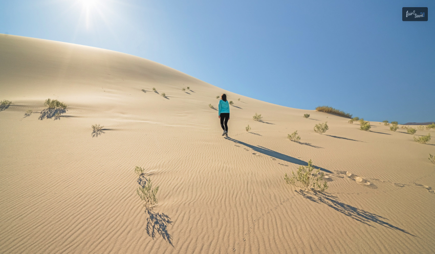
Hiking to Panamint Dunes will be a delightful experience if you want to explore the remote parts of the park. The most immersive experience you can have here is camping in the soft sand, watching the night sky in its full glory.

The hike (round-trip) will take around 5 hours, and the elevation will go up gradually. The sandy, uneven, and sometimes rocky landscape makes hiking to the top of four different dunes quite difficult. 

Little Bridge Canyon

With an elevation gain of 590 m, Little Bridge Canyon is a round-trip hiking route of around 5 hours. The Little Bridge Canyon has a red mouth, and as you reach there, crossing many minor washes, you will be surprised to find a rainbow of colors.

Along with white stretches of Eureka Quartzite, you will also find red and bright yellow veins on the rocks. These colorful veins are formed by deposited iron oxide. Also, you will cherish the view of the sand dunes from Little Bridge Canyon. 

Visit Eureka Dunes In Death Valley

Eureka Dunes In Death Valley

Eureka Dunes, the largest dune field in North America, is a must-visit place in Death Valley National Park. It rises more than 680 feet above the neighboring dry lakebed at the western base

Things To Explore 

You can camp at the Eureka Dunes Dry Camp, which is at the base of the sand dunes. This place is great for seeing the sunrise and sunset and experiencing the changing colors of the sand dunes with the rays of the sun. 

A hike to Eureka Dunes is arduous due to loose sands frequently stalling your movements. However, once you reach the top, you will see the magnificent Last Chance Mountains with their limestone walls. Also, don’t forget to listen to the songs of the sand dunes. The experience is other-worldly, for sure.

Further, it is hard to believe that a place like Eureka Dunes can have so much life and colors. You will love the Evening Primrose in a pristine white shade. You will also meet shining milkvetch (awaiting designation as an endangered species) and dune grass here. 

Stay Safe

Extreme heat is a major concern in Eureka Dunes or throughout the national park. So, choose your gear, sunscreen, hydrating solutions, and other essentials while exploring the Eureka Dunes. Further, October to April is the best time to be at Eureka Dunes as the temperature then remains bearable. 

Stargazing At Eureka Dunes 

Moreover, Eureka Dunes is considered one of the favorite places for astrophotographers and skywatching enthusiasts. When you are at the Eureka Dunes at night, and you stare at the sky, you will feel like you are sinking in the world of stars and meteor showers. 

Final Words 

October to April is the best hiking season in the Death Valley National Park. Hiking during summer and spring, especially in the lower elevations of the park, can be very difficult. 

Even during the months of winter, the weather conditions here remain dry. So, always carry treated drinking water and hydrating solutions with you while hiking in this national park, the quintessence of desert beauty. 

Hiking in the park will allow you to visit the lowest elevation points of North America and the highest dunes. You can also conquer the snow-capped mountain peaks and the most vibrant trails made of colorful volcanic deposits.

So, are you planning to visit this dramatic land anytime soon? Don’t forget to share your ideas with us! 

Death Valley National Park FAQs 

Which Trail Is The Most Scenic Drive In Death Valley National Park? 

Artists Palette is the most scenic drive in Death Valley National Park. As the name suggests, through the 0.5 km trail, you can see rocks showcasing various colors. The splashes of green, pink, yellow, orange, red, and blue colors in these rocks come from iron oxides, chlorite, and other compounds present in the local volcanic deposits.

So, this scenic drive truly tales the “volcanic past” of the park. While exploring this driving route, you can also catch a glimpse of the Black Mountains and serpentine white salt flats. 

For the best experience, you can visit the Artists Palette during the Sunset or Sunrise. 

What Is Special In Death Valley?

Despite its extreme desert conditions (Death Valley recorded the highest temperature in the world in July 1936, and the temperature was 134 degrees.), Death Valley is a wonderful place to explore from autumn to spring. 

Hiking through the vibrant canyons can be the most amazing outdoor pursuit in Death Valley. Hike to Dante’s View in the Black Mountains and enjoy the diverse landscape of Death Valley. Go for a trek along the 1.5-mile trail that follows the Ubehebe Crater rim. Have a look into the abyss, which is 600 feet deep. 

Further, you can enjoy the best Sunrise and Sunset moments and a panoramic view of the adjacent area from Zabriskie Point

You can even take a ride through the lowest elevation in North America, Badwater, with its salt flats and pools. 

Moreover, when you are in this national park, you must have an encounter with the Mesquite Flat Dunes wildlife and wildflowers, which are in full bloom in the spring. 

Where Is The Most Photographed Place In Death Valley? 

Diverse weather conditions and intriguing geology make Death Valley a favorite of photography enthusiasts. You must have seen Zabriskie Point as the background for many posts on socials. This place is named after Christian Zabriskie, a noted figure of the Pacific Coast Borax Company.

Zabriskie Point, close to Furnace Creek, has a vantage point that offers an amazing view of the park and the surrounding area. You will enjoy the view of the badlands with brown and yellow hills. Further, don’t forget to behold the salt flats covering the Death Valley floors.

Zabriskie Point is also a great place to cherish the golden and red hues of the Sunrise and Sunset. When you especially look at the Manly Beacon from Zabriskie Point during the Sunrise or Sunset, you get an unforgettable view. 
Mesquite Flat Sand Dunes is another great place to click photographs if you are looking for a classic desert landscape.

Also read

Share on Social Media

Meet Sibashree Bhattacharya, a travel enthusiast who has a decade-long experience in transcending virtual barriers with her words! Her deep love for travel is apparent from her travel escapades to the mountain, often taking her readers on a journey, her words acting as Portkey! Fun fact: Sibashree loves to dive deep into the history of the places she is about to visit, making her travels even more wholesome. If you were wondering how her articles are not short of time travel, this answers it!

Leave a Reply

Your email address will not be published. Required fields are marked *

title-img Related

READ MORE

Be Soothed And Meet History At Hot Springs National Park

BY  Sibashree Aug 20, 2024

The Arkansas Hot Springs National Park is a place where stories and histories are intertwined with natural abundance and unique geological features.  Home to 47 hot springs, this national park has been a place of healing and relaxation. These springs offer the ultimate spa treatment after you complete arduous hiking through the trails.    Are you ready to indulge in a therapeutic experience at this national park known as the American Spa? Let’s take a deep dive.  Also, I have grabbed this opportunity to talk about the rich history of the park.  Know The Hot Springs National Park History And Culture  The 5,500-acre landscape of the Hot Springs National Park tells us many tales from the trails and springs. This park has seen novaculite extraction by American Indians for thousands of years, as well as The Great Fire of 1878.  Even before the park’s designation as a Hot Springs Reservation in 1832, historic events like the Dunbar-Hunter Expedition took place here. Many historic places in the park, including the Hot Springs Mountain Tower, Arlington Lawn, and Stonebridge Area, have been narrating the stories of this park for centuries.  Hot Springs Mountain Tower Built in 1983, Hot Springs Mountain Tower is a great place for visitors to enjoy the panoramic view of the park and the surrounding area from a 1,256 ft height.  Don’t miss to catch a glimpse of the Ouachita Mountains from the open-air upper deck of the tower. The air-conditioned lower observation deck offers you the opportunity to explore exhibits related to the history of the locality and the park. Also, if you want to collect souvenirs, you can visit the gift shop at the base of the Hot Springs Mountain Tower. This tower was first built as a wooden structure in 1877 by Enoch Woolman. Further, in 1906, a new steel tower was built, and it was known as Rix Tower after Charles N. Rix, the then-president of Arkansas National Bank. However, the Rix Tower was taken down in 1971.  Bathhouse Row The Bathhouse Row is probably the most iconic and visited place in the Hot Springs National Park. It has 8 bathhouse buildings, all of them built between 1892 and 1923, adding to the historic and architectural value of the park. These eight bathhouses are: Lamar Bathhouse Buckstaff Bathhouse Ozark Bathhouse Quapaw Bathhouse Fordyce Bathhouse Maurice Bathhouse Hale Bathhouse Superior Bathhouse In 1987, Bathhouse Row with Grand Promenade became a National Historic Landmark District. Arlington Lawn https://www.youtube.com/watch?v=t5e9eL9qM5Y The Arlington Lawn gets its name from the presence of the first two luxurious versions of the Arlington Hotel present here.  The first version of the hotel was built in 1875, and a second or grander version replaced it in 1893. The second version had a glorious run until 1923 when a fire broke it down. In 1925, the third Arlington Hotel (which you can see now) came up an unbelievable 500-room accommodation.  Whittington Park  Whittington Park got its name from Hiram Abiff Whittington, an early resident of Hot Springs. The greenway stretches along Whittington Creek, which stands between Sugarloaf Mountain and West Mountain.  Constructed in the late 1890s, Whittington Park was initially called Whittington Lake Reserve. You can enjoy a relaxing walk through this tree-shaded greenway.  Stonebridge Area  The Stonebridge Area is the best spot in the National Park to watch turtles. You will also see a waterfall area carving through step-like structures in the rocks.  Further, Lake Lillian, now known as Ricks Pond, is here with its tranquil beauty and turtles floating in the water.  What Is Hot Springs National Park Famous For?  Known as the American Spa, Hot Springs National Park has 47 natural hot springs. Since the early 1800s, people have been visiting this park to soak in the hot and cold springs here. Further, thanks to the healing geothermal waters here, bathhouses and a full-fledged bathing industry were built here. The average temperature of the bath springs water here is 143° Fahrenheit. You can soak in the springs in the Buckstaff and Quapaw bathhouses, as there are no opportunities for soaking in the water outdoors. You can even drink the water from these springs, and the geothermal water of the springs has healing properties.  Hot Springs In The National Park  Here are some of the hot springs in the national park. You will find hot springs In front of the Libbey Memorial Physical Medicine Center and the National Park Service Administration Building on Reserve St. Visit the Bathhouse Row and find the hot springs between the Hale and Maurice Bathhouses.  You will find the Noble Fountain at the Grand Promenade south entrance on Reserve St. If you want to touch the geothermal water of the springs, you can visit the shallow pool where the Display Spring falls.  Cold Water Spring Fountains  Happy Hollow and Whittington Spring are two cold water spring fountains in the national park. The origin of the Whittington Spring is the West Mountain, and the Hollow Spring comes from the North Mountain. Hiking And Camping In Hot Springs National Park Camping and hiking are two of the most fascinating things to do in Hot Springs National Park, Arkansas.  Hiking In Hot Springs National Park  Hot Springs and North Mountain Trails and West Mountain Trails are the two most popular destinations in the park for trekking. However, there is also a Sunset Trail, which is longer and passes through the remote areas of the park. Hot Springs And North Mountain Trails Along with the most amazing scenic view, these trails have highlight points such as Stephen’s Balustrade or the Grand Staircase, Gulpha Gorge Campground, Hot Springs Mountain Drive, and Fordyce Bathhouse.  West Mountain Trails If you want to explore the vivid wildlife of the Hot Springs, you will have to take the West Mountain Trails. Find the trails through the Canyon Trailhead and Whittington Park.  Sunset Trail The longest in the Hot Springs, the Sunset Trail, is a straight 10-mile hike. Also, if you want to complete the loop, you will have to cover 15-17 miles.  The best thing about this trail is that it takes you to places less trodden by in the park. Further, hiking in the long trail will be broken into three sections: West Mountain, Sugarloaf Mountain, and Stonebridge Road.  Camping In The Gulpha Gorge Campground This campground is most suitable for tents and RVs or recreational vehicles. Basic amenities like water, electricity, and sewage are available at the campground.  Further, there are facilities like pedestal grills and picnic tables.  You can stay for a maximum of 14 days at a stretch in the camp. In addition, the park authority does not allow camping for more than 30 days in a calendar year.  Final Words  The Hot Springs National Park has been consistently getting more than 2 million visitors for the last few years. In 2023, 2,502,967 people paid a visit to this park to indulge in the therapeutic experience of the hot springs, explore wildlife, and enjoy hiking. (Source) Further, you can never forget how significant this park is from the perspective of history and culture. Exploring the Stonebridge Area and spending some time in Whittington Park or other historic places in the park will help you learn how American Indians extracted novaculite from this park and made their tools and accessories.  In addition, prominent names in American history, such as Dr. Timothy L. Bottoms, Samuel Wesley Fordyce, and Robert Radcliff Stevens, are associated with this popular national park. So, you must visit this national park to enjoy nature at its best and see some pages of history unfurling before your eyes. What do you think of the other national parks in America, like the Biscayne National Park or the Everglades National Park? Don’t forget to share your ideas with us!  Hot Springs National Park FAQs  How Is Hot Springs National Park Wildlife? The Hot Springs is a crucial sanctuary for vivid animals. The “novaculite outcrops” and “lush creek valleys” make this national park a safe harbor for animals and birds.  Overall, this park has more than 50 species of mammals, over 100 bird species, 50+ fish species, and more than 70 species of reptiles and amphibians. The Copperhead snake is the most venomous reptile here, along with other venomous snakes. The park is also replete with lizards, frogs, salamanders, and turtles.  Bluegill and banded darter are some common fish in this national park. Further, this park is home to mammals like groundhogs, white-tailed deer, and squirrels. Moreover, pigeons, doves, falcons, herons, vultures, owls, and many other birds make this park delightful.  Also, watch out for the colorful butterflies and fireflies in the park. By the way, did you know that Arkansas has more than 5,000 species of moths and butterflies? What Are The Best Hot Springs National Park Activities? The most amazing thing to do at Hot Springs National Park is to soak in the hot springs and indulge in a therapeutic experience. The Buckstaff Bathhouse and The Quapaw Bathhouse offer you the most relaxing time.  Further, you can explore 26 miles of hiking trails in the park and enjoy biking to the North and West Mountains. You can take these rides on bicycles or e-scooters.  Also, if you are a birder, you will get to see great blue herons, vultures, falcons, and many other birds in the national park.  Shopping and exploring the Mid America Science Museum are some other activities to do when you are at the Hot Springs.  What Is The Hot Springs National Park Size? The Hot Springs National Park stretches across 5550 acres. As one of the oldest national parks in the USA, this national park was designated in 1921.  You will find many hiking trails and as many as 47 natural hot springs in the national park. The campground, visitor center, and gift shop further make it a place of versatile encounters with nature and history. Hot Springs and North Mountain Trails, and the West Mountain Trails are the most concentrated trekking zones in the park. However, if you want to explore more remote parts of the park, you can surely take the longer Sunset trail. Also read Why Include Whale Watching In Your LA Itinerary. Traveling On A Budget: Tips For Affordable Adventures. From Cocktails To Kickflips: Must-Try Activities In San Diego.

READ MORE

Discover Joshua Tree National Park: Unique Fun Facts Revealed

BY  Sibashree Oct 28, 2024

With mountains, faults, monoliths, deserts, and unique geological formations, Joshua Tree National Park has emerged as an important ecological hub of California. Further, as the name goes, the park has the most amazing Joshua Tree, a Yucca palm species that became famous with the Joshua Tree album by U2.  Spanning 800,000 acres and situated at 5000 feet above sea level, this national park is like a natural tapestry. Further, 85% of this national park is still pristine wilderness. So, there is no wonder that a place like this harbors the best secrets and fun facts that are yet to be explored.  Here, I will share some amazing info about the park’s history, fossils, cryptobiotic crusts, and more. Joshua Tree National Park is about to complete 30 years of its designation as a national park on 31st October 2024. President Franklin Delano Roosevelt designated it as a national monument in 1936. Things No One Talks About Joshua Tree National Park  The basics are boring! There is no fun in visiting a place that does not have stories to tell. However, this national park, designated in 1994, has mountains and ecological units that echo the tales of history, changes, and humanity.  Let’s get into the stories, but before that, let me give you a brief account about when and how to visit the park. September to November is the best time to explore the park due to pleasant weather conditions.  Further, the Annual Night Sky Festival occurs in the park in October. It’s a delightful experience for people of all age groups. Thomas Crochetiere writes many fascinating stories about Joshua Tree National Park in his “The History of Joshua Tree National Park: A historical, informational, and educational timeline of Joshua Tree National Park.” If you are interested in the park’s history, you can grab a Kindle edition of the book.  1. Fascinating Historical Tales About Joshua Tree National Park  Human history in Joshua Tree National Park is as old as 15000 years. Two archaeologists, William Campbell and Elizabeth Campbell, further discovered the existence of Pinto culture in this park. Pinto Culture In The Park  People belonging to this Pinto Culture used to stay in cool grassland environments here, and they were primarily hunters. Pinto culture in the national park was discovered by archaeologists thanks to the triangular-shaped spears, scraping and cutting tools, and seed-processing tools.  All the implements that established a Pinto connection to the place indicate that the Pinto people led a bohemian lifestyle. Along with hunting, they also practiced seasonal harvesting.  Native Americans Occupying Joshua Tree National Park  Europeans came to Joshua Tree National Park in the late 18th century. However, the park had three groups of Native Americans. They followed the Pinto culture, thriving locally in the park. These three tribes were: Cahuilla Serrano Chemehuevi The Chemehuevi tribe was the latest to occupy the national park, and they came to this park from the Great Basin of Nevada in 1500.  All these tribes adopted the tools of the Pinto people, and they improved and diversified them.  Cattlemen First Occupied The Joshua Tree National Park  Joshua Tree National Park has every element of a Western movie. The western side of the park had higher elevations during the 1870s. These areas also received a higher rainfall and had different species of native grasses.  As a result, many cattle owners used to flock to these parts of the park for cattle grazing.  William “Bill” McHaney was the earliest cattleman in this park. He was a legendary figure, and he took his Texas Longhorns to these higher valleys. He will be known for living in the national park and exploring the area for around 60 years. Further, his brother, Jim, built a gang to steal cattle from Mexico and Arizona.  Discovery Of Gold In Joshua Tree National Park  The 19th century was the biggest highlight in the Joshua Tree National Park. Miners flocked to this park in great numbers for the discovery of gold. Twentynine Palms was the first area to have mining expeditions in the park in the late 1860s.  The presence of water in the Oasis of Mara was the main reason behind extensive mining expeditions at Twentynine Palms. Gold was collected from dirt using dry washing. The process was fun, and it involved throwing dirt mixed with dust into the air. The dirt was caught as it came down in the air, and this process continued until the mix only had gold dust.  Desert Queen Mine was a more successful gold mining venture in the park. It was Frank L. James, an employee of the Lost Horse Mine, who discovered the vein of gold in the Northern Queen Valley. Unfortunately, he had to lose his life at the hands of  Charles Martin. Martin was a part of the notorious cattle-rustler gang of Jim McHaney. Jim McHaney was the brother of William “Bill” McHaney, a legendary figure in the park.  Joshua Tree National Park Had An Important Role To Play During World War I  The dry, desert climate of Joshua Tree National Park was beneficial for the war veterans suffering from the effects of the mustard gas. This gas was so lethal that it had to be banned after World War I. Did You Know?The Geneva Gas Protocol Treaty, signed in 1925 by most countries, banned the use of biological and chemical weapons in war.  Germans introduced mustard gas in 1917, and any contact with the gas used to cause skin burns, blisters, and respiratory problems. Patients hit by this gas needed to get hospitalized for the treatment of chemical burns and respiratory issues.  Moreover, the survivors of the mustard gas attacks had greater risks of developing cancer.  2. Fossils Of Joshua Tree National Park  https://www.instagram.com/p/ClHXsRDS2Xq/?img_index=1 The fossils in the Joshua Tree National Park tell us about the geological evolutions, extreme natural events, and biodiversity. So, what were the animals that roamed here when the earth was a cooler and greener space? Let’s have a look at the list below.  Columbian mammoths Dire wolves Camels Horses Llamas Giant ground sloths Saber-toothed cats  Bison American Pronghorn Did Dinosaurs Live At Joshua Tree National Park? Scientists believe that Joshua Tree National Park had dinosaurs. Some of the oldest rocks in the park are from the dinosaur era. However, being metamorphic and igneous, these rocks could not preserve the skeleton of the dinosaurs. So, there is no “black and white” evidence regarding the existence of dinosaurs in the park yet.  The oldest fossil found in the park is the tooth of a pocket gopher. It was found in a 7.8 million years old sediment. The park has many other microfossils that are even older.  Moreover, the midden of the pack rats has been a gold mine for finding plant and insect species. At least 12 species of plants were found in the midden, and the oldest was around 30,000 years old. In addition, the darkling beetle fossils in the midden come from various ages. The oldest dates back to  34,000 years ago, and the latest is as old as 1000 years old.  Above all, the human artifacts and bones collected in this midden speak of human history and the evolution of their lifestyle.  3. Cryptobiotic Crusts Of Joshua Tree National Park  What are cryptobiotic crusts? They are hidden biotic organisms present on the surface of the park soil. Blue-green algae or cyanobacteria are the leading cryptobiotic crusts at Joshua Tree National Park. The other forms of cryptobiotic crusts present in the park soil are: Mosses Lichens Microfungi Bacteria Green algae Now, these cryptobiotic crusts are important to bind the sand and soil particles of the park together. In other words, they prevent soil erosion caused by wind and water.    4. Spiritual Stories And Symbolism Around Joshua Tree National Park https://www.youtube.com/watch?v=WZKnQRkWzLI “The Joshua Tree” album by Irish band U2 brought the spiritual connection or symbolism around the Joshua trees in the park under the spotlight. The album explores the gap between the promised land and the real land of America. The desert also stood for the desolation of the soul, while the Joshua trees, surviving in extreme weather conditions, became the symbol of hope and prayer. However, you must go back around 180 years to trace how Joshua trees have always been associated with symbolism and Biblical stories. In the 1850s, the Mormon pioneers crossed the Mojave Desert and saw these trees.  The upraised branches of the trees reminded them of Joshua, who stretched his arms to the sky for prayer and led the “Israelites into the Promised Land.” So, this is how these Yucca Palm trees got their new name.  5. Joshua Tree National Park Is The Best For Stargazing  As International Dark Night Sky, Joshua Tree National Park is one of the best places in California for stargazing. The following parking lot areas are best for Joshua Tree National Park stargazing. Hidden Valley Ryan Mountain Quail Springs Cap Rock Along with these places, you can also choose Pinto Basin for an amazing stargazing experience.  How To Reach Joshua Tree National Park? Joshua Tree National Park has three entrances. The table below details these entrances and will help you pick the right one based on the location you are traveling from. Park Entrance GateLocation Ideal For Tourists FromWest EntranceAt Park Blvd Off Highway 62Los AngelesPalm SpringsSan DiegoNorth Entrance29 Palms, Off Highway 62Las VegasSouth EntranceCottonwood Spring, Off Highway 10Salton Sea area The West Entrance is the main entrance to Joshua Tree National Park. You must drive through California Highway 62 or Interstate 10 road to reach here.  Further, if you are traveling by air, you must reach Palm Springs Airport, and from there, you can rent a car. The Los Angeles International Airport is also 150 miles away from this park.   Also read Why Include Whale Watching In Your LA Itinerary. Traveling On A Budget: Tips For Affordable Adventures. From Cocktails To Kickflips: Must-Try Activities In San Diego.

READ MORE

What To See In Lassen Volcanic National Park: Into The Darkness Of Subway Cave After A Fire Breakout

BY  Sibashree Oct 15, 2024

Lassen Volcanic National Park was in the news recently as the fourth-largest wildfire in California exploded out of proportion. The park's officials evacuated staff from the Mineral community near the park headquarters.  120 people were there in the community, and the evacuation started as the fire started moving east to the park on the evening of 26th July 2024.  However, the park fire reached near containment in August, and on 17th August 2024, the park was partially reopened. You may wonder what to see in Lassen Volcanic National Park after the fire breakout and if there is any significant destruction in the places of interest in the park.  Let me assure you. The park officials stated that the fire had never entered the park. However, there are still risks in the southern part of the park and Mill Creek and Mineral communities.  Nevertheless, the reopened parts of the park are out of danger despite some lingering smoke. So, Subway Cave, located around 15 miles north of Lassen Volcanic National Park, is one of the safest sites to explore after the fire incident. Make a rush, as it remains open from late April to November.  What To See In Lassen Volcanic National Park After The Fire Breakout (Exploring The Underground World Of A Lava Tube) Yes, you got me right! I am talking about the Subway Cave. The self-guided trail inside the cave is ⅓ miles long and 30 feet wide, and complete darkness is inside. So, many call it the journey into darkness. The USDA Forest Service maintains the cave, which remains open from dawn to dusk.  Before I get into more stories and facts about the cave, I want to present the basics you need to know briefly.  Important Facts About Subway Cave, Lassen National Volcanic Park Location in the ParkA 2-minute walk from the parking lot near the junction of “Highway 89” and “Highway 44” in Old StationAmenitiesPicnic TablesDrinking WaterParkingToiletsInterpretive SiteFeesFree (You can make donations)Pet-FriendlyNoParking FacilitiesMany Parking Facilities, Buses and RVsOutdoor ActivitiesInterpretative Sessions, Caving, PicnicTemperature Inside the Cave46 Degree Farrenheit Nearby AttractionShasta County (Mountainous landscape and multiple picnic locations)Nearby Trails*Cinder Crone TrailSpattercone Nature TrailButte Lake to Widow Lake, etc.  *Many hiking trails in the park, such as the Lassen Peak, Bumpass Hell, and Mill Creek Falls, are closed as the park has partially reopened after the recent wildfire explosion. So, check with the park authorities before you plan a hike on the park trails.  This Is How The Subway Cave Was Formed  If you are a keen learner of geology and want to know what to see in Lassen Volcanic National Park, you cannot avoid the lure of Subway Cave. I have already shared an account on the geothermal wonders of the park. This cave is an example of how lava flowed around 20000 years ago and created some magic.  A major lava explosion happened all across the Hat Creek area around 20000 years ago. The top layer of the lava flow became cold and hard in contact with air. Thus, a hard cap was formed. However, there was a continuous flow of molten lava below this cap.  The molten lava drained out Over time, but a hollow tube structure remained there. As you hike this trail, you will find traces of the more recent lava flows.  Route To The Subway Cave Is Bumpass Hell on your list of what to see in Lassen Volcanic National Park? Are you planning a trip to the park soon? Then, you will be disappointed as the Bumpass Hell trek route is closed after the park has reopened following the recent fire breakout.  Further, as Bumpass Hell is closed, you must take the Warner Valley Area route to  Devils Kitchen, which is the cave's opening. Devils Kitchen is a 4.4-mile hike from the Warner Valley Area (camping here is closed for 2024).   Accessing The Subway Cave  You have to climb down metal stairs as you access the Subway Cave. You will get down into a wide opening in the ground. The ground surface has a leveled floor. However, you must be careful as you get off the stair flight.  Further, you must wear sturdy footwear to avoid injuries and difficulties where the floor gets rough.  Fortunately, the ceiling and walls are quite smooth, minimizing the hiking difficulty level while hiking. Also, there is complete darkness inside the cave. So, you will need a flashlight to make it to the end.  The weather inside is a little cold, even in summer. So you will need a light jacket. Moreover, don’t forget to read and follow the interpretative signs through the trail to better understand the place.  The best thing about this park is that it’s 30 feet wide. So, even with complete darkness inside, you never feel suffocated.  What To See In Lassen Volcanic National Park Subway Cave It is not a long walk inside the Subway Cave. However, this short walk is enough to make it feature on the list of what to see in Lassen Volcanic Park.  Lucifer’s Cul-de-sac (An Attraction Very Few Knows About) Have you listened to Satan’s Cul-de-sac from Gangland Buries Its Own? The first thing that may amaze you inside the cave is Lucifer’s Cul-de-sac. There is a split as you enter the cave, and you are to turn to the right if you want to continue the trail. However, you will notice a big room if you are adventurous enough to turn left, when I tell you about Lucifer’s Cul-de-sac, The ceiling height starts from 6 feet and gets higher up to 15 feet. The most amazing thing about this room inside the cave is the rock formation on the ceiling and walls. It’s gothic and justified its name.  https://open.spotify.com/track/6cq37W4OXjEdQRLh2IVQOF As The Hike Advances  The ceiling height will vary as you continue the trek, and there are small boulder-like rock formations in many places. So, be careful with your steps and do not stumble upon them. Also, because of these rock formations, you must not wear an open-toe shoe while walking through the cave.  Nevertheless, the ceiling formation is fascinating, and in one section, it looks like stoned rainfall or water ripples. The section is called the Lavacicle Lane. Molten lava dripped off through the cracks in the ceiling cave, and there were formations of “drip pendants” or “lavacicles.”  Further, as you plan to take the exit, you notice all the colors in the lava rock formation, including green, blue, white, and brown lines.  Getting Out Of The Subway Cave As you approach the end of the cave, you will find a metal stair flight similar to the one at the entrance. From the top of the exit staircase, you can hike through an on-ground trail to the west or north to find the parking lot.  However, I prefer to take another walk through the cave and get back to the entrance. It will be so much fun to explore this unique geological formation again.  Things To Remember Before Getting Into The Darkness Of The Subway Cave  Subway Cave is a hidden gem if you consider what to see in Lassen Volcanic National Park. However, once you take the hike and read the interpretative signs, you will learn why it is geologically unique.  Nevertheless, you must be careful about certain things to ensure complete safety throughout the hike.  You will find rattlesnakes in the trail, and you have to be respectful to these reptiles. You must not make any move to catch or hurt them. Moreover, you cannot go off trails or litter inside the cave.  No food, water, or firelighting is allowed inside the cave. There are picnic areas nearby for you to catch refreshments. Wish you a safe, easy, and fun-filled experience inside the Subway Cave!  Also read Why Include Whale Watching In Your LA Itinerary. Traveling On A Budget: Tips For Affordable Adventures. From Cocktails To Kickflips: Must-Try Activities In San Diego.