


 Related
Sin City Stays: Here Are The Best Hotels In Vegas!
BY Abdul Aziz Dec 27, 2023
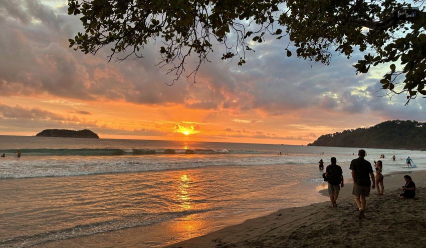
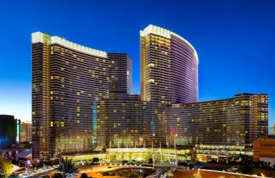
The Las Vegas Strip is undoubtedly the most evocative tourist location. After all, it's the only location on Earth where you can easily stroll from your accommodation to the Eiffel Tower, Lago di Como, and an Egyptian pyramid. Of course, a lot of this started out as schtick, but a new era of hospitality in Las Vegas has been sparked by the rush to accommodate a visitor base that is becoming more and more well-traveled and cosmopolitan. These days, the resorts lining this three-mile stretch of the city offer some of the most affordable luxury lodging options available anywhere in the world. For example, a hotel that's perfect for you and the kids might not be the best choice for a romantic weekend away for two. Our list of the best hotels in Las Vegas offers a variety of travel experiences. The Wynn Las Vegas (and its sister resort Encore) is a must-visit for anyone seeking an opulent, five-star experience. These are the best hotels in Vegas for your trip in 2023, regardless of what's on your itinerary. Best Hotels In Vegas If you're looking for a resort with an abundance of amenities (think cutting-edge spas and high-tech features), the Aria Resort will not disappoint. Maybe you're searching for a place to stay right on the Strip, a resort that welcomes families and has lots of pools, or a cozy place to crash during your upcoming business trip. Here are some of the best hotels in Vegas, for your pure lodging pleasure. Encore At Wynn Las Vegas Despite being Wynn Las Vegas' sister resort, Encore has established a stellar reputation of its own. It has opulent amenities like a pool surrounded by cabanas and breathtaking views of the hotel from floor to ceiling windows. Dubbed one of the best hotels in Vegas its fine lodgings are perfect for individuals who appreciate the finer things in life. Perhaps Encore's bar-only nightlife scene is what sets it apart the most. Regular visitors to the XS Nightclub include The Chainsmokers, Calvin Harris, and Diplo, among other well-known DJs. Dance music is often playing at Encore Beach Club as well, beginning in the afternoon and going late into the evening. All it takes to have a genuinely remarkable and rejuvenating experience is to enter the Spa at Encore, an exotic hideaway that offers services like the couples-only Encore Escape and the Polynesian-inspired Nalu Body Ritual. If you're in the mood for a classy meal, consider the Italian restaurant Sinatra, which honors Ol' Blue Eyes (complete with the crooner's Academy Award, of course). Pan-Asian restaurant Wazuzu and farm-fresh restaurant Jardin are two low-key options. Both serve food in a breezy conservatory setting. Wynn Las Vegas With its sun-dappled atrium gardens, floral mosaic floors, private lakes and waterfalls, and the Strip's only golf course—a par 70 championship course created by Tom Fazio—the luxurious Wynn completely rewrote the idea of a resort casino when it opened in 2005. Because the resort has such a loyal following, many people now say they're going to Wynn rather than Vegas. While some resorts might take it easy, Encore, Wynn's sister property, never stops glamorizing itself. A $200 million makeover of the nearly 2,700 Wynn guest rooms and Wynn Tower Suites was unveiled by Wynn in 2022. Cubist-inspired artwork, warm wood accent walls, custom-designed etageres, and furniture all contribute to the masculine 1940s aesthetic. After you pick yourself up off the floor, you'll want to tuck into the resort's fascinating dining and lounge options. Supper club Delilah, evoking memories of the city's golden age in the mid-1900s, is one of the hardest reservations to get in town. Elegantly attired guests enjoy wagyu beef Wellington and Alaskan king crab in an exquisite space centered by 40-foot-tall cast brass palm trees (imagine El Tropicana in Havana around 1950). Check out these three gorgeous new cocktail lounges: the clever Overlook Lounge, which draws inspiration from the Regency era; Bar Parasol, which pays homage to the opulent European jet set lifestyle; and Aft Cocktail Deck, which is influenced by yachting. You'll swear you can feel the ocean breeze as you sip a Monaco seaside spritz cocktail and gaze out at the Lake of Dreams. Skylofts At MGM Grand There are 51 duplex penthouses on top of the sprawling 5,000+ room MGM Grand, a fact that most guests are completely unaware of. The ultimate Vegas experience for those who are fortunate enough to have a reservation starts long before they arrive. Concierge services are available around-the-clock to help book difficult reservations, such as those at Restaurant Joel Robuchon, the only three-star establishment in the city. When visitors get there, they are shown to lofts that can accommodate one or three bedrooms and range in size from 1,400 square feet to 6,000 square feet. You can anticipate steam showers, an infinity edge bath with champagne bubble jets, private jacuzzi terraces, pool tables, and Bang & Olufsen electronics in media rooms. If the need arises in the early morning, butlers can arrange for in-loft dining from any MGM venue or even grab an In-N-Out burger. Perhaps the greatest benefit for visitors to Skylofts is the opportunity to reserve a table in the Mansion Estate Dining Room, which is adjacent to a climate-controlled atrium that rivals the Conservatory at the Bellagio. Traditionally, only the biggest high rollers and celebrities were allowed inside The Mansion; don't miss their brunch, which includes a harpist and the best bloody mary cart around. Aria Resort & Casino Aria's two glass and steel towers added more modernity to the Vegas resort casino when they opened in 2009 as a part of the enormous CityCenter complex. The bright, natural-material-filled lobby of Aria is the complete opposite of the dim, windowless casino area. High-tech features like temperature, lighting, and curtain controls have long been a feature of sanctuary-like guest rooms; however, Aria's seven Sky Villas and more than 400 Sky Suites elevate luxury to a whole new level. The villas and suites feature private pools, personal concierges, elevators, and entrances. They also provide airport transportation. Additionally, visitors staying in the desert-themed Sky Suites are treated to a rotating assortment of turndown gifts, including truffles, kid-friendly backgammon, and drink coasters created by regional artists. The butlers at Sky Villa might arrive with freshly baked bread, bespoke chocolates, or a cigar cart. Not only are the amenities in the rooms excellent, but Aria is also conveniently located near T-Mobile Arena, the Shops at Crystals, and CityCenter. Among the top eateries in Aria were Jean Georges Steakhouse, Din Tai Fung, and a branch of the popular New York restaurant Carbone, where Drake gets first choice for the restaurant's private dining area when he visits. This could easily be one of the best hotels in Vegas. Wrapping Up There is something for everyone in the world's most magnificent hotel pools in Las Vegas. Encore Beach Club has the best adult party scene, complete with three tiers of pools and an incredible summer DJ lineup. Mandalay Bay, with its 1.6 million-gallon wave pool, white sand beach, and lazy river, is a family favorite. With seven pools, Caesars Palace has something for everyone: a large kid-friendly pool, an adults-only pool, a pool with swim-up blackjack, and a poolside cabana at the spa. The Cosmopolitan's Boulevard Pool offers a plethora of activities, including swim-up evening films, brunches by the pool, and an ice skating rink in the winter. If you have thoughts to share or questions to ask about the best hotels in Vegas, please leave question below. We would love to hear from you! Read Also: Eternal Elegance: A Guide To The Best Hotels In Rome Here Are The 25+ Best Hotels In Mexico City That You Must Visit! Seaside Splendor: Unveiling The Hidden Charms Of Hotels In Brighton