The Holiday Planning Trip: 4-days Itinerary Of Queensland!
BY
sagnika
May 6, 2024
Are you a traveler at heart? Do you miss meeting new people, culture, food, or experiences when you have been in one place for too long? Of course, many people are mostly calm in their homes, but what if traveling is also like a home for you? What if the feeling you get while traveling blends nostalgia and melancholy?
I have been curious about people, cultures, and places since childhood. Yet, in the last four to five years, I have been able to take time and have financial independence to travel. For me, it is important to feel different cultures and how people live in other parts of the world.
I am talking about countries apart from me and places in my own countries that I need to explore. We all are bound by different elements around us, be it natural people or practices. That is why we have mountain lovers while some are attracted to the sea!
Others look forward to exploring dense forests and trees! These elements add layers to our personalities and push us to understand ourselves better over our lifetime. Another important aspect that you must remember is, it is not just about traveling but also doing things to enjoy your life.
So, let me share with you a holiday worth remembering by creating a four-day itinerary of Queensland, Australia. You will also get to know a lot of things to do in Australia thus, creating a perfectly planned holiday!
Types of Travellers!
Many of you go on a trip to relax and enjoy the place, while for many of you, it is important to enjoy the hustle and bustle of a tourist destination. For example, I like both a bit. I prefer a place depending on its vibe, so just like Brisbane offers vibrant chaos, O’Reilly offers peace, calm, and the beauty of nature.
It is all about how you feel at the end of the day! Every trip is different, and so are you. You have different expectations every time you plan a trip. Additionally, you consider the people you are going with or how it brings your true personality to the forefront.
I have even created my survey based on the types of travelers because each person and their preferences are different.
Types of Travelers Purpose Thrill Traveler Adventure seeker Family traveler Togetherness Solo Backpack traveler Individual growth and contentment The foodie Trying new food The Tourist Trying new places Luxury Traveler Leisure and relaxation Budget Traveler Less money more exposure Romantic Traveler Bonding with partner Cultural Tourist Experience diverse culture
How Do You Plan a Trip: What Are the People Saying?
So, I took an survey among a group of people, mostly my colleagues and some of my close friends, who I know love traveling or often travel. I created this survey to learn the significance of traveling for people and the patterns they create.
I created a Google form with ten multiple-choice questions because we know people need more time to give detailed answers. I will make observations and analyze the responses of 20 individuals.
Of course, I added my personal experiences and perspectives because I am an avid traveler, too! So, let's get into the survey, how I formed the questions, and what responses were received.
Observations
So, my first question was to know why most of them travel. The common reason why most of them travel is that they “need a break from routine life”! 60% of my colleagues and friends are boring...Ha Ha! Jokes aside, it is true, I guess. (They ate boring! Wink)
Most people feel the urge to travel because they are exhausted from their daily routine. About 30% of people said they travel because they “love exploring new places”! 10% travel to experience diverse human interaction. I also provided them with another option, “professional requirements,” and none of them went for it.
My second question was how they decide on a destination for traveling. 55% of the responses claimed that they visit places that have been on their bucket list for a long time. 30%, however, stated that they are mostly impulsive when planning to visit a destination.
15% of responses leaned towards places to vacation someone suggested. So, it is all about places you already have thought of! Then they answered the question of what they love the most about traveling! 65% of individuals believed that they wanted to explore new places.
15% of responses were about experiencing a new culture, 15% thought that meeting new people was why they traveled, and 5% said that they liked the food when traveling! Evaluating the responses and exploring new places might suggest that most people have a wanderer within them.
Analysis: Travelers and Their Preferences
I asked them what they did not like about traveling, and 20% said they did not like packing luggage. 30% said they did not like the unexpected expenses they had to face while traveling, while 10% believed that they did not like investing too much time into planning the travel itinerary.
While most of the responses, 40% of individuals believed that they liked everything about traveling! Do you realize that this is a way for people to express how traveling rejuvenates them? When I asked the next question about what place they preferred traveling to, about 60% of them said they loved mountains.
35% were okay with anything, be it the beach, mountains, or forests, and 15% wanted to travel to beaches. There are mainly four types of trips: activities, adventure, romantic, and leisure. 45% of my respondents claimed that they prefer adventure, while 20% of people travel and plan activities within it.
Also, 30% of individuals prefer leisure when they travel, while 5% want to go on a romantic trip! So, most people are attracted to adventure. 40% of individuals think traveling adds satisfaction and contentment to our lives.
35% of respondents claimed that traveling is all about gathering knowledge about places, cultures, and people. 25% of people think they gain diverse experiences from traveling. When asked about the type of company people want when traveling, 40% want their partner.
25% want to hang out with their friends, 20% want to travel with their family, and 20% want to travel solo. Finally, for 40% of individuals, traveling means relaxation and satisfaction. 30% think traveling is about going on an adventure and becoming a true wanderer at heart, while 30% want to make new memories.
My Plan of Exploring Queensland
I am going to share with you the glamour of the Gold Coast! The southern end area of Queensland has beautiful natural wonders and hidden gems. Of course, I will remind you about the hidden gems and how the natural wonders will take your breath away!
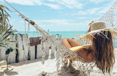
I will tell you how the itinerary I created for you will give you an amazing overall experience! For that, you must hit the road so that you experience some of the best places, coolest eateries, marvellous spots, and diverse cultures. Let me create a vision for you, especially with loads of sand and sun!
When exploring Queensland, Indigenous experiences are quite important, especially when nature plays such an important role in it.
Day 1 Time: 7 a.m. to 12 p.m. 12 p.m. to 3 p.m. After 3 p.m. Activities: Noosa Beach to Rainbow Beach Lunch Evening Day 2 Time: 7:40 a.m. to 12:30 p.m. 9 a.m. to 4 p.m. 12:30 p.m. to 1 p.m. After 4 p.m. Activities: Burleigh Beach Among the Wildlife Lunch Night stay Day 3 Time: 7 a.m. to 12 p.m. 12 p.m. to 2 p.m. 2 p.m. to 5 p.m. After 5 p.m. Activities: Hiking at Hinterland Lunch O’Reilly’s rainforest Accommodation Day 4 Time: 7 a.m. to 12 p.m. 12 p.m. to 3 p.m. After 3 p.m. 5 p.m. to 9 p.m. Activities: Sunsets and Kayaking Accommodation A walk down the street Yummy food
Day 1: Explore The Beaches: Noosa Beach to Rainbow Beach
When I am planning a trip to Queensland, Australia, there are some places that I must visit. You cannot miss the beaches in Australia! Noosa Beach is one of them! If you do not have a car, you can catch the travel train from Brisbane and Gympie stops and reach Nambour or Cooroy via the Travel train.
Once you reach Nambour or Cooroy, you can hop on Sunbus, which will take you to Noosa! Please visit translink.com.au to learn everything about rail and bus timetables. However, if you are planning a beautifully romantic road trip or an adventurous holiday, you can choose a 4WD vehicle. Now, let us go towards Noosa North Shore to start your trip!
Are you hungry already? Check out Bistro C for a hot cup of coffee and a delicious breakfast. When you reach Tewantin, you will get a vehicle ferry to cross the Noosa River, so have food before that because there is no food joint for the next 100 km (about 62.14 mi)!
You can take the third beach access road from there, which means you have officially started your vacation. Cheers mate!
A Stunning Drive
I am the kind of traveler who likes experiencing my surroundings as I go so that I will inform you about the multiple pitstops of the sandy biosphere. It is completely up to you about where you stop! The first place you can stop is Teewah, a picnic spot under the vibrant hues and shadows of the sand cliffs!
Once you are done, keep going north via Leisha Track! Double Island Point is in Great Sandy National Park, offering captivating views of the beach going out to the sea. You can access this point through Cooloola Beach, which is between Noosa and Rainbow!
If you are with your partner, why don’t you go up the Double Island Point lighthouse? It is a romantic place that offers enthralling views of nature. You can also launch a canoe at Double Island Point from the northern beaches!
If you are more of an activity person, I have surf lessons on Australia’s Longest Wave and kayak tours at Dolphin View Sea, or you can check out Stand-Up Paddle Eco Tours.
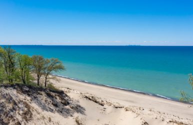
After you reach Rainbow Beach, you will see a picturesque seaside town surrounded by towering sand cliffs. The beauty that will meet your eyes is ethereal, as the sand cliffs exhibit more than 70 different colors.
Hog on that Lunch!
If you love the intense flavor, you must go to Arcobaleno on the Beach! With a beautiful ambiance, this place does it right when it comes to pizza and pasta! You can get the best woodfire pizzas, along with zonzelle for dessert.
You can read my other blog, restaurants in Maitland Australia to know more about the culinary delights! The food quantity is quite good as you will be filled up by the end of it! You must try the Bruschetta, as it is a favorite tourist spot!
Visiting a beach and loving seafood, this place packs a punch with its capers and anchovies with a splash of prawn/ salmon/ cuttlefish chunks. If you are a vegan, I have just the perfect place for you: The Deck @ Sea Salt! The atmosphere is great, with its open and planned area allowing the sea breeze!
They have a good range of vegan options, including salads, sides, lasagna, vegan cheese mezze platters, and burgers. Do not miss the vegan enchiladas!
Accommodation
You should book the Plantation Resort in Rainbow Beach! This beautiful luxury resort is perfect for that beach-facing view from your bedroom, and hearing the ocean at night is so peaceful. Imagine seeing whales from the balcony of the top-floor rooms. Yes, it happens!
You should book the penthouse, a sea-view apartment with three bedrooms! You can also access the pool, which is heated in winter, so you won’t have a problem. There are comfy lounge chairs on the balcony, so you can have a clear view of the parks and the ocean while enjoying your morning coffee or sipping your evening drink!
There is a well-equipped kitchen with plenty of pots and pans to cook for yourself and your family if you want! The beds are comfy, and the rooms are quite spacious. Even the location is perfect, as you can walk around the dunes! There are several surf clubs, restaurants, and shops nearby.
Day 2: Surfer’s Paradise at the Burleigh Beach
If you do not have a car, this can take almost half of your day as you must catch a bus from Rainbow Beach, QLD, Australia. It will take 4 hours and 50 minutes to reach Brisbane Roma Street. You can get an early start from 7:40 and reach about 12:30! You can have lunch in The Garden Room, an aesthetic railway pavilion-style cafe.
Considering you only have a little time; you must know about some of the best dishes you can try. You can order Vietnamese rice noodle salad or harissa spiced pulled lamb pita! There are several other dishes, such as:
Buttermilk fried chicken bun
Cheeseburger
Poached chicken Caesar salad
Pan-roasted Atlantic salmon
Young Henry’s beer-battered reef fish with chips and minted pea puree
This is one of the best places to visit among the restaurants in Australia after all! Once you finish your lunch, you catch the bus to Burleigh Heads, which will take about one hour and forty minutes.
You get about 15 minutes of transfer time for all passengers, after which you catch another bus from Burleigh Heads to Stockland Burleigh Heads, which takes about 5 minutes.
You reach Burleigh by 3 p.m. so you can enjoy the beautiful Burleigh beach, where you can check out some of the highest tides! If you are an experienced surfer, you must try the tides here. There are also several surfing schools where you can learn if you are inexperienced.
A Day Among the Wildlife from Burleigh
If you are traveling by car, it will take about three hours and thirty-three minutes! So, you can easily have your breakfast at the Social Brew, which offers quality coffee and creative brunch options. Then, you must visit Currumbin Wildlife Sanctuary, a zoological garden that is a heritage site.
The visiting time is from 9 a.m. to 4 p.m., along with the activity duration is 4 hours. There is an impressive collection of 1400 species of animals in this beautiful wildlife sanctuary, you can do wild lorikeet feeding, with beautiful Aboriginal performances and free flight bird shows.
There are woodlands and rainforests that you can explore to check out Tasmanian devils, dingos, nocturnal animals, and saltwater crocodiles. You can pet a kangaroo, cuddle a koala, and meet interactive keepers!
Next to Coolangatta is an amazing spot called Snapper Rocks, where you can attend several international surfing events.
What’s for Food?
According to the tourist recommendation, you must have lunch at the Rainbow Bay Surf Club, which is close to the beach. With a bite to eat, you can order a beer to relax. They have a beautifully delicious beer on tap known as Tapper! The place offers you some of the coolest views!
Rick Shores is an aesthetically beautiful restaurant with surf break right in front of the dining room. Try to come when it is still light so that you can enjoy the view from the terrace and bar. They offer Pan-Asian flavors through fresh, locally sourced produce.
Food items such as plump lobster dumplings with black vinegar, or you can try red curry of roast fuck with a sweet pop of lychee. Let me tell you that the owners of Rick Shores’ restaurant are opening a new beachfront restaurant at The Oxley at Nobby’s Beach.
Accommodation
Once you finish the whole day of activities, take your car and enter the Gold Coast Hinterland! You can take a shuttle cab to your destination if you do not have a car. I suggest staying the night at Binna Burra Lodge!
You are waking up to a beautiful sunrise at the edge of the Bluebird Cliffs. It is a tranquil experience, and the Gondwana Rainforest is very special. You can get daily breakfasts, three-course dinners, and an extra treat, so you will have no problem with your dinner choices.
The accommodation is nestled among the scenic rims, and the track is 800 meters (about 2624.67 ft) above sea level. The apartment-style Sky Lodges have a touch of nature, so you feel closer to it. There is a rainforest campsite where you can sleep in Safari Tents, which is the perfect place for all nature lovers.
Day 3: Put on your Hiking Shoes in Hinterland
Today is a day of adventure and activities! Get up early, have a fulfilling breakfast, and grab your hiking shoes. Please do not forget your water bottle when going on a hike, as you will need it when you meander from Lamington across Springbrook National Park.
Hinterland as a city is considered one of the best places to live in Australia! If you are someone who likes staying close to nature, you can also book places in the city. They are both affordable and really cool to hanf out with.
There are bushwalks, an amazing loop walk, and the landmark the Natural Bridge, formed by a cavern and a basalt bridge. An ancient cascade surrounds the bridge, along with hoop pines, where you can find living relics from the Jurassic Age, 180 million years ago.
After the hike, you can explore Lamington National Park, a UNESCO World Heritage site. You can also drive across the rainforest of Australia, and you will have a beautiful afternoon! You must visit O’Reilly’s Canungra Valley Vineyards, where you can taste-test and spend your leisure time.
Furthermore, if you are with your partner, you can organize a picnic in the vines. What is more romantic and goofier is the friendly local population of alpacas roaming around, creating a perfect date scene for you. You can order from the diverse menus, such as chipolatas, bacon, sourdough bread, muesli, fresh juice, seasonal fruit, and other condiments.
A Beautiful Evening!
The place, O’Reilly’s, is not just about wine but also about nature, as you can check out the rainforest up close. You will be in awe of the beauty and natural wonders offered by the Retreat, so take in the natural beauty. If you want to know the best time to visit Australia, I will say between the months of September to November!
We cannot forget to visit Morans Falls; its thunderous cascade can be heard deep inside the forest! The cottage Rainforest Retreat is nestled deep inside the iconic Gold Coast hinterland, Australia, and is operated by third-generation O’Reilly family members.
The popular Tree Top Walk, animal shows, and guided bird walks are available while staying at the Retreat. A 25-meter wet-edge infinity lap pool and a World Day Spa offer classy experiences. A sublime couples suite is also available for a romantic time.
Sleep peacefully in the beautifully architecturally designed villas at night after having delicious food! Sweet dreams, you guys!
Day 4: Sunsets and kayaking in Brisbane
If you do not have a car, you can take a drop from O’Reilly Canungra to Brisbane Airport. However, if you have been traveling through it for the past three days, it will take about two hours and two minutes to reach Brisbane Airport. From there onwards, you continue towards your accommodations.
You must check in first to keep your luggage there and then plan for the rest of the day. Furthermore, you might need to change into something more comfortable, considering you might go out to explore the place.
Accommodation
You can stay at The Calile; it is one of the best experiences of a friend who went on a trip last year! It is a unique hotel; the interior is pale pink, beautiful, and aesthetic. The room has golden fittings and a mini bar, which looks so beautiful that you must take a mirror selfie in front of it.
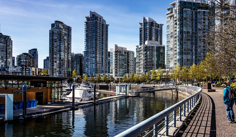
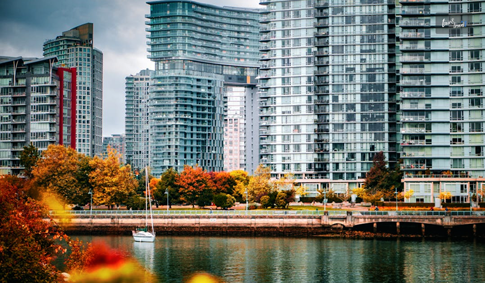
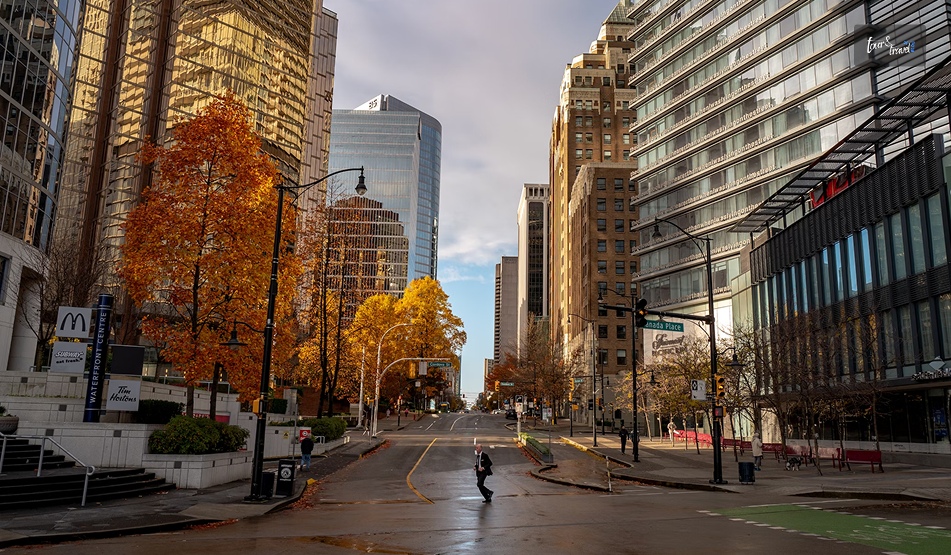
One thing is for certain: the breakfast is delicious with the gourmet breakfast along with fresh produce, so please take it. Now it is time to explore the most exciting city in Australia because it has a diverse vibe, both a trendy and laid-back experience.
I can assure you that you will not feel overwhelmed, but the experience is unforgettable because there is no end to what you can do!
A Walk Down the Streets
There are several little laneways and streets to check out the beautiful art and sculptures. You can experience art in Brisbane through the Gallery of Modern Art and other fascinating museums! There are several local dishes, such as Lamberts Restaurant and Rogue Bistro.
Then you have fine dining choices such as Moo Moo The Wine Bar + Grill and 1889 Enoteca. If you are looking for budget-friendly bites, visit Rogue Bistro and Spice Central Kitchen and Bar. When looking for bars and pubs, go for Felons Brewing Company and Miss Demeanour.
The Food Options are Endless
Brisbane's diverse options of trendy bars and cafes make it so cool, especially when you get fresh food and some of the best places for delicious coffee. You must visit Eat Street; it is one of the coolest places in Brisbane. You only need to pay a small entry fee of $6AUD to access the amazing food inside.
The place is open from 4 to 10 p.m. on Friday and Saturday, and from 4 to 9 p.m. on Sunday. The experience is so fun because, in each section, there is entertainment along with live music! It is perfect to go hand in hand with your partner or take your family there, sit, eat, and watch or listen to music.
You can then move on to the next section and experience something different. If you don’t have a car, you can go via public transport, which is easy to navigate. The food is delicious, phenomenal, and accommodating, and the staff is helpful and super friendly.
At times, there are long queues during weekends, so if you are a tourist, please be prepared to have the best experience during the weekend! There is a huge selection of food outlets, such as:
Beer Asia
Calamari Me
Brownie Bar
Arancini Bros
Carcamo Gourmet Caramel Apples
Chips on a Stick
Churro Lab
Charcoal Hut
Corn Dogs
Dessert Depot
Diner Bar
Dutch De Lites
Fluffy Japancakes
Don’t Worry Eat Curry
Funky Dragon Dumpling
Japanese Pizza Kotetsu
Khao Sarn Thai
Las Catrinas
There are many more eateries in the place! You must check them out. Your weekend is sorted!
Brisbane is a Vibrant Experience!
The sunset is epic, so either Kangaroo Point or Mount Coot are some of the best places to see it! Pick up your picnic supplies, set up a special spot in one of these two spots, and enjoy the sunset with your family, partner, or friends.
You can also get the setup from an event organizer who will beautifully decorate your date and supply food! They use rustic rugs, twinkling lights, and picnic baskets to make your experience comfortable and perfect. You can either have a 3-course meal or a grazing platter.
This will be a truly memorable experience! Another unforgettable experience is that you must have kayaking in the Brisbane River at night. For people who are adventurous at heart, this activity is perfect. When you go out Kayaking, a unique experience, you will be safe and secure.
This unique activity and experience are organized by Riverlife Brisbane, which provides you with a guide. The guide is very supportive and tries to make the visitors as comfortable as possible. There is also a beautifully organized BBQ dinner by the river—the romance is literally dripping from the whole experience!
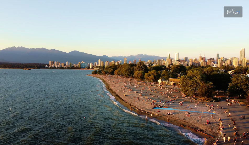
Considering Australia is known for its beaches, you must check out beaches in Melbourne and Sydney! These are some of the coolest places in Australia which should not miss when you plan the itinerary.
You Cannot Miss the Unique Food Culture of Queensland!
Queensland is not just about beautiful places and people but also about tickling your taste buds. The place is known for its protein products from Coral Trout, Spanner Crab, and Organic beef. It is difficult to catch Coral Trout.
Therefore, it is often tagged as the “fish of the day” across eateries' menus instead of being a staple. The Spanner crab is a product with sweeter flesh, a staple in Queensland food culture. It is available in raw and cooked form from the trawlers in Moolooba. Fine-dining restaurants, namely Sum Yung Guys, serve this across the state!
If you want to check out places where organic farming is done, travel down to Channel Country. There, you will find grazing land of about three million hectares owned by the Brook family. They run the Birdsville Races, which pioneered OBE Beef. The beef is organic because no tick treatments or pesticides are used.
If you want to check them out, all you need to do is visit the Three Blue Ducks or your local organic butcher, who might stock OBE Beef. Some of the best food experiences in Queensland are from restaurants and eateries that combine flavour, local produce, and the talent of the chefs!
Birrunga Gallery and Dining, Brisbane
The First Nations-owned gallery and cafe in Brisbane is the only one that is a cultural hub blending experiences, people, food, and culture. The place is a cafe by day; in the evening, it turns into a wine bar. An Australian twist is added to the cuisine, where native ingredients play an important part.
The feast includes crocodile bao buns, teriyaki-style barramundi, braised eggplant with saltbush jus, and kangaroo loin! These exhibits are part of the First Nation menu that they offer to the people. You should go on weekdays if you are out for lunch while eating dinner; you must make reservations on Thursdays and Fridays.
Saltwater Eco Tours, Sunshine Coast
This tour involves setting sail on a heritage-listed vessel and experiencing a combination of cuisine and culture. You will travel through the canals of Mooloolaba, getting insight into the culture and history of the Kabi Kabi or Gubbi Gubbi people.
Along the way, you will get to taste native ingredients as you are offered a five-course meal for over two hours. The canapes combine local Sunshine Coast elements, such as native spiced prawn skewers.
They are cooked in kangaroo tacos along with indigenous flavors! You can enjoy them along with Aboriginal stories and music. You will experience the magic of indigenous people along with delicious food.
Desert Dreaming Centre, Outback Queensland
Owner and operator Cheryl Thompson offers to share indigenous culture through Aboriginal crafts and arts workshops, song and dance shows, along with a cooking class. If you attend this cooking class, you will experience the uniqueness of the indigenous ingredients.
And It's a Wrap...
To sum up, Australia is a country with diverse places, people, food, and culture. When you visit, you will realize that you will experience both the calm and the bustle of the place; hence, it is up to you to decide which experience you want to integrate into your trip.
I like both a little bit and have planned the 4-day itinerary accordingly. I am sure, after reading my blog, you have realized by now that I am a foodie at heart. So, why will experiencing unique food help you create a memory stamp so that you can eternally enjoy these experiences as memories?
Comment on what type of vacation you are planning to Queensland, and does my plan help you in any way?
Learn More Also:
How To Enjoy Your Night In Sydney?
6 Tips For A Luxurious Trip To Australia
Budget-Friendly Travel Ideas In Australia
Romantic Getaway Tips: 9 Romantic Tips To Celebrate Couples Vacation


 Related