
What Are The Best National Parks In Arkansas? Know Why You Will Love Them 

Sep 1, 2021

Last Updated on: May 19, 2026

Travel Guides

Especially, the best national parks in Arkansas, along with national museums and trails, are a must-visit to learn about the American Civil War history. 

But do you know that there is only one national park in Arkansas? The National Park Service only recognizes the Hot Springs National Park. 

Along with that, you can also explore the National Memorial, Arkansas Post, National River, Buffalo, the National Historic Site, Fort Smith, etc. 

For the campers and the hikers, these natural parks, monuments, and sites in Arkansas are like gems. Every hiking trail has a rich history along with a mesmerizing beauty.

7 Best National Parks In Arkansas

Arkansas is home to the birthplace of the 42nd President of the United States, Bill Clinton. Also, it is known as the “Natural State.” 

Furthermore, the state has seen major economic success in the tourism sector. 

According to a report from Arkansas Money & Politics, in 2024, the tourism spending (business and leisure) was $10.3 billion, and it was a 4% increase from 2023. 

Now these national sites, monuments, and national parks of Arkansas are the pillars of such a tourism boom. 

Also, I had a wonderful time at these natural wonders. So, here, I will share some important details and my experience at these places. 

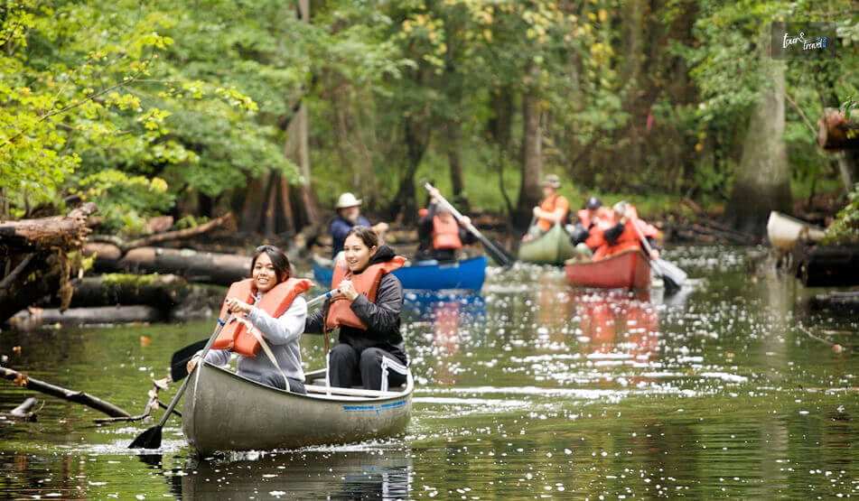
1. Buffalo, The National River, Best For Canoeing, Kayaking, And Stargazing

Buffalo, The National River, Best For Canoeing, Kayaking, And Stargazing

Quick Facts 

  • Established: 1st March, 1972
  • Flowing Distance: 135 Miles through the Ozarks 
  • Entry: Free
  • Camping Charges: $0-$50

As I cruised through the Ozark Mountains and saw the massive limestone bluffs, Buffalo, the first national river of America, gifted me some goosebump moments. 

It is also one of the undammed rivers in America.

As the Sun went down, I along with my co-travelers and I enjoyed our campfire on the Buffalo River banks. 

Furthermore, the Buffalo National River bank was designated as an International Dark Sky Park (IDSP) in 2019. You can even take part in various night sky programs in the river. 

Moreover, the National Park Service has made some changes to the restrooms and lighting facilities around the Buffalo River to keep the light pollution and interference minimal for dark sky observation. 

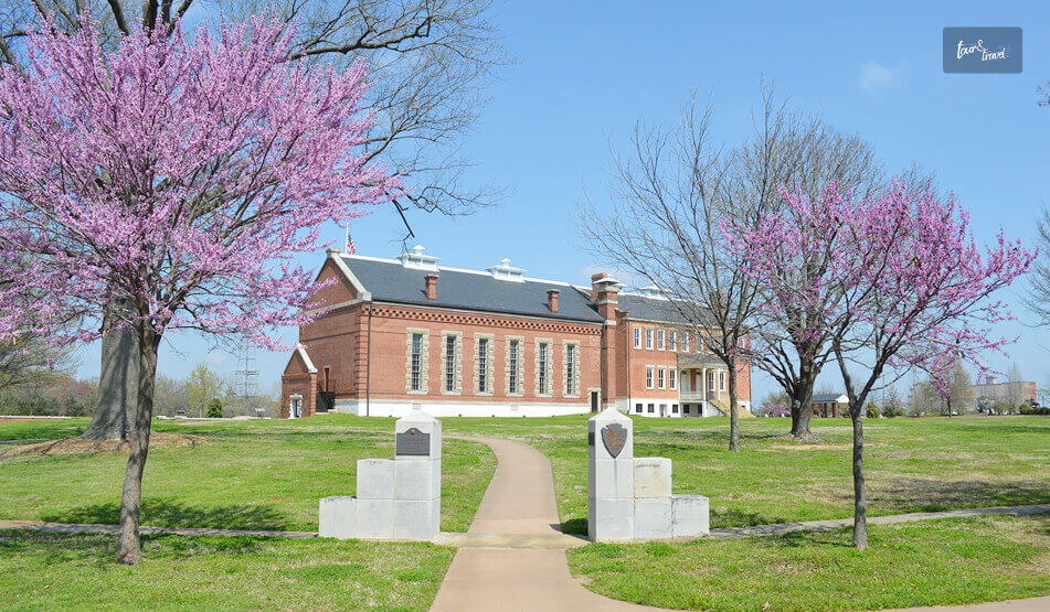
2. Fort Smith National Historic Site: Best For An American Civil War History Tour

Fort Smith National Historic Site Best For An American Civil War History Tour
  • Entry: Free
  • Hours: 9 AM to 5 PM
  • Contact Number: Voice Phone Number, (479) 783-3961

Once you visit the Fort Smith Historic Site, 80 years of history will be alive in front of your eyes. 

It awaits you to tell the story from 25th December 1817, the day it was established, to 1896, the jurisdiction of Judge Isaac C. Parker over Indian Territory. 

In the middle of Oklahoma and Arkansas, there are many historic buildings from the Civil War era, in the Fort Smith National Historic Site. 

Also, can you believe that 86 got the verdict of execution at Fort Smith between 1873 and 1896 in the courtroom of Isaac C. Parker? The gallows are also still there. 

Does not seem surprising again, thanks to the jurisdiction of Judge Isaac C. Parker, who believed and said, “Permit no innocent man to be punished, but let no guilty man escape.”

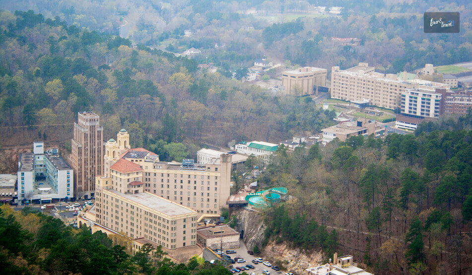
3. Hot Springs: The National Park In Arkansas With Ancient Thermal Springs  

Hot Springs The National Park In Arkansas With Ancient Thermal Springs
  • Entry Fee: Free
  • Hours Open: Visitor Center, 9 AM to 5 PM, and Hiking 24/7

Hot Springs, the national park of Arkansas, has an interesting geology, and the ancient thermal springs are the most fascinating feature of this national park. 

Furthermore, it has historic bathhouses where you can heal and relax with the ultimate spa experience. Choose between the Lamar Bathhouse, Ozark Bathhouse, Hale Bathhouse, Superior Bathhouse, and many such names. 

Also, remember that the bathhouse area, constructed during the period of 1892 and 1923, was designated as a National Historic Landmark District in 1987 along with the Grand Promenade. 

Furthermore, along with exploring the hot springs and bath houses, you can even camp at the Gulpha Gorge Campground. The camping fee is $34 per night. 

However, the most rewarding experience here is hiking through Hot Springs and North Mountain Trails, Sunset Trail, and West Mountain Trails. 

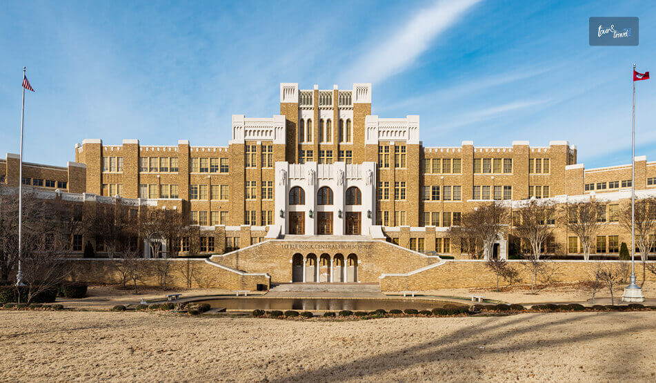
4. Little Rock Central High School: National Historic Site

Little Rock Central High School National Historic Site

I missed visiting the Little Rock Central High School. In 1957, this school was the epicenter of the enforcement of the African American Civil Rights.

The school followed the Brown v. Board of Education.

Moreover, the struggle of the Little Rock Central High School ensured that everyone around the world got opportunities for education. 

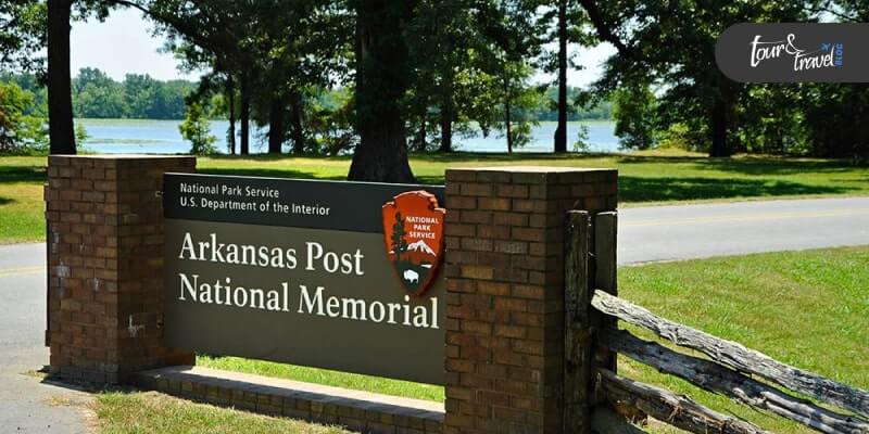
5. Arkansas Post: National War Memorial

Arkansas Post War National Memorial

Henri de Tonti established the Poste de Arkansea in 1686. Located at the Quapaw village of Osotouy, it became known as “The Post.” 

There was a long struggle between Spain, France, and England for dominion over the Mississippi Valley. 

The Post eventually became the first semi-permanent settlement of the French in the Lower Mississippi Valley. 

Moreover, The Post is witness to the only Revolutionary War in Arkansas, in which the British partisans logged head with Spanish soldiers. It took place in 1783 and was also known as the Colbert Raid. 

Again, in 1803, thanks to the Louisiana Purchase, the Post became a part of the United States. Moreover, by 1819, it was the first city to become the capital of the Arkansas Territory, and it was the largest regional city. 

During the Civil War, Fort Hindman was built here to take control over the confluence of White and Arkansas Rivers. However, it was destroyed in 1863. 

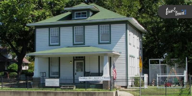
6. President William Jefferson Clinton Birthplace

President William Jefferson Clinton Birthplace

This place is the perfect definition of an American leader born in the woods, who makes some revolutionary movements. President William Jefferson Clinton was born in the Town of Hope in the Arkansas ranges.

The president spent his first four years here. The property is still in good condition. Take a walk on the property. Then take a tour of the town of Hope. And feel the historical vibes of the place.

7. Trail Of Tears

Trail Of Tears

The historical value of the trails is pretty touching, and is remembered by the Native Indian tribes and the Cherokee people. 

The Trail of tears is a historical trail that is 5,043 miles long. The track stretches from the southern Appalachian mountains to the west side.

This single historical trail crosses over nine USA states. The heart-touching facts are attached to this trial. In 1830, seventeen Cherokee groups were removed from their homelands. And the painful consequences determined the fate of these people. For the remembrance of the sacrifice of the people, this historical path is called the Trail of Tears.

Wrapping It Up:

The best national parks in Arkansas, along with other national sites, are good travel destinations for people of all ages. If you are looking for a good travel option that has historical value.

This is the best choice. For adventure-loving travelers, this is the best choice to spend the entire day on the side of the Buffalo River.

You can visit the nearest places from the river banks, and all the hiking trails lead towards a town. So most often there is less chance of getting lost.

But morning and daytime are the most suitable times to explore the place. So what is your next travel plan? Do not forget to share your experience with us in the comment section.

Read Also:

Share on Social Media

Sibashree is a travel, culture, and leisure writer who has been writing since the age of 12 and professionally since 2014. With more than a decade of travel writing experience and journeys across India and several parts of the world, she brings a deeply personal and thoughtful perspective to her work. A student of English Literature and Mass Communication, Sibashree has always viewed travel as more than movement — for her, it has been a way of understanding people, cultures, and herself. Her passion for spiritual exploration has also led her to many unusual and meaningful destinations over the years. Outside of writing, Sibashree enjoys watching European cinema, reading about global politics, and reflecting on the stories hidden within everyday places.

Leave a Reply

Your email address will not be published. Required fields are marked *

title-img Related

READ MORE Rome to amalfi coast

What Is The Rome To Amalfi Coast Distance? How To Reach Amalfi Coast From Rome? 

BY  Sibashree Mar 13, 2026

Traveling from Rome to Amalfi Coast is easy thanks to the availability of diverse public transportation.  So, if you want to give the notorious crowd in the Italian capital a miss, you can choose the enchanting coast.  Here is more about traveling the Rome to Amalfi Coast distance of around 278 km.  A Few Things To Remember Before Planning A Rome To Amalfi Coast Trip  If you are a first timer, you may find reaching the Amalfi Coast difficult. Also, the distance of 278 km may seem massive.  However, as I have mentioned, thanks to a well-connected network of public transport, you will travel the distance in less than 4 hours.  Having said that, you have to keep certain things in mind if you are planning a Rome to Amalfi Coast trip for the first time.  1. Avoid A Rome To Amalfi Coast Day Trip  Firstly, a day trip from Rome to the Amalfi Coast is not a suitable option. You will lose a lot of time traveling if you are planning a day trip or a round trip.  Instead, you can use the time to explore the beautiful villages on the Amalfi Coast.  Remember, it is the prettiest coast in Italy, one of the best summer destinations in Europe, and a UNESCO World Heritage Site.  Moreover, the Amalfi Coast is one of the best beaches in Naples, Italy.  So, it deserves a little more of your time. Also, if you want to fuse the rich coastal experience with luxury, you can stay at any of the Le Collectionist villas.  2. Travel In The High-Speed And Intercity Trains  Now, TheLowDownUnder Travel inspires me always. So, of course, I would recommend enjoying the journey from Rome to Amalfi Coast in a high-speed or intercity train.  These trains are the cheapest, most convenient, and they offer a culturally rich experience.  Also, around 58 high-speed trains ply from Rome to Salerno daily, and you have multiple options in intercity trains.  So, you can travel at a convenient time.  However, if you want to travel in a high-speed train, you must book the tickets a day before. Otherwise, the tickets for your chosen slot may become unavailable, or the ticket price can shoot up.  3. Enjoy A Ferry Ride From Salerno  If you are traveling from Rome, Salerno is the most convenient gateway to exploring the Amalfi Coast.  You will get the Sita buses easily from Salerno to reach the beautiful villages on the coast.  However, to make the journey unforgettable, you can try this trick.  The Salerno Railway Station, or Stazione di Salerno, is located at a distance of just 900 meters from the Piazza della Concordia or tourist port.  You can take a short walk for 10 minutes and then board Travelmar ferries to explore Amalfi by sea.  Multiple ferry rides are available on this route, and the ticket price is just 12,00 € for an adult.  4. Traveling From The Fiumicino Airport To The Amalfi Coast  If you are traveling from the Fiumicino Airport, you have to first reach the Roma Termini Station.  So, take the Leonardo Express, available every 15 minutes. Moreover, the ticket price is just 14 Euros.  Bus services such as Terravision and Sit Bus Shuttle are also available on this route. However, these take longer due to the city traffic. How To Travel From Rome To Amalfi Coast?  You can travel from Rome to Amalfi Coast by train via Salerno. Otherwise, you can rent a car or drive a private vehicle to reach the Amalfi Coast from Rome via Naples.  Here are more details.  1. Traveling From Rome To Amalfi Coast By Train  As I have mentioned, traveling by the intercity or high-speed trains is the best option for a trip to the Amalfi Coast from Rome.  Italia Rail has enlisted 58 high-speed trains on the route, and they help you cover the distance in just 1 hour and 26 minutes.  Moreover, the ticket price for these train rides starts from $12.  Furthermore, Rail Europe runs multiple trains on this route, and the first one leaves Rome at 6:26 AM and reaches Salerno at 9:23 AM.  Also, the fastest Rail Europe train on this route leaves at 7:30 AM and reaches at 9:05 AM.  The ticket price for these trains ranges between 25 and 59 Euros.  2. From Rome To Amalfi Coast Via Salerno  From Salerno railway station, you can walk for five minutes and find the Sita Bus Terminal. Also, from here, you will find buses to all the towns on the Amalfi Coast.  However, these buses are very busy during the summer months.  So, for a more peaceful and comfortable journey, you can reach the Piazza della Concordia.  From there, you will get ferries to the Amalfi Coast. The first ferry starts from Salerno Concordia at 8:40 AM and reaches the Amalfi Coast at 9:15 AM.  Moreover, the average time for this ferry ride is between 35 minutes and 1 hour and 10 minutes. Also, the ticket price is just 12 Euros.  3. From Rome To Amalfi Coast Via Naples  As an alternate route, you can take a train from Rome (Roma Termini) to Naples (Napoli Centrale). The high-speed trains are available from 7 AM to 9:53 PM in regular intervals.  Furthermore, the travel time is between 1 hour and 8 minutes and 2 hours and 11 minutes. Also, the ticket price for the high-speed trains is between 49 and 52 Euros.  Moreover, from Napoli Centrale, you can take the Circumvesuviana train to Sorrento. It departs from Piazza Garibaldi, the lower level of Napoli Centrale.  The travel time by this train is between 1 hour and 15 minutes and 1 hour and 30 minutes. Also, the ticket price is about 4 Euros.  Once you reach Sorrento, explore the beautiful coast and then take a Sita bus ride to Positano on the Amalfi coast.  Rome To Amalfi Coast Distance: Frequently Asked Questions (FAQs) Here are the frequently asked questions and answers about the Rome to Amalfi Coast distance. 1. Is There A High-Speed Train From Rome To The Amalfi Coast? Yes, around 58 high-speed trains are available from Rome to Salerno, the gateway to the Amalfi Coast. Thanks to these high-speed trains, you can now travel a distance of more than 200 kilometers in less than an hour. Moreover, the ticket price starts from just 12 Euros. 2. Is It Worth Going To Amalfi Coast From Rome? Yes, you must travel from Rome to the Amalfi Coast if you want to experience the iconic coastal life of Italy and its food. However, if you want a more relaxed itinerary, the Amalfi Coast can only suit you when you have at least 2 days for the trip. A day trip to the Amalfi Coast is exhausting. 3. How Far Is Amalfi From Rome By Plane? A flight journey from Rome to the Amalfi Coast takes around 50 minutes, and daily flights are available on this route. Moreover, ITA Airways, Air France, and Lufthansa are some of the main airlines operating on this route. Also, the flight ticket costs between 132 Euros and 4000 Euros. 
READ MORE Winter Destinations in Saudi Arabia

6 Must-visit Winter Destinations in Saudi Arabia

BY  Mashum Jan 15, 2025

Saudi Arabia has a typical climate of a desert: hot, dry and intense. People visiting KSA often get fed up with the extremely hot weather conditions, especially in summer. Even in winter, the temperature doesn’t fall below 25 Degrees Celsius. Therefore, it is difficult for people to stay here, especially the ones traveling from cold climatic regions. Pilgrims of Umrah packages from UK and tourists often come here during winter as it offers pleasant weather. Yet, if you want to escape the desert heat, Saudi Arabia houses several cooler regions to your surprise. Here are 6 must-visit winter destinations in Saudi Arabia. Al Bujairi Heritage Park. Al Bujairi Heritage Park is a cultural oasis in Riyadh that comes to life in the winter season. Its traditional architectural style, lush greenery, and various tourist activities add to its significance. Spreading over an area of 60,000 square meters, it hosts various workshops and light shows for visitors. In addition, you can indulge yourself in the local culture through traditional and roadside food stalls.  There are also rides and play areas available for children to enjoy. Al Bujairi Heritage Park is your best choice for a day trip during winter in KSA. Plan a picnic with your family here and spend the day with your loved ones in this scenic and happening area.  Abha. Abha is the ‘City of Fog’ in Saudi Arabia. Present in the Asir region, Abha is famous for its lush green surroundings and misty peaks. The cherry on top, the winter season brings snowfall here as well. Therefore, if you are planning a visit to the Asir region, Abha is the destination you should not miss. Especially if you are a nature lover. Asir National Park here is also a popular tourist spot as it houses more than 300 species of birds. There are also various trails and hiking treks for you to cover and have a memorable stay. So if you are applying for a Ramadan Umrah Packages 2025 UK online plan a visit to Abha after Umrah rituals. Snowy mountains in Tabuk. Tabuk is one of the favorite winter destinations of locals and tourists alike in Saudi Arabia. Covering the northern region of KSA, Allous Mountain is the coldest peak of the Tabuk region. It often receives snowfall during the winter season. Therefore, becoming an ideal spot for skiing, ice skating and snow sledding.  There are more than 15 mountain ranges in the Tabuk region, each offering a unique landscape and cold temperatures. Jabal Al-Lawz (also called ‘Mountain of Almonds’) wears the crown for the tallest peak here. It has a height of 2,549 meters above sea level, present near the Saudi-Jordan border. As Tabuk is a popular tourist destination in winter, there are numerous luxury resorts and restaurants to facilitate them. You can enjoy various winter sports here as well. Such as hiking, camping, skiing, and picnics in the breath-taking scenery. Rawdat Khuraim. Rawdat Khuraim Oasis has its second name, ‘King Abdul Aziz Forest’. It is a serene oasis that possesses stunning lakes, lush green palm trees, and a number of walling trials. This particular tourist spot is popular throughout the year. Though spring is the ideal time to visit this oasis, winter is the second best choice.  Present near Riyadh, you can see diverse flora and fauna here during your visit in winter. Many rare flowers bloom here during the winter season that are not seen elsewhere in the kingdom. So make it a place worth visiting with cheap Umrah packages.  Edge of the World. Jabal Fihrayn (Edge of the World) holds the title of being the tallest peak of the Tuwaiq mountain range in KSA. This cliff suddenly falls off to the ground at a height of 1,131 meters. It’s a truly breathtaking yet thrilling experience.  There are various hiking trails that you can use for trekking to reach the top and have panoramic views of the surroundings. The winter season further adds to your comfort for trekking as pleasant weather conditions persist in the region. Yet, this destination is not for the weak of the heart.  Thumama Desert. A visit to the Thumama Desert is a must during your winter trip to KSA. Though the desert experiences intensely hot weather in the summers, winter brings lush green valleys covered in white snow here. It is the perfect place for traditional Bedouin-style camping and stargazing at night. When you apply for your Umrah visa UK online during winter, plan a visit to these 6 destinations necessarily. Weather In Saudi ArabiaWinter: Here, the winter season is very mild. The Average temperature ranges from 8-20°C (46-68°F).Spring: Saudi Arabia offers a warm and pleasant spring with temperatures ranging from 20-30°C (68-86°F).Summer: Summer feels very hot and dry in SA. The temperature can exceed 40°C (104°F).Fall: You may experience a very warm to hot, with temperatures ranging from 25-35°C (77-95°F). Now Comes The Most Important Part: What To Pack! Knowing what to pack for a trip to the winter destinations in Saudi Arabia is the ultimate key to a successful holiday. When you are traveling to earnestly conservative countries, you would require a lot of pre-planning and, most importantly, an excellent packing list.  ClothingLong-sleeved shirtsLight sweater or fleeceWarm jacketComfortable trousers or jeansScarf and hat for cooler eveningsSocks and underwearModest swimwear for hotel poolsComfortable walking shoesToiletriesToothbrush and toothpasteDeodorantShampoo and conditionerBody washMoisturizerSunscreenLip balmShaving kitElectronicsSmartphone and chargerTravel adapter (Type G plug)Power bankCamera and memory cardHealth And SafetyFace masksHand sanitizerPersonal medicationBasic first aid kitMiscellaneousBooks or e-readerTravel journal and penReusable water bottleDocumentsPassport VisaTravel InsuranceFlight ticketsHotel reservationPhotocopies of important documentsTravel AccessoriesBooks or e-readerTravel journal and pensReusable water bottle Final Words!  Whether you are planning to go hiking to the edge of the world, enjoy the beautiful weather at Rawdat Khuraim, or maybe be escaping this bustling city life to look for a serene place like the snowy mountains in Tabuk, this guide will help you to choose your ultimate winter gateway!  Also read Top 10 Most Popular Paraguay Food That You Must Try. Top 13+ Famous Wonders Of India That You Must Visit. Top Tips For Motorbike Rental In Phuket – A Guide To Exploring The Island On Two Wheels.

READ MORE card-img

Kootenay National Park Or The Land Of Ice And Fire (Experiencing Nature’s Game Of Contrasts)

BY  Sibashree Sep 12, 2024

No, it’s not the battle of the Starks, Lannisters, and other houses of Westeros. In Canada lies Kootenay National Park, the actual land of ice and fire. The glacier-made canyons and valleys sing the song of the ice, while the hot springs and grasslands keep the “fire” element alive here.  Also, the national park is a hub of ancient fossils, encouraging walks through the fossil trails. Moreover, you can take a scenic drive through the park, rich in Indigenous culture, history, architecture, and cultural landscape.   So, do you want a virtual tour of this Canadian national park? THIS is where your journey begins! THESE Are The Things You Will Do At Kootenay National Park With no cell service available in Kootenay National Park, you can get lost in the wilderness and explore the most fascinating landscape. However, being respectful to the wildlife is a must in this national park. Also, this August, I came across disturbing news while doing my research on Kootenay National Park.  I have been in touch with a local from Radium Hot Springs for quite some time now. He told me that a grizzly bear coming out of Kootenay National Park was almost struck by an SUV on 19th August 2024.  This incident occurred on a busy highway in southeastern British Columbia, and fortunately, the Kia Sportage SUV made its way to the other side safely. Further, it was a lesson on why following the safety guidelines is crucial while driving in and around the Kootenay National Park. On the major routes of Kootenay National Park, you will have to maintain a maximum speed of 56 mph.However, on the minor routes, the highest driving speed limit will be 37 mph.  Also, around one month before the incident, on 24th July 2024, there was a minor fire on the  Sinclair Canyon slopes (near Radium Hot Springs) of the national park. It was called the Berland Ridge wildfire. This fire was brought under control, though, thanks to a helicopter bucketing water on it. However, outside the park’s southern boundary, there was a blazing fire that was brought under control after painstaking efforts.  So, these incidents show how mindful and cautious you need to be while taking part in the following activities.  Hiking In Kootenay National Park (Hikers’ Favorite Trails) The hiking trails in Kootenay National Park are full of elevation gains and losses. Also, today, the national park has more than 70 hiking trails at easy, moderate, and difficult levels.  However, I have curated a few hiking trails in the table below. Moreover, after interacting with a couple of hikers, I found out that these are the most preferred ones. Name of the Trail Difficulty LevelDistanceLocationHighlightsMarble CanyonEasy1.4 Km with 42 M Elevation Gain Located near Lake Louise, Alberta•Hiking, snowshoeing, and running are the favorite activities here.•Also, it is a pet-friendly and kid-friendly trail. •Moreover, it is a year-round hiking trail. Stanley Glacier Trail Difficult 10.9 Km with 607 M Elevation Gain Located near Lake Louise, Alberta•Snowshoeing, camping, and hiking are popular activities on this trail.•You can take your dog as a companion.•June to September is the best time to hike this trail. Sinclair Canyon via Juniper Trail Moderate5.8 Km with 291 M Elevation GainIt is close to Radium Hot Springs in British Columbia.•You will have to hike through a beautiful cedar fir forest on this trail.•The view of verdant Sinclair Canyon Falls and the Columbia Valley from this trail is breathtaking.Marble Canyon to Paint PotsModerate2.9 Km with 110 M Elevation GainRadium Hot Springs (Marble Canyon Parking Lot  - 89 km east of Radium Hot Springs, Paint Pots - 86 Km east of Radium Hot Springs).•Explore a good mix of mature and burnt forest throughout the trail.•Behold the Vermillion River running parallel to the trail. Floe LakeDifficult10.5 Km with 1,110 M Elevation Gain Near Radium Hot Springs (72 Km East)•Backpacking and camping are popular on this trail. •The trail leads to the Floe Lake Backcountry campground. •This popular meadowy trail is known for its views of peaks, glaciers, and the beautiful Floe Lake. Numa CreeksModerate 6.3 Km with 385 M Elevation GainThe trailhead is near Numa Falls, which is 80 Km east of the Radium Hot Springs. •It is a forested trail.•The trail leads to heavy avalanche paths in the park.  The hikers’ words about the trails in this national park are quite encouraging. So, let’s find out what they are saying about the mesmerizing hiking trails.  “This is a beautiful, deep canyon hike. The trail crosses the canyon multiple times to view the ferocious Kootenay River below. Hiking boots aren't necessary since it is a well-traveled trail.” - Deborah Turcotte on the Marble Canyon Trail. “The trail was mostly dry and in very good condition. No snow on the trail, just a few short wet spots. The trek up is mostly sheltered but a bit chilly and windy in the bowl so bring layers as the temp changes quickly when the sun is behind clouds. Still lots of snow in the bowl. Found one rock with fossils. There are a few small waterfalls on Stanley Peak. Lots of boulders at the base of the bowl to sit and enjoy a lunch and 360 views. An easy to moderate 3-4 hour hike with nice views of Stanley Peak, Storm Mtn, and the Kootenay Valley.” - Sue W on the Stanley Glacier Trail. Kootenay National Park Camping  Kootenay National Park is a wonderful place for frontcountry and backcountry camping. You can even live in oTENTiks and spend some unforgettable days in the park under the sky.  Frontcountry Camping You can camp near the Vermillion, Kootenay, and Simpson rivers. Also, you can find some quiet spots near Radium Hot Springs village.  Furthermore, summer is the best season for front-country camping in the national park. However, the sites remain crowded. So, you must make a prior booking.  Further, the daytime temperature in the national park remains between 16-23 degrees centigrade. Still, the temperature at night can drop below 0 degrees centigrade. So, abiding by the camping rules is crucial, and especially, be particular about the things you will have to carry. Moreover, like camping in any national park, here you also have to ensure that you don’t leave any trace behind as you leave the site.  Backcountry Camping Backcountry camping and backpacking are the best ways to explore the wilderness of this Canadian national park. However, you must make a prior booking and carry a backcountry permit if you want to spend some days and nights amidst grizzly bears, black bears, wolves, elk, and cougars.  Further, there are six backcountry camping grounds in the park. Also, five of them are located along the  Rockwall Trail. In addition, the Verdant Creek Trail has the sixth camping ground.  Moreover, random camping is not allowed during summer, as protecting the landscape and vegetation is crucial. Also, this restriction applies from May to October.  However, in the winter months, you can do random camping in the designated areas. You will still need a permit for this. As I have mentioned, the Rockwall Trail is the most prominent place for backcountry camping in the park. This site is also popular for the presence of various multi-day hiking trails. These trails are: Honeymoon Pass and Verdant Creek Tumbling - Floe The Rockwall  Tumbling - Helmet - Ochre Loop Numa Creek Helmet Creek and Falls Tumbling Creek Helmet - Ochre Junction In the popular backcountry camping areas, the trails are maintained quite well. Further, there will be amenities like food storage cables, food lockers, picnic tables, and tent pads.  Living in oTENTik An oTENTik is a modern fusion of a cabin and a tent. In the park, you will find the oTENTik site on the Redstreak campground’s A loop.  If you stay in an oTENTik, you will wake up amidst nature, and taking a bath at the hot springs will be the most rejuvenating experience. Then, you can explore the nearby hiking trails and gorge on traditional meals cooked by the campfire.  Relaxing At Radium Hot Springs  Beneath the colorful Sinclair Canyon mountains lie the most refreshing hot springs. Further, the mineral-rich water of the hot springs does not have any odor, and you can take a bath with your entire family.  To reach the Radium Hot Springs, you must drive from Banff and Lake Louise for around 1.5 hours. Further, the journey is as interesting as the destination. You will get to small turquoise lakes, falls, canyons, and bridges over rivers as you drive through the Kootenay National Park. Also, don’t forget to stop at the following locations to make the most of your journey. Continental Divide (The line dividing the Pacific and Atlantic watersheds) Marble Canyon Hike Paint Pots Trail Numa Falls Kootenay Valley Viewpoint (It is the place to get the most beautiful view of Vermilion and Mitchell Ranges.)  Olive Lake Trail and Day-Use Area However, the highlight of the journey, of course, is the Sinclair Canyon, where you will also find big horn sheep roaming. As you hike through the Juniper / Sinclair trail, you will get a “bird’s eye view” of Sinclair Canyon.  Further, as you enter the Radium Hot Springs village, you will see an iconic steel horn sculpture. The “Bighorns Public Art Sculpture” was officially unveiled on 7th April 2021. Moreover, Clara Reinhardt, the mayor of Radium in 2021, said,  “We chose something that implies a sense of arrival to Radium, the Columbia Valley, and beyond. We captured the undeniable natural beauty of the curved horns through a Fibonacci spiral—the golden ratio in nature and art.” “We wanted to create a piece of art that speaks to both the history and the future of bighorn sheep in Radium. We captured the undeniable natural beauty of the curved horns through a Fibonacci spiral—the golden ratio in nature and art.” - Adam Meikle (Artist of the Bighorns Public Art Sculpture) Burgess Shale Fossil Hike  The Burgess Shale Fossil Hike in the national park will give you access to Mount Stephen and Walcott Quarry. These are UNESCO Restricted Sites. Further, you will get to see some of the oldest fossils in the world here.  However, in total, you have three routes to explore in the Burgess Shale Fossil Hike. Let’s discuss them in detail.  Walcott Quarry Starting Point: Takakkaw Falls Difficulty Level: Difficult  Elevation Gain: 825 Meters Duration: 11 Hours Return Distance: 22 Kms Walcott Quarry is a classic example of a fossil hike. Also, the top view of Emerald Lake from the top here is amazing. Further, you will find Burgess Shale creatures here, which were found in fossilized conditions at the mountaintop in Yoho National Park.  “The Burgess Shale organisms lived 508 million years ago in a time period that Geologists call the Cambrian, which began at 541 Ma (million years ago) and ended by 485.4 Ma. The first fossil occurrence of most animal lineages (at the phylum and class levels) occur in the Cambrian. As a result of this fact, and because the fossils are well preserved, Paleontologists studying the Burgess Shale fossils can deduce a great deal about the ancestry of animal lineages.” The Burgess Shale fossils were discovered at the Walcott Quarry site in 1909 by Charles Doolittle Walcott. 1 Mount Stephen Difficulty Level: Difficult  Elevation Gain: 795 Meters Duration: 7.5 Hours Return Distance: 9 Kms As you hike through the Mount Stephen trilobite beds, you will get to overlook the “town of Field” in British Columbia. However, railway workers in the 1880s used to call the town of Field the place of “stone bugs.”  Further, during this trek, you will see trilobite fossils (now extinct and one of the earliest marine arthropods). Moreover, the view of the Kicking Horse River from the trail is amazing.  Stanley Glacier Difficulty: Moderate Return Distance: 10 km Elevation Gain: 385 m Duration: 7.5 hours You will start hiking the Stanley Glacier in a fire-swept forest. The forest has lodgepole pine and wildflowers. Further along your route, you will get to see a turquoise river, waterfalls, and the best view of the Stanley Glacier. Moreover, you will get to see the fossils of hyolithids, sponges, and trilobites here, and they are from the Eldon Formation.  Cambroraster, an ancient arthropod, and many other species are found in the quarry near the Stanley Glacier. Further, the shell of a Cambroraster looks like the Millennium Falcon spaceship in its shape. Important Kootenay National Park Data At A Glance  Before you start for Kootenay National Park, don’t forget to have a look at the stats. Location: British Columbia, Canada Established: 21st April, 1920 Area: 1,406 km² Highest Landscape: Deltaform Mountain (3,102 m) Designation: UNESCO World Heritage Site in 1984 (As Part of the “Canadian Rocky Mountain Parks ) Visitor Center: Kootenay National Park Visitor Centre (7556 Main Street East; Radium Hot Springs, B.C.) How to Reach: Via Highway 1 from Banff, AB or Calgary, AB/Via Highway 95 at Radium Hot Springs, BC Also Read Why Include Whale Watching In Your LA Itinerary. Traveling On A Budget: Tips For Affordable Adventures. From Cocktails To Kickflips: Must-Try Activities In San Diego.