

Wasgamuwa National Park: My Search For Sri Lanka’s Quietest Elephant Safari

Before I reached the Wasgamuwa National Park, I had already completed the classic Sri Lankan safari.  

In Yala National Park, the jeeps were queued, and when a leopard was spotted, all the vehicles were boxed around it.  

The chaos was such that I almost forgot I was in the wilderness.  

However, Wasgamuwa was the antidote I did not know I needed. 

Our jeep drove in through the Handungamuwa entrance on a grey, humid morning, half-expecting another crowded circuit, and instead spent four hours without seeing another jeep.  

That is Wasgamuwa’s whole pitch! 

You will find the same elephants, sloth bears, and dry-zone forest you would find in  Sri Lanka’s headline parks, minus the traffic jam. 

Quick Facts: Wasgamuwa National Park 

Detail Information 
 Location Matale and Polonnaruwa Districts, Central/North Central Sri Lanka  
 Distance from Colombo   225 km (via Kandy–Hasalaka–Wilgamuwa Route) 
 Area   37,062 Hectares 
 Declared   7 August 1984 (Strict Nature Reserve since 1938) 
 Main Entrances   Handungamuwa Gate Kalundawa Gate  
Park Hours  6:00 AM to 6:00 PM Daily 
Ticket Counter Hours  6:00 AM to 4:00 PM 
Known for Wild Elephant Herds Sri Lanka’s Densest Sloth Bear Population  
Nearest Towns  Polonnaruwa (10 Km) Hasalaka Wilgamuwa  

How To Reach The Wasgamuwa National Park?

Wasgamuwa National Park: My Search For Sri Lanka’s Quietest Elephant Safari

The location of Wasgamuwa National Park is a little reclusive, for lack of a better word.  

It is neither part of the hill country nor is it included in the cultural triangle. So, often, it is left out of usual Sri Lanka trip itineraries.  

However, this national park is accessible from Colombo, Kandy, Sigiriya, Dambulla and Polonnaruwa.  

So, you can plan a cultural trip combined with a wildlife experience by including the Wasgamuwa National Park in your bucket list.  

From Colombo 

The most straightforward route runs via Kandy on the A1, then the A26 towards Mahiyangana.  

At Hasalaka, you turn off onto the Wilgamuwa road and follow it through to the park.  

Budget five to six hours for the roughly 225 km drive, longer if you get stuck in Kandy’s town traffic, which you almost certainly will around midday. 

From Kandy, Sigiriya, And Dambulla 

If you are already based in the Cultural Triangle, Wasgamuwa is a far more manageable side trip. 

From Kandy, it is about 50 km northeast via Hasalaka and Wilgamuwa. So, it is just around a 90-minute drive from the Colombo slog.  

On the other hand, Sigiriya Rock and the Dambulla Royal Cave Temple are around two hours away by road, and the route passes through Naula and Elahera.  

So, as I did, you can tack a Wasgamuwa morning safari onto a Sigiriya stay rather than treating it as its own base. 

The Expenses 

A private car rental or taxi fare from Colombo to the Wasgamuwa National Park will cost you LKR 15000 onward.  

So, the best option is to travel from Colombo to Kandy, stay there, and travel to the Wasgamuwa National Park from there.  

To know more details about how to travel from Colombo to Kandy, you can check my guide.  

From Sigiriya or the Dambulla Royal Cave, a public vehicle to this national park will cost you around LKR 10000.  

From Polonnaruwa 

Polonnaruwa is the closest major town, just 10 km from the park’s northern boundary. 

The  Wilgamuwa “Japan Bridge” gives easy access from the Mahaweli System C area. 

Despite the short distance, the taxi fare from Polonnaruwa to Wasgamuwa is quite high. It will be around LKR 7000.  

Also, for the jeep safari inside the national park, the cost will be around LKR 7500 to LKR 10000.  

Entrance Fees And Permits 

 Category   Approximate Cost (2026)  
 Foreign Adult (12+)   USD 12 
 Foreign Child (6–12 Years)   USD 6 
 Foreign Children under 6 Years    Free 
 SAARC Nationals USD 10 for Adults USD 5 for Children between 6 and 12 Years Free for Children below 6 Years   
 Locals   Adults: LKR 60 Children from 6 to 12 Years: LKR 30 Children below 6 Years: Free Students: LKR 20  
 Vehicle Entry Ticket   LKR 300  
 Foreign Group Fee Per Vehicle   USD 10 

What Is The Best Time To Visit Wasgamuwa National Park?

Wasgamuwa National Park: My Search For Sri Lanka’s Quietest Elephant Safari

You will have to decide the best time to visit the park based on the kind of experience you want.  

For Elephant Herds  

Wasgamuwa has a different timing for spotting the elephants than Minneriya.  

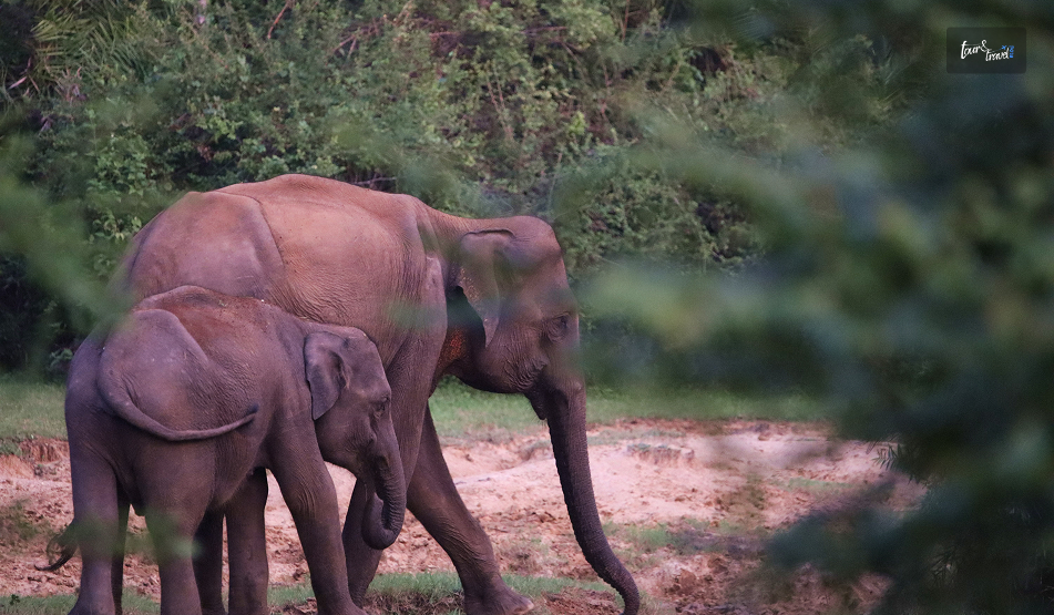
During the dry months (roughly June to September), much of Wasgamuwa’s elephant population actually migrates north toward Minneriya and Kaudulla in search of water, which is where you will find those spectacular 200-strong herds.  

So, if you want to spot the elephants, November to May is when more of them stay resident within Wasgamuwa itself, following the Mahaweli River corridor that forms the park’s eastern boundary. 

Weather And General Visiting 

The dry season from June to September offers comfortable safari conditions. 

The thinner vegetation makes it easy to spot sloth bears and leopards.  

October to January brings the northeast monsoon, when the park can turn muddy, and some interior tracks become difficult to navigate. 

What To See Inside The Park?

Wasgamuwa National Park: My Search For Sri Lanka’s Quietest Elephant Safari

The park offers the most wonderful fusion of wildlife and history.  

Wildlife 

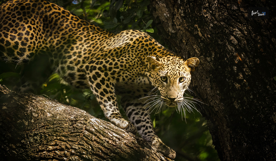
Wasgamuwa gets all the hype for its elephants. However, it also has sloth bears and leopards. 

In fact, many surveys suggest that sloth bear density in this park is highest in Sri Lanka.  

Also, some accounts suggest the park’s own name derives from “walas” (sloth bear) and “gamuwa” (wood). So, it is literally the forest of the sloth bears.  

Along with these three, you can even spot purple-faced langurs, wild boar, sambar, spotted deer, and water buffalo here. 

Moreover,  in the park’s pools and waterways reside water monitors, mugger and estuarine crocodiles, and pythons.  

Birdlife is understated but real.  I counted painted storks, white ibis, and several raptors circling over the grasslands in a single morning. 

Ancient Ruins Within The Park 

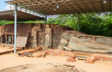
Long before it was a protected area, this land carried Anuradhapura- and Polonnaruwa-era settlement. 

I saw dagobas, an ancient canal system, and reservoir remains scattered through the jungle, well away from the standard vehicle tracks. 

Moreover, the area between the park and the Mahaweli River has a link to a battlefield from the Dutugemunu–Elara conflict of the 2nd century BCE. 

However, I could not visit most of the sites because I did not have the required special permission. Also, these are not part of the regular safari visits.  

Safari Timings And Practicalities 

Feature Half-Day Morning Half-Day Evening Full-Day Safari 
Timing 5:30 AM – 6:30 AM Start 2:30 PM / 3:00 PM – 6:00 PM Full day (split by picnic break) 
Duration 3 – 4 hours 3 – 4 hours All day 
Coverage Area Main tracks near Handungamuwa Gate Main tracks near Handungamuwa Gate Mahaweli riverbank sections 
Jeep Cost (LKR) 7,500 – 10,000 7,500 – 10,000 15,000 – 20,000 
Wildlife Focus General park wildlife General park wildlife Reliable elephant sightings 
Hotel Pickup 30–60 mins early (if less than 5 km from gate) Varies by hotel proximity 30–60 mins early (if less than 5 km from gate) 

A Sample One-Day Wasgamuwa Itinerary 

 Time   Activity 
 5:00 AM   Depart accommodation (Kandy base) 
 6:00–6:30 AM   Arrive at Handungamuwa Gate, complete entry formalities 
 6:30–10:00 AM   Morning Safari including Riverine Forest and Grassland Tracks 
 10:00–10:30 AM   Picnic/Tea Break Near Mahaweli Riverbank 
 10:30–11:30 AM   Continue Safari toward Interior Water Holes 
 11:30 AM   Exit Park and Return to Base 
 3:00–6:00 PM   Evening Safari Session with a Separate Entry 

Wasgamuwa does not have the wall-to-wall wildlife density of Yala or the spectacle of Minneriya’s Gathering.  

However, you will get a quiet forest to explore for several hours. Also, the elephants and sloth bears here are never performing for the tourists or camera lenses.  

So, I would pair it with a Cultural Triangle any day for the best value safari experience in the country. 

Share on Social Media

Sibashree is a travel, culture, and leisure writer who has been writing since the age of 12 and professionally since 2014. With more than a decade of travel writing experience and journeys across India and several parts of the world, she brings a deeply personal and thoughtful perspective to her work. A student of English Literature and Mass Communication, Sibashree has always viewed travel as more than movement — for her, it has been a way of understanding people, cultures, and herself. Her passion for spiritual exploration has also led her to many unusual and meaningful destinations over the years. Outside of writing, Sibashree enjoys watching European cinema, reading about global politics, and reflecting on the stories hidden within everyday places.

Leave a Reply

Your email address will not be published. Required fields are marked *

title-img Related

READ MORE

Bakers Falls: The Reward At The End Of The Horton Plains Loop

BY  Sibashree Aug 29, 2026

By the time I heard Baker's Falls, my legs already knew we were on the return leg of the Horton Plains loop.  We had started before sunrise to beat the mist at World's End, walked the open plateau in that strange, cold, grassland light, and then dropped back into cloud forest for the final stretch.  The falls announced themselves before they appeared as a low rush of water through the trees. After the wide-open plains, that first glimpse of water tumbling over dark rock into the ferns felt almost intimate by comparison. Baker’s Falls Quick Facts DetailInformationHeightAround 20 MetersWidthAround 25 MetersRiverBelihul Oya, a Tributary of the Walawe RiverLocationHorton Plains National Park, Nuwara Eliya DistrictDistance from EntranceAround 3 Km from the Main Loop TrailFull Loop Distance9.5 Km Round Trip, including Bakers Falls and World’s EndPark ElevationAround 2100 to 2300 MetersEntry FeeEntry Fee to Horton Plains National Park, No Additional FeeNamed AfterSir Samuel Baker, a British explorer, who is said to have come upon it in 1845 Where Is Bakers Falls And How To Reach? Baker's Falls is inside Horton Plains National Park in the Nuwara Eliya District. You have to walk from the entrance along the main park trail to reach Baker's Falls.  Belihul Oya, a major tributary of the Walawe River, has formed this waterfall.  Reaching The Park Entrance You can reach Horton Plains National Park from Nuwara Eliya, at a distance of around 32 km.  You can also travel from the towns of Pattipola and Ohiya, both of which sit on the upcountry railway line.  If you are traveling by train, you will have to hire a tuk-tuk or taxi for the final stretch to the gate. The Hike To The Falls You can reach Baker's Falls via the park's main loop trail. The same trail also takes in Little World's End and the main World's End escarpment.  From the entrance, it is about 4 km to World's End, then roughly 2 km further around the loop to Baker's Falls, and another 3.5 km back to the entrance. So, it is a 9.5 km round trip in total, usually taking about three hours at a comfortable pace. To reach the water itself, you'll descend a set of steps from the main trail down to the viewing area. World's End: The Rest Of The Loop Almost nobody visits Baker's Falls on its own. It is one stop on the wider Horton Plains circuit, alongside Little World's End (a roughly 300 m drop) and the main World's End escarpment, where the plateau falls away nearly 880 m. Horton Plains is unusual among Sri Lanka's national parks in that visitors can walk the main trail independently, without a mandatory guide. However, hiring one at the entrance is a good way to learn more about the park's cloud-forest ecology and resident sambar deer. What Makes Baker's Falls Worth The Walk Baker's Falls is modest by Sri Lankan standards, with a height of around 20 meters. It is dwarfed by giants like Bambarakanda further south.  But its setting is what makes it memorable.  The Belihul Oya spreads across a wide, dark rock face in two stages, hemmed in by rhododendron and tree-fern growth that feels completely different from the open grassland just a couple of kilometres back up the trail.  Originally known as Gonagala Ella, the falls were renamed after Baker, who is credited with discovering them during his time exploring and hunting in the Nuwara Eliya highlands. After the exposed walk to World's End, where wind and cold are the main things you are contending with. The descent into the forest around Baker's Falls is a genuine change of pace. It is quieter, greener, and sheltered.  Most people treat it as the natural place to stop, catch your breath, and refill water before the final stretch back to the entrance. What Is The Best Time To Visit Bakers Falls? SeasonMonthsWhat to Expect Dry SeasonJanuary to AprilBest overall conditions.Clearer views at World's End and easier underfoot.Wet SeasonMay to SeptemberFrequent Mist, Especially After Mid-MorningSlippery Trail SectionsEarly MorningAny Season, Before 9-10 AMEssential for a Clear View at World's End Before the Cloud Rolls in. A One-Day Itinerary: The Full Horton Plains Loop TimeStopNotes5:30 AMDepart Nuwara EliyaStart Early to Beat the Mist at World’s End6:30 AMArrive at Park EntranceBuy Tickets and Start the Loop Trail. 7:15 AMLittle World's EndFirst Viewpoint, About 45 minutes in7:45 AMWorld's EndThe Main EscarpmentAim to Arrive Before 9 AM for Clear Views9 AMBaker's FallsRoughly 2 Km Further Along the Loop.Descend the Steps to the Base.10:30 AMReturn to EntranceFinal 3.5 Km Stretch Back Along the Trail.11:30 AMDepart for Nuwara EliyaYou Can Also Continue Toward Ella if Heading Further into the Hill Country.  Practical Tips To Keep In Mind For A Trip To Baker’s Falls Start before sunrise because World's End is frequently shrouded in mist by mid-morning, especially from April to September. Wear proper hiking shoes as parts of the trail are uneven. Also, the steps down to Baker's Falls can be slippery. Pack warm layers. Horton Plains sits above 2,000 m and mornings are cold, even though the walk itself will warm you up. There is no swimming at the pool below Baker's Falls. It is deeper than it looks and has a history of drownings. We reached the park entrance again a little after ten, legs tired and jackets finally shed.  Of everything on the Horton Plains loop, World's End is the view people talk about. However, Baker's Falls is the one I would send someone back for on its own.

READ MORE Devon Falls

Devon Falls, Nuwara Eliya: Know The Timings, Entry Fee, Experience, How To Reach And More

BY  Sibashree Aug 29, 2026

Like how I had pulled over for St. Clair's Fall, the same thing happened a few kilometers along the A7.   The driver asked me not to keep my camera aside yet, and suddenly the hillside opened up.   There was a long, narrow ribbon of white water dropping almost straight down into a gorge of tea bushes.  It was Devon Falls, the “Veil of the Valley” in Sri Lanka’s Tea Country. The name comes from how it falls a long way.   So, it more than makes up for the lack of width compared to St. Clair's Waterfall. Here is more about this beautiful waterfall that should be on your Sri Lanka itinerary the next time you visit.   Some Quick Facts About Devon Falls, Nuwara Eliya   Details  Information Height Around 97 Meters Number of Drops  3 Tiers River A Tributary of the Kotmale Oya, Part of the Mahaweli River System Location 6 KM West of Talawakele, Nuwara Eliya District, Central Province Elevation Around 1140 Meters Above Sea Level Entry Fee Free and Viewable from Roadside Platform Nickname The Veil of the Valley Rank 19th Highest Waterfall in Sri Lanka  Where Is Devon Falls And How To Get There? Around 6 kilometers west of Talawakele, Devon Falls is on the A7 highway that connects Colombo to Nuwara Eliya via Hatton.  This waterfall in the Nuwara Eliya District is at an elevation of around 1140 meters. It is in the heart of the Dimbula tea-growing region.   From Nuwara Eliya  The distance between Nuwara Eliya and Devon Waterfall is around 30 kilometers. I took a car from Nuwara Eliya, and it cost me around 3000 LKR.   You can also take a tuk-tuk, which costs around LKR 2000.   The road passes directly above the falls. So, even before you reach the viewpoint, you will get your first glimpse of it through the windscreen.  From Kandy Or Colombo  If you are traveling from Kandy by road, you will reach Devon Falls within 2 to 2.5 hours via Gampola and Nawalapitiya.   Furthermore, from Colombo, it is a 4-hour drive on the Avissawella–Hatton route. Since it is a long journey from Colombo, you can pair it with a night in Hatton or Nuwara Eliya rather than a same-day round trip.  On Foot From The Road  There are two designated car parks along the A7 that double as observation platforms.   Both offer a clear view of the three-tiered drop without any walking required.   If you want a closer look, a short trail leads about a kilometre through the surrounding tea estate toward the base, though the pool itself is not easy to reach.  The Story Behind The Name Of Devon Falls Devon Falls gets its name from Devon, a pioneering English coffee planter.   His plantation once occupied the land nearby.   When coffee cultivation collapsed across Sri Lanka's hill country in the late 19th century due to a leaf-rust blight, tea took its place.  Today, the falls tumble past neat rows of tea bushes rather than coffee, though the name from that earlier era stuck.  What I found most memorable about Devon Falls was not just its height, but how sudden it feels.   St. Clair's spreads its water wide and slow.  Devon narrows it and lets it drop, almost in a single unbroken curtain through the first two tiers before spreading again near the base.   Moreover, standing at the main viewpoint opposite the Mlesna Tea Centre, you get the full length of the fall in one frame, framed by steep, green escarpments on both sides.  What Is The Best Time To Visit Devon Falls?  Season Months What to Expect Wet Season May to September Fuller, more dramatic flow, though mist can obscure the view Dry Season December to March Clearer skies, better for photography, lighter flow Early Morning Any Season, Before 9 AM Less roadside traffic and softer light on the water  Pairing Devon Falls With St. Clair's Because the two falls sit only a few kilometres apart on the same road, almost nobody visits just one.   St. Clair's is the wider, more famous of the pair, while Devon is the taller and, to my eye, the more dramatic.   Seeing both in a single stop along the A7 takes less than half a day, which makes this stretch of road one of the most efficient sightseeing detours in the hill country.  A One-Day Itinerary Around Devon Falls Here's how I'd plan a day trip centred on Devon Falls, starting from Nuwara Eliya or Hatton.  Time Stop Note  8:30 AM Depart Nuwara Eliya or Hatton Aim to reach the falls before the midday tour-bus crowds.  9:30 AM St. Clair's Falls Roadside viewpoint, about 6 km east of Devon.  10:30 AM Devon Falls View from the main platform opposite Mlesna Tea Centre.  11:15 AM Tea estate walk or factory visit Several estates in Dimbula offer short tours.  12:30 PM Lunch in Talawakele Local rice-and-curry spots along the main road.  2:00 PM Onward to Hatton or Nuwara Eliya Or continue toward Adam's Peak if timing allows.   Practical Tips For A Visit To Devon Falls  Both viewpoints are roadside, so no hiking is required if you just want the classic photo.  Traffic along the A7 can be heavy with tour vans in the late morning. So, an early start helps.  Skip swimming here. The pool is difficult to access, and the currents near the base are not considered safe.  Pack a light jacket. At over 1,100 m elevation, mornings can be genuinely chilly even in the dry season.  We only stopped for about fifteen minutes at Devon Falls.  However, it was one of those places that have stayed with me. That long, narrow drop through the tea hills, half-hidden in mist, is hard to shake.

READ MORE Kudawella Beach

Where Is Kudawella Beach? What To Do In Kudawella Beach For Beginners?

BY  Sibashree May 5, 2026

Very close to the Hiriketiya Beach, Kudawella Beach is a pristine, small, and beginner-friendly beach for surfers.  However, even if you are not a surfer, you can visit this hidden gem to find the turtle nests and the surrounding mangroves.  Also, at Kudawella Beach, you can enjoy the beauty of the Indian Ocean or just laze around on the sand.  Here is more about this beautiful, sickle-shaped beach on the southern coast of Sri Lanka.  Where Is Kudawella Beach? How To Reach Kudawella Beach As I have mentioned, Kudawella Beach is on the southern coast of Sri Lanka, and it stretches from west to east.  Furthermore, the beach is around 10 km away from Dickwella, the closest major town to the beach.  Moreover, if you are already visiting the Hiriketiya Beach, you can just take a 10-minute tuk-tuk ride to reach the Kudawella Beach.  The most popular way to reach the Kudawella Beach is to take a direct car or taxi from Colombo, which is at a distance of around 160 km.  The journey by road will take close to 5 hours, and the taxi fare will be over 30000 LKR.  However, I was already in Ella and had a day after visiting the iconic Nine Arch Bridge and exploring all the other top attractions in Ella.  So, I took a bus from Ella to Galle. The bus #31 was moderately crowded, and I was enjoying the local experience.  That bus from Ella to Kudawella Beach took around 6 hours, and the ticket price was LKR 350.  What Are The Things To Do In Kudawella Beach?  Kudawella Beach is a place that offers you the ultimate flexibility.  Yes, there are a few hotspots when you are on the beach. However, you can spend your entire day without doing anything.  Moreover, it is a delightful place for amateur surfers.  Still, here are a few things to do in Kudawella Beach, along with surfing and chilling.  1. A Walk To The Hummanaya Blow Hole I loved walking to the Hummanaya Blow Hole on the eastern side of the Kudawella Beach. However, to see the water shooting up, you have to reach the viewing point at the top of a cliff.  The cliff also has a safety barrier.  It is the only blowhole in Sri Lanka and the second-largest in the world, shooting the water at a height of 25-30 meters when the water forcibly enters a narrow cavern.  I saw the blowing taking place at least 5-6 times during the short moment I halted there. The water shoots up as the sea movement builds pressure in the tunnels in the rock.  2. A Walk To The Nilwella Beach If you want even a more idyllic retreat, you can visit the Nilwella Beach from the Kudawella Beach.  This beach has blonde sand, and the waves here are gentle.  Moreover, I loved walking across the beach to reach a rocky island. The rocky island had many palm trees and pandanus trees.  There was also a hiking trail, and as I advanced, I found many little coves and unique geographical shapes.  3. Kayaking Around Mawella Lagoon Mawella Lagoon was pretty, and the water was covered by beautiful lily flowers.  Furthermore, there are many hotel rooms and massage rooms near the lake where you can chill or enjoy a relaxing massage session.  However, just behind the Kudawella Beach, this lagoon is also ideal for kayaking around.  It cost me around 8000 LKR, and I spotted many birds such as storks, beeaters, and kingfishers there.  I heard that sometimes you can also spot crocodiles here.  Kudawella Beach: The Best Spot For Surfing For Beginners  As I have mentioned, Kudawella Beach is a beginner-friendly surfing spot.  Unlike Hiriketiya, you will not find outer waves here. You can only surf here at the beach break, which is further on the inside of the bay.  So, it is safer than Hiriketiya Beach.  In fact, even in the dry season from November to March, the waves seldom reach a height of more than 4 feet.  However, you have to be watchful of the few rocks in the water. Having said that, during the dry season or the peak surfing season, the water of the Indian Ocean is crystal clear.  So, you will be able to see the rocks clearly.  Moreover, on the Kudawella Beach, there are two surf rentals. However, when I visited, there was a longer queue in front of the Saranga at Kudawella Surf School, and its surfboard-shaped signboard also looked pretty cool.  What Is The Best Time To Visit Kudawella Beach?  November to March, or the dry season, is the best time to visit the Kudawella Beach.  Long hours of sunshine make these months ideal for beach activities. However, there can be sudden rainfalls. So, you have to carry your rain gear.  However, the wet season from March to August, despite having fewer crowds, is not ideal as there can be harsh storms and heavy rainfall.  Where To Stay Near The Kudawella Beach?  When I visited Kudawella Beach, it was still very pristine, and thus it is a quintessential beach on the southwestern coast of Sri Lanka.  You will find only a few hotels here.  Also, if you want to find an accommodation here, you can stay on the beachfront or in hotels near the lagoon.  Here are some of the places where you can stay.  Sisi Place The Sisi Place is on the hilltop at the west end of the beach. It is the most budget-friendly option here with clean and comfy rooms.  Simply Peace  Choose Simply Peace if you are looking for a luxury accommodation near the lagoon.  It is a beautiful pool where you can relax. Furthermore, it has a garden where you can enjoy birdwatching.  Calma I loved the pastries and coffee at the on-site cafe of Calma. With a sand front, it exudes a quintessential Balinese bungalow aesthetic.  Moreover, you can take a short tuk-tuk ride from Kudawella Beach to Hiriketiya Beach. There, you will find more diverse accommodation options, including Airbnbs.