Horton Plains National Park: Why Is Walking To The Edge of Sri Lanka Worth The 3 AM Alarm?
BY
Sibashree
Aug 21, 2026
It was still pitch dark when I left Nuwara Eliya. I was wrapped in every layer I had.
It was a bit weird, and I felt overpacked considering Sri Lanka spends most of the year in a state of tropical sweat.
After an hour and a half, I was standing at the entrance gate of Horton Plains National Park.
My breath was fogging, and I realized that it was actually Cold and not the Sri Lankan cold you would usually expect.
On a high plateau in the Central Highlands, the Horton Plains National Park sits at an elevation of more than 2100 meters.
Unlike most of the Sri Lankan landscape, the Horton Plains National Park does not have rice paddies, palm trees, and the lowland heat haze.
In fact, it looked like the Scottish Highlands with gnarled cloud forest, windswept grassland, and silence broken by birdsong.
So, overall, it looked like a contradiction in the middle of a tropical island country.
Horton Plains: A Plateau With A History
Horton Plains stands out with an ecological and historical weight.
This weight is more than the windswept image it has.
Long before it became a popular hiking destination, it was famous as a colonial retreat.
Furthermore, in July 2010, it became a UNESCO-listed ecosystem as part of the Central Highlands of Sri Lanka.
From Maha Eliya Thenna To National Park
Horton Plains was earlier known as Maha Eliya Thenna before it became a national park.
Maha Eliya Thenna means “The Great Open Plain.” During British Rule, it was renamed after Sir Robert Wilmot-Horton.
He was a governor of Ceylon.
Also, during that time, the highlands became a retreat for planters escaping the heat of the lowlands.
Until 1969, the Horton Plains were not formally protected.
Then, it became a wildlife sanctuary.
Finally, in 1988, it got the full designation as a national park.
Then came 2010.
Horton Plains got the UNESCO designation along with the Peak Wilderness Protected Area (home to Adam's Peak) and the Knuckles Mountain Range.
Together, these three protected areas form what conservationists describe as one of the island's most important biodiversity hotspots.
These shelter species found nowhere else on Earth.
Why The Ecosystem Matters
Sri Lanka, being a party to the Convention on Biological Diversity, submitted the “Sixth Annual Report” in 2019.
I am quoting the content of the report as highlighted by the Daily Mirror Online here.
“The Peak Wilderness Sanctuary, Horton Plains, and the surrounding protected and unprotected areas containing small wet-zone forests possess the highest levels of endemic plant and animal diversity in Sri Lanka.”
The Horton Plains National Park is also the source of the three major rivers in Sri Lanka.
Mahawell
Kelani
Walawe.
Moreover, as an important ecological region, it was the first national park in the island country to ban single-use plastics.
So, when you are about to enter the national park, the rangers check the bags at the entrance.
You have to leave the water bottles (if you are carrying water in single-use plastic ones) and snack packets before entering it.
The Walk Itself
Recently, there have been talks about the reopening of the Nonpareil Estate and Nagrak to Horton Plains route.
After failed attempts in 2015 and 2020, this recent request in August 2026 has been submitted by the tourism hotel operators.
The Development Committee meeting has also discussed this matter.
Also, Gayani Renuka, the Divisional Secretary of Imbulpe, has presented it to Dr. Dhammika Patabendi, the Minister of Environment.
However, there are uncertainties about reopening this route for better accessibility.
It is because of environmental concerns and the pristine nature of the Horton Plains.
So, if you go for a trek now, you have to pass through three distinct moments strung along one loop trail.
Each loop has a distinct character.
The Main Loop
The distance of the main trail is around 9 to 9.5 kilometers.
At an easy, photo-stopping pace, you can cover the loop in 3 to 4 hours.
There is no steep elevation gain.
So, technically, it is not a difficult trek to complete.
Also, the route is well-maintained and well-marked.
However, the elevation adds to the challenges of trekking.
Add to that the cold, unfamiliar to most parts of Sri Lanka!
You can complete the loop clockwise like most hikers.
Thus, you will reach Little World's End first and then World's End.
Next, you will find the Baker's Falls on the return leg.
Walking it this way means you catch the two main viewpoints while the sky still has a chance of being clear.
Little World's End
About 3.5 kilometres in, this is the warm-up act.
The Little World’s End is a cliff edge with a drop of around 270 metres.
It is less dramatic than what comes next, but on a clear morning you can see the patchwork of tea estates and village rooftops laid out far below.
It is often far less crowded than its famous neighbour.
World's End
Roughly 4 kilometres from the start, this is the reason everyone makes the pre-dawn drive.
It is a sheer escarpment that drops somewhere between 870 and 880 metres, depending on which source you believe.
Also, there is genuinely nothing gentle about it.
A low metal railing marks the edge in places, but a fair stretch of it has nothing but exposed rock and open air.
So it is worth keeping a firm grip on children and a healthy respect for the drop yourself.
On a clear day, the view stretches all the way to the south coast, nearly 100 kilometres away.
The feeling, standing at nearly 2,000 metres above sea level, is inexplicable.
I got lucky with about ten clear minutes before the mist rolled back in.
It was enough to understand why people set their alarms for 3 AM to be here.
Baker's Falls
Baker’s Falls is an important landmark on the way back, and you will find it after completing a hike of 7.5 kilometers.
The waterfall is modest, but its beauty is unmatched.
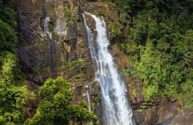
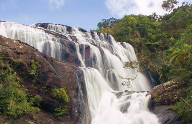
Moss-covered boulders and cloud forest thick with ferns frame this 20-meter waterfall.
I wanted a closer look at this beautiful fall.
So, I took a short flight of stone steps leading down to the base.
Longer Routes For The Ambitious
If you have more time and stamina, longer routes branch off toward Kirigalpotta, Sri Lanka's second-highest peak.
It also takes you to Thotupola Kanda, the third-highest, along with a section of the long-distance Pekoe Trail that now runs through part of the park.
These require permits and, in most cases, a guide, but they are a genuine option if the main loop leaves you wanting more.
When To Visit The Horton Plains National Park?
The gates of the Horton Plains National Park open at 6 AM.
By 9:30 or 10 AM, the mist in the national park rolls in and swallows the views.
I came across one highland lodge owner online. He runs a "Highland Trek" experience out of Nuwara Eliya.
He said, “It is not just the sunrise if you reach the Horton Plains National Park by 6 AM.
Reaching early also helps you to beat the cloud that builds through the morning.”
Time Of Year
Choose December to March if you want to know about the best time to visit the Horton Plains National Park.
The park stretch is the driest and clearest during these months.
However, being the best time, this window also brings heavy crowds on weekends and local holidays.
April through September brings more mist and drizzle, and while the views become less reliable, the trail is also quieter.
Several travellers I found comparing notes online argued that a misty, moody Horton Plains has its own appeal.
It is just a different trip than the postcard version.
Wildlife, Without The Big Cat Guarantee
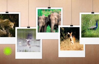
The Sambar Deer is the poster animal of the Horton Plains National Park.
I could spot them easily.
If you especially visit the park early in the morning, you will find these adorable creatures grazing in the open grassland.
Furthermore, if you are a bird-watcher, you will find endemics like the Sri Lanka whistling thrush and the yellow-eared bulbul.
Other birds you will find here are:
Scaly-Breasted Munia
Sri Lanka Whistling Thrush
Sri Lanka Spurfowl
Horton Plains is also, on paper, a leopard territory with the Sri Lankan leopard as the apex predator here.
However, sightings are exceptionally rare, and I would not build a trip around the hope of one.
Most guides are refreshingly honest about this rather than overselling it.
Instead, expect wildlife such as Fishing Cat, Grizzled Giant Squirrel, and Wild Boar here.
If you are here to spot reptiles, watch out for the black-cheek lizard, Boie’s rough-sided snake, and the horned lizard.
The Nelu Bloom: A Once-In-A-Generation Sight
The flowering of the Nelu is one of the main highlights of the Horton Plains National Park.
This flower of a genus of shrubs in the highlands does not bloom every year.
In fact, these flowers bloom once every 12 years.
When these flowers bloom, the entire hillsides turn a soft purple-blue almost overnight.
You must have seen these photographs on Instagram.
Sample Itinerary
Most visitors do Horton Plains as a single early-morning excursion.
However, there are a few ways to structure the day depending on your fitness, time, and onward travel plans.
Half-Day Trip From Nuwara Eliya To Horton Plains National Park
TimeActivity3:30–4:00 AMWake up, dress in layers, depart Nuwara Eliya.5:00–5:30 AMArrive at Horton Plains entrance, buy tickets, bag check.6:00 AMGate opens, begin the loop (clockwise).6:00–7:00 AMWalk to Little World's End (3.5 km).7:00–7:45 AMReach World's End, main viewpoint stop.7:45–9:00 AMContinue on the loop to Baker's Falls, a short detour to the base.9:00–10:00 AMFinish the loop back to the car park.10:00–11:30 AMDrive back to Nuwara Eliya and have breakfast en route or in town,
Extended Day Trip (With Kirigalpotta Or Thotupola Kanda)
TimeActivity3:30–4:00 AMDepart Nuwara Eliya.5:30–6:00 AMArrive and buy extended tickets and permits for an extended trail if required.6:00–10:00 AMMain LoopLittle World's EndWorld's EndBaker's Falls.10:00 AM–1:00 PMExtended Trail Kirigalpotta or Thotupola Kanda with a guide.1:00–2:00 PMReturn to car parkDrive back3:00 PM onwardLate lunch in Nuwara Eliya and relax
Moreover, instead of making a return to Nuwara Eliya, you can continue your journey to beautiful Ella.
Tentative Cost Breakdown
Costs vary depending on how you get there and whether you hire a guide.
However, here is a realistic breakdown to budget against.
Entrance Fees
ItemApproximate CostForeign adult, day visitUSD 25 per personForeign childUSD 12Sri Lankan national, day visit•LKR 150 for Adults•LKR 75 for Children•LKR 20 for Local Students with Valid IDVehicle entryLKR 250-1000 for VehiclesDrive/Guide Fee: Overnight/extended permit (for longer trails)Around LKR 2400 for a Campsite of 12 People.
Tickets are generally sold only at the entrance, not online. So budget extra queueing time in peak season (December–March, weekends).
Transport From Nuwara Eliya
OptionApproximate CostPrivate car, round trip with 3-hour waitLKR 5000 to LKR 13000Tuk-tuk, round tripLKR 1500-2000Organised half-day tour (driver + guide)LKR 6000 Per PersonFull-day customisable tuk-tuk/car tour (Horton Plains + extras)LKR 10000 for the vehicle/group
Other Costs To Budget For
ItemApproximate CostLocal guide (optional, for main loop)LKR 600Guide for extended trails (Kirigalpotta/Thotupola)LKR 700Breakfast/snacks in Nuwara Eliya after the hikeLKR 300-400 Per PersonTips for driver (customary but not obligatory)Around LKR 200
Rough Total, Per Person
For a solo or paired traveler doing the standard half-day loop with a shared private car, all-in costs typically start from around LKR 15000.
What People Are Actually Saying About The Horton Plains National Park
Beyond the official descriptions, recent traveller reviews and hiking forums paint a fuller, more candid picture of what to actually expect.
The Praise
I have checked the recent traveler reviews and hiking forums for recent updates on the Horton Plains trek.
I wanted updates as it has been almost 2 years since I have been there.
I have got a pretty consistent and useful picture of the park beyond the marketing photos.
People consistently describe the loop as peaceful, scenic, and surprisingly quiet once you are past the entrance area.
Also, many travelers have remarked that they barely saw another hiker on the trail itself despite a busy car park.
The cool climate and the drama of World's End come up again and again as the highlight.
More than one reviewer said the steep entrance fee for foreign visitors was worth it for the experience alone.
The Complaints
The complaints cluster around two things.
First, Value For Money At The Gate
Several visitors felt the facilities, particularly the restrooms, didn't match what they were paying.
They especially compared the facilities with well-maintained remote parks elsewhere in the world.
Second, Logistics
Getting to the park without a private vehicle or organised transport is genuinely difficult.
A few forum threads mention drivers or ticket-side "tips" being expected in ways that caught first-time visitors off guard.
My own advice, echoing what I saw repeated often:
Agree on a return fare with your driver before you set off.
Keep small notes handy at the gate.
Treat the fee as the cost of one of the more unusual landscapes in South Asia rather than comparing it to lowland attraction pricing.
Also, there are concerns about the vulnerability of the Horton Plains National Park.
It is disappointing that I did not find many travelers talking about it.
The Vulnerabilities
“Many visitors to the Horton Plains NP come here when they are on holiday in Nuwara Eliya and that is the loud and boisterous behaviour they bring here as well, creating much havoc in this sensitive area.”
These are the words of Sankha Wanniatchi, an author, photographer and leopard researcher.
He shared his views with The Sunday Times regarding the “Clarion Call to Protect Vulnerable Horton Plains NP.”
The researcher has also urged the Sri Lankan authorities to refer to Yellowstone National Park for implementing strict regulations in the Horton Plains National Park.
His suggestions include relocating the entry gate to the national park.
It is because the stretch between the Pattipola Railway Station and the entry gate is ripe with wildlife activity.
An overspeeding car killing a young sambar in the stretch has strengthened his claim.
Moreover, there are suspicions of poaching activities, with loud sounds of gunshots being heard outside the boundary lines.
Practical Notes For Your Own Visit
A short checklist of the logistics worth locking down before you leave your hotel.
Getting There
Horton Plains is roughly 32 kilometres, about 1.5 hours by road, from Nuwara Eliya, which is the most common base.
A hired car or tuk-tuk with waiting time is the standard arrangement.
Public transport options are limited and awkward for the early departure time you will want.
What To Bring
Carry layers, a light rain jacket, sturdy closed shoes, and cash for the entrance and any incidentals.
There is no phone signal inside the park, which, once you adjust to it, becomes part of the appeal.
Was It Worth The 3 AM Alarm?
Genuinely, yes.
Horton Plains is not trying to be the rest of Sri Lanka.
That is exactly what makes it worth the detour from the hill country's tea estates and waterfalls.
It is cold, it is a little inconvenient to reach, and the view you are chasing is entirely at the mercy of the weather.
However, standing at the edge of an 880-metre drop with the whole southern half of the island somewhere beneath the mist is an experience.
Set the alarm.
Bring the jacket you think you won't need. It is worth it.

 Latest