

Kilinochchi, Sri Lanka: The De Facto Capital Of Tamil Tigers Teaching The Story Of Recovery

Killinocchi is a place where the sparks of protests are not extinguished completely. 

As I am penning this article in July 2026, the arrest of the Tamil rapper Sangeethsan and the protests of the locals condemning the PTA, or Prevention of Terrorism Act, a month back, make me concerned. 

The Kilinochchi District Civil Organisations were behind the demonstrations, and the theme was “Let us unite to break the chains around our voices.”

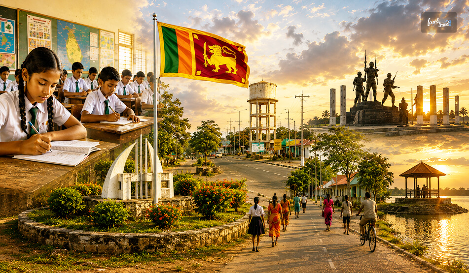
In plain sight, Killinochi is a town where paddy fields, temple bells, and war memorials share the same stretch of road.

However, if you want to know about the history of this town and understand how it is getting rebuilt after the Civil War, you need to spend some time in Killinochi. 

Moreover, of all the places I have covered on my Sri Lanka trips, Vavuniya and Mannar had already told me that the Northern Province holds a different Sri Lanka altogether.

Also, Northern Sri Lanka does not sit on any typical bucket list.

Kilinochchi is the next chapter of that same story.

Kilinochchi: Quick Facts

ProvinceNorthern Province, Sri Lanka
DistrictKilinochchi District
Distance from JaffnaAround 330 km
Main HighwayA9 (Kandy-Jaffna Highway)
Founded1936, as a colonization settlement for Jaffna’s farmers
Former StatusDe facto administrative capital of the LTTE until 2009
Main LivelihoodPaddy farming and agriculture
Best Time to VisitThe dry season from May to September

Where Is Kilinochchi And How Do I Reach It?

Kilinochchi is on the A9 Highway that connects Jaffna to Kandy. 

I was traveling from Anuradhapura, and I reached Kilinochchi after three hours in a car. After Vavuniya, it was Kilinochchi that Ravi introduced me to. 

However, you can travel to Kilinochchi by train and bus. 

Traveling By Train 

However, if you are traveling from Colombo, you can take the train on the Yal Devi Line continuing to Jaffna. 

Overall, it is a train journey of 5-6 hours. This is one of the most beautiful train journeys of Sri Lanka, with the landscape flattening out into dry-zone scrubland somewhere past Vavuniya.

44089 Kankasanthure Night Mail – Moratuwa – Kankesanthurai, 444421 Intercity Express –

Mount Lavinia – Kankesanthurai, and 44477 Yal Devi – Colombo Fort – Kanakasanthurai are the trains plying on this route.

A ticket for the second-class reserved category will cost LKR 1700, and the ticket price for the AC saloon car will be between LKR 2400 and LKR 3000. 

Traveling By Bus 

If you are a backpacker, you can also board a Colombo-Jaffna or an Anuradhapura-Jaffna bus. 

You will get semi-luxury and premium-luxury bus options on this route, and the travel time will be around 7 hours. 

Also, the ticket price will be between LKR 1800 and 3000.

What Is The History Of Kilinochchi?

What Is The History Of Kilinochchi

The history of Kilinochchi goes back to 1936. 

In the same year, Kilinochchi was constructed as part of a colonization scheme meant to ease overcrowding and unemployment in Jaffna. 

The farmers came here to take part in paddy cultivation supported by government land grants.

However, the recent history of the Sri Lankan Civil War has primarily shaped it today. 

Kilinochchi was the de facto administrative capital of the LTTE (Liberation Tigers of Tamil Eelam) during the final phase of the civil war. 

At the same time, Jaffna, with its strong Tamil base, remained under government control. 

Then, with the Sri Lankan forces closing in on Kilinochchi in December 2008, the LTTE forced many civilians to flee with them toward Mullaitivu.

Thus, the LTTEs used the civilians here as human shields. 

However, before fleeing the town, the LTTEs blew up the town’s main water tower in an act of scorched-earth destruction, cutting off the town’s water supply in an already dry region.

Nevertheless, the Sri Lankan army took charge of Kilinochchi on 2nd January 2009. 

It was one of the major landmarks toward the end of the Civil War, and it finally ended in May 2009. 

After that, Kilinochchi has worked on rebuilding itself. 

It now has new water infrastructure, roads, and returning farming communities.

Today, it stands as a quiet marker of how a place absorbs a violent past and keeps going.

My Day In Kilinochchi

My Day In Kilinochchi

Kilinochchi offers a sobering experience, and once you get involved in the history of the Civil War, most of your time will go into pondering and understanding what actually happened. 

Nevertheless, here are the highlights of my day in Kilinochchi.

1. The Story Of The Water Tower

Ravi first took me to the fallen water tower. 

For years, the collapsed remains of the tower bombed by the LTTE in 2008 lay exactly where they fell, fenced off as an informal memorial along the highway.

However, in 2020, the structure was finally removed to make space for a new building.

While I could not see the fallen tower, it was not difficult for me to visualize the anarchy and destruction. 

This was a monument not to victory or grandeur, but to how war strips away the most basic necessities, in this case, clean drinking water in a region where water is already scarce.

2. The Kilinochchi War Memorial

The Kilinochchi War Memorial was very close to Kilinochchi Town. It commemorates how the Sri Lankan military recaptured the town in 2009. 

I had mixed feelings as I approached the site. 

The memorial itself is a straightforward structure offering you the moment of truth. 

However, of course, you will interpret the truth depending on which side of the conflict’s history you come from.

I found a few tourists taking photos of the memorial. However, I spent the time talking to the locals, and I tried to understand what the final months felt like. 

3. Elephant Pass

The Elephant Pass was just a short distance away from the town of Kilinochchi. 

It is a narrow strip of land that connects the mainland to the Jaffna peninsula. 

This was one of the most fiercely contested locations throughout the entire civil war, changing hands multiple times between government forces and the LTTE.

However, when you visit it today, you will only see a quiet causeway with the Elephant Pass lagoon stretching out on either side.

Still, the personnel there will share the details of the war if you approach them. 

4. Iranamadu Tank

Visiting the Iranamadu Tank was a welcome break after exploring the grim history of civil war in Kilinochchi. 

It is one of the largest man-made reservoirs in the region. It was originally built for the water supply to the surrounding paddy fields. 

I visited the tank in the late afternoon and spotted local fishermen rowing out onto the water. A few egrets were also picking through the shallows. 

5. Chundikulam National Park

Chundikulam National Park is a delightful detour if you are visiting Kilinochchi in the winter migratory season. 

This wetland hosts large flocks of Greater Flamingos. Furthermore, many other migratory birds pass through the brackish lagoon system in this season. 

I did not manage to see the flamingos myself, as I visited outside the migratory window.

However, locals I spoke to described early mornings here as one of the best birdwatching experiences in the entire Northern Province.

6. The Local Temples And Kanagapuram Kovil

Like the temples in Jaffna, Kilinochchi’s Tamil Hindu identity shows up in its temples or kovils.

I stopped briefly at Kanagapuram Kovil, a modest temple with local visitors.

Also, don’t forget to visit the Kaala Vairavar Temple when you are in Kilinochchi. 

7. The Kilinochchi Market

Before heading out of town, I walked through the local market, where vendors sold fresh produce, dried fish, and simple Tamil snacks.

It was a good reminder that beneath the weight of Kilinochchi’s recent history, everyday life here continues much like anywhere else in rural Sri Lanka.

What To Eat In Kilinochchi

What To Eat In Kilinochchi

The food in Kilinochchi has the same Tamil roots as the food in Jaffna

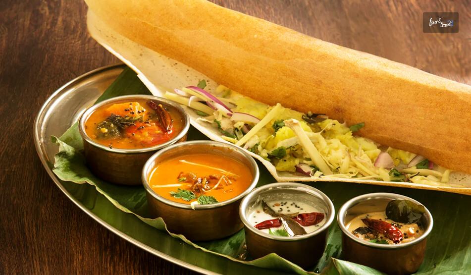
It was a great experience trying Thosai and Idiyappam for breakfast and dinner in a rural setup. 

Also, the coconut sambal and sambar were great and spicier than what we are used to having in South India. 

Kothu Roti, a chopped roti stir-fried with vegetables, egg, and spices, is another filling option for lunch.

Also, you cannot miss the Jaffna-Style Crab Curry. It is a spicy and tangy curry.

Pittu, steamed rice flour with grated coconut, is another Tamil staple worth trying here.

I ate at a small, no-frills eatery near the town center, and it remains one of the more memorable simple meals of my entire Sri Lanka trip.

Where To Stay In Kilinochchi

Accommodation options are limited in Kilinochchi, and you will only find budget and mid-range guesthouses and small hotels in the town center.

So, if you are planning to spend a night in Kilinochchi, expect modest, rural hospitality. 

What Is The Best Time To Visit Kilinochchi?

May to September, or the dry season, is the most ideal time for a visit to Kilinochchi. 

However, remember that the Northern Province of Sri Lanka is punishingly hot at midday, irrespective of the season of the visit. 

Furthermore, if birdwatching at Chundikulam National Park is on your list, plan your visit around the winter migratory season instead.

Share on Social Media

Sibashree is a travel, culture, and leisure writer who has been writing since the age of 12 and professionally since 2014. With more than a decade of travel writing experience and journeys across India and several parts of the world, she brings a deeply personal and thoughtful perspective to her work. A student of English Literature and Mass Communication, Sibashree has always viewed travel as more than movement — for her, it has been a way of understanding people, cultures, and herself. Her passion for spiritual exploration has also led her to many unusual and meaningful destinations over the years. Outside of writing, Sibashree enjoys watching European cinema, reading about global politics, and reflecting on the stories hidden within everyday places.

Leave a Reply

Your email address will not be published. Required fields are marked *

title-img Related

READ MORE Mannar

Mannar, Sri Lanka: The Island I Almost Skipped

BY  Sibashree Jul 10, 2026

Many unexpected things happened during my trip to Sri Lanka. For example, I did not expect what I felt at the Dambulla Royal Cave Temple.  Similarly, there are places like Puttalam. Puttalam stands out with its ancient history, wildlife, coconut plantation, and ideal ambiance for stargazing.  However, of course, Puttalam is not as celebrated as the cultural richness of Kandy or the thrill of a Kandy to Ella train ride. It is more like a hidden gem.  Now, talking about hidden gems, Mannar is another destination I almost missed.  I am glad that I did not ultimately, as in recent times, it has become the land where women are fighting for the protection of the bodies and land impacted by industrialization, bypassing their consent.  In this article, I will share my experience in Mannar, and of course, why women in this coastal village are putting up such a strong fight.  However, I will begin with why I almost missed it. This Is Why I Almost Missed Mannar Mannar is not a usual or bucket-list destination when planning a trip to Sri Lanka. So, it was not originally on my list even after multiple visits to the country.  For the first time, Jaffna and its Tamil culture were my priority.  Also, for the next time, it was quite a predictable loop with Ella for the hills, Kandy for the temples, and Mirissa for the beaches.  Again, while Mannar kept popping up as a suggestion, most forums described it as "connected by a causeway, has some baobab trees, not much else."  So, I never had Mannar on my mind.  However, when I visited Sri Lanka for the third time, my focus was more on historical exploration in the country that is so connected to the country I come from, India.  So, I was staying in Anuradhapura, and Adeesha, the guesthouse owner, told me about Mannar.  He said, “Mannar is where Sri Lanka forgets it's an island for a while. The wind never stops, and neither do the birds." This description stayed with me. And in three days, I took to the Medawachchiya-Talaimannar Highway for a road trip to Mannar.  The distance was around 119 km, and it took around 2 hours and 17 minutes.  Initially, I thought that it was a mistake as I saw the landscape flattening out into salt pans and scrub.  However, I had not!  Mannar Reminded Me Of Art Of Slow Travel: We All Know It But Often Forget  I planned a half-day detour and ended up staying two nights, and even that felt like less.  What I appreciated most was how little the island tried to perform for visitors. You don’t have a polished tour script to follow. Also, from the causeway moment to standing on the spot where two countries meet, you will not notice the crowd for photo ops.  And do you know what you have as your companions here?  Just baobabs older than most nations, donkeys that own the road, flamingos that don't care if you're watching, and a stretch of water that people once believed connected two entire countries! So, Mannar is more than worth being beyond an afterthought when you are planning a trip to Sri Lanka.  I certainly did not expect a forgotten causeway town to end up as one of my favorite stops in the entire country, but that's exactly what happened. Here are more details about my days in Mannar, from the causeway moment to visiting the historical fort.  1. The Causeway Moment There's a specific moment on the drive-in that I still think about.  I left the palm-fringed road of the mainland behind, and the land narrowed into a causeway with water pressing in on both sides.  I rolled the window down, and I instantly felt the gush of wind on my face.  My driver, Aslam, laughed and said I should get used to it.  Talaimannar, further west, is considered one of the windiest points in the country, which is exactly why it's become a magnet for kite-surfers. Crossing that causeway felt like flipping a switch. The dense, wet green of the rest of the island gave way to something drier, flatter, and quieter.  I hadn't expected Sri Lanka to have a landscape like this, and it was closer in spirit to the Deccan scrublands than to a tropical postcard. 2. First Impressions Of Mannar Town Mannar town itself is unhurried in a way that took me a day to appreciate.  My first afternoon, I wandered past fishing boats pulled up on the shore, nets drying in loose piles. I also spotted a handful of tea shops where conversations paused just long enough for someone to glance at the obvious outsider before returning to their card game.  Nobody tried to sell me anything. It was the first place in Sri Lanka where I felt like a guest rather than a customer. 3. Meeting The Giant Of Pallimunai I was not prepared for the first baobab tree I spotted in Mannar. Seeing it for real is a different experience than seeing the photos.  The barrel-shaped trunk was wider than a small room, and the branches moved upward.  Furthermore, it had a thick and wrinkled grey bark, which gave it the name of the “Elephant Tree” from the locals.  However, the most famous one among the baobab trees in Mannar is the one in the village of Pallimunai.  It has a history of 600 to 800 years.  Furthermore, it was fascinating to think that baobabs are native to Africa and Madagascar, not South Asia. Common sayings are that the Arab traders carried the seeds here centuries ago, possibly using the leaves as camel fodder during the long sea crossings. The seeds eventually took root in Mannar's dry soil. I sat under that tree for a good twenty minutes, and a local teenager on a bicycle stopped to chat, half in English and half in gestures.  He told me his grandfather used to tell him the tree was older than any building on the island. Looking up at it, I believed him completely. Things To Know About The Baobab Trees In Mannar Mannar has around thirty baobab trees scattered across the district.  All of them are not as gigantic as you expect them to be. However, even the smaller ones along back roads and behind houses will grab your attention with their unique silhouette.  4. The Donkeys Of Mannar The feral donkeys are a part of Mannar’s wildlife identity.  They come from the animals the Arab merchant brought generations ago.  When I reached Mannar, I spotted them wandering freely across the island. They were unbothered by traffic or tourists. Even I watched one calmly block an entire lane of road near the causeway, chewing grass with the unhurried confidence of something that knows it has the right of way. Aslam just waited it out, grinning. "This is Mannar traffic," he said. 5. Flamingos At Vankalai My visit to the Vankalai Sanctuary and the nearby wetland was one of the highlights of my trip to Mannar.  I spotted flamingos, and they looked unreal for the first few minutes. I have never been so up close to these majestic birds.  Furthermore, I spotted a flock lift off a shallow lagoon at dusk, and it was dusk. So, they were catching the last orange light for the day.  Everything around me paused for a while.  6. Adam's Bridge And Talaimannar: Standing Where Two Countries Almost Touch The furthest point of my trip was Talaimannar.  It was right at the western tip of the island, where a chain of limestone shoals, the Adam's Bridge, stretches out toward Rameswaram in India.  In Hindu tradition, this is the causeway said to have been built by Rama's army in the Ramayana. Furthermore, geologically, it is a natural formation due to sedimentation and shifting sea levels over thousands of years. The Moment… I was standing on the shoreline, and the wind hammered at my jacket.  I squinted toward the horizon and tried to make out India. Certainly, I could not.  Now, being from the land of spirituality, the myth was quite fascinating. However, the practical history seemed more tantalizing.  It was one of the busiest pearl-trading points in ancient times, and it was famous even in Rome.  7. The Fort That Changed Hands Three Times On the way back, I stopped at Mannar Fort, a low, weathered structure sitting near the causeway.  The Portuguese built it in 1560, and then the Dutch took over until they surrendered to the British. Compared to the grandeur of the Galle Fort or the Sigiriya Rock Fortress, it is a small, crumbling monument to how many empires passed through this one unassuming stretch of coastline.  There wasn't a ticket booth or a gift shop. The caretaker nodded me through, and I wandered the ramparts alone, looking out over the water as the light started to fade. My Two Days In Mannar: The Itinerary  Here is my two-day slow travel itinerary in Mannar. Day 1: Causeway, Town, And Giants Time ActivityMorningThe Road Trip to MannarLate MorningThe Causeway MomentEarly AfternoonCheck-in and Town ExplorationLate AfternoonThe Giant of PallimunaiEveningMannar "Traffic" and Dinner Day 2: Ancient Connections, Wildlife, And Heritage TimeActivityMorningJourney to TalaimannarMid-DayAdam's Bridge ExperienceAfternoonVisiting the Fort of Three EmpiresDuskSpotting Flamingos at Vankalai Sanctuary That’s it from my days in Mannar. However, I want to conclude with a brief discussion on how women in Mannar are fighting for their bodies and soil.  Konniyan Kudiyirippu: A Mannar Village Where Women Fight For Their Bodies And Soil  Konniyan Kudiyirippu is a small coastal village on the southern edge of Mannar. Here, the lives of the women revolve around the soil and palmyrah. However, the setting up of a windmill here without consent has ruined their lives by poisoning the water and flooding the land.  That is not all! A mining company is eyeing this village.  I was reading about this news on eathjournalism.net, and there, a 32-year-old woman and a kindergarten teacher from the village, Vashingtina, mentioned,  “We use everything from nature to earn an income.” So, due to the industrialization without consent, the village economy based on nature is about to get ruined.  The women of this village are putting up a fight against this and the violation of “the right to free, prior and informed consent.” So, come and visit Mannar to see how the women here are fighting one of the biggest battles of mankind, saving the environment vs. industrialization.
READ MORE ratnapura

What Is Ratnapura Famous For? Know The Best Places To Visit In Ratnapura 

BY  Sibashree Jun 30, 2026

I wanted to begin this article with details about how the air in Ratnapura is different from the air in Colombo.  However, the recent news about the Ratnapura air quality index (AQI) made me stop for a while. The presence of the main air pollutant PM2.5 in the quantity of 11 µg/mÂł in the air is actually 2.5 times higher than the World Health Organization (WHO) standard.  When I read the news, I could not match it with the heavy air of Ratnapura, constantly laden with the scent of wet earth, crushed tea leaves, and the electric promise of an impending downpour. Also, when I first stepped off the bus onto the rain-slicked tarmac of this valley town, wrapped tight by the jagged peaks of the Sabaragamuwa Province, I felt an immediate shift in energy. So, my experience of Ratnapura will always remain soaked in wet soil and very intimate.  Ratnapura: The Story Behind The Name Ratnapura gets its name from the Sanskrit words Ratna (Gem) and Pura (Town). So, literally, the name of the town means the “City of Gems.” It is fascinating how the region has been unearthing unbelievable wealth out of the mud. These gemstones include: Cat’s Eyes Deep Cornflower Blue Ceylon Sapphires Fiery Rubies Alexandrites Still, the glitz of neon lights has not touched Ratnapura. Everywhere you go, you will notice the rugged humility typical of a working class community.  Also, as a traveler, getting my boots caked in mud was a way more rewarding experience for me than walking on a pristine resort floor.  In the next section, I will describe in detail why Ratnapura is so famous and the best places to visit in the City of Gem.  What Are The Best Places To Visit In Ratnapura?  Located in the Sabaragamuwa province, Ratnapura is not just the Gem Capital of Sri Lanka. It is a rich depository of the fossils of extinct elephants and rhinoceroses from the prehistoric age.  Furthermore, it is the gateway to Adam’s Peak, and it is home to the spiritually significant Maha Saman Devalaya.  It is the shrine of Lord Saman, the presiding deity of the region.  Moreover, as a high-rainfall wet zone of Sri Lanka, it is also famous for its waterfalls and ecotourism.  1. Sinharaja Forest Reserve As I entered the forest reserve, for the first 20 minutes, my boots were in the mud.  It is a UNESCO World Heritage Site and it is special as it is one of the last remaining virgin rainforests on Earth.  Even in mid-noon, you will experience the thrill of the emerald twilight in the forest reserve as the canopy grows very dense. The canopy swallows the midday Sun.  Nuwan, a local guide, accompanied me through the forest reserve.  Within an hour, he silently pointed into the dense brush where a purple-faced langur monkey sat watching us with an expression of mild amusement.  We spotted giant squirrels leaping across tree crests and listened to the distinct, symphonic calls of over 130 bird species.  Keep a bottle of saltwater or a stick of soap handy, though, because the forest floor crawls with overzealous leeches who consider trekkers a moving buffet. 2. Udawalawe National Park The Udawalawe National Park, with its sweeping grasslands and skeletal trees, offered a lot of drama.  All these create a stark contrast against the distant highlands. Furthermore, the park is as thrilling as the African savannah for wildlife viewing.  I was on an open-top jeep safari, and our driver had cut the engine near a large watering hole. Then, within minutes, I could spot a large herd of wild Sri Lankan elephants emerging from the scrub.  Those were moments of absolute silence as three matriarchs gently guided a tiny, clumsy calf into the water, spraying mud to shield its skin from the Sun. Along with the elephants, I could also see glimpses of water buffaloes tracking us with heavy gazes and water monitor lizards sliding into the reeds. And the most fascinating part? I could spot a solitary, brief shadow that our driver swore was a Sri Lankan leopard. 3. Bopath Ella Falls Bopath Ella Falls was a short drive from the city center in Kuruwita.  The water flows through a narrow gap at the top and cascades down a stepped rock face, widening out into a shape that perfectly mimics the sacred Bo leaf (Ficus religiosa)  Furthermore, a dense forest surrounds the pool at the bottom. I was a little tired, and I sat on a slick rock and sipped fresh king coconut water bought from a roadside vendor.  He shared a fascinating local folklore with me.  “The old people say the pool is haunted," he murmured, looking at the churning white water. "They believe a great ancient treasure trove lies buried underneath, guarded by spirits." 4. Adam’s Peak (Sri Pada) Climbing Adam’s Peak from the Ratnapura Side is a strenuous job, and the path is known as the “King’s Way.” It is an act of sheer endurance.  The northern route from Nallathanniya is shorter and more popular. However, you cannot deny the allure of this southern trail which climbs over 7,300 feet via thousands of uneven, ancient stone steps. I started climbing the Adam’s Peak under a blanket of stars, my calves burning instantly. The closer I got to the top, the trails got steeper.  Furthermore, as the Sun broke over the horizon, its rays cast a perfect, triangular shadow of the mountain across the misty lowlands below.  The overall ambiance was deeply spiritual, and from pilgrims to adventure lovers, everyone can experience the shift of energy here.  5. Kitulgala  If you want to complement the tranquil ambiance of Ratnapura with something more vibrant, you can head to Kitulgala.  This small tone is home to a wet-zone rainforest that sees two monsoons a year. It holds fame not only for its raw beauty but also as the filming location for the 1957 classic The Bridge on the River Kwai. Furthermore, Kitulgala is the adventure capital of the region. I threw myself into white-water rafting down the churning Kelani River, gripping the paddle tightly as our raft slammed through technical, white-capped rapids. Moreover, if you want to stay in the land, you can enjoy bird-watching, canyoning, and the rides of natural rock slides in the jungle.  6. Maha Saman Devalaya Stepping into the tranquil grounds of the Maha Saman Devalaya was a humbling experience.  It is the spiritual heart of Ratnapura, and Sumana Saman, the presiding deity here, watches over the sacred mountain and the surrounding gem valleys. Furthermore, according to a legend, a royal court minister built this temple after a successful gemming expedition.  Though it carries deep historical Hindu influences, it functions today primarily as a serene place of Buddhist worship, framed by beautiful white Kandyan-style arches. 7. Bambarakanda Waterfalls The Bambarakanda Waterfalls stand at an amazing height of 790 feet, and it is the tallest waterfall in Sri Lanka.  I reached this waterfall after a steep hike through whispering pine forests. So, I did not feel the humidity and heat of the lower valleys here.  The cliff face is regularly shrouded in thick, rolling mountain mist, giving the entire landscape an ethereal quality.  Standing at the rocky base of the falls, looking up as the water plummeted from the clouds, I let the cool spray drench my face. It was the perfect antidote to days of humid trekking. 8. The Gem Mines You cannot leave Ratnapura without visiting a gem mine. I bunked the commercial showrooms and walked out into the surrounding paddy fields to see a traditional, artisanal pit mine.  I saw the miners digging deep, narrow shafts into the mud, reinforcing the walls with logs and fern leaves. They haul up baskets of illam (gem-bearing gravel) using simple wooden pulleys, then wash the dirt away in nearby streams.  A seasoned miner let me watch over his shoulder as he swirled a woven basket in the water, revealing a translucent, rough pebble of purple-blue sapphire.  It was an unfiltered look at the hard, manual labor behind the world's most glamorous stones. 9. Batadombalena If you are a history enthusiast, Batadombalena is a must visit for you.  This ancient rock cave and archeological site, hidden deep within the foothills, contains evidence of the prehistoric Balangoda Man (Homo sapiens balangodensis), dating back over 30,000 years. I hiked up to the cave, walking through rubber plantations and dense thickets.  Furthermore, this cave has excavation trenches where stone tools and charred animal bones were uncovered.  10. National Museum Of Ratnapura The National Museum of Ratnapura is inside the Ehelepola Walauwa, which is a historic colonial mansion.  Here, I became familiar with the natural history of the valley. Also, I spent an hour marveling at prehistoric fossils of hippopotamuses, rhinoceroses, and elephants excavated directly from the local gem pits.  It also holds an incredible collection of traditional weapons, ancient jewelry, and an educational breakdown of the region's complex geology. My 3-Day Ratnapura Itinerary DaysThe Time of the DayActivities/Places to Visit Key Highlights and TipsDay 1MorningMaha Saman DevalayaStart early to beat the heat, enjoy the crisp air, and listen to peaceful morning chants.AfternoonBatadombalena Caves and Bopath Ella FallsHike up to explore prehistoric cave history, then enjoy a picnic lunch by the unique heart-shaped waterfall.EveningCentral Clock Tower Street MarketWander the central streets to watch local merchants rapidly trading rough gemstones right on the pavement.Day 2MorningSinharaja Forest ReserveEnter via Kudawa or Pitadeniya gates by 7:00 AM for the best chances of spotting active wildlife and rare birds. AfternoonUdawalawe National Park SafariHead south and hire a 4x4 jeep for a 3:00 PM safari to see elephants gathering by the water reservoirs.Day 3MorningActive Gem Mine TourCoordinate with a local guide to visit a working mine; remember to tip the miners generously for their time.AfternoonNational Museum of RatnapuraHead back into the city to view ancient fossils of extinct animals that once roamed the valley.EveningLocal Culinary DiningWind down at a local eatery with traditional red rice, jackfruit curry, pol sambol, and sweet kithul jaggery. Ratnapura: Muddy, Chaotic, And Magical  Ratnapura is not the place where you will find curated beauty. It can be wet, muddy, and chaotic.  However, if you don’t mind smelling the coffee, you will experience the magic it offers.  The magic of the smile of a miner hauling up mud and the primeval silence of Sinharaja!  Also, it is not the place where you will just pass through for the sapphires.  Moreover, I would love to come back for the wild, untamed spirit and mist of the waterfalls.  Read Also: Why Is Puttalam Sri Lanka Famous? What Are The Things To Do In Puttalam? What Is Batticaloa Famous For? Know The Best Things To Do In This Eastern Town Of Sri Lanka What Is The Yala National Park Safari Price? Why Is It One Of The Top Things To Do In Sri Lanka?

READ MORE bambarakanda

Bambarakanda Falls: A Trek To The Tallest Waterfall In Sri Lanka, Location And Everything You Must Know

BY  Sibashree Aug 27, 2026

Most waterfalls in Sri Lanka announce themselves with a roar from half a kilometer away. However, Bambarakanda Falls was different.   It has a thin water flow, and as it drops far, I could only hear the sound of the waterfall when I was standing directly under it.   However, it is the tallest in the country, and I could not find the top even after craning my neck all the way back.   The Story Behind The Name Of The Bambarakanda Falls The name comes from Bambara. In the Sinhalese language, Bambara means wasps.  The rock face around the falls was once a prominent colony of wasps.   However, before the waterfall became known as Bambarakanda,  it was called Bambarakele Falls and Dultota Falls.   What struck me more than the etymology was how quiet the setting is compared to its size and fame.  This is not a waterfall with restaurants and gift shops crowding the base, just pine forest, a rough access road, and the sound of falling water.  Where Is Bambarakanda Falls? Bambarakanda Falls is close to the small town of Kalupahana in the Badulla District. It is also near the boundary of the Horton Plains National Park.   Kuda Oya, a modest stream, is the source of this waterfall.   However, it transforms into the most dramatic tributary the moment it reaches the cliff edge above Kalupahana and drops in a single, thin, horsetail plunge.   Furthermore, this waterfall is around 200 km away from Colombo. The distance between Bambarakanda Waterfall and Belihuloya is just 18 km.   So, Bambarakanda Falls easily fits into the itinerary if you are in the Central Highlands of Sri Lanka or on the Ella–Haputale–Horton Plains corridor.   How To Reach Bambarakanda Falls? Bambarakanda is easily accessible from Colombo by road and train. Here are the details.   From Colombo By Road  The most common route is Colombo to Ratnapura to Belihuloya to Kalupahana, following the A4 highway toward Beragala.   At Kalupahana Junction, a signposted turn-off leads onto a narrower road that runs for roughly 5 km through Weerakoongama's pine and tea plantations before reaching the parking area.   The final stretch is rough enough in places that not every car will manage it comfortably.  So a tuk-tuk from the junction is a popular last-mile option if you're not driving a higher-clearance vehicle.  By Train And Bus  If you're relying on public transport, the nearest useful rail stop is Ohiya.  From Ohiya, you will still need a taxi or tuk-tuk to cover the remaining distance.   Buses running the Colombo–Badulla A4 route will drop you at Kalupahana Junction, where three-wheelers wait to ferry visitors up the access road for a small fixed fare.  The Trek To The Base  From the parking area, I had to take a flight of steps to reach the base of the waterfall. The flight took around 10-15 minutes.   It was an easy trek as I passed through a pine forest. Also, compared to places such as Sinharaja, the leeches were way fewer in number throughout the route.   However, with the pine needles scattered on the ground, it was a bit slippery. So, you need to wear proper walking or trekking shoes.   As I reached the base of the waterfall, I found a shallow pool, perfect for wading. Also, if you want to remain dry and want to appreciate the scale of the waterfall, you can watch the waterfall from the concrete viewing platform.   Climbing To The Top: The Devil's Staircase  If you want more adventure, you can take the steep trail nicknamed the Devil's Staircase, winding up the mountainside to the crest of the falls.  Remember that this stretch, leading to the top, is a proper hiking route. It is not like strolling anyway!  The elevation here is several hundred meters through pine and mixed forest. So, even if the weather is a little bad, you must not attempt this.   The reward at the top is a small natural infinity pool and a miniature waterfall feeding into the main drop, along with sweeping views down the valley toward the eastern plains.   A short trek from the base also leads to Lanka Ella, a smaller waterfall nearby whose shape is sometimes said to resemble the outline of Sri Lanka itself.  What Is The Best Time To Visit The Bambarakanda Falls? Honestly, the guides on the best time to visit Bambarakanda Falls are mostly confusing.   Some sources say that March to May is the ideal time for a visit to this waterfall. Indeed, going for a trek is safest in this season, as the flow is modest and the trails are less slippery.   However, if you want to see the most dramatic version of the waterfall, May to September is the ideal window.   I am someone who is always in for the later window. Visiting shortly after rain gave me a fuller view of the fall, and it was the most photogenic.   A dry spell, on the other hand, makes the waterfall look thinner.   What Are The Attractions Near Bambarakanda Waterfalls? Some of the best-known sights of the Sri Lankan Central Highlands are very close to Bambarakanda Waterfalls.  Horton Plains National Park and World's End are a scenic drive away. Haputale, with its cooler climate, tea estates, and views toward the southern coast on a clear day.  Haputale further makes a good overnight base. Also, if you are continuing along the A4, Belihuloya offers river-adjacent guesthouses and a much gentler pace than the falls themselves.  Practical Travel Tips  If you are planning to capture the beauty of the waterfall, you should pack wide-angle lenses.   The waterfall is so tall that, considering how close you stand, fitting the entire cascade into one frame from the base is genuinely difficult.  Furthermore, if you are driving yourself to the waterfall, budget extra time for the access road, which is narrow, occasionally rutted, and best driven slowly regardless of your vehicle.  A Few Things I Wish I Had Known  It was a mistake on my part to underestimate the remoteness of the final stretch of the road.  The stretch was just a few kilometers off the main A4 Highway. Still, once I quickly reached the pine forest, there was no phone signal for the majority of the route leading to the base.   Furthermore, you will have to bring cash, as digital payments or cards are not accepted at the entrance or along the trail.  Also, barring the odd roadside stall near the junction, you will not find much food.   Moreover, if you are on the Devil's Staircase climb to the crest, go early in the day. Clouds tend to roll in by early afternoon and can turn a rewarding view into a very damp anticlimax.  Where To Stay Near Bambarakanda Falls  You will not find real accommodation facilities right at the falls.   As convenient options, you can base yourself in Haputale or Belihuloya. You can reach both locations within 30-40 minutes by car from Bambarakanda.   Haputale sits higher up and cooler, with a scattering of small guesthouses and a couple of well-regarded boutique stays that make a good stop if you are also planning to see World's End at Horton Plains the next morning.   Belihuloya, down in the valley, has a handful of riverside guesthouses that suit travelers who'd rather relax by moving water than climb toward it after a long day on the road.   Either option works as a base for a half-day dedicated to Bambarakanda, with enough flexibility to add Horton Plains or a tea-estate walk without much extra driving.