
Sinharaja Forest Reserve: Inside Sri Lanka’s Last Rainforest

I had been warned about the leeches before I ever booked a guide for Sinharaja. 

Within twenty minutes of entering the forest, I understood why everyone mentions them first.  

They are a minor, manageable nuisance. High socks and a quick check every so often took care of it. 

However, they are also the forest’s way of telling you have left the manicured, dry-zone version of Sri Lanka behind. 

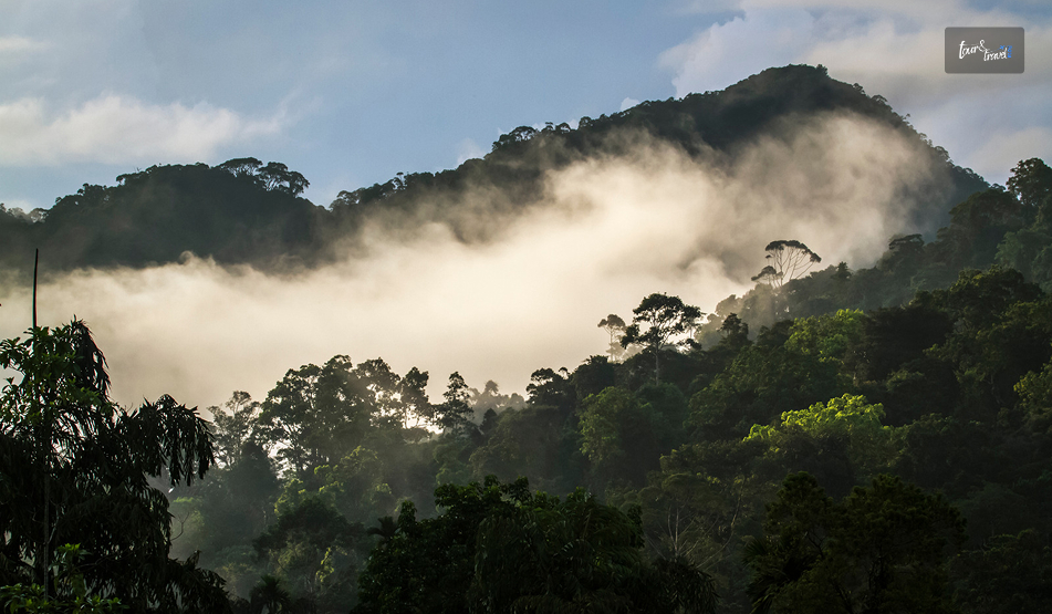
Sinharaja is wet, dense, and alive in a way none of the country’s safari parks are. 

Also, it doesn’t take long inside the canopy to understand why UNESCO calls it the island’s last viable stretch of primary tropical rainforest. 

The name means ‘Lion Kingdom’ in Sinhalese.  

Also, the forest earned its UNESCO World Heritage status in 1988, a decade after it was declared a National Heritage Wilderness Area in 1978 in response to government-sanctioned clear-felling.  

Conservationists and the March for Conservation movement pushed to stop the logging. What is left today, around 8,864 hectares in the country’s south-west wet zone, is the reason Sri Lanka still has a rainforest at all. 

Sinharaja Forest At A Glance 

Location South-West Wet Zone Spanning Sabaragamuwa and Southern Provinces 
Area About 8,864 Hectares 
UNESCO Status World Heritage Site since 1988 
Main Entrances Kudawa (North) Pitadeniya Deniyaya (South) Morningside 
Entry Fee Roughly LKR 2,700 (USD 15) Per Person Guide Charges Often Included in Tour Rates 
Best Time to Visit January to April August to September 
Known For 26 of Sri Lanka’s Endemic Bird Species 60%+ Endemic Tree Cover 
Guide Required?  Yes, Mandatory in the Core Zone 

Entry and guide fees are adjusted periodically. So, check current rates before you travel. 

Two Ways In: Kudawa Or Deniyaya

Sinharaja Forest Reserve: Inside Sri Lanka’s Last Rainforest

Sinharaja has several access points, and which one you choose shapes the whole trip.  

Kudawa 

Kudawa, on the northern side, is the most established entrance. It is home to the Rainforest Research Centre and the easiest place to arrange a local guide on short notice. 

It is the default choice for most first-time visitors.  

Deniyaya 

It is on the southern side, sits closer to Galle and the south coast, making it the more convenient option if you are combining Sinharaja with a beach stay rather than approaching from the hill country.  

There are also quieter entrances at Weddagala and Lankagama, better suited to serious birders who’d rather skip the more-visited trails entirely. 

I went in through Kudawa, mainly because I was routing down from Ratnapura, and found it well organised. 

A small visitor centre, a board of registered guides, and a clear sense that the rangers here take the guide requirement seriously.  

That is not a formality to skip. The trail network inside the core zone isn’t signposted, and entering without an assigned guide is not allowed. 

Finding A Guide Worth Having 

Arrive early by 6:30 or 7 AM if you can to get first pick of guides rather than waiting around mid-morning for whoever’s free.  

The good ones carry field notebooks, know individual bird calls from memory, and can tell you at a glance which species is endemic and which is not. 

It matters a lot in a forest where a large share of what you are looking at exists nowhere else.  

Tipping is customary and separate from the guide fee. A 500–1,000 LKR per person for a thorough half-day is a reasonable benchmark. 

What You Will Actually See

Sinharaja Forest Reserve: Inside Sri Lanka’s Last Rainforest

Sinharaja’s reputation rests heavily on its birdlife, and for good reason.  

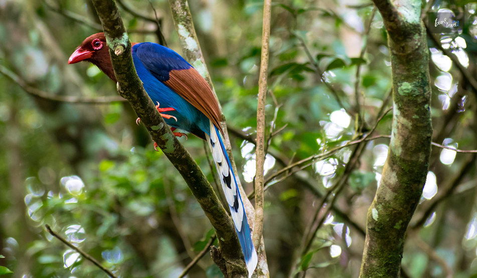
Close to 20 of Sri Lanka’s endemic bird species live here. The species include Sri Lanka blue magpie, red-faced malkoha, green-billed coucal, and ashy-headed laughingthrush.  

The real spectacle is not a single rare sighting, but the mixed-species feeding flocks locals call ‘bird waves.’  

A sudden, chattering rush of a dozen or more species moving through the canopy together.  

My guide seemed to time our walk around finding one, and when it happened, it was worth the wait. 

Mammals  

Mammals are a different story.  

Leopards and Indian elephants both live in Sinharaja, along with the endemic purple-faced langur. 

However, the dense canopy and thick undergrowth make sightings genuinely rare. 

So, don’t plan your visit around seeing one.  

Endemic Plants  

What you will see, reliably, is an extraordinary concentration of endemic plant life. 

Over 60% of the tree species in the core zone exist nowhere else on Earth, alongside rare amphibians, reptiles, and insects that make Sinharaja one of the world’s recognised biodiversity hotspots. 

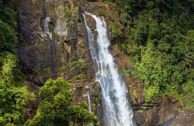
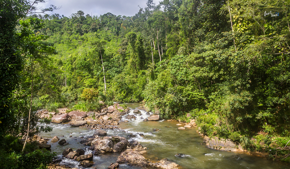
Streams and small waterfalls cut through the forest at several points, and they are some of the best rest stops on a longer walk. 

Slippery rocks and mossy banks rather than anything manicured, but a welcome place to sit with the sound of water after an hour of humidity and undergrowth. 

Not Untouched, But Genuinely Wild 

It is worth knowing that Sinharaja is not pristine wilderness in the strictest sense. 

Selective logging continued until the 1970s, and buffer zone villages still use parts of the surrounding land.  

But the core zone has regenerated substantially, and walking into it, the canopy closes overhead within minutes in a way that immediately feels different from anywhere else I visited in Sri Lanka.  

It is less a technicality than a reminder of how close the country came to losing this forest entirely. 

That is why the conservation fight over it in the 1970s still shapes its management today. 

Practical Tips For Visiting Sinharaja Forest Reserve

Sinharaja Forest Reserve: Inside Sri Lanka’s Last Rainforest

Here are the things you need to keep in mind about what to carry, how to reach Sinharaja Forest Reserve, and the duration of your time here.  

What To Wear And Bring 

Bring leech socks (available cheaply near the entrances) or high boots tucked into trousers, a light rain jacket regardless of season, binoculars if birding is any part of your interest, and a reusable water bottle.  

The humidity is constant, so pack lighter layers than you’d expect for a ‘forest’ hike. 

How Long To Plan For 

A guided walk typically runs two to five hours depending on your pace and chosen trail. A standard loop from Kudawa is often around three hours.  

If you are serious about birding, build in a full morning. The best activity clusters between roughly 6:30 and 10 AM, after which the forest quiets down and the heat picks up. 

Getting There 

The nearest major towns are Ratnapura and Galle. Neither entrance has access to direct public transport. 

So a hired vehicle or pre-arranged tour is the practical option.  

Several south-coast-based tours run day trips from Galle, Bentota, and Hikkaduwa if you would rather not organise transport yourself. 

Where This Fits In A Sri Lanka Itinerary 

Sinharaja pairs naturally with a hill country or south coast loop. You can visit it either as a detour from Ratnapura’s gem country or as a rainforest counterpoint to a beach-heavy stretch of the south.  

It is a full-day commitment once you factor in travel, entry, and the walk itself. So, I would avoid trying to squeeze it in alongside another major activity on the same day.

Share on Social Media

Sibashree is a travel, culture, and leisure writer who has been writing since the age of 12 and professionally since 2014. With more than a decade of travel writing experience and journeys across India and several parts of the world, she brings a deeply personal and thoughtful perspective to her work. A student of English Literature and Mass Communication, Sibashree has always viewed travel as more than movement — for her, it has been a way of understanding people, cultures, and herself. Her passion for spiritual exploration has also led her to many unusual and meaningful destinations over the years. Outside of writing, Sibashree enjoys watching European cinema, reading about global politics, and reflecting on the stories hidden within everyday places.

Leave a Reply

Your email address will not be published. Required fields are marked *

title-img Related

READ MORE bambarakanda

Bambarakanda Falls: A Trek To The Tallest Waterfall In Sri Lanka, Location And Everything You Must Know

BY  Sibashree Aug 27, 2026

Most waterfalls in Sri Lanka announce themselves with a roar from half a kilometer away. However, Bambarakanda Falls was different.   It has a thin water flow, and as it drops far, I could only hear the sound of the waterfall when I was standing directly under it.   However, it is the tallest in the country, and I could not find the top even after craning my neck all the way back.   The Story Behind The Name Of The Bambarakanda Falls The name comes from Bambara. In the Sinhalese language, Bambara means wasps.  The rock face around the falls was once a prominent colony of wasps.   However, before the waterfall became known as Bambarakanda,  it was called Bambarakele Falls and Dultota Falls.   What struck me more than the etymology was how quiet the setting is compared to its size and fame.  This is not a waterfall with restaurants and gift shops crowding the base, just pine forest, a rough access road, and the sound of falling water.  Where Is Bambarakanda Falls? Bambarakanda Falls is close to the small town of Kalupahana in the Badulla District. It is also near the boundary of the Horton Plains National Park.   Kuda Oya, a modest stream, is the source of this waterfall.   However, it transforms into the most dramatic tributary the moment it reaches the cliff edge above Kalupahana and drops in a single, thin, horsetail plunge.   Furthermore, this waterfall is around 200 km away from Colombo. The distance between Bambarakanda Waterfall and Belihuloya is just 18 km.   So, Bambarakanda Falls easily fits into the itinerary if you are in the Central Highlands of Sri Lanka or on the Ella–Haputale–Horton Plains corridor.   How To Reach Bambarakanda Falls? Bambarakanda is easily accessible from Colombo by road and train. Here are the details.   From Colombo By Road  The most common route is Colombo to Ratnapura to Belihuloya to Kalupahana, following the A4 highway toward Beragala.   At Kalupahana Junction, a signposted turn-off leads onto a narrower road that runs for roughly 5 km through Weerakoongama's pine and tea plantations before reaching the parking area.   The final stretch is rough enough in places that not every car will manage it comfortably.  So a tuk-tuk from the junction is a popular last-mile option if you're not driving a higher-clearance vehicle.  By Train And Bus  If you're relying on public transport, the nearest useful rail stop is Ohiya.  From Ohiya, you will still need a taxi or tuk-tuk to cover the remaining distance.   Buses running the Colombo–Badulla A4 route will drop you at Kalupahana Junction, where three-wheelers wait to ferry visitors up the access road for a small fixed fare.  The Trek To The Base  From the parking area, I had to take a flight of steps to reach the base of the waterfall. The flight took around 10-15 minutes.   It was an easy trek as I passed through a pine forest. Also, compared to places such as Sinharaja, the leeches were way fewer in number throughout the route.   However, with the pine needles scattered on the ground, it was a bit slippery. So, you need to wear proper walking or trekking shoes.   As I reached the base of the waterfall, I found a shallow pool, perfect for wading. Also, if you want to remain dry and want to appreciate the scale of the waterfall, you can watch the waterfall from the concrete viewing platform.   Climbing To The Top: The Devil's Staircase  If you want more adventure, you can take the steep trail nicknamed the Devil's Staircase, winding up the mountainside to the crest of the falls.  Remember that this stretch, leading to the top, is a proper hiking route. It is not like strolling anyway!  The elevation here is several hundred meters through pine and mixed forest. So, even if the weather is a little bad, you must not attempt this.   The reward at the top is a small natural infinity pool and a miniature waterfall feeding into the main drop, along with sweeping views down the valley toward the eastern plains.   A short trek from the base also leads to Lanka Ella, a smaller waterfall nearby whose shape is sometimes said to resemble the outline of Sri Lanka itself.  What Is The Best Time To Visit The Bambarakanda Falls? Honestly, the guides on the best time to visit Bambarakanda Falls are mostly confusing.   Some sources say that March to May is the ideal time for a visit to this waterfall. Indeed, going for a trek is safest in this season, as the flow is modest and the trails are less slippery.   However, if you want to see the most dramatic version of the waterfall, May to September is the ideal window.   I am someone who is always in for the later window. Visiting shortly after rain gave me a fuller view of the fall, and it was the most photogenic.   A dry spell, on the other hand, makes the waterfall look thinner.   What Are The Attractions Near Bambarakanda Waterfalls? Some of the best-known sights of the Sri Lankan Central Highlands are very close to Bambarakanda Waterfalls.  Horton Plains National Park and World's End are a scenic drive away. Haputale, with its cooler climate, tea estates, and views toward the southern coast on a clear day.  Haputale further makes a good overnight base. Also, if you are continuing along the A4, Belihuloya offers river-adjacent guesthouses and a much gentler pace than the falls themselves.  Practical Travel Tips  If you are planning to capture the beauty of the waterfall, you should pack wide-angle lenses.   The waterfall is so tall that, considering how close you stand, fitting the entire cascade into one frame from the base is genuinely difficult.  Furthermore, if you are driving yourself to the waterfall, budget extra time for the access road, which is narrow, occasionally rutted, and best driven slowly regardless of your vehicle.  A Few Things I Wish I Had Known  It was a mistake on my part to underestimate the remoteness of the final stretch of the road.  The stretch was just a few kilometers off the main A4 Highway. Still, once I quickly reached the pine forest, there was no phone signal for the majority of the route leading to the base.   Furthermore, you will have to bring cash, as digital payments or cards are not accepted at the entrance or along the trail.  Also, barring the odd roadside stall near the junction, you will not find much food.   Moreover, if you are on the Devil's Staircase climb to the crest, go early in the day. Clouds tend to roll in by early afternoon and can turn a rewarding view into a very damp anticlimax.  Where To Stay Near Bambarakanda Falls  You will not find real accommodation facilities right at the falls.   As convenient options, you can base yourself in Haputale or Belihuloya. You can reach both locations within 30-40 minutes by car from Bambarakanda.   Haputale sits higher up and cooler, with a scattering of small guesthouses and a couple of well-regarded boutique stays that make a good stop if you are also planning to see World's End at Horton Plains the next morning.   Belihuloya, down in the valley, has a handful of riverside guesthouses that suit travelers who'd rather relax by moving water than climb toward it after a long day on the road.   Either option works as a base for a half-day dedicated to Bambarakanda, with enough flexibility to add Horton Plains or a tea-estate walk without much extra driving.

READ MORE Kilinochchi

Kilinochchi, Sri Lanka: The De Facto Capital Of Tamil Tigers Teaching The Story Of Recovery

BY  Sibashree Jul 21, 2026

Killinocchi is a place where the sparks of protests are not extinguished completely.  As I am penning this article in July 2026, the arrest of the Tamil rapper Sangeethsan and the protests of the locals condemning the PTA, or Prevention of Terrorism Act, a month back, make me concerned.  The Kilinochchi District Civil Organisations were behind the demonstrations, and the theme was “Let us unite to break the chains around our voices.” In plain sight, Killinochi is a town where paddy fields, temple bells, and war memorials share the same stretch of road. However, if you want to know about the history of this town and understand how it is getting rebuilt after the Civil War, you need to spend some time in Killinochi.  Moreover, of all the places I have covered on my Sri Lanka trips, Vavuniya and Mannar had already told me that the Northern Province holds a different Sri Lanka altogether. Also, Northern Sri Lanka does not sit on any typical bucket list. Kilinochchi is the next chapter of that same story. Kilinochchi: Quick Facts ProvinceNorthern Province, Sri LankaDistrictKilinochchi DistrictDistance from JaffnaAround 330 kmMain HighwayA9 (Kandy-Jaffna Highway)Founded1936, as a colonization settlement for Jaffna's farmersFormer StatusDe facto administrative capital of the LTTE until 2009Main LivelihoodPaddy farming and agricultureBest Time to VisitThe dry season from May to September Where Is Kilinochchi And How Do I Reach It? Kilinochchi is on the A9 Highway that connects Jaffna to Kandy.  I was traveling from Anuradhapura, and I reached Kilinochchi after three hours in a car. After Vavuniya, it was Kilinochchi that Ravi introduced me to.  However, you can travel to Kilinochchi by train and bus.  Traveling By Train  However, if you are traveling from Colombo, you can take the train on the Yal Devi Line continuing to Jaffna.  Overall, it is a train journey of 5-6 hours. This is one of the most beautiful train journeys of Sri Lanka, with the landscape flattening out into dry-zone scrubland somewhere past Vavuniya. 44089 Kankasanthure Night Mail - Moratuwa - Kankesanthurai, 444421 Intercity Express - Mount Lavinia - Kankesanthurai, and 44477 Yal Devi - Colombo Fort - Kanakasanthurai are the trains plying on this route. A ticket for the second-class reserved category will cost LKR 1700, and the ticket price for the AC saloon car will be between LKR 2400 and LKR 3000.  Traveling By Bus  If you are a backpacker, you can also board a Colombo-Jaffna or an Anuradhapura-Jaffna bus.  You will get semi-luxury and premium-luxury bus options on this route, and the travel time will be around 7 hours.  Also, the ticket price will be between LKR 1800 and 3000. What Is The History Of Kilinochchi? The history of Kilinochchi goes back to 1936.  In the same year, Kilinochchi was constructed as part of a colonization scheme meant to ease overcrowding and unemployment in Jaffna.  The farmers came here to take part in paddy cultivation supported by government land grants. However, the recent history of the Sri Lankan Civil War has primarily shaped it today.  Kilinochchi was the de facto administrative capital of the LTTE (Liberation Tigers of Tamil Eelam) during the final phase of the civil war.  At the same time, Jaffna, with its strong Tamil base, remained under government control.  Then, with the Sri Lankan forces closing in on Kilinochchi in December 2008, the LTTE forced many civilians to flee with them toward Mullaitivu. Thus, the LTTEs used the civilians here as human shields.  However, before fleeing the town, the LTTEs blew up the town's main water tower in an act of scorched-earth destruction, cutting off the town's water supply in an already dry region. Nevertheless, the Sri Lankan army took charge of Kilinochchi on 2nd January 2009.  It was one of the major landmarks toward the end of the Civil War, and it finally ended in May 2009.  After that, Kilinochchi has worked on rebuilding itself.  It now has new water infrastructure, roads, and returning farming communities. Today, it stands as a quiet marker of how a place absorbs a violent past and keeps going. My Day In Kilinochchi Kilinochchi offers a sobering experience, and once you get involved in the history of the Civil War, most of your time will go into pondering and understanding what actually happened.  Nevertheless, here are the highlights of my day in Kilinochchi. 1. The Story Of The Water Tower Ravi first took me to the fallen water tower.  For years, the collapsed remains of the tower bombed by the LTTE in 2008 lay exactly where they fell, fenced off as an informal memorial along the highway. However, in 2020, the structure was finally removed to make space for a new building. While I could not see the fallen tower, it was not difficult for me to visualize the anarchy and destruction.  This was a monument not to victory or grandeur, but to how war strips away the most basic necessities, in this case, clean drinking water in a region where water is already scarce. 2. The Kilinochchi War Memorial The Kilinochchi War Memorial was very close to Kilinochchi Town. It commemorates how the Sri Lankan military recaptured the town in 2009.  I had mixed feelings as I approached the site.  The memorial itself is a straightforward structure offering you the moment of truth.  However, of course, you will interpret the truth depending on which side of the conflict's history you come from. I found a few tourists taking photos of the memorial. However, I spent the time talking to the locals, and I tried to understand what the final months felt like.  3. Elephant Pass The Elephant Pass was just a short distance away from the town of Kilinochchi.  It is a narrow strip of land that connects the mainland to the Jaffna peninsula.  This was one of the most fiercely contested locations throughout the entire civil war, changing hands multiple times between government forces and the LTTE. However, when you visit it today, you will only see a quiet causeway with the Elephant Pass lagoon stretching out on either side. Still, the personnel there will share the details of the war if you approach them.  4. Iranamadu Tank Visiting the Iranamadu Tank was a welcome break after exploring the grim history of civil war in Kilinochchi.  It is one of the largest man-made reservoirs in the region. It was originally built for the water supply to the surrounding paddy fields.  I visited the tank in the late afternoon and spotted local fishermen rowing out onto the water. A few egrets were also picking through the shallows.  5. Chundikulam National Park Chundikulam National Park is a delightful detour if you are visiting Kilinochchi in the winter migratory season.  This wetland hosts large flocks of Greater Flamingos. Furthermore, many other migratory birds pass through the brackish lagoon system in this season.  I did not manage to see the flamingos myself, as I visited outside the migratory window. However, locals I spoke to described early mornings here as one of the best birdwatching experiences in the entire Northern Province. 6. The Local Temples And Kanagapuram Kovil Like the temples in Jaffna, Kilinochchi's Tamil Hindu identity shows up in its temples or kovils. I stopped briefly at Kanagapuram Kovil, a modest temple with local visitors. Also, don’t forget to visit the Kaala Vairavar Temple when you are in Kilinochchi.  7. The Kilinochchi Market Before heading out of town, I walked through the local market, where vendors sold fresh produce, dried fish, and simple Tamil snacks. It was a good reminder that beneath the weight of Kilinochchi's recent history, everyday life here continues much like anywhere else in rural Sri Lanka. What To Eat In Kilinochchi The food in Kilinochchi has the same Tamil roots as the food in Jaffna.  It was a great experience trying Thosai and Idiyappam for breakfast and dinner in a rural setup.  Also, the coconut sambal and sambar were great and spicier than what we are used to having in South India.  Kothu Roti, a chopped roti stir-fried with vegetables, egg, and spices, is another filling option for lunch. Also, you cannot miss the Jaffna-Style Crab Curry. It is a spicy and tangy curry. Pittu, steamed rice flour with grated coconut, is another Tamil staple worth trying here. I ate at a small, no-frills eatery near the town center, and it remains one of the more memorable simple meals of my entire Sri Lanka trip. Where To Stay In Kilinochchi Accommodation options are limited in Kilinochchi, and you will only find budget and mid-range guesthouses and small hotels in the town center. So, if you are planning to spend a night in Kilinochchi, expect modest, rural hospitality.  What Is The Best Time To Visit Kilinochchi? May to September, or the dry season, is the most ideal time for a visit to Kilinochchi.  However, remember that the Northern Province of Sri Lanka is punishingly hot at midday, irrespective of the season of the visit.  Furthermore, if birdwatching at Chundikulam National Park is on your list, plan your visit around the winter migratory season instead.

READ MORE Hurulu Eco Park

Hurulu Eco Park Safari: Exploring The Wilder Side Of Sri Lanka

BY  Sibashree Mar 16, 2026

After Kaudulla National Park and Dehiwala Zoo, the Hurulu Eco Park was another destination for me to explore Sri Lanka’s wildlife.  If places such as Jaffna in northern Sri Lanka and Kandy in Central Sri Lanka have been the cultural hubs of the country, these parks have shown how people have lived here since eternity in collaboration with nature and wildlife.  The Hurulu Eco Park is especially very close to Habarana, the epicenter of cultural and historical landmarks such as the Sigiriya Rock Fortress, Pidurangala Rock, Ritigala Forest Monastery, and Ritigala Forest Reserve.  The distance between Habarana and the Hurulu Eco Park, at the edge of the Hurulu Forest Reserve, is just around 3 to 4 kilometers. However, despite the short distance, this eco park is quiet and understated.  Also, you know what makes Hurulu Eco Park different? Here, you relish the art of slow traveling and the scent of wet soil after a fresh spell of rain.  Furthermore, elephants are the heart of this eco park, and watching them grazing through the golden light is a delight.  Here is more about this beautiful eco park in Sri Lanka.  Hurulu Eco Park, Sri Lanka: Quick Details  Hours Open7 AM to 6 PMLast Time to Enter5 PMPark Entrance Fee- $15-25 for an Adult- $5 for Children above 6 Years- Free for Children below 6 YearsSafari Cost$65 OnwardSafari DurationAround 3 HoursBest Time to VisitDecember to June Where Is Hurulu Eco Park And How To Reach?  In Sri Lanka’s North Central Province, Hurulu Eco Park is between the landmarks such as Polonnaruwa (1 hour and 15 minutes), Anuradhapura (1 hour and 50 minutes), Dambulla (45 minutes), and Sigiriya (45 minutes).  So, often there is a safari add-on to explore these ancient cities and the cultural landmarks.  Furthermore, as mentioned, it is closest to Habarana. So, ideally, it should be your base.  Habarana also has many budget, mid-budget, and luxury accommodations. Moreover, most hotels in Habarana, Dambulla, and Sigiriya offer door-to-door safari facilities.  You can expect a pick up around one hour before the safari time.  Moreover, you can take a train from Trincomalee, Kandy, or Colombo to reach Habarana Junction. From there, you can take a 10-minute tuk-tuk ride to reach the eco park.  However, online booking for these train tickets may not work most of the time.  The Landscape Of Hurulu Eco Park  Hurulu Eco Park is a mix of open plains, rock, and jungle.  Furthermore, as a part of the dry evergreen forest area of Sri Lanka, it functions as an important corridor for elephants roaming between Minneriya and Kaudulla National Parks.  So, you can easily spot Sri Lankan elephants here, especially the mothers and babies making small groups and moving.  Along with elephants, you can also spot peacocks, spotted deer, macaques, langurs, and many birds here.  What I Saw At Hurulu Eco Park  I was initially disappointed the day I had to visit the Hurulu Eco Park. I thought that the tropical rain would mess up my safari experience.  However, I opted for an afternoon safari, and by the time I reached Hurulu, except for the heavy dampness in the air, everything was fine.  Also, the mud on the track was not a problem to start the safari in full swing.  After a few turns in the park, I could spot a herd of elephants, and they were winding up leaves and fruits with their trunks. Moreover, they were flapping their ears.  Then, after waiting for 15 minutes, the herd passed by and we continued our safari.  We passed through rocks, canopies, and bushes. I spotted a peacock and monkeys before reaching an open land. And that was the moment of the entire safari.  At least 25 elephants were grazing, and the younger ones were rolling in the mud.   Finally, the air became cooler, and the sky started getting red. So, our jeep driver planned a return.  How To Plan A Safari In The Hurulu Eco Park?  Safaris in Hurulu Eco Park include a guide, a jeep, park entry, and a pickup and drop off from Hurulu Eco Park.  Morning safaris are the best, ideally starting from 7 AM. Furthermore, like me, you can also opt for an afternoon safari at 1 PM.  Furthermore, each jeep carries about 6 tourists. Also, you must carry some water, wear sunscreen, and a hat. What Is The Best Time To Visit Hurulu Eco Park? The best time to visit Hurulu Rco Park is between December and June. Especially, February to April is the ideal time to see the lush landscapes and the biggest elephant herds.  Furthermore, the number of jeeps is quite low in these months.  Again, from May onward, the conditions become drier, and the elephants start moving from the Kaudulla National Park to the Minneriya National Park. So, in Hurulu Eco Park, you will notice smaller herds of elephants.  Moreover, from October to January is the wet season, and the jungle becomes the most vivid. So, these months are the best for photographers.  Photography Tips For Hurulu Eco Park  You will find a mix of open plains, forest shades, and red earth in Hurulu Eco Park. So, the landscape is challenging yet interesting for photographers.  Furthermore, for photography, you must bring a 70-200 mm lens. It is ideal to capture wildlife, and the wider lens is the best to frame the color and scale of Hurulu Eco Park during the golden hour.  Moreover, after the rain, the conditions become more ideal for photography. Grey elephants, red dust, and the green foliage create wonderful frames.  Again, the light filters through the tree branches becomes low in the late afternoon. So, you can capture the texture and warmth of the Hurulu Eco Park. Things To Keep In Mind For A Visit To Hurulu Eco Park  Do not use single-use plastic bottles during the safari to minimize the impact on the environment, wildlife, and marine life.  Furthermore, keep the water use to a minimum level to reduce the pressure on water resources.  Moreover, collect your souvenirs from the local shops and eat at the local eateries to help the economy of the community.