

The Closest Beach To Knoxville, TN: Know The Best Getaways

Sep 20, 2023

Last Updated on: Jun 10, 2025

Travel Guides

Does Tennessee have a beach? No, it does not. 

For the longest time, I have been planning a long beach holiday. And something or else will always turn up ruining the plan. 

The kids have their exams and there are family commitments. So, our beach vacation was always limited to Douglas Lake or Cherokee Lake. 

However, I had done my research on the closest beach to me and this time, we had a long weekend. 

So our road led to Sullivan’s Island, the closest beach to Knoxville, TN. Having said that, there are many beaches near Knoxville TN. 

For example, Myrtle Beach in South Carolina is one of the most popular ocean beaches near Tennessee. We also have Folly Beach in South Carolina and Oak Island in North Carolina. 

In today’s Tour and Travel blog, we will talk about the beaches close to Knoxville TN, and tell you why they are most suitable for the ultimate Tennessee beach vacation.

What Is The Closest Beach To Knoxville Tennessee? 

What Is The Closest Beach To Knoxville Tennessee? 

Our journey to the closest beaches to Knoxville TN will start from Sullivan’s Island, as promised. 

However, before taking you on a tour of these beaches, I wanted to share the best time to visit the closest beach from Knoxville TN. 

Knoxville primarily has two tourist seasons. You can visit the closest beach to Knoxville, TN between March and June and September to November. 

So, let’s begin the ultimate Knoxville beach journey. Here we go! 

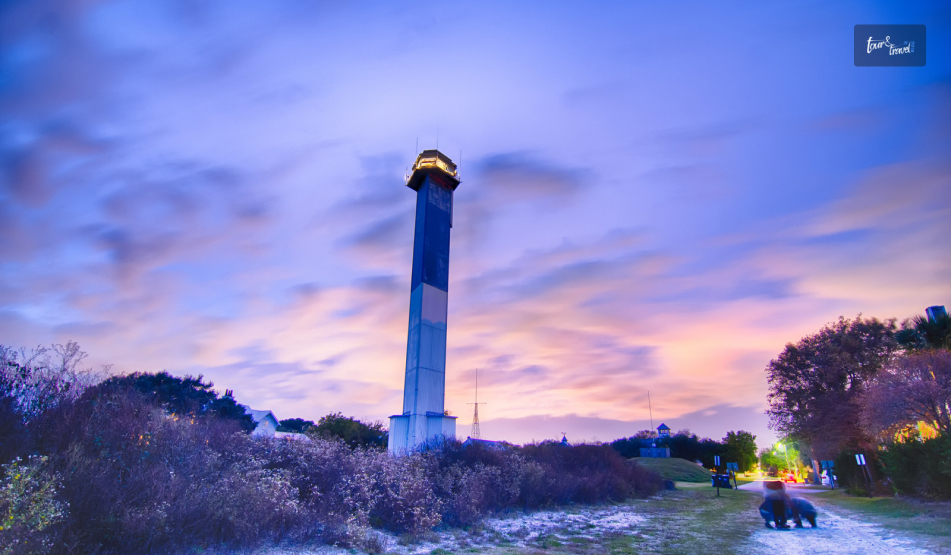
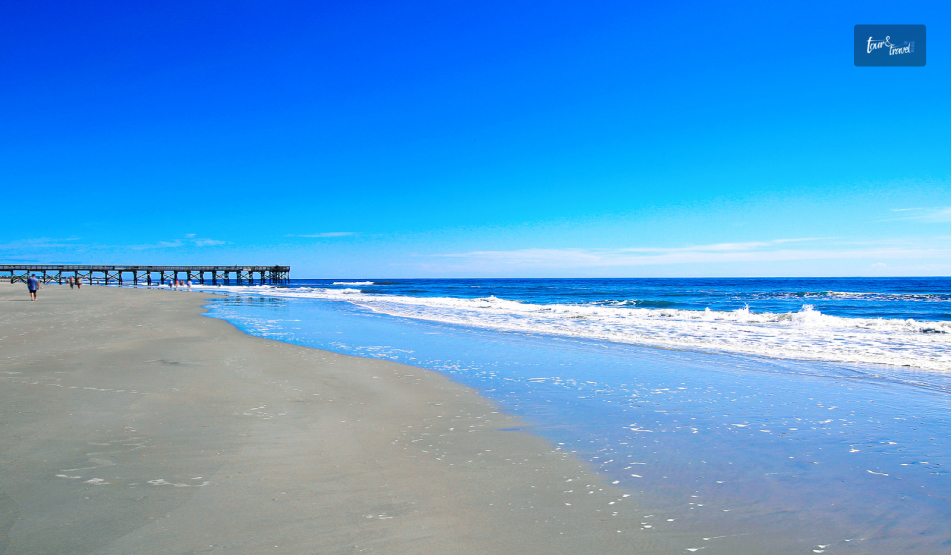
1. Sullivan’s Island, South Carolina

Sullivan’s Island, South Carolina
  • Distance from Knoxville: 380.4 Miles
  • Travel Time: 6 Hours

I was looking for ocean beaches within 6 hours of me, and I found out Sullivan’s Island. It is a barrier island with an area of around 8.91 km². 

Further, Sullivan’s Island, the closest beach to TN, stands out with its local history. It has Fort Moultrie, built in 1776 and it still tells the story of how it protected the city from the cannonball attacks of the warships. 

Moreover, Sullivan’s Island is important in the history of literature. Edgar Allan Poe was stationed at Fort Moultrie between November 1827 to December 1828.

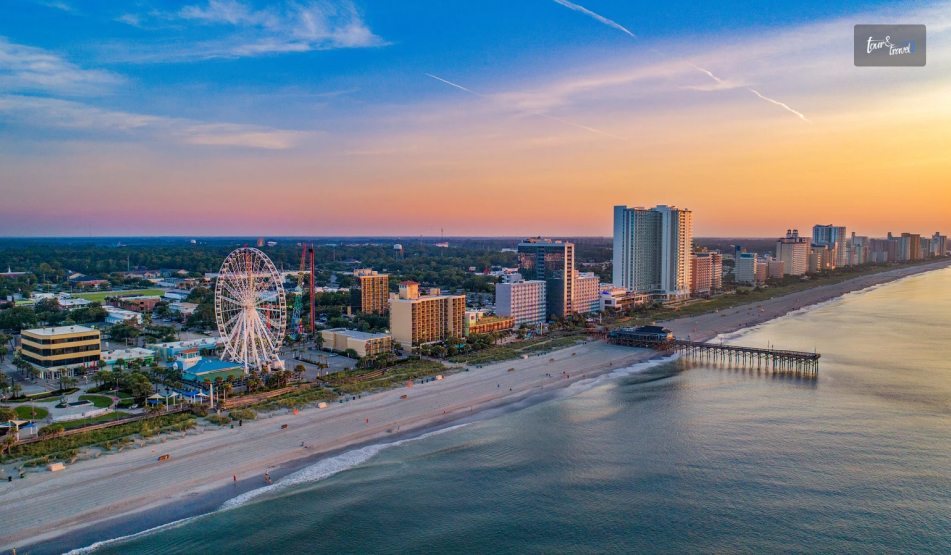
2. Myrtle Beach, South Carolina

Myrtle Beach, South Carolina
  • Distance from Knoxville: 412 Miles
  • Travel Time: 6 Hours 46 Minutes

Sitting in Knoxville, I was looking for beaches within 7 hours of me. I found the name of Myrtle Beach in South Carolina. 

Myrtle Beach is nothing short of a fantasy island and it was once the hub of pirates. Further, Myrtle Beach is associated with the Indigenous people and roaming ghosts. 

A visit to Myrtle Beach is incomplete without exploring the Ripley’s Aquarium of Myrtle Beach. Further, you must spend some time at the Myrtle Beach State Park, and Myrtle Beach Pinball Museum. 

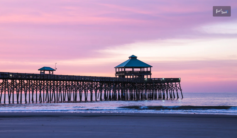
3. Folly Beach, South Carolina

Folly Beach, South Carolina
  • Distance from Knoxville: 383 Miles
  • Travel Time: 6 Hours 35 Minutes 

Folly Beach, one of the closest beaches to Knoxville, is the ultimate destination to stay, eat, play. and explore! 

Further, life on Folly Beach revolves around outdoor activities. From a casual stroll on the beach to more adventurous activities like surfing, boating, kayaking, and biking, Folly Beach offers you the opportunity to enjoy the best beach vacation. 

Moreover, Folly Beach is a wonderful melting pot of modern entertainment and exploring wildlife. You can attend the Annual Folly Festivals and take part in birdwatching and exploring wildlife. 

Blu Restaurant And Bar, Bert’s Market, and Bounty Bar are some popular places to eat on Folly Beach. 

4. Kiawah Island, South Carolina

Kiawah Island, South Carolina
  • Distance from Knoxville: 396.5 Miles
  • Travel Time: 6 Hours 30 Minutes

Kiawah Island with a majority of marshland, is located at a distance of 6 hours and 16 minutes by car from Knoxville. 

To emphasize the adventure, let me tell you that the beach is often used for native wildlife watching!

Several locations across the beach are perfect if you are looking for wildlife spotting! The two locations popular for this purpose on the beach are Canvasback Duck Pond and Marsh Island Park.

What’s more, there are two scenic observation towers in Kiawah where you will get a 360-degree view of the sea and land! 

If you are a hiker or like to bike, this beach is perfect! They have natural paths for these types of adventures.

For accommodation, there is a private 2nd story deck that you can rent to enjoy some stunning ocean views. 

There is one popular restaurant called Jasmine Porch where you can splurge on good food, especially the Low-country favorites such as shrimp and grits, she-crab bisque, fresh seafood, po’boys, and burgers!

5. Isle Of Palms, South Carolina

Isle Of Palms, South Carolina
  • Distance from Knoxville: 383 Miles
  • Travel Time: 6 Hours 30 Minutes

There is a playground for children, so this is the perfect destination if you have kids. 

There is also a picnic area, so if you plan to spend the whole day out, you can go to this beach. For accommodation, there is a single-family cottage which is well decorated!

Food is another important part of the vacation, so I suggest the Sea Biscuit Cafe! Try out the seafood omelets, shrimp, and gravy because these are the low-country options.

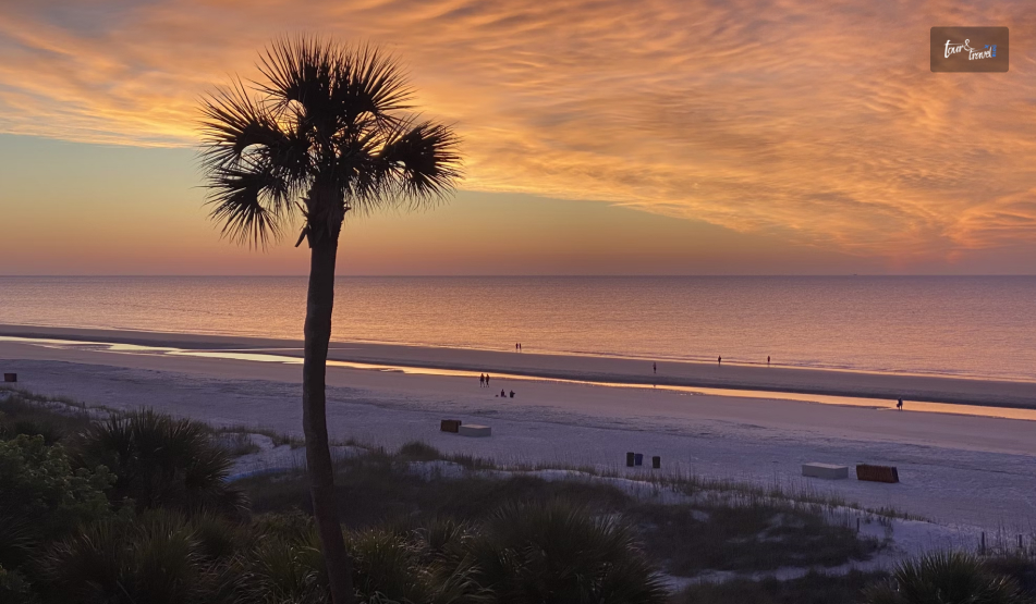
6. Hilton Head, South Carolina

Hilton Head, South Carolina
  • Distance from Knoxville: 411 Miles
  • Travel Time: 6 Hours 32 Minutes

You have to visit this beach for the best sunsets across the water! In a distance of 6 hours, 26 minutes from Knoxville, the coastal paradise is someplace to be visited. 

If you are planning on staying the night, there is a resort rental that you can book. You can enjoy the outdoor and indoor pool, a tiki bar, etc.

You must catch the coastal area food, especially crab cakes, sandwiches, shrimp, grits, and salads. 

7. Oak Island, North Carolina

Oak Island, North Carolina
  • Distance from Knoxville: 441.5 Miles
  • Travel Time: 7 Hours 14 Minutes

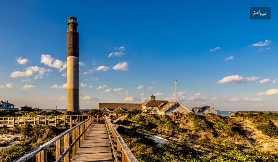
If you are looking for a scenic beach, Oak Island is the place to visit for all adventurous activities. 

Water sports are quite famous here, along with that, you can see Fort Caswell, used in the 1800s and 1900s. This is one of the beaches near Knoxville TN!

You will take 7 hours and 8 minutes to reach the beach and can visit the island lighthouse, which is situated just beside the fort. 

There is a perfect walk to enjoy Oak Island Nature Center at the beach, so if you are a nature lover, you know where to go!

Further, adventures such as kayaking are the thing to do as an outdoor adventure sport. Many family homes and rentals are at a distance of the March beach, providing incredible views across the beach.

If you visit the beach, you must try out scrumptious food items such as steak, chicken, and pasta, apart from the delicious seafood.

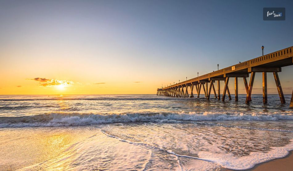
8. Wrightsville Beach, North Carolina

Wrightsville Beach, North Carolina
  • Distance from Knoxville: 442 Miles

The beach is a little farther from Knoxville, TN, as it takes about 7 hours and 23 minutes. 

There are three beaches in Wilmington: Kure, Carolina, and Wrightsville. All the beaches qualify as some of the best beaches near Knoxville.

Apart from common activities such as shopping and dining, there are interesting activities to perform, such as going on catamaran cruises, visiting the History Museum, and attending fairs and seasonal festivals.

The Fred and Alice Stanback Coastal Education Center organizes educational programs and treasure hunts for children. 

IIn terms of food, you will find some of the best cheeseburgers at this closest beach to Knoxville, TN! If you are a picky eater, you will find various options, from steaks to seafood platters.

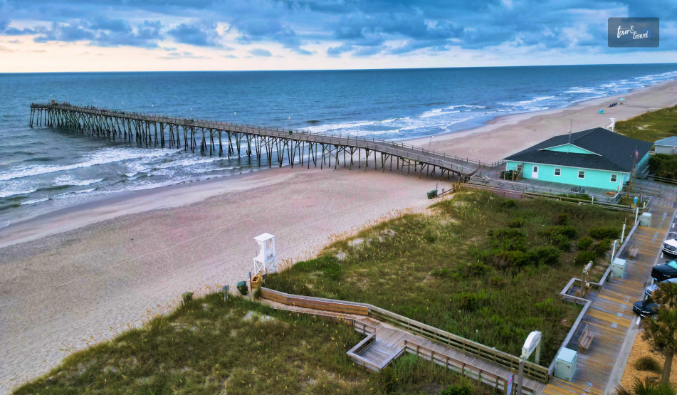
9. Kure Beach, North Carolina, Closest Beach To Knoxville, TN

Kure Beach, North Carolina, Closest Beach To Knoxville, TN 
  • Distance from Knoxville: 449.5 Miles
  • Travel Time: 7 Hours 30 Minutes

The beach at Kure is beautiful, apart from the North Carolina Aquarium, which is situated at Fort Fisher. 

Significant features are located at the beach, such as a nature play area, an adventure reef, and touch tanks.

This beach is located at a distance of 7 hours and 31 minutes. 

Apart from the beach, you can also visit places such as the historical site of the Civil War Museum, the Fort Fisher State Site, beach cruises, a dog park, and a playground in front of the beach.

You cannot miss the food such as burgers, sandwiches, seafood and pasta! I am already drooling!

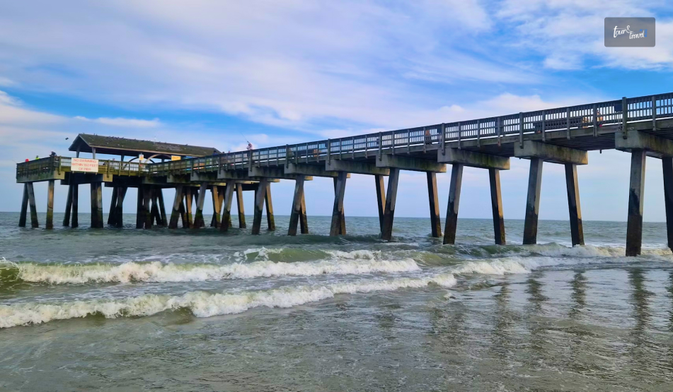
10. Tybee Island, Georgia: Closest Beach To Knoxville, TN

Tybee Island, Georgia: Closest Beach To Knoxville, TN
  • Distance from Knoxville: 434 Miles
  • Travel Time: 7 Hours

The beach is located at a distance of 6 hours and 55 minutes by road from Knoxville. Some of the place’s main attractions are the restaurants and the quaint little shops. 

The beach is popular for people finding their relaxing haunt near Tennessee. Considering, it is the closest beach to Tennessee!

It is a low-key beach situated just outside of Savanah! Apart from relaxing on the beach, you can also access different amenities in Savanah, such as museums, historic architecture, upscale shops, ghost tours, and other attractions perfect for family outings.

Beautiful rentals are close to the beach and a 1-minute distance from where you can enjoy some stunning visuals. 

The food available in and around the place is quite popular! One such restaurant is located near the waterfront called Bubba Gumbo.

The seafood Gumbo is their signature dish! You can also order fried fish, jambalaya, burgers, and crab cakes. They also popularly serve shrimp.

11. Simon’s Island, Georgia: Closest Beach To Knoxville, TN

  • Distance from Knoxville: 491.2 Miles
  • Travel Time: 7 Hours 32 Minutes

The beach is situated at a distance of 7 hours and 42 minutes from Knoxville, TN! The beach Oasis is a perfect place to relax, especially with all the amenities present to make your life easier. 

The Neptune Park Fun Zone here is for family attractions.

You can also find a store to rent accessories for water sports restaurants, and several shops provide you with good food and the necessary equipment for the beach vacation, such as sunscreen, sunglasses, and others.

There is one family beach rental along with its private swimming pool. The rental can host a family, which is pretty close to the lighthouse. 

You cannot miss the delicious food available on this closest beach to Knoxville, TN! Once such a restaurant opens, Porch offers fried catfish, shrimp, and fried chicken.

Read Also:

Share on Social Media

Sibashree is a travel, culture, and leisure writer who has been writing since the age of 12 and professionally since 2014. With more than a decade of travel writing experience and journeys across India and several parts of the world, she brings a deeply personal and thoughtful perspective to her work. A student of English Literature and Mass Communication, Sibashree has always viewed travel as more than movement — for her, it has been a way of understanding people, cultures, and herself. Her passion for spiritual exploration has also led her to many unusual and meaningful destinations over the years. Outside of writing, Sibashree enjoys watching European cinema, reading about global politics, and reflecting on the stories hidden within everyday places.

Leave a Reply

Your email address will not be published. Required fields are marked *

title-img Related

READ MORE Tucumán wine tour guide

The Best Tucumán Wine Tour Guide: How To Explore The Higlands Of Northern Argentina?

BY  Sibashree Jan 13, 2026

Along with the cultural richness of Tucumán, what hooked me was the community bonding and development. For the longest time, grape growing has been a part of local life. Now, in 2016, the Bodega Los Amaichas built the Amaicha del Valle community to take the local tradition and use it for the benefit of local people. It is the first indigenous community-owned winery in South America. Furthermore, Mendoza may get all the spotlight as the home of world-class Malbecs. But for travelers like me, who want a more rugged and authentic experience, Tucuman is the ultimate destination in Northern Argentina. Also, the wine tour in Tucuman is almost like a time capsule. The viticulture here is defined by family legacies, indigenous roots, and vineyards that touch the clouds.  In this Tucumán wine tour guide, I will talk about why Tucumán is an alternative to Mendoza, the route, the top wineries, and the specialty of local wines. For more on this beautiful province in Northern Argentina, you can check out my Tucumán Argentina itinerary. Why Is Tucumán The "Untouched" Alternative To Mendoza?  The flat plains of Mendoza are ideal for massive production. However, the vineyards of Tucumán are in the narrow folds of the Calchaquí Valley. So, the experience in Tucumán is more like a boutique. Furthermore, there are very few crowds in Tucumán, and the terroir is not just about the soil. Here, people celebrate a 10,000-year-old connection to the land. As Visit Argentina says, “The dry climate, the wide temperature range, the gentle winds, and sunshine 350 days a year create the characteristics of Tucumán wine: intense colors, simple and spicy aromas, and ripe, sweet, and fruity flavors.”  The Concept: "Vinos De Altura"  Wine is a high-altitude sport in Tucumán. Grapes are grown under extreme conditions at an altitude of 2000 to 3000 meters. Also, the struggle is here with intense UV radiation and a dramatic jump in temperature between sun-scorched days and freezing nights. As a result, the grapes here have thicker skins to protect themselves. The thicker skin further leads to intense tannins and deeper colors. In addition, the aromatic profile here is more concentrated than in the lowlands. The Route: From Jungle To Vineyards (Route 307)  The drive to the wine country of Tucumán is one of the most spectacular road trips in South America. The journey from San Miguel to Amaicha del Valle starts in the subtropical and humid rainforest of the Yungas. Then, you will climb Route 307 to witness a radical transformation of the landscape. Your eyes will settle down with the lush ferns and moss-covered trees of the Quebrada de Los Sosa. Wait for 2 hours, and the Calchaquí Valley will appear with an arid landscape and cactus. Then, you will cross the Abra del Infiernillo at an elevation of 3000 meters before you descend to the Amaicha del Valle wineries. Visit Argentina promotes the "Ruta del Vino" as a cultural corridor, linking the wine not just to gastronomy, but to the Pachamama (Mother Earth) festivities in February.  Map Of The Ruta Del Vino Tucumán (Ruta 40 Connection)  Technically, Tafí del Valle is the beginning point of the Tucumán Wine Route. Then, it continues to the Amaicha del Valle and Colalao del Valle. Finally, there is a link with Ruta 40, and then it advances to the ruins of Quilmes and the border of Salta. What Are The Top Wineries To Visit In Tucumán?  The top wineries of Tucumán offer a diverse experience. While Bodega Comunitaria Los Amaichas offers an authentic local experience, Finca Albarossa is more about a boutique feel. 1. The Indigenous Icon: Bodega Comunitaria Los Amaichas  This is the only winery in Argentina and one of the few in the world that is owned and operated by an indigenous community.  This winery has a cactus wood and stone architecture. The Amaicha del Valle community governs it, and every custom here respects the Mother Earth or Pachamama. I have seen people offering wine to Mother Earth before drinking. Furthermore, the Sumak Kawsay Malbec, meaning the good living, is the best wine to taste here. It offers the most authentic wine experience. The wine gere is robust, unfiltered, and has a deep, earthy taste. 2. The Heritage Player: Bodega Chico Zossi  This winery is family-run and located in Colalao del Valle, and it has been operating since 1900. As you walk through Chico Zossi, you will feel like you are at a family home. The production level is small and artisanal. Furthermore, the wine-making technique here has been passed down through four generations of the Zossi family. 3. The Modern Estate: Las Arcas De Tolombón  Las Arcas De Tolombón is the most awarded winery in the province. It has a Siete Vacas or Seven Cows label. There is a local legend behind the name. It is about the seven cows that would appear in the desert in prosperous times. The wine you will get here is a standout. You will love the floral and crisp flavor of it, along with the sweet perfume. 4. The Boutique Stop: Finca Albarossa  Finca Albarossa exudes sheer Italian elegance with a touch of Andean ruggedness. It is a boutique winery and hotel. So, it is an excellent experience to enjoy a glass of Malbec while watching the sunrise. Thus, it completely justifies its name, Finca Albarossa, where Albarossa means the “Red Dawn.” Understanding Tucumán Wines: What To Drink?  Amanda Barnes of the South America Wine Guide often highlights that the Calchaquí Valley doesn't stop at the Salta border. She praises Tucumán for its "extreme terroir" and the preservation of the Criolla grape varieties.  Tucumán Wines are different with a diverse flavor. From the signature purple to white wines, here are the varieties you can try. 1. Torrontés  If you want the quintessential wine experience of the north, you can try Torrontés. I would rather call it the flagship white of the North. It stands out with a refreshing aroma of peach and jasmine. However, the palette of this wine is dry and refreshing. Tim Atkin, the British Master of Wines, regularly scores Northern Argentine wines highly, noting that the Torrontés from this region is the most aromatic white wine in the world.  Even if you are a red wine drinker, you must try the Torrontés here. It is the only grape variety native to Argentina, and the Tucumán expression is floral and unique.  2. High-Altitude Malbec  I was looking for an alternative to the jammy Mendoza Malbecs. The high-altitude malbec, standing on the opposite spectrum of the flavor profile, comes with a spicy and structured flavor. This wine comes from the grapes with Soun-toughened skins. So, these have a signature dark purple hue. 3. Vino Patero  Vino Patero is an experience. It has an intense, sweet, and fruity flavor. This boutique wine was made traditionally by pressing the grapes by foot. The “Patero” part in Vino Patero comes from " pata " or foot. This wine is artisanal, and it is unfiltered. Vino Patero is a frequently served beverage at the local festivals, and you will have it along with empanadas. Things To Remember For Planning Your Tucumán Wine Tour  Best Time to Visit • February/March - Harvest Season, and for the Vendimia Festivities• August - Pachamama Festival Mode of Transport• Rental Car  Vendimia festivities are a celebration of the grape harvest. The Pachamama Festival, on the other hand, is a sacred week-long celebration to sink into the local culture. You will not get any Uber services here. Buses are available, but they do not take you to the remote areas. Where To Stay On The Wine Route In Tucumán?  Do you want to sleep in a vineyard? Estancia Río de Arena on Ruta 40 is the perfect place, exuding a rustic "hacienda" feel. Get out of our room, and within a minute, you will walk into the tasting room. If you need a budget option, look for Hospedajes in Amaicha del Valle. These locally run facilities are clean and authentic, and they will even guide you on which Vino Patero is the best in town. Expert Tips On The Best Tucumán Wine Tour Guide  The Sacred City of Quilmes is just 15 minutes away from the wineries. Also, the early mornings are the ideal time to explore the ruins. Do you want more such insights about exploring the wineries of Tucumán? Check out the following points. 1. Respect The Siesta Amaicha and Colalao del Valle turn into ghost towns between 1 PM and 5 PM. Most wineries shut their door during these hours. So, schedule your trip at 10 AM or after 5:30 PM. 2. Designated Driver Is Essential, And Check The Fuel Route 40 has narrow roads and even gravel. The route also often has goats/llamas and other stray animals. So, professional expertise and familiarity with local road conditions are important. Fill your tank in Tafí del Valle. There are long stretches on Route 40 without reliable gas stations between Amaicha and Cafayate. 3. Book "Los Amaichas" In Advance  The local people run "Los Amaichas. These people also work in the field. So, you must keep them informed about your arrival via WhatsApp so that a guide is available to open the cellar for you. 4. Cash Is King Smaller wineries rarely accept credit cards, and if you want to buy bottles from them, you will need to pay them in cash. Also, the ATMs in Amaicha often run out of cash. So, you have to bring a stack of Pesos from the city. 5. Try The Mistela  Along with the signature Tucuman wine, you can also try Mistela. It is a fortified wine with a very sweet taste. It is a cultural staple. So, you have to sip it slowly and savor its strong taste. 6. Get Enough Sun Protection The wineries are at a height of more than 2000 meters. So, the UV index is high, and within 10-15 minutes, you can get sunburned. So, wear a hat and sunscreen if you are doing the wine tasting outdoors. 7. Ask For The "Reserva"  In small boutique wineries like Chico Zossi, the "Reserva" bottles are often only $2-$3 more than the table wine but are aged significantly better.  Tucumán Wine Tour Guide: Frequently Asked Questions (FAQs)  Here are the frequently asked questions and answers about the Tucumán wine tour guide. 1. Can I Visit Wineries Without A Tour?  Yes, you can go on a self-drive tour on Route 40 and explore the wineries. However, you will have to book an appointment via WhatsApp. Booking is crucial as these wineries are small, family-run operations. 2. What Is The Best Winery For Lunch?  Bodega Río de Arena near the Quilmes Ruins is the best winery for lunch. It has a hotel and restaurant on-site. You can have excellent llama meat and empanadas there.  3. How Far Is The Wine Region From Tucumán City?  The wineries are around a 3.5 to 4-hour drive from the city.On the route from the city to the wineries, you have to cross a mountain range. So, it is not your usual day trip in Argentina. It is best to plan an overnight stay in Amaicha or Tafí del Valle.  4. Is It Safe To Drive Route 307?  Route 307 is a paved and scenic route. However, it is a mountain road and has many curves. Furthermore, the road is often misty. So, you must avoid driving at night. 5. Are The Wine Tours In English?  Yes, you can attend wine tours in English in larger wineries like Las Arcas de Tolombón.  However, if you want a tour of the smaller family wineries or the community wineries, the tours will be mostly in Spanish.  6. Can I Bring Kids For The Wine Tours In Tucuman?  Yes, you can bring kids for the wine tours in Tucuman. This is where the wineries of Tucuman are different from the wine estates in Mendoza.  The Tucumán wineries are more like farms, and they are very family-friendly. In fact, Río de Arena even has a petting zoo with llamas.  7. When Is The Harvest Season In Tucuman?  Late February to March is the harvest season in Tucuman. However, it is the busiest time in the Tucuman wineries. So, you will have to book the facilities in advance.On the other hand, August is the month of the sacred Pachamama Festival. 8. Why Is The Community Winery Famous?  Bodega Los Amaichas is the first winery in Argentina and the third winery in the world owned entirely by an indigenous community. The Bodega Los Amaichas tour reflects the Diaguita worldview of "Sumak Kawsay" (Good Living).  Read Also: The Best Places To See Northern Lights In The USA: When And Where To Watch Aurora Borealis Jaffna Travel Itinerary For 5 Days: What Are The Places To Visit And Local Transport What Are The Best Places To Visit In December In The USA? Vote For Your Favorite

READ MORE card-img

Kootenay National Park Or The Land Of Ice And Fire (Experiencing Nature’s Game Of Contrasts)

BY  Sibashree Sep 12, 2024

No, it’s not the battle of the Starks, Lannisters, and other houses of Westeros. In Canada lies Kootenay National Park, the actual land of ice and fire. The glacier-made canyons and valleys sing the song of the ice, while the hot springs and grasslands keep the “fire” element alive here.  Also, the national park is a hub of ancient fossils, encouraging walks through the fossil trails. Moreover, you can take a scenic drive through the park, rich in Indigenous culture, history, architecture, and cultural landscape.   So, do you want a virtual tour of this Canadian national park? THIS is where your journey begins! THESE Are The Things You Will Do At Kootenay National Park With no cell service available in Kootenay National Park, you can get lost in the wilderness and explore the most fascinating landscape. However, being respectful to the wildlife is a must for this national park. This August, I came across disturbing news while doing my research on Kootenay National Park.  I have been in touch with a local from Radium Hot Springs for quite some time now. He told me that a grizzly bear coming out of Kootenay National Park was almost struck by an SUV on 19th August 2024.  This incident occurred on a busy highway in southeastern British Columbia, and fortunately, the Kia Sportage SUV made its way to the other side safely. Further, it was a lesson on why following the safety guidelines is crucial while driving in and around the Kootenay National Park. On the major routes of Kootenay National Park, you will have to maintain a maximum speed of 56 mph.However, on the minor routes, the highest driving speed limit will be 37 mph.  Also, around one month before the incident, on 24th July 2024, there was a minor fire in the  Sinclair Canyon slopes (near Radium Hot Springs) of the national park. It was called the Berland Ridge wildfire. This fire was under control thanks to a helicopter bucketing water on it. However, outside the park’s southern boundary, there was a blazing fire that was brought under control after pain-stricken efforts.  So, these incidents show how mindful and cautious you need to be while taking part in the following activities.  Hiking In Kootenay National Park (Hikers’ Favorite Trails) The hiking trails in Kootenay National Park are full of elevation gains and losses. Also, today, the national park has more than 70 hiking trails at easy, moderate, and difficult levels.  However, I have curated a few hiking trails in the table below. After interacting with a couple of hikers, I found out that these are the ones most preferred. Name of the Trail Difficulty LevelDistanceLocationHighlightsMarble CanyonEasy1.4 Km with 42 M Elevation Gain Located near Lake Louise, AlbertaHiking, snowshoeing, and running are the favorite activities here.It is a pet-friendly and kid-friendly trail. It is a year-long hiking trail. Stanley Glacier Trail Difficult 10.9 Km with 607 M Elevation Gain Located near Lake Louise, AlbertaSnowshoeing, camping, and hiking are popular activities on this trail.You can take your dog as a company.June to September is the best time to hike this trail. Sinclair Canyon via Juniper Trail Moderate5.8 Km with 291 M Elevation GainIt is close to Radium Hot Springs in British Columbia.You will have to hike through a beautiful cedar fir forest on this trail.The view of verdant Sinclair Canyon Falls and the Columbia Valley from this trail is breathtaking.Marble Canyon to Paint PotsModerate2.9 Km with 110 M Elevation GainRadium Hot Springs (Marble Canyon Parking Lot  - 89 km east of Radium Hot Springs, Paint Pots - 86 Km east of Radium Hot Springs).Explore a good mix of mature and burnt forest throughout the trail.Behold the Vermillion River running parallel to the trail. Floe LakeDifficult10.5 Km with 1,110 M Elevation Gain Near Radium Hot Springs (72 Km East)Backpacking and camping are popular activities on this trail. The trail leads to the Floe Lake Backcountry campground. This popular meadowy trail is known for its views of peaks, glaciers, and the beautiful Floe Lake. Numa CreeksModerate 6.3 Km with 385 M Elevation GainThe trailhead is near the Numa Falls, which is 80 Km east of the Radium Hot Springs. It is a forested trail.The trail leads to heavy avalanche paths in the park.  The hikers’ words about the trails in this national park are quite encouraging. Let’s find out what they are saying about the mesmerizing hiking trails.  “This is a beautiful, deep canyon hike. The trail crosses the canyon multiple times to view the ferocious Kootenay river below. Hiking boots aren't necessary since it is a well-traveled trail.” - Deborah Turcotte on the Marble Canyon Trail  “The trail was mostly dry and in very good condition. No snow on the trail, just a few short wet spots. Trek up is mostly sheltered but a bit chilly and windy in the bowl so bring layers as the temp changes quickly when the sun is behind clouds. Still lots of snow in the bowl. Found one rock with fossils. There are a few small waterfalls on Stanley Peak. Lots of boulders at the base of the bowl to sit and enjoy a lunch and 360 views. An easy to moderate 3-4 hour hike with nice views of Stanley Peak, Storm Mtn, and the Kootenay Valley.” - Sue W on the Stanley Glacier Trail  Kootenay National Park Camping  Kootenay National Park is a wonderful place for frontcountry and backcountry camping. You can even live in oTENTiks and spend some unforgettable days in the park under the sky.  Frontcountry Camping You can camp near the Vermillion, Kootenay, and Simpson rivers. Also, you can find some quiet spots near Radium Hot Springs village.  Summer is the best season for front-country camping in the national park. However, the sites remain crowded. So, you must go for a prior booking.  Further, the daytime temperature in the national park remains between 16-23 degrees centigrade. Still, the temperature at night can drop below 0 degrees centigrade. So, abiding by the camping rules is crucial, and especially, be particular about the things you will have to carry. Moreover, like camping in any national park, here also you have to ensure that you don’t leave any trace behind as you leave the site.  Backcountry Camping Backcountry camping and backpacking are the best ways to explore the wilderness of this Canadian national park. However, you must make a prior booking and carry a backcountry permit if you want to spend some days and nights amidst grizzly bears, black bears, wolves, elks, and cougars.  Further, there are six backcountry camping grounds in the park, five of which are located along the  Rockwall Trail. The  Verdant Creek Trail has the sixth camping ground.  Random camping is not allowed during summer, as protecting the landscape and vegetation is crucial. This restriction applies from May to October.  However, in the winter months, you can do random camping in the designated areas. You will still need a permit for this. As I have mentioned, the Rockwall trail is the most prominent place for backcountry camping in the park. This site is also popular for the presence of various multi-day hiking trails. These trails are: Honeymoon Pass and Verdant Creek Tumbling - Floe The Rockwall  Tumbling - Helmet - Ochre Loop Numa Creek Helmet Creek and Falls Tumbling Creek Helmet - Ochre Junction In the popular backcountry camping areas, the trails are maintained quite well. Further, there will be amenities like food storage cables, food lockers, picnic tables, and tent pads.  Living in oTENTik An oTENTik is a modern fusion of a cabin and a tent. In the park, you will find the oTENTik site on the Redstreak campground’s A loop.  If you stay in an oTENTik, you will wake up amidst nature, and taking a bath at the hot springs will be the most rejuvenating experience. Then, you can explore the nearby hiking trails and gorge on traditional meals cooked in the campfire.  Relaxing At Radium Hot Springs  Beneath the colorful Sinclair Canyon mountains lie the most refreshing hot springs. Further, the mineral-rich water of the hot springs does not have any odor, and you can take a bath with your entire family.  To reach the Radium Hot Springs, you must drive from Banff and Lake Louise for around 1.5 hours. Further, the journey is as interesting as the destination, as you will get to small turquoise lakes, falls, canyons, and bridges over rivers as you drive through the Kootenay National Park. Also, don’t forget to stop at the following locations to make the most of your journey. Continental Divide (The line diving the Pacific and Atlantic watersheds) Marble Canyon Hike Paint Pots Trail Numa Falls Kootenay Valley Viewpoint (It is the place to get the most beautiful view of Vermilion and Mitchell Ranges.)  Olive Lake Trail and Day-Use Area However, the highlight of the journey, of course, is the Sinclair Canyon, where you will also find big horn sheep roaming. As you hike through the Juniper / Sinclair trail, you will get a “bird’s eye view” of Sinclair Canyon.  Further, as you enter the Radium Hot Springs village, you will see an iconic steel horn sculpture. The “Bighorns Public Art Sculpture” was officially unveiled on 7th April 2021. Moreover, Clara Reinhardt, the mayor of Radium in 2021, said,  “We chose something that implies a sense of arrival to Radium, the Columbia Valley, and beyond. We captured the undeniable natural beauty of the curved horns through a Fibonacci spiral—the golden ratio in nature and art.” “We wanted to create a piece of art that speaks to both the history and the future of bighorn sheep in Radium. We captured the undeniable natural beauty of the curved horns through a Fibonacci spiral—the golden ratio in nature and art.” - Adam Meikle (Artist of the Bighorns Public Art Sculpture) Burgess Shale Fossil Hike  The Burgess Shale Fossil Hike in the national park will give you access to Mount Stephen and Walcott Quarry. These are UNESCO Restricted Sites. Further, you will get to see some of the oldest fossils in the world here.  However, in total, you have three routes to explore in the Burgess Shale Fossil Hike. Let’s discuss them in detail.  Walcott Quarry Starting Point: Takakkaw Falls Difficulty Level: Difficult  Elevation Gain: 825 Meters Duration: 11 Hours Return Distance: 22 Kms Walcott Quarry is a classic example of a fossil hike. Also, the top view of the Emerald Lake from here is amazing. Further, you will find Burgess Shale creatures here, which were found in fossilized conditions at the mountaintop in the Yoho National Park.  “The Burgess Shale organisms lived 508 million years ago in a time period that Geologists call the Cambrian, which began at 541 Ma (million years ago) and ended by 485.4 Ma. The first fossil occurence of most animal lineages (at the phylum and class levels) occur in the Cambrian. As a result of this fact, and because the fossils are well preserved, Paleontologists studying the Burgess Shale fossils can deduce a great deal about the ancestory of animal lineages.” The Burgess Shale fossils were discovered at the Walcott Quarry site in 1909 by Charles Doolittle Walcott. 1 Mount Stephen Difficulty Level: Difficult  Elevation Gain: 795 Meters Duration: 7.5 Hours Return Distance: 9 Kms As you hike through the Mount Stephen trilobite beds, you will get to overlook the “town of Field” in British Columbia. Railway workers in the 1880s used to call the town of Field the space of “stone bugs.”  Further, during this trek, you will see trilobite fossils (now extinct and one of the earliest marine arthropods), and the view of the Kicking Horse River from the trail is amazing.  Stanley Glacier Difficulty: Moderate Return Distance: 10 km Elevation Gain: 385 m Duration: 7.5 hours You will start hiking the Stanley Glacier in a fire-swept forest. The forest has lodgepole pine and wildflowers. Further, along your route, you will get to see a turquoise river, waterfalls, and the best view of the Stanley Glacier. Moreover, you will get to see the fossils of hyolithids, sponges, trilobites, and sponges here, and they are from the Eldon Formation.  Cambroraster, an ancient arthropod, and many other species are found in the quarry near the Stanley Glacier. Further, the shell of a Cambroraster looks like the Millennium Falcon spaceship in its shape. Important Kootenay National Park Data At A Glance  Before you start for the Kootenay National Park, don’t forget to have a look at the stats. Location: British Columbia, Canada Established: 21st April, 1920 Area: 1,406 km² Highest Landscape: Deltaform Mountain (3,102 m) Designation: UNESCO World Heritage Site in 1984 (As Part of the “Canadian Rocky Mountain Parks ) Visitor Center: Kootenay National Park Visitor Centre (7556 Main Street East; Radium Hot Springs, B.C.) How to Reach: Via Highway 1 from Banff, AB or Calgary, AB/Via Highway 95 at Radium Hot Springs, BC Also Read Why Include Whale Watching In Your LA Itinerary. Traveling On A Budget: Tips For Affordable Adventures. From Cocktails To Kickflips: Must-Try Activities In San Diego.

READ MORE national parks in Idaho

What Are The Best National Parks In Idaho? The Ultimate Travel Guide In 2026

BY  Sibashree Sep 2, 2021

Idaho is the only western state that does not have a national park. However, some parts of the Yellowstone National Park, a UNESCO World Heritage Site, are in Idaho.  Yellowstone National Park has witnessed a boost in the number of visitors in 2025. Furthermore, it has been recently in the news for how AI audio recorders are documenting bird chirps and wolf barks.  Furthermore, while we can call Yellowstone the only and the best national park in Idaho, the state also has some state parks, national reserve, national monument, and national preserve. Beyond the parks, Idaho offers incredible lakeside destinations like Sandpoint, located in the northern panhandle.If you want to explore the state's diverse landscapes while staying in comfort, book a place to stay! Vacation rentals Sandpoint Idaho, serve as a perfect home base for exploring nearby nature trails and the beautiful Lake Pend Oreille. So, if you are looking for the best national parks in Idaho, you can visit these places. What Are The Best National Parks In Idaho?  You can start your exploration of the best national parks in Idaho with Yellowstone National Park, as I have mentioned.  Then, you will also love the Farragut State Park, City of Rocks National Reserve, and other outdoor gems in Idaho.  1. Yellowstone National Park The geology and the wildlife of the Yellowstone National Park are fascinating. However, only 1% of this magnificent national park is in Idaho.  Furthermore, the UNESCO World Heritage Convention says,  “Yellowstone contains half of all the world's known geothermal features, with more than 10,000 examples.  It also has the world's largest concentration of geysers (more than 300 geysers, or two-thirds of all those on the planet).  Established in 1872, Yellowstone is equally known for its wildlife, such as grizzly bears, wolves, bison, and wapitis.” So, it is no wonder that the Yellowstone National Park is at the epicenter of the “Greater Yellowstone Ecosystem,” (GYE) that stretches over 7 million hectares.  In addition, you will find fossil plants of around 150 species here. Moreover, it has the largest recognized caldera in the world.  Yellowstone National Park Now  The Yellowstone National Park has witnessed a surge in its visitor numbers in 2025.  According to the latest data from the National Park Service, 4,762,988 people visited this national park in 2025. It has secured the third position among the most-visited national parks in the USA.  However, the Great Smoky Mountains National Park and Zion National Park, with 11,527,939 and 4,984,525 visits respectively, are the most and second-most-visited national parks in the USA.  Furthermore, the Yellowstone National Park now has the “Cry Wolf” Project. It is a collaboration of the Yellowstone Wolf Project and Jeff Reed, a computational linguist.  With this project, 50 recording units have been installed across 50000 acres of the park. These AI sound recorders record “Yellowstone's wolves as they bark, yip, howl, and whine.”  Wolves have always been one of the most difficult animals to monitor. Thanks to this recorder, the problem of monitoring them has been solved here.  2. Craters Of The Moon National Monument And Preserve From one geological wonder to another! Craters of the Moon National Monument and Preserve has one of the most unique landscapes in the United States.  What’s more fascinating is that the landscape is formed due to volcanic activities occurring over the last 15000 years.  So, today, you will notice cinder cones, lava fields, and even “underground lava tubes” in this 753000-acre preserve.  Furthermore, it gets its name from its unique terrain that looks like a lunar surface. Also, did you know that back in the 1960s, astronauts used to prepare for their lunar missions here?  In addition, this national preserve is home to a wide range of wildlife, including: Pika Proghorn Mountain Lions Packrats Moreover, this national preserve with a volcanic landscape looks the most beautiful in the spring season.  In the spring season, you will notice a wide range of wildflowers blooming on the dark rock. Again, the Craters Of The Moon National Monument and Preserve is one of the five designated dark skies in the state of Idaho.  So, it is great for stargazing, and it is one of the best places to see the Northern lights in the USA.  How To Explore The Craters Of The Moon National Monument And Preserve You can take the seven-mile Loop Road to get easy access to the trails of the preserve.  Hike through these trails to explore the unique geological features like the Inferno Cone and Big Craters.  Moreover, here you can see many lava tube caves. However, you will need a flashlight and, most importantly, a free permit to explore the caves.  Furthermore, you can camp in the grounds of the Craters of the Moon, and don’t miss the exhibits on the geological forces at work here.  Having said that, please keep in mind that the caves are now closed here due to snow and ice. They have been closed since 11/13/2025 and will remain closed till June 2026.  3. Sawtooth National Recreation Area With an area of 756,000 acres, the Sawtooth National Recreation Area, east of Boise, stands out with its jagged peaks.  It has more than 300 alpine lakes. Furthermore, its wilderness trails are a paradise for hikers and backpackers.  The most popular hiking trails here lead to Redfish, Sawtooth, and Alice lakes. You can also hike the Fishhook Creek Trail, which is easier to conquer and ideal for wildlife spotting.  Moreover, this national park was established by the U.S. Forest Service, which still manages the diverse ecosystem and natural landmarks of this recreational area.   Along with hiking, you can even paddle in Redfish Lake, do rock climbing, and camp in the two campgrounds of the park.  In addition, during the winter months, skiing and snowshoeing on the trails near Ketchum make the recreation area a winter paradise.  4. City Of Rocks National Reserve Close to the Almo town, you will find the City of Rocks National Reserve. It is at Idaho’s southern edge, and it stands out with its unique rock formations rising from the high desert floor.  It also has monoliths and granite spires.  Today, when you visit this national reserve, you will be transported to the mid-1800s. Then, this area was a landmark along the famous California Trail.  You can still see how the emigrants inscribed their names on the rocks while passing the trail.  Moreover, today, you will find over 600 routes of climbing with changing difficulty levels here.  You can even hike through the Creekside Towers Trail that passes through sagebrush valleys.  5. Farragut State Park Farragut State Park, with an area of 4000 acres, stands out due to its historic significance.  During World War II, it was a naval training station, and you can still see the remnants of the training facility here.  Furthermore, today, it has many recreational amenities, such as launching a boat. You can also fish and swim in some of the deepest and largest lakes of Idaho.  So, it has beautifully blended military history with modern recreational facilities here.  Moreover, it has trails of around 40 miles, ideal for adventure activities such as horseback riding, biking, and hiking.  You can even stay in the park as it has 223 campsites. 6. Bruneau Dunes State Park If you drive for an hour south from Boise, you will find the Bruneau Dunes State Park. It has the “tallest single-structured sand dune in North America.” The dune has a height of 470 feet, and it is a telltale of how wind and erosion have created a gorgeous landscape at the Bruneau Dunes State Park.  Furthermore, the landscape, which is a work of the natural forces over 1000 years, is a sharp contrast against the mountainous region of Idaho.  You will find the most popular trails in the park near the dunes, and while exploring them, you can spot wildlife such as mule deer, owls, and lizards.  Moreover, the ancient channels of the Snake River have created many lakes and channels here. So, you can even do birdwatching, boating, and fishing here. Stargazing At Bruneau Dunes State Park Bruneau Dunes State Park is the third designated Dark Sky Park in Idaho. It has a public observatory that conducts a telescope program for visitors across all age groups.  Low light pollution and year-round camping facilities in cabins and RV sites further make it ideal as a stargazing location.  In the June 14, 2024, publication of DarkSky, Amber Harrison, the Dark Sky Places Program Manager, remarked,  “For over 25 years, the Park has demonstrated a commitment to preserving natural dark skies.  Bruneau Dunes State Park’s astronomy programs are vital for raising awareness about protecting natural darkness from artificial light at night.  Programs are offered to the public each weekend, attracting visitors with stunning celestial views and educational content, emphasizing dark sky conservation.  This initiative benefits the local community and draws photographers and amateur astronomers from nearby Boise, solidifying Bruneau Dunes as a supreme destination for a quality celestial experience and education.  We are excited to see another International Dark Sky Park in Idaho.” 7. Minidoka National Historic Site The Minidoka National Historic Site holds much more history of World War 2. This park is also situated in the central part of Idaho.  This park is naturally beautiful as the place is long and covered with rich, stretching green lands. This total area has a historical background and the history of World War 2. During the world war 2, 13000 Japanese Americans were imprisoned.  And in 1979, this place was counted as a national historical site in the United States.  The site measures more than 210 acres. The Minidoka National Historic Site and the monuments are the best attractions of the place.  So, along with the excellent walking trails, you can explore the significant historical grounds to feel the site’s history. Quick Details: A Summary Of The Entry Fees And Timings Of Best National Parks In Idaho  Best Outdoor Attractions in IdahoHours OpenEntry FeeYellowstone National Park24/7$20 OnwardCraters Of The Moon National Monument And Preserve24/7$10 OnwardSawtooth National Recreation Area24/7FreeCity Of Rocks National Reserve24/7FreeFarragut State Park7 AM to 10 PM$14 Per Vehicle for Non-residents and $7 Per Vehicle for Locals Bruneau Dunes State ParkSunrise to Sunset$7 Per VehicleMinidoka National Historic Site10 AM to 5 PMFree So, which one among these parks and reserves is your favorite?