I love beaches. But, also, I really love Nashville. So, you can guess the sad part here. The last time I went to Nashville, I had to come back dry and without a tan.
But I thought there must be some beaches close to Nashville, right?
Also, why stick to the same beaches in the Nashville area, or even in and around? Have you thought about venturing out to beaches a little farther away?
Additionally, you can also check out the closest beach to Nashville or even some of the closest beaches near Nashville.
Additionally, Nashville is a popular tourist attraction on prestigious lists like the New York Times’ 52 Places to Go.
Also, I must say that it has a colorful history, great heritage, and architectural excellence.
However, if you want some coastal fun and some sultry sunbathing seasons, the beaches around Nashville will be your ultimate call!
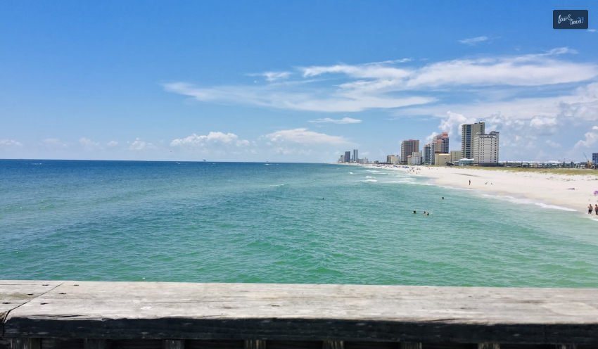
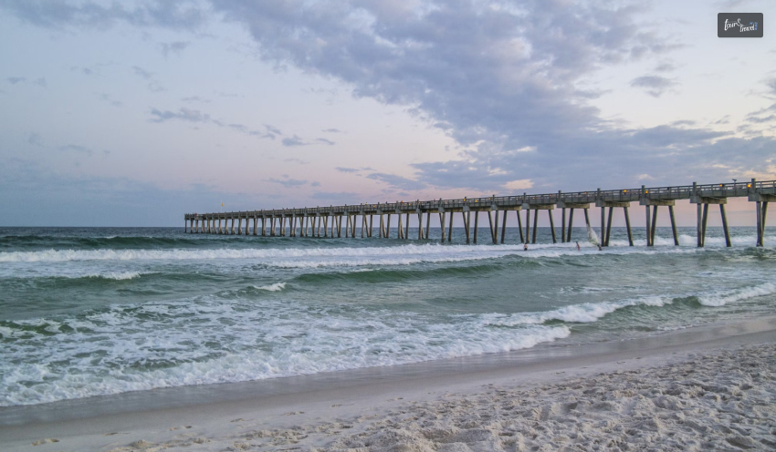
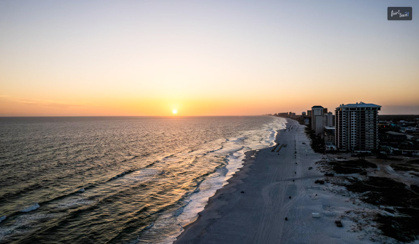
What Is The Closest Beach To Nashville? Top 10 Beaches You Can Visit
So here you are, searching for the closest beach to Nashville, TN! And here we are with a curated list featuring the best beaches near Nashville.
Also, “The Music City” is the door to cool sand and water pursuits. Let’s check out the names.
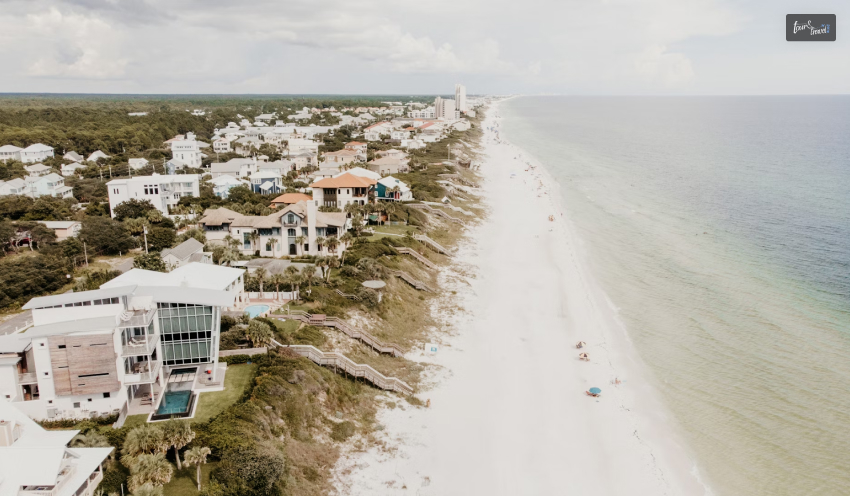
1. Dauphin Island, Alabama:
Dauphin Island in Alabama is fairly close to Nashville, and it will take you about 7 hours to drive to Mobile since the island is located in the southern part of Mobile. You can also fly to Mobile.
Spend time playing with the waves and collecting seashells, or take a ferry and visit the beautiful Fort Morgan to check out some dolphins.
Also, you must not miss out on other prime tourist spots nearby, like:
Fort Gaines,
Bird Sanctuary, and
The Estuarium.
So, it is quite idyllic and a family-friendly island with beautiful attractions such as the Alabama Aquarium, Mobile Bay Ferry, and others.
Additionally, excitement, wildlife, and southern culture are quite apparent in and around Dauphin Island, which has white sand and blue water.
Best Time To Visit
Estimated Cost
Driving/flying hours from Nashville
Spring (March-May), Fall (October-November)
$350 to $1,000
560 miles
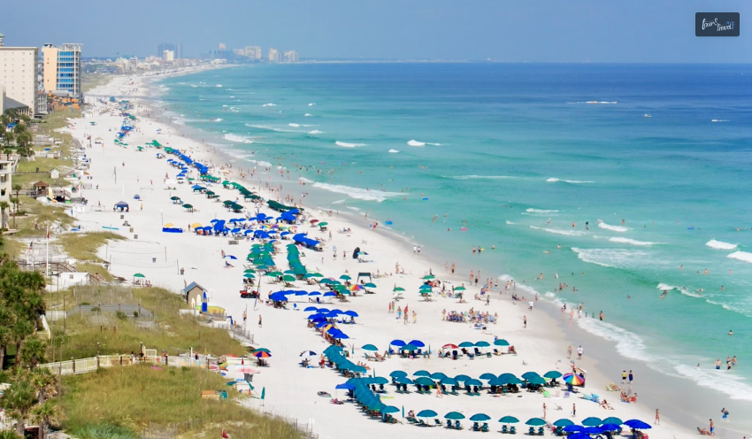
2. Gulf Shores, Alabama:
While looking for beaches near Nashville, TN, there’s no way you can forget about the Gulf Shores in Alabama.
It’s pretty popular among tourists, especially Tennessee residents. Located only a seven-hour drive away from Nashville, the area boasts several lodging options, activities, and fresh seafood.
The area has amusement parks, entertainment zones, shopping opportunities, and more.
Plus, if you love educational activities and history, there’s much to do in this area. So just pack your bags already – because the beach awaits you!
With its warm and soothing water, Gulf Shores also has bright white beaches. You can perform daytime activities such as dolphin-watching, hiking, and scenic cruises.
There is an Alabama Gulf Coast Zoo and a recreation center with bumper boats called The Track, where you can visit with your family.
Best Time To Visit
Estimated Cost
Driving/flying hours from Nashville
Fall (September to November) and spring (March to May)
$210
7-8 hours
Gulf Shores is about to get a Goodwill Center. The 50,000-square-foot facility in Foley will offer job and employment training to the local people.
With time, it will likely be developed as a community development center. The center is likely to open its doors in the fall of 2025. Then, it will be an added attraction to the places of interest.
3. Pensacola, Florida:
There are several beaches close to Nashville, but Pensacola, located in Florida, stands out because it will take you less than seven hours to drive from Nashville!
Popular for its charming historic culture and exquisite natural beauty, Pensacola is a must-visit. Spanning over eight acres, the historic village of Pensacola is timeless.
From golfing and go-karting to other fun activities, there’s so much to do when you are bored with the beach.
Pensacola is also known as ‘the city of five flags’ since it was passed around in History – you will spot British, French, Confederate, American, and even Spanish flags all over this charming city.
The beach is in the panhandle of Florida, surrounded by coastline across 50-plus miles.
There are crystal clear bay areas and emerald-green Gulf of Mexico waters; thus, when you visit the beach, you can find a vibe that mixes a bustling metropolitan center and a relaxing beach town!
Best Time To Visit
Estimated Cost
Driving/flying hours from Nashville
Spring (March-May) and Fall (September-November)
$340
6 hours 39 minutes
4. Destin, Florida:
Why aren’t you considering Destin, located in Florida? Driving to Destin from Nashville will take only around seven hours!
Destin has been a prime vacation spot for families! There are several places to eat – you could check out the popular chain dining, Whataburger!
Then there are so many outlet stores for you to visit if you love shopping. If you are traveling with kids, then you have to check out the following places,
The Gulfarium Marine Adventure Park,
Local Zoo, and
Big Kahuna Water Park (only if you travel to Destin during the summer!)
Located in northwest Florida, the area of Destin Beach is called the Panhandle! There are natural trails through the dunes of Henderson Beach State Park. There are beautiful oak and pine trees that provide shelter for wildlife.
Also, there are waterfalls, pools, tall slides, and Big Kahuna’s water park, so you can explore all these places. The emerald-green waters of the beach are breathtaking, and the geology is unique!
Best Time To Visit
Estimated Cost
Driving/flying hours from Nashville
Spring (April-May) and Fall (September-November)
$105
7 hours
5. Panama City, Florida:
It’s not like there are no beaches in Tennessee. Of course, Tennessee has beaches, but sometimes, venturing a little away from home feels so much better!
And how can you ignore Panama City, located in Florida? Famed as a destination for Spring Break, it will take you about 7.5 hours to drive to Panama City from Nashville. You can also opt for direct flights.
The beaches span 27 miles, and Panama City has about a hundred public accesses.
While you are in Panama City, you must visit Pier Park – you will spot several restaurants, playing areas, bungee jumping opportunities, bumper boats, sky wheels, passenger trains, and plenty of places to shop.
Best Time To Visit
Estimated Cost
Driving/flying hours from Nashville
Fall (September-November) and Spring (March-May)
$106
7.5 to 8 hours
6. 30A, Florida:
People in the Middle Tennessee area either have or know others with bumper stickers with 30A on them. This is because 30A has now become perhaps one of the most well-known getaway spots for most residents of Nashville! And that too throughout the whole year.
30A is not your regular Nashville beach! Instead, it’s a pretty coastal highway with solid touristy spots, like,
Miramar Beach,
Rosemary Beach,
Santa Rosa Beach, and
Blue Mountain Beach.
Best Time To Visit
Estimated Cost
Driving/flying hours from Nashville
Spring (March-May), Fall (October-November)
$105
7 hours 25 minutes
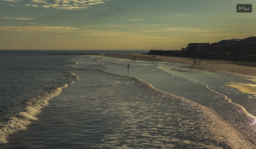
7. Tybee Island, Georgia:
Tybee Island might not be the closest beach to Nashville, but that doesn’t mean it’s that far away – you can either drive to Tybee Island in the Savannah region or even directly fly to Savannah.
If you drive, it will take you more than eight hours; if you take a flight, it will take a little less than two hours.
An Atlantic getaway that’s historical – this is exactly what Savannah stands for! Steeped deeply in culture and history, there’s so much to see and do.
Explore the local restaurants and shopping outlets at the lighthouse near Tybee Island to make the most of your stay here.
Best Time To Visit
Estimated Cost
Driving/flying hours from Nashville
Spring and summer
$210
8 hours 6 mins
8. Gulfport, Mississippi:
While looking up the closest ocean beach to Nashville, TN, it’s impossible not to stumble upon Gulfport, located in Mississippi. The entire Mississippi coastline is unforgettable. It takes about seven hours to drive from Nashville, or you could also do something adventurous and fly to New Orleans – it will be worth the trip!
The area boasts miles of beaches known for their beautiful sand, fun attractions, and exciting water activities. Once you are done spending time on the beach, don’t forget to check out,
The Gulfport children’s museum,
INFINITY Science Center, a space facility by NASA,
A famous aquarium,
Drag racing,
Waterparks, and
The railroad museum.
Best Time To Visit
Estimated Cost
Driving/flying hours from Nashville
March through May
$200
1 hour 21 minutes
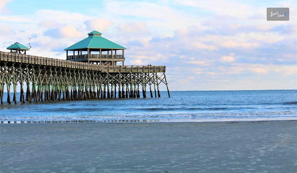
9. Charleston, South Carolina:
Move any beach in Tennessee over, because it’s time for Charleston to shine! Yes, it will take you more than 8 hours to drive to Charleston, located in South Carolina, or a flight of 1.5 hours, but who cares? It will be worth the journey.
Another coastal town in the Atlantic steeped deeply in history, this place is perfect for visiting with your family, especially kids.
If you love visiting historical spots, you have to visit Fort Sumter. And that’s not all! Pamper yourself with some spa time and some golfing, while your kids can enjoy the children’s museum and the aquarium.
You will also get to see some world-class restaurants, sandy beaches, and cobblestone paths.
The easiest way to enjoy South Carolina is to dip your toes in the white sand and enjoy the beautiful weather.
It is perfect for frolicking, as you can walk across the sand and visit the lighthouses. The beaches are wild, you gotta have a towel and sturdy shoes to enjoy your best!
Best Time To Visit
Estimated Cost
Driving/flying hours from Nashville
spring (March-May) and fall (October)
$124.58
9-10 hours
10. Myrtle Beach, South Carolina:
It is not the closest beach to Nashville if you have a packed itinerary. It will take you about nine hours to drive to Myrtle Beach, but it’s so worth the drive.
We say keep at least three to four days in hand while going to Myrtle Beach in South Carolina!
From cheering the baseball team and Pelicans, riding the gigantic Ferris wheel, visiting New South Brewing MicroBrewery, or even having a night out at some local dinner theater, there’s so much to do here.
Myrtle Beach has a subtropical climate, with 86 golf courses and 1800 restaurants to visit. The Myrtle Beach Area Fact Sheet states that around 17 million people visit Myrtle Beach annually. If you plan to visit the beach, you can take your family to the Kingdom amusement park.
If you love adventure, the SkyWheel is the way to go, considering it is one of the tallest Ferris Wheels in the world.
Best Time To Visit
Estimated Cost
Driving/flying hours from Nashville
June through August
$129
9 hrs 26 min
In 2024, Myrtle Beach was the top trending destination for the Memorial Day weekend in the USA, according to Booking.com reports.
TripAdvisor also featured it as the second-most coveted destination for the Memorial Day weekend 2024.
Frequently Asked Questions (FAQs):
Check out the most frequently asked questions related to the closest beach to Nashville, mentioned below.
1. What is the closest beach to Nashville by car?
The beach that would be closest to Nashville would be Panama City Beach, Florida, and would take about 450 miles. A car ride would take around 7-8 hours, and this beach would be the most preferred by people from Nashville.
2. Are there any ocean beaches within driving distance from Nashville?
Yes. Even Nashville, which is a mainland city, has some Gulf Coast Beaches within a day’s drive. These places include Panama City Beach, Destin, Gulf Shores, and Orange Beach, and can be reached within a time frame of 7-9 hours.
3. Why is Panama City Beach the best option from Nashville?
What’s also distinct about Panama City Beach is that it offers: • Shorter transport time to the beaches •White sand beaches and warm Gulf waters • Numerous options of places to visit, as well as accommodations, that are suitable for families • Easy access by major highways All these features make this a most preferable spot for people in Nashville who love to visit beaches.
4. What is the closest beach to Nashville that one could go to over a weekend?
Concerning a weekend getaway, Panama City Beach is the most accessible destination in terms of the drive. Furthermore, others prefer the Gulf Shores in Alabama because of its longer drive to the destination.
5. Are there any beaches in Nashville that are not close to an ocean?
Yes. If you like lake beaches, then you find that you are in the Nashville area, so you do have some options, such as Percy Priest Lake and Old Hickory Lake. There are sandy beaches and swimming areas. Dawkins
6. How far is Destin, Florida, from Nashville?
Destin is about 470-480 miles from Nashville. It will take about 8 hours to drive there. Destin is well-known for its “emerald-green waters.” It also has a lot of activities for families.
7. What is the best beach for families in the Nashville area?
Panama City Beach and Destin: These are also ideal destinations to consider when traveling with family. The destinations are famous for their calm waters, amusement parks, dolphin tours, and the availability of resorts and vacation homes.
8. Is there a less crowded beach near Nashville?
Yes. Alabama: Gulf Shores and Orange Beach offer fewer visitors than some popular beaches in Florida, especially during the regular year. This would be an awakening for visitors looking for an uninhabited vacation spot.
9. Do you have the option of flying from Nashville to a beach location as opposed to driving?
Absolutely. The Nashville International Airport (BNA) offers flights to neighboring beach resorts, these being Pensacola, Destin-Fort Walton Beach, and Panama City. It takes a considerably shorter time compared to traveling by road.
10. What is the best time to come and enjoy the beaches in and around Nashville?
The period that is considered the best time to visit the Gulf Coast Beaches in Alabama is late spring, which comprises April and May, and early autumn, which comprises September and October.
11. Gulf Coast beaches – safe for swimming?
In general, yes. Most of the Gulf Coast beaches have quiet waters; they’re ideal locations for swimming. Also, it must be remembered at all times that ‘flag warnings’ as well as weather be disregarded.
12. Why do people in Nashville like the beaches of Florida or Alabama instead?
The beaches of Florida and Alabama are preferred because of the following reasons: • Reasonable Driving Distance • Warm tropical water, beautiful white sandy beaches. • World-class tourist facilities • Top class packages for family & group holidays
Sibashree is a travel, culture, and leisure writer who has been writing since the age of 12 and professionally since 2014. With more than a decade of travel writing experience and journeys across India and several parts of the world, she brings a deeply personal and thoughtful perspective to her work. A student of English Literature and Mass Communication, Sibashree has always viewed travel as more than movement — for her, it has been a way of understanding people, cultures, and herself. Her passion for spiritual exploration has also led her to many unusual and meaningful destinations over the years. Outside of writing, Sibashree enjoys watching European cinema, reading about global politics, and reflecting on the stories hidden within everyday places.
Aging parents often need extra assistance when traveling, whether it's for a family vacation or for a necessary medical procedure. If your parents fall into this category, don't worry - there are ways to make traveling easier for them.
Let's check the 5 tips to travel for seniors with limited mobility you should know.
The Common Types of Wheelchairs for Seniors
The first step is to choose the right wheelchair. For traveling, you'll want to find a lightweight option that can be easily transported. There are three types of wheelchairs: manual, electric, and foldable.
1. Manual Wheelchairs
Manual wheelchairs are the most common type - they're also the least expensive. If your parent is able-bodied and only needs a wheelchair for short periods of time, this might be the best option.
2. Electric Wheelchairs
Electric wheelchairs like the Jazzy power wheelchair are more expensive than manual ones, but such a vehicle offers a number of advantages. They're easier to maneuver and require less effort to use, which can be helpful for seniors with limited mobility. Electric wheelchairs can also get features like cup holders and storage baskets, which can be handy when traveling.
3. Foldable Wheelchairs
Foldable wheelchairs are a good option if you're traveling by car or plane. They're easy to transport and take up less space than other types of wheelchairs. Many foldable wheelchairs also have features like adjustable leg rests and reclining seats. This can make the vehicle more comfortable for seniors with limited mobility.
5 Tips to Follow When Traveling with Seniors with Limited Mobility
Whether it is about finding wheelchair support Moscow or looking for teeth whitening Vaughan, traveling with seniors is quite challenging. However, with the right tips by your side, you can always make it easier.
1. Choose the Right Destination
Before booking your tickets, make sure to do your research on the destination. Consider things like the weather, accessibility, and attractions that would be suitable for your parent. When in doubt, always err on the side of caution and choose a destination that is known to be senior-friendly.
2. Prepare for Emergencies
Make sure to pack a first-aid kit and any medications your parent might need. It's also a good idea to have an emergency contact list on hand in case of any unforeseen circumstances.
3. Make a List of Bare Essentials
To make packing easier, sit down with your parent and make a list of items they will need for the trip. This should include clothes, toiletries, medications, and any other essential items.
4. Pack Light
This means only bringing the essentials and leaving behind any unnecessary items. This will make it easier to pass through airports and train stations, as well as reduce the risk of lost luggage. Make sure your parent is comfortable and has everything they need before leaving on your trip.
5. Bring a Wheelchair
If your parent is mobility-impaired, then it's essential to bring along a wheelchair. This will help them get around easily and avoid any potential injuries from walking long distances.
What to Bring with You When Traveling with Elderly Seniors?
A first-aid kit
A wheelchair
Comfortable clothes
Portable ramp
Snacks and drinks
Entertainment (books, music, etc.)
Emergency contact information
Frequently Asked Questions
Is Traveling with Seniors Safe?
Yes, traveling with seniors is safe as long as you take the necessary precautions. Make sure to plan your trip ahead of time and pack everything your parent will need to stay comfortable and safe.
What Are the Best Wheelchairs for Traveling?
The best wheelchairs for traveling are lightweight and easy to fold. This way, you can easily transport the wheelchair in a car or on public transportation. Look for a wheelchair that has large wheels for smooth maneuverability over different types of terrain.
Should I Rent a Wheelchair?
If you plan on traveling with a senior with limited mobility, it is a good idea to rent a wheelchair. This way, you will not have to worry about carrying the wheelchair around with you everywhere you go. You can also find wheelchairs that are specifically designed for traveling, which may be more comfortable for your parent.
Conclusion
Traveling with aging parents can be a challenge, but it is possible to make it work with some planning and preparation. By following our handy tips, you can make sure that your trip is enjoyable for your seniors.
Read Also:
Why Travel Trailers Are The New Vacation Norm
Must Pack Business Travel Packing List Along With Tips
Three Ways Traveling Can Open Your Mind And Heart
Split is a port city on the beautiful Adriatic Sea. It has delightful beaches in Croatia and a vibrant nightlife. However, it is the ancient heart of the city that attracts me the most.
It’s great that I reached Split in November and spent weeks getting to know the Dalmatian region and the city’s history.
The Mediterranean climate of Split is blissful, and that’s what makes it a year-round attraction. However, it is one of the best family vacation spots if you are planning something for the summer.
Also, if you are a history buff like me, you can plan an off-season trip and avoid the crowd.
As I chose November for my Split Croatia trip, I got the chance to soak up the never-ending stories.
Did you know that Split was the place where Emperor Diocletian retired from his throne? He was the only Roman emperor who voluntarily retired from his throne.
Also, Split was the place where Julius Nepos, another Roman Emperor, was killed by his soldiers in 480 AD. Thus, Split saw the final nail in the coffin of the Western Roman Empire.
Nikola Tesla, the legendary inventor, studied in Split.
Split has been used as the backdrop of many Hollywood movies and TV series, including the magnanimous Game of Thrones. Split is the actual place where Daenerys kept her three dragons.
So, overall, Split has history, intrigue, natural abundance, and a happening nightlife. Here is more about the best things to do in Split Croatia, in 2026, and exploring the old and new Dalmatian regions.
How Many Days Are Enough To Explore Split?
If you only want to explore the city of Split, a budget of 2-4 days will be enough for you. However, Split opens your path to the vast Dalmatian coast area.
So, if you are planning to also explore the Dalmatian area, it will take at least 3-4 days more.
Then, spend a day or two getting to know about the local culture, food, and history. Overall, 6-7 days is a reasonable duration to spend in Split, Croatia.
Also, Split Croatia is just a ferry ride away from Dubrovnik. There are many exciting things to do in Dubrovnik.
Also, Dubrovnik is the Croatian gateway to the beautiful Kotor, Montenegro.
If you want to explore all of it together, you will need at least 10-15 days. Having said that, let’s get into the discussion on the things to do in Split Croatia.
What Are The Best Things To Do In Split Croatia?
Do you want to get lost in the Old Town, or do you want to just eat, drink, and party? Split is the place that caters to all types of travelers.
However, if you want to try the best things do in Split Croatia as the locals do, here is your ultimate checklist.
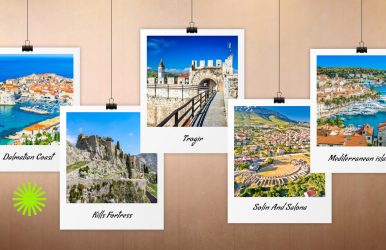
1. Exploring The Dalmatian Coast And Even Beyond
Dubrovnik, Split, Sibenik, and Zadar. These are the four major cities that make the Dalmatian Coast what it is.
There are many smaller towns in between. However, these are the most populous and accessible. Split, again, has the highest population among them.
Also, I used Split as the base for my journey on the Dalmatian Coast. The city airport has modern amenities, and it gets many connecting flights to other Dalmatian cities. So, this is the best way to enjoy a day, cherishing the Adriatic region.
However, you can also choose Zagreb, the inland capital of Croatia, as your base, and then take a bus to Split and the Dalmatian coast.
2. Visiting Diocletian’s Palace
Diocletian, an enlightened Roman emperor, ruled from 284 to 305 AD. The seat of his voluntary retirement or abdication was his palace in Split.
Diocletian’s Palace is an intriguing combination of a military fortress, an imperial accommodation, a fortified town, and gardens.
You can still listen to the cry of the while marble palace for the retired emperor.
A DIY tour of the palace is free. However, you can also be a part of a small group tour and have an in-depth idea about the past of the palace and Split.
Also, if you want, you can plan a stay at the Diocletian’s Palace. However, there is always a large queue of tourists who want to stay here. So, book in advance.
Moreover, here are the most noteworthy spots I visited in the Diocletian’s Palace Complex.
• The Cybele Temple Or The Cathedral Treasury Split
I came across the Cybele Temple or the Cathedral Treasury as I just entered the complex. This complex also functions as a museum.
Inside the museum, I saw some really intriguing Catholic relics and artifacts from the Roman era. So, the museum at the entrance sets the perfect mood for the things you can expect throughout the tour of the palace.
It is also the time when you will choose the tours you want to take. The amount you pay will depend on the number of tours you take.
• Saint Dominus Bell Tower
Now, this part is a little difficult as I had to climb almost 200 steep steps to reach the top of the bell tower. The narrow passageways once again reminded me why I needed to take my fitness sessions more seriously.
Finally, after climbing upward through a tight space, the tower culminates in an “open-air metal staircase.”
The view from here is amazing.
• Saint Dominus Cathedral
The Saint Dominus Cathedral is just below the cathedral. It is the second-oldest among the Catholic cathedrals that are still being used.
Furthermore, the Catholic iconography and the soaring dome inside really humbled me. The building may not be massive, but it has an impressive architecture.
• The Temple Of Jupiter
I love Greco-Roman architecture and always look for historical things to do whenever I visit a new destination. So, I had to stop by the Temple of Jupiter.
Dedicated to the Greek God, Jupiter, the temple also tells the tales of human resilience. It was destroyed three times and then reconstructed.
The final version was built during 81-96, in the time of Emperor Domitian.
Furthermore, the granite sphinx outside the temple is headless and this is a 3000-year-old statue, which was beheaded in the 4th century by the enraged local Christians.
After the temple visit, I took the Pusti Me Da Prodjem or the Let Me Pass alley.
3. Exploring The Old Town
The Diocletian’s Palace is in a fortified town. The alleys here still exude the old-world charm.
The only modern elements are the internet cafes, stray cats, and ice cream shops here. I especially loved walking the alleyways at night with the moonlight bathing the streets.
The activity was simple, but the sense of adventure and romance I had was matchless. It was the perfect TheLowDownUnder Travel vibe.
4. Walking The Riva
The harbor and the Riva are just outside the Old Town and temple walls. This section is very wakable, and it is the place to explore the shops, local restaurants, and cafes.
You can call it the living room of the city, and it is the most prominent place in Split. Moreover, you can have all types of seafood and cuisine at the restaurants here.
I loved the English-only menus and authentic Croatian cuisine here. You can also try the seafood, fresh burgers, and pizzas.
Moreover, I loved watching people here and how they got involved in animated conversations after a dose of cigarettes, booze, or just good food.
Overall, with music playing in the background, Riva is all about camaraderie, great energy, and sharing vibes.
5. Eating, Drinking, And Partying In Split
Do you love authentic Croatian food? Try the top-rated restaurants in Split, such as Duje, DeListes or Konoba Matejusta.
Furthermore, I loved the cuttlefish risotto at DeListes and black truffle carbonara. The best thing about these restaurants is that the menus change regularly because the dishes are made using fresh and locally-sourced ingredients only.
Also, they always do not accept reservations, and you may have to pay only in cash.
Moreover, I came across many excellent bars in the Old Town. O’Hara’s Irish Pub was a discovery there, and a local lady advised me to pay a visit to Trogir.
Also, Marvlvs Libray Jazz Bar, Charlie’s Bar, and Crew Bar are some of the places to enjoy the party vibe of Croatia.
6. Visiting A Museum
With such a rich culture, Split has no dearth of options when it comes to museums. I visited the following museums here.
• Mestrovic Gallery
This museum celebrates Mestrovic, the famous Croatian artist and sculptor. It is a place to learn about his life and work.
• Split Ethnographic Museum
It is a wonderful display of the Croatian home objects and clothing.
• Game Of Thrones Museum
This museum has the most authentic costumes and props used in the iconic TV series. Also, some parts of the TV series were shot here.
7. Getting Aerobic At Marjan Park
The Marjan Park, with its network of forested trails, extends into the ocean. It was an experience to climb the Telegrin Peak, the highest point of the park.
From the peak, I loved the views in the surroundings. If you don’t want to walk, you can also take a bike to reach the peak.
In fact, you walk for four hours and still do not see every corner of the park. So, getting the rental immediately after reaching the park is the best thing you can do.
Moreover, I don’t want you to repeat the mistake I made. So, you must bring your swimsuit here as you will find the Kasjuni Beach, Plaza Jezinak, and Kupaliste Bene here.
8. A Day Trip In The Dalmatia Historic Region
Split is more alluring for the quintessential Croatian experience because of its accessibility and central location.
Furthermore, you can start exploring the historic region of Dalmatia from Split. So, take a short bus ride and explore the following regions.
• Trogir
I took the Flix bus and reached Trogir to soak in its medieval vibe. Time stands still here, and it feels like a journey to the fairyland.
• Kills Fortress
Visiting the Kills Fortress feels nothing short of an investigation project. In Game of Thrones, it was the Meeren.
The views from the fortress are breathtaking.
• Solin And Salona
You can experience Solin, which is a modern city, and it surrounds Salona. Salona is the place where Emperor Diocletian was born.
Furthermore, it is an ancient Roman City, probably even older than Pompeii. It has a large cemetery, a large bathhouse, and a massive amphitheater.
Other places you can visit during the day trip are the Plitvice Lakes National Park, Krka National Park, or the Blue Cave. Even Mostar in Bosnia and Herzegovina can be a part of your Split Croatia itinerary.
9. Hopping A Ferry
Croatia has more than a thousand islands. Some of them are unpopulated. However, you can explore the other islands by ferry.
I used the ferryhopper.com app to plan my ferry route and schedule the ride. I took a ticket for a visit to Hvar.
You can even take a ferry ride to Mediterranean islands such as Korkula and Vis.
However, when planning a ferry ride, you have to check the weather conditions first. Adriatic is unpredictable.
10. Making Good Memories In Split Croatia
Split Croatia harbors most of the historical wonders and flows here. So, I listened to endless stories and learned many lessons here.
Furthermore, the Mediterranean climate here is very seductive, and in every nook of Split, there is a sense of discovery.
People are warm, the beaches are gorgeous, and the food is great.
So, plan a visit to this city of Roman history and culture soon!
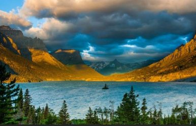
There are very few places on Earth as beautiful as the Glacier National Park. It was protected in the year 1910, during the beginning of the American conservationist movement.
This national park ranks with the Grand Canyon, Yosemite, and Yellowstone as one of the most astonishing natural beauties of the world.
Keep reading till the end to find out more information on the best time to visit glacier national park!
About Glacier National Park
Glacier National Park is actually an American National Park that is located on the border of Canada and the United States. This park encompasses a total area of more than 1 million acres.
The park features two mountain ranges, more than a thousand different species of animals and plants. It also has more than 130 lakes.
Best Time To Visit
The best time to visit Glacier National Park can vary depending upon a lot of different factors. For some people, pleasant weather may be a priority, while for others, it may be traveling during a time when there are fewer crowds.
In this section of the article, I will be talking about the glacier national park best time to visit based on different factors.
For Avoiding Crowds
There are millions and millions of tourists visiting the park every year. If you are a person, who is notably not fond of crowds, then the perfect time to visit glacier national park would be during one of the off-season times.
The time of Spring is one of the park's quietest season.
For Wildlife Spotting
The Park has been a great wildlife refuge ever since it was established in the year 1910. Its terrain is home to several thousand species of animals.
Some of the animal sightings that you can get here are - bears, mountain lions, moose, goats, wolves, bighorn sheep, and deers.
You also want to ensure that you are doing it safely while on an animal sighting. You need to ensure that you are staying at least three hundred feet away from the bears.
As for all other wildlife, you must stay at least seventy-five feet away from them.
Tip: If you are planning on visiting glacier national park in May, then make sure that you avoid hiking, as temperatures can go really high during that time.
You wouldn’t want to do a rigorous activity while there’s extremely high temperatures.
For A Warm & Pleasant Weather
The park has very unpredictable weather. It can go from one to a hundred real quick in a matter of a few minutes.
If you want to go there and experience a sunny day hike - the best time to visit glacier national park would be to visit in early July and towards the end of October.
During this time, the weather is known to remain mild.
Tip: You would best carry a rain jacket and a few extra layers as well, just to be prepared.
For Budget Travelers
During the winter time (i.e, November through April), the passes and fees of Glacier National Park drop a great deal.
For instance, a 7-day private vehicle pass would typically cost thirty-five dollars at other times, but during the winter months, it drops down to twenty-five dollars.
While the entry ticket person drops from twenty dollars to fifteen dollars.
Things To Note Before Visiting
Here are a few things that one needs to take care of before planning a trip to Glacier National Park:
Bring Your Own Car
Shuttles are available throughout the park, but you would benefit from bringing your car to reach some of the best spots.
There are many trailheads situated in different remote locations which are not serviced by the shuttle system.
However, if you are someone who does not have a car, then, of course, use the shuttle systems that are available.
But you need to make sure that your are checking the schedule of the shuttle and the routes before going out for your adventure.
Tip: A while before, I discussed about when is actually the right time to visit glacier national park! If you haven’t given it a read already, you can go back to find out information about it.
Read More: Top 8 List Of National Parks In North Carolina – Travel Guide
Plan A Stay For At Least Five Days
A weekend-long trip just won't do! There's much to explore in here. There is a lot to see and do in the Glacier National Park.
A majority of the visitors come back year after year to this place and still find new places to explore.
You could definitely consider a four nights visit to this place - by spending two nights in the West Glacier and the other two nights in the East Glacier.
Do remember to include Sun-Road on your itinerary when visiting this place. Even if you are visiting for just a day - do go on the sun road drive!
It connects the east and west sides through the middle of the park - which makes a crossing at Logan Pass.
Go On Trails
There are over seven hundred miles worth hiking trails in the Glacier National Park. There's trails for every sort of person out there - be it 1 mile - 20 miles.
You need to remember that hiking is an extremely popular sport during summer time and you would need to ensure that you arrive early.
That is to be done so that you can secure a parking spot and be ahead of midday crowds.
Sign Up For Activities
Inside the Glacier National Park, there are plenty of activities to partake in. There is a rope course, horseback riding, and rafting options.
These are perfect choices for a guided day tour inside the park premises.
To Wrap It Up!
That was all for information regarding the best time to visit Glacier National Park. Thank you for reading up till here.
I hope you found the information useful. Let me know in the comments your thoughts on the same.
Read Also:
Things To Do In Rocky Mountains National Park
A Guide Of Top 6 National Parks In Wyoming
A Complete Guide To Maine National Parks


 Related