
Why Is Puttalam Sri Lanka Famous? What Are The Things To Do In Puttalam?

Puttalam grabbed everyone’s attention with the sudden visibility of a mysterious object with a length of several feet in the sky. 

There were speculations about the object being a missile, rocket, or meteor shower. 

A few months ago, on 15th December, 2025, the Geminid meteor shower was clearly visible in the sky. 

However, these are not one-off instances. I could clearly see the Milky Way in Puttalam Sri Lanka, in the month of April. 

Furthermore, the wilderness surroundings, remote areas such as Eluwankulama, and a relatively flat topography on the southwestern coast, make Puttalam one of the chosen places of stargazing in Sri Lanka. 

But beyond the stargazing excitements, Puttalam, Sri Lanka, bears a rich history, exudes serene coastal beauty, and has a colonial heritage. 

In this article, I will talk about my days in Puttalam so that you know that coastal beauty better. 

Where Is Puttalam?

Known for massive coconut production, prawn farming, and salt production, Puttalam town is the capital of the Puttalam district. 

It is on the shore of the Puttalam lagoon, the second largest lagoon in the country. 

The International Union for Conservation of Nature (IUCN) is now encouraging the most sustainable use of the lagoon resources. 

Thus, they are supporting the exploration of new ecosystems here for better fisheries management. Here is an excerpt from a report published by IUCN on 4th April, 2025

With 88 fishing villages and approximately 165,000 people dependent on it, fisheries in Puttalam have been identified by its residents as their most important ecosystem service, particularly for women, who participate in bivalve gleaning and other post-harvest livelihoods.

The lagoon is an important area for endangered species, such as green sea turtles and dolphins, and contains ecosystems vital for its health, such as seagrass and mangroves. 

Tourism is also important in the Lagoon, which hosts seasonal aquatic sports and has year-round visitors to its islands. 

The islands additionally have cultural importance as they are connected to local religious values.

Moreover, Puttalam has the Indian Ocean on the west, and it is the gateway to the Kalpitiya peninsula and Wilpattu National Park.

How To Reach Puttalam Sri Lanka?

Puttam is located around 130 km north of Colombo. It is also located at a distance of close to 95 km from Nogombo. 

Furthermore, it is well-connected to Colombo and other major cities/hubs of the country through the Puttalam Railway Line and A3, A10, and A12 highways. 

By Train 

The train travel from Colombo Fort to Puttalam takes between 3 hours and 45 minutes and 5 hours. 

Moreover, the ticket price will be between LKR 250 and LKR 1550 (Source: the Department of Railways. Sri Lanka.

By Bus 

Also, you can take a bus from the Bastian Mawatha Bus Terminal in Colombo and travel to Puttalam with a stopover in Anuradhapura

You can even take the direct 87/816 buses. They cover the distance within around 4 to 4.5 hours, and the regular, non-AC bus tickets cost between LKR 500 and LKR 800. 

What Is The History Of Puttalam Sri Lanka?

Puttalam in Sri Lanka today stands out with its multicultural identity. Here, you will find a fusion of Sinhalese, Sri Lankan Moors, and Tamil cultures, which have lived for generations. 

Furthermore, as a commercial and administrative center, it supports diverse activities such as prawn farming, shallow sea fishing, and salt production. 

However, this town on the northwestern coast of Sri Lanka has a history spanning 10000 years. 

Located on the large Puttalam Lagoon, it has been a maritime trade hub, a center for the colonial spice and coconut industries, and has an enduring and culturally diverse population.

Here, I have broken the history of this coastal town into three sections. 

Ancient Roots And Indigenous Beginnings

The archaeological evidence of the locality shows that human settlements started here 75000-125000 years ago. 

Prince Vijaya, 6th century B.C., chose it as the landing site, and thus the Sinhalese lineage started here. 

Medieval Trade And Arab Influence 

During the medieval period, Puttalam became a major location for maritime trade. 

Arab merchants, who established deep roots in the region, laid the foundation for the prominent Moorish population in the area. 

Furthermore, the name Puttalam comes from the Tamil word Puthu-kulam. Puthu-kulam means “new tank” or “new pond.”

Thus, it indicated the vital irrigation tanks that sustained early agricultural settlements.  

The Colonial Era 

Many European powers wanted to control the lucrative trade routes of Puttalam because of its natural resources and coastal position. 

The Potuguese was the forest to build a built a strategic fort in Puttalam to secure the region and monitor trade in the 16th century. 

Then, in the 17th and 18th centuries, the Dutch came. They captured and significantly expanded the Portuguese fortress.

Furthermore, during these times, Puttalam became a central transit point for the highly profitable cinnamon trade and salt production within the lagoon.

In addition, in the 19th and 20th centuries, the British came to power. 

They used the fertile soil of the region for the expansion of the coconut industry. Thus, Puttalam became one of the most critical sources of copra and coconut products in the island. 

A Quick Summary Of The History Of Puttalam 

Era/PeriodKey Historical Developments and Milestones
Over 10,000 years agoEarly human settlements established, supported by archaeological evidence.
Medieval Period– Puttalam became a pivotal west-coast maritime trade hub.
– Arab merchants settled, forming the roots of the Sri Lankan Moor community.
– Named Puthu-kulam (“new tank/pond”) after vital local irrigation tanks.
Portuguese Rule(16th Century)A strategic coastal fort was constructed to monitor trade and secure the region.
Dutch Rule (17th and 18th Centuries)– Captured and expanded the Portuguese fortress.
– Transformed the town into a transit hub for cinnamon and lagoon salt production.
British Rule (19th and 20th Centuries)– Developed agricultural infrastructure.
– Oversaw rapid expansion of the coconut industry, making it a top source for copra.

Why Is Puttalam Famous?

Puttalam is famous for its historical ruins, religious centers, and natural attractions. You cannot miss the following attractions.

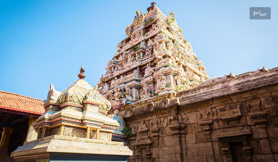
1. Munneswaram Hindu Temple

Munneswaram Hindu Temple

The Munneswaram Hindu Temple is one of the five historic coastal temples of Lord Shiva in Sri Lanka. 

The history of the temple goes back to at least 1000 CE. 

Moreover, it is associated with the stories of the Ramayana. 

Also, it is a unique spiritual hub where Buddhists and Hindus unite. 

2. St Anne’s Church

St. Anne’s Church is along the coastline of Thalawila. It has a peaceful ambiance. 

Also, it dates back to the Portuguese era. 

It serves as a monumental pilgrimage site. Furthermore, it draws hundreds of thousands of believers from across the island for its grand annual feast in July.

3. Alankuda Beach

The Alankuda Beach has a tranquil stretch of golden sand, and it is known for dolphin and whale watching excursions. 

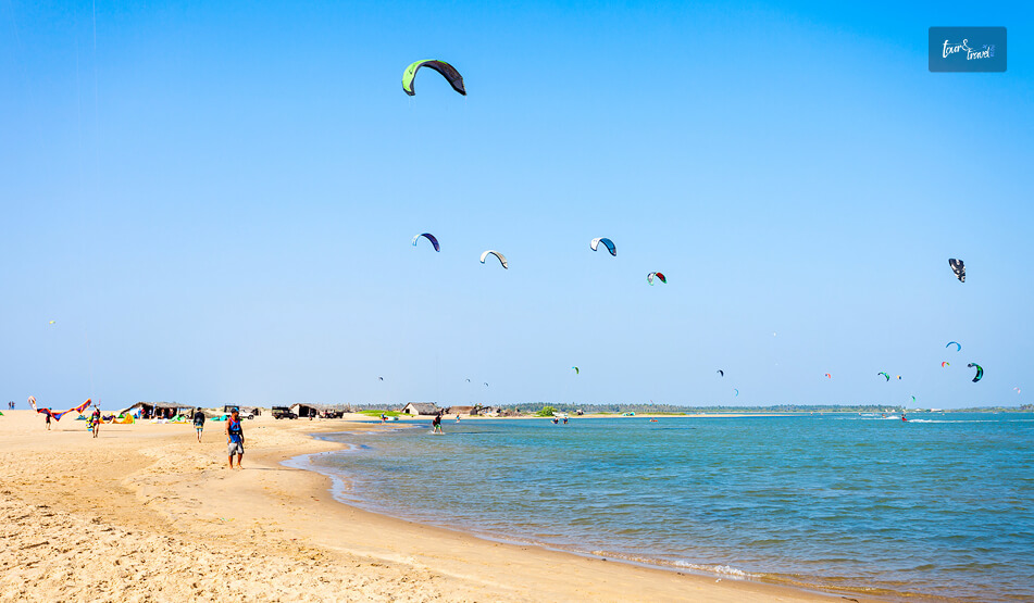
Located in Kalpitiya, it is a premier eco-tourism destination, highly favored by adventure travelers for thrilling water sports like kitesurfing and windsurfing.

4. Hatthikuchchi Viharaya

Tucked away in a peaceful forest landscape, this 3rd-century BCE Buddhist monastic complex is famous for a massive rock formation that resembles an elephant’s stomach. 

It is highly revered as the legendary sanctuary where the pious, exiled King Sirisangabo self-sacrificially gave up his own head to assist a poor peasant.

5. Anawilundawa Wetland Sanctuary

This Ramsar-designated site is an important landmark for ecotourism in Sri Lanka. 

It has a historic human-made system of interconnected freshwater tanks crashing right against a coastal lagoon.

Furthermore, it is an irreplaceable, thriving sanctuary for thousands of native and migratory birds.

6. Puttalam Lagoon

The Puttalam Lagoon, spanning an area of 32,700 hectares, is the second-largest backwater body in the country. 

It has calm waters, and it is an ideal hub for small-scale prawn harvesting, wildlife viewing, and kite surfing. 

7. Puttalam Station

The colonial rulers of Puttalam opened the railway station officially on 12th May 1926. 

Today, it is a state-run railway station and attracts many visitors due to its colonial charm and surrounding scenic beauty. 

8. Yapahuwa

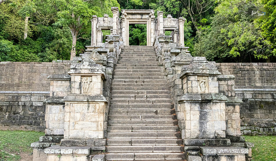
Yapahuwa

Built by King Buwanekabahu, Yapahuwa was the royal residence in the 13th century. 

Today, you will get to see the remains of this royal palace. I was especially mesmerized to see the ornate staircase. 

9. Chilaw 

Chilaw, located a few kilometers south of Puttalam, is a small town that stands out because of its religious harmony. 

People from various traditions, backgrounds, and religions live here. 

Furthermore, the beach here offers a calm and relaxing ambiance and the fishing villages here give you insights into the local way of living life. 

What Are The Things To Do In Puttalam? 

While Puttalam has the most tranquil vibe, it is also the hub of most adventurous activities, such as kite surfing, bar reef snorkeling, and wildlife safaris. 

1. Kite Surfing In Kalpitiya 

Kite Surfing In Kalpitiya

Kalpitiya is a global kite surfing hub. It has consistent wind conditions for over nine months of the year. 

Furthermore, the flat-water lagoons here offer a safe space for learning. On the other hand, the ocean waves here challenge the advanced riders. 

Also, the Margarita Kite School is the best name in kite surfing training in Kalpitiya today. It trains tourists and locals with the latest equipment. 

Moreover, the downwind trips here are epic. You can glide across pristine, uninhabited islands and sandbars dotting the massive lagoon.

2. Dolphin Watching 

I could spot hundreds of playful dolphins gathering in spectacular groups just off the Kalpitiya coast. 

November to April is the best season to spot these adorable animals as the water remains calm. 

Also, local guides follow strict conservation guidelines to protect the natural habitat of mammals. So, you have to follow responsible tourism practices. 

3. Diving

Puttalam has a diverse marine life. So, you can explore vibrant ecosystems teeming with sea turtles, reef sharks, and manta rays. 

It also has historic shipwreck sites where fascinating sunken vessels are wrapped in colorful soft coral colonies.

Furthermore, warm waters offer crystal-clear viewing conditions during the calm winter diving months.

In addition, when you descend along deep underwater cliffs that host a spectacular variety of macro life.

4. Wildlife Safari At Wilpattu National Park

Wildlife Safari At Wilpattu National Park

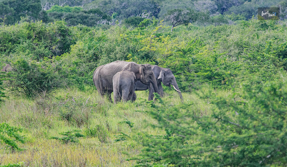
The Wilpattu National Park has villus or natural rainwater lakes. It is famous for its high density of leopard population. 

Furthermore, here, you can spot elusive sloth bears, wild elephants, crocodiles, and colorful endemic jungle birds.

So, the jeep tour on the rugged off-road tracks was immersive. It cost me around LKR 16000. 

5. Bar Reef Snorkeling 

Here, you will find the most beautiful coral sanctuary of Sri Lanka. 

Also, here, you can swim alongside brightly colored butterflyfish, giant parrotfish, and harmless blacktip reef sharks.

Furthermore, you will marvel at delicate, healthy formations of brain and staghorn corals just below the surface.

In addition, you can take short boat rides from the mainland to reach these shallow swimming areas. 

What Is The Best Time To Visit Puttalam Sri Lanka?

January to March and May to September are the best times to visit Puttalam.

The dry and sunny weather conditions in the month are ideal for coastal kitesurfing in Kalpitiya, whale watching, and leopard safaris in the nearby Wilpattu National Park.

Share on Social Media

Sibashree is a travel, culture, and leisure writer who has been writing since the age of 12 and professionally since 2014. With more than a decade of travel writing experience and journeys across India and several parts of the world, she brings a deeply personal and thoughtful perspective to her work. A student of English Literature and Mass Communication, Sibashree has always viewed travel as more than movement — for her, it has been a way of understanding people, cultures, and herself. Her passion for spiritual exploration has also led her to many unusual and meaningful destinations over the years. Outside of writing, Sibashree enjoys watching European cinema, reading about global politics, and reflecting on the stories hidden within everyday places.

Leave a Reply

Your email address will not be published. Required fields are marked *

title-img Related

READ MORE Horton Plains

Horton Plains National Park: Why Is Walking To The Edge of Sri Lanka Worth The 3 AM Alarm?

BY  Sibashree Aug 21, 2026

It was still pitch dark when I left Nuwara Eliya. I was wrapped in every layer I had. It was a bit weird, and I felt overpacked considering Sri Lanka spends most of the year in a state of tropical sweat.  After an hour and a half, I was standing at the entrance gate of Horton Plains National Park. My breath was fogging, and I realized that it was actually Cold and not the Sri Lankan cold you would usually expect.  On a high plateau in the Central Highlands, the Horton Plains National Park sits at an elevation of more than 2100 meters.  Unlike most of the Sri Lankan landscape I have explored, the Horton Plains National Park does not have rice paddies, palm trees, and the lowland heat haze.  In fact, it looked like the Scottish Highlands with gnarled cloud forest, windswept grassland, and silence broken by birdsong.  So, overall, it looked like a contradiction in the middle of a tropical island country.  Horton Plains: A Plateau With A History Horton Plains stands out with an ecological and historical weight. This weight is more than the windswept image it has.  Long before it became a popular hiking destination, it was famous as a colonial retreat, and in July 2010, it became a UNESCO-listed ecosystem as part of the Central Highlands of Sri Lanka.  From Maha Eliya Thenna To National Park Horton Plains was earlier known as Maha Eliya Thenna before it became a national park.  Maha Eliya Thenna means “The Great Open Plain.” During British Rule, it was renamed after Sir Robert Wilmot-Horton. He was a governor of Ceylon. Also, during that time, the highlands became a retreat for planters escaping the heat of the lowlands. Until 1969, the Horton Plains was not formally protected. Then, it became a wildlife sanctuary.  Finally, in 1988, it got the full designation as a national park.  Then came 2010, when Horton Plains got the UNESCO designation along with the Peak Wilderness Protected Area (home to Adam's Peak) and the Knuckles Mountain Range. Together, these three protected areas form what conservationists describe as one of the island's most important biodiversity hotspots, sheltering species found nowhere else on Earth. Why The Ecosystem Matters Sri Lanka, being a party to the Convention on Biological Diversity, submitted the “Sixth Annual Report” in 2019.  I am quoting the content of the report as highlighted by the Daily Mirror Online here.  “The Peak Wilderness Sanctuary, Horton Plains, and the surrounding protected and unprotected areas containing small wet-zone forests possess the highest levels of endemic plant and animal diversity in Sri Lanka.” The Horton Plains National Park is also the source of the three major rivers in Sri Lanka. Mahawell Kelani Walawe.  Moreover, as an important ecological region, it was the first national park in the island country to ban single-use plastics.  So, when you are about to enter the national park, the rangers check the bags at the entrance. You have to leave the water bottles (if you are carrying water in single-use plastic ones) and snack packets before entering it.  The Walk Itself Recently, there have been talks about the reopening of the Nonpareil Estate and Nagrak to Horton Plains route.  After failed attempts in 2015, and 2020, this recent request in August 2026 has been submitted by the tourism hotel operators.  The Development Committee meeting has also discussed this matter and Gayani Renuka, the Divisional Secretary of Imbulpe, has presented it before Dr. Dhammika Patabendi, the Minister of Environment.  However, there are uncertainties about reopening this route for better accessibility because of environmental concerns and the pristine nature of the Horton Plains.  So, if you go for a trek now, you have to pass through three distinct moments strung along one loop trail.  Each loop has a distinct character.  The Main Loop The distance of the main trail is around 9 to 9.5 kilometers. At an easy, photo-stopping pace, you can cover the loop in 3 to 4 hours.  There is no steep elevation gain. So, technically, it is not a difficult trek to complete. Also, the route is well-maintained and well-marked.  However, the elevation adds to the challenges of trekking. Add to that the cold, unfamiliar to most parts of Sri Lanka!  You can complete the loop clockwise like most hikers. Thus, you will reach Little World's End first and then World's End.  Next, you will find the Baker's Falls on the return leg. Walking it this way means you catch the two main viewpoints while the sky still has a chance of being clear. Little World's End About 3.5 kilometres in, this is the warm-up act. The Little World’s End is a cliff edge with a drop of around 270 metres.  It is less dramatic than what comes next, but on a clear morning you can see the patchwork of tea estates and village rooftops laid out far below. It is often far less crowded than its famous neighbour. World's End Roughly 4 kilometres from the start, this is the reason everyone makes the pre-dawn drive.  It is a sheer escarpment that drops somewhere between 870 and 880 metres, depending on which source you believe. Also, there is genuinely nothing gentle about it.  A low metal railing marks the edge in places, but a fair stretch of it has nothing but exposed rock and open air. So it is worth keeping a firm grip on children and a healthy respect for the drop yourself.  On a clear day, the view stretches all the way to the south coast, nearly 100 kilometres away.  The feeling, standing at nearly 2,000 metres above sea level, is inexplicable.  I got lucky with about ten clear minutes before the mist rolled back in, and it was enough to understand why people set their alarms for 3 AM to be here. Baker's Falls Baker’s Falls is an important landmark on the way back, and you will find it after completing a hike of 7.5 kilometers.  The waterfall is modest, but its beauty is unmatched. Moss-covered boulders and cloud forest thick with ferns frame this 20-meter waterfall.  I wanted a closer look at this beautiful fall. So, I took a short flight of stone steps leading down to the base.  Longer Routes For The Ambitious If you have more time and stamina, longer routes branch off toward Kirigalpotta, Sri Lanka's second-highest peak, and Thotupola Kanda, the third-highest, along with a section of the long-distance Pekoe Trail that now runs through part of the park.  These require permits and, in most cases, a guide, but they are a genuine option if the main loop leaves you wanting more. When To Visit The Horton Plains National Park? The gates of the Horton Plains National Park open at 6 AM. By 9:30 or 10 AM, the mist in the national park rolls in and swallows the views.  I came across one highland lodge owner online. He runs a "Highland Trek" experience out of Nuwara Eliya. He said, “It is not just the sunrise if you reach the Horton Plains National Park by 6 AM. Reaching early also helps you to beat the cloud that builds through the morning.”  Time Of Year Choose December to March if you want to know about the best time to visit the Horton Plains National Park.  The park stretch is the driest and clearest during these months.  However, being the best time, this window also brings heavy crowds on weekends and local holidays.  April through September brings more mist and drizzle, and while the views become less reliable, the trail is also quieter.  Several travellers I found comparing notes online argued that a misty, moody Horton Plains has its own appeal. It is just a different trip than the postcard version. Wildlife, Without The Big Cat Guarantee The Sambar Deer is the poster animal of the Horton Plains National Park. I could spot them easily.  If you especially visit the park early in the morning, you will find these adorable creatures grazing in the open grassland.  Furthermore, if you are a bird-watcher, you will find endemics like the Sri Lanka whistling thrush and the yellow-eared bulbul.  Other birds you will find here are: Scaly-Breasted Munia Sri Lanka Whistling Thrush Sri Lanka Spurfowl Horton Plains is also, on paper, a leopard territory with the Sri Lankan leopard as the apex predator here. However, sightings are exceptionally rare, and I would not build a trip around the hope of one. Most guides are refreshingly honest about this rather than overselling it. Instead, expect wildlife such as Fishing Cat, Grizzled Giant Squirrel, and Wild Boar here.  If you are here to spot reptiles, watch out for the black-cheek lizard, Boie’s rough-sided snake, and the horned lizard.  The Nelu Bloom: A Once-In-A-Generation Sight The flowering of the Nelu is one of the main highlights of the Horton Plains National Park. This flower of a genus of shrubs in the highlands does not bloom every year.  In fact, these flowers bloom once every 12 years.  When these flowers bloom, the entire hillsides turn a soft purple-blue almost overnight. You must have seen these photographs on Instagram.  Sample Itinerary Most visitors do Horton Plains as a single early-morning excursion, but there are a few ways to structure the day depending on your fitness, time, and onward travel plans. Half-Day Trip From Nuwara Eliya To Horton Plains National Park TimeActivity3:30–4:00 AMWake up, dress in layers, depart Nuwara Eliya.5:00–5:30 AMArrive at Horton Plains entrance, buy tickets, bag check.6:00 AMGate opens, begin the loop (clockwise).6:00–7:00 AMWalk to Little World's End (3.5 km).7:00–7:45 AMReach World's End, main viewpoint stop.7:45–9:00 AMContinue on the loop to Baker's Falls, a short detour to the base.9:00–10:00 AMFinish the loop back to the car park.10:00–11:30 AMDrive back to Nuwara Eliya and have breakfast en route or in town,  Extended Day Trip (With Kirigalpotta Or Thotupola Kanda) TimeActivity3:30–4:00 AMDepart Nuwara Eliya.5:30–6:00 AMArrive and buy extended tickets and permits for an extended trail if required.6:00–10:00 AMMain LoopLittle World's EndWorld's EndBaker's Falls.10:00 AM–1:00 PMExtended Trail Kirigalpotta or Thotupola Kanda with a guide.1:00–2:00 PMReturn to car parkDrive back3:00 PM onwardLate lunch in Nuwara Eliya and relax Moreover, instead of making a return to Nuwara Eliya, you can continue your journey to beautiful Ella.  Tentative Cost Breakdown Costs vary depending on how you get there and whether you hire a guide, but here's a realistic breakdown to budget against. Entrance Fees ItemApproximate CostForeign adult, day visitUSD 25 per personForeign childUSD 12Sri Lankan national, day visitLKR 150 for AdultsLKR 75 for ChildrenLKR 20 for Local Students with Valid IDVehicle entryLKR 250-1000 for VehiclesDrive/Guide Fee: Overnight/extended permit (for longer trails)Around LKR 2400 for a Campsite of 12 People. Tickets are generally sold only at the entrance, not online. So budget extra queueing time in peak season (December–March, weekends). Transport From Nuwara Eliya OptionApproximate CostPrivate car, round trip with 3-hour waitLKR 5000 to LKR 13000Tuk-tuk, round tripLKR 1500-2000Organised half-day tour (driver + guide)LKR 6000 Per PersonFull-day customisable tuk-tuk/car tour (Horton Plains + extras)LKR 10000 for the vehicle/group Other Costs To Budget For ItemApproximate CostLocal guide (optional, for main loop)LKR 600Guide for extended trails (Kirigalpotta/Thotupola)LKR 700Breakfast/snacks in Nuwara Eliya after the hikeLKR 300-400 Per PersonTips for driver (customary but not obligatory)Around LKR 200  Rough Total, Per Person For a solo or paired traveler doing the standard half-day loop with a shared private car, all-in costs typically will start from around LKR 15000.  What People Are Actually Saying About The Horton Plains National Park Beyond the official descriptions, recent traveller reviews and hiking forums paint a fuller, more candid picture of what to actually expect. The Praise I have checked the recent traveler reviews and hiking forums for recent updates on the Horton Plains trek, as it has been almost 2 years since I have been there.  I have got a pretty consistent and useful picture of the park beyond the marketing photos.  People consistently describe the loop as peaceful, scenic, and surprisingly quiet once you are past the entrance area, with several remarking that they barely saw another hiker on the trail itself despite a busy car park.  The cool climate and the drama of World's End come up again and again as the highlight, and more than one reviewer said the steep entrance fee for foreign visitors was worth it for the experience alone. The Complaints The complaints cluster around two things.  First, Value For Money At The Gate Several visitors felt the facilities, particularly the restrooms, didn't match what they were paying. They especially compared the facilities with well-maintained remote parks elsewhere in the world.  Second, Logistics Getting to the park without a private vehicle or organised transport is genuinely difficult, and a few forum threads mention drivers or ticket-side "tips" being expected in ways that caught first-time visitors off guard.  My own advice, echoing what I saw repeated often: Agree on a return fare with your driver before you set off. Keep small notes handy at the gate. Treat the fee as the cost of one of the more unusual landscapes in South Asia rather than comparing it to lowland attraction pricing. Also, there are concerns about the vulnerability of the Horton Plains National Park. It is disappointing that I did not find many travelers talking about it.  The Vulnerabilities  “Many visitors to the Horton Plains NP come here when they are on holiday in Nuwara Eliya and that is the loud and boisterous behaviour they bring here as well, creating much havoc in this sensitive area.” These are the words of Sankha Wanniatchi, an author, photographer and leopard researcher. He shared his views with The Sunday Times regarding the “Clarion Call to Protect Vulnerable Horton Plains NP.” The researcher has also urged the Sri Lankan authorities to refer to Yellowstone National Park for implementing strict regulations in the Horton Plains National Park.  His suggestions include relocating the entry gate to the national park, as the stretch between the Pattipola Railway Station and the entry gate is ripe with wildlife activities.  An overspeeding car killing a young sambar in the stretch has strengthened his claim.  Moreover, there are suspicions of poaching activities, with loud sounds of gunshots being heard outside the boundary lines.  Practical Notes For Your Own Visit A short checklist of the logistics worth locking down before you leave your hotel. Getting There Horton Plains is roughly 32 kilometres, about 1.5 hours by road, from Nuwara Eliya, which is the most common base.  A hired car or tuk-tuk with waiting time is the standard arrangement. Public transport options are limited and awkward for the early departure time you will want.  What To Bring Carry layers, a light rain jacket, sturdy closed shoes, and cash for the entrance and any incidentals.  There is no phone signal inside the park, which, once you adjust to it, becomes part of the appeal. Was It Worth The 3 AM Alarm? Genuinely, yes. Horton Plains is not trying to be the rest of Sri Lanka, and that is exactly what makes it worth the detour from the hill country's tea estates and waterfalls.  It is cold, it is a little inconvenient to reach, and the view you are chasing is entirely at the mercy of the weather. However, standing at the edge of an 880-metre drop with the whole southern half of the island somewhere beneath the mist is not an experience you get anywhere else on this coastline.  Set the alarm. Bring the jacket you think you won't need. It is worth it.

READ MORE Uppuveli Beach

Where Is Uppuveli Beach, Trincomalee? What Are The Best Things About The Beach?

BY  Sibashree Mar 24, 2026

After spending time in the northern city of Jaffna exploring everything it has to offer, I was looking forward to relaxing.  Jaffna has some beautiful temples, and despite being a slow travel destination, the rich Tamil culture and history offered a fulfilling experience.  However, I needed a place where I could relax and soak in the memories I have collected there. I intended to enjoy just those "beachy" times when I arrived at Trincomalee, and that is exactly what I found on the Uppuveli Beach.  This was the ultimate "holiday within my backpacking trip," and completely different from the beaches in Jaffna. Where Is The Uppuveli Beach? Uppuveli Beach is in Trincomalee. On the northeastern coast of Sri Lanka, it is further the epicenter if you are exploring the things to do in Trincomalee.  The distance between the Uppuveli Beach and the Trincomalee city center is just 6 kilometers. So, you can reach within a drive of just 15 minutes.  Moreover, it is famous for the beauty of the Bay of Bengal, and from here you can explore nearby attractions such as the Pigeon Island Marine National Park and Swami Rock. How To Reach Uppuveli Beach From Trincomalee? The Blue Bus Experience? You can travel from Jaffna to Trincomalee by bus like me. Trincomalee, anyway, is a major transport hub.  Furthermore, it is well-connected to Colombo, Kandy, and even Habarana, which is the major gateway to many other things to see in Sri Lanka, such as the Hurulu Eco Park, Sigiriya Rock, the Pidurangala Rock, and the Kaudulla National Park.  I reached Trincomalee from Jaffna by bus within 4 hours and 50 minutes. However, our driver, Ahoy, said that on days of dense traffic, it can take up to 5 hours and 30 minutes.  Travel From Jaffna To Trincomalee By Bus The blue buses from Jaffna to Trincomalee are the cheapest mode of transport. The ticket cost roughly 1100 LKR.  From Trincomalee To Uppuveli Beach  From the Trincomalee Bus Station, I took a tuk-tuk to the Uppuveli Beach. The tuk-tuk driver charged me 500 LKR.  The Experience At Uppuveli Beach  Uppuveli Beach is the place that offers you simplicity, and here, you will forget keeping track of your time.  You can swim, sunbathe, or just soak in the beauty of the golden hour, or just soak in the beauty of golden hour or count the waves like me.  The Golden Hour See a sunset on the beach while it’s still dark out.  Uppuveli faces the east, and it offers an amazing view of the Bay of Bengal when the sun rises.  The sky looks like it’s on fire with shades of pink and gold lighting up the clouds.  The Waves The waves were huge when I was there in July. The waves here rise really high above your head and can definitely knock you over if you don’t pay attention to them when swimming.  If you can catch the waves just right, they are also great for body surfing. As always, be respectful of the Indian Ocean.  What Are The Things To Do At Uppuveli Beach? Uppuveli offers a serene alternative to the more crowded southern beaches.  Boasting breathtaking turquoise waters and palm trees swaying in harmony with one another, Uppuveli is a welcoming community that exudes a sense of calm. 1. Marine Adventures At Pigeon Island Marine National Park The number one attraction in Uppuveli is Pigeon Island Marine National Park.  A 20-minute boat ride from the beach will take you to Pigeon Island, a protected sanctuary surrounded by colorful and lively coral reefs.  Pigeon Island is famous as one of the three places in the world where you can see black-tip reef sharks and giant sea turtles in the shallow waters (up to 12 feet).  You may also dive deeper by visiting several local dive shops that operate daily excursions to the Uppuveli Pinnacles and the famous shipwrecks in and around Uppuveli.  Local dive shops also provide excursions between March and September to boat watch for blue whales and pods of spinning dolphins. 2. Visit The Cultural Landmarks Of Swami Rock You may take a short tuk-tuk ride to the Swami Rock Temple located in Trincomalee town.  Swami Rock is perched on a cliff and provides some of the best views of the ocean as you look towards the Koneswaram Hindu Temple, which is located in the middle of the cliff and overlooks Trincomalee Harbor. The temple is dedicated to Shiva and is a great example of intricate Dravidian-style architecture.  In addition to the temple at Swami Rock, you will also see Lover’s Leap, which is nearby and steeped in local folklore. 3. Visit Fort Frederick And Find Spotted Deer On your way to the Koneswaram Temple, be sure to visit Fort Frederick. It is a 17th-century fortress built by the Portuguese.  Fort Frederick today is a peaceful area. It has many spotted deer, and you can see them roaming freely between colonial buildings and massive banyan trees. 4. Kanniya Hot Water Springs For something unique, head inland to the Kanniya Hot Water Springs.  There are seven stone wells here, each producing water at a slightly different temperature.  It’s a traditional site for ritual bathing. Also, people believe that water here has healing properties. Moreover, at Uppuveli Beach, you can have the best dining and drinking experience thanks to places such as Fernando’s Bar, Rice 'n' Curry, and Cafe on the 18th. Also, you will find Wanderers Hostel and other budget-friendly places to stay near the Uppuveli Beach.  When Is The Best Time To Visit Uppuveli Beach?  The best time to visit Uppuveli Beach is between February and August, and July is the peak month.  From August, the ocean starts getting a little rougher.  Moreover, as I have mentioned, it is best to hit the beach when it is still dark. Thus, you can enjoy the magic of the sunrise.  Also, if you want a drink by the sea, 3:30 PM to 4 PM will be the best. As you gulp down some cold Lion Lager, the Sun prepares to go to rest for the day.

READ MORE Knuckles Mountain Range

Knuckles Mountain Range Sri Lanka: A Guide To The Wildest Central Highlands Of Sri Lanka

BY  Sibashree Aug 21, 2026

I saw the Knuckles Mountain Range from a distance, and I knew where it got its name from.  Near Riverston, the ridgeline transformed into a row of rounded peaks with unique folds. The folds further made it look like a clenched fist against the sky. I was expecting an extension of Nuwara Eliya or the charm of Ella in the Knuckles Mountain Range.  However, instead of the tea estates, I got days of cloud forest, leech socks, village guides, and a silence so complete that I could hear my own footsteps on the trail. Also, if you have loved Horton Plains National Park, you will definitely cherish the Knuckles Mountain Range, the less-polished and wilder counterpart. Where The Knuckles Mountain Range Is And The Mystery Behind Its Name The Knuckles Conservation Forest is in the Central Highlands of Sri Lanka. It is between the Kandy and Matale districts and at a distance of around 30 to 40 kilometers northeast of Kandy Town. Furthermore, it stands between the Kandy and Matale districts.   The Mountain Range gets its name from five or six peaks that you can see from certain angles. These peaks, with their folds and unique round shapes, resemble knuckles on a closed fist. However, the local name for the mountain range is Dumbara Kanduvetiya. The name means the "misty mountain range."  Honestly, I could relate to this name more during my visit. On the two days I visited the mountain range, the Sun was not out even when it was 9 AM.  In 2010, the Knuckles Mountain Range got the designation of a UNESCO World Heritage Site as part of the Sri Lankan Central Highlands listing.  It got the designation because of how many distinct climate zones and endemic species are packed into a relatively small area. How To Reach The Knuckles Mountain Range? Most people base themselves in Kandy or the small village of Meemure, Corbett's Gap, or Hunnasgiriya before heading in. I stayed in a homestay near Hunnasgiriya, which cut my morning drive to the trailhead down to about 40 minutes. FromDistanceApprox. Travel TimeKandy30–42 km (depending on trailhead)1.5 to 2 hours by tuk-tuk or carColombo140 km4 to 4.5 hours by carMatale25 km1 hourDambulla45 km1.5 hours There is no train access into the range itself. So, a hired vehicle, tuk-tuk, or your own transport is essentially mandatory.  Roads narrow into single-lane gravel past Loolwatte, and a couple of the approach roads are only comfortable in a 4WD or trail bike during monsoon months. What Makes Knuckles Different From Other Highland Parks If you have already read up on Horton Plains, you will know that the park is essentially a single well-marked loop trail to World's End.  Knuckles is the opposite. It is a sprawling, largely unmarked forest reserve with more than 35 identified peaks and a dozen-plus trail combinations, most of which require a local guide. I hired mine through the Forest Department office near the Wattegama entrance, and I am glad I did. Without him, I would have missed the point entirely where the trail splits toward Deer Park versus the summit route. Flora And Fauna The range spans five distinct climatic zones within a 20-kilometer radius, which is unusual anywhere in the world.  On my hike, I moved from dry-zone scrub near the base, through a submontane forest thick with orchids, into genuine cloud forest by midday, where the canopy dripped constantly even without rain. FeatureDetailsElevation range300 Meters to 1,863 Meters (Knuckles Peak)Endemic plant speciesOver 160 RecordedBird speciesAround 128 Bird Species, including the Endemic Sri Lanka Whistling ThrushNotable wildlifePurple-faced LangurRusty-Spotted CatKandyan DrongoBest known peaksKnuckles PeakGombaniyaCorbett's GapDeer Plateau I did not spot the rusty-spotted cat, and almost nobody does. However, I did have a long, unbothered staring match with a purple-faced langur troop near Deer Park, and the birdlife alone was worth the leech bites. Popular Trails And What To Expect You can choose the loops and trails in the Knuckles Mountain Range based on the kind of experience you want.  The Meemure Loop This is the trail most guides recommend for a first visit. It is a roughly 10-kilometer loop through the traditional village of Meemure, one of Sri Lanka's most isolated settlements. It is still reachable only by a single mountain road.  I spent a night here in a village home, ate red rice and jackfruit curry cooked over a wood fire, and left with a much better sense of why people describe Knuckles as a living landscape rather than just a park. Corbett's Gap And Riverston If you have limited time, Riverston is the easiest win.  It is a short drive-up viewpoint rather than a trek, and on a clear morning the "Bible Rock" formation and the valley below are genuinely dramatic.  I would treat this as a half-day add-on rather than the main event. Knuckles Peak Summit Trail This is the demanding one.  It is approximately a 14-kilometer round trip with a real elevation gain, usually done as a full-day hike starting before dawn.  Expect grassland patches, patana grass ridgelines, and a scramble near the top.  I would not recommend it without a guide or without reasonable fitness. Parts of the descent were harder on my knees than the climb up. TrailDistanceDifficultyTime NeededRiverston / Corbett's Gap1–2 Km ViewpointsEasy2–3 HoursMeemure Loop10 KmModerateFull day / OvernightKnuckles Peak Summit14 km round tripChallengingFull day (Start Pre-Dawn)Deer Park Trail6 KmModerateHalf Day Practical Tips From My Trip Leeches are real and constant in the wetter zones, especially June through September. So, leech socks aren't optional; I learned this the hard way on day one. Weather flips fast. I packed for cold cloud-forest mornings and sweated through humid valley afternoons on the same day. A guide is genuinely necessary for anything beyond Riverston. Trails are not signposted, and the Forest Department requires registered guides for most routes anyway. The best season is broadly February to April and August to September, avoiding the heaviest southwest monsoon rains. Phone signal disappears past Hunnasgiriya on most networks, so download offline maps beforehand. Entry to the Knuckles Mountain Range is free. However, based on the loop you take, the trekking and permit charges will be between LKR 1000 and LKR 2500.  Where To Stay Near The Knuckles Mountain Range? Options are simple by design. This is not a resort destination.  Homestays in Meemure and Loolwatte give the most authentic experience. On the other hand, Hunnasgiriya and Corbett's Gap have a handful of small eco-lodges with better amenities if you want a hot shower after the hike. Knuckles Mountain Range: The Ultimate Remoteness Of Sri Lanka Knuckles won't give you the manicured, easy-access experience of Horton Plains or the tea-country views of Nuwara Eliya.  What it gives instead is a genuine sense of remoteness. I found village life largely untouched by tourism, a forest that changes character every few hundred meters of elevation, and trails that still require a bit of local knowledge to navigate.  If World's End felt like Sri Lanka's highlands on display, Knuckles felt like walking into them.  I am already planning a return trip to attempt the summit trail from the Deanston side, weather permitting.