

Beaches In Perth That You Absolutely Must Visit This Year!

May 13, 2024

Last Updated on: Sep 8, 2026

Travel Blog

This is a call to action for all beach lovers! I’ve put together a list of the top nine beaches in Perth that will satisfy your urge to submerge yourself in the water and enjoy the activities that come with it.

You will not be disappointed if you visit even one of these nine beaches.

These beaches offer great views and a range of activities, including swimming, snorkeling, surfing, and scuba diving!

Australia is known for its diversity in flora and fauna. If you are visiting Perth, they are a must.

I am a mountain lover, but there is something in the sea and the wide expanse of the ocean that takes your breath away!

Beaches are designed by nature to help you relax and do things you don’t usually have time for. So, what is the best time to visit Australia?

If you sit on the beach with a drink in hand and stare at people, you will have the best time of your life. I am also a reader, so if you stretch out on the white sand and read a book, I am sure you will have this relaxing memory for the rest of your life.

9 of the Best Beaches in Perth that You Must Visit

9 of the Best Beaches in Perth that you must Visit

So why are you looking for beaches in Perth? Did you know that other coastal areas in Australia, such as beaches in Sydney and Melbourne, are also beautiful and worth visiting?

Sometimes, even locals need clarification on which one to choose.

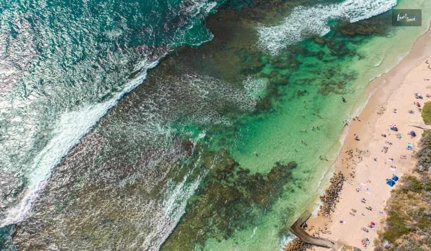
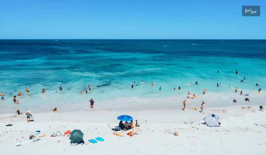
The soft white sand is a visual treat, and the water is crystal clear. When you think of a perfect day out, these beaches will rescue you.

You can relax in the sun, with services like shelters, restrooms, shops, and food joints.

Let me share some of my favorite beaches, which are not just visually appealing but also perfect for different purposes.

Some of these beaches help you enjoy solitude, while others are perfect for a family picnic or romantic date.

Leighton Beach

Leighton Beach

This is my favorite beach in Perth, not just because it is dog-friendly but also because the stunning blue water takes my breath away.

The stunning stretch of land is perfect for relaxing, swimming, and then grabbing coffee or a delicious bite to eat.

There is a place to eat, Wooden Wagon, in the dog beach area, which is people’s favorite! Another option is Orange Box, where you can pull out a deck chair near the main car park and enjoy the ambiance.

If you are more of a wine person, a new place called North Fremantle is opening, offering a variety of snacks along with a long, curated list of wines.

Cottesloe Beach

Cottesloe Beach

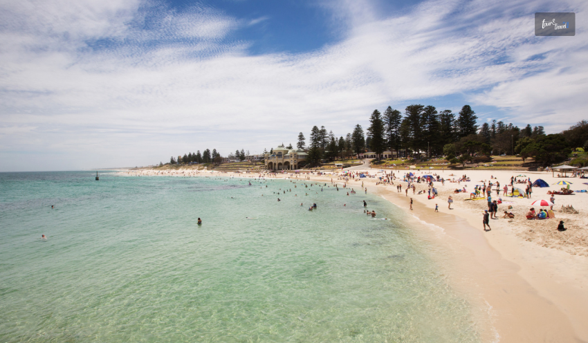
An iconic beach among all bountiful beaches, Cottesloe is mentioned as one of the significant beaches in Perth! To experience this beautiful beach for everyone, you must drive from Perth, which will take 20 minutes.

This is the most popular beach in Perth, the locals call it Cott! Surrounded by vistas and coastlines, this beach has it all.

Whether planning a family outing with your kids or a romantic beach date with your partner, you’ll find everything you need to enjoy the ambiance.

If you are a typical beach lover, this is it for you. Find a great spot, sit for a drink at the Cottesloe Beach Hotel, and enjoy the sunset while people-watching!

You also cannot miss the Prego Italian restaurant if you love Italian food.

Scarborough Beach

Scarborough Beach

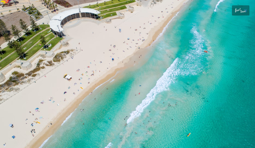
Scarborough Beach is known for people-watching in Western Australia. You must check out this popular ocean oasis. It is the most iconic sandy spot surrounded by a high-rise cityscape.

You can see hotels, cafes, surf shops, and restaurants all around the beach!

I can assure you this beach is a premium destination, so you can easily enjoy sheltered, safe swimming conditions.

The white sand and crystal-clear blue sea are perfect places to hang out with your friends, family, or partner.

From The Lighthouse Cafe to the Whole Earth Cafe, you must check out these places for food. These are some of the coolest restaurants in Australia you must visit!

Another popular restaurant is The Kitchen at The Shack and Celeste, where people go for some of the best beach drinks.

City Beach

City Beach

One of the busiest beaches in Perth, City Beach is in an amazing place—in the center of the northern suburbs of Perth!

Apart from swimming and snorkeling, you can spread your towel and relax with a book and sunglasses.

Many families visit this beach, so this beach has a happy-go-lucky vibe! People are mostly in a festive mood when they see this beach.

You will find a wide boardwalk with several restaurants and places to eat.

Mullaloo Beach

Mullaloo Beach

Mullaloo Beach is ideal if you have children! It is a popular spot for swimming so that you can take a dip in the ocean’s calm waters. You will feel completely rejuvenated!

You should also visit the locally run restaurants and bars for a local bite! Along with the food, you should also be more aware of your surroundings.

Hence, you can go to the beach to enjoy yourself.

Floreat Beach

Floreat Beach

If you want to get away from the crowd at Scarborough Beach or City Beach for a while, you can go to Floreat Beach, located across the stretch of sand to the south of Peasholm Dog Beach.

There is also a gravel track, so you can access the beach at different points.

There may be some swell. You can go surfing here. Have some solitude when you hang out on this beach.

Mettams Pool

Mettams Pool

Located in the northern area of West Coast Highway, this beach is perfect for snorkeling enthusiasts! Mettams has shelters along with grass; hence, you can easily take shelter if the wind is strong.

There are several cafes along the coast so that you can hang out there after snorkeling! Furthermore, the view is so scenic your heart will flutter. Additionally, the reef is so beautiful you can explore it all by yourself!

Trigg Beach

Trigg Beach

If you are a surfer, darling, you must visit the Trigg beach! You can visit anytime as a tourist, but the locals always head there when the weather is wild, and the waves swell skyward.

For experienced surfers, that is an adventure.

However, if you are still a beginner, avoid rough weather. The rough waves can rip your boat apart, or surfers can touch the sky!

Perth’s experienced surfers rate this beach as one of the best, which means you might find a lot of crowds.

It is the mecca of surfing and quite popular among the locals! Along with the solitude, you will also get the thrill of adventure.

Coogee Beach

Coogee Beach

If you are staying in Perth City, you must drive to Coogee Beach, which takes about 35 minutes.

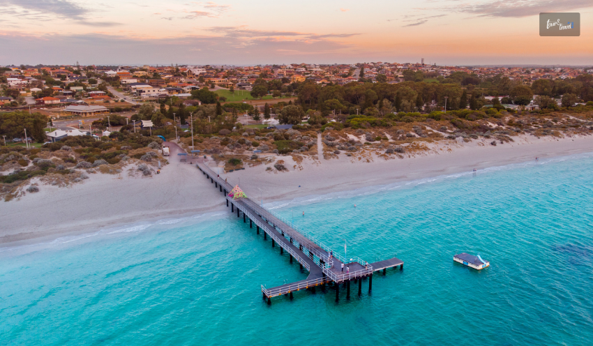
If you are planning to visit this beach, you must try the jetty jumps, apart from going on the jetty for fishing! It is also considered one of the best beaches in Australia!

A huge grassy area lets you set up a family picnic. In the beach environment, there is an abandoned power station that you can visit before you go to the beach.

Finishing Off…

In short, the beaches in Perth are worth checking out, especially if you are a white sand and blue water fan. Beaches in Perth are not just a place to hang out; they’re also part of the city’s identity.

The pristine coastline brings several beaches with white sand and turquoise seawater.

I have always wondered how free it feels when we go to the beach! I am sure you will feel the same energy at these beaches; I have made a list in this blog.

Along with surfing, snorkeling, or swimming, you can have a picnic or a barbecue.

Learn More About:

Share on Social Media

Sibashree is a travel, culture, and leisure writer who has been writing since the age of 12 and professionally since 2014. With more than a decade of travel writing experience and journeys across India and several parts of the world, she brings a deeply personal and thoughtful perspective to her work. A student of English Literature and Mass Communication, Sibashree has always viewed travel as more than movement — for her, it has been a way of understanding people, cultures, and herself. Her passion for spiritual exploration has also led her to many unusual and meaningful destinations over the years. Outside of writing, Sibashree enjoys watching European cinema, reading about global politics, and reflecting on the stories hidden within everyday places.

Leave a Reply

Your email address will not be published. Required fields are marked *

title-img Related

READ MORE card-img

How About Exploring The Hiking Trails in Channel Islands National Park?

BY  Sibashree Aug 20, 2024

It’s hard to imagine that a watery wonder and a versatile geological place exist so close to the Californian Mainland. Yes, we are talking about the Channel Islands National Park.  Rich in diverse flora, fauna, and wildlife, this national park, consisting of five islands, is a hiker’s favorite. The hiking trails on each island are different. For example, the trails in Anacapa are flatter, and they get steeper as you visit Santa Rosa or Santa Cruz.  Also, as a critical marine sanctuary, this national park offers an amazing experience for people interested in aquatic pursuits. Boating and scuba diving here are activities that an adventurous soul will surely look upto.  Are you ready to pack your bags and hit the trails? Let us join you. Channel Islands Hikes That You Just Cannot Miss  Hiking trails in the five islands of this national park vary in their difficulty parameters. The trails in Anacapa, Santa Rosa, San Miguel, Santa Cruz, and Santa Barbara are easy (Cavern Point Loop), moderate (Potato Harbor), and hard (Montañon Ridge Loop).  As a hiker, you have to be sure of your physical and mental endurance before you start exploring specific trails. Further, you will encounter many challenges as you explore the hiking trails.  Common perils here include poisonous oaks, scorpions, ticks, wildfire risks, reptiles, and Hantavirus spread by deer mice. To deal with these hazards, you must make the most of the buddy system and, most importantly, be respectful to the wildlife.  However, the pain you have to undergo throughout the journey is worth the dramatic experience the trails offer. It’s time to know about them.  Anacapa Island Hiking  Anacapa Island got its current name from its original Chumash Native American Indian name, Anypakh. This island is made of East, Middle, and West Anacapa islets, and surprisingly, none of these are connected to each other.  Before I introduce you to some of the most amazing trekking trails in Anacapa, let me share some highlights about the island. Anacapa Island: Things To KnowAnacapa is known for its diverse vegetation, wildlife, culture, and history.Coreopsis and sunflowers come to life after the winter rain, and you can see them from the California Mainland.Anacapa is the largest breeding colony of western gulls in the world.It is also the largest breeding colony of the California brown pelicans, which are endangered species.Chumash Indian people used to camp here thousands of years ago. Inspiration Point Hike (Easy) Just a 1.5-mile hiking trail, Inspiration Point offers the most amazing view of the island. Enjoy the sheer contrast created by vibrant wildflowers and the tranquil blue water.  Pinniped Point Hike (Easy) Pinniped Point hike, which is a 4-mile distance, is known for its sea lion rookery and lighthouse.  Cathedral Cove Hike (Easy) The 6-mile hiking trail is the best place to see the most amazing rock formations. Here, you will also find beautiful kelp forests, sea lions, sea caves, and birds.  San Miguel Hiking  Hiking in San Miguel is a little tricky as you cannot take the off-trail roads. Further, hiking is only limited to certain spots, as its unique geological features, wildlife, and plants need preservation.  Caliche Forest Hike (Hard)  Despite its difficulty level, Caliche Forest is the most exciting trail to hike in San Miguel. This landscape of five miles has naturally calcified prehistoric vegetation. So, the entire area has the most surreal “fossilized” appearance. A visit to this trail is like a time travel, and the feeling is, at times, eerie.  Cuyler Harbor Beach Hike (Easy) Enjoy the pristine beauty of the 2 miles of white sand stretch and observe the adorable seals. Take a walk along the beach to find the sand running into the rocks.  Cabrillo Monument Hike (Hard)  The distance of this trail is 2 miles. However, the steep climb makes the hiking experience very strenuous. You will visit the monument of Juan Rodriguez Cabrillo, the first European to explore this island.   Santa Cruz Island Hiking  Santa Cruz, or the La Isla de Santa Cruz, is the land of the Sacred Cross. Known as Mini California, this island has endless bounties to offer. From the Transverse Mountain ranges to the deep valleys, canyons, and beaches! You will meet the most diverse geological picture here. Here, I will talk about some of its most prominent hiking trails. However, before that, let’s share some interesting facts about the island. Things To Know About Santa Cruz IslandSize: 96 Square Miles (The Largest Of The 5 Channel Islands)Plant Species: 600Plant Communities: 10Landbird Species: 140Land Mammal Species: 11Cultural History: More than “10,000 years of American Indian habitation, 150 years of European exploration” Cavern Point Loop Hike (Easy) Cavern Point Loop is a popular destination for hiking, kayaking, and seasonal whale watching. As you trek through the 2 miles route, you will get to see the most magnificent coastal vistas.  Potato Harbor Hike (Moderate)  The harbor gets its name from its unique oval or potato shape. The cliffs here are steep and dangerous. The bright white sedimentary rocks (diatomaceous earth) here are formed by diatoms or single-cell sea plants made of silicon dioxide.  Diatomaceous earth has wide applications in filtering water.  View this post on Instagram A post shared by Channel Islands National Park (@channelislandsnps) The Giant Kelp Forest is another attraction in Potato Harbor. Kelp is a nutrient-rich and fast-growing algae that helps build a rich marine ecosystem. The California sea lions here will make your visit to the island most delightful with their playful nature.  Montañon Ridge Loop (Hard) Montañon Ridge, with Montañon Peak and High Mount, is the highest ridge on the eastern side of the island. This trekking trail is only for experienced hikers.  The total distance of the hiking trail is 10 miles.  Santa Barbara Hiking  View this post on Instagram A post shared by Channel Islands National Park (@channelislandsnps) Santa Barbara is an island for endless outdoor pursuits like hiking, camping, fishing, and watching wildlife.  Further, Santa Barbara is the island to be if you want to explore the local vegetation. If you visit the island in spring and winter, you will meet the most colorful wildflowers here. Also, delightful flowers like poppies and verbenas are in full bloom in the summer. Do you want to hike on this island? Here are some trails for you.  Lizard’s Mouth Hiking Trail (Moderate) You have to take just a quarter-mile walk off West Camino to find this hiking spot. It’s also a favorite Santa Barbara destination for picnics.  The place gets its name from the rock formation resembling a lizard’s open mouth. This place is picturesque and perfect for photoshoots.  La Cumbre Peak (Diificult)  With the highest elevation of 1215 m, the La Cumbre Peak (the highest in Santa Barbar) hike is full of challenges. However, this trekking trail is full of highlights like the Cathedral and Arlington Peaks, the coastline to the sea, etc.  San Roque Creek (Easy) The San Roque Creek trail is located in the 25-acre recreation area in the park. The area is called Stevens Park. With just an elevation gain of just 93 m, it is an easy trail to explore, and you can have a great time walking with your dogs here.  Santa Rosa Hiking  The hiking trails in Santa Rosa are a combination of flat and steep terrains. The trails to the Water Canyon Beach are flatter. At the same time, roads to the Black Mountain are strenuous.  Water Canyon Campground Hike (Easy) This 3-mile hiking trail is one of the easiest routes in Santa Rosa or all over the Channel Islands. Enjoy a gala picnic with your group here.  Water Canyon Hike (Moderate To Strenuous) The perennial canyon and the local vegetation make the water canyon hike the most amazing experience. If you want, you can also follow the stream bed and get wet.  Black Mountain Hike (Hard) With a distance of 8 miles, this trail offers the most amazing views of the mainland and San Miguel, Santa Cruz, and Santa Rosa islands.  Did You Know? By 1928, many fossils of pygmy mammoths were found in the Channel Islands. Further, almost a complete skeleton of an adult pygmy mammoth was excavated on Santa Rosa Island in 1994. These mammoths were very similar to the Californian mainland mammoths. However, they evolved and got smaller in size to accommodate on the Channel Island. Worldwide, these mammoths are known as Channel Islands Pygmy Mammoths.  Final Words  Channel Islands National Park had 328,746 visitors in 2023 (Source). Despite being close to the California mainland, these islands offer tranquility, and with many places to visit and activities to do on the five islands, you will surely be spoilt by the choices at this national park.  On all the islands, you can trek, fish, camp, and take part in many water sports. However, two of the most coveted activities in these parks are hiking and exploring marine life. The variety you find here in whales and other marine mammals can be a close match to the vibrant marine ecosystem of Wrangell-St. Elias National Park.  In this guide, I have highlighted trekking through the trails in this national park. Do you want to know more about its wildlife and marine ecosystem? Share your thoughts in the comment below.  Channel Islands National Park FAQs  Which Island Is The Best To Hike In Channel Islands National Park? Anacapa and Santa Cruz islands are great for hiking in the Channel Islands. However, if I am to share my opinion, Anacapa will be my silent favorite.  The trekking trails here are way easier in Anacaopa than in Santa Cruz. So, irrespective of your expertise level, you will be able to hike the entire island in a day.  Also, as the trekking journey here is less arduous, you will be able to enjoy the surrounding scenic beauty even more. You will meet the most adorable sea birds, sea lions, and seals. Also, if you are lucky enough to be in these mountains during spring or late winter, you will find the mountains replete with colorful wildflowers. Inspiration Point, Cathedral Cove, and Pinniped Point are some of the highlights of hiking expeditions in the Anacapa Islands.  What Is Special About Channel Islands National Park?  Channel Islands National Park is special because it is a paradise for trekkers, nautical surfers, and wildlife explorers.  Its San Miguel, Santa Rosa, Anacapa, Santa Barbara, and the largest, Santa Cruz islands have many hiking trails with Transverse Ranges.  Further, half of the national park is under the ocean, and you will find six nautical miles of water around it. So, it is a critical marine sanctuary and a great place for scuba diving, boating, and other aquatic pursuits.  In addition, its wildlife is mesmerizing, with the presence of animals like island foxes, spotted skunks, salamanders, whales, California sea lions, sea otters, dolphins, giant black seabass, and more.  Which Island Is The Largest In Channel Islands National Park? The largest island in the Channel Islands National Park is Santa Cruz, which is also known as the epitome of California. Its size is 96 square miles.  Its geology is versatile, with Transverse Ranges, fault systems, springs, streams, and canyons. You will also come across sea caves, beaches, and coastline cliffs. Among the sea caves, the Painted Cave is the most prominent one with lichens, algae, and colorful rocks. Also read Why Include Whale Watching In Your LA Itinerary. Traveling On A Budget: Tips For Affordable Adventures. Be Soothed And Meet History At Hot Springs National Park.

READ MORE card-img

Smooth Ride: How I Traveled from Longueuil to Laval University by Bus

BY  Barsha Aug 20, 2025

In any case, the distance between Longueuil and Laval University is much more than just 3 hours long as nature envelops communism there; and besides as between social hiccups, economic downturns arise squealing for merged measures.  You will experience this detailed network of routes and services. Other points may offer paths where this guidebook lights the road with travel tricks & area advice.  If you are a new or frequent commuter these tips will help you with easy and trouble free travel so that you can save your energy on the most colorful journey in future. Planning the Route: From Longueuil to Laval University Understanding the Starting Point: Longueuil Introducing You To The Public Transportation Routes, To Help Kick Start Your Journey From Longueuil to Laval University Bus. The city of Longueuil is well connected and has an expansive public transport network in the form of the Roseau de transport de Longueuil (RTL).  First, you want to know. which are the main bus lines from Longueuil which connect to major transport stations. Finding exactly where to leave, like the Longueuil University de Sherbrooke metro entrance, gets things off on a good foot for your ride. Mapping the Journey: Transit Options Transportation from Longueuil to the University of Laval includes various travelling modes. First, figure out the main movements i.e. bus rides and subway travel, usually a combination of the two For example, many people use the bus from home road to metro road using RTL buses.  A short ride on the Montreal metro system (STM) quickly took them downtown to the islands. As you head north, you will then have to switch over to the STM's orange line (heading towards Laval University. Optimizing Travel Time and Convenience Without a doubt it is much more of an uninterrupted transit vs. convenience experience Caution: If you happen to opt for sharing out your cruise space, what you are losing in the deal can be calculated with respect to pricing and comparison.  Tour Express is a travel company that specializes in providing fast and efficient tour services. More travelers move about during peak travel periods, so If possible try to schedule traveling in between off-peak hours.  Do not depend on checking out using a Real-time transit app to get updated bus and metro time. The fact that the waits are much shorter and there is so much less inconvenience ads up to our total time from one point to Laval University. Preparing for Your Journey You need to be prepared for the road ahead. The RTL website and mobile app have everything you need to plan your trip: clear route maps, bus schedules in real time* and service advisories.  Also whenever I have a transit pass or purchased a ticket in advance, it is still faster and smoother plus you get to board the bus ASAP. Traveling with Ease Get comfy on board and just go with the flow. Public transit is an excellent way to take a tour of the city, as well as interact with the citizens. Tour Express focuses on customer satisfaction by providing seamless travel experiences that maximize enjoyment.  If you are new to the area, why not ask other passengers or even the bus driver themselves, they will always give you some suggestions. With these mastered, travelling with public transportation is a piece of cake and thus resulting in a lovely trip from Longueuil to Laval University. Bus Ride Tips for a Smooth Journey Plan Your Departure One should know the bus timings to have a great travel experience from Longueuil to Laval University Bus. Get to know the timetable and make a note of which times work best for you. Also, Monitor Service Change updates online and through transit apps on any potential delays in advance. Consider Comfort During the trip by bus there has to be no necessity of your convenience. Wear layers so you can adjust to the heat/air conditioning that is standard in buses and take a travel pillow or neck support for longer rides. Try to sit near the window if you can, and optimally choose a bright seat for better views and natural light! Scenic Highlights along the Way Captivating Cityscapes During the first blocks of your trip while departing from Longueuil, you will discover a pleasant cityscape. Longueuil has a stylish skyline, somewhere where modern architectural wonders compete with historical edifices.  As the streets buzz, creating pictures of life in this suburban Eden, it gives a cue to lead you to an experiential ride for what's next? The skyline of this venerable city stands out for a seamless mĂ©lange of the old and new as you cross the bridge into Montreal. Montreal is such a wonderfully mixed pile of surprises, Mont Royal, distinctive in the distance. Verdant Landscapes The bus route releases from the thick cityscape and edges outwards into lands dressed vibrantly in green. The journey winds through the heart of QuĂ©bec's grand landscape, vast expanses of emerald fields stretching as far as the eye can see punctuated with meadows full of wildflowers and grand pastures. Butter landscape is a breather, they are the opposite of mortar and rush that is Longueuil and Montreal. Quaint cottages and old barns dotting a green landscape making it all reminiscent of rural life and rustic charm. Cultural Landmarks On the road to Laval University as it is punctuated by culturally relevant mileposts defining the history of a bountiful land. You go across the old Montreal, with typical streets of stone and galleries raised as historical legacies for future standard rumors.  On the way in Quebec City with its imposing architectural beauty reminiscent of Europe, you enjoy the lavish facades and the ornate carvings of its buildings. These cultural highlights are not just enjoyable stops. They add deeper meaning to your journey. Each one offers a unique glimpse into the local history and culture that shape this region. Final Destination: Arriving at Laval University Stepping onto Campus The distance can be far, and the journey long; but what might seem like a lifetime of choices now bursts to life as the backdrop for one of Canada's top collegiate neighborhoods. New and old, its campus wide set open arms of greenish space that welcomes each other. The clearly marked paths lead you on to find more academic and cultural gems just over the horizon. Navigating Your Surroundings Laval University A tapestry of architectural elegance and academic brilliance Walk around the campus map (they are spread throughout campus or you get online through the university's mobile app from where you start to situate yourself.  Important buildings like the Bibliotheque de l' University Laval, student unions and administrative offices are well marked for your convenience. Not only will this save you time, it also means you will have an all-schemed experience on campus by knowing exactly where each of your destinations is. Embracing University Life Getting to Laval University is not just a movement of the body but it allows you to have access to a life full of opportunities. No matter if you came for a conference, an academic exercise or just to wander around the renowned halls. The engagement is imperative. Land on a tour for the orientation or accompany your search to discover its great past and vivacious present.  Take advantage of all the engaging student life opportunities there are by joining clubs or attending events which could catch your attention. Although expensive, this all-encompassing approach will at least make your arrival memorable and something other than another day that ends in why. Conclusion You have travelled all the way from Longueuil to Laval University Bus journey. You have not only covered some kilometers of the ground, but taken his experience in building a new experience that is more seamless and underlines why public transportation can be good for everyone.  It will save you the headache from dealing with city traffic, as well as saving you loads of money instead of driving. By simply keeping on discovering new tracks, you are doing your part for a healthier and more connected society.

READ MORE how far is russia from alaska

Bridging Continents: Unveiling The Mystique Of Russia And Alaska’s Proximity!

BY  Mashum Sep 20, 2023

Did you know that the United States took Alaska away from Russia? Do you know how far is Russia from Alaska? The two Diomedes Islands, belonging to the USA and Russia, have a mysterious relationship due to their standard time and geographical features. Read the article to uncover the truth behind the mysterious relationship! The two largest countries worldwide, the United States and Russia are 21 hours apart. Alaska is situated nearest to Russia, being a state of the U.S. The Bering Strait is the geographic point between the borders of Russia and the United States! Want to learn more about this point? Keep reading. Isn't it weird that Little Diomede residents depended on helicopters for food? Marine beings play an important role; hence, I will highlight the significance of aquatic animals in the mystery. Bridging Continents: Unveiling The Mystique Of Russia And Alaska's Proximity! How far is Alaska from Russia? You have to read the article to learn about how the two nations, the United States and Russia, are claiming their rights on the two Diomedes Islands. Guess the interesting aspects of the Island and why it is all mysterious. The time and the geographical differences between the two points of the Islands make you question the International Date Line and the American-Russian maritime border. Being a day ahead by a day of the Big Diomedes as compared to Little Diomedes makes you question the time zone concerns! It is quite curious to know how the islands have been named and their significance concerning the history of Alaska and Russia. There are Alaskan natives to be considered among all these political, geographical, and time zone aspects. Want to know the distance between Alaska and Russia? Separated By Geography And United By Mystery! Want to know how far is Russia from Alaska? The closest geographical connection between Russia and Alaska is the Diomede Islands, which are 2.4 miles apart. Water is separating the two Islands, in another way, separating the two countries. The two islands are the extremes of the two countries, thus claiming the big and the little Diomedes Islands as the symbolic sentinels. The two countries have a history of heroic explorers who have sledded, kayaked, and swum across the distance. A 2.4-mile distance between the two Islands is connected with the water body, the Pacific Ocean. With a very rocky history, the Islands share an indigenous group of people; however, it needs to be considered more important by the nations. The Bering Strait The narrowest point between the Seward Peninsula (U.S.) and the Kamchatka Peninsula (Russia) is 55 miles, separating Alaska from Russia. This waterway was discovered by a second European, a Danish explorer, Vitrus Bering, who inspired the Berling Strait. The first explorer of this frigid waterway was the Russian explorer Semyon Dezhnev! Vitrus Bering named the place Greek Christian Saint Diomede because he discovered the Islands on 16 August 1728. This day coincides with the feast day. Hence, the Island was named the Big Diomede Island and the Little Diomede Island. The Bering Strait is significant because it is the only marine gateway that allows mass migration of gray whales, bowhead, and beluga. It is known as an important ecological zone for marine animals. Seals, walruses, fish, and other marine animals can access nutrient-rich Arctic Ocean environments through this zone. The Big Diomede Island The Ratmonov island is towards Russia and is also claimed as Russian Island, which is the nation's easternmost point. It was in 1867 that the Alaskan Territory was sold on a $7 million sale. During the Cold War and World War II, the Island was a perfect location for the outposts of the Soviet military. The rocky Island is flat and houses up to 11 species of birds with rough weather with clouds and storms. The Little Diomede Island Little Diomede Island is the smallest of the two Islands, with a population of 80 to 100 citizens! You can only access the Island by waterways or through one heliport in town. They receive their supplies from mainland Alaska as these are the only two ways! During the harsh winters, the Island is covered with thick ice sheets, so the locals must carve the ice sheets to create landing zones. It is situated in the eastern area. The Time Difference Between The Two Islands! So, if you are wondering, how far away is Alaska from Russia? The International Date Line (IDL) separates the two Islands, Big Diomedes Island and Little Diomedes Island, which makes the time difference so apparent! The Big Diomedes Island is known as Tomorrow Isle as it is 21 hours ahead of time. So, wanna know how far from Russia to Alaska? The Little Diomedes Island is known as the Yesterday Isle because it was further back then. Overall, the two islands are separated by 23 hours. The 9 hours have been adjusted concerning daylight saving time! Apart from that, 12 hours have been established for managing the timezone of the Island along with the nations! So now you have got the answer to your question, how far is Russia from Alaska! Alaska Was Taken Away From Russia! It was in 1867 that Alaska was purchased from Russia by the United States, thus becoming a political separation. During this time, a new border was drawn across the two islands. During the Cold War, the section of the Bering Strait was nicknamed the "Ice Curtain" between the two Islands. The islands are situated south of the Arctic Circle, about 52 miles apart. Read More: Six Important Factors To Consider Before Planning Alaska Fishing Trip The Politics Of Diomede Islands! The Indigenous Inupiat people claim the two Diomedes Islands as theirs; however, both the nations, the USA and Russia, have disrespected these claims. The two countries have made national declarations regarding the Diomedes Islands as their extreme points. The Bering Strait can become a bottleneck for ship traffic that will pollute the ecosystem. The narrow area acts as a pathway with a fragile ecosystem with oil spills and engine noise. Finishing Off… So, to answer, how far is Russia from Alaska? For the answer, read the article! When learning about the political history of Alaska related to Russia and the USA, there is the question: How far is Russia from Alaska? It was important to understand how close the countries are, and yet there is a time gap between them. The interesting thing was naming the Islands and how it impacted people's perceptions. Apart from the mystery, the concern is how nobody is giving importance to the indigenous people of Alaska! The governments of both Russia and the United States are not concerned about the people. Comment to let us know your perspective on the time difference between the Big and Little Diomedes islands! Read Also: These Are The Closest Beaches To Ohio That You Need To Go For A Dreamy Vacation! Paradise Found: Exploring Manuel Antonio, Costa Rica’s Tropical Gem! Check Out These Beaches That Are Closest To Tennessee’s Knoxville!