Related
Must Pack Business Travel Packing List Along With Tips
BY Abdul Aziz Aug 24, 2023
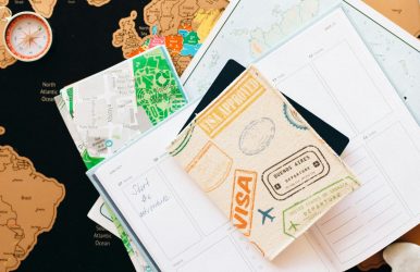
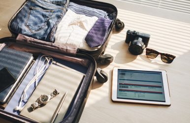
As a frequent business traveler, you understand the significance of having an efficient suitcase. From traveling for short meetings to attending lengthy conferences, having essential items can make all the difference in how smoothly everything runs. This blog post offers a complete packing list for business travelers and includes helpful advice to ensure they're fully prepared for their professional adventure. So grab your suitcase and begin packing like an expert! How To Pack For A Business Trip Packing for a business trip requires careful thought to bring everything you need for meetings and presentations while maintaining an attractive appearance. Here is a step-by-step guide to packing efficiently: Make A Checklist: Draft an essential items list that covers clothing, toiletries, electronics, documents and any special items required for meetings. Check The Weather: Research the weather forecast for your destination during your trip. This will help you determine the appropriate clothing to pack. Choose Versatile Clothing: Opt for versatile pieces that can be mixed and matched to create different outfits. Stick to a color palette that coordinates well. Includes business attire like suits, blouses, dress shirts, slacks, skirts, and comfortable shoes. Formal Attire: If you have formal events or meetings, pack appropriate attire such as a formal suit, tie, and polished shoes. Accessories: When accessorizing an outfit, bring along accessories to enhance its style. Ties, scarves, belts, and jewelry can all add the perfect finishing touches and complete their style. Toiletries: When traveling abroad, travel-sized items such as toothbrushes, toothpaste, shampoo/conditioner/soap, deodorant, razor, and any medications required for your trip are essential. Electronics: When traveling for business, always pack all necessary equipment, such as your laptop, chargers, smartphone, and any essential accessories, such as power banks or headphones, that may be needed. Documents: Organize and pack essential documents such as your passport, identification card, boarding pass, travel itinerary, business cards, and meeting materials. If you need fresh business cards for networking, you can easily get a custom business card print with Adobe Express, ensuring a professional look. Additionally, digital tools can help convert text to speech, making it easier to review travel details or meeting notes on the go. Work Essentials: Include a notepad, pens, and any work-related materials needed for meetings or presentations. Shoes: Pack comfortable yet professional shoes that match your outfit. If you're attending formal events, pack appropriate formal shoes. Outerwear: Pack a versatile jacket or blazer that complements your business attire. Also, consider packing an umbrella in case of unexpected weather changes. Gym Gear: If you plan to work out during your trip, pack gym clothes, sneakers, and any necessary accessories. Chargers And Adapters: Ensure you have the right adapters and chargers for the electrical outlets at your destination. Packing Strategy: Use packing cubes or folders to organize clothing and minimize wrinkles. Roll clothes to save space and reduce wrinkles. Check Airline Restrictions: Familiarize yourself with your airline's baggage allowance and restrictions to avoid surprises at the airport. Travel-Size Laundry Supplies: When packing for travel, remember a small bottle of laundry detergent or stain remover in case any laundry needs arise. Medications: In terms of medications, be sure to pack sufficient supplies of medicines necessary for the duration of your journey. Personal Items: Include items like your wallet, keys, and regularly used items. Double-Check Before Leaving: Double-check your checklist to ensure you have everything essential. Pack Light: Try to pack efficiently and avoid overpacking. Focus on the essentials to make your trip more manageable. Business Travel Packing Tips And Tricks Embarking on a business expedition demands more than a suitcase; it requires a masterful symphony of strategy and practicality. These indispensable tips and ingenious hacks will be your guiding stars, ensuring your seamless and stylish journey. Strategic Selection Based On Itinerary: Craft your wardrobe like an artist's palette, with each garment chosen for a purpose. Analyze your Itinerary, from meetings to downtime, and curate outfits that effortlessly transition. Versatility is your ally. Hotel Amenities As Allies: Embrace the luxury of your chosen abode. Leverage hotel amenities like laundry services, hairdryers, and irons. Leave these bulky items behind, freeing up precious space in your luggage. The Art Of Packing Cubes: Unravel the magic of packing cubes. These versatile compartments can transform chaos into order, granting each item its enclave within the suitcase symphony. Prioritize Quality Luggage: Your suitcase is more than storage; it's a partner in your journey. Opt for quality and durability. A well-designed bag can safeguard your belongings and enhance your travel experience. Medicine And Essentials First: Begin your packing symphony by arranging essential medications and personal items. Build from this foundation, securing your well-being before diving into other necessities. Liquid Allowance Awareness: Navigate the labyrinth of liquid restrictions set by airlines. Prioritize travel-sized toiletries or consider solid alternatives to avoid spillage and streamline security checks. Virtual Documents And Backup: Liberate yourself from paper documents. Digitize your essentials – from travel itineraries to business documents. A cloud-based backup ensures access regardless of circumstances. Minimalist Shoe Strategy: Shoes are notorious space-hoggers. Choose a versatile pair for formal events and another for casual strolls. Your feet and luggage will thank you. Clever Clothing Coordination: Opt for a color scheme that allows mix-and-match possibilities. Each garment should complement others, maximizing outfit options while minimizing the number of pieces. Roll, Don't Fold: Tame clothing in bulk with the roll, not fold technique. This minimizes wrinkles and opens up additional space for more necessities. Elegance In Accessories: Elevate your outfit with carefully selected accessories. A statement tie, scarf, or jewelry can transform a simple attire into an impressive ensemble. Power Of Reusable Bags: Pack a collapsible tote bag. It's ideal for unexpected purchases, separating dirty laundry, or accommodating an impromptu excursion. Backup Charging Arsenal: Keep a dedicated charging kit with spare cables, a power bank, and adapters. You won't scramble for power amidst vital engagements. Emergency Clothing Stash: Unexpected spills or mishaps are inevitable. Pack a compact emergency clothing kit, including spare socks, a shirt, and an accessory to freshen up quickly. Tech Armor For Gadgets: Your device is vital. Shield them with protective cases and sleeves to ensure they reach your destination unscathed. Travel Insurance: Non-Negotiable: Protect your journey with comprehensive travel insurance. A safety net is invaluable, whether for trip cancellations or medical emergencies. Decanting For Delicate Liquids: Opt for small, leak-proof containers for cosmetics or toiletries prone to leakage. This ensures your essentials remain intact and your luggage spill-free. Tailored To Tees: Pack clothes that align with your style. Feeling confident in your attire can significantly impact your overall outlook and performance. Digital Detox Deliberation: Reflect on the necessity of every tech gadget. A temporary digital detox can foster mindfulness and enhance your experience. Return With Room: Leave room in your luggage for souvenirs or potential acquisitions. A well-planned packing strategy ensures your journey concludes with a sense of accomplishment. Travel with Travel-Wise! The leisure trend has rapidly gained popularity as an effective way to combine business travel with pleasure. An itinerary that provides both productive work time and leisure activities is critical to maximize the experience of any trip. Travel-Wise provides an intuitive trip planner that makes travel plans tailored to your preferences easier than ever, enabling you to combine productivity with enjoyment for any upcoming business trip seamlessly. With Travel-wise on your side, creating the ideal business trip is now more manageable than ever! Read Also: How To Save Money On A Trip To Abu Dhabi 7 Tips To Make The Most Out Of Your Trip To Gatlinburg