

Swiss Delights: Mountains, Lakes, And Chocolate

Nov 1, 2023

Last Updated on: Nov 20, 2024

Travel Guides

Switzerland is a must-visit destination for captivating your senses and creating lifetime memories. With breathtaking mountain ranges, glistening lakes, and mouth-watering chocolate, the country has something to offer everybody, and we’ll give you a taste of the Swiss trifecta to help you plan your trip. But if the thought of planning overwhelms you, fear not. Exoticca offers a seamless solution—a vacation where you don’t worry about flights, accommodations, or even your breakfasts. With Exoticca’s best of Switzerland tours, all you need to do is pack your bags and show up.

Swiss Mountains

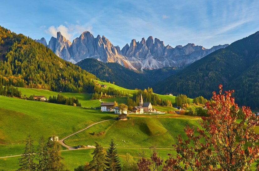
When you think of Switzerland, it’s almost impossible not to conjure images of soaring, snow-capped mountains. These majestic peaks are the true heart and soul of the country. The Swiss Alps are an iconic wonder, a natural masterpiece that inspires awe and reverence.

Standing at the foothills of these towering giants, you’ll feel a sense of insignificance, yet at the same time, an overwhelming connection to nature. The air is crisp, and the vistas are simply breathtaking. These mountains, including the famous Eiger and Matterhorn, are a playground for adventure seekers and nature enthusiasts alike.

Hiking is one of the most popular activities in the Swiss mountains. With a network of well-marked trails, you can explore alpine meadows, cross pristine streams, and immerse yourself in the tranquil beauty of the Swiss countryside. The sound of cowbells in the distance is a reminder of the country’s pastoral charm.

In the winter, the Swiss Alps transform into a snow-covered wonderland. Ski resorts like Zermatt and Verbier offer some of the finest skiing and snowboarding experiences in the world. You’ll glide down pristine slopes, surrounded by stunning alpine scenery, and savor the adrenaline rush that only the mountains can provide.

For those who prefer a more relaxed experience, Switzerland’s cable cars and cogwheel railways offer a convenient way to reach higher altitudes. As you ascend, you’ll witness the landscape gradually changing from lush valleys to rocky terrain and, ultimately, the world of snow and ice. The views from the summit are a reward for the journey, providing a sense of tranquility and appreciation for the world’s natural wonders.

Swiss Lakes

Swiss Lakes

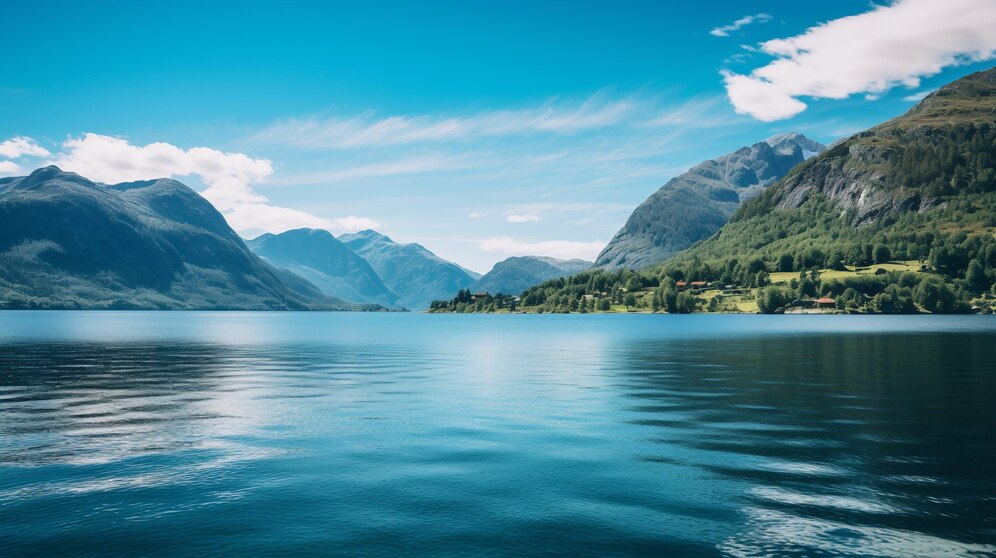
Switzerland isn’t just about mountains; it’s also home to some of the most serene and picturesque lakes in the world. These bodies of water, nestled amid the alpine landscape, offer a tranquil respite from the hustle and bustle of everyday life.

Lake Geneva, surrounded by the cities of Geneva, Lausanne, and Montreux, is a gem of Western Switzerland. It’s a place where you can relax by the shore, enjoying the play of sunlight on the water and the cool breeze in your hair. The promenades are perfect for leisurely strolls, and the lakeside cafes offer a delightful setting for a nice cup of joe or chocolate or a glass of local wine.

Lake Lucerne, with its striking blue waters and the charming town of Lucerne at its heart, is another Swiss marvel. You can take a relaxing boat ride across the lake, passing picturesque villages, while the backdrop of the Swiss Alps creates a captivating scene.

For those seeking adventure, Swiss lakes offer numerous water activities. You can paddleboard or a kayak, try your hand at windsurfing, or even go for a refreshing swim. Some lakes have diving spots where you can explore the underwater world.

Fishing is also a popular pastime on Swiss lakes, with the opportunity to catch trout and other native species. If you’re an angler at heart, you’ll appreciate the tranquility and the simple joy of waiting for a nibble from the depths.

Swiss Chocolate

No journey through Switzerland would be complete without indulging in the country’s most famous treat – chocolate. Swiss chocolate is renowned worldwide for its quality and flavor. It’s a delightful experience that will make your taste buds dance with joy.

Switzerland has a long history of chocolate making, dating back to the 17th century. The secret of Swiss chocolate lies in the meticulous craftsmanship and the use of high-quality ingredients. Swiss chocolatiers take pride in their art, and every piece of chocolate is a work of culinary excellence.

The best way to savor Swiss chocolate is to visit one of the many chocolate factories and shops that dot the country. In cities like Zurich, Geneva, and Lausanne, you can take guided tours of these chocolate wonderlands, where you’ll learn about the chocolate-making process from bean to bar.

During these tours, you’ll have the chance to sample a wide variety of chocolates. From creamy milk chocolate to rich dark chocolate and everything in between, the flavors are diverse and decadent. Swiss chocolate often features fillings like hazelnuts, caramel, and praline, adding layers of texture and taste that will leave you craving for more.

Swiss chocolate isn’t just a treat for your palate; it’s also a feast for your eyes. The craftsmanship involved in creating chocolate sculptures and figurines is truly astonishing. At Swiss chocolate shops, you’ll find a wide array of chocolate creations, from delicate truffles to intricately designed chocolate bars.

In Switzerland, chocolate isn’t just a sweet treat; it’s a cultural icon. Swiss chocolate brands like Lindt, Toblerone, and Nestlé have gained international acclaim. As you explore the local shops, you’ll have the chance to pick up these renowned brands as well as artisanal chocolates crafted by local chocolatiers.

Swiss Trifecta: Mountains, Lakes, and Chocolate

Swiss landscape

As you traverse the Swiss landscape, you’ll find yourself falling in love with the simplicity of life amid breathtaking natural beauty. Indeed, the Swiss have mastered the art of living in harmony with their environment, and this is a lesson they willingly share with visitors.

In addition, it’s a destination that promises adventure, relaxation, and a taste of culinary heaven. Hiking in the Alps, cruising on a Swiss lake, and savoring a piece of Swiss chocolate are some of the must-dos in this charming country. Apart from your adventure, you can also apply for finma license to set up a business in the Swiss financial industry if you are interested. So, when planning your next adventure, put Switzerland at the top of your list. Create memories you won’t soon forget.

Read Also:

Share on Social Media

Arnab is a professional blogger, having an enormous interest in writing blogs and other jones of calligraphies. In terms of his professional commitments, He carries out sharing sentient blogs.

Leave a Reply

Your email address will not be published. Required fields are marked *

title-img Related

READ MORE card-img

The Great Barrier Island Beach Guide: What Are The Best Beaches On The Great Barrier Island, New Zealand? 

BY  Sibashree Nov 17, 2025

The beaches add to the laid-back vibe and off-the-grid living of the Great Barrier Island, New Zealand. Surfing breaks, boating, canoeing, or just relaxing by the sea, the beaches are ideal for families, surfers, couples, nature seekers, and solo travelers.  Furthermore, it is the largest island of the Hauraki Gulf in the Auckland region. It has protected the Auckland Harbour from the rampage of the Pacific Ocean and storms. It is now a Dark Sky Sanctuary and a boating paradise.  Also, the eastern and western beaches of the Great Barrier Island have many differences. The beaches on the eastern side have long white surf beaches and high cliffs. On the other hand, the beaches on the western side are way calmer and have deep, sheltered harbors.  Tryphena, on the southwestern side of the Great Barrier Island, is the largest settlement. The calmer and picturesque beaches of Tryphena are ideal for families. These are also ideal for spotting dolphins.  Whangaparapara Harbour, on the southeastern side, is another important beach location on the Great Barrier Island. I was fortunate enough to meet Tony & Carol Litherland, who have been living on a catamaran here since October 1979.  So, the top beaches to visit on Great Barrier Island, New Zealand, are beyond water and sand. They are the telltales of human history and home to distinct ecosystems.  In this Great Barrier Island beach guide, I have discussed the top beaches to visit on Great Barrier Island. I have included hidden gems, pet-friendly spots, and insider tips. What Are The Top Beaches To Visit On The Great Barrier Island?  The beaches of the Great Barrier Island get transformed into a planetarium after sundown. Being a dark sky sanctuary, it allows us to see the luminous arch of the Milky Way and the constellations.  Medlands, Awana, and Kaitoke draw the crowds. However, the secluded beaches are the best for soaking in the real vibe of this nature-first island.  Nevertheless, let’s slip into a kayak and explore secluded coves, surfing beaches, and spot the most fascinating wildlife. 1. Medlands Beach Medlands Beach is also called Oruawharo Beach, named after the early settler family. It is ideal for surfers, and the Medlands Beach campground is one of the best camping spots on the Great Barrier Island. This campground is maintained by the Department of Conservation (DoC).  It is also home to Oyster catchers and Dotterels. The Medlands ecovision community group works hard to preserve the nesting community of birds here.  Furthermore, I saw many pet parents taking their dogs for a walk along Medlands Beach. The dogs are allowed off-leash at 100 meters south of the Lane Walkway. However, they have to stop at 100 meters north of the creek.  However, for me, the biggest attraction of the Medlands Beach has been the Good Heavens Dark Sky. In my Great Barrier Island travel tips, I have mentioned how the sunset moments were magical. They add to our anticipation for the stargazing moments.  2. Awana Beach The Awana Beach, on the eastern coast of the Great Barrier Island, is a popular surfing destination. The DoC campground on the northern end is a favorite spot for watching wetland birds.  Awana Beach is also a prominent location for wildlife tours in the Great Barrier Island for spotting marine life.  3. Kaitoke Beach On our way from Auckland to the Great Barrier Island, we met the long sandy stretch of Kaitoke Beach. Our flight overlooked Kaitoke Beach on its way to the runway.  It is a popular spot for watching hammerhead sharks and stingrays. 4. Whangapoua Beach Whangapoua Beach is a popular surfing spot, and it stands out thanks to the wonderful views of Rakitu Island and Hirakimata. Furthermore, the Whangapoua DOC campground is on the southern end of the beach. It is a favorite of fishing and surfing enthusiasts.  In addition, the Northern end of the beach has the SS Wairaapa grave walkway. The grave has a white picket fence. Another major attraction of the beach is the Whangapoua to Harataonga coastal walkway.  5. Harataonga Beach Harataonga Beach has one of the most family-friendly hiking trails on the Great Barrier Island. It is a favorite spot for rock fishing and snorkeling.  You can reach the beach after a walk through the DoC campground. However, camping here is a little difficult. The gravel road leading to the campsite is quite bumpy for RVs and campervans.  6. Blind Bay Blind Bay, located on the western coast of the Great Barrier Island, is a lot calmer, and it is ideal for family vacations. Located in Okupu, this bay looks beautiful with the presence of magnificent pohutukawa trees.  What I loved the most about Blind Bay was how the dolphins came to the shore of Okupu. You just need to get into a kayak and take a ride to spot the dolphins.  Furthermore, September to March is the ideal time for spotting Dotterel nests along the shoreline. Dogs are allowed on the Blind Bay. However, you have to keep them on the leash and ensure they only stick to the marked routes.  7. Gooseberry Flat & Pa Beach The Gooseberry Flat Beach is in the heart of the Great Barrier Island. It is around the corner from the Stonewall Village. Also, Pa Beach, below the Stonewall Village, is an ideal destination for a quaint boat ride.  However, the headland between these two beaches, featuring the most unique purple stone, is the highlight of this Gooseberry Flat & Pa Beach exploration.  Another fascinating thing on the beach is how sandbars have formed warm pools of water. Kids love to splash around these pools when the tide goes away.  From here, you can go to the southern end and take the walkway over to Mulberry Grove. 8. Mulberry Grove Beach The Mulberry Grove Beach on the Tryphena harbour is easily accessible. It is ideal for snorkeling, swimming, and boat launching.  Furthermore, don't miss the Mulberry Grove store behind the beach, a playground for young children, and the half pipe for skaters .  You can also spot nesting native birds here. Moreover, indulging in an ice cream or fish and chips and watching the Sun go down with your family will be fun!  Camping And Eco Stays Near These Popular Camping Sites In Great Barrier Island, New Zealand The DoC campsites and eco-friendly lodges are the best options for staying near these beaches.  BeachesNearby AccommodationsMedlands Beach Campsite, Harataonga Beach Campsite, Awana Beach CampsiteDoC CampsitesMedlands BeachMedlands Beach Lodge• Address: Medlands Beach 149 Sandhills Road, Medlands, Tryphena 0961, New Zealand• Contact No: +64 9 429 0335 What Are The Best Beaches For Photography And Drone Footage? Kaitoke Beach is the ideal destination for sunrise photography. The beaches suitable for sunset photography are Blind Bay, Tryphena Bay, and Medlands Beach.  For drone photography during golden hours, use ND filters. Also, respect the privacy of the designated zones and ensure that flying birds are not harmed by flying drones.  What Is The Family-Friendly Beach Guide? Harataonga and Gooseberry Flat are the best options if you are on holiday on the Great Barrier Island with your family. These have shared areas, picnic tables, and toilets.  When exploring the family-friendly beaches of the Great Barrier Island, you will have to bring reef shoes. Moreover, determine the child safety zones by monitoring the tides.  What Are The Hidden Beaches And Local Secrets Of The Great Barrier Island? Yes, Kaitoke, Medlands, and Awana are the best crowd pullers of the Great Barrier Island. However, as I talked to the locals, they suggested some really cool hidden gems. These, with their unkempt beauty, helped us connect to the wild spirit of Aotea.  1. Puriri Bay North of the Tryphena Harbour, Puriri Bay is a quiet beach with a rocky shoreline. The low tide makes pockets of dark sand on the shore.  Puriri Bay is also famous for spotting dolphins in the summer season.  2. Schooner Bay Schooner Bay is another hidden gem near Tryphena. Visiting Schooner Bay is a bit of an adventure and fun at the same time. You have to pass through a winding road to reach this spot.  It is a favorite for stargazers and couples. Also, with a cliffside landscape, it is one of the quietest beaches in the Great Barrier Island, New Zealand. The silence here is so powerful that the experience is almost spiritual.  3. Nagle’s Cove Nagle’s Cove is on the Northwest coast near Orama and Kawa. Framed by native bush and volcanic ridges, it exudes a remote and pristine vibe. You have to access it via a kayak or a boat, as there is no marked trail.  In addition, Motairehe Marae, affiliated with Ngātiwai Ki Aotea, is an important community center for weddings, social celebrations, and funerals.  Why These Hidden Beaches Are The Attractions You Must Not Miss? The hidden beaches of Great Barrier Island are beyond scenic. As cultural treasures, or cultural taonga of Great Barrier Island, New Zealand, they stand for the off-the-grid lifestyle.  They are also the telltale signs of Māori heritage and community spirit. To respect the local heritage and culture, you must stick to the following practices.  Avoiding Nesting Bird Zones  Leaving No Trace Staying on the Marked Path Cooperating with Biosecurity Measures  How To Explore These Hidden Beaches On The Great Barrier Island?  Renting an electric bike or a 4WD is the best way to explore the hidden beaches on the Great Barrier Island. Also, as always, it is best to take suggestions from the locals and cafe owners.  They can guide you to the best unnamed spots and directions where Google Maps fails, or the network is unavailable.  Also, it’s unfortunate that we could not meet Benny Bellerby during our trip. But he is like a wizard of the conservation process and stargazing on the Great Barrier Island. He is the adventure operator of Star Treks and is the most passionate about protecting the cultural and natural heritage of the island.  In addition, I have already mentioned Tony & Carol Litherland, who live on a catamaran on the Whangaparapara Harbour. They epitomize the signature hospitality of Great Barrier Island, New Zealand.  What Are The Adventure Add-Ons Near These Beaches Of The Great Barrier Island?  Glenfern Sanctuary, Windy Canyon, and the Kaitoke Hot Spring are the attractions near the beaches of the Great Barrier Island.  1. Glenfern Sanctuary Glenfern Sanctuary opens your door to the Kotuku Peninsula. It is located in the northwest of Great Barrier Island. Also, it takes us through nearby walking tracks such as the Cooper’s Castle Track, Aotea Track, and Old Lady Track.  Furthermore, know how biosecurity and the endeavors to protect the endangered plants, animals, and birds are essential for the Great Barrier Island.  2. Windy Canyon Windy Canyon and the Palmers Track, which continues from there, are among the most picturesque hiking routes on the Great Barrier Island.  Along with being the route to Mount Hobson, it is also home to many rare species, such as black petrels and tomtits. Moreover, North Island robins are being reintroduced on this route. So, it is a wholesome hiking and birdwatching experience.  3. Kaitoke Hot Springs The walk to the sulphurous Kaitoke Hot Springs continues along the edge of the Kaitoke Swamp. It is one of the most accessible tracks with pushchairs. Also, the walk through the ancient shoreline continues through the Kaitoke wetlands and kānuka forest.  Furthermore, the umbrella fern and orchids near the creek keep the path filled with colors. Also, a nature soak after a long beach day feels very refreshing. What Are The Best Conservation And Safety Tips?  Aotea is not just a scenic destination. It is a culturally rich and ecologically sensitive island with deep Māori heritage and a close-knit community. Respecting local customs and beach etiquette is essential for a positive experience and responsible tourism. 1. Respecting The Māori Heritage And Sacred Sites Avoid trespassing on private land or areas marked as tapu (sacred). Do not touch or move carvings, stones, or natural markers, as they may hold spiritual significance. Ask before photographing people or cultural sites, especially near marae (Māori meeting grounds). Learn basic greetings like “Kia ora” and show appreciation for local stories and traditions. 2. Being Mindful With Pets There are designated on-leash and off-leash areas on the Great Barrier Island, New Zealand. Furthermore, walking with pets through the bird nesting areas, especially in the breeding season, is an absolute No-No.  Furthermore, after hiking, you have to clean your pet to stop soil transfer and prevent the resurgence of the Kauri Dieback disease. Proper disposal of the pets is also very important.  Moreover, you must be aware of the conservation and pet policies of the ferries and accommodations before taking them as your companions.  3. Leaving No Trace The Great Barrier Island does not have strategically placed dustbins. So, you will have to pack and carry all the biodegradable items, food scraps, and rubbish, especially when you are hiking and camping.  There is a dumping ground at Claris Landfill PDS at 70 Gray Road for cleaning the campervans and caravans. In addition, you cannot use detergent or soap when swimming on the beaches, as the practice can impact marine life.  Moreover, stay on the marked trails while hiking to protect the flora and fauna from the Kauri Dieback Disease.  4. Respecting The Peace And Privacy If you are staying in eco lodges or near the residential areas, you have to keep your noise level in check. You cannot play loud music. You have to be more mindful, especially when camping on the beaches.  In addition, be careful when using drones near the sacred sites and wildlife of the Great Barrier Island. You may need permission from local authorities for the same. 5. Being Safe During Swimming And Other Water Activities We could rarely find a lifeguard on the beaches of Aotea. Still, the western beaches of the Great Barrier Island are calmer and suitable for swimming. Also, you have to ensure that you are not blocking the surfing zones.  Stingrays and Jellyfish are common in the shallow waters of Tryphena Harbour. So, be careful when swimming.  6. Supporting Local Sustainability Efforts We can support the local economy of the Great Barrier Island by shopping at the shops and businesses owned by the Island. Furthermore, you can protect marine life by wearing reef-safe sunscreen.  Also, participate in beach cleanups and local cleanup activities. In addition, stick to the water conservation rules of the Great Barrier Island, as the supply of fresh drinking water is limited on the island.  7. Ask, Listen, And Learn You cannot know the Great Barrier Island unless you are talking to the locals. The island is the cradle of the incredible Māori heritage. It is them who told us about Kupe, the mythical navigator and one of the first people to arrive on the Great Barrier Island.  The Okupu settlement, or Ō-Kupe-Mai-Tawhiti, is named after him.  8. Transport Tips Take a Barrier Air flight from Auckland to reach the Great Barrier Island in New Zealand. You can even take a SeaLink ferry and reach the Great Barrier Island from Auckland in 4.5 hours.  Also, once you reach the Great Barrier Island, you will have to rent a car, e-bike, or scooter to move across the rugged landscape.  9. Embracing Local Culture Off-the-grid living is the essence of the Aotea Great Barrier Island, New Zealand. So, you will not find any banks or ATMs on the island.  You will have to pay by EFTPOS or credit card. However, sometimes the local businesses may refuse to take cards. So, carry enough cash to support your stay and other expenses on the Great Barrier Island.  Why The Beaches Of The Great Barrier Island Will Be On Your Bucket List?  Are you chasing waves, or are you seeking solitude and moments of introspection by the waters? The beaches of Great Barrier Island are ideal for both types of experiences. Add to that the rugged landscape and rich flora and fauna of Great Barrier Island.  Before you plan your trip, you can read this Great Barrier Island beach guide to experience the magic of Aotea.

READ MORE card-img

The Hiking Trails In Saguaro National Park Are Calling! Pack Your Bags

BY  Sibashree Aug 12, 2024

Saguaro National Park has a massive footfall every year thanks to its delightful trails, mountains, and endless species of cacti. Despite being a favorite of hikers and equestrians, this park is also a delightful destination for family trips.  Further, exuding the essence of the Sonoran Desert, Saguaro National Park in Arizona is also home to creatures like the Gila monster, mountain lions, desert dogs, and coatis.  So, are you planning a vacation between October and April? Pack your bags and visit the trails and desert land in Saguaro National Park.  Know The Best Trails In Saguaro National Park The Saguaro National Park is divided into two sections, east and west. The east side has the more intriguing trails, whereas the trails in the west offer the most amazing scenic beauty.  Along with desert and mountain trails, you will also be able to go for short walks and explore the natural trails filled with cacti and saguaros.  So, let’s know the trails in the Rincon Mountain District in the east and Tucson Mountain District in the west.  Best Hikes In Saguaro National Park East (Rincon Mountain District) If you want to experience the pristine beauty of Saguaro National Park, your road must lead to the east. This side of the park has fewer tourists and old vegetation of cacti and saguaros. Also, are you an early bird? You can enjoy the best Sunrise view from the Saguaro Eastern trails.  Hope Camp and Ridgeview Trail Distance: 2 miles This trail is famous for the best views of the Rincon Peak and has an elevation of 400 feet. Toward the end of the trail, all your strain will be gone as you discover vibrant wildflowers and beautiful panoramic views.  As the trail ends at the top, the Box Canyon will appear before your eyes. If you are in the park during the wet season, the view of the waterfalls will give you the most fulfilling experience.  Freeman Homestead Trail Distance: 1 mile An old homestead foundation, large saguaros, and a desert wash are the highlights of Freeman Homestead Trail.  You can call this a “home in the desert,” and it is related to plant life and history. This Saguaro National Park East trail is one of the favorites of youngsters.  Loma Verde Loop Distance: 3.8 miles The Loma Verde Loop comes with a 60-feet elevation. The presence of mature mesquite trees along the trail gives the space a gothic vibe.  Here, you will cross a seasonal wash and climb onto bajada (Spanish), a gravel land at the mountain base.  Next, you will have to cross the Loma Verde Mine and continue through the Pink Hill Trail. Wait a while and keep hiking in a minor spur trail, offering a mesmerizing view of the cactus vegetation.  Further, take a right turn on the Pink Hill Trail and also take a right turn on the Squeeze Pen Trail. Finally, take a left on the Loma Verde Trail to head back to the trailhead.  As you can see, a lot of twists and turns await throughout the loop. So, keep a topographical map handy.  Garwood Dam and Wildhorse Tank Distance: 6.4 miles Garwood Trail is one of the best routes for you if you have come to the park to see cacti. As you take the steep section of the trail, you will visit Garwood Dam, built by Nelson Garwood.  Continue your journey through the switchbacks until you reach a ridge with the most amazing views.  Further, as you cross the ridge, you will find Wildhorse Trail. Turn right and take a steep of 0.3 miles to reach the Wildhorse Tank.  Tanque Verde Ridge Trail  Tanque Verde Ridge Trail is one of the most strenuous hiking routes in this National Park because the distance and elevation of the trail keep varying. The highest point in the trail is the Tanque Verde Peak, which is 7049 feet high.  However, as you advance through the route, you will get to see the most exciting views. Further, when you reach the top of the ridge, you will find many other ranges in the north, south, and west. The Tucson Basin also becomes visible from the ridge top. In addition, don’t forget to take snaps of “the Dome,” a “crested saguaro,” and the unique views.  Best Trails In Saguaro National Park West (Tucson Mountain District) Tuscan Mountain District has the largest cacti in the USA. This large saguaro is acknowledged as the universal symbol of the American West.  Hike through the trails in the west to meet a variety of cacti and the most amazing Sunset views.  King Canyon Trail Distance: 3.5 miles The King Canyon Trail ascends to the Hugh Norris Trail. Watch out for the stair-step-like rock formations in the wash bottom.  Hugh Norris Trail  Distance: 4.9 miles Hugh Norris Trail is the most delightful among other trails in the park. It leads to the Wasson Peak, the highest spot in the Saguaro National Park.  Along with scenic beauty, the rocks of various formations will grab your attention throughout the trail.  Sendero Esperanza Trail Distance: 3.2 miles Sendero Esperanza Trail hiking is a little arduous thanks to the constant ascends and descends. However, it is one of the most beautiful trails in the park.  Cam-Boh Trail Distance: 2.7 miles  Cam-Boh Trail works as a connection between the eastern and western trails of Tucson Mountain District. Further, it is a favorite of hikers for its connectivity to many hiking loops. You can also enjoy a horse ride through the trail.  Ringtail Trail Distance: 1 mile Ringtail Trail connects you to many other trails on the eastern side of the Tucson Mountain District. The trail can get moderately steep.  Sweetwater Trail Distance: 3.4 miles  If you want to visit the Wasson Peak from the east of the Tucson Mountains, you will have to take the Sweetwater Trail.  The trail starts at  El Camino del Cerro Road’s western end.  Cactus Wren Trail  Distance: 1.5 miles  This one-way trail stretches to the Signal Hill Picnic Area, a favorite of localities for family trips. You can start your journey from the “Sandario Road and Rudasill Road” corner.  You will see many desert washes on the trail.  Short Walks And Nature Trails In Tucson Mountain District The short walks and nature trails of the national park will make you familiar with the local ecosystem. Get ready to explore the following trails replete with various cacti.  Cactus Garden Trail - 100 yards Desert Discovery Trail - 0.5 miles Valley View Overlook Trail - 0.8 miles Signal Hill Petroglyphs Trail - 0.5 miles Organpipe Cactus, Pink Hedgehog, and Claret Cup Cactus are some of the most popular cacti species found across these trails.  Final Words  Saguaro National Park had more than 1 million (1,010,906) visitors in 2023. The easy trails with the best scenic views and the diversity of cacti here consistently attract visitors to this park. In the last five years, the park has welcomed more than a million visitors three times.  Perri Spreiser, the district ranger for interpretation at Saguaro’s Rincon Mountain District, has rightly said, “We are no longer a small park.”  The increasing popularity of the park has left a positive impact on the local community. They are proud of the park and ensure that everything is quiet and serene in the park. The park owes much of its popularity to the pristineness of its beauty. The local community does not want to ruin it. Do you want to explore beautiful desert trails, and are you a cacti-enthusiast? It’s time to pack your back and take a drive to the land of saguaros. Or have you already been to this wonderful national park that was designated in 1994? Don’t forget to share your experience with us.  Saguaro National Park FAQS  Is Saguaro National Park Worth Seeing? Yes, Saguaro National Park is worth seeing, as you can see the most amazing cactus and saguaros here. The place has a distinct rugged charm with flat desert and rocky mountains.  You can hike through the trails and enjoy the most beautiful Sunset views in the park.  How Many Trails Are In Saguaro National Park? Saguaro National Park has as many as 78 trails spreading across 200 miles. A combination of flat deserts and rocky mountains, Saguaro National Park, is a great place for hiking with family and beginners.  What Is The Most Scenic Trail In Saguaro National Park? Hugh Norris trail leading to the Wasson Peak, the highest point of the Tucson Mountains District of Saguaro National Park, is the most scenic trail.  You have to travel through a dense forest, and as you advance toward the peak, you will find a rocky landscape. You can enjoy an expansive view of the Sonoran Desert as you explore through this trail.  Opuntia, echinocereus, and barrel cacti are the most amazing cactuses found on this trail.  What Is The Best Place To See Sunset In Saguaro National Park? Saguaro National Park West is the best place to see the Sunset. You can enjoy the most beautiful view from Gates Pass, which is at the western end of Speedway Boulevard.  In Saguaro National Park East District, the Sunset looks most beautiful as you explore the  Tanque Verde Ridge trail. Javelina Rocks pull-out is another great spot to watch Sunset in the East District.  How To Spend One Day In Saguaro National Park West? A day in Saguaro National Park West will be filled with activities. Camping and hiking are the most adventurous activities here to explore.  The Tucson Mountain District is on the west side, and your trip to the west starts with the Red Hills Visitor Center. The west side of the national park has many cacti and large saguaros.  Also read Why Include Whale Watching In Your LA Itinerary. Traveling On A Budget: Tips For Affordable Adventures. From Cocktails To Kickflips: Must-Try Activities In San Diego.

READ MORE best national parks in arkansas

What Are The Best National Parks In Arkansas? Know Why You Will Love Them 

BY  Sibashree Sep 1, 2021

Especially, the best national parks in Arkansas, along with national museums and trails, are a must-visit to learn about the American Civil War history.  But do you know that there is only one national park in Arkansas? The National Park Service only recognizes the Hot Springs National Park.  Along with that, you can also explore the National Memorial, Arkansas Post, National River, Buffalo, the National Historic Site, Fort Smith, etc.  For the campers and the hikers, these natural parks, monuments, and sites in Arkansas are like gems. Every hiking trail has a rich history along with a mesmerizing beauty. 7 Best National Parks In Arkansas Arkansas is home to the birthplace of the 42nd President of the United States, Bill Clinton. Also, it is known as the “Natural State.”  Furthermore, the state has seen major economic success in the tourism sector.  According to a report from Arkansas Money & Politics, in 2024, the tourism spending (business and leisure) was $10.3 billion, and it was a 4% increase from 2023.  Now these national sites, monuments, and national parks of Arkansas are the pillars of such a tourism boom.  Also, I had a wonderful time at these natural wonders. So, here, I will share some important details and my experience at these places.  1. Buffalo, The National River, Best For Canoeing, Kayaking, And Stargazing Quick Facts  Established: 1st March, 1972 Flowing Distance: 135 Miles through the Ozarks  Entry: Free Camping Charges: $0-$50 As I cruised through the Ozark Mountains and saw the massive limestone bluffs, Buffalo, the first national river of America, gifted me some goosebump moments.  It is also one of the undammed rivers in America. As the Sun went down, I along with my co-travelers and I enjoyed our campfire on the Buffalo River banks.  Furthermore, the Buffalo National River bank was designated as an International Dark Sky Park (IDSP) in 2019. You can even take part in various night sky programs in the river.  Moreover, the National Park Service has made some changes to the restrooms and lighting facilities around the Buffalo River to keep the light pollution and interference minimal for dark sky observation.  2. Fort Smith National Historic Site: Best For An American Civil War History Tour Entry: Free Hours: 9 AM to 5 PM Contact Number: Voice Phone Number, (479) 783-3961 Once you visit the Fort Smith Historic Site, 80 years of history will be alive in front of your eyes.  It awaits you to tell the story from 25th December 1817, the day it was established, to 1896, the jurisdiction of Judge Isaac C. Parker over Indian Territory.  In the middle of Oklahoma and Arkansas, there are many historic buildings from the Civil War era, in the Fort Smith National Historic Site.  Also, can you believe that 86 got the verdict of execution at Fort Smith between 1873 and 1896 in the courtroom of Isaac C. Parker? The gallows are also still there.  Does not seem surprising again, thanks to the jurisdiction of Judge Isaac C. Parker, who believed and said, “Permit no innocent man to be punished, but let no guilty man escape." 3. Hot Springs: The National Park In Arkansas With Ancient Thermal Springs   Entry Fee: Free Hours Open: Visitor Center, 9 AM to 5 PM, and Hiking 24/7 Hot Springs, the national park of Arkansas, has an interesting geology, and the ancient thermal springs are the most fascinating feature of this national park.  Furthermore, it has historic bathhouses where you can heal and relax with the ultimate spa experience. Choose between the Lamar Bathhouse, Ozark Bathhouse, Hale Bathhouse, Superior Bathhouse, and many such names.  Also, remember that the bathhouse area, constructed during the period of 1892 and 1923, was designated as a National Historic Landmark District in 1987 along with the Grand Promenade.  Furthermore, along with exploring the hot springs and bath houses, you can even camp at the Gulpha Gorge Campground. The camping fee is $34 per night.  However, the most rewarding experience here is hiking through Hot Springs and North Mountain Trails, Sunset Trail, and West Mountain Trails.  4. Little Rock Central High School: National Historic Site I missed visiting the Little Rock Central High School. In 1957, this school was the epicenter of the enforcement of the African American Civil Rights. The school followed the Brown v. Board of Education. Moreover, the struggle of the Little Rock Central High School ensured that everyone around the world got opportunities for education.  5. Arkansas Post: National War Memorial Henri de Tonti established the Poste de Arkansea in 1686. Located at the Quapaw village of Osotouy, it became known as “The Post.”  There was a long struggle between Spain, France, and England for dominion over the Mississippi Valley.  The Post eventually became the first semi-permanent settlement of the French in the Lower Mississippi Valley.  Moreover, The Post is witness to the only Revolutionary War in Arkansas, in which the British partisans logged head with Spanish soldiers. It took place in 1783 and was also known as the Colbert Raid.  Again, in 1803, thanks to the Louisiana Purchase, the Post became a part of the United States. Moreover, by 1819, it was the first city to become the capital of the Arkansas Territory, and it was the largest regional city.  During the Civil War, Fort Hindman was built here to take control over the confluence of White and Arkansas Rivers. However, it was destroyed in 1863.  6. President William Jefferson Clinton Birthplace This place is the perfect definition of an American leader born in the woods, who makes some revolutionary movements. President William Jefferson Clinton was born in the Town of Hope in the Arkansas ranges. The president spent his first four years here. The property is still in good condition. Take a walk on the property. Then take a tour of the town of Hope. And feel the historical vibes of the place. 7. Trail Of Tears The historical value of the trails is pretty touching, and is remembered by the Native Indian tribes and the Cherokee people.  The Trail of tears is a historical trail that is 5,043 miles long. The track stretches from the southern Appalachian mountains to the west side. This single historical trail crosses over nine USA states. The heart-touching facts are attached to this trial. In 1830, seventeen Cherokee groups were removed from their homelands. And the painful consequences determined the fate of these people. For the remembrance of the sacrifice of the people, this historical path is called the Trail of Tears. Wrapping It Up: The best national parks in Arkansas, along with other national sites, are good travel destinations for people of all ages. If you are looking for a good travel option that has historical value. This is the best choice. For adventure-loving travelers, this is the best choice to spend the entire day on the side of the Buffalo River. You can visit the nearest places from the river banks, and all the hiking trails lead towards a town. So most often there is less chance of getting lost. But morning and daytime are the most suitable times to explore the place. So what is your next travel plan? Do not forget to share your experience with us in the comment section. Read Also: Living Your Solo Travel Dreams: 8+ Best Places To Travel Solo Female In US Unique Things To Do In Tulsa: Into The Land Of Art Deco Architecture Be Soothed And Meet History At Hot Springs National Park