


 Related

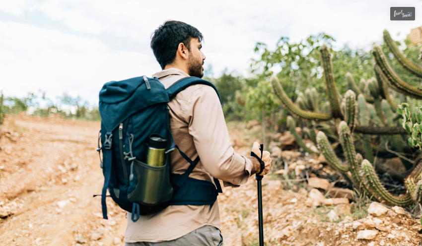
The Best Great Barrier Island Camping Tips: Ultimate Guide To The Best Camping Spots On Great Barrier Island, New Zealand
BY Sibashree Nov 17, 2025
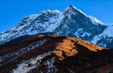
Spotting the burrows of the black petrels at Glenfern Sanctuary and the hillside was like magic! The burrows had eggs in a cream shade with tan freckles. They almost looked like the eggs of a hen, though slightly larger. Also, some chicks were chirping their hearts out inside the burrows. They looked like those squishy dog toys. Now, spotting birds is one of the most fulfilling activities when you are camping on Great Barrier Island, New Zealand. Furthermore, if days were about hiking and spotting the birds, the nights were about indulging in the surreal beauty of the celestial bodies at this designated Dark Sky Sanctuary. Moreover, camping in Great Barrier Island is a true off-grid and remote experience. No Streetlight! No Public Rubbish Bins! And, No Powered Camping Sites! It’s just you, the camping tent, and the rugged beauty of New Zealand’s Hauraki Gulf. Hi, in today’s blog, I will talk about the Great Barrier Island camping tips. Here, you will learn about the must-book DOC sites, the non-negotiable biosecurity rules, and everything else you need to plan your adventure. Camping In Aotea, Great Barrier Island: Setting The Right Mindset For Biosecurity And Sustainability View this post on Instagram A post shared by Department of Conservation (@docgovtnz) Aotea isn't a place that just hands you its beauty. It's a place that makes you earn it. It's a true adventure that rewards you for being self-sufficient. It's the thrill of waking up to the raucous call of a Kākā parrot, not an alarm clock. It's the magic of watching the Milky Way rise over the dunes at Medlands Beach, and the peace of having a rugged, white-sand cove all to yourself. Also, it is one of the rare islands that serve as sanctuaries, and with 60% of its area protected by the Department of Conservation, Great Barrier Island demands the utmost care for biosecurity and the adoption of sustainable practices. So, before you want to explore the best camping spots on Great Barrier Island New Zealand, you have to build your mindset. This is your invitation to join a small community of travellers who value wild, authentic, and responsible adventure. 1. Offering The True Off-Grid Experience The campsites of the Great Barrier Island are exactly what the island is. They are not powered, and they have basic amenities. Furthermore, open fire is not allowed in these campsites. So, you will have to bring fuel-powered or gas cookers. Furthemore, the Department of Conservation camping sites have only a specific number of tents. So, you need to make the booking well in advance. Contact the Department of Conservation (DoC) at 0800 275 362. 2. The Golden Rule: "Pack In, Pack Out” Zero waste and recycling are important for the sustainability and environmentally friendly practices of the Great Barrier Island. However, the island does not have public rubbish bins. So, whatever you carry to the island, you will have to take it back. You must use the official Orange Council bags with stickers for trash disposal. 3. Biosecurity Is Most Important Protecting the Kauri trees from the infamous “Kauri Dieback disease” and the island's endemic animals requires a high level of biosecurity. So, when you leave for the Great Barrier Island from Auckland, you will have to check for ants and rats. Also, when you leave Great Barrier Island, check the tents and packs for skinks. In addition, the Phytophthora Agathidicida attack on the kauri trees has been a serious concern. Stopping the soil movement is crucial to stopping the attack of this dieback disease. Soil movement can happen through pigs, footwear, and vehicles. Therefore, the Department of Conservation (DoC) cleaning stations play an important role in cleaning and removing soil from your gear and footwear before entering a kauri forest on Great Barrier Island, New Zealand. In addition, you have to stick to the marked routes when hiking through the best Great Barrier Island hiking trails. 4. How To Book The Camping Sites: DOC Vs. Private If you are camping in any of the DoC sites, you have to make the booking online well in advance. Private camping sites can be booked directly. Here is the step-by-step guide for booking a DoC Campsite on the Great Barrier Island. First, visit the Department of Conservation site for the particular campsite. For example, let’s talk about the Akapoua Bay Campsite. On the dedicated Akapoua Bay Campsite page, you will get to know about the campsite and the fees. The fees for the Akapoua Bay Campsite are $18 per night for adults, $9 per night for children ages 5 to 17, and $0 per night for infants ages 0 to 4. In addition, you can book a campsite pass from the Department of Conservation of New Zealand. It will give you access to all the bookable and non-bookable campsites in the country. If you need any assistance in booking the campsite pass, you can avail of that at a service tax of $10. For adults, the camping pass will cost $295.00 (365 nights), and for children between 5 and 17 years, the pass will cost $147.50. Moreover, for children below 5 years, the camping pass is free. If you need any assistance regarding the booking of the 1-year campsite pass or a pass for any specific site, you can contact Whakatū/Nelson Visitor Centre at +64 3 546 9339 or email them at nelsonvc@doc.govt.nz. The Kauaeranga Visitor Centre (+64 7 867 9080/kauaerangavc@doc.govt.nz) also offers the same assistance. What Are The Best Camping Spots On Great Barrier Island New Zealand? View this post on Instagram A post shared by Department of Conservation (@docgovtnz) Digital detox has been a trending thing these days, and if you want to truly experience that and shut all the noise in your head, the camping spots on the Great Barrier Island will be the best for you. Further, the real magic of camping on Aotea starts after sunset. You haven't lived until you've watched the Milky Way rise over your tent from the dunes at Medlands. However, along with the Medlands Beach, there are 5 other DoC campsites in the Great Barrier Island, New Zealand. Here are the details. 1. Akapoua Bay Campsite The sheltered waters of Port FitzRoy have a beautiful camping ground, which is like a gateway to the many walking tracks of the Great Barrier Island, New Zealand. From waking up with a 60-second dash of a cold shower to exploring the paths graced by the pohutukawa trees, the Akapoua Bay Campsite will offer you a peaceful and off-the-grid experience. The maximum number of campers on this site can be 75. Moreover, the camp is hosted from Christmas to the end of January. 2. Harataonga Campsite This campground is very close to Harataonga Beach. So, it is an ideal camping site for swimmers and snorkeling enthusiasts. It can accommodate 120 campers, and this campsite is surrounded by bush and farmland. and camping takes place between Christmas and mid-February. Harataonga is for the romantic escape. 3. Awana Beach Campsite The Awana Beach Campsite is a surfer’s dream. It has beautiful dunes and farmlands around. It can accommodate 120 campers, and the campground remains open from Christmas to the end of January. The only problem with this camping site is mosquitoes. So, you have to carry mosquito repellents. 4. Medlands Beach Campsite The sound of the waves at Medlands. This is the music you will listen to when you go to sleep or wake up at the Medlands Beach Campsite. Medlands is like an all-rounder. It is ideal for families and surfers alike. The campsite remains open from Christmas to mid-February, and it can accommodate 120 campers. 5. The Green Campsite You can boat in or walk in the Green Campsite, which remains open from 1st December to the end of February. With a capacity of accommodating only 30 campers, this campsite has a rich history associated with whaling, kauri logging, and timber milling. The waters of the Whangaparapara Harbour make it an idyllic retreat, and it is also the base of the Aotea Track. 6. Whangapoua Campsite The Whangapoua Campsite is a surfer’s paradise, and it is located on the edge of the Whangapoua estuary. It is also a favorite camping site for fishing. With an accommodation capacity of 150 people, this campsite remains open from Christmas to the end of February. However, the biggest highlight of this camping site is the views of Rakitu Island and Mount Hirakimata. A Comparison Summary Table Of The DoC Camping Sites On The Great Barrier Island, New Zealand DoC Campsite Access Landscape Facilities Activities Dog Access Fees Akapoua Bay Campsite Campervan, Car and Caravan Coastal Boat Launching, Cooking Shelter, Cold Shower, Non-Flush Toilets for Men and Women Boating, Fishing, Walking, and Tramping No Adults: $18 per night, Children of 5-17 years, $9 per night, and Children below 5 years: free Harataonga Beach Campervan, Car and Caravan Coastal Cooking Shelter, Cold Shower, Non-Flush Toilets for Men and Women Swimming, Snorkeling, Fishing No Adults: $18 per night, Children of 5-17 years, $9 per night, and Children below 5 years: free Awana Beach Campsite Campervan, Car and Caravan Coastal Cooking Shelter, Cold Shower, Non-Flush Toilets for Men and Women Kayaking and Canoeing No Adults: $18 per night, Children of 5-17 years, $9 per night, and Children below 5 years: free Medlands Beach Campsite Campervan, Car and Caravan Coastal Boat Launching, Cooking Shelter, Cold Shower, Non-Flush Toilets for Men and Women Fishing, Surfing, Swimming No Adults: $18 per night, Children of 5-17 years, $9 per night, and Children below 5 years: free The Green Campsite Boat, Foot Coastal Cooking Shelter, Non-Flush Toilets for Men and WomenHiking, Boating No Adults: $18 per night, Children of 5-17 years, $9 per night, and Children below 5 years: free Whangapoua campsite Campervan, Car and Caravan Coastal Cooking Shelter, Cold Shower, Non-Flush Toilets for Men and WomenFishing, Surfing No Adults: $18 per night, Children of 5-17 years, $9 per night, and Children below 5 years: free Insider Tips For Camping At DoC Campsites On The Great Barrier Island If you are camping in a caravan or campervan, remember that the gravel roads leading to the camping sites, especially the Harataonga Campsite, are steep and winding. Also, the sites are off-the-grid. Furthermore, the campervans are not usually allowed on the beaches. The Best Private & Unique Camping Options On The Great Barrier Island View this post on Instagram A post shared by Department of Conservation (@docgovtnz) 1. Great Barrier Island Campground The Great Barrier Island Campground, spanning over an area of 12 square acres, is an ideal camping ground for access to different beach activities. The camping site is located at a distance of just 200 meters from the beach. The camping fee at the Great Barrier Island Campground is $10 per person per night. You can contact them at 021 298 8905 for booking. 2. Mickeys Place The O'Shea Family farm in Awana houses the Mickey's Place camping ground. It is a family-friendly camping site with the following facilities. A Communal Cooking Area Flush Toilets Showers Patrick, Sean, and Mickey are the hosts of this campsite, and you can contact them at 09 4290 140. 3. Stray Possum Stary Possum in Tryphena is an ideal camping site for backpackers. If you are camping here, you will have access to the kitchen, toilets, and showers of the adjacent Stray Possum Lodge. This camping site has 14 tents, and you can call 09 4290 109 for booking details. 21 Essential Great Barrier Island Camping Tips I promised you tips, and here they are. Do not go to Great Barrier Island without reading this checklist. • Packing And Food 1. Bringing a Gas Cooker Open fires are banned in the Camping sites of the Great Barrier Island. So, you will have to bring a gas burner for preparing your food. 2. Packing Your Food Groceries are not available everywhere, and they are even very expensive. So, it is better to collect and pack the groceries you will need before leaving Auckland. 3. Bringing a Good Chilly Bin You will need this insulated chest for storing warm and cold food items. 4. Bringing a Red-Light Torch The island is a Dark Sky Sanctuary. A red torch lets you stargaze without ruining your night vision. 5. Bringing Cash EFTPOS (debit) is unreliable, and many camping sites only accept cash. 6. Packing Warm Clothes The weather can suddenly become cold, even on summer days. So, you will have to pack layered clothes. 7. Carrying Mosquito and Insect Repellent Sandflies and mosquitoes are notorious on Great Barrier Island. So, you will have to carry an insect repellent. • On-Site & Facilities 8. Cold Showers Most shower stations on the Great Barrier Island are cold water shower stations. This is great as the dash of cold water in the morning, literally works as the eye opener. 9. Long-Drop Toilets The long-drop toilets are basic and waterless. Using these pit toilets can be challenging for some campers. 10. Drinking Water The tap water available at these sites is not ideal for drinking unless it is purified or boiled. 11. Pet-Friendly The DoC camping grounds are not accessible to dogs. This is crucial for the protection of wildlife, the safety of the pets, and soil movement, causing the resurrection of pets and parasites affecting the local flora and fauna. 12. Booking The slots for camping sites such as Medlands, Akapoua get sold more than 6 months in advance for the Christmas and New Year periods. So, it is indeed a year-long planning. 13. Alcohol Rules The consumption of alcohol can be banned in various camping sites, especially during the peak seasons. So, check with the camping site authority. • Transport & Logistics 14. Having a Vehicle Having a vehicle is a must for moving around the rugged and large Great Barrier Island. You cannot walk between the sites. 15. Renting a 4WD (or 4WD-Capable) The roads to various campsites are challenging. The road to Harataonga, especially, is very difficult. So, you will have to rent a 4WD-capable vehicle. 16. The Motorhome/Campervan Reality The gravel roads are narrow, steep, and winding, and if you are planning to camp in a large RV, you will definitely struggle. 17. The Dump Station Nightmare There is only one dump station in Claris, and it is only for black water or toilet waste. You will have to carry your grey water or sink with you. 18. Freedom Camping Freedom camping on the Great Barrier Island, New Zealand, is a fascinating idea. However, the reality is quite different. It is heavily restricted, and sticking to the DoC sites is the best option. • Safety & Etiquette 19. Using a Paper Map Mobile network and GPS will not function in various parts of the Great Barrier Island. So, you will have to carry a paper map. 20. Tell Someone Your Plans If you are hiking on the Great Barrier Island, you have to keep someone informed. The wilderness and remote locations of the hiking trails can throw many challenges, despite having an easy to moderately difficult level. 21. Being a Good Neighbour You must respect the quiet, off-grid, and nature-first vibe of the Great Barrier Island. So, you have to keep the noise level down. How To Reach The Aotea Great Barrier Island With Your Camping Gear? For campers, especially the ones with campervans, traveling by the ferry from SeaLink is the best option. It is the only mode of transportation in which passengers and cars are both transported. It is a 4.5-hour picturesque journey from Auckland. Your Great Barrier Island Camping Adventure Is Calling Camping on the Great Barrier Island, New Zealand, is the right mix of adventure, soaking in nature, and cherishing the off-the-grid living of the island. However, it’s not going to be easy with the amenities at the campsites being basic, and even the gravel roads posing challenges for the big RVs and campervans. Also, you will have to take care of biosecurity and all the sustainability guidelines to ensure that the island, a sanctuary of wildlife, does not get impacted negatively. Conservation as a pristine sanctuary is the reason why camping in the Great Barrier Island allowed us to see a billion more stars and birds than I have ever seen in my life.