



Unexplored Places To Visit Near Delhi – Explore The Unexplored Delhi

Oct 6, 2021

Last Updated on: Apr 21, 2026

Travel Guides

When we talk of exploring Delhi or looking for places to visit near Delhi, we find the same regular answers. Delhi, being the capital of India, has received enough love over the years; hence, we call Delhites “Dilwala.” Dilwala means someone who has a big heart. 

Exploring Delhi includes the Red Fort, Jama Masjid, Taj Mahal Lodhi Gardens, etc. But is that enough to see in Delhi? Nothing beats the beauty of the off-beat places in Delhi. 

Here, we will talk about the lesser-known places in Delhi that are worth noting.

Unexplored Places To Visit Near Delhi

Unexplored Places To Visit Near Delhi

Here we will list the not too famous places in Delhi that you will definitely love, You must visit them at least once in your life. Many people who visited Delhi are also unaware of these places. Do not miss this opportunity. Visit the places near that have not been explored ever before are here. Here are the places to visit near Delhi, 

Delhi is one of the world’s top travel destinations and is frequently a stopover point for people looking to visit the wonders of Rajasthan and the famous Taj Mahal in Agra. However, if you want to just be in the capital city of India, and undertake Delhi tours, you can take help from the below-mentioned unexplored places. From great food to inspiring culture, Delhi has something to offer to every traveler

1. Hauz Khas Village

Exact Location – Hauz Khas Village, South DelhiNearest Metro – Hauz Khas

Hauz Khas Village

This is an amazingly beautifully crafted medieval age city of the new age party culture. The name of this place is Hauz Khas Village, but without mention, this place is surprising. This place has a unique combination of tradition and trends. Leaving aside the sculptural beauty this place also has some new and trendy pubs, clubs, and cafes. The youth of Delhi enjoys this place day and night. 

Many might not be aware that the place where Hauz Khas Village has been built was a place named Siri in the past. Since this place is situated in south Delhi, it faces a lot of crowds there. This tourist destination is securing its first place in the list of the best tourist places near Delhi.

2. Majnu ka Tila

Exact Location – GT Road Nearest Metro – Vidhan Sabha metro station is near the Majnu Ka Tilla.

Majnu ka Tila

This is the Tibetan colony which is also known as “the little Tibet”. This place gives shelter to 1000s of Tibetan refugees who had followed their religious leader Dalai lama. Now the entire area is for the Tibetan people who have made up their lifestyle comfortably in Majnu ka Tilla. 

This place is located in North Delhi and represents the vivid Tibetan culture and tradition with clothes, accessories, and food of Tibet. Anyway, you could enjoy food in Delhi, but the food that the menu ka Tilla has is incomparable. The places near Delhi all are a little bit different, impression-wise.

Anyway, you could enjoy food in Delhi, but the food that the Majnu ka Tilla has is incomparable. The places near Delhi are all a little bit different, impression-wise.

3. Mirza Ghalib ki Haveli

Exact Location – New Delhi, Qasim Jan Street, Shahajanabad. Nearest Metro – Chawri Bazar Metro is the Nearest Metro station.

Mirza Ghalib ki Haveli

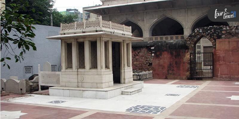
This is the Haveli or the palace made in the memory of the world-recognized Urdu poet, Mirza Asadullah Baig Khan who is also known as Mirza Ghalib. He is said to have produced the most famous of his creations when he was in this home. Hence this place stands of importance to everyone. 

This place is in Chandni Chowk which is the heart of the city, and it has been transformed into a museum now because it is maintained by the Government. Chadinchwak is a popular marketplace. Many tourists are visiting Chandni Chowk as a popular marketplace. But do you ever searching the “places to visit near me” when you are already in the Chadnichwak market? Try these tricks and let us know what the different types of tourist destinations you are getting.

4. Best Places To Visit Near Delhi – Sanjayvan

Exact Location – Vasant Kunj, New DelhiNearest Metro – The nearest metro stations are the Chhattarpur metro station and the Qutub Minar metro station. 

Sanjayvan

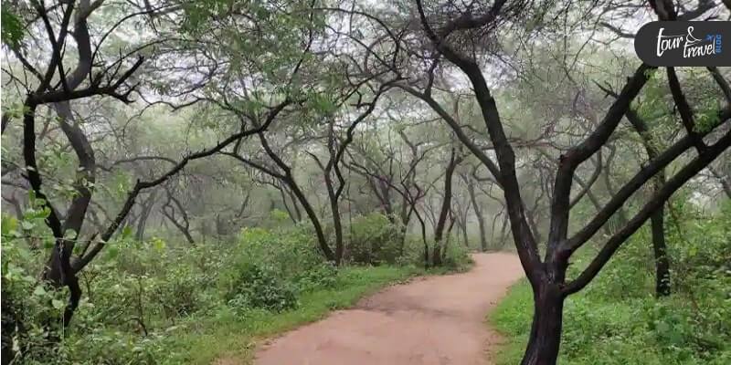
No one would have ever thought that there could be a forest in the heart of the city? But there is, the Sanjayvan is right in the middle of South Delhi. It is very close to the Qutub Minar there. It is a lush green forest, and this green forest spreads over 780km straight from all directions. This is one of the best-hidden places to visit near Delhi.

This Sanvayvan is near or between Mehrauli and Vasant Kunj in the southern part of Delhi. 

5. Best Places To Visit Near Delhi – Ghazipur Phool Mandi

Exact Location – Ghazipur Village Nearest Metro Station – Anand Bihar ISBT is close to this place. You can either take an auto or walk down.

Ghazipur Phool Mandi image

As soon as you enter this place, you will get the fragrance of different kinds of flowers. Different types of flowers are there in this market, right from marigolds, roses, orchids, tulips, carnations, lilies of different types are available here. When you are searching the places to see around Delhi, you are getting the options from the surrounding areas, which are mostly human-made or artificial, but this small village is delivering the beauty of nature.

This is an astonishing magical place known for its beautiful collection of flowers in the market. This place has all sorts of flowers at unimaginable low prices. You must take a visit to this place if you are visiting Delhi. This flowery village is one of the best places to visit near Delhi.

6. Neemrana, Rajasthan

Neemrana Rajasthan

Neemrana has been recently in the news with the rising air pollution level in the NCR region. So, the Graded Response Action Plan (GRAP-4) has started in Neemrana, which borders Rajasthan. 

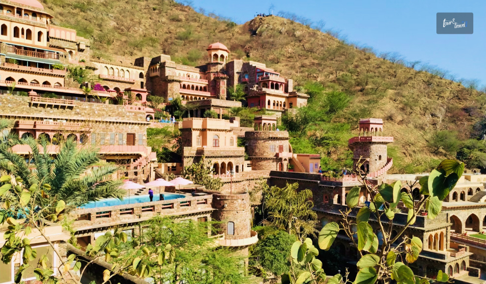
Just around 116 kms away from Delhi, is Neemrana in Rajasthan. It is the ultimate destination if you are a history buff. 

Once the power seat of Rajput Chauhans was taken over, Neemrana has now become a heritage destination. 

Neemrana Fort is the center of attraction here and it was built by the Chauhans. However, unfortunately, the fort became an abandoned place in 1947. 

Further, in 1991, there was some revival work to transform the Fort into a heritage hotel. 

Also, Neemrana is famous as the zipline site in India. So, you can go for a zipline tour here for some adrenaline rush. 

You can even visit the Neemrana Baori here and learn how this underwater conservation project has been crucial in the social and economic evolution of Neemrana. 

Moreover, you cannot miss enjoying a camel ride when in Neemrana. It is the best way to understand the traditional way of living in Rajasthan. 

7. Nuh, Haryana

Nuh Haryana

Just around 2 hours drive from Delhi, Nua is one of the less-explored places to visit near Delhi. Its distance from the New Delhi Airport is around 63 kms. 

If you are a history buff and have an interest in Sufism, you must visit the Sheikh Musa Mosque. This mosque has an association with the Chisti Order. 

Further, if you love watching birds, you must spend some time at Hari-Ke-Pattan Bird Sanctuary. There is no entry fee to visit the sanctuary and it remains open between 9 AM to 5 PM.

The Hari-Ke-Pattan wetland is a manmade wetland spanning across 4100 acres. It is the largest in North India and is home to almost 375 species of birds. 

You will find here great crested grebe, Indian Skimmer, Black-Necked Stork, etc. You may even spot jackals and wild boars here. 

Moreover, if you are interested in automobiles, you can visit the Heritage Transport Museum in Nuh. 

Frequently Asked Questions 

Where should I go for a one day trip to delhi?

You can visit these following places

  1. Murthal
  2. Damdama lake 
  3. Mathura and Vrindavan
  4. Noor Mahal Karnal 
  5. The Taj Mahal, Agra

Where can couples go for privacy in delhi?

  1. Garden to five senses
  2. Qutub Minar
  3. Lodhi garden
  4. Millennium Indraprastha Park
  5. Hauz khas Village.

What are the lesser known sights in Delhi to visit?

  1. Haveli Of Mirza Ghalib 
  2. Agrasen ki Baoli
  3. Majnu ka Tilla
  4. Sanjay Van 
  5. Kumhar Colony

Where can I sit and study in delhi?

  1. Triveni Terrace Cafe
  2. Ivvy and Bean 
  3. Bent Chair Cafe
  4. Tea Trails Cafe

Conclusion

Delhi is the capital city. The rich history and the perfect combination of modern attire and historical background are making this place a perfect tourist spot. The city’s culture is very devised, and this diversity is making Delhi a different kind of tourist place. When you want to feel the true vibes of Delhi, visit these unexpected surrounding tourist places along with the main city.

When you want to feel the true vibes of the city, include the unexplored places to visit near Delhi in your itinerary. Along with the places mentioned, you can also visit Nizamuddin Dargah, Agrasen ki Baoli, and Meharauli Archaeological Park. 

Further, Delhi is about exploring the local culture. From enjoying the whiff of spices at the biggest wholesale spice market in Asia (Khari Baoli Road) to taking a stroll around the painted houses in Naughara, you have a lot to do in Delhi.

If you liked our post, please comment below, and do not forget to share your experience with us.

Share on Social Media

Abdul Aziz Mondol is a professional blogger who is having a colossal interest in writing blogs and other jones of calligraphies. In terms of his professional commitments, he loves to share content related to business, finance, technology, and the gaming niche.

One response to “Unexplored Places To Visit Near Delhi – Explore The Unexplored Delhi”

Leave a Reply

Your email address will not be published. Required fields are marked *

title-img Related

READ MORE card-img

Italy: Is Florence flat or hilly?

BY  Sibashree Aug 12, 2024

Are you looking at booking a vacation to Florence? Or, perhaps you’ve already booked and want to know what to expect when you reach this amazing destination. If you have the question, “Is Florence flat or hilly?” read on to the end of the article to learn more. Florence is one of the best cities in the world. It has an immense historical and cultural significance, and, of course, it is full of Italian passion. Hence, when you’re visiting a place like Florence, you’ll be thinking about how best to get around. That means you need to understand if Florence is fat or hilly. The Truth About Is Florence Flat Or Hilly Hills surround Florence, and they are full of treasures worth seeing. Is Florence hilly? Yes! However, the city center is surprisingly flat. There are some slopes and inclines, but nothing that will stop you from getting around on foot. That means you can happily visit the Florence Baptistry, the Bargello National Museum, the Uffizi Gallery, Michelangelo’s David, and so much more. You can traverse the city on foot and enjoy the rich culture, architectural delights, and ambiance. Making The Most Of Florence And Its Hills You’re in Italy, and one of the many iconic things about Italy is the Vespa. What better way to enjoy every element of your vacation than by riding a Vespa? Fortunately, it’s possible to do just that: simply visit Florence Hills on Vespa with Walkabouttours.com. You’ll be able to enjoy the thrill of riding a Vespa through narrow streets in the various small towns located around Florence. A Vespa is also the perfect way to appreciate the countryside without having to walk up and down the many hills! Don’t forget to look down on Florence from the hills. Here, you will get an impressive sight, and you’ll want plenty of photos. Naturally, riding a Vespa through the countryside also means you can enjoy the vineyards, olive groves, and abundance of ancient castles. There are plenty of sights worth seeing in the hills around Florence, and you’ll find it effortlessly fun to get to them. Top Sights in Florence You Have to Check Out Once you reach Florence, take time to enjoy the experience each sight has to offer. Also, spend time to get the sound and feel of the city. Hence, you need to plan your days accordingly. So, when you are in Florence, make sure you visit two to three sites every day. Don’t do more than that. Therefore, make sure these places are in close proximity to one another. The following are some of the top sights that you need to check out when you are visiting the hills of Florence: 1. Viale dei Colli This is a road lined with beautiful houses, pine trees, and cypresses. Moreover, it runs next to the river. It’s a reminder of when Florence was briefly the capital of Italy. 2. Giardino delle Rose This was designed by the same architect who designed the Viale dei Colli. It’s a rose garden with over species of roses! Just above the rose garden, you’ll find the Piazzale Michelangelo, which has one of the best views of Florence. 3. Church of San Miniato This is another spot with stunning views of Florence. It’s on the hill near Piazzale Michelangelo and was created over 800 years ago. It’s worth looking at the Chapel of the Crucifix and the stunning central mosaic. Of course, while you’re in Florence, you’ll need to visit a vineyard and sample the local wine. If you’re enjoying the Vespa at the same time, you may want to stay the night! 4. Santa Maria del Fiore Cathedral/Duomo This is the church complex where you will find both history and beauty. Once you reach the plaza, the view of the surroundings will be mesmerizing. Moreover, step inside the cathedral to experience some of the best views of your lifetime. However, before visiting the place, purchase tickets in advance. 5. Ponte Vecchio This is a beautiful pedestrian walkway where you will get a bustling market. This place is filled with jewelry stores, leather shops, and mesmerizing views. Additionally, you will also find plenty of musical performers in the walkway. On the northern side of the bridge, there is the Uffizi Gallery, while on the southern end, there is the Boboli Gardens. Apart from the Ponte Vecchio bridge, check out the other bridges near the area as well. 6. Uffizi Gallery The Uffizi Gallery contains some of the most exquisite works of painters and sculptors like Michelangelo, Leonardo da Vinci, Sandro Botticelli, Filippo Lippi Raphael, Giotto, and many more. Here, too, make sure you purchase tickets in advance to avoid crowds and queues. Apart from that, always check whether reservations are still available or not. 7. Galleria dell'Accademia Being one of the major cities during the Renaissance, Florence boasts some of the best works of the time. In the Galleria dell-Academia, you will find one of the most famous statues by probably the most famous sculptor of all time - the Statue of David by Michelangelo. Make sure to take a selfie with the statue. Apart from that, check out other pieces of some of the best artworks of the Renaissance era. 8. Medici Chapels These chapels at the heart of Florence are some of the most beautiful structures in the city. The Medici Chapels are present in the Basilica of San Lorenzo and were built during the 16th century (at the height of the Renaissance). Once you step inside the Chapels, you will find some of the best statues, frescoes, and stoneworks with intricate details. This will give you an idea of the impact of the Renaissance not just in Florence but in the whole of Italy. Buon Viaggio - Happy Traveling When you’ve experienced everything this fabulous place has to offer, you can decide how to handle the answer to ‘Is Florence flat or hilly?’ In reality, it doesn’t matter. You can embrace the hills on your Vespa and help make the experience perfect. Also read Top 10 Naples Italy Beaches You Can’t Miss! 8 Best Places to Go in Italy You Must Explore. Paradise Islands: Discovering Italy’s Hidden Gems.

READ MORE card-img

Kootenay National Park Or The Land Of Ice And Fire (Experiencing Nature’s Game Of Contrasts)

BY  Sibashree Sep 12, 2024

No, it’s not the battle of the Starks, Lannisters, and other houses of Westeros. In Canada lies Kootenay National Park, the actual land of ice and fire. The glacier-made canyons and valleys sing the song of the ice, while the hot springs and grasslands keep the “fire” element alive here.  Also, the national park is a hub of ancient fossils, encouraging walks through the fossil trails. Moreover, you can take a scenic drive through the park, rich in Indigenous culture, history, architecture, and cultural landscape.   So, do you want a virtual tour of this Canadian national park? THIS is where your journey begins! THESE Are The Things You Will Do At Kootenay National Park With no cell service available in Kootenay National Park, you can get lost in the wilderness and explore the most fascinating landscape. However, being respectful to the wildlife is a must for this national park. This August, I came across disturbing news while doing my research on Kootenay National Park.  I have been in touch with a local from Radium Hot Springs for quite some time now. He told me that a grizzly bear coming out of Kootenay National Park was almost struck by an SUV on 19th August 2024.  This incident occurred on a busy highway in southeastern British Columbia, and fortunately, the Kia Sportage SUV made its way to the other side safely. Further, it was a lesson on why following the safety guidelines is crucial while driving in and around the Kootenay National Park. On the major routes of Kootenay National Park, you will have to maintain a maximum speed of 56 mph.However, on the minor routes, the highest driving speed limit will be 37 mph.  Also, around one month before the incident, on 24th July 2024, there was a minor fire in the  Sinclair Canyon slopes (near Radium Hot Springs) of the national park. It was called the Berland Ridge wildfire. This fire was under control thanks to a helicopter bucketing water on it. However, outside the park’s southern boundary, there was a blazing fire that was brought under control after pain-stricken efforts.  So, these incidents show how mindful and cautious you need to be while taking part in the following activities.  Hiking In Kootenay National Park (Hikers’ Favorite Trails) The hiking trails in Kootenay National Park are full of elevation gains and losses. Also, today, the national park has more than 70 hiking trails at easy, moderate, and difficult levels.  However, I have curated a few hiking trails in the table below. After interacting with a couple of hikers, I found out that these are the ones most preferred. Name of the Trail Difficulty LevelDistanceLocationHighlightsMarble CanyonEasy1.4 Km with 42 M Elevation Gain Located near Lake Louise, AlbertaHiking, snowshoeing, and running are the favorite activities here.It is a pet-friendly and kid-friendly trail. It is a year-long hiking trail. Stanley Glacier Trail Difficult 10.9 Km with 607 M Elevation Gain Located near Lake Louise, AlbertaSnowshoeing, camping, and hiking are popular activities on this trail.You can take your dog as a company.June to September is the best time to hike this trail. Sinclair Canyon via Juniper Trail Moderate5.8 Km with 291 M Elevation GainIt is close to Radium Hot Springs in British Columbia.You will have to hike through a beautiful cedar fir forest on this trail.The view of verdant Sinclair Canyon Falls and the Columbia Valley from this trail is breathtaking.Marble Canyon to Paint PotsModerate2.9 Km with 110 M Elevation GainRadium Hot Springs (Marble Canyon Parking Lot  - 89 km east of Radium Hot Springs, Paint Pots - 86 Km east of Radium Hot Springs).Explore a good mix of mature and burnt forest throughout the trail.Behold the Vermillion River running parallel to the trail. Floe LakeDifficult10.5 Km with 1,110 M Elevation Gain Near Radium Hot Springs (72 Km East)Backpacking and camping are popular activities on this trail. The trail leads to the Floe Lake Backcountry campground. This popular meadowy trail is known for its views of peaks, glaciers, and the beautiful Floe Lake. Numa CreeksModerate 6.3 Km with 385 M Elevation GainThe trailhead is near the Numa Falls, which is 80 Km east of the Radium Hot Springs. It is a forested trail.The trail leads to heavy avalanche paths in the park.  The hikers’ words about the trails in this national park are quite encouraging. Let’s find out what they are saying about the mesmerizing hiking trails.  “This is a beautiful, deep canyon hike. The trail crosses the canyon multiple times to view the ferocious Kootenay river below. Hiking boots aren't necessary since it is a well-traveled trail.” - Deborah Turcotte on the Marble Canyon Trail  “The trail was mostly dry and in very good condition. No snow on the trail, just a few short wet spots. Trek up is mostly sheltered but a bit chilly and windy in the bowl so bring layers as the temp changes quickly when the sun is behind clouds. Still lots of snow in the bowl. Found one rock with fossils. There are a few small waterfalls on Stanley Peak. Lots of boulders at the base of the bowl to sit and enjoy a lunch and 360 views. An easy to moderate 3-4 hour hike with nice views of Stanley Peak, Storm Mtn, and the Kootenay Valley.” - Sue W on the Stanley Glacier Trail  Kootenay National Park Camping  Kootenay National Park is a wonderful place for frontcountry and backcountry camping. You can even live in oTENTiks and spend some unforgettable days in the park under the sky.  Frontcountry Camping You can camp near the Vermillion, Kootenay, and Simpson rivers. Also, you can find some quiet spots near Radium Hot Springs village.  Summer is the best season for front-country camping in the national park. However, the sites remain crowded. So, you must go for a prior booking.  Further, the daytime temperature in the national park remains between 16-23 degrees centigrade. Still, the temperature at night can drop below 0 degrees centigrade. So, abiding by the camping rules is crucial, and especially, be particular about the things you will have to carry. Moreover, like camping in any national park, here also you have to ensure that you don’t leave any trace behind as you leave the site.  Backcountry Camping Backcountry camping and backpacking are the best ways to explore the wilderness of this Canadian national park. However, you must make a prior booking and carry a backcountry permit if you want to spend some days and nights amidst grizzly bears, black bears, wolves, elks, and cougars.  Further, there are six backcountry camping grounds in the park, five of which are located along the  Rockwall Trail. The  Verdant Creek Trail has the sixth camping ground.  Random camping is not allowed during summer, as protecting the landscape and vegetation is crucial. This restriction applies from May to October.  However, in the winter months, you can do random camping in the designated areas. You will still need a permit for this. As I have mentioned, the Rockwall trail is the most prominent place for backcountry camping in the park. This site is also popular for the presence of various multi-day hiking trails. These trails are: Honeymoon Pass and Verdant Creek Tumbling - Floe The Rockwall  Tumbling - Helmet - Ochre Loop Numa Creek Helmet Creek and Falls Tumbling Creek Helmet - Ochre Junction In the popular backcountry camping areas, the trails are maintained quite well. Further, there will be amenities like food storage cables, food lockers, picnic tables, and tent pads.  Living in oTENTik An oTENTik is a modern fusion of a cabin and a tent. In the park, you will find the oTENTik site on the Redstreak campground’s A loop.  If you stay in an oTENTik, you will wake up amidst nature, and taking a bath at the hot springs will be the most rejuvenating experience. Then, you can explore the nearby hiking trails and gorge on traditional meals cooked in the campfire.  Relaxing At Radium Hot Springs  Beneath the colorful Sinclair Canyon mountains lie the most refreshing hot springs. Further, the mineral-rich water of the hot springs does not have any odor, and you can take a bath with your entire family.  To reach the Radium Hot Springs, you must drive from Banff and Lake Louise for around 1.5 hours. Further, the journey is as interesting as the destination, as you will get to small turquoise lakes, falls, canyons, and bridges over rivers as you drive through the Kootenay National Park. Also, don’t forget to stop at the following locations to make the most of your journey. Continental Divide (The line diving the Pacific and Atlantic watersheds) Marble Canyon Hike Paint Pots Trail Numa Falls Kootenay Valley Viewpoint (It is the place to get the most beautiful view of Vermilion and Mitchell Ranges.)  Olive Lake Trail and Day-Use Area However, the highlight of the journey, of course, is the Sinclair Canyon, where you will also find big horn sheep roaming. As you hike through the Juniper / Sinclair trail, you will get a “bird’s eye view” of Sinclair Canyon.  Further, as you enter the Radium Hot Springs village, you will see an iconic steel horn sculpture. The “Bighorns Public Art Sculpture” was officially unveiled on 7th April 2021. Moreover, Clara Reinhardt, the mayor of Radium in 2021, said,  “We chose something that implies a sense of arrival to Radium, the Columbia Valley, and beyond. We captured the undeniable natural beauty of the curved horns through a Fibonacci spiral—the golden ratio in nature and art.” “We wanted to create a piece of art that speaks to both the history and the future of bighorn sheep in Radium. We captured the undeniable natural beauty of the curved horns through a Fibonacci spiral—the golden ratio in nature and art.” - Adam Meikle (Artist of the Bighorns Public Art Sculpture) Burgess Shale Fossil Hike  The Burgess Shale Fossil Hike in the national park will give you access to Mount Stephen and Walcott Quarry. These are UNESCO Restricted Sites. Further, you will get to see some of the oldest fossils in the world here.  However, in total, you have three routes to explore in the Burgess Shale Fossil Hike. Let’s discuss them in detail.  Walcott Quarry Starting Point: Takakkaw Falls Difficulty Level: Difficult  Elevation Gain: 825 Meters Duration: 11 Hours Return Distance: 22 Kms Walcott Quarry is a classic example of a fossil hike. Also, the top view of the Emerald Lake from here is amazing. Further, you will find Burgess Shale creatures here, which were found in fossilized conditions at the mountaintop in the Yoho National Park.  “The Burgess Shale organisms lived 508 million years ago in a time period that Geologists call the Cambrian, which began at 541 Ma (million years ago) and ended by 485.4 Ma. The first fossil occurence of most animal lineages (at the phylum and class levels) occur in the Cambrian. As a result of this fact, and because the fossils are well preserved, Paleontologists studying the Burgess Shale fossils can deduce a great deal about the ancestory of animal lineages.” The Burgess Shale fossils were discovered at the Walcott Quarry site in 1909 by Charles Doolittle Walcott. 1 Mount Stephen Difficulty Level: Difficult  Elevation Gain: 795 Meters Duration: 7.5 Hours Return Distance: 9 Kms As you hike through the Mount Stephen trilobite beds, you will get to overlook the “town of Field” in British Columbia. Railway workers in the 1880s used to call the town of Field the space of “stone bugs.”  Further, during this trek, you will see trilobite fossils (now extinct and one of the earliest marine arthropods), and the view of the Kicking Horse River from the trail is amazing.  Stanley Glacier Difficulty: Moderate Return Distance: 10 km Elevation Gain: 385 m Duration: 7.5 hours You will start hiking the Stanley Glacier in a fire-swept forest. The forest has lodgepole pine and wildflowers. Further, along your route, you will get to see a turquoise river, waterfalls, and the best view of the Stanley Glacier. Moreover, you will get to see the fossils of hyolithids, sponges, trilobites, and sponges here, and they are from the Eldon Formation.  Cambroraster, an ancient arthropod, and many other species are found in the quarry near the Stanley Glacier. Further, the shell of a Cambroraster looks like the Millennium Falcon spaceship in its shape. Important Kootenay National Park Data At A Glance  Before you start for the Kootenay National Park, don’t forget to have a look at the stats. Location: British Columbia, Canada Established: 21st April, 1920 Area: 1,406 km² Highest Landscape: Deltaform Mountain (3,102 m) Designation: UNESCO World Heritage Site in 1984 (As Part of the “Canadian Rocky Mountain Parks ) Visitor Center: Kootenay National Park Visitor Centre (7556 Main Street East; Radium Hot Springs, B.C.) How to Reach: Via Highway 1 from Banff, AB or Calgary, AB/Via Highway 95 at Radium Hot Springs, BC Also Read Why Include Whale Watching In Your LA Itinerary. Traveling On A Budget: Tips For Affordable Adventures. From Cocktails To Kickflips: Must-Try Activities In San Diego.

READ MORE card-img

Welcome To The Pecos National Historical Park: The Land Of The First American Revolution

BY  Sibashree Sep 12, 2024

I stood before the remnants of the South Pueblo walls, looking over the Mission Church on an autumn day last year. Looking at the archaeological site and standing below the blue fall sky, I was transported to the time of the American Revolution.  Further, I could hear the noise of a bustling trade fair with people from the Pecos Pueblo community doing business. However, the historical importance of the park is much beyond its association with the American Revolution. It is also related to the Civil War in New Mexico and the Independence of Mexico.  So, with centuries of human history etched in every corner, the Pecos National Historical Park is an intersection of past tales and nature. To be honest, The Pecos Pueblo and Santa Fe Trail were the biggest highlights for me when I was at the national park.  Therefore, my ode to the park will start with brief accounts of these places. Then, I will talk about the Glorieta Pass, again a site of historical importance in the park. Finally, you will have a quick look at the park's wildlife.  Pecos National Historical Park: A Land Of Historic Wars And Revolutions  The history of human lives in the Pecos National Historical Park goes back to the Preceramic Period or the 11,500 B.C.E. - 600 C.E. However, the Pecos Pueblo site in the park became a prominent place in the history of the American Revolution in the Early Colonial and Pre-Revolt era.  Spanish people started interacting with the Pueblo people. Further, thanks to the Franciscan Missions, the Spanish rule wanted to have command over the economic life and beliefs of the Pueblo people.  Thus, the first seeds of the American Revolution were sown. To combat the oppression of the Spanish people, the Pueblo Revolt took place on 10th August 1680. As a result, the Spanish Government and Franciscan Friars were expelled from the southwest under the leadership of  Po’pay from Ohkay Owengeh. The Spanish Mission Church, built in 1625, was also destroyed in the revolt of 1680.  However, in 1692, the Spanish People further reclaimed the Pecos Pueblo and many other pueblos. Finally, the Pueblo people declined in numbers in 1700. Before, during, and after the first American Revolution, The Pecos Pueblo emerged as an important location with significant events around it!  Further, around 200 years later (1821-1846 C.E.), another site in the park, the  Santa Fe Trail, witnessed travelers, settlers, and everyone else passing through it. The trail was opened in 1821 after Mexico gained its independence from Spain.  The remains of Pecos Pueblo stood there! By the 1830s, the migration of the Pubelo people was complete, and everyone had shifted to the Pueblo of Jemez and continued their traditions.  Moreover, in 1862, there was the “Battle of Glorieta Pass.” On 26th March 1862, this battle between the Union forces and Confederates occurred at a 700 feet elevation.  The Pecos Pueblo Site Today  https://www.instagram.com/p/Cto5MWnS5Oa/ The rise of the Pecos Pueblo site occurred between 1350 C.E. and 1838 C.E. The Pueblo site had two units, the north and south, and could accommodate around 2000 people. Further, it had 1000 rooms. Therefore, Pecos Pueblo thrived as a busy trading center with trade fairs involving people from Rio Grande Pueblos, Plains Nations, the Gulf of Mexico, and the Pacific Coast. The flint arrowheads and shells found here explain the expansive stretch of the route.  Nevertheless, with time, Pecos Pueblo became instrumental in eliminating Spanish oppression and rule. Still, a drop in the trade, Comanche attacks, and diseases deserted Pecos Pueblo. By 1838 C.E., the last resident of the Pueblo had left and joined the Pueblo of Jemez.  Today, the site stands as a relic from the past. However, it is still equally important for archaeologists and historians.  The Santa Fe Trail  Do you know what the Santa Fe Trail marker near Kozlowski's Trading Post says? It says,  Santa Fe Trail 1822-1879 Marked by the daughters of the American Revolution and the Territory of Nex Mexico.  With the independence of New Mexico and the western territories becoming an annexure to New Mexico, the Santa Fe Trail became the route or passage to the westward movement. Naturalists, journalists, travelers, aspirants, traders, and others took this passage as part of the American expansion. Colonel Henry Inman’s “Stories of the Old Santa Fe Trail,” published in 1881, describes the trail well. If you are a history buff, you must read this book well before visiting the Santa Fe Trail today!  “Kozlowski’s Stage Stop and Trading Post” is the highlight of this trail. You can spend some time here to visualize travelers from the past catching some rest after a long journey through the trail. When on the trail, you can explore the remains of the Pueblo and the Mission Church. You can even consider taking a guided tour of the Forked Lightning Ranch.  Glorieta Pass Battlefield Trail  https://www.instagram.com/p/B9xRKctnb3M/ Important Details About the Glorieta Pass Battle1. Reason for Conflict: Union forces and Confederates wanted to control the Glorieta Pass Route through the Sangre de Cristo mountains and the main supply center (Fort Union) for the passage of soldiers and supplies. 2. Contenders: The Confederates, with volunteers from Texas and under the leadership of General Shipley and the Union forces led by Colonel Canby, and soldiers from Fort Union, New Mexico, and Colorado. 3. Battle Begins: March 26, 18624. Reinforcements: 27th March, 18625. Battle Resumes: 28th March, 18626. Battle Ends: 29th March, 18627. Casualty: Death of 375 People 8. Consequence: The Union forces defeat the Confederates as they fail to ruin the Fort Union. Further, the Union forces maintain complete control over Southwest America.  The Glorieta Battlefield Trail is a popular hiking destination today in Pecos National Historical Park. It is a roundtrip loop, and you will have to cover a distance of 2.25 miles to complete your expedition. Further, the unpaved or graveled hiking route makes it moderately difficult for the hikers. In addition, there is an elevation gain of 152 meters.  You have to drive for around 7.5 miles from the main visitor center of the park. You will need to collect a gate code from the visitor center, which is your access code, to open the locked gate in front of the trail.  As you walk through the forest trail, you get to know more about the Civil War in New Mexico. Many infographics are installed throughout the trail, telling you tales from the past. In addition, there are wayside signs and 14 trail markers to explain the history of the battle on this pass in detail.  More About Hiking The Glorieta Pass Battlefield Trail  Time: Around 1 hour Refreshments (Hikers’ Favorites): Pecos Burger at El Maria Bonita (With a lot of meat and a smoky green chilly flavor!) and Chips and Salsa, of course! The Trail Guide you collect from the visitor center already keeps you hooked on the site's history. Indeed, this trail is less about hiking and more about flipping through the pages of the American Civil War in Mexico.  Let’s Hear It From Other Visitors To The Park  “Really nice park. Easy to find and it is free! Inside the visitor center, they had a really great exhibit that followed the pecos overtime. It was super informative and brought a lot more meaning to the actual park. After looking around the exhibit, you can take the trail up and around the park and church. It's amazing that the walls are still there. The view around the park is also beautiful. We spent about 2 hours here.” - Isabelle M. “I really enjoyed this park. My husband didn't care for it but I think it's really amazing what is still here. He thinks it's all recreation and I can't say if it is or not but I know the current Pecos people don't see it that way. It's pretty awesome that it's free to visit and the visitors center has a little museum that's also free! The trail starts near the restrooms. We accidentally started it from the end. But who cares. We saw everything and I recommend checking it out. Native people history is really cool.” - Lydia G. Exploring Wildlife At The Pecos National Historical Park https://www.instagram.com/p/CA-hAl8nrUW/ This historical national park is a hub of wildlife with a 6,500-acre expansion of forests, rivers, grasslands, and streams. The table below enlists the species that call the Pecos National Historical Park their home.  MammalsElk of Northern New MexicoColorado Chipmunk DeerRock SquirrelBirds*Steller’s JayMountain BluebirdBald EagleFish and AmphibiansRio Grande ChubLongnose DaceRainbow TroutBrown TroutNew Mexico Spadefoot ToadWoodhouse ToadTiger SalamanderPlains Leopard FrogReptilesShort-horned LizardNew Mexico Whiptail LizardBull SnakesGarter SnakesPrairie Rattlesnakes You will find the Prairie rattlesnakes along the trails. So, please exercise caution and inform the ranger if you come across one on your way.  A Quick Glance At Some Important Information About Pecos National Historical Park You must quickly look at the important information available about Pecos National Historical Park before you set in. Location: San Miguel County, New Mexico Established: 28th June, 1965 Area: 27 km² Highest Landscape: Truchas Peak, 3990 Meter Visitor Center: Pecos National Historical Park Visitor Center How to Reach: Via State Road 63  Entry Fee: Free Best Time to Visit: Autumn (Early September to Mid October) Also read Why Include Whale Watching In Your LA Itinerary. From Cocktails To Kickflips: Must-Try Activities In San Diego. Kootenay National Park Or The Land Of Ice And Fire (Experiencing Nature’s Game Of Contrasts)