Want to learn more about the mountains of Kenya? A geographically and topographically diverse country, the Republic of Kenya has beautiful mountains that are more than just a geographical feature! Please read this article to learn about the features of the mountains, their cultural significance, as well as their beauty.
There are almost 3888 mountains, out of which 3856 are named mountains. Mount Kenya is the highest peak of all these mountains, with an elevation of 5199 meters. It is one of the second-highest mountains in Africa and is considered a UNESCO World Heritage Site.
Kenya is located in the eastern part of Africa, more towards the southern horn of Africa, with diverse geographical features ranging from towering alpine peaks to mangrove swamps. The mountains’ beauty adds to the country’s natural features, making it a perfect place to visit!
Explore The Beauty Of The Mountains Of Kenya!
As a country with a topographical contrast, Kenya is located in the eastern section of Africa. The equator crosses the country across Nanyuki, Maseno, and Timboroa. These features highlight Kenya as a stunning destination that many wish to visit!
Being a topographically diverse country where the forests offer diverse wildlife, it is perfect to visit if you love taking safaris. There are also coasts and grasslands, making the location more diverse.
The nation is also highly agricultural, with diverse produce, including vegetables, fruits, and animals, even though the location is remote and can be difficult for regular travel.
An African safari holiday is a dream for every hodophile, and Kenya offers the perfect backdrop. With spectacular wildlife, astounding landscapes, and a melting pot of culture, Kenya ranks at the top of the travel list of everyone!
Moreover, the beautiful mountains play an important role in making Kenya a fascinating place! The country borders nations such as South Sudan, Ethiopia, Tanzania, Uganda, and Somalia. So want to know more about the up-warped giants of the earth? Read along!
1. What Makes Kenya’s Mountains Unique In Africa?
Kenya’s mountains are unique due to:
Equatorial location with alpine conditions
Rare plant species
Combination of glaciers and savannah landscapes
Strong cultural significance
Few places in the world offer such dramatic ecological contrasts.
2. Are Kenya’s Mountains Culturally Significant?
Absolutely. Many Kenyan communities consider mountains sacred:
Mount Kenya is sacred to the Kikuyu people, who believe it is the dwelling place of their god, Ngai.
Mountains often feature in local folklore, rituals, and traditions
This cultural importance adds depth beyond their physical beauty.
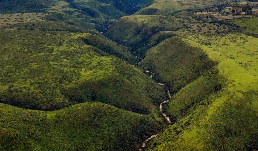
Highest Mountains Of Kenya
The total area of Kenya is 586,000 square kilometers, with high-rising regions such as high plateaus, mountains, arid deserts, and low-lying coastal areas, including islands and coral reefs. 7 freshwater and salt lakes are creating the Great Rift Valley cutting the country in half!
Kenya has two of the tallest mountains on the continent. There are several other mountains, most inactive or extinct volcanoes. The landscape is diversified, yet the mountains are as beautiful as ever! Read more on some of the noteworthy mountains in Kenya.
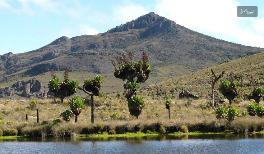
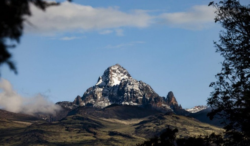
Mount Kenya
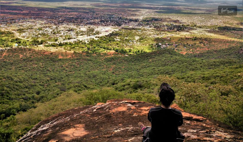
The highest mountain in Kenya is Mount Kenya, located in the center of Kenya, approximately 100 miles northeast of the Capital, Nairobi.
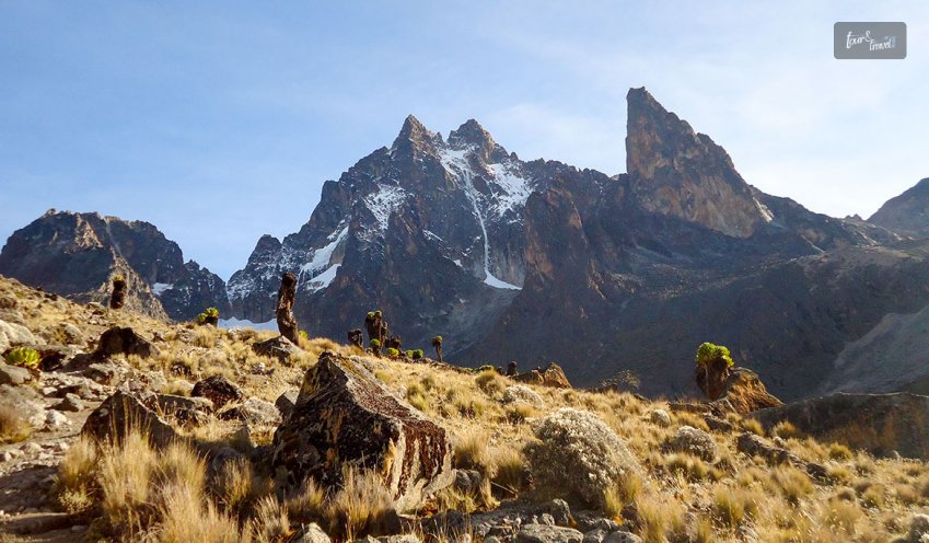
The mountain has several summits. Nelion, Lenana, and Batian are some. Bastian is the highest, with 17,058 feet, indicating the mountain’s peak. The mountain formed about 3.5 million years ago.
A well-known tourist destination, the Mount Kenya National Park surrounds Mount Kenya at the base. You can see elephants, buffalo, as well as colobus monkeys in the park.
You can trek the mountain’s peak of Lenana Summit as it is feasible without any mountaineering expertise. The rock kente is only available on Mount Kenya as well as the Antarctic, situated at the South Pole.
The Spiritual Connection Of Mount Kenya
Riuki is found on Mount Kenya, which in a spiritual context is considered the symbolization of the throne of God. Riuki is regarded as the pathfinder by the Gikuyu medicine men. They also believe it therapeutic as they put pebbles at risk as seers.
The history of Mount Kenya is interconnected with the Egyptians, Jews, and Ethiopians. Mount Kenya is called Ta-Neteru by the Egyptians, which means the abode of the gods. The God Hapi or lotus, the gods of the Nile Floods, lived on the mountain.
The farming communities that settled in Egypt in 7000 BC before the inundation of the Nile corresponded with “Isis,” the heliacal rising of the star. It was after the water from the Nile flooding receded, leading to rich dark silt across the Central African countries and highlands.
The land is called “Kemet,” which is fertile land ready for planting. They consider the lands around Mount Kenya as one of the fertile lands. It also believed that the goddess Isis hid her son, her husband Horus, to raise him from the dead.
They say the mountain has medical properties, and the locals consider it amazing. They pray to the mountains for protection and safety. Communities such as Maasai and Samburu are semi-nomadic people who use the northland of the mountain as a paying ground.
Mount Elgon
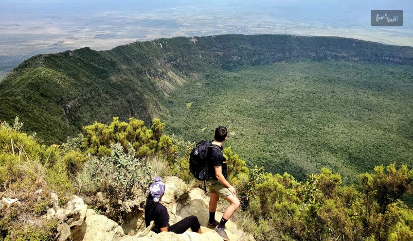
The second tallest peak in Kenya is Mount Elgon, located on the country’s western side, closer to the Kenya-Uganda border. The mountain has distinguishing characteristics, such as having one of the largest volcanic craters.
The top of the mountain is a flat-topped plateau made of basalt. The total height of the mountain is 13,852 feet, with lava tube tunnels across the mountain.
Elephants and buffaloes often visit the lava tube tunnels. A national park surrounding Mount Elgon also has rhinos, eagles, leopards, and duikers.
Mount Longonot
Mount Longonot is an inactive volcano that last erupted in the 1860s but is not completely extinct. The height of the mountain is 9108 feet, and the mountain’s slopes are filled with ridges.
Mount Longonot is a mountain in Kenya. A park nearby has plenty of wildlife, such as zebras and giraffes. The mountain is situated approximately 60 kilometers northwest of Nairobi.
Travelers can visit the park by car, and the base of Mount Longonot has a lot of forest, even around the top crater. Compared to many stony mountains, this one is thickly wooded across the slopes and the summits.
Satima
Mount Satima is also “Ol Donyo Satima,” which roughly translates to “Mountain of the bull calf.” It is one of the Kenya mountains! It is the highest mountain across the Aberdare range, with a height of 13,127 feet, and is located on the northern side of the mountain range.
The mountain has tussock grass and rocks in some areas and rainforests. There are bamboo forests and Moorland across a section of the mountain. The mountain has a collection of 150 species of plants, such as Podo and Cedar.
The mountain is part of the water catchment area for both the Sasumua and Ndakaini dams. The two dams for Nairobi City are the primary source of water.
Kinangop
Kinangop is a dormant volcano in the Great Rift Valley and the west of the Kinangop Plateau. It is also situated in the Aberdares, with extensive bamboo forests across the mountain in the lower portion. The height of the mountain is 12815 feet.
Moreover, the higher sections of the mountain are covered with tussock grass. The top of the mountain is rocky with open moorlands. The top of the mountain is quite chilly and turns freezing at night.
Ngiro
Mount Ngiro is located in the northern region of Kenya, with a height of 9344 feet. The mountain is part of the Great Rift Valley to the west overlooking the Suguta Valley. The upper slopes have forests, while the mountains is popular for cultivating bees.
The mountain falls under the territory of the Samburu people, while the Lmasula phratry performs bee cultivation. The clan claims exclusive rights to the water and the land.
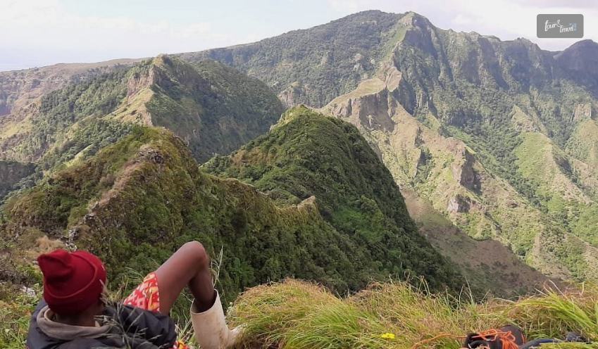
Several other mountains and hills are situated in the nation, creating an exciting place for vacationing. If you are a hiking person, Kenya is the perfect place to visit as there are several advantages. There are enough mountains in Kenya for you to go hiking, as well as trails.
It is a perfect spot to share holidays as well as weekends with your hiking partners. Some of the tallest mountains are situated in East Kenya.
Kulal
The mountain Kulal is identified as a biosphere reserve with lava fields, and the origin of the mountain is a volcano. The moisture in the biosphere leads to rain as well as mist, providing hydrological services to the people in northern Kenya.
The mountain is located in the middle of East Africa, with steep slopes while deep canyons go across the mountain. It is also one of the driest places in Africa. There are forests across the mountain, a habitat for black rhinoceroses and elephants.
Marsabit
Mount Marsabit is surrounded by Mt. Marsabit National Park and Reserve, with a height of 1703 meters above sea level. The mountain has many craters, while the hills around it highlight the mountain.
Across the mountain are many low-lying arid plains with elliptical shapes 70 km long on the northeast-southwest as well as 45 km wide on the northeast-southwest. The mountain comprises weathered lava flow.
Mogila
Mogila is one of the mountains of Kenya with a height of 1698 meters. A local relief of 300 meters, steep slopes, and a small summit area characterize the mountain. Moreover, it is located in the Turkana, creating the Great Dividing Range.
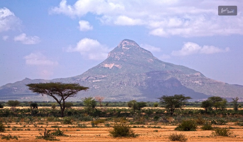
Namanga Hills
The mountain is in the southern part of Kenya. It is located on the borders of Tanzania, with the highest point being 2548 meters.
The Great Rift Valley has four peaks: Suswa, Paka, Namarunu, and Menengai. The hills have a collection of hyenas, zebras, ostriches, as well as Antelopes.
Cultural Relations Of The Mountains Of Kenya
According to the Kikuyu tribe, they say the local Kikuyu god, N’gai resides at the summit of Mount Kenya. Mount Kenya is one such place that the local cultures worship. They consider these mountains the home of spirits as well as gods.
Mount Kenya is a spiritual mountain, as the local communities think of it as the residence of God. Ethiopians also consider it the home of God and revered in its presence. The belief gains further confirmation because of the snow at the top of the mountain.
The mountain is very close to the equator. Hence, it is quite surprising that there is snowfall at the top. There are thick forests around the mountain, and initially, the military dug the woods to flush the Maumau freedom fighters.
According to the traditional version of Mount Kenya in Kikuyu, a star fell on the ground with a bang and formed the mountain. The mountain has volcanic ashes and oozing magma which forms the Kenyte.
Mount Longonot has its Masai name, “Oloonong’ot,” meaning “mountain with many spurs.” The mountains are important as well as are traditional sites for worship by the local populations.
Some vow in the mountain’s name, while some send prayers based on cultural traditions. Both visitors and the natives join in collaborative activities such as mountain climbing and hiking.
What Are The Major Mountains In Kenya?
Kenya is home to several notable mountains, the most famous being Mount Kenya, Mount Elgon, and the Aberdare Range. Among these, Mount Kenya is the highest and most iconic mountain in the country.
Other important highland areas include the Mau Escarpment, Cherangani Hills, and Ngong Hills, which contribute significantly to Kenya’s geography, climate, and biodiversity.
What Is Mount Kenya And Why Is It Famous?
Mount Kenya is the highest mountain in Kenya and the second-highest peak in Africa, standing at approximately 5,199 meters (17,057 feet) above sea level.
It is famous for its dramatic peaks, permanent glaciers (though shrinking), alpine vegetation zones, and spiritual significance to local communities.
Mount Kenya is also a UNESCO World Heritage Site, recognized for its unique ecosystems, scenic beauty, and ecological importance.
Are Kenya’s Mountains Safe For Tourists?
Yes, Kenya’s mountain regions are generally safe for tourists, especially within national parks and guided groups. Safety improves with:
Proper planning
Licensed guides
Weather awareness
Altitude acclimatization
Like all outdoor adventures, caution and preparation are key.
What Are The Main Peaks Of Mount Kenya?
Mount Kenya has three primary peaks:
Batian (5,199 m) – The highest and technically most challenging peak
Nelion (5,188 m) – Slightly lower, also requiring technical climbing skills
Point Lenana (4,985 m) – The most accessible peak, popular with trekkers
Point Lenana is often climbed by hikers without technical mountaineering experience, making it the most visited summit.
What Is The Aberdare Range?
The Aberdare Range is a mountain range located in central Kenya, north of Nairobi. Unlike Mount Kenya and Mount Elgon, it is not volcanic but consists of folded mountains.
The Aberdares are known for:
Dense forests
Moorlands
Waterfalls
Wildlife, including elephants and leopards
The range forms part of the Aberdare National Park, a key conservation area.
Are The Mountains Of Kenya A Cult?
The high places in Kenya, especially mountains with snow caps, high mountain ranges, and island mountains, are cults. There are psychological roots of the communities who believe that mountains act as a heavenly ladder.
Besides the spiritual connection for the community, mountains are also helpful natural elements for humans as they bring rain, while they also have volcanoes. Volcanoes have a fiery side to them, representing the element of earth.
According to the myths based on the world’s origin, mountains are the first natural element from ancient water. The indigenous people believe mountains are a great phenomenon of the earth, symbolizing cosmic connection.
The local communities consider the mountains as shrines or altars for the Gods and worship them. For example, people in Africa often blame an earth deity when there is an earthquake.
They also consider snakes to be culprits, a belief that their cult teaches in the cultural practices of Africa.
FAQs
Here are some frequently asked questions and answers about the mountains of Kenya.
1. Is Mount Kenya A Volcano?
Yes, Mount Kenya is an extinct stratovolcano. It was formed millions of years ago through volcanic activity. Over time, erosion removed much of the volcanic cone, leaving behind the rugged peaks seen today. Although extinct, the mountain still plays a critical role in water catchment and climate regulation in the region.
2. Are The Mountains Of Kenya Suitable For Hiking And Trekking?
Yes, Kenya’s mountains offer excellent opportunities for hiking, trekking, and mountaineering, catering to various skill levels: • Beginner to intermediate hikers: Point Lenana (Mount Kenya), Aberdare trails •Experienced climbers: Batian and Nelion peaks •Leisure trekkers: Mount Elgon’s gentle slopes Guides are recommended, especially for high-altitude or protected areas.
3. What Is The Best Time To Visit The Mountains Of Kenya?
The best time to visit Kenya’s mountains is during the dry seasons: • January to March •July to October These months offer clearer skies, better trail conditions, and safer climbing environments. The rainy seasons (April–June and November) can make trails slippery and challenging.
4. What Types Of Vegetation Are Found On Kenya’s Mountains?
Kenya’s mountains feature distinct vegetation zones based on altitude: •Lower slopes: Forests and farmland •Mid-altitude: Bamboo forests and montane forests •Higher zones: Moorlands, giant lobelias, and senecios •Upper alpine zone: Sparse vegetation, rock, and ice This vertical diversity makes Kenya’s mountains biologically rich.
5. Are Kenya’s Mountains Important For Wildlife?
Yes, the mountains of Kenya are vital wildlife habitats. Species commonly found include: • Elephants and buffaloes (lower slopes) • Leopards and hyenas • Rare bird species • Endemic plants and insects Protected areas like Mount Kenya National Park and Aberdare National Park help conserve this biodiversity.
6. How Difficult Is It To Climb Mount Kenya?
Climbing Mount Kenya varies in difficulty depending on the peak: • Point Lenana: Moderate difficulty; suitable for fit hikers •Batian and Nelion: Technical climbs requiring mountaineering skills, ropes, and guides Acclimatization is essential due to altitude.
7. Do I Need A Guide To Climb Kenya’s Mountains?
While not always legally required, hiring a licensed local guide is strongly recommended. Guides provide: • Navigation assistance • Safety support • Local knowledge • Emergency preparedness For technical climbs, guides are essential.
8. Can Beginners Hike In The Mountains Of Kenya?
Yes. Many routes are suitable for beginners, particularly: • Lower Mount Kenya trails • Aberdare forest hikes • Mount Elgon trekking paths Basic fitness and preparation are usually sufficient.
Conclusion
Did you notice something unique about the mountains of Kenya? Most of these mountains have physical features giving an Alpine appearance. There are many ridges across the mountains, giving it a ragged nature.
So now you know about the beauty of the mountains, especially when it comes to the cultural aspect of it. People worshiping mountains is one tradition that integrates respect and protection of the natural elements.
People from different cultures in Kenya believe in spirituality and offer prayers to the mountains. Let us know in the comments below if you see any culture where people worship mountains too!
Sibashree is a travel, culture, and leisure writer who has been writing since the age of 12 and professionally since 2014. With more than a decade of travel writing experience and journeys across India and several parts of the world, she brings a deeply personal and thoughtful perspective to her work. A student of English Literature and Mass Communication, Sibashree has always viewed travel as more than movement — for her, it has been a way of understanding people, cultures, and herself. Her passion for spiritual exploration has also led her to many unusual and meaningful destinations over the years. Outside of writing, Sibashree enjoys watching European cinema, reading about global politics, and reflecting on the stories hidden within everyday places.
One response to “The Major Mountains Of Kenya: Location, Altitude, & Why You Should Visit Them! ”
Attractive section of content. I just stumbled upon your blog and in accession capital to assert that I get actually enjoyed account your blog posts. Anyway I will be subscribing to your augment and even I achievement you access consistently fast.
Step into a world where inhibitions are left at the door, and the freedom to embrace nature in all its glory takes center stage. In 2024, the allure of nude resorts beckons adventurous souls seeking an extraordinary escape. This curated list has the top 10 clothing-optional nude resorts across the globe, promising an unforgettable blend of relaxation, adventure, and camaraderie.
From the sun-kissed shores of Mexico's Hidden Beach Resort to the vibrant atmosphere of Jamaica's Hedonism II, each destination on this list offers a unique twist on the traditional vacation. Whether you're a seasoned nudist or a curious explorer, join me as I delve into the liberating world of the best nude resorts, where the only dress code is the freedom to be yourself.
Let the journey to self-discovery and ultimate freedom begin!
Top 10 Nude Resorts in 2024 Around The World!
Ah, the allure of basking in the sun, feeling the warm breeze against your skin, with the freedom to shed the confines of clothing. Clothing-optional resorts provide the perfect escape for those seeking a liberating vacation experience.
In 2024, the world boasts a plethora of options for those who dare to bare. So, let's dive into the top 10 clothing-optional nude resorts across the globe, embracing the carefree spirit of nude travel.
1. Hidden Beach Resort - Riviera Maya, Mexico
Nestled along the pristine beaches of the Riviera Maya, Hidden Beach Resort offers a secluded paradise for nudists. With an intimate atmosphere and luxurious accommodations, this resort provides an ideal escape for couples seeking a clothing-optional retreat.
Explore the nearby ancient Mayan ruins during the day, and at night, indulge in the gourmet dining options available on-site. The cost per night ranges from $400 to $600, making it a premium yet worthwhile experience.
2. Desire Riviera Maya Resort - Puerto Morelos, Mexico
For a more adventurous experience, Desire Riviera Maya Resort caters to couples looking to spice up their vacation. This adults-only resort features a clothing-optional beach and an open-minded atmosphere, creating an unforgettable and sensual escape.
Explore the vibrant coral reefs just offshore or take a short trip to the nearby town of Puerto Morelos for a taste of local culture. The cost per night starts at $350, offering a tantalizing blend of luxury and excitement.
3. Hedonism II - Negril, Jamaica
Known for its lively and vibrant atmosphere, Hedonism II in Negril, Jamaica, is a legendary destination for those embracing the naturist lifestyle. The resort hosts themed parties, offers a nude beach, one of the best nude beaches in the world, and encourages guests to let loose and enjoy the uninhibited ambiance.
Visit the famous Seven Mile Beach or explore the Negril Cliffs during the day, and return to the resort for nightly entertainment. The cost per night ranges from $250 to $400, providing an affordable yet unforgettable escape.
4. Cypress Cove Nudist Resort - Kissimmee, Florida, USA
Venture into the heart of Florida and discover Cypress Cove Nudist Resort, a family-friendly haven for nudists. With a laid-back vibe, this resort offers a range of activities, from nude yoga to naked volleyball, ensuring a wholesome and liberating experience.
Visit the nearby Walt Disney World or explore the Kennedy Space Center during the day. The cost per night starts at $180, making it an accessible option for nudist families.
5. Caliente Club & Resorts - Land O' Lakes, Florida, USA
Florida continues to be a hotspot for clothing-optional resorts, and Caliente Club & Resorts is no exception. This luxurious retreat caters to a diverse crowd, providing a mix of relaxation and excitement with its pools, bars, and themed events.
Explore the cultural scene in Tampa Bay during the day or take a short drive to the pristine beaches of the Gulf Coast. The cost per night starts at $250, offering a blend of sophistication and entertainment.
6. Cap d'Agde Naturist Village - Cap d'Agde, France
Cap d'Agde Naturist Village in France is a must-visit for the European naturist enthusiast. This sprawling village offers a complete naturist experience, with nude beaches, shops, and even a nude city center. It's a haven where clothing is truly optional in every aspect of daily life.
Explore the historic city of Montpellier during the day and return to the village for a vibrant nightlife. The cost per night ranges from $150 to $300, making it a reasonable choice for those seeking a unique European adventure.
7. Terra Cotta Inn - Palm Springs, California, USA
Escape to the desert oasis of Palm Springs and indulge in the tranquil surroundings of Terra Cotta Inn. This nudist-friendly resort offers a relaxed environment with beautiful mountain views, making it an ideal destination for those seeking a serene, clothing-optional getaway.
Explore the nearby Joshua Tree National Park during the day or take a stroll through the vibrant downtown area. The cost per night starts at $150, offering a budget-friendly option in a picturesque setting.
8. Orient Beach - Saint Martin
While not a traditional resort, Orient Beach in Saint Martin deserves a spot on this list. Known for its white sandy beaches and crystal-clear waters, Orient Beach features designated nude areas, allowing visitors to enjoy the freedom of a clothing-optional beach day.
Explore the eclectic markets of Marigot or indulge in the vibrant nightlife on the Dutch side of the island. Accommodations in the nearby resorts vary, with prices starting from $100 per night, providing an affordable beachfront option.
9. The Natural Curacao - Willemstad, Curacao
Embrace the laid-back Caribbean vibe at The Natural Curacao. This resort, located on the beautiful island of Curacao, offers an intimate and authentic naturist experience. Enjoy the freedom of swimming, sunbathing, and socializing without the constraints of clothing.
Explore the vibrant Willemstad during the day, known for its colorful architecture and rich history. The cost per night ranges from $120 to $200, offering a mid-range option in a tropical paradise.
10. Sunland Holiday Village - South Australia
Venture down under to Sunland Holiday Village in South Australia. Surrounded by native bushland, this nudist retreat provides a peaceful escape for those seeking a connection with nature. Explore the hiking trails, take a dip in the pool, or simply unwind in this serene, clothing-optional haven.
Discover the nearby wineries of the Barossa Valley or visit the picturesque beaches along the Southern Ocean. The cost per night starts at $100, making it an affordable choice for nature-loving nudists.
Choosing Your Nude Adventure
Whether you're a seasoned nudist or a curious first-timer, these top 10 clothing-optional resorts cater to various preferences and comfort levels. From the lively atmosphere of Hedonism II to the serene landscapes of Sunland Holiday Village, each destination offers a unique blend of relaxation, freedom, and camaraderie.
As you embark on your clothing-optional adventure, remember to embrace the liberating spirit of these resorts. Shedding your inhibitions along with your clothes, you'll find a community of like-minded individuals and a world of unforgettable experiences. So, pack light, leave your worries behind, and embark on a journey of self-discovery and ultimate freedom at the top nude resorts of 2024.
Read Also:
A Detailed Guide On Malaysia Bay – From Traveling To Outing
Planning A Vacation To Bali? Read This Blog!
Las Vegas is often associated with bright lights, crowded casinos, and indoor entertainment.
Outside the Strip, however, the landscape changes quickly.
There, you come across certain geographical factors that are quite challenging, such as:
Dry Washes
Rocky Trails
Open Desert
Steep Terrain
These create an exciting setting for an off-road excursion. But they also make preparation essential.
Therefore, a little planning helps travelers enhance their Las Vegas ATV Experience.
Also, they will spend less time managing discomfort and more time enjoying the ride.
Whether you are organizing an outing for friends, planning a family vacation, or arranging an employee activity, the best desert experience starts before you reach the trailhead.
Best Practices To Enhance Your Las Vegas ATV Experience
These are the top three practices that will help you make the most out of your experience.
1. Match The Ride To Your Group
ATV excursions are not one-size-fits-all.
A first-time rider may need a different pace and vehicle setup than someone who regularly spends weekends on off-road trails.
Before booking, consider the age and comfort level with uneven terrain of everyone in the group.
In addition, you must consider factors such as their riding experience and fitness levels.
If your party includes beginners, look for an outfitter that provides clear instruction and a guided route.
A professional guide can explain to you certain basics of the rides, such as:
Throttle Control
Braking
Turning
Moreover, they will give you a clear picture of spacing between vehicles before the ride begins.
This instruction is especially valuable in desert terrain, where loose gravel, sudden dips, and narrow paths can make simple maneuvers feel unfamiliar.
Review the company’s requirements in advance.
Some operators have minimum age or height rules, require a valid driver’s license, or limit passengers based on the vehicle type.
Confirming those details before your trip can prevent an expensive or disappointing change of plans.
For visitors comparing local options, ATV Las Vegas can serve as a starting point for researching guided desert rides and planning around the group’s experience level.
2. Prepare For Heat, Dust, And Uneven Ground
Desert conditions can be demanding even when the air feels comfortable at the beginning of the day.
As we all know, temperatures rise quickly under direct sun. Then, riding adds physical exertion.
During summer, an afternoon outing may be considerably more tiring than a morning departure.
In cooler months, early starts can bring chilly air before the sun reaches its peak.
Therefore, you need to wear lightweight, breathable clothing. This will help you cover the arms and legs.
Long pants help protect against dust, brush, and minor scrapes, while a breathable long-sleeved shirt can reduce sun exposure.
Closed-toe shoes with a secure fit are more practical than sandals or loose footwear.
Eye protection is another small detail with a major effect on comfort.
Dust and grit can become irritating when several vehicles travel along the same route.
Many guided excursions provide helmets and protective equipment, but it is worth asking what is included before arriving.
Sunglasses or clear protective eyewear may also be useful, depending on the operator’s recommendations.
Bring water and use sunscreen before the ride starts.
Reapply sunscreen if the excursion lasts several hours, especially on the face, neck, and hands.
A hat may help before or after the ride, although it generally will not fit under a helmet.
3. Plan Around Safety And Timing
The desert is remote in ways that may not be obvious from Las Vegas hotels.
Cell service can be limited, weather can change quickly, and a minor problem can become more serious when a group is unprepared.
Follow the guide’s instructions, maintain the recommended distance, and avoid pushing beyond your skill level to keep up with more experienced riders.
Check the forecast for high winds, extreme heat, or possible storms.
Heavy rain can create flash-flood conditions in desert washes, even when the sky above the city appears clear.
A reputable operator may adjust or postpone a route when conditions create unnecessary risk.
Build extra time into the day. Transportation, check-in, safety briefings, equipment fitting, and return travel can take longer than expected.
Rushing from a hotel, airport, or another attraction can cause people to arrive without enough water, proper clothing, or time to listen carefully to the orientation.
Mistakes To Avoid For A Protected Las Vegas Atv Experience
To make the most of your Las Vegas ATV adventure, avoid rookie mistakes like skipping eye protection, wearing the wrong clothes, and underestimating the desert heat.
• Skipping Eye Protection
Desert riding kicks up massive amounts of dust and rocks.
Therefore, you must ensure taht you are always wearing snug-fitting off-road goggles.
This will be a much more appropriate option than regular sunglasses.
• Wearing Open-Toed Shoes And Shorts
You will be maneuvering around a hot engine and riding through rocky terrain.
So, it is a better option to protect yourself with over-the-ankle boots.
In addition, you must wear durable pants and long sleeves.
• Underestimating Hydration
The Mojave Desert air strips moisture faster than you realize.
Drink plenty of water the night before and bring a hydration pack on the trail.
• Ignoring The Guide's Rules
Tour guides set specific paces and hand signals to keep the group safe.
Trying to pass others or break formation is a safety hazard that can get you booted from the tour.
• Booking At The Wrong Time Of Day
You must avoid riding during peak midday heat in the summer months.
Additionally, it is better to opt for early morning or sunset tours for a much more comfortable climate.
• Improper Body Positioning
When taking sharp turns or going up steep inclines, shift your weight correctly rather than keeping it dead center.
This will help prevent the vehicle from becoming unstable
Make The Las Vegas ATV Experience Work For Everyone
The strongest group outings balance excitement with comfort.
Schedule the ride when participants are most alert. Additionally, you must allow time for meals and hydration.
Also, you need to avoid placing a demanding excursion immediately after a late night or long travel day.
If someone has a medical concern, injury, or limited mobility, address it with the operator before booking rather than making assumptions at the trailhead.
Preparation does not take away from the adventure.
It allows riders to focus on the scenery, the changing terrain, and the shared experience.
In the Las Vegas desert, thoughtful planning is what turns an ordinary excursion into a safer, more enjoyable day outdoors.
Read Also:
Travel Considerations For Out-Of-Town Facial Plastic Surgery Patients
How To Pack Light For Any Trip: 10 Essentials Every Traveler Needs
Common Mistakes Travellers Make Before International Flights
When planning to go on a trip next, I would say Fiji should be on the top of your list. With unexplored islands, the unique features of these places highlight the natural beauty of the place.
Offering one of the most beautiful and secluded locations in the world for vacation.
Did you know that it is in the Fiji Islands, that the movie Cast Away was shot on the mountainsides of Mamanucas? Imagine the place and visit to make memories.
Let me share with you the best time to visit Fiji and enjoy the most.
You should carry the best travel credit card so that you can use it if needed.
At the end of the day, you must have backup for money if the cash you are carrying finishes.
What is the Best Time to Visit Fiji for your Next Vacation?
If you are wondering when is the best time to visit Fiji, plan your vacation between October to February.
Apart from experiencing some of the coolest festivals, you also get to experience adventurous water sports.
Some of the most revered tourist' places in Fiji Island will pull you towards its beautiful natural and spiritual elements.
For example, if you want to own natural pearls, you should visit Savusavu with crystal clear water.
Further, you can visit Levu, Mamanucas, Viti Levu and other places to experience natural botanical gardens, untouched island areas, secluded thriving with greenery and lush water.
Let me share with you in more details when you should visit Fiji and what you need to do!
Best Time to Visit
If you are wondering about when to visit Fiji, let me share with you the best time to visit. From May to October, you can visit Fiji as it is considered the peak time with warm and dry weather.
Just like death valley, visiting Fiji is important when it comes to the right time!
Additionally, the temperature is also moderate ranging from 20 to 30-degree Celsius. Yes, the tourist crowd will be quite heavy with a vibrant atmosphere all around!
If you want to avoid the crowd, the time for you to visit Fiji is between the month of November to March.
It is off-season, and you will find it ideal to explore the islands with much fewer people around. However, you might not get to attend cultural events or festivals that are the life of the party during the peak season.
You might experience severe temperatures during this time which might make the whole process difficult.
The moderate season to visit Fiji is from the month of April to May. It is ideal for beach activities along with some leisure time that you can spend.
Things to Do
There are several things to do when you visit Fiji especially during the peak time. From exploring untouched islands like Mamanuca to doing several water-based sports activities like diving, snorkeling and exploring other attractions like the Garden of the Sleeping Giant.
Island Hopping
One of the most important things to do in Fiji is island hopping. You can explore different types of experiences such as walking along the pristine beaches and seeing the vibrant coral reefs.
Yasava Island is known for its beautiful resorts on its stunning beaches.
You can also experience Fijian culture while hopping Island because everyone is very communal, helping each other in village and family.
Eat their food like Lovo while dance and music are an integral part of their tradition.
You can experience “meke”, Fijian dance, and music which ranges from performance, athletic dance, and war dance.
Let's not forget to visit Mamamuca Island where you can kayak around thus, exploring lagoons and hidden coves.
Water Activities
You can take boat tours exploring different islands and thus, doing different water sports. Snorkeling is one of the most popular activities to do as water sports when you visit Fiji on vacation.
Use a mask when snorkeling and then enjoy underwater scenery and life!
You also wear a wetsuit, fins, and a tube, snorkel allows your face to be covered while you can breathe. Another water sport, surfing, is an activity where you ride a board on the waves breaking it.
The sport has its roots in pre-modern Polynesia and Hawaii.
Paddleboarding is another similar water sport like surfing where you stand on a board and use a paddle to propel yourself through the water.
It looks very much like an offshoot of surfing enjoying riding the waves. Another water-related activity is recreational diving where you go underwater and then come up for water!
If you are planning to experience a relaxing activity where you have the time to check out the beautiful scenery around you, you should Kayak.
On the kayak, you can explore different caves, lush forests on the edge of the waterbody and others.
Hiking with Adventure
If you are an adventurous person but are more into natural beauty compared to sports, you hike!
The adventure waits for you as you explore the waterfalls, mountains and forests of Fiji, appreciating the beauty of the exotic places.
Waterfalls
If you love waterfalls, go to Vanibauloa waterfall for a hike and experience the adventurous landscape.
You must discover the beauty of the place along with making memories on your Fiji vacation. I feel Fiji is one of the best places to visit in February!
Another significant waterfall that you must visit if you are planning to go on a trek is Tavoro falls, also known as Bouma falls, which is stunning.
During peak time, you will find a lot of crowds here as it is a tourist favorite.
Mountains
The highest peak in Fiji, the mount Tomanivi can be hiked as it is moderate level difficult however, you will need a guide.
The trek will require about 4 to 5 hours and will need you at the top of your physical and mental fitness. Enjoy the spectacular view when you are on top!
A challenging trek across mount Batilamu offers you a rewarding view however difficult it is.
There are diverse landscapes across the trails that you hike upwards so, keep medication with you, drink water, stay hydrated and stay cautious.
Rainforests
Love lush forests? Visit Colo-i-Suva Forest Park which offers opportunities to see giant trees and various kinds of birds. The lush forests offer you breathtaking views across the trails.
You also should not miss the Bouma National Heritage Park located in Taveuni, which features beautiful rain forests.
The opportunities are endless, and you can easily camp here. However, you need to be a bit aware during the rain.
There will be insects and poisonous animals, so please be cautious before you visit and carry ointments for allergies.
Leisure in Nature
You can soak up the sun at the beautiful beaches in the Fiji Islands with a drink and a book in your hand.
Don't forget to apply sunscreen properly every two hours and have your sunglasses and hat to protect you from the sun. one of the most exotic places to travel when you are in love with nature!
Soak up the sun but carefully thus, unwinding properly on your vacation. You can also go for a swim in the ocean or at the resort pool, thus relaxing properly.
You will be facilitated with several other activities like having dinner alongside the beach, going for a stroll, spending quality time with your friends or partners with whom you are on vacation!
Wrapping Up!
Now that you know the best time to visit Fiji after you have read the article, what do you think is the necessary things to do.
I have shared several fun activities which you can explore and make your trip more memorable.
Comment on what you think is the best time to visit in consecutive with the peak time. Read the blog and understand the things you need to consider before you plan your trip to Fiji.
Also read
Top 10 Most Popular Paraguay Food That You Must Try.
Top 13+ Famous Wonders Of India That You Must Visit.


 Related

Attractive section of content. I just stumbled upon your blog and in accession capital to assert that I get actually enjoyed account your blog posts. Anyway I will be subscribing to your augment and even I achievement you access consistently fast.