Related
Must-See Attractions While Camping on Everest Base Camp Trek
BY Sibashree Sep 16, 2024
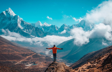
Everest Base Camp is situated on the southern side of Mount Everest, the tallest peak in the world at 5,364 meters. The place is accessible for climbers and trekkers to stay and see the beautiful sights of the Himalayas. However, before you begin your trekking, you should enjoy and relish the places, towns, and bazaars. They offer many holiday centers like billiards, and gambling areas to enjoy the time. Also, do not forget beautiful food and antique pieces to enhance your trekking experience. So, look down to see the things before you Experience trekking the Annapurna Circuit in Nepal. Things to See While Camping at Everest Base Camp Trek Here are a few places and things to see while camping at Everest base camp trek - Lukla Lukla is one of the famous destinations for travelers. It stands at 2860 meters and is situated in the northeastern part of Nepal, where you can see the beautiful sight of the Himalayas. Moreover, it is the place where you start your trekking journey. Hence, the town has evolved over the years to become a commercial place where tourists can find the best food and shops to buy. Also, the city has a small airport with a landing strip of 525 meters and boasts of having the most petite landing strip and being the airport at the highest peak in the world. Syangboche and Everest View Hotel Syangboche is one of the famous places to visit when you visit Everest base camp. Everest View Hotel is located at the highest peak in the world, which gave it a Guinness record for being the highest-placed hotel in the world. That way, you can see the 360-degree view of the snow-capped mountain from the hotel. Peaks like Mt. Everest, Tawache, Ama Dablam, and Khumbu Himal are sights to behold. Takashi Miyahara and Yoshinobu Kumagaya envisioned the hotel's construction. Moreover, they had to transport loads of materials to the Himalayas with the help of local Sherpas. The task began in 1960 and came into action in 1971. Tengboche Tengboche is one of the towns located near the Imja Khola, a typical night halt after Namche. It offers breathtaking views of the Himalayas, including peaks like Everest, Ama Dablam, Thamserku, Tawache, Nuptse, and Lhotse. Tenzing Norgay was also born in Tengboche. Furthermore, every year in October, the Tengboche Monastery holds the Mani Rimdu festival. This is primarily a Buddhist celebration that includes religious gatherings, ritual singing, and dancing. During the celebration, famous people visit the place, especially Rinpoche, who blesses pilgrims and travelers. Namche Bazaar Namche Bazaar is one of the bubbling places in Nepal. From the town, you can see the Everest Region. It is also one of the vibrant markets where you can buy Tibetan antiquities, especially trekking and climbing attire. From every point of the city, you can see a panoramic view of the Himalayas. Moreover, the town has been preserving its historical culture and natural friendliness. It is a trading town known for its yak cheese and butter. Also, you can see a pub, motels, and hotels where travelers can enjoy and have fun. Thus, you can stop in the town for two days before you move on to the trek. Lastly, many Sherpa settlements like Khunde, Khumjung, and Thane can be seen when you visit the town. Dingboche Dingboche is another popular point from which trekkers move on to Mount Everest from the base camp. You can stay for two nights in the town to see the beautiful Imja River and the beautiful sights of the Himalayas. Thus, many lodges and tents are available, providing the best accommodation for tourists. Also, a helicopter landing pad lies on the west of Imja River, especially near Moonlight Lodge. Moreover, you can find a satellite cafe and enjoy playing billiards in one of the tallest billiards parlors. Lastly, you can see the kilometers of Mani Walls, which is a great way to create a tourist sight. Additionally, it is made in various sizes and put on top of the kilometers of walls. Gorakshep Gorakshep is the last stop before you go on your trekking journey. It is a village amidst the Sagarmatha National Park, a hub for Sherpa guides, tourism businesses, and porters. Beyond this point, there is no accommodation facility, so you have to stay in tents amidst the cold weather and winds of the Himalayas. You will find various guesthouses to stay in before you go for a hike. It is the last resting point for trekkers to experience the great wilderness of the Himalayas. Thus, you can visit Gorakshep before you start your trekking to Mt. Everest. So, spend the night in the lodging house and enjoy the great wilderness of the Himalayas. The Bottom Line In the end, Everest Base Camp is where you can begin your trekking journey. However, if you go trekking, you have to wait and see the beautiful sights of the Himalayas. The serene nature that comes along with the great wilderness and bazaar is full of Tibetan things. Furthermore, you can gamble and play billiards in the parlor, as it is one of the best places for visitors to have fun. Hence, you can visit the place mentioned above, where you must carry a hard disk to capture millions of beautiful pictures. Consequently, you can taste beautiful Nepali and Tibetan dishes, filling your soul. So, pack your bags and start your trekking journey right now. FAQs Here are a few frequently asked questions - Do you need oxygen at Everest Base Camp? Yes, you need a reliable oxygen tank before you go on a trek to higher altitudes. Can you drink alcohol at Everest Base Camp? You should avoid drinking alcohol while camping at the Everest Base Camp. It will reduce your vision and judgment as the trails are rough. How many hours of walking is Everest Base Camp? You must walk 7 to 8 hours a day before walking to the Everest Base Camp. What is the best time to visit Everest Base Camp? The best time to visit Everest Base Camp is during the late-May to mid-September. Also read Top Reasons To Do Everest Trekking – Himalaya View Treks. Explore Human History And Wildlife With Backcountry Camping In Gates Of The Arctic National Park. From Himalayan Peaks to Cultural Experiences: The Ultimate Guide to Everest Base Camp and Manaslu Circuit Trek.