


 Related
10 Most Famous Restaurants In Hyderabad For A Wholesome Experience
BY Abdul Aziz Nov 29, 2022
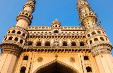
Hyderabad is a city in the south-central Indian state of Telangana. The largest and most populated city, it serves as the main urban hub and famous restaurants for the whole of the south-central heartland of India. Hyderabad has developed into a major worldwide center for business and trade as well as information technology (IT). The city is renowned for its monuments, which include the fort of Golconda and the masterpiece Charminar. It is famous for its rich cultural diversity, historical legacy, and, of course, its delectable cuisine, including biryani. Moreover, TasteAtlas has ranked Hyderabad 50th for its diverse food options. Also, the inclusive culture of the city is reflected in its food. So, when Biryani and Nihari are pure joy for non-vegetarians, the city never fails to offer the best options for vegetarians. Exploring the street food of the city is an experience in itself. However, if you are looking for fine dining and elaborate lunch options for you and your family, these are the best restaurants in Hyderabad. 10 Famous Restaurants In Hyderabad For Your Family You can explore the wide variety of the taste of Hyderabad in the following top 10 famous restaurants in Hyderabad. The rich food culture of the city gets a modern twist and some contemporary flavors at these highly-cherished places. 1. Exotica Banjara Hills Address: 5th Floor, 12th Square, Building, Hyderabad Contact Number: 095505 15500 Pocket Pinch: INR 2500 for Two People One of Hyderabad's best famous restaurants is popular with the name of Exotica. Exotica, a well-known eatery that serves Mughlai, North Indian, Chinese food, and others offering outside seating, lives up to its name. A complete bar counter with live sports screenings, supporting valet parking, a buffet, and many other luxury amenities available at the location. Known for its Kulfi, and delicious flavourful chicken malai tikka, Kheer, and Chicken Manchow Soup. The jucy Mutton Biryani, with Pina Coladas, is without a doubt one of the top restaurants in Hyderabad. Its staff is amicable, and the setting on the rooftop provides it with an added benefit. Anybody with a distinct cuisine philosophy can come here and have a fantastic feast. Exotica should therefore be on your list while you are visiting Hyderabad. Location: Banjara Hills 2. Jalpaan https://www.instagram.com/p/C-IGvHOpxwM/?hl=en Address: Jalpaan Oyster complex, Malabar Gold Show Room, Begumpet Contact Number: 083741 11102 Pocket Pinch: INR 600-800 Jalpaan, a popular vegetarian restaurant in Hyderabad, is elegantly decorated and has a cheerful staff. Butter Naan, Chaat, Potli Biryani, Gulab Jamun, and Paneer Tikka are some of its appetizing dishes that are well-known and never fail to tempt diners. It is without a doubt one of Hyderabad's best famous restaurants and is renowned for giving its vegetarian menu a royal twist. You can also book some pocket-friendly hotels in Hyderabad located in the area. Location: Begumpet 3. Flechazo https://www.instagram.com/p/Cyht4U5r75y/?hl=en Address: Floor, D. No.8, 5th, 2-120/86/9/3, Road No. 2, opp. Park Hyatt, Banjara Hills, Hyderabad Contact No: 073375 53270 Pocket Pinch: INR 800-1000 A very famous multicuisine restaurant that brings to you flavors from all across the globe. Flechazo, one of the city's newest eateries, specializes in Mediterranean, Asian, and North Indian cuisine. The famous restaurants' interiors, decor, and hospitality are frequently praised by customers. One of Hyderabad's greatest restaurants for families, it has free valet parking and wifi and is kid-friendly. Hyderabad is also a superb venue for New Year's celebrations. Location: Jubilee Hills 4. Amogham- The Lake View Restaurant https://www.instagram.com/p/C5DyUSbB3Ur/?hl=en Address: NTR Marg Adjacent to Lumbini Park, NTR Marg, opposite Tankbund, Khairtabad, Hyderabad Contact Number: 093552 34567 Pocket Pinch: INR 1600 for Two People Amogham Restaurant is renowned for its rich scent and indulgent use of spices. The service, atmosphere, and ambiance are all worth experiencing because they never fail to make a lasting impression. Given that you are in the southern region of the country, the Biryanis and Mughlai cuisine is known to be fairly authentic. The menus have been carefully crafted to ensure that each dish embodies the flavor and charm of traditional Indian cuisine. Location: Khairatabad, Central Hyderabad 5. Daily Treats Address: Raheja IT Park, Mindspace, HUDA Techno Enclave, HITEC City, Hyderabad Contact Number: 040 6767 6767 Pocket Pinch: INR 2500 for Two Daily Treats is one of the finest famous restaurants in the city for a fine-dining experience thanks to its magnificent décor, comfortable seating, and kind and helpful staff. It never fails to impress the foodie in you with its variety of delicacies from North Indian to European cuisines and vegan as well as gluten-free options. The out-of-this-world flavor of its meals and the elegance with which they are served on a platter make it one of the best vegetarian restaurants in Hyderabad. Location: The Westin Hyderabad, Madhapur, Hyderabad 6. Altitude Lounge Bar Hyderabad Marriott Hotel & Convention Centre https://www.instagram.com/p/CeOBi5aMdrG/?hl=en&img_index=1 Address: 8th Floor, Hyderabad Marriott Hotel & Convention Centre, Tank Bund Road, Bhagyalaxmi Nagar, Central, Hyderabad Contact Number: 096664 12009 Pocket Pinch: INR 3000 for Two People This eatery draws in both families and couples with its soft lighting and cozy atmosphere. Apart from the divine food, one of the main factors contributing to its appeal is the affordable prices. The vibe is welcoming and relaxing. It is one of the greatest famous restaurants in Hyderabad, offering rooftop and, lake & skyline views along with exceptional service, scrumptious dishes, cocktails, and a pleasant environment. Location: Hyderabad Marriott Hotel & Convention Centre 7. The Fisherman’s Wharf https://www.instagram.com/p/C-piLwaoFDr/?hl=en Address: 304, Nehru Outer Ring Road, Financial District, Gachibowli, Hyderabad, Nanakramguda Contact Number: 091003 32244 Pocket Pinch: INR 1800 for Two Due to its Goan theme, Hyderabad's The Fisherman's Wharf restaurant and pub are wildly famous. The lavish furnishings, colorful walls, and open rooftop almost make you believe that you are on a beach, far from the bustling streets. The seafood platter they serve is remarkable. Fisherman's Wharf is an excellent dine-out option for a group outing or corporate meal. Location: 304, Puppalaguda, Gachibowli, Hyderabad 8. Mist-The Poolside Kitchen Address: Golkonda Resorts & Spa, The Golconda Resort, Gandipet, Hyderabad Contact Number: 099514 97555 Pocket Pinch: INR 4000 for Two People A casual restaurant offering beverages and Mediterranean and Pan-Asian food next to a swimming pool. Your ideal romantic candle night dinner place. Both locals and tourists frequent the restaurant, and its reasonable rates significantly increase business. The well-known delicacies offered here never fail to win hearts and please the tastebuds. Location: The Golkonda Resort, Sagar Mahal Complex, Hyderabad 9. Jewel Of Nizam https://www.instagram.com/p/CsTSFBwr7b6/?hl=en Address: D No. 10/1/124, The Golkonda Hotel, Saifabad Rd, Masab Tank, Hyderabad Contact Number: 040 6611 0101 Pocket Pinch: INR 5000 for Two People A restaurant that sounds (and appears to be) straight out of a dream is a premium dining establishment called Jewel of Nizam, The Minar. The cobalt blue crystal glasses and seats lend a splash of color, while the exquisite ivory decor and delicate chandeliers give the space a pleasant, sophisticated appearance and feel. The tower's spectacular views are the icing on the cake as you feast and raise a toast to Hyderabadi life. Location: Golkonda Resort, Gandipet. 10. Mazzo https://www.instagram.com/p/DCVylVzuVSY/ Address: SLN terminus, Gachibowli, Marriott Executive Apartments, Level ST (Super Terrace, Survey No. 133, SLN Terminus Rd, Gachibowli, Kondapur Contact Number: 091000 80131 Pocket Pinch: INR 3000 for Two People A fantastic location to enjoy the nightlife, taking in the mesmerizing view along with mouthwatering food. It is a popular foodie hotspot, so making reservations in advance is always a smart decision. It makes for a special supper with family and friends because of the relaxed atmosphere and excellent service, located near some of the best Hyderabad famous restaurants to stay in. Location: SLN Terminus, 10th floor, Jayabheri Enclave, Gachibowli, Hyderabad Conclusion: You must acknowledge that there is a lot to explore in the city after reading the blog. Where would you go first in a city with such a wide variety of mouthwatering food among these famous restaurants list and share your experiences through the comment section? Frequently Asked Questions On Best Restaurants In Hyderabad (FAQs:) 1. What are the most popular restaurants in Hyderabad that one can’t afford to miss? Ans: Flechazo, Conçu, Olive Bistro, and AB's Absolute Barbecue are the leading eateries in Jubilee Hills that serve quality food. These are a few of the well-liked eateries where visitors enjoy dining. You can also visit Mist, Mazzo, and Jewel of Nizam to have a sumptuous experience that will leave you craving for more. 2. What kind of cuisines do the top restaurants in Hyderabad offer? Ans: Hyderabad is a food lover's paradise, especially for those who enjoy spicy food! While Biryani is Hyderabad's most well-known dish, one can also discover a wide range of other cuisines in Hyderabad's restaurants, including North Indian, Mediterranean, Italian, Continental, and a lot more. 3. What are some good hotels to stay in for a while on your trip to Hyderabad? Ans: There are numerous hotels in Hyderabad that are budget friendly and centrally located. Trident Hyderabad, Taj Falaknuma Palace, Hyatt Place, Marriott Executive Apartments, and Courtyard by Marriott, to name a few.