


 Related
You Cannot Miss These Things To Do In Wilmington, NC (With Tour And Travel Tips And Tricks)
BY Sibashree Nov 28, 2024
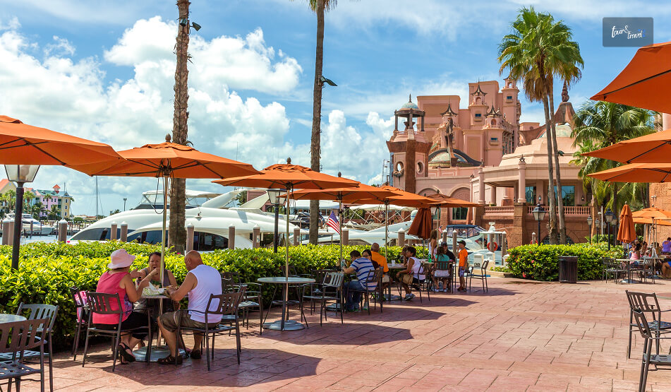
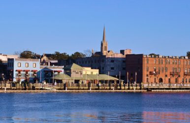
The Memorial Day weekend in 2024 saw an influx of tourists in Wilmington, NC. This even led to temporary employment in the community, with local businesses recruiting more staff to serve more tourists. Connie Nelson, the director of Public Relations at Wilmington and Beaches Convention & Visitors Bureau, has acknowledged this seasonal staffing along with the daily efforts of the lifeguards. However, the surge in tourists during the Memorial Day Weekend is one of many high points for tourism in this port city. It has always been consistent with its tourism scenario and, is even on the rise recently. Further, as the location for films like Dawson’s Creek and Iron Man 3, it has earned the nickname “Hollywood East.” So, it’s a favorite among movie buffs. Moreover, Wilmington, the historic port city on the Cape Fear River and the Atlantic Ocean, offers a wonderful fusion of city tours, culinary explorations, historic tours, and endless outdoor activities. Therefore, being named the “South’s Best City On The Rise in 2024” did not surprise those interested in Wilmington tourism. At Tour and Travel, we have curated some of the best things to do in Wilmington, NC. We want to keep it helpful for all types of travelers. So, we have covered nature and beach experiences, exploring Wilmington’s historic places and culinary scenes. Best Things To Do In Wilmington, NC For History Buffs Wilmington, or North Carolina’s Port City, has a long association with history. It takes us back to the Colonial times and since 1739, it has been serving as an important trade and commerce center. Moreover, the city was associated with the Civil War, the American Revolution, and World War II. Today, you can visit the following historic sites here. 1. Bellamy Mansion Museum Operating Hours: 10 AM to 4 PM Entry Fee: $7 to $15 (Based on Age Groups and Special Groups, Free for Members and Children Below 5) Contact Number: +1 910-251-3700 Founded in 1994, the Bellamy Mansion Museum will complete its 30th year in 2024. Today, it stands tall as an example of the finest antebellum architecture in North Carolina. The museum is housed in a 19th-century mansion owned by Dr. John Bellamy. He lived here with his wife and 10 children. Further, around 115 enslaved people worked for Dr. John Bellamy, and nine resided here. So, along with the main property of 22 rooms, you must also take a tour of the slave quarters. Another attraction of the museum is the Bellamy Gift Shop. You can buy plates, spoons, fridge magnets, ornaments, caps, books, bow ties, and other souvenirs from here. Tour And Travel Note A Premium Tour of the museum is available. If you are an adult, you will have to buy a ticket for $20 for the Premium Tour. Students can collect their Premium Tour tickets at $10. However, Premium Tour tickets are not sold online. You have to check the availability and buy yours by calling +1 910-251-3700 (Extension: 308). 2. Battleship North Carolina Operating Hours: 8 AM to 5 PM Entry Fee: $6 to $14 (Based on Age Groups and Special IDs, Free for Children Below 5) Contact No: +1 910-399-9100 Battleship North Carolina is the most tragic reminder of World War II. It had 15 stars, and today, it remembers 10000 men and women of North Carolina sacrificing their lives to protect America’s freedom in World War II. Today, the battleship in downtown Wilmington is a common attraction for history enthusiasts. A tour of Battleship North Carolina will take you at least 2 hours. However, you can spend longer. Furthermore, you can attend interactive programs at Battleship North Carolina throughout the year. These courses are free; you just need to pay the regular admission fee. Tour And Travel Note As a history enthusiast, you can support the preservation of Battleship North Carolina. It does not have the regular backing of the USA government. You can be of great help as a donor. 3. Wilmington Railroad Museum https://www.instagram.com/p/DABdZTGvZBB/ Operating Time: 10 AM to 4 PM Entry Fee: $8 to $12 (Based on Age and Special Groups, Free for Children Below 2 Years) Contact Number: +1 910-763-2634 Wilmington Railroad Museum is a place to explore history and indulge in nostalgic activities. Here, you can climb on an old steam locomotive of 110 years. Further, in this museum, you will learn about the railroad development in Wilmington and the people working on the railway. Moreover, the Children’s Hall in this museum has interactive models. Your little ones will love those fun models and customized train tables. Tour And Travel Note You can get the Polar Express Tickets on Sale on the official website of the Wilmington Railroad Museum. The Polar Express fun takes place every weekend from Thanksgiving Day to New Year. You will need to pay $5 and a Processing Fee for taking part in this event. The activities include “a reading of the Polar Express,” a surprise visit of Santa Claus and indulging in hot chocolate and cookies. Did You Know?Built on 1st May 1979, the Wilmington Railroad Museum completed its 45th year in 2024. 4. Cape Fear Museum of History & Science https://www.instagram.com/p/Csv1rAtISqI/ Operating Hours: 9 AM to 5 PM (Tuesday To Saturday), Sunday 1 PM to 5 PM Admission Fee: $5-$8 (Based on Age Groups), Free for Members and Children Below 5 Years, Reduced Fee for NARM and ASTC Participants Contact Number: 910-798-4370 If you want to know about the culture, history, and science of Lower Cape Fear, the Cape Fear Museum of History & Science will be your go-to destination. You will find over 57000 objects here. It has photographs, a collection of oral history, and digital yearbooks for shedding light on history, science, and culture. Did You Know?Wilmington became the first designated “American World War II Heritage City” in the USA. It was designated on 2nd September 2020 to commemorate the 75th year of World War II coming to an end.The city got this designation after meeting all the criteria laid out by Congress to preserve the WWII heritage. The city also recognized the veterans and preserved many wartime facilities. Things To Do In Wilmington, NC: Enjoy Nature, Beaches And Outdoor Activities In Wilmington, NC Indulging in the beach experience is one of the best things to do in Wilmington, NC. You can visit the following beaches here. Wrightsville Beach Kure Beach Carolina Beach Wilmington’s fun water activities include Surfing, fishing, chartering, and cruising. You can also just relax at the beaches and enjoy fun moments with your family. March to May and September to November are the best times to visit Wilmington beaches, as the temperature is moderate during these months. Things to Do in Wilmington, NC, For Foodies And Drink Enthusiasts Culinary tourism is one of the best things to do in Wilmington. The Taste Carolina Gourmet Food Tours are already famous. In these tours, you will visit and explore eclectic restaurants and try their assortments of food. The city is also great for drink enthusiasts with local breweries. Here, we have curated the names of some places to eat and drink in Wilmington, NC. 1. Michael’s On The Waterfront https://www.instagram.com/p/CzcKC4vPtrT/?img_index=1 Phone Number: (910) 769-4252 Opens at: 11:30 AM Michael’s On The Waterfront is a family-owned restaurant. you will find the best American cuisines with a coastal Carolina twist Here. The BBQs and pub fries here are the stars. And don’t forget to try the crab and lobster delicacies here. Furthermore, Michael’s Bar has wines and beers. You can even try the curated cocktails with seasonal flavors. 2. Copper Penny https://www.instagram.com/p/DAgXoumvg8r/ Phone Number: (910) 762-1373 Operating Hours: 11 AM to 9 PM It is one of the best American restaurants and bars in Wilmington. You can try here classics like fish and chips and French onion soup. Further, they make amazing steaks and chicken tenders. 3. The Rooftop Bar Phone Number: (910) 833-5886 Operating Hours: 5 PM to 2 AM The corn fritters at The Rooftop Bar are amazing, and their chunks of shrimp are delicious. Drunken shrimp is another favorite of mine here. Also, you will get the best pina colada here. 4. Rumcow https://www.instagram.com/p/C-vQgHAvXzc/?hl=en Phone Number: +1 910-769-4659 Operating Hours: 5 PM to 9 PM Fall cocktails are great at Rumcow. Further, you must try avocado fries and chicken and waffles here. Exploring The Art And Culture Of Wilmington: One Of The Best Things To Do In Wilmington, NC As the designated historic district of the state, Wilmington also has an evolving landscape of art and culture. I have already mentioned places like Bellamy Mansion Museum, Wilmington Railroad Museum, and Cape Fear Museum of History & Science. However, the city also has many happening centers for performing arts. Here is a quick overview for you. 1. Thalian Hall Center for Performing Arts Contact No: +1 910-632-2285 John Montague Trimble, one of the pioneering theater architects of the 19th century, designed this performing art center. In fact, today, it is the only surviving theatre designed by him. This center for performing arts is a converted city hall and it has around 500 performances each year. You can visit this Center for Performing Arts on a guided tour. 2. The Wilson Center At Cape Fear Community College Contact No: +1 910-362-7999 The Wilson Center has been the host of The Wilmington Symphony, Kinky Boots, and many other Tony Award winning symphonies. So, spending an evening here watching a comedy or Broadway show is an experience in itself. 3. Kenan Auditorium Contact No: +1 910-962-3500 The Kenan Auditorium is at UNCW or the University of North Carolina Wilmington. Throughout the year, it houses more than 150 dance performances, musicals, and theatricals. Also, you can attend the brilliant University productions and award-winning events at Kenan Auditorium. 4. Brooklyn Arts Center Contact No: +1 910-859-4615 Visiting the Brooklyn Arts Center is like indulging in sheer nostalgia and stories of history. It is a 19th-century church converted into a center for performing arts. It also has a beautiful private courtyard where you can click beautiful photographs. Upcoming Events At Wilmington, NC Here are some important events in Wilmington, NC, in 2024. So, mark the venues and dates. EventVenueDatesHadestownThe Wilson CenterOngoing, till November 27, 2024Comedian Cipha SoundsDead Crow Comedy Room | Lush LoungeOngoing, till November 23, 2024BUZZWORTHY! Art in the GardenAirlie GardensOngoing, till December 31, 202430th Anniversary Cucalorus FestivalVarious Venues (Historic Downtown Wilmington)Ongoing, till November 24, 2024 Also read Beginner Tips For Your First Camino de Santiago. Ultimate Guide to Your Next Family Vacation in Israel. Boat Charter Miami: Essential Tips for a Great Experience.