



Airwander: Should You Try This Platform For Booking Your Travel?

Jul 12, 2023

Last Updated on: Jul 22, 2026

Travel Guides

Are you an Airwanderer? Do you think this platform is quite effective for making bookings? Read the article to learn more.

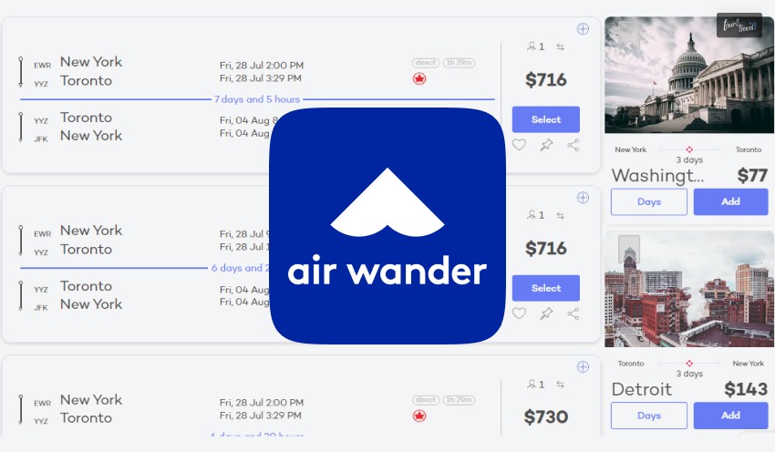
A flight meta-search engine, Airwander combines travel with cheap stopovers and automated suggestions for a flight.

The company’s founders, Ela Bader, and Douglas Deming, live a digitally nomadic lifestyle contributing to their startup further expanding across Hawaii, Honolulu, Malaga, and Spain.

The search engine or the website of Airwander is also accessible in an app form developed in 2014, and finally, it was released in 2015 with the name of QuestOrganizier.

Later, with significant enhancements and rebranding, it was launched in 2016 at TechCrunch Disrupt London.

According to the official website, www.airwander.com, the Airwander V2 went live in 2018, while the V3 is still under development.

The app provides a detailed layout across a city or region that a probable passenger is trying to book.

Airwander: Should You Try This Platform For Booking Your Travel?

Booking Your Travel Airwander

Airwander is majorly an integration of automated systems and stopovers leading to the recommendations or suggestions made to the customers by the website.

Stopover is different from a layover, and it is the feature that is the unique element of Airwander.

Stopover allows a passenger to explore a city as it extends for 24 hours and more, while layover is just about connecting flights through a specific country or regional airport.

Many passengers want to reach their destination as fast as possible; however, with a stopover, passengers who like exploring new places can find the perfect booking.

Therefore, passengers can add stopovers to their central booking instead of booking separate tickets for different locations.

What Is Airwander?

What Is Airwander

Ela Bader and Douglas Deming are the creators of the service Airwander, who founded the company inspired by their 8 months of a backpacking trip across South America.

They added other countries to their journey to save up money.

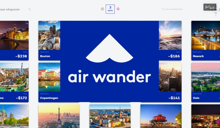
Airwander is a flight metasearch engine that produces itself by adding multi-day stopovers, making the experience of the flyers more elaborate and diverse.

You can hop in many cities before reaching directly to your location with the help of it.

The website of Airwander is integrated with advanced algorithms which suggest individuals book stopovers that will be added to the flight booking.

All the routes are considered by it the moment you input all the details of departure and arrival dates, location, and other such information.

According to the reviews on Producthunt.com, it rates 4 out of 5 based on 606 votes. Many studies have agreed about the advantage of stopovers and recommended the website.

What Benefits Of Airwander?

What Benefits Of Airwander

The fact that air wander helps in visiting and exploring new places before focusing on your final destination.

If you have a travel buddy, you both might like to explore new cities before reaching the final town or region you visit.

Savings

You can save money, especially if you add stopovers to direct travel between two locations. For example, you can save up to $101 if you book a 3 day stay in Los Angeles.

There is additional information available while booking because you receive recommendations and suggestions.

Most Affordable Flights

Airwander flights are affordable compared to other booking sites and search engines for travel.

You will find that the services offered by Airwander are comparatively cheap because they are in partnership with other brands.

With the increasing competition and services offered by other websites that provide travel and accommodation booking, air wander is considerably affordable regarding flights.

Personalized Layovers

The users can customize the layovers. If you book flights on Airwander, you can personalize the layover.

You can adjust accordingly to manage the takeoff time and landing time accordingly. Layover is controlled based on the trip.

Customized Destination

The destination is customized based on the directions of the flights and how you manage the trip. When flying to a specific location or region of the country, you can add more stops to the trip.

What Disadvantages Of Airwander?

What Disadvantages Of Airwander?

There are limited disadvantages, as it is most effective for users who like exploring different cities before going to a specific location.

The Website Could Be Faster

At times, the website of Airwander could be faster, which can be difficult for users. Sometimes, the website needs to catch up, making it more difficult.

Expensive On Certain Occasions

On specific occasions, the charges for flights in Airwander are pretty high. It can be not easy, especially when adding additional flight stopovers.

Should You Use The Airwander Platform For Making Bookings To Travel?

Airwander Platform For Making Bookings To Travel

You can use Airwander because it is quite effective to make cheap bookings and yet create a diverse itinerary. The service has been designed so that users can use this service through flight hacking features.

It is the stopovers that help individuals to take advantage of this service because the AI of the website effectively integrates the cost-effectiveness.

You can receive travel insurance when you book flights at Airwander, considering you will get covered based on injury, theft, and illness.

You will receive both Visitors Coverage and Safety Wing with the insurance regarding travel management on it. The service effectively helps users to find the best and exclusive deals.

The website can further be improved by working on the speed of the website loading and how it needs to make the services available.

You can add up to 3 stops or more for each trip; the landing and takeoff times are correct.

Alternatives For Airwander

Alternatives For Airwander

Other alternatives to Airwander are verified and can be used instead of this service. These alternatives are significantly cost-productive and help in integrating cutting-edge services.

ComplyCube

The site verifies the customers within 15 seconds, which helps integrate cutting-edge services such as API and SaaS platforms for identity verification.

Skyscanner

You can also use Skyscanner, through which you can choose cheaper flights helping people get the best deals. The website lets customers compare more than 1000 airlines worldwide and their most reasonable offers.

KAYAK

A travel search engine, KAYAK, has effectively connected several significant travel sites for booking cheap flights and affordable deals.

You will receive compelling features and tools that can be used to check up on rental cars, hotels, vacation packages, and flights.

Google Flights

You can find the cheapest flights on Google Flights by putting the destination on the map. You can sign up from your Google account to receive alerts on your booking.

How Is A Stopover Different From From A Layover?

To help you better understand the features of the service, it is necessary to familiarize yourself with a few flight terms before continuing with our Airwander review.

To begin with, what is a stopover and how is it different from a layover?

When you spend less than a day at a connecting city prior to reaching your ultimate destination, it’s known as a layover.

Conversely, stopovers are defined as stays of one day or longer. What does this signify, then, for a tourist?

Some travelers prefer to take a slower route, visiting a few different nations or cities along the way, while others want to reach their destination as quickly as possible.

A stopover gives you more flexibility to explore connecting cities than a layover because it lasts longer than 24 hours.

Using stopovers is the best way to accomplish goals such as visiting a landmark, going on a tour, or spending time with friends or family who are from a different country. However, why?

Why are stopovers preferable to purchasing individual tickets for each destination? To learn more, read our review of Airwander.

Who Is Airwander For?

Anyone who enjoys traveling should use Airwander. However, it’s a particularly appealing service for two kinds of travelers: those who love adding layovers to their flights to explore new places, and those who are constantly searching for flight deals.

Airwander is ideal if your travel schedule allows you to smuggle in a few extra days to spend exploring a place.

The purpose of Airwander’s search engine is to provide travelers with the most affordable options for places to stopover, rather than having them look for a specific destination.

This is not to say that you cannot intentionally choose a stopover at a particular location; however, if your destination is not listed in the first set of results, you will likely have to pay a high fare.

In light of this, the service is designed for more impulsive travelers who won’t hesitate to visit an unknown location.

Recall that while traveling allows for spontaneity, going without travel insurance does not. Verify that you are protected! Having without needing is preferable to needing and not having!

Conclusion

Please read the article to learn more about Airwander and the benefits that you might get if you use it.

Comment below about whether you think it is worth using Airwander if you are interested in exploring more cities before you reach your destination.

Read Also:

Share on Social Media

Mashum Mollah is the feature writer of Search Engine Magazine and an SEO Analyst at Real Wealth Business. Over the last 3 years, He has successfully developed and implemented online marketing, SEO, and conversion campaigns for 50+ businesses of all sizes. He is the co-founder of Social Media Magazine.

Leave a Reply

Your email address will not be published. Required fields are marked *

title-img Related

READ MORE Suva nature guide

Suva Nature Guide: Exploring The Hidden Waterfalls, Peaks And Coastal Gems In The Green Heart Of The Pacific

BY  Sibashree Feb 12, 2026

Suva has the nickname of “The Green Heart of the Pacific,” and there is a reason behind that. It is more than government buildings and rich cultures. It is a rainforest city. Also, the city has Naitasiri and Rew adventure zones in the surrounding. Moreover, with an annual rainfall of 3000 millimeters, it has natural wonders such as the Colo-i-Suva Forest Park and urban places such as the Thurston Gardens and Albert Park. In addition, the city is home to a “Healthy City” initiative. Newer and greener pedestrian paths, parklands, and improved waste management systems of the city are the major parts of this initiative. Hi, in today’s blog, I will talk about the Suva nature guide. The topics discussed here are:  The best natural places to visit in Suva, Fiji  Suva nature guide tips from experts  Things to know to travel like a local  FAQs. Suva Nature Guide: What Are The Best Natural Places To Visit In Suva? Located on a hilly peninsula on the southeast coast of Viti Levu, Suva is incredibly blessed with lush greenery. Also, starting from Colo-i-Suva Forest Park, to the hidden nature spots in Suva, Fiji, there are many places to explore. 1. The Crown Jewel: Colo-I-Suva Forest Park  Do you know how the locals of Suva pronounce Colo-I-Suva Forest Park? They call it tholo-ee-soo-va. This rainforest has an area of 2.5 square kilometers. Also, this lush green forest oasis serves as the primary green lung of the city. The Upper Vs. Lower Pools  The two pools, the upper and lower pools of Suva, are divided by the main road. On each side, you will have a distinct experience. The Upper Pools Nature lovers and hikers love the steep and well-maintained trails of the Upper Pools.  Also, here it is less about the splash of swimmers. The focus is more on the symphony of the forest. The Lower Pools The Lower Pools have swimming holes and a rope swing that has seen decades of use. Daring travelers and local families love this area. Also, these are the ideal places if you want to cool off after a humid trek. Birdwatching Guide In Colo-I-Suva Forest Park  Suva's rainforests are a symphony of endemic species. Keep your binoculars ready for the scarlet robin and pink-billed parrotfinch. You must not miss the dawn chorus as it is the best birdwatching experience you can have in Suva. Safety And Practical Tips For Colo-I-Suva Forest Park  While the park is beautiful, it requires common sense. Security guards are usually stationed at the main pools and trailheads. It is wise to stick to the populated trails and avoid hiking alone late in the afternoon. Slippery paths are a guarantee, and Suva's high rainfall means the clay-heavy soil is perpetually slick. Wear shoes with aggressive tread, not flip-flops.  2. Hidden Waterfalls And Swimming Holes (Within 20 Mins) If you find that Colo-i-Suva is very curated, you can choose a more local or secret experience and know the rugged side of Fiji.  Here are the best waterfalls and swimming holes of Suva. These are just 20 minutes away from the city.  Korolailai Waterfall (Wailoku) The Korolailai Waterfall in Wailoku is a favorite of the locals. Use the Sikh Temple in Wailoku as your landmark, and the trail starts from here.  The trail passes through local farms and secondary forest.  Also, the main fall features a flat rock ledge directly behind the curtain of water. You can sit there and let the weight of the waterfall pound your shoulders. It’s the best free spa treatment in the Central Division. Navakavu Blue Hole Take a short drive toward the Lami side of the bay to reach the Navakavu coastline.  A short drive toward the Lami side of the bay brings you to the Navakavu coastline. This area is a protected tabu (sacred/restricted) site under the local Iqoliqoli (customary fishing grounds). So, you have to check with the village headman or local guides before entering the village.  Moreover, "Blue Hole" is a stunning turquoise indentation in the reef flats, perfect for snorkeling during high tide. 3. Hiking Suva: From Peaks To Reserves Are you looking for some elevation and solitude? Do you have the fitness to explore heights? Hike these peaks and explore these reserves.  • Mount Korobaba Summit Hike It is the best Suva hike experience you can have. Mount Korobaba rises above the Lami harbor, and from the mountain, you can enjoy a panoramic view of the Suva peninsula and Laucala Bay.  This trekking trail starts behind the Lami Cement Factory. So, the start is humble, but it is worth the grand view.  However, the hike is strenuous, and a return trip will take at least 2 to 3 hours. Also, here, you have to be very careful about the mud warning.  If it rains, the trail will become muddy and act like a vertical natural slide. Nevertheless, there are ropes in some sections to help you haul yourself up.  • Savura Forest Reserve Savura Forest Reserve is like a hidden gem, and it is a quiet academic zone that you would love to explore. It is a vital area for the water supply of Suva.  Furthermore, because it has fewer tourists, the biodiversity of the place remains almost intact. Overall, the condition is meditative and peaceful.  4. Coastal And Island Nature To cherish the coastal beauty and Island nature of Suva, you must visit the Nukulau Island and My Suva Park & The Seawall. At these places, you will understand the relationship of Suva with its marine landscape. So, leave the mainland and walk the southern edge.  • Nukulau Island The Nukalau Island is small, but it has a long history. It has served as a quarantine station and a prison. However, ironically, today, it is not a dark tourism site anymore.  In fact, it is now a peaceful place for a picnic.  Sandbank, And The History Of Nukulau Island  When there is a low tide, you will notice a massive stretch of sandbank here. The sandbank is ideal for wading.  You will also find here the remnants of many old structures. Thus, you can blend history with a beach day.  Nukulau Island Boat Logistics  The boats in the Nukulau Island leave from the Suva Wharf or the Vatuwaqa area. Charter a long boat and enjoy a breezy ride across the lagoon for 20 minutes.  A longboat is a fiverglass boat with an outboard motor. • My Suva Park And The Seawall You don’t always need a boat to see the coastal beauty of Suva. You can visit My Suva Picnic Park and explore the rehabilitated mangrove walkways.  Here, you will find the most intricate root systems that protect the shoreline from decay.  On the other hand, the Suva Seawall is the social hub of Suva City. Here, you will enjoy the sunset views over the peaks of Joske’s Thumb.  Also, don’t miss the view of Mount Korobaba in the distance.  During the sunset, the sky has the most fiery shade of violet, and looking at that, you can end a day of exploration on a perfect note.  5. Urban Greenery: Thurston Gardens Suva Botanical Gardens, or the Thurston Gardens, is an urban green space. The place got its name in 1976 after Sir John Bates Thurston, the founder of this botanical garden and the fifth governor of the city.  You can see diverse fauna in this botanical garden. It has water lilies, colorful gingers, ferns, and palms. It is also home to a prominent bat colony. In this context, you must know that bats are the only native mammals of Suva.  Currently, the Fiji Museum maintains this urban park, and other historical landmarks in the park are the bandstand and the Clock Tower.  These were built to commemorate the first mayor of the city.  Suva Nature Guide And Tips From Experts  Now, only the locals and taxi drivers know that Mt. Korobaba, "Pacific Cement Limited" factory in Lami, is better than the "Korobaba trailhead."  You can start your hike behind the factory fence. Now, this is what makes all the difference. The local and expert tips always help to enhance your Suva travel itinerary.  Do you want to know more such tips? Follow the details here.  1. Avoid Heavy Rain Days The weather in Suva is either wet or very wet. So, while it’s not practical to wait for a sunny morning and you must embrace the rainforest bath, you cannot trade the day of or after a heavy rainfall.  When it rains, the trails and forest tracks of Suva become natural and dangerous mudslides.  2. Take The Bus To Colo-i-Suva If You Are Traveling On A Budget  You don’t need to take a taxi for $15 if you are traveling to Colo-i-Suva from the city.  As a budget traveler, you can take the Sawani Bus from the main bus station and ask the driver to drop you at the park gate. The ticket price will be just $2.  3. Suva Keeps It Quiet On Sundays  Sundays are great for exploring the natural spots of Suva. These places are less crowded on Sundays.  Quite a surprise compared to the Western standards.  However, there is a catch! Public transport options are very limited on Sundays. So, you must pre-book a taxi for a smooth experience.  4. Follow The Sulu Rule  Suva is very particular about its customs and traditions.  Suppose you are visiting a secluded nature spot and you have to walk through a village, such as Korolailai, to reach that place.  Then, you will have to cover your legs with a sarong as a gesture of respect for the local community.  5. Be Aware Of Leptospirosis The pools and natural swimming places in Suva have tropical water. So, you cannot swim in them if you have open cuts.  Tropical water carries bacteria, and if you swim in the water with open injuries, you may have Leptospirosis.  6. Use Your Skills To Negotiate  You cannot just agree to whatever the boat owner asks you to pay for a ride to Nukulau. You must negotiate the boat fee at the Suva Carrier Stand, which is near the Suva Market.  If you are taking a private fiberglass boat, a return trip will cost you around $80-$100 FJD.  7. Wear Mosquito Repellent  My Suva Park in Suva, or the mangrove areas and rainforest, has mosquitoes. Also, Dengue is a serious concern here.  So, you have to wear mosquito repellent, and you need to spray to get rid of the mosquitoes.  8. Stay Hydrated  The humidity percentage in Suva Rainforest is more than 90%. So, when you are hiking, sweating will be profuse.  If you are hiking for 1 hour or more, you need to carry around 2 liters of water.  Things To Know In Suva, Fiji, If You Want To Travel Like A Local  You have to embrace Suva, Fiji, as it is, if you want to travel like a local. Also, there are some stories, or rather facts, that only locals know. For example, the Dakua trees are native to this place. However, the Mahogany Trees were later introduced to stabilize the soil.  Here is more about the reality checks, about the weather quirks, and the food of Suva if you soak in the true spirit.  1. The Reality Of The Rain Capital  The precipitation of around 3000 millimeters in a year, or a wet tropical climate, makes Suva the rain capital of Fiji.  In Fiji, it rains for more than 200 days a year.  So, if you want to explore Suva, you cannot wait for the Sun to shine bright. You have to embrace the rainforest swimming.  It means that you can get wet while it rains while exploring the rainforest, and do not waste time waiting for the Sun.  2. Picnic Like A Local In Suva, Fiji  If you are on a Suva food tour and want to indulge in the real flavors, you will have to picnic like a local.  Once you are tired after a long swimming session, you must buy a Bhuja or a spicy mix and have it with a long loaf as a snack.  Quirks And Cultural Hidden Gems Of Suva, Fiji Talking about the cultural hidden gems of Suva, Fiji, the first story that comes to my mind is about the Liuliu.  Liulius are the guardians of the waterfalls.  So, when you visit these waterfalls, you must not shout or scream. The guardians can be angry, and they can curse you if you shout and disturb them.  Along with this myth about the Liuliu or guardians, Suva is also known for its Lami vibe. It is at the base of the Mt Korobaba. It is the town that has the perfect fusion of a silent natural retreat and an industrial town.  In addition, the dark past of Nukulau is very intriguing in Suva, Fiji. It was once a quarantine island and later became a prison for coup leaders.  Moreover, this place has a stark contrast between the beautiful sandy beaches and a turbulent past. Thus, it has all the potential of becoming a dark tourism destination.  Do you want to learn more about the culture of this Fijian capital? Read my Suva cultural guide.  Discovering The Real Suva  The primal beauty of Viti Levu, the amber pools of Colo-i-Suva, the mud-slicked trails of Mt. Korobaba, and finding peace in the hidden Korolailai basin!  Also, the Fijian capital asks you to be a little dirty. So, wear your reef shoes, pack your mosquito repellent, and step off the pavement.  Moreover, allow the trees to embrace you and show you the real Suva.  Suva Nature Guide: Frequently Asked Questions And Answers (FAQs) Here are the frequently asked questions and answers about the Suva nature guide.  1. Is It Safe To Swim In Colo-i-Suva? Yes, you can swim safely in the freshwater pools of the Colo-i-Suva Forest Park. The pools here are in an inland rainforest, and they are not connected to the ocean. So, there will be no saltwater hazards.However, like other natural pools, these pools also vary in depth, and the surfaces can be rocky or slippery. So, you have to exercise caution when swimming in the natural pools here.  2. How Long Is The Mt. Korobaba Hike? The Mt. Korobaba hike is around 6 Kilometers or 3.7 miles long. It is a challenging hike, and the elevation gain is around 404 meters. Furthermore, the red clay path is challenging, and the clay route often gets muddy. Also, based on your pace, you will be able to complete the trek in 2 to 3 hours.  3. Are There Crocodiles In Suva’s Rivers?  Unlike many other islands of the Pacific Ocean, the rivers of Suva do not have crocodiles. However, you can spot saltwater crocodiles in Suva, and these crocodiles come from the nearby Solomon Islands or Papua New Guinea. They visit the region due to the strong oceanic currents. However, their sightings are very rare.  4. Do I Need A Guide For The Hikes In Suva? No, it is not mandatory to have a guide if you're hiking in the Colo-I-Suva forest or areas near Suva. However, the trails can be slippery, and the presence of wildlife in Suva is abundant. Also, often the major trails are linked to minor trails, and staying on the right tracks becomes difficult. So, it is better to have a local guide for safety purposes, and they will also guide you about the flora and fauna.  5. How Much Is The Entry Fee For Colo-I-Suva? The entry fee for Colo-I-Suva is around $1 FJD for the local adults and $0.50 FJD for children. However, if you are a foreign visitor, you will have to pay $5 FJD for adults and $1 FJD for children. 6. Can I Camp On Nukulau Island? Yes, you can camp on Nukulau Island, but you need a permit from the Department of Environment in Suva City beforehand. The permit will cost you around $2 for 24 hours. Also, the island has a shade for camping. However, you will have to bring your own tent, food, and water. 7. What Wildlife Will I See In Suva, Fiji? Suva is rich in wildlife. Places such as the Suva Botanical Gardens and Colo-i-Suva Forest Park are ideal for watching the birds, mammals, and amphibians. Birds to see in Suva are the Collared Lory (Kula), masked shining parrots, Fiji Goshawk, and blue-crested Broadbill. You will also find amphibians such as the Pacific Boa, Fiji Tree Frog, and Fiji Banded Iguana. Furthermore, while bats are the only native mammals of Suva, you will also find the Samoan Flying Fox, the Fijian Monkey-faced Bat, and the Mongoose. Moreover, Spinner & Bottlenose Dolphins, Banded Sea Krait, Spinner & Bottlenose Dolphins and Reef Sharks are the prominent marine animals found in Suva, Fiji. 8. Is Korolailai Waterfall Free? Yes, the Korolailai Waterfall is free to visit. However, there is a border of a settlement around the waterfall. You can pay a small donation of around $2-5 as a polite gesture. Also, you will have to pay a taxi fee of FJ$15–FJ$25 to reach the Korolailai Waterfall from Suva City.  9. What Is The Best Time For Birdwatching In Suva? Early morning is the best time of day for birdwatching in Suva. If you start birdwatching between 5 and 5:30 AM, you will find birds such as the Slaty Monarch, Fiji White-eye, and fruit dove. Season-wise, May to October is the best time for birdwatching. Especially, mid-August 10. Where Can I See Mangroves In Suva?  You will find the mangrove trees along the coastal areas of Suva. The easiest zone to access from the city is, of course, the Suva Seawall & Queen Elizabeth Drive. Another easy zone is the Rewa River Delta. It is around 25 km from Suva. It has an extensive stretch of mangroves. You can take a boat ride from Nausori to explore the area. Furthermore, Kalokolevu Village is a local community that proactively conserves the mangroves and is very particular about the restoration efforts. Moreover, the areas near the University of the South Pacific campus have mangroves. Low tide is the best time of the day to explore the mangrove forests. This is the best time for noticing the intricate root systems and the wildlife in the mangrove zone. 

READ MORE edge of the world arizona

How To Get To The Edge Of The World Arizona? Navigating The Route 

BY  Sibashree Oct 10, 2025

Drama and Golden hour glow! And of course, the Jenga rock formations!  All these make the Edge of the World Arizona perfect for camping, stargazing, and scenic drives. The Edge of the World calls the Coconino National Forest its home, and the national forest is further located between Sedona and Flagstaff.  The 55 km round trip is fun, provided you are ready to take the bounce coming from the washboards on the road. Furthermore, every bit of toil on the road is worth it once you enjoy the views from the Mogollon Rim top or inhale the whiff of the Ponderosa Pine.  What’s more? Let’s discuss the Edge of the World Arizona, in detail. We will also talk about the practical tips for a safe outdoor experience. Quick Facts About Edge Of The World Arizona  Distance from Sedona: 28 Miles Distance from Flagstaff: 27-28 Miles Road Type: A combination of gravel, dirt, and washboards Ride Types: High-Clearance 4x4, Dirt Bike, ATV (50"), SxS (60"), and SUV Difficulty: Easy to Moderate Road Condition: Not Maintained After Snow or Rain Best Time of the Day for Visit: Sunrise or Sunset Tools Needed: GPS Coordinates for Viewpoints Route Length: 55 Miles Dog-Friendly: Yes Elevation Change: 3,400’ Drones Allowed: No Edge of the World Arizona Map  1. East Pocket Arizona View this post on Instagram A post shared by ThreeSixZero Photo (@threesixzero_photo) The Edge of the World and the larger area are often referred to as the East Pocket. There is an old watchtower nearby for keeping an eye on the wildfire. This watch tower is called the East Pocket Tower.  2. The Knob The Jenga Rock formations, offset the cliffs, look like knobs, and they seem to be formed with puzzle blocks, which are not in order.  How To Reach The Edge Of The World Arizona  Here are the step-by-step guides for how to reach the Edge of the World Arizona from Flagstaff and Sedona. Flagstaff to Edge of the World Arizona RouteSedona to Edge of the World Arizona Route Journey Time: 1 Hour and 45 Minutes â€˘ Take the 89A Highway from the south of Flagstaff.• Drive for around 25 minutes to find the US Forest Service Road 535.• Continue for 19 Miles on Service Road 535. â€˘ Then, find the Forest Service Road 9012R and turn right to reach the Knob. Journey Time: Around 1 Hour and 30 Minutes• From the North of Sedona, Take Highway 89A.• Drive till Forest Road 535. You will find the turnoff after driving for around 17 miles north of Sedona.• Drive for 19 miles on Forest Road 535. Then, take the # 9012R.• Drive till the end of the road and turn right to find the Knob. â€˘ You will find various switchbacks, and navigating through the rocks and ruts here is really difficult. Also, following the numbered rock signs can be a little difficult.  During December to February, these roads can get blocked with extreme snowfall and ice accumulation. The icy patches remain till the spring months of March and May.  However, the summer months from June to August and the Fall months from September to November are ideal for the drive from Sedona or Flagstaff.  Before you plan a drive to the Edge of the World, Arizona, you can download and use the AZ 511 app and know about the current weather conditions.  What To Expect At The Viewpoint Of The Edge Of The World Arizona?  View this post on Instagram A post shared by Mary Forbes (@sunkissed_mary) With rocky cliffs in the surrounding area, you will also enjoy views of multiple peaks and ridges when driving to the Edge of the World in Arizona.  There are no hiking trails. However, you can climb some rocks and walk in some spots to get wonderful vistas of the canyon and the surrounding area.  Furthermore, to up your adventure level a few notches higher, you can go for a hike to the Courthouse Butte and Cathedral Rock Mountains in Sedona.  Nevertheless, the Lego or Knob Rock formation here is the main attraction. However, taking a photo of the formation is a bit tricky as the formation sits almost at the edge of the cliff.  So, you can climb up the left rock of the twin boulders you will come across before reaching the viewpoint.  Moreover, if you want to just stand below the rock formation, you can jump over a chasm and reach the lower rock in front of it. There is a gap of around 15 feet. So, jump only if you can manage.  Warnings And Things To Keep In Mind At The Edge Of The World Arizona  Keep the map open and follow the blue GPS dot, as network connectivity will be lost once you are on the Service Road 535. Do not follow Google Maps blindly, as in most cases, the road numbers on Google Maps may not match the signs of the Forest Service Roads.  Follow the Leave No Trace policy and follow all the local regulations of the Coconino National Forest. Keep the contact number of the national forest (+1 928-527-3600) handy so that you can contact them in an emergency. You can also contact the forest service at 1-800-832-1355.  Nature And Wildlife At Coconino National Forest Home to the Mormon Lake and Rogers Lake, the national forest is also home to many wildlife animals and birds.  Types of AnimalsExamplesMammals• White-Tailed Deer• Mule Deer• Black Bears• ElkPronghorn• Porcupines• Mountain Lions (Rarely Visible)Birds• Mexican Spotted Owls• Wild Eages• Bald Eagles• OspreysReptiles• Desert Spiny Lizard• Short Hord Lizard Plants At Coconino National Forest I have already mentioned that the Edge of the World in Arizona is filled with the aroma of Ponderosa Pines. I love these pine needles for their vanilla scent. These plants stand as the eternal witness, with an imposing height of up to 8000 feet.  These plants are also crucial for the fire-prone nature of the forest. They can withstand fire attacks thanks to their thick bark and pruning branches.  Other plants and trees found here are Quaking Aspen and Rocky Mountain Junipers.  Overall, the Coconino National Forest houses a combination of diverse ecosystems such as the high-elevation tundra, desert, and ponderosa pine forests. So, you will notice a great variety in the animals and plants living here.  Camping And Overnight Stay At The Edge Of The World Arizona View this post on Instagram A post shared by Andrew Imhoff (@imhoff.imagery) The red rock formations and wonderful vistas make the Edge of the World in Arizona an ideal place for camping. However, the camping conditions here are primitive. Also, you have to be very careful about the fire usage as the forest is prone to catching fire.  Follow these simple tips to avoid fire hazards during the Edge of the World camping in Arizona.  Use dead firewood for lighting up a fire. Do not cut the branches of the standing trees. Use a small stove for cooking according to the rules and regulations of the United States Forest Service (USFS). Listen to the rangers and use lanterns at night. Use fire rings if you are building a fire. Keep a shovel and 6 gallons of water handy. Ensure that the woods you are burning are turned to ash and there are no sparks.  Camping is free of cost at the Coconino National Forest. Also, you do not need a permit for camping here.  What Is The Best Time To Visit The Edge Of The World Arizona?  View this post on Instagram A post shared by Jessica Kesti | 📍Arizona | Hiking + Adventures (@jess.kesti96) The fall season from September to November is the best time to visit the Edge of the World. However, here is a detailed breakdown of the weather conditions and road conditions in Edge of the World, Arizona. Season and MonthWeather ConditionRoad ConditionBest ForSpring/ March to MayCool and ComfortableMostly smooth. However, sometimes snowy patches are visibleClear ViewsSummer/June to AugustHotDustySunset CampingFall/September to NovemberMild ColdSmoothBeautiful Fall ColorsWinter/December to FebruaryColdMud and SnowOften, roads remain closed Visiting The Edge Of The World Arizona: Itinerary & Nearby Places 1-Day Itinerary â€˘ Driving Early Morning• Picnic in the Afternoon• Take Sunset Photos• Plan a Return2-Day Itinerary• Day Drive and Picnic• Overnight Camping• Sedona Hikes on the Next MorningNearby Places for Food and Fuel â€˘ Desert View Market and Deli• Desert View Gas StationNearby Attractions• Kaibab National Forest• Grand Canyon National Park Edge Of The World Arizona: Frequently Asked Questions (FAQs) Here are the frequently asked questions and answers about the Edge of the World, Arizona.  1. What 7th Wonder Of The World Does Arizona Have? The Grand Canyon is the 7th wonder of the world in Arizona. It is a chasm formed by the erosion of the Colorado River and the rampage of wind and rain. The chasm is 277 miles in length, and it has a length of 18 miles.  2. Where Is The Top Of The World In Arizona? Humphreys Peak, the tallest mountain in Arizona and the highest point in the San Francisco Peaks, is the top of the world in Arizona. With an elevation of 3,852 meters, Humphreys Peak is a popular hiking destination. In the summer season, especially many hikers flock to this place.  3. Are You Allowed To Camp Anywhere In Arizona? No, you cannot camp anywhere in Arizona. The Bureau of Land Management in Arizona says that dispersed camping is allowed in national forest lands, the Bureau of Land Management lands, and for a limited time on State Trust Lands.  Read Also: The Best Places To See Northern Lights In The USA: When And Where To Watch Aurora Borealis Here are Some Warm Places to Travel in February in the USA! Check the Best Warm Winter Destinations in USA!

READ MORE Cabo San Lucas

Exploring Cabo San Lucas? Here’s Your Guide to Getting Around

BY  Shahnawaz Dec 15, 2023

Nestled on the Baja Peninsula's southern tip, Cabo San Lucas, is a sun-soaked paradise renowned for its breathtaking beaches, vibrant nightlife, and exciting activities. As a traveler, one of the key aspects to consider is getting around Cabo San Lucas. This comprehensive guide provides insights into various transportation options, ensuring an effortless and enjoyable travel experience. Before You Go: Understanding the Layout of Cabo San Lucas Cabo San Lucas is a lively Mexican town with beaches, shops, and vibrant nightlife. The main area downtown contains endless restaurants, bars, and shops. The marina is a hub for boat tours and water activities.  The beaches stretch along the coast, offering sunbathing and water sports. Resorts dot the shoreline, offering luxury stays with ocean views. Streets are easy to navigate, and taxis are readily available.  The iconic Arch of Cabo San Lucas marks the tip of the peninsula. Enjoy stunning sunsets from the beaches or viewpoints. The town blends Mexican culture with modern amenities. Overall, Cabo is lively, beachy, and filled with fun! 8 Ways to Get Around Cabo San Lucas 1. Walking: The Best Way to Explore the Town One of the most enjoyable ways of getting around Cabo San Lucas is on foot. The downtown areas of both Cabo San Lucas and San Jose del Cabo are compact and walkable. From delightful taquerias to Italian restaurants, you'll find a medley of eateries within a few blocks. Walking allows you to immerse yourself in the local culture, with the added benefit of being cost-effective and eco-friendly. While walking is generally safe, it's advisable to remain cautious, especially at night. Stick to well-lit tourist areas and avoid venturing into unfamiliar neighborhoods. Cabo is as safe as any other tourist hotspot, but it's always wise to stay alert and aware of your surroundings. 2. Public Bus: An Affordable Option If you're considering public transportation, the Ruta del Desierto bus service is a convenient and inexpensive option. These purple and orange buses run along the Tourist Corridor between Cabo San Lucas and San Jose del Cabo. The bus service, though not the fastest, is a reliable mode of transportation, with buses running every 15 to 30 minutes. Bus conditions can vary - some are air-conditioned, while others may be stuffy. Don't be surprised if you encounter a freelance guitarist hoping for a tip from passengers. The local bus service is a cost-effective way of getting around Cabo San Lucas, with fares as low as 40 pesos (less than $2.50 USD a person). 3. Renting a Car: Freedom to Explore Renting a car offers the freedom and flexibility to explore Los Cabos at your own pace. Several car rental agencies operate in Los Cabos, offering competitive deals. However, keep in mind that you will need to purchase a car insurance policy, as your existing insurance may not cover you in Mexico. While driving in Cabo is generally safe, it's crucial to exercise caution. Try to avoid driving at night, particularly during weekends and holidays. The highways are well-maintained, but it's advisable to use a GPS or reliable map as road signs can be inadequate. 4. Taxis: A Convenient Option Taxis offer convenient transportation due to their availability and ease of access. They can be found easily throughout the town, making them accessible for travelers. With numerous taxis circulating, getting around becomes swift, especially for short distances or when navigating within the town's central areas.  They provide a hassle-free option for visitors unfamiliar with the town's layout or those looking for a quick and direct mode of transportation. Taxis also cater to different group sizes and offer a comfortable way to explore various attractions and beaches, making them a reliable and convenient choice for getting around Cabo San Lucas. 5. Uber: A Comfortable and Affordable Alternative Uber serves as a fantastic option for navigating Cabo San Lucas due to its ease, cost-effectiveness, and safety. It offers a convenient app-based platform, allowing travelers to request rides and track their drivers in real-time.  Transparent pricing ensures fair fares without negotiation hassles. Additionally, Uber provides a sense of security through driver information and trip tracking, especially for tourists. It's a reliable alternative, especially during peak times or when taxis might be scarce.  With a familiar interface and English-speaking drivers, Uber has become an accessible choice for visitors seeking a comfortable, affordable, and dependable means of transportation. 6. Airport Shuttle Service: Smooth and Hassle-free Transportation to and from Cabo Airport can be simplified with an airport shuttle service. This pre-arranged transportation service can escort you from the airport to accommodations or other destinations and can include shuttles, private cars, or vans arranged beforehand or through resorts/hotels.  They ensure a smooth transition upon arrival, minimizing travel stress. Generally booked in advance, shuttle services offer convenience, reliability, and often personalized experiences. They eliminate the need to navigate transportation options upon landing, providing a seamless journey to hotels or resorts.  Shuttles can be tailored to suit individual preferences, offering comfort, safety, and sometimes added perks like refreshments or guided information about the area. Related: Is Cabo San Lucas Safe? – Let’s Find Out! 7. Water Taxis: A Unique Mode of Transportation Water taxis in Cabo San Lucas offer a scenic and unconventional way to travel. They ferry passengers between beaches and landmarks. These vibrant boats cruise along the coastline, providing picturesque views of the town.  With their colorful designs and open-air setting, they offer a memorable and enjoyable ride. Passengers can hop on for quick transfers or scenic tours around the famous Arch and Lover's Beach. The experience adds an adventurous touch to exploring Cabo San Lucas's coastal beauty. 8. Renting Bikes: Great for Short Excursions Bikes are fantastic for short trips in Cabo San Lucas due to the town's bike-friendly streets and compact layout. They offer a fun, eco-friendly way to explore, especially for shorter distances. The Marina area is perfect for biking, allowing riders to cruise along the waterfront, enjoy scenic views, and stop at various eateries or shops.  Medano Beach, with its flat terrain, is ideal for biking along the coastline, taking in the beach vibes and maybe stopping for a refreshing dip. Additionally, the bike path leading to El Arco provides breathtaking views of the iconic landmark and a chance to explore the natural beauty of the coastline.  Read Also: 10 Best Places To Travel In May – Travel Guide 2022 6 Things To Consider While Booking A Vacation Rental 10 Useful Malayalam Words To Learn Before Traveling To Kerala