


 Related
The Best Mountain Getaways in Washington: Where to Stay, What to Do, and How to Relax
BY Abdul Aziz Feb 17, 2024
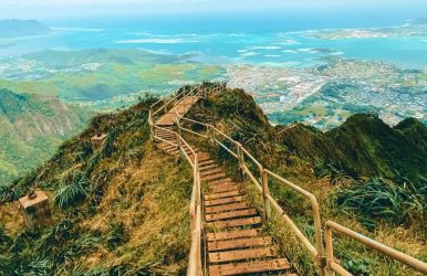
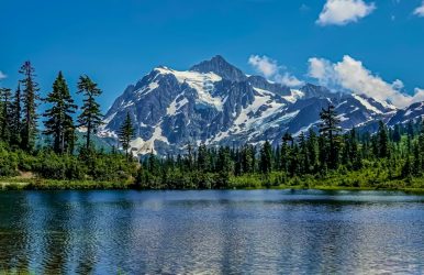
Washington State's mountains are renowned for their splendor. Washington has some of the tallest mountains in the lower 48 states and some of the most breathtaking. The Cascade Mountains are the most well-known mountain range in Washington. The Cascade Mountains include Mount Rainier, Washington's tallest and most famous mountain. Because some of the Washington mountains are so high up, hiking and climbing them is not always simple. However, the vistas from the snow-covered peaks are just breathtaking. Tallest Mountains in Washington If you are looking for the tallest climbs around Washington, the state will not disappoint. The vantage points, as well as the natural grandeur of the mountains in Washington, are simply mesmerizing. Here are all the mountains in Washington that you must check out. Mount Rainier Glacier Peak Mount Adams Bonanza Peak Mount Stuart Mount Fernow Goode Mountain Mount Shuksan Buckner Mountain Mount Baker Mountains In Washington Several of the tallest mountains in Washington map are in the Cascade Mountain Range. You may have heard of them before. The others will be instantly recognizable from pictures you may have seen in books or on the internet. Despite your familiarity with their name or their looks, a trip to these inclines will give you something to remember for a lifetime. Here are the top mountains in Washington. Mount Rainier Among the most well-known mountains in the US is Mount Rainier. Standing at one of the most breathtaking locations in the nation, this active volcano dominates the surrounding landscape. Situated at the center of Mount Rainier State Park, the park offers year-round outdoor activities such as hiking, trail running, and camping that are truly amazing. There are many hiking trails but few paved roads because the park was not intended to be visited by large numbers of people. Nonetheless, there is something for everyone, as many of the trails are suitable for beginning hikers. Climbing to the peak of Mount Rainier presents a distinct experience. Mount Rainier is the highest peak in Washington and has the steepest incline of all the mountains. Those who wish to try to reach the summit will have to hike more than ten miles, with a significant portion of that distance being nearly vertical ascent. Hikers must be in excellent physical shape. They will also require rock climbing abilities as well as an understanding of glacial rope safety. Before attempting to hike to the summit of Mount Rainier, it is a good idea to get some experience at lower elevations. Mount St. Helens Another active volcano is Mount St. Helens. In 1980, Mount St. Helens erupted with a massive explosion that resulted in the largest landslide in American history, making it the most famous eruption of all time. Although experts warn that such a massive and deadly eruption could occur, it has never happened before. The United States' most active volcano is still Mount St. Helens. At Mount St. Helens, a sizable Visitor's Center serves as the entrance to the mountain itself. There is a ton of information about the volcano at the Visitor's Center. Moreover, children adore viewing the interactive exhibits about the volcano's eruption. Convenience stores, trail maps, as well as camping and hiking supplies are available on the premises. Any licenses or permits required for activities like hiking, fishing, camping, as well as other pursuits are also available. Numerous trails wind around the mountain, beginning at the Visitor's Center. There is something for everyone on these trails, which range in difficulty from beginner to expert. However, hiking to the summit should only be attempted by the most skilled hikers. Mount Adams While part of Mount Adams is on the Yakima Indian Reservation, the majority of the mountain is located in the Gifford Pinchot National Forest. Among the Cascade Mountains' older peaks is Mount Adams. On Mount Adams, volcanic activity is thought to have started more than 900,000 years ago. Mount Adams is an outdoor enthusiast's paradise in the surrounding protected area. In addition to many other activities, visitors can ride 4-wheelers and ATVs, hike, camp, ride horses, swim, kayak, fish, and much more. The Mount Adams South Climb trail is an option if you have the courage to try hiking to the summit of Mount Adams. You need to be at least an intermediate hiker to tackle this difficult trail. But after you finish this 13-mile hike, the views from the summit will astound you. Mount Baker Mount Baker is a volcano, just like most of the Cascade Mountains in Washington, albeit relatively young in geology. Its glacier cover is also the second-heaviest. Snow is what makes Mount Baker truly famous. It has a massive amount of snow. Moreover, it's among the world's snowiest locations. When the Mount Baker Ski Area received nearly 100 feet of snow in a single season in 1999, it broke the previous record for snowfall. Winter sports, skiing, and skating are the main reasons visitors come to Mount Baker. However, Mount Baker can also be hiked thanks to its hiking trails and brave hikers who are well-versed in snow as well as cold weather conditions. A few hikers use Mount Baker as a practice run for the Alaskan mountains covered in snow. Alternatively, they use Mount Baker's winter hiking to hone their extreme weather hiking and rock climbing techniques. Even if Mount Baker is a steep mountain, it does not snow here all the time. In addition to hiking the challenging paths in the summer, visitors can enjoy other local attractions, like dining at the well-known Heather Meadows Café, which is located at the foot of Mount Baker and offers breathtaking views. Read More: Top 9 Edition: Exploring The Wonders Of Washington’s National Parks Glacier Peak The most remote peak in Washington's Cascade Mountains is Glacier Peak. There aren't any facilities like in other well-known mountains. However, the experience at Glacier Peak is well worth the journey if you decide to go there. Discover intriguing geological artifacts and ancient lava deposits if you can climb to the summit. The views from the summit of Glacier Peak are also quite amazing. However, as with other mountains in this range, climbing to the summit can be difficult. The name "Glacier Peak" comes from the more than thirty glacial peaks that encircle the summit. To complete this trek, you must have prior experience hiking on glaciers and enduring the cold and snow. There are over 19 trails in the lower portions of the mountain that are rated for hikers of all skill levels, so even if climbing to the summit isn't your thing, you can still enjoy the breathtaking natural beauty of the area. All year long, you can go horseback riding, biking, camping, hiking, and running in the stunning Glacier Peak Wilderness Area. Mount Storm King One of the hardest mountains in Washington state for hiking is Mount Storm King. It's still a difficult climb even though it's not as high as some of the Cascade Mountains. The trail to the summit is almost entirely on a steep incline. Actually, after completing the ascent from the base, you'll need to use a number of ropes to pull yourself up to the summit. Don’t skip leg day if you want to try this hike. To get the last few feet to the summit, you'll need strong legs. A short stroll from the Storm King Ranger Station will get you started on the summit trail. There is a detour leading to Marymere Falls. It's a good warm-up before attempting the summit ascent, and it's a mile loop. The summit trail's final three miles are an almost straight incline, but the first two miles are not too tough. You will be climbing and rock scrambling almost the entire way. You'll be rewarded with a breathtaking view of Crescent Lake below if you can reach the summit. Wrapping Up This was a list of some of the most incredible hiking trails and mountains in Washington, D.C. for the outdoor enthusiast. Climbing these picturesque mountains offers the opportunity to take in even more picturesque vistas. There is a variety of trails, most of which are easy. Pack our bags, plan your trip to Washington, and set out to explore the natural beauty of the nation's capital. If you have thoughts to share or questions to ask, please leave a comment below. We would love to hear from you! Read Also: This Is The Best Time To Visit The Seven Magic Mountains In Vegas! 7 Fun Things To Do In The Great Smoky Mountains National Park Explore The Beauty Of The Mountains Of Kenya!