


 Related
Travel To Florence: What To Do In The Evenings In The City
BY Ankita Mar 25, 2024
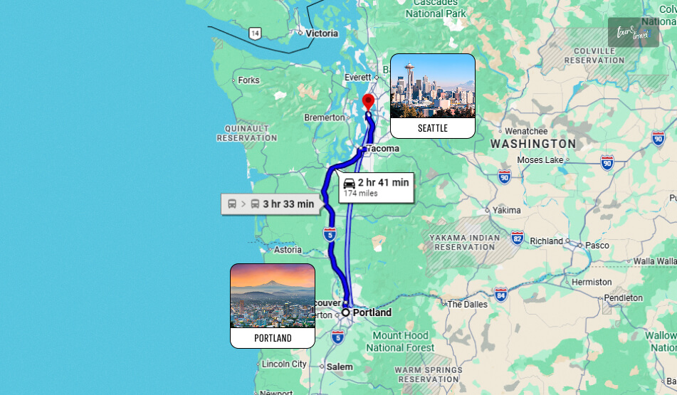
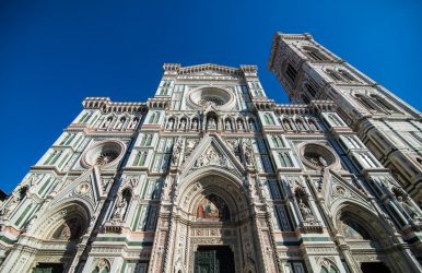
If you're finally on vacation in Florence, you'll definitely want to know how to enjoy your trip at night as well. Here in the evening, it is mostly the piazzas, clubs, and restaurants that come alive, all perfect places to discover another face of the city. 5 Things To Do In The Evenings While Travel To Florence Florence is a city that deserves to be experienced even when the sun goes down. While during the day it is interesting to wander around visiting monuments and attractions, in the evening, it is more pleasant to slow down and enjoy its beauty at a leisurely pace. Moving well in advance and choosing the best Florence hotel deals will give you the chance to find the most convenient lodging in the center, so you can move around in comfort and with ease, even in the evening. That said, here are 5 things to do in Florence as the sun goes down. Treating Yourself To A Tuscan Dinner: Travel To Florence Top Attraction You can't say you've been to Florence without treating yourself at least once to a delicious dinner in full Tuscan style. Take advantage of your vacation to also explore the food and wine side of this city and choose one of the many restaurants where you can try typical local appetizers, first courses, main courses, and desserts. Among the traditional dishes, you are sure to find the famous Florentine steak, lampredotto, ribollita, tripe, schiacciata, and delicious Santucci. Accompany your dinner with an excellent glass of local wine. At the end of your meal, you can also end the evening with a delicious Italian gelato, which you can try at one of the many gelato shops dotting the center. Related: Best Places To Visit In Italy Taking A Walk Along The Arno River After Dinner Walking around without following a specific itinerary is one of the best experiences to have in the evening in Florence, especially after dinner when there are less people around. At this time of day, the city is truly magical and can show you another aspect of its beauty. It is a must for your travel to Florence. One of the most striking points to reach is Ponte Vecchio, from which you can admire the Arno and the surrounding landscape. The famous jewelry stores will surely be closed, but this makes the bridge the main protagonist of the scene. You can take advantage of the moment to take memorable souvenir photos and capture the view from a different perspective. Travel To Florence And Admie The Duomo Without Crowds One of the best times to reach Piazza del Duomo is definitely in the evening. After sunset, the square begins to empty out, and admiring the Duomo in all its magnificence becomes even more impressive. You can also decide to reach the square in time for the sunset: admiring it from the top of the Dome or from Giotto's Bell Tower is impressive. Chilling Out In Piazza Della Signoria Piazza della Signoria is one of the most beautiful squares in the evening. Located a stone's throw away from the Uffizi Gallery, it is a great place to spend a few hours, if only to sit and admire the many wonders it houses. In fact, it is one of the city's main squares, home to the seat of civic power and the copy of the David. It is also one of the most popular gathering spots for tourists because of its elegant outdoor cafes and monuments. Visit The Academy Gallery With An Evening Tour Finally, it might be a good idea to take an evening tour of the Accademia Gallery so you can see the original statue of Michelangelo's David. In fact, there are guided tours that also start in the late afternoon, around 5 p.m., so you can avoid the crowds that invade the museum during daylight hours. There are also other attractions that give you the opportunity to join tours like this, such as the Uffizi Gallery or Palazzo Vecchio. Things To Know About Florence When planning to visit Florence during your holidays, you must have an idea of the evening life and the whole thing. This particular section provides a little discussion regarding Florence as a city. Cost Of Living If you wish to stay there for a week, the hotels will do it, but if you intend to stay longer, you must know the market prices. The groceries, restaurants, and transport prices are quite affordable in Florene compared to other major European cities. However, leisure activities can be quite costly. Therefore, you must take additional precautions and prepare for the stay budget there. The cost of renting the flats bank is in the area where you want to live. You can even find rent as low as 900 Euros in San Nicolo! Shopping While You Travel To Florence To Save Money Don’t get disheartened about finding the price of food products in Florence. Supermarkets like COOP and SISA are great places to shop for your daily requirements, there. There, you can find farmers’ markets in Florence. In the local shops, you will be able to find good deals for the day. It can give you good savings. You can easily enjoy bulk shopping and get cheaper deals compared to supermarkets. What Are The Best Neighborhoods For Expats In Florence? When you intend to stay for a few days in Florence, you definitely understand the local culture. Living in the safest and best neighborhood will be the best choice. The district is on the south side of the Arno River. It is known for its massive art galleries, restaurants, and antique shops. These are the places where you find yourself close to the culture of Florence. Mention needs to be made of the Duomo neighborhood. This is the place for those fascinated with old things and historic neighborhoods. The place is located right in the heart of the city. Moreover, it has become one of the prime spots for tourists. Apart from them, you have the San Marco neighborhood, which has a lot of similar characters. Read Also: Unlocking The Secrets: Key Ingredients In Italian Cuisine Which Is The Best Time To Visit Auli? – Travel Guide
