


Interesting Facts about Australia that will surprise you!

May 15, 2024

Last Updated on: Mar 12, 2026

Travel Guides

Did you know that the world’s first “selfie” was invented in Australia? Did you know thatthat Australia has the world’s longest fence? There are so many interesting and surprising things about Australia that will shock and surprise you.

In this blog, I will share some interesting facts about Australia. You will be inspired to visit the country, especially because you will create symbiotic relationships. You can perform several adventurous activities along with beautiful landscapes.

Furthermore, these are interesting facts about several states in Australia! The blog will teach you a lot about planning your itinerary to visit these interesting places. I will share several things to do in Australia related to these facts!

I am sure you will be inspired to visit these places and enjoy yourself. You will also learn about various unique places in Australia!

Interesting Facts about Australia that will surprise you!

Interesting Facts about Australia that will surprise you

If you have heard a lot about Australia, what will you do when you go there? This huge country has so much to offer, from beautiful views to unique animals. It is a secure place to travel, and the beautiful locales around it are a delight.

It is an interesting place because it includes several aspects that combine to create a beautiful lifestyle. There are multicultural communities, and the natural environment adds a beautiful flavour to the country, along with the diverse people, excellent food, and delicious wine.

Did you know that Australia has about 60 regions that produce wine? Imagine the diverse flavors and the production process. Therefore, you cannot miss the restaurants in Australia! Let me share with you some of the interesting facts about Australia that will bring together the place’s beauty and vibrancy.

World’s Most Unique Wildlife

World's Most Unique Wildlife

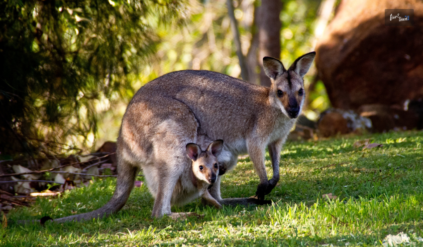
What do I even say when it comes to the diverse wildlife in Australia? It has the most unique animals on the global scale, as 80% of the wildlife is endemic to Australia. Can you imagine the significance of these animals, as we need to protect them?

A report claims that about 87% of mammals, 94% of frogs, 45% of birds, and 93% of reptiles in Australia only exist there. From Koalas to iconic Kangaroos, wombats, and elusive echidnas, you can see various wildlife.

Echidnas and Platypus are the only mammals that lay eggs, but did you know they are only found in Australia? The place is so filled with wildlife that, apart from zoos and national parks, you might encounter them in the open.

The country has one of the oldest Island cultures, Aboriginal and Torres Strait Islanders, who experienced oppression and displacement at the hands of European colonization!

A Country and A Continent  

A Country and A Continent  

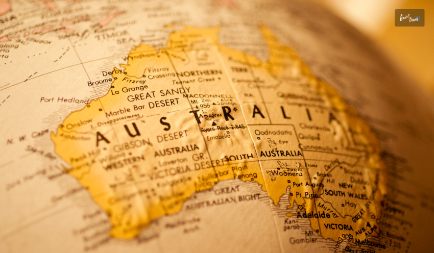
Did you know that Australia is both a continent and a country? Australia is the 6th largest country on the global scale. Geographically, Australia is a part of Oceania, which is inclusive of Melanesia, Polynesia, Australasia, and Micronesia.

Oceania’s subregions include New Zealand, New Guinea, and Australia. It is one of the smallest continents in the world, lying between the Indian and Pacific Oceans in the Southern Hemisphere.

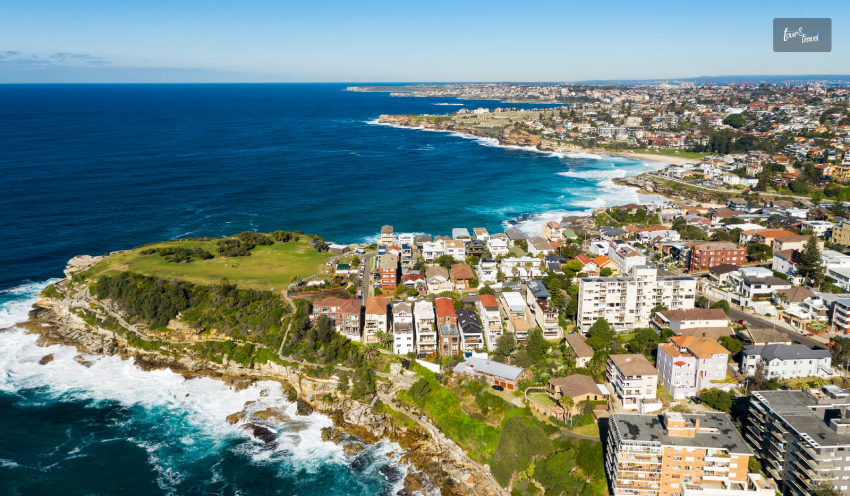
Hemisphere. If you are traveling to Australia, you also need to check out the beaches in Australia!

The Majority of Uluru is Underground

The Majority of Uluru is Underground

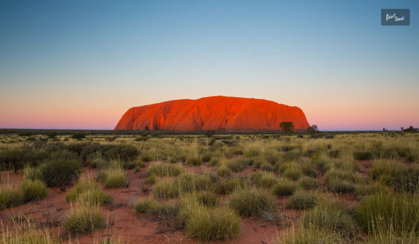
Uluru in Australia is known for its beautiful sunset, which is framed by a huge rock! It is now a UNESCO World Heritage site, and it can be identified as a natural and cultural element of Australia.

The place is quite sacred for the Aboriginal tribes as it is surrounded by scrubland! The rock is 2.5km underground and is believed to be related to Olgas. You will then see it emerge 16 miles away. You can also visit Uluru by railway between Adelaide and Darwin or by plane!

The stark beauty of the rock against the beautiful sky with the best sunset offers an amazing view. You can also enjoy the pitch-black skies along with the several sparkling stars. If you are going from Alice Springs, you can enjoy it a lot, especially when you plan to visit Uluru.

The Longest Straight Section of Train Track

The Longest Straight Section of Train Track  

Did you know that Australia has the longest straight section of train tracks? Let me tell you, the rail journey between Perth and Sydney, known as the Indian Pacific, is the longest straight section! The tracks snake around the country, where you can check out the beautiful blue mountains!

The train moves towards the mountainous Flinders Ranges, giving you some spectacular views! I would also suggest you stop in Adelaide. Of course, you cannot miss the gourmet food, the wide-open spaces of the city, and the art museums.

Further, the train takes you across the fertile Avon Valley and into Sydney. You will receive luxury services on the train!

The Largest Sand Island in the World

The Largest Sand Island in the World

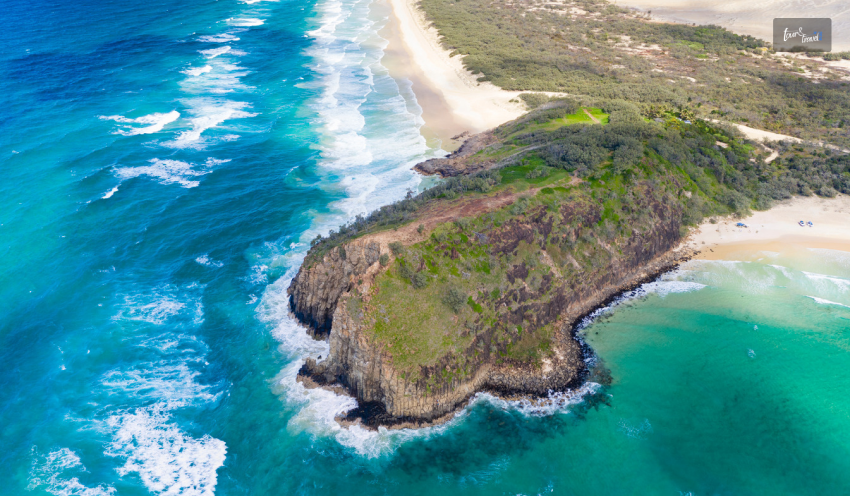
Australia has the largest sand Island, which you can explore by hopping on a boat! Why don’t you plan a trip to Queensland? The highlight of this trip will be the sandy shores of Fraser Island.

There are some jumping-off points, and Hervey Bay is one of them. You must take a boat to discover this delightful place, an island paradise with white sands. Lake MacKenzie, surrounded by a white sand shore where you can swim, awaits you!

You can also take a dip into the Champagne Pools, which have shallow water, and swim across the edge of the ocean. There are about 150 dingos on this island, so you can check out these wild dogs. However, keep your distance because they are wild and aggressive.

Dingos, the wild dogs, are not like the local or domestic dogs and live in the national park of K’gari Island or Fraser Island!

Dingos, the wild dogs, are not like the local or domestic dogs and live in the national park of K’gari Island or Fraser Island! If you love the beach, check out the beaches in Perth!

No Active Volcano in Australia

No Active Volcano in Australia

Can you imagine that with so many volcanoes worldwide, Australia is the only continent without any active volcanoes? If you are planning to travel to Australia, it is one of the safest countries in the world.

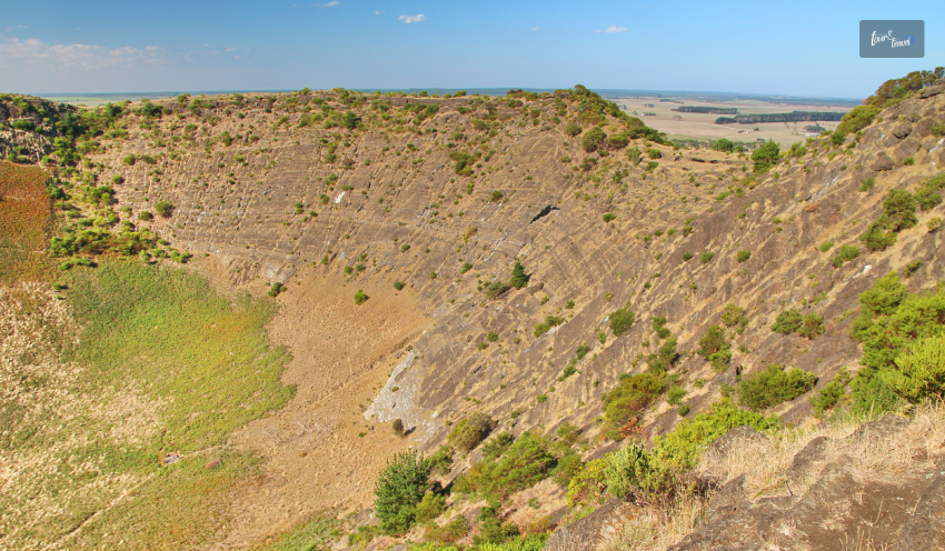
With the wildlife which is quite notorious even though it is not deadly all the time! Of course, there is a location in Southeast Australia, also called Newer Volcanic Province, where there is a collection of about 400 volcanoes spread across 15000 square kilometers (about the area of Connecticut).

The Largest Eco-System in the World

The Largest Eco-System in the World

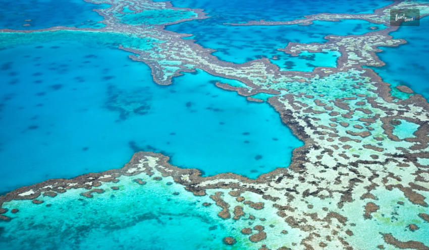
Can you imagine that Australia has the largest ecosystem in the world? The Great Barrier Reef is the joy and pride of Australia, with about 2500 individual reefs. Did you know that these reefs are visible from space? Apparently, halfway down the eastern coast of the country, it is covered in it!

There are several jumping-off points where you can go down into the water and check out the kaleidoscopic coral. The cities closer to these reefs are Cairns, Townsville, Airlie Beach, and Port Douglas.

Several activities, namely deep-sea diving, snorkeling, swimming, and surfing can be attempted and done. Marines, like sea turtles and colorful fish, live in these reefs.

The Australian Alps Receive More Snow Compared to Swiss Alps

Did you know that the Australian Alps have heavy snowfall between June and September? It is shocking that it is heavier than the Swiss Alps. The Alps are across Victoria and New South Wales and are a perfect place for skiing!

During the northern hemisphere summer, you can enjoy the environment, so you can go skiing. Apart from that, you can also enjoy the beautiful environment. There are two large resorts, namely Perisher and Thredbo, near Canberra.

Finishing Off

In short, the interesting facts about Australia will not only surprise you but also shock you! After reading the blog, you will learn how the continent has worked hard to create a sustainable and diverse ecosystem.

There are many other interesting facts, but the ones mentioned are quite significant. The diverse aspects of Australia will not only interest you but also teach you a lot of things.

Comment on which part of Australia you want to visit and why.

Learn More About:

Share on Social Media

Sagnika Sinha is a content writer who is passionate about writing travel vlogs, entertainment and celebrity articles and literature-based pieces. With a 4 years experience in teaching, she loves reading books. A procrastinator by nature, she loves travelling, listening to music, planting and gardening.

Leave a Reply

Your email address will not be published. Required fields are marked *

title-img Related

READ MORE Raja Ampat diving season tips

Raja Ampat Diving Season Tips: When To Go For Mantas, Whales, And Sunshine? 

BY  Sibashree Dec 29, 2025

Timing is not just a tip to remember for divers in Raja Ampat. A change of season and the difference? It’s as big as having a glass boat ride to a Manta cleaning station and a bumpy trek through monsoon winds.   Known as the "Last Paradise," Raja Ampat sits at the heart of the Coral Triangle. Here, the seasons do not just mean the weather. The seasons also dictate the challenges the waters will throw at you and the giants you will meet.   In this guide on Raja Ampat diving season tips, I will start with a short answer about the diving seasons and then give you the details.   The Short Answer: Peak Vs. Off-Peak Season For Diving In Raja Ampat   Feature Peak Season (October – April) Off-Peak Season (May – September) Sea Conditions Calm, glassy water Choppy in the South, calm in the North Visibility Excellent (15m–30m) Variable (can be lower near islands) Marine Life Manta Rays, Whale Sharks, and Dolphins Resident Reef Life, Macro, "Walking" Sharks Crowds High (Book 12-18 months early) Low (Peaceful dive sites) Price Premium Potential discounts (10-20% off)  Have you already booked your dates? Check our guide on Raja Ampat diving trips for a detailed itinerary planning.   The Two Main Seasons Of Diving In Raja Ampat: A Detailed Breakdown  The character and conditions of the dive sites in Raja Ampat change in dry and wet seasons.   The Dry Season (October to April) The Wet Season (May – September)  â€˘ Low Winds  â€˘ Calm Water  â€˘ Ultimate Raja Ampat Liveaboard Season  â€˘ Ideal for Spotting Reef and Oceanic Mantas â€˘ High Southern Winds  â€˘ Misool Becomes Inaccessible  â€˘ Dampier Strait is Accessible  â€˘ Ideal for Spotting Snapper and Barracuda  Raja Ampat Marine Life Calendar  For you, the best diving season in Raja Ampat Indonesia depends on the kind of marine animal you want to encounter. Here, I will give you details about the Oceanic and Reef Manta Ray season, the whale and dolphin migration season, and the season for walking sharks and macro life.   1. Manta Ray Season (Oceanic Vs. Reef)  December to March is the best season for spotting these marine animals.   Manta Sandy cleaning station is great for Reef Manta sightings. Magic Mountain in Misool is one of the sites where you will find Oceanic and Reef Mantas together.   Furthermore, Dr. Setyawan, in a report published by Conservation International on 9th October 2024, has shared some interesting facts about the Reef Mantas. He mentioned that   “...reef manta rays can travel hundreds of kilometres, and there aren’t any obvious barriers to movement between these three regions in Raja Ampat.”  2. The Whale And Dolphin Migration (November – December)  You will find Pilot Whales and different dolphin species in the deep channels of the Dampier Strait in November and December.   3. Walking Sharks & Macro Life (Year-Round)  The endemic Walking Sharks, or Raja Ampat Epaulette Sharks, are visible in the water year-round. Night dives are the best to watch these marine creatures in action.   You will also spot the Pygmy Seahorses and Nudibranchs across all seasons.   Regional Differences: The Misool Vs Dampier Strait Season  Let’s check out the regional differences in Raja Ampat across seasons. 1. Dampier Strait (North/Central)  Sheltered by large islands, the Dampier Strait offers safe diving conditions even when the wind is high.  So, you can dive here safely in all seasons.   2. Misool (South)  Thanks to the southern monsoon, crossing Misool is dangerous in the wet season. The frotier is wilder than the north and central zones.   Raja Ampat Diving Season Tips For Liveaboard Vs. Resort  There is no "bad" time to visit Raja Ampat, only the "wrong" region for the season. If you want Mantas and luxury liveaboards, aim for January. If you want solitude and budget-friendly resort stays, June in the Dampier Strait is a hidden gem.  1. The Komodo Switch And The liveaboard Season   In May, about 80% of the liveaboard fleet sails west to Komodo National Park to follow the dry weather. If you want a luxury boat experience, you must visit Raja Ampat between October and April.  2. Choose Diving Resorts For Off-Peak Season Diving   If you are traveling in the summer, between June and August, you must choose the land-based resorts in the Dampier Strait. These resorts offer stability, and you can take shorter boat rides to reach the dive sites. Enjoy the low-season pricing.   What Are The Expert Tips For the Raja Ampat Diving Season?  You cannot fear the rain when you are diving in Raja Ampat. Also, the consistent temperature of the water in Raja Ampat makes diving possible, especially in the Dampier Strait sites.  Here are some other things to remember if you are diving in Raja Ampat.   Expert Tips What It Means Don't Fear the Rain It is a rainforest; it rains even in the dry season. The fish don't mind, and you're already wet.  The "Green Water" is Good Lower visibility often means plankton, and dense plankton is the "dinner bell" for Manta Rays. Book Christmas Early This is the busiest window, and some boats sell out 2 years in advance.  Currents and Moons For the most intense fish action, book your trip during the New or Full Moon.  Surface Intervals Use sun protection in the dry season and bring a windbreaker for the wet season boat rides.  Water Temp is Constant It stays 28 to 30 degrees Celsius all year. A 3mm wetsuit is plenty.  Check Boat Locations Ensure your preferred boat hasn't already moved to Komodo for the summer. Flight Reliability Pad your travel schedule in July/August, as wind can delay small island hops or ferries.  Raja Ampat Diving Season Tips For Photographers: The Lens Guide  Seasons  Ideal Lens What to Capture  October to April Wide Angle â€˘ Perfect for Capturing Mantas  â€˘ Sweeping Schools of Fish  Split Shots with Blue Skies  May to September Macro Lens â€˘ Fluctuating Visibility  â€˘ Perfect to Focus on Pygmy Seahorses, Blue-ringed Octopus, and Ornate Ghost Pipefish.  Late April and Early October (The Shoulder Season Secret) Macro Lens  â€˘ These are Sweet Spots, and You Get to Frame the Calm Transition of the Marine Animals.   â€˘ Still, the Crowd of the Big 5 is Not Intense as the December and January Holidays.   Raja Ampat Diving Season Tips: Frequently Asked Questions (FAQs)  Here are the frequently asked questions and answers about the Raja Ampat diving season tips.   1. What Is The Absolute Best Month To Dive Raja Ampat?  January is the absolute best or the prime month to dive in Raja Ampat. You get peak visibility, around 25 to 30 meters in the water, and it is the ideal month to spot Reef and Oceanic Mantas due to plankton increases.  Furthermore, all the regions, the south, the central, and the north, remain accessible this month.   2. Can I Dive Raja Ampat In August? Yes, you can dive in Raja Ampat in August. In fact, August is a great month if you want to explore Cape Kri and Blue Magic without the crowd. However, if you are diving in Raja Ampat in August, stick to the sites in Waigeo, Gam, and Mansuar and along the Dampier Strait in the North and Central zones. 3. When Is The Best Time For Whale Sharks In Raja Ampat? October to April is the best time to see Whale Sharks in Raja Ampat. You can find them in Misool and the Dampier Strait sites. However, for a better and more certain visibility of Whale Sharks, you must visit Triton Bay, south of Raja Ampat. The Full Moon Nights are ideal for spotting Whale Sharks.  4. Is The Wet Season Cheaper In Raja Ampat? Yes, the wet season is cheaper in Raja Ampat as it is the off-peak season for diving. In the diving resorts, mostly concentrated around the Dampier Strait Region, you will get a discount of around 10-15%. There is also a hefty discount on the diving packages. On the other hand, the liveaboards will offer around 20-30% discount in the wet season.  5. What Is The Water Temperature Like Year-round In Raja Ampat? The year-round water temperature in Raja Ampat is around 28 to 30 degrees Celsius. One of the best things about diving in Raja Ampat is the incredibly stable, bathtub-warm water. Because the archipelago is located just one degree from the equator, you won't experience the dramatic temperature drops or "thermoclines" found in other parts of Indonesia, like Komodo or Bali.  6. Do I Need A Dry Suit Or A Thick Wetsuit In The Off-season? No, you don’t need a dry suit or thick wetsuit to dive in Raja Ampat, even in the off-season. It is because the temperature of the waters here hovers around 28 to 30 degrees Celsius throughout the year. A 3mm thick wetsuit is enough if you are doing deep diving. It ensures that your body does not lose temperature rapidly. It also protects you from the irritants in the water and helps in buoyancy. 7. Does Visibility Change With The Seasons In Raja Ampat? Yes, visibility changes with the seasons in Raja Ampat. However, remember that having clear water does not mean the ideal condition for spotting the marine life in Raja Ampat. In the dry season, from October to April, the visibility is around 15 to 30 meters. Still, from December to March, nutrient-rich currents flood the archipelago. This creates "green" or "particulate" water. While this might frustrate wide-angle photographers looking for a pure blue background, it is the "dinner bell" for Manta Rays and Whale Sharks.Furthermore, during the wet season, from May to September, the visibility is 10 to 20 meters. However, this is an ideal time for many photographers as the water is clearer due to the lack of plankton blooms. 8. When Do The Liveaboards Move To Komodo? The famous Indonesian Switch, or the transition of liveaboards to and from Komodo, happens twice a year. In April and May, the peak diving season in Raja Ampat approaches its end. So, 80% of the liveaboards in Raja Ampat move toward the Komodo National Park. These liveaboards often pass through the Banda Sea and the Forgotten Island, where you can spot hammerhead sharks in late April and May. Again, these liveaboards return in September and October as Komodo starts getting heavy rainfall, but the water of Raja Ampat becomes still. On the way, you can spot deep-sea pinnacles and incredible whale shark encounters in Triton Bay or the Banda Sea.  9. Is It Safe To Visit Raja Ampat During The Monsoon? Yes, the rainy season does not mean a complete shutdown for tourists to Raja Ampat. In fact, the central zone (Dampier Strait) and areas such as Waigeo/Gam remain quite accessible even in high winds due to the protection of huge land masses. However, the diving sites in the southern zone of Misool are risky in these months.  10. When Is The Best Time For Underwater Photography In Raja Ampat? The best time for underwater photography in Raja Ampat will depend on the kind of backdrop you want. The waters of Raja Ampat always amaze you with an impressive marine life. October to November is the time for the best all-round photography experience. You will get calm seas, returning Mantas, and massive schools of baitfish. Great for wide-angle and split shots. Also, for a truly unique photographic subject, aim for the Full Moons in October and November. This is when the reefs often experience mass coral spawning. It is a spectacular nighttime event that turns the water into a "snow globe" of biological activity.Again, January and February are ideal for framing the Manta action. Plankton blooms can create "green" water, but offer world-class Manta displays. These are the months for macro specialists. The months of March and April offer peak visibility. You will now find the clearest water of the year (30m+). Ideal for large reefscapes and blue backgrounds.Finally, June to September is ideal for shooting the empty reef and macros in action. 

READ MORE Fishing

Catch The Day With The Ultimate Fishing Guide For Travelers

BY  Nabamita Nov 29, 2023

Fishing transcends mere recreation; it's a doorway to nature's beauty and cultural immersion. Picture yourself amidst stunning landscapes, casting your line into shimmering waters as you feel the gentle tug of a potential catch. Whether you're an angling aficionado or a novice eager for adventure, this comprehensive guide is your compass to curating an unforgettable fishing trip during your travels. Choosing the Ideal Fishing Destination Selecting the right fishing spot lays the foundation for a memorable journey. Beyond merely seeking a productive location, consider destinations that offer a complete experience. For instance, Key West fishing charters present a picturesque setting blending abundant fish varieties with the vibrant local culture. Whether you prefer freshwater lakes, coastal bays, or deep-sea adventures, understanding the nuances of each location ensures a fulfilling experience. Preparing for the Adventure Packing for a fishing expedition demands meticulous planning. Aside from the essential fishing gear—rods, reels, lines, and tackle boxes—ensure you're equipped with suitable attire, sunscreen, and ample hydration. Equally crucial is familiarizing yourself with local regulations and guidelines governing fishing activities. Acquiring the necessary permits or licenses and understanding catch limits prevent any unwanted setbacks during your trip. Techniques for Successful Fishing Mastering fishing techniques is a blend of art and science. Beginners might start with fundamental casting methods and basic bait presentation. As proficiency grows, exploring advanced techniques like fly fishing or trolling allows anglers to target specific species more effectively. Understanding the nuances of each method significantly enhances the likelihood of a successful catch, adding to the thrill of the experience. Immersing in the Experience Beyond the thrill of reeling in a catch lies a deeper connection with the environment and local culture. Engaging with the surroundings, appreciating nature's serenity, and immersing yourself in the local fishing traditions enriches the experience. Embracing sustainable fishing practices, such as catch-and-release, not only preserves the ecosystem but also fosters a profound respect for marine life and its conservation. Capturing the Moment Preserving the essence of your fishing journey extends beyond the memories. Through photography, storytelling, or journaling, you immortalize these moments. Share your adventures on social media platforms, compile them into a personalized travelogue, or simply cherish them as a testament to the enriching experience. Reflecting on these memories heightens the impact of the journey, fostering a deeper appreciation for the adventure you've embarked upon. Conclusion In summary, embarking on a fishing expedition while traveling transcends the act of catching fish; it's about embracing a holistic experience. From meticulously selecting an ideal destination like Key West fishing charters to meticulous preparation, mastering fishing techniques, immersing in nature and culture, and capturing indelible memories, each facet intertwines to create an unforgettable journey. So, pack your gear, set sail, and let the waters guide you towards an adventure that's more than just a fishing trip—it's a soul-enriching escapade. Read Also: Six Important Factors To Consider Before Planning Alaska Fishing Trip 10 Best Fishing Charters In Florida To Visit In 2022 – Tour And Travel Guide Unforgettable Island Adventures: Things To Do In Tenerife

READ MORE

Kootenay National Park Or The Land Of Ice And Fire (Experiencing Nature’s Game Of Contrasts)

BY  Sibashree Sep 12, 2024

No, it’s not the battle of the Starks, Lannisters, and other houses of Westeros. In Canada lies Kootenay National Park, the actual land of ice and fire. The glacier-made canyons and valleys sing the song of the ice, while the hot springs and grasslands keep the “fire” element alive here.  Also, the national park is a hub of ancient fossils, encouraging walks through the fossil trails. Moreover, you can take a scenic drive through the park, rich in Indigenous culture, history, architecture, and cultural landscape.   So, do you want a virtual tour of this Canadian national park? THIS is where your journey begins! THESE Are The Things You Will Do At Kootenay National Park With no cell service available in Kootenay National Park, you can get lost in the wilderness and explore the most fascinating landscape. However, being respectful to the wildlife is a must for this national park. This August, I came across disturbing news while doing my research on Kootenay National Park.  I have been in touch with a local from Radium Hot Springs for quite some time now. He told me that a grizzly bear coming out of Kootenay National Park was almost struck by an SUV on 19th August 2024.  This incident occurred on a busy highway in southeastern British Columbia, and fortunately, the Kia Sportage SUV made its way to the other side safely. Further, it was a lesson on why following the safety guidelines is crucial while driving in and around the Kootenay National Park. On the major routes of Kootenay National Park, you will have to maintain a maximum speed of 56 mph.However, on the minor routes, the highest driving speed limit will be 37 mph.  Also, around one month before the incident, on 24th July 2024, there was a minor fire in the  Sinclair Canyon slopes (near Radium Hot Springs) of the national park. It was called the Berland Ridge wildfire. This fire was under control thanks to a helicopter bucketing water on it. However, outside the park’s southern boundary, there was a blazing fire that was brought under control after pain-stricken efforts.  So, these incidents show how mindful and cautious you need to be while taking part in the following activities.  Hiking In Kootenay National Park (Hikers’ Favorite Trails) The hiking trails in Kootenay National Park are full of elevation gains and losses. Also, today, the national park has more than 70 hiking trails at easy, moderate, and difficult levels.  However, I have curated a few hiking trails in the table below. After interacting with a couple of hikers, I found out that these are the ones most preferred. Name of the Trail Difficulty LevelDistanceLocationHighlightsMarble CanyonEasy1.4 Km with 42 M Elevation Gain Located near Lake Louise, AlbertaHiking, snowshoeing, and running are the favorite activities here.It is a pet-friendly and kid-friendly trail. It is a year-long hiking trail. Stanley Glacier Trail Difficult 10.9 Km with 607 M Elevation Gain Located near Lake Louise, AlbertaSnowshoeing, camping, and hiking are popular activities on this trail.You can take your dog as a company.June to September is the best time to hike this trail. Sinclair Canyon via Juniper Trail Moderate5.8 Km with 291 M Elevation GainIt is close to Radium Hot Springs in British Columbia.You will have to hike through a beautiful cedar fir forest on this trail.The view of verdant Sinclair Canyon Falls and the Columbia Valley from this trail is breathtaking.Marble Canyon to Paint PotsModerate2.9 Km with 110 M Elevation GainRadium Hot Springs (Marble Canyon Parking Lot  - 89 km east of Radium Hot Springs, Paint Pots - 86 Km east of Radium Hot Springs).Explore a good mix of mature and burnt forest throughout the trail.Behold the Vermillion River running parallel to the trail. Floe LakeDifficult10.5 Km with 1,110 M Elevation Gain Near Radium Hot Springs (72 Km East)Backpacking and camping are popular activities on this trail. The trail leads to the Floe Lake Backcountry campground. This popular meadowy trail is known for its views of peaks, glaciers, and the beautiful Floe Lake. Numa CreeksModerate 6.3 Km with 385 M Elevation GainThe trailhead is near the Numa Falls, which is 80 Km east of the Radium Hot Springs. It is a forested trail.The trail leads to heavy avalanche paths in the park.  The hikers’ words about the trails in this national park are quite encouraging. Let’s find out what they are saying about the mesmerizing hiking trails.  “This is a beautiful, deep canyon hike. The trail crosses the canyon multiple times to view the ferocious Kootenay river below. Hiking boots aren't necessary since it is a well-traveled trail.” - Deborah Turcotte on the Marble Canyon Trail  “The trail was mostly dry and in very good condition. No snow on the trail, just a few short wet spots. Trek up is mostly sheltered but a bit chilly and windy in the bowl so bring layers as the temp changes quickly when the sun is behind clouds. Still lots of snow in the bowl. Found one rock with fossils. There are a few small waterfalls on Stanley Peak. Lots of boulders at the base of the bowl to sit and enjoy a lunch and 360 views. An easy to moderate 3-4 hour hike with nice views of Stanley Peak, Storm Mtn, and the Kootenay Valley.” - Sue W on the Stanley Glacier Trail  Kootenay National Park Camping  Kootenay National Park is a wonderful place for frontcountry and backcountry camping. You can even live in oTENTiks and spend some unforgettable days in the park under the sky.  Frontcountry Camping You can camp near the Vermillion, Kootenay, and Simpson rivers. Also, you can find some quiet spots near Radium Hot Springs village.  Summer is the best season for front-country camping in the national park. However, the sites remain crowded. So, you must go for a prior booking.  Further, the daytime temperature in the national park remains between 16-23 degrees centigrade. Still, the temperature at night can drop below 0 degrees centigrade. So, abiding by the camping rules is crucial, and especially, be particular about the things you will have to carry. Moreover, like camping in any national park, here also you have to ensure that you don’t leave any trace behind as you leave the site.  Backcountry Camping Backcountry camping and backpacking are the best ways to explore the wilderness of this Canadian national park. However, you must make a prior booking and carry a backcountry permit if you want to spend some days and nights amidst grizzly bears, black bears, wolves, elks, and cougars.  Further, there are six backcountry camping grounds in the park, five of which are located along the  Rockwall Trail. The  Verdant Creek Trail has the sixth camping ground.  Random camping is not allowed during summer, as protecting the landscape and vegetation is crucial. This restriction applies from May to October.  However, in the winter months, you can do random camping in the designated areas. You will still need a permit for this. As I have mentioned, the Rockwall trail is the most prominent place for backcountry camping in the park. This site is also popular for the presence of various multi-day hiking trails. These trails are: Honeymoon Pass and Verdant Creek Tumbling - Floe The Rockwall  Tumbling - Helmet - Ochre Loop Numa Creek Helmet Creek and Falls Tumbling Creek Helmet - Ochre Junction In the popular backcountry camping areas, the trails are maintained quite well. Further, there will be amenities like food storage cables, food lockers, picnic tables, and tent pads.  Living in oTENTik An oTENTik is a modern fusion of a cabin and a tent. In the park, you will find the oTENTik site on the Redstreak campground’s A loop.  If you stay in an oTENTik, you will wake up amidst nature, and taking a bath at the hot springs will be the most rejuvenating experience. Then, you can explore the nearby hiking trails and gorge on traditional meals cooked in the campfire.  Relaxing At Radium Hot Springs  Beneath the colorful Sinclair Canyon mountains lie the most refreshing hot springs. Further, the mineral-rich water of the hot springs does not have any odor, and you can take a bath with your entire family.  To reach the Radium Hot Springs, you must drive from Banff and Lake Louise for around 1.5 hours. Further, the journey is as interesting as the destination, as you will get to small turquoise lakes, falls, canyons, and bridges over rivers as you drive through the Kootenay National Park. Also, don’t forget to stop at the following locations to make the most of your journey. Continental Divide (The line diving the Pacific and Atlantic watersheds) Marble Canyon Hike Paint Pots Trail Numa Falls Kootenay Valley Viewpoint (It is the place to get the most beautiful view of Vermilion and Mitchell Ranges.)  Olive Lake Trail and Day-Use Area However, the highlight of the journey, of course, is the Sinclair Canyon, where you will also find big horn sheep roaming. As you hike through the Juniper / Sinclair trail, you will get a “bird’s eye view” of Sinclair Canyon.  Further, as you enter the Radium Hot Springs village, you will see an iconic steel horn sculpture. The “Bighorns Public Art Sculpture” was officially unveiled on 7th April 2021. Moreover, Clara Reinhardt, the mayor of Radium in 2021, said,  “We chose something that implies a sense of arrival to Radium, the Columbia Valley, and beyond. We captured the undeniable natural beauty of the curved horns through a Fibonacci spiral—the golden ratio in nature and art.” “We wanted to create a piece of art that speaks to both the history and the future of bighorn sheep in Radium. We captured the undeniable natural beauty of the curved horns through a Fibonacci spiral—the golden ratio in nature and art.” - Adam Meikle (Artist of the Bighorns Public Art Sculpture) Burgess Shale Fossil Hike  The Burgess Shale Fossil Hike in the national park will give you access to Mount Stephen and Walcott Quarry. These are UNESCO Restricted Sites. Further, you will get to see some of the oldest fossils in the world here.  However, in total, you have three routes to explore in the Burgess Shale Fossil Hike. Let’s discuss them in detail.  Walcott Quarry Starting Point: Takakkaw Falls Difficulty Level: Difficult  Elevation Gain: 825 Meters Duration: 11 Hours Return Distance: 22 Kms Walcott Quarry is a classic example of a fossil hike. Also, the top view of the Emerald Lake from here is amazing. Further, you will find Burgess Shale creatures here, which were found in fossilized conditions at the mountaintop in the Yoho National Park.  “The Burgess Shale organisms lived 508 million years ago in a time period that Geologists call the Cambrian, which began at 541 Ma (million years ago) and ended by 485.4 Ma. The first fossil occurence of most animal lineages (at the phylum and class levels) occur in the Cambrian. As a result of this fact, and because the fossils are well preserved, Paleontologists studying the Burgess Shale fossils can deduce a great deal about the ancestory of animal lineages.” The Burgess Shale fossils were discovered at the Walcott Quarry site in 1909 by Charles Doolittle Walcott. 1 Mount Stephen Difficulty Level: Difficult  Elevation Gain: 795 Meters Duration: 7.5 Hours Return Distance: 9 Kms As you hike through the Mount Stephen trilobite beds, you will get to overlook the “town of Field” in British Columbia. Railway workers in the 1880s used to call the town of Field the space of “stone bugs.”  Further, during this trek, you will see trilobite fossils (now extinct and one of the earliest marine arthropods), and the view of the Kicking Horse River from the trail is amazing.  Stanley Glacier Difficulty: Moderate Return Distance: 10 km Elevation Gain: 385 m Duration: 7.5 hours You will start hiking the Stanley Glacier in a fire-swept forest. The forest has lodgepole pine and wildflowers. Further, along your route, you will get to see a turquoise river, waterfalls, and the best view of the Stanley Glacier. Moreover, you will get to see the fossils of hyolithids, sponges, trilobites, and sponges here, and they are from the Eldon Formation.  Cambroraster, an ancient arthropod, and many other species are found in the quarry near the Stanley Glacier. Further, the shell of a Cambroraster looks like the Millennium Falcon spaceship in its shape. Important Kootenay National Park Data At A Glance  Before you start for the Kootenay National Park, don’t forget to have a look at the stats. Location: British Columbia, Canada Established: 21st April, 1920 Area: 1,406 km² Highest Landscape: Deltaform Mountain (3,102 m) Designation: UNESCO World Heritage Site in 1984 (As Part of the “Canadian Rocky Mountain Parks ) Visitor Center: Kootenay National Park Visitor Centre (7556 Main Street East; Radium Hot Springs, B.C.) How to Reach: Via Highway 1 from Banff, AB or Calgary, AB/Via Highway 95 at Radium Hot Springs, BC Also Read Why Include Whale Watching In Your LA Itinerary. Traveling On A Budget: Tips For Affordable Adventures. From Cocktails To Kickflips: Must-Try Activities In San Diego.