Related

How To Create A Travel Journal Or Blog As A New Mother
BY Barsha Feb 13, 2024
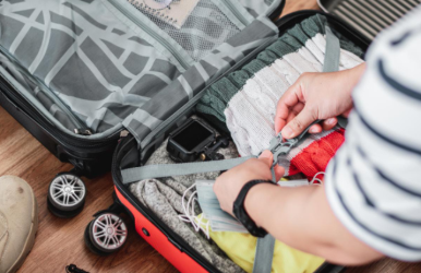
For moms with wanderlust, balancing parenting and travel weaves an extraordinary narrative of shared growth and discovery. Adventure-seeking moms don't just jot down places; they sketch out the deep story of parenting while roaming, sharing wisdom and tricks that hit home with other nomadic families. Carving Your Unique Narrative Your journey is unique, stitched with the threads of wanderlust and the new rhythms of motherhood. Whether it's the serene walks through ancient ruins or the bustling energy of a city market, your narrative is a blend of travel insights and parenting on the go. Tell it like it is, from the careful plans you laid out to those unplanned gems that end up stealing the show on your family trips. As a mom sharing your travel tales, highlight those hidden gems that cater to kids, like the coolest play areas or peaceful spots perfect for breaks and baby care. The Digital Tapestry In this digital age, your blog is your gateway to the world. WordPress lets you craft a blog that mirrors your own adventures, decking it out with all the bells and whistles that scream 'you.' Choosing a name like "WanderlustWithTots.com" immediately tells your story, inviting like-minded parents into your world. Crafting your blog with neatly organized sections for each spot and age-appropriate travel insights can seriously ramp up the ease of reading and practicality. Weaving Stories That Captivate Your blog's heart pulses with the tales you craft, each brimming with the joy and trials of adventuring alongside your young companion. Paint your stories with such vibrant colors and genuine emotions that readers can't help but feel they're right there beside you, sharing in every adventure and misstep. Sharing not just the highlights but also the mishaps and how you navigated them offers a well-rounded view of travel as a new mom. The Art Of Storytelling Your blog thrives on the authenticity and emotion of your storytelling. From the first beach day with your baby to the unexpected joys found in the simplest moments, your narrative resonates with the universal themes of exploration and family. Keeping a small journal or using a note-taking app during your travels to jot down memorable moments and thoughts ensures your blog posts are rich with detail and emotion. Cultivating A Global Community Your blog is more than a collection of travel tales; it's a community hub for parents sharing your wanderlust spirit. Foster a warm community by actively engaging with readers in the comments, collaborating on social media, and co-creating content to keep the conversation alive among traveling parents. Regularly featuring guest posts from other traveling parents can diversify content and foster a sense of community on your blog. Embracing Technology And Innovation Leverage the latest digital tools to enhance your blog's appeal. Imagine turning your blog into a virtual passport where readers can click on an interactive map to explore places you've visited or use augmented reality for a vivid peek into far-flung locales—all thanks to cutting-edge tech. Using social media platforms not just for promotion but for real-time updates and behind-the-scenes glimpses into your travel adventures adds a personal touch to your online presence. Navigating The Logistics Of Travel with A Little One Traveling with a baby presents a unique set of logistics, but with the right preparation, it can be a smooth journey. Navigating travel with your little one? Pick baby-friendly spots, pack smart, and keep them cozy to ace the journey. Being open to change as you travel with your baby turns those surprise twists into chances for creating special memories and getting closer. Traveling with a baby not only changes the itinerary but also the very essence of each journey. With their innate sense of wonder and joyful chuckles, babies effortlessly turn the simplest of times into memories that stick with us forever. From their first awe-struck gaze at the ocean's vastness to their delighted squeals in a field of wildflowers, babies remind us to savor the simple joys of discovery. Documenting these precious firsts in your travel blog captures the heartwarming milestones and the unexpected adventures that come with baby-led explorations. Each blog post celebrates the awe and joy that babies bring to our journeys, offering us a chance to see the world anew through their curious eyes. Fostering Personal Growth Through Travel Traveling as a new mom is a journey of personal growth and discovery. Embarking on travels with your infant is transformative; it not only forges resilience but also brings into focus the evolving identity of a new mother. Part of this new identity can involve embracing the evolving identity of a new mother with unique baby names, reflecting the unique journey you and your child are embarking on together. This choice symbolizes the uniqueness of your path and the individuality of your child in a world full of wonder and discovery. When we share these insights, we're not just bonding more deeply; we're telling a story that weaves our outer adventures with the inner growth they spark. Creating Memorable Content Draw in your crowd with tales that stir up feelings and dreams, painting pictures with words and sharing experiences that resonate, all while sprinkling in images that stick. Draw in travel-loving moms by mixing up quizzes and engaging activities with exclusive downloadable content, making your blog the ultimate hub they rely on. Harnessing The Power Of Reflection And Connection Reflect on your travels and the moments of stillness they bring, sharing the inner transformations and the journey through your child's eyes. When you share your travel stories, they offer a window into the profound changes that have helped shape who you are. Embracing The Unpredictable: Learning From Each Journey Traveling with an infant turns every trip into a masterclass in staying cool and rolling with the punches. Telling tales about those unplanned turns and lucky breaks gives your writing a genuine edge, capturing the highs and lows of hitting the road with a tot in tow. Cultivating Mindfulness And Presence In the rush of capturing moments for your blog, remember the importance of being truly present. Talk about how tuning into the little moments with your kid and soaking up your environment deepens both your adventures and the stories you tell. Exploring new places with all your senses, or taking time for some peace and quiet, can really spice up both the trip and the stories you'll tell later. Read Also: How Do I Keep My Child Occupied When Traveling? Nurturing Your Creative Voice Developing your unique voice is key to captivating your audience. Dive into different ways of sharing your stories, mixing it up with both simple and intricate tales that map out the richness of traveling while raising kids, drawing in readers to view the globe as you do. Dabble in video journals or sketched journey sketches to capture your experiences and strike a chord with those following your path. Leveraging Collaborations And Community Engagement Build a richer, more diverse blog by collaborating with other travel enthusiasts and engaging deeply with your community. Teaming up with other travel enthusiasts not only boosts your blog's richness but also strengthens bonds among your readers, fostering a lively space where stories ignite creativity and connection. Setting up events or challenges that get your readers talking and sharing tales with each other can really build a community vibe and turn reading into a collective journey. Charting A Sustainable Path Consider sustainable practices to maintain your travel lifestyle and blog. Your blog can become a powerful tool for promoting eco-friendly travel by sharing your own sustainable journeys and spotlighting collaborations that prioritize environmental care. Spotlighting eco-friendly travel options and earth-kind goods does more than boost your journey—it's a solid move that strengthens the local economies you drop into. Embarking With Heart And Purpose Your travel journal is a testament to the adventures and insights gained on the road, woven with the joys and challenges of motherhood. Each story glows, inspiring moms with wanderlust to embrace both the joys of travel and the deep changes in parenting that come from venturing into new territories. Keeping your blog's purpose at the heart of your writing ensures each post reflects the wonder, learning, and connection that travel brings to you and your family. Mix practical advice with vivid tales in your travel journal, and it transforms into a wellspring of motivation, a toolkit for globe-trotting parents, plus an intimate chronicle of motherhood's epic voyage mingled with global discovery. Read Also: Journey To Joy: Unleash The Potential Of Your Road Trip With These Tips Record-Breaking Holiday Travel Anticipated As TSA Prepares For Busy Season! The Italian Train Group FS Will Launch A New “Night Train Like Hotel”: Rome To Dolomites