


 Related

These Exotic Places To Travel Are Unusual: Explore The Must-Visits Around The World
BY Sibashree Nov 11, 2024
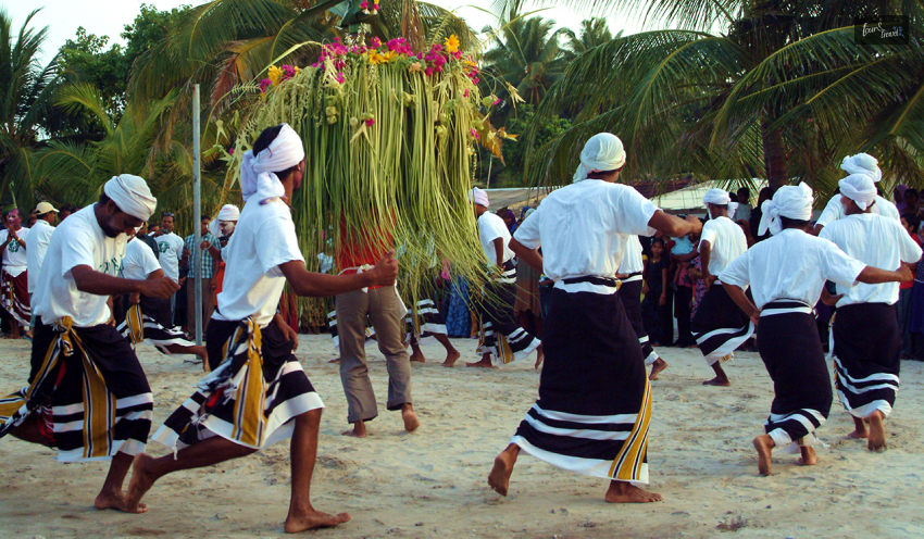
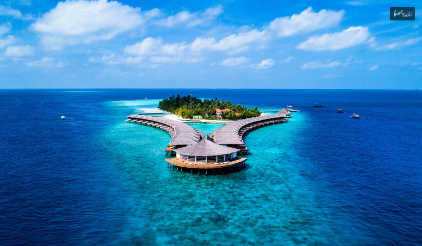
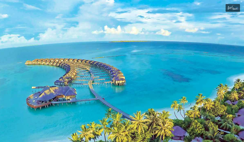
With the festive season knocking on doors, everyone is set for holidays and travel plans. The exotic places to travel offer you the best beach experience. You also get to soak in the Sun and have some fun in the tropical jungle. How about some unusual experience this time? You can always add exotic places to your wishlist according to your preferences. From the cultural heritage of Fiji to the mountains of Sardinia, you must go for something unique. What Is An Exotic Place To Travel, BtW? An exotic place is a far-off destination from your country. These places are called exotic because they offer unusual experiences. Some bucket-list-worthy exotic destinations are Mexico, Madagascar, Fiji and Belize. Most Unusual Exotic Places To Travel In The World: Curated For An Eclectic Experience The exotic places to travel offer you the experience of a lifetime. Located in a distant country, these destinations are great for knowing about local culture and human history. So, exotic tourism is beyond beautiful landscapes and outdoor pursuits. To ensure you have the most amazing experience, I have listed the exotic places to travel worldwide. Let’s check out the entries. 1. Baja California Sur, Mexico Best Time to Visit: December to April Baja California Sur is a place of wonderful scenic beauty and diverse ecosystems. Further, you will love the following water activities here. Visit Magdalena Bay to watch whales Enjoy the best snorkeling experience in Cabo Pulmo. Don’t miss Espiritu Santo Island and its diving fun. Also, do you want to swim with sharks? La Paz is your go-to destination in Baja California Sur. However, you can also have the most serene vacation at Balandra Beach. You will love paddle boarding, kayaking, and swimming here. 2. Madagascar Best Time to Visit: April to October Madagascar is home to fascinating rainforests and white-sand beaches. The beaches here are pristine. So, there is a lot to explore, and you can expect fewer crowds on the beaches. Further, the canyons and limestone karsts make it one of the most exotic places to travel in the world. However, Madagascar will win your heart with its diverse wildlife. Most of the wild animals you see here are not found anywhere else in the world. Moreover, what can be more adventurous than swimming with sharks at the Nosy Be island? 3. Cappadocia, Turkey Best Time to Visit: April to June and September to November Have you heard of “Fairy Chimneys” in Cappadocia? A UNESCO World Heritage Site, they are the rock formations in a cone shape, and you will find them in Monks Valley and Göreme. Further, Cappadocia takes you on a history walk with homes made by troglodytes or cave dwellers. These homes are from the Bronze Age. Another UNESCO World Heritage Site in Cappadocia is the Gerome Open Air Museum. With rock formations, monasteries, and churches, Gerome tells the tales of the Byzantine Era. Moreover, Cappadocia is popular for its hot balloon rides. It feels most amazing during the sunrise and sunset. 4. Fiji, Oceania Best Time to Visit: May to October A paradise of crystal clear waters and beaches, Fiji is exotic. Further, the sugarcane plantations here speak volumes about the livelihood of the local people. Fiji also has endless attractions, such as the Garden of the Sleeping Giant, Kula Wild Adventure Park, Sobeto Hot Springs and Mud Pool, and Biausevu Waterfall. However, for someone keen to learn about human lives and culture, the best experience would be visiting the Fiji Culture Village. The Kava Ceremony and the traditional dance performances are mesmerizing. Moreover, you will get to gorge on traditional Fiji cuisine cooked on earth ovens. 5. Sardinia, Italy Best Time to Visit: June to September Sardinia is one of the most exotic places in Italy. Just driving in a car or scooter along the coastal paradise is an experience in itself. Further, swimming in the Emerald Coast and Costa Smeralda is something that I will cherish for a lifetime. You can even take a chartered sailboat to visit the hidden bays. Furthermore, Cagliari, the capital city of Sardinia, introduces you to the local culture with many archaeological sites, museums, and churches. Bosa and other small villages will also cast a lasting impression on you with colorful buildings. Don’t forget to visit Doria Castle in Bosa. It was built in the 12th century. 6. Belize Best Time to Visit: December to April Belize, a country in Central America, is a wonderful fusion of ancient ruins, lush jungles, marine life, and turquoise water. Further, Belize has the most amazing beaches where you can take part in the following activities. Snorkeling Scuba Diving A Flight Over If you want to have the best inland experience, you can visit ATM Cave, Rio Frio Cave, and various Mayan historical sites. If you want to learn more about the history of Belize and human life, you can visit Cahal Pech, an ancient city. 7. Kefalonia, Greece Best Time to Visit: June to August Kefalonia is the largest Ionian island in Greece. Its blue coastline looks the most amazing, with coves and limestone cliffs. Further, you will love the vineyards and rugged mountains here. One of the exotic places to travel, Kefalonia stands out because of its Myrtos Beach. You will enjoy an amazing view of the turquoise sea here. Other places that will keep you intrigued are: Melissáni Cave Ainos National Park Mount Ainos Moreover, you must not forget a visit to Fiskardo, a quaint village with the best architecture from the 18th century. 8. Rajasthan, India Best Time to Visit: November to February The land of great Rajput warriors and rulers, Rajasthan is a living destination of human history. James Tod, an Oriental scholar, penned the most beautiful historical account of the state. The name of the book is “Annals and Antiquities of Rajasthan.” Further, “Rajkahini” by Abanindranath Thakur is a wonderful depiction of Rajasthan's royalties. If you want to visit Rajasthan, one of the most exotic places in the world, you must read these books once. Rajasthan has so much to offer that you need at least 15 days to touch upon its iconic spots, such as the Amber Fort, Hawa Mahal, Mehrangarh Fort, and many other fortifications. Don’t forget to explore the desert on a camel safari. You will also fall in love with the local culture. Rajasthan has some of the most iconic dance forms, like Kalbelia, and the tunes of the Sindhi Sarangi are a sheer delight to the ears. Moreover, the local puppet shows are vibrant, and they depict historical and folk stories. 9. Sa Pa, Vietnam Best Time to Visit: March to May and September to November Sa Pa in northwest Vietnam is a tranquil beach destination. The beautiful Hoàng Liên Son Mountains are also present here, making you cherish a scenic view. Moreover, Da, Dao, Hmong, and other local tribes live here. An interaction with them is better than any book describing the culture and human history of the country. So, you can miss the best luxury hotels in Sa Pa and spend your days here in homestays surrounded by these tribes. Also, you can collect the most aesthetic souvenirs from the local market. It has handicraft products. 10. Indonesia Best Time to Visit: July to December Indonesia itself is a wonderful travel destination. Indonesia’s tourism industry supports 12.5 jobs and is projected to contribute more than IDR 1,131TN to the country's economy in 2024. (Source: World Travel & Tourism Council) However, I want to discuss the Raja Ampat Islands, one of the most exotic places to visit in Indonesia. Snorkeling and scuba diving are the most amazing activities here. You will encounter amazing turtles, mata rays, and dolphins here. Furthermore, a wildlife exploration here will allow you to meet the most beautiful birds and many endemic species. Also read Why Include Whale Watching In Your LA Itinerary. Traveling On A Budget: Tips For Affordable Adventures. From Cocktails To Kickflips: Must-Try Activities In San Diego.