


8 Beaches of Melbourne, Australia Where You Can Cool Off!
BY sagnika May 8, 2024
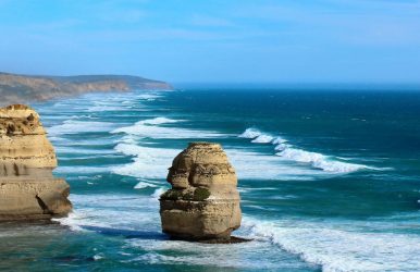
Are you a beach person? Do you want to visit beaches in Melbourne? Some of the beaches not only offer beautiful views but also help you have an amazing holiday. You can perform different activities such as swimming and surfing, organize picnics, enjoy a beach bonfire, and build a sandcastle! There are other activities, some of which are my favourites, such as kayaking, snorkeling, parasailing, and scuba diving! With unending fun times, you can also enjoy delicious food, especially if you are a foodie. Remember that when planning a beach trip, we must carry essentials such as sunscreen, sunglasses, hats, towels, water bottles, and others. Let me share with you eight of the coolest beaches in Australia, more specifically in Melbourne! You will not only enjoy it but make memories for a lifetime. 8 Beaches Of Melbourne, Australia, Where You Can Cool Off! Several Melbourne beaches are renowned for their beautiful visuals and numerous opportunities. I will list eight beaches where you can cool off and relax on your holiday. You will love the article if you love surfing, swimming, fishing, and other activities. There are several things to do in Australia, and I will help you decide on them! It would be best if you explored everything from sandy beaches to the delicious food joints across the foreshore of these beaches. In Australia, there are several opportunities that you can explore when planning your holiday. South Melbourne Beach Port Melbourne Beach, also known as South Melbourne Beach, is charming and offers a beautiful view. There is the tiny Prince's Pier, which is the perfect place for photography during sunset! You will get complete privacy if you visit this beach with your partner. People can go out on casual strolls along the stretch of sand! If you are a pet parent, this is a perfect place to take your pet out on a walk; even the locals do that. You can see people playing beach tennis or taking a cruise ship to visit other places! Visiting this beach is easier if you have less time. If you are a foodie, you can visit South Melbourne Beach to sample the delicious food there. Oceanside Pizza, Ocean 302 Bar and Grill, Sunnyside Cafe, and Billie's on the Beach are some of the restaurants in Australia you must visit. St. Kilda Beach Even the locals cannot avoid this beach, so if you are a tourist, how can you prevent it? You must visit St. Kilda Beach, which has the vibe of Bondi Beach. However, the camera and the crowds still need to be included. If you are a surfer, you must visit this beach because it is wave-free. One of the coolest places for water sports, paddle-boarders wobble across the ocean while the kite surfers enjoy to the best of their ability. You will see several palm trees surrounding the boardwalk where you can cycle with your partner, spending a romantic evening! On Acland Street, there are several trendy restaurants and cafes, which you must check out if visiting St. Kilda Beach. Also, please do not forget Luna Park, another significant attraction. Elwood Beach If you love a relaxed vibe when traveling to the beach, you can go to Elwood Beach! It is just around the corner from St. Kilda Beach, so if you want to avoid all the hustle and bustle, you can escape to this beautiful, classic sandy beach! The beach is not very far from the city; however, what is more beautiful? The CBD skyline looks mesmerizing, especially with that stunning view from the beach. Whether you are a vegetarian, vegan, or non-vegetarian, you will have all kinds of options, from cheesy empanadas to seafood such as oysters and kingfish! You cannot miss the porterhouse steak; the service and deliciousness of the restaurant will transport you to heaven! Brighton Beach If you plan to visit Brighton Beach, let me tell you it is an ideal spot for surfers, sunbathers, and swimmers. One of the best beaches in Melbourne, Brighton Beach is a long stretch of beaches, and the boardwalk scenario is quite popular. This area is also one of best places to live in Australia because it is a vibrant neighborhood. You can stay with your family or partner in residential areas on their sun-splashed streets and sandy beaches. On the foreshore of the beach, there is a line of eighty-two little brightly colored charming bathing boxes! You will fall in love with these multicolored boxes, which also ensure the beauty of the beach. The wave on this beach is quite decent, and there are several places for fishing. You can also not miss the restaurants, cafes, and galleries that are just a walk away from the beach. Even the market near the beach is quite popular! Gunnamatta On this beach, Gunnamatta, you can experience the full force of the Southern Ocean; hence, the ocean is harsh. However, with experienced surfers, this place can be a slice of heaven! You can also visit the Mornington Peninsula National Park near the beach. The beach is clearly dramatic, but thrill seekers will love the gigantic waves! Some food joints allow you to take consistent breaks based on your preferences. Dromana Beach With its clear turquoise waters, Dromana Beach is a perfect fit for places in Australia that will take your breath away. The best time to visit Australia is mostly during the summer months, and the swimming conditions at the beach are perfect here! You can go to different barbeque spots across the foreshore to hang out with your friends or partner. There is also a small fishing pier where you can perform a lot of fun activities! Several hiking trails surround this beach, which makes your visit more exciting and adventurous. Apparently, there is a stamina test which you can take especially with the nearby Arthurs Seat State Park! You can also take the Arthurs Seat Eagle gondola, which offers beautiful and incredible views of Melbourne's skyline across Port Phillip Bay. Williamstown Beach For the locals there, you must ask where" Willy Beach" is. This beach is just a few steps from the city. A popular beach, it provides some of the most spectacular views of the water and the horizon. From sailors and sunbakers to swimmers, this beach is a spot for many. If you are traveling from the train station, the closest beach to this is Gem Pier. This station offers some of the coolest unobscured views of the skyline. It is spectacular during the night, with teeming lights across Williamstown city! If you plan to visit during New Year's Eve, you can check out the beautiful fireworks across the town! Traveling from Sydney to this beach will take about 17 km (about 10.56 mi) by car. Mordialloc Beach The beach is not just a combination of water and sand but also a beautiful southeast suburb that offers resources and beauty. It is a charming seaside pocket with access to delicious food such as Tommy Ruff Fish Bar, Manow Thai, Doyle's Deck & Bistro, Braeside Brewing Co., and others. Sunny Boy Beach Club, a restaurant, is a combination picnic area, BBQ, and playground! A bike path runs directly to the restaurant from the beach. There is also a sturdy pier about 300 meters (about 984.25 ft) across the beach. A family beach, it is quite popular for huge families and groups of friends to hang out and enjoy themselves. So, if you are someone who does not like crowds, you should avoid this beach because, during the week, there is always a huge crowd here. Finishing Off... In short, these beaches are cool to hang out with and offer beautiful locales and visuals! These beaches in Melbourne fit the bill when it comes to hanging around the water on a sunny and warm day. After reading the blog, I am sure you are dying to visit these places when creating an itinerary. Check out our picks of the beaches in Melbourne, one of Australia's coolest places. An amazing experience is dedicated to you, especially when traveling to these places. Comment on which of the best beaches in Melbourne are already on your bucket list! Learn More Also: Top 10 Beaches In Sydney You MUST VISIT The Holiday Planning Trip: 4-Days Itinerary Of Queensland The Top Things To Do When Visiting The Great City Of Sydney Top Restaurants In Maitland Australia That Give You Culinary Delights

This was beautiful Admin. Thank you for your reflections.
For the reason that the admin of this site is working, no uncertainty very quickly it will be renowned, due to its quality contents.